gao-17-86, defense infrastructure: dod efforts to prevent ... · defense infrastructure . dod...
TRANSCRIPT
DEFENSE INFRASTRUCTURE
DOD Efforts to Prevent and Mitigate Encroachment at Its Installations
Report to Congressional Committees
November 2016
GAO-17-86
United States Government Accountability Office
United States Government Accountability Office
Highlights of GAO-17-86, a report to congressional committees
November 2016
DEFENSE INFRASTRUCTURE
DOD Efforts to Prevent and Mitigate Encroachment at Its Installations
What GAO Found The Department of Defense’s (DOD) processes for stationing, or determining where to locate units and assets consider incompatible land use. Specifically, the military departments have processes to determine how to satisfy military requirements while considering incompatible land use. DOD instructions further require that installations have master plans in place to manage incompatible land use issues, based on a strategic assessment of an installation’s mission and expected use. For the nine installations visited, GAO found these plans considered all or almost all of seven types of incompatible land use that GAO identified—historic assets, archeological assets, protected species, protected habitat, climate change, urban development, and airborne noise.
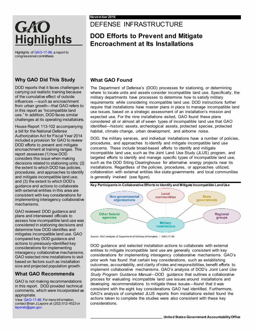
DOD, the military services, and individual installations have a number of policies, procedures, and approaches to identify and mitigate incompatible land use concerns. These include broad-based efforts to identify and mitigate incompatible land use, such as the Joint Land Use Study (JLUS) program, and targeted efforts to identify and manage specific types of incompatible land use, such as the DOD Siting Clearinghouse for alternative energy projects near its installations. Regardless of the policies, procedures, or approaches utilized, collaboration with external entities like state governments and local communities is generally involved (see figure).
Key Participants in Collaborative Efforts to Identify and Mitigate Incompatible Land Use
DOD guidance and selected installation actions to collaborate with external entities to mitigate incompatible land use are generally consistent with key considerations for implementing interagency collaborative mechanisms. GAO’s prior work has found that certain key considerations, such as establishing outcomes, accountability, and clarity of roles and responsibilities, benefit efforts to implement collaborative mechanisms. GAO’s analysis of DOD’s Joint Land Use Study Program Guidance Manual—DOD guidance that outlines a collaborative process for evaluating incompatible land use issues around installations and developing recommendations to mitigate these issues—found that it was consistent with the eight key considerations GAO had identified. Furthermore, GAO’s analysis of completed JLUS reports from installations visited found the actions taken to complete the studies were also consistent with these key considerations.
View GAO-17-86. For more information, contact Brian J.Lepore at (202) 512-4523 or [email protected].
Why GAO Did This Study DOD reports that it faces challenges in carrying out realistic training because of the cumulative effect of outside influences —such as encroachment from urban growth—that GAO refers to in this report as “incompatible land use.” In addition, DOD faces similar challenges at its operating installations.
House Report 113-102 accompanying a bill for the National Defense Authorization Act for Fiscal Year 2014 included a provision for GAO to review DOD efforts to prevent and mitigate encroachment at training ranges. This report assesses (1) how DOD considers this issue when making decisions related to stationing units; (2) the extent to which DOD has policies, procedures, and approaches to identify and mitigate incompatible land use; and (3) the extent to which DOD’s guidance and actions to collaborate with external entities in this area are consistent with key considerations for implementing interagency collaborative mechanisms.
GAO reviewed DOD guidance and plans and interviewed officials to assess how incompatible land use was considered in stationing decisions and determine how DOD identifies and mitigates incompatible land use. GAO compared key DOD guidance and actions to previously-identified key considerations for implementing interagency collaborative mechanisms. GAO selected nine installations to visit based on factors such as installation size and projected population growth.
What GAO Recommends GAO is not making recommendations in this report. DOD provided technical comments, which were incorporated as appropriate.

Page i GAO-17-86 Incompatible Land Use
Letter 1
Background 5 DOD Has Basing Processes to Consider Incompatible Land Use
that Can Potentially Restrict DOD Activities 10 DOD, the Military Services, and Installations Have A Number of
Policies, Procedures, and Approaches to Identify and Mitigate Incompatible Land Use that Generally Involve Collaboration with Stakeholders 15
Key DOD Guidance and Military Installation Actions at Locations Visited Are Generally Consistent with Key Considerations for Implementing Interagency Collaborative Mechanisms 24
Agency Comments 27
Appendix I Objectives, Scope, and Methodology 30
Appendix II Implementation of the Readiness and Environmental Protection Integration Program at Installations Visited 36
Appendix III Key Considerations for Implementing Interagency Collaborative Mechanisms 38
Appendix IV Comments from the Department of Defense 40
Appendix V GAO Contact and Staff Acknowledgments 41
Related GAO Products 42
Contents

Page ii GAO-17-86 Incompatible Land Use
Tables
Table 1: Summary of Compatible Uses for Accident Potential Zones (APZ) and Noise Zones 23
Table 2: Summary of Participants in Joint Land Use Studies (JLUS) for Installations Visited 26
Table 3: Projected Population Growth at 33 Selected Installations (2015 to 2020) 32
Table 4: Summary of Benefits Reported by Readiness and Environmental Protection Integration Projects at Installations Visited 36
Table 5: Summary of Key Considerations for Implementing Interagency Collaboration 38
Figure
Figure 1: Key Participants in Collaborative Efforts to Identify and Mitigate Incompatible Land Use 15
Abbreviations AICUZ Air Installations Compatible Use Zones APZ Accident Potential Zones DOD Department of Defense FAA Federal Aviation Administration INRMP Integrated Natural Resources Management Plan JLUS Joint Land Use Study REPI Readiness and Environmental Protection Integration
This is a work of the U.S. government and is not subject to copyright protection in the United States. The published product may be reproduced and distributed in its entirety without further permission from GAO. However, because this work may contain copyrighted images or other material, permission from the copyright holder may be necessary if you wish to reproduce this material separately.

Page 1 GAO-17-86 Incompatible Land Use
441 G St. N.W. Washington, DC 20548
November 14, 2016
Congressional Committees
The Department of Defense (DOD) reports that it faces growing challenges in carrying out realistic training at installations and training ranges due to outside influences that inhibit military training and testing, which DOD refers to as encroachment.1 In 2001, DOD formed the Sustainable Ranges Initiative to act as a coordinating body for all encroachment issues affecting DOD ranges and to address encroachment through policy formulation, legislative initiatives, and compatible land use activities.2 In addition, a provision in the Bob Stump National Defense Authorization Act for Fiscal Year 2003 required DOD to develop a training range sustainment plan and submit annual reports to Congress concerning the progress made in implementing the plan.3 DOD faces similar challenges at those installations not designated as either training or testing ranges located within the United States.4 As early as 1985, local communities, in conjunction with military installations, began conducting Joint Land Use Studies (JLUS) to study land uses that are
1 DOD defines encroachment as external, as well as internal, DOD factors and influences that constrain or have the potential to inhibit the full access or operational use of the live training and test domain. It includes, but is not limited to, endangered species and critical habitat, unexploded ordnance and munitions, radio frequency spectrum, maritime or airspace restrictions, air quality, airborne noise, urban growth, physical obstructions, and renewable energy projects. DOD Directive 3200.15, Sustaining Access to the Live Training and Test Domain (Dec. 18, 2013). (Hereinafter cited as DODD 3200.15 (Dec. 18, 2013)). 2 According to a DOD official, the Sustainable Ranges Initiative is tri-chaired by the Assistant Secretary of Defense (Readiness), Assistant Secretary of Defense (Installations, Energy, and Environment), and Director, Operational Test and Evaluation. 3 Pub. L. No. 107-314, § 366 (2002), amended by National Defense Authorization Act for Fiscal Year 2013, Pub. L. No. 112-239, § 311 (2013). In addition the act included a provision for GAO to review the annual reports submitted to Congress. See also, GAO, Military Training: DOD Met Annual Reporting Requirements in Its 2016 Sustainable Ranges Report , GAO-16-627 (Washington, D.C.: June 15, 2016). 4 Training ranges and testing ranges refer to what DOD calls “live training domain” and “live test domain,” respectively. DOD defines a live training domain as the environment where DOD executes training, with or without the use of munitions, under field conditions to achieve and sustain proficiency on training requirements. A live test domain is defined as the actual field environment (land, air, water) where DOD conducts testing in anticipation of the military’s use of any weapons, equipment, munitions, systems, or their components. DODD 3200.15 (Dec. 18, 2013).
Letter

Page 2 GAO-17-86 Incompatible Land Use
incompatible with the installation’s military mission, such as residential development within accident potential zones around airfields, and seeking ways to reduce the operational impacts on adjacent land. For the purposes of this report, we are also using the term “incompatible land use” to refer to encroachment.5
The House Committee on Armed Services report accompanying a bill for the National Defense Authorization Act for Fiscal Year 2014 included a provision that we review DOD’s activities to prevent and mitigate encroachment at training ranges. In December 2014, we issued a report assessing the acquisition of assets or conducting of business by foreign entities near test and training ranges, which we referred to as “foreign encroachment.”6 In this follow-on review, we assessed DOD’s ability to identify and mitigate effects from incompatible land use, including urban growth, on and around its installations in the United States. Specifically, we assessed: (1) how DOD considers incompatible land use, including urban growth, when making decisions related to stationing units and assets; (2) the extent to which policies, procedures, and approaches exist that DOD, the military services, and installations used to identify and mitigate incompatible land use at their installations; and (3) the extent to which DOD’s guidance and actions to collaborate with certain civilian federal agencies, state and local governments, and non-government entities in order to manage and mitigate the effects of incompatible land use are consistent with key considerations for implementing interagency collaborative mechanisms.
To address our objectives, we reviewed applicable DOD and military department guidance pertaining to encroachment management. To provide illustrative examples of the influence of site-specific planning; policies, procedures, and approaches employed by military installations; and collaborative efforts, we selected installations to visit based on (1) 5 For this report, we discuss incompatible land use due to urban growth and related issues such as, endangered species and critical habitat, airborne noise, and climate change. We identified these incompatible land use factors based on a review of DOD and military department documents, including the JLUS encroachment factors and military departments’ encroachment management program instructions. We do not discuss radio frequency spectrum encroachment in this report. 6 GAO, Defense Infrastructure: DOD Has Made Limited Progress in Assessing Foreign Encroachment Risks on Federally Managed Land, GAO-16-381R (Washington, D.C.: Apr. 13, 2016) and Defense Infrastructure: Risk Assessment Needed to Identify if Foreign Encroachment Threatens Test and Training Ranges, GAO-15-149 (Washington, D.C.: Dec. 16, 2014).
Page 3 GAO-17-86 Incompatible Land Use
size of the installation, (2) existence of an incompatible land use mitigation project, (3) being an installation of interest because of the existence of or potential for future incompatible land use, and (4) projected population growth in adjacent counties.7 Using these factors, we selected nine installations, from a population of 187 military installations, for site visits: two installations from each military service8—Naval Air Station Patuxent River, Maryland; Naval Submarine Base Kings Bay, Georgia; Marine Corps Base Quantico, Virginia; Marine Corps Air Station Beaufort, South Carolina; Robins Air Force Base, Georgia; MacDill Air Force Base, Florida; Fort Carson, Colorado; and Fort Knox, Kentucky—and one joint base—Joint Base Lewis-McChord, Washington. Our observations from these installation visits are not generalizable to all DOD installations, but provided illustrative examples of the potential implications of incompatible land use issues at the installation level.
To assess how DOD considers incompatible land use, including urban growth, when making unit stationing decisions and managing its installations, we reviewed statutes, regulations, and guidance pertaining to DOD’s basing process and incompatible land use. We interviewed DOD headquarters officials in Office of the Assistant Secretary of Defense for Energy, Installations, and Environment; the Office of Economic Adjustment;9 the Under Secretary of Defense for Personnel and Readiness; Office of the Director, Test Resource Management
7 Site selection criteria included (1) size of installation—medium or large—as defined in DOD’s Base Structure Report; (2) existence of an incompatible land use project, such as a JLUS, Readiness and Environmental Protection Integration program, or Sentinel Landscapes partnership; (3) being an installation of interest, i.e., being an installation where (a) DOD officials identified the installation as having incompatible land use issues, (b) incompatible land use issues at the installation had been discussed in Defense Communities 360 articles or (c) the installation is included on the Office of Economic Adjustment’s list of major growth projects or increased by more than 1,000 personnel as a result of base realignment and closure in 2005; and (4) projected population growth. The installations we visited were selected from a universe of 187 installations located in the United States that DOD considers medium or large because the real property assets at these sites had plant replacement value (the calculated cost to replace the current facilities and supporting infrastructure using today’s construction costs and standards) of $1.0 billion or greater. See appendix 1 for a more detailed discussion of our site selection process. 8 We did not include the U.S. Coast Guard in our review. 9 The Office of Economic Adjustment is responsible for supporting state and local government's response to defense program changes, such as base closures, base restructuring, or realignment; incompatible civilian development that may impair military operations; and other issues that can impact the economy of a region.

Page 4 GAO-17-86 Incompatible Land Use
Center; and the Office of the Director, Operational Test and Evaluation, to identify how they assess whether an installation experiences incompatible land use, the extent to which incompatible land use is considered when making basing decisions, and the challenges that exist regarding the basing process and training for installation employees related to incompatible land use. We also reviewed installation master plans and interviewed officials from nine installations that we visited for illustrative examples of how incompatible land use is considered during the planning process at the installation level.
To assess the extent to which policies, procedures, and approaches to identify and mitigate incompatible land use exist at DOD, the services, and installations, we reviewed applicable policy documents, directives, instructions, and other guidance documents. We also reviewed documents, such as JLUS reports, to identify approaches and strategies employed at the installation level. In addition, we interviewed Office of Economic Adjustment officials, as well as officials at the nine installations we visited, to discuss the approaches and programs available to the installations, the authority under which the installations use and execute these approaches and programs, and how, if at all, the installations benefit from these approaches and programs.
To assess the extent to which DOD’s guidance and actions to collaborate with other federal agencies, state and local governments, and non-government entities to manage and mitigate the effects of incompatible land use are consistent with leading practices for interagency collaboration, we reviewed DOD regulations, policies, and other relevant documents related to DOD’s approaches to identify and mitigate incompatible land use. Based on this review, we determined that the JLUS process generally incorporates these approaches into a single effort. Consequently, for the purposes of our analysis, we focused on the Joint Land Use Study Program Guidance Manual and JLUS reports that had been completed at eight of the nine installations that we visited. In addition, we interviewed officials at the Departments of the Interior and Agriculture to gain insight into the type and frequency of collaboration that occurs with DOD to address various types of incompatible land use on and around installations.10 We also interviewed officials from the nine 10 The Departments of the Interior and Agriculture are the two federal agencies collaborating with DOD on the Sentinel Landscapes partnership program, which is designed to identify areas where the conservation efforts of the Departments of Agriculture and the Interior are compatible with the efforts of DOD to preserve their training, testing, and operating activities.
Page 5 GAO-17-86 Incompatible Land Use
installations we visited to understand their collaborative efforts with the aforementioned agencies and the communities surrounding the installations. In order to better understand the collaboration and coordination that occurred between the DOD installation officials and local public officials, we interviewed representatives from the local government agencies that were involved with the JLUS process when possible at each of the installations. Finally, we compared the information we gathered to key considerations for implementing interagency collaboration mechanisms identified by our prior work to determine whether DOD’s guidance and actions were consistent with these key considerations.11 Appendix I provides further information on our scope and methodology.
We conducted this performance audit from May 2015 to November 2016, in accordance with generally accepted government auditing standards. Those standards require that we plan and perform the audit to obtain sufficient, appropriate evidence to provide a reasonable basis for our findings and conclusions based on our audit objectives. We believe that the evidence provides a reasonable basis for our findings and conclusions based on our audit objectives.
Encroachment, as defined by DOD, refers to external, as well as internal, DOD factors and influences that constrain or have the potential to inhibit the full access or operational use of the live training and test domain.12 In addition, encroachment can also affect operating installations that are not designated as either training or test ranges, including four of the nine installations we visited (Fort Knox, Naval Submarine Base King’s Bay, MacDill Air Force Base, and Robins Air Force Base). Furthermore, DOD and the military services have identified a number of compatibility factors and encroachment challenges related to incompatible land use on and near their installations. For the purposes of this report, we have
11 GAO, Managing for Results: Implementation Approaches Used to Enhance Collaboration in Interagency Groups, GAO-14-220 (Washington, D.C.: Feb. 12, 2014). 12Department of Defense Directive 3200.15, Sustaining Access to the Live Training and Test Domain (Dec. 18, 2013).
Background
Types of Incompatible Land Use
Page 6 GAO-17-86 Incompatible Land Use
summarized these factors and challenges into a list of types of incompatible land uses. These include, but are not limited to:13
• Urban development – growth in the communities surrounding an installation can result in restrictions on the training, testing, and operations of the installation because of noise, safety, or other reasons related to the surrounding population.
• Threatened or endangered species – the presence of threatened or endangered species requires that an installation consult with the United States Fish and Wildlife Service, as well as with the National Oceanic and Atmospheric Administration and National Marine Fisheries Service, to ensure that any actions authorized, funded, or carried out by the installation are not likely to jeopardize the continued existence of any endangered or threatened species, unless the installation has been granted an exemption for such action.14 In addition, some states have enacted legislation related to endangered and threatened species and maintain a listing of species of concern or importance from the state perspective.
• Critical habitat – DOD must consult with the United States Fish and Wildlife Service to ensure that any actions authorized, funded, or carried out by the installation are not likely to result in the destruction or adverse modification of lands determined to be critical habitat, unless the installation is subject to an integrated natural resources management plan.15
• Historic sites – DOD must identify historically significant sites within its installations’ boundaries and conduct evaluations of the sites to determine if the sites are eligible for the National Register of Historic
13 We identified seven incompatible land use factors based on a review of DOD and military department documents including, the JLUS encroachment factors and military departments’ encroachment management program instructions. We did not include electronic frequency spectrum encroachment in this report because spectrum use is managed by the Federal Communications Commission and the National Telecommunications and Information Administration. See GAO, Spectrum Management: Federal Relocation Costs and Auction Revenues, GAO-13-472 (Washington, D.C.: May 22, 2013). 14 16 U.S.C. § 1536(a)(2); DOD Manual 4715.03, Integrated Natural Resources Management Plan (INRMP) Implementation Manual, enclosure 4 (Nov. 25, 2013). (Hereinafter cited as DODM 4715.03, enclosure 4 (Nov. 25, 2013)). 15 16 U.S.C. § 1536(a)(2); DODM 4715.03, enclosure 4 (Nov. 25, 2013).

Page 7 GAO-17-86 Incompatible Land Use
Places.16 The National Historic Preservation Act requires DOD to take into account the effect of an undertaking—such as testing, training, or operating activities—on any historic property, and that DOD consult with the appropriate State Historic Preservation Officer and other consulting parties.
• Cultural sites – DOD must identify culturally significant sites, such as archaeologic sites and cemeteries, within its installations’ boundaries and conduct evaluations of the sites to determine if the sites are eligible for the National Register of Historic Places.17 The National Historic Preservation Act requires DOD to take into account the effect of an undertaking—such as testing, training, or operating activities—on any historic property, which may include culturally significant sites, and that DOD consult with the appropriate State Historic Preservation Officer and other consulting parties.
• Airborne noise – noise from training, testing, and operating activities frequently affects nearby communities around the installations. In some instances, installations adopt restrictions on their activities to avoid creating noise during certain periods of the day.
• Climate Change – future climate changes resulting from natural factors and human activities that influence long-term atmospheric conditions can affect testing, training, and operating activities.
In addition, there are also instances where DOD’s decisions have an effect on its ability to accomplish its training, testing, and operating activities. These types of instances include, but are not limited to:
• Stationing decisions that bring new military organizations or missions to an installation can increase the amount of training or change the type of training occurring on the installation. This, in turn, can lead to increased complaints from citizens living close to the installation, which can lead to restrictions being placed on the type of or times when training can be accomplished.
• New weapon systems and capabilities can affect the ability of an installation to conduct testing, training, and operational activities. Specifically, weapon systems with greater firing distance or speed
16 National Historic Preservation Act, 54 U.S.C. § 306102 (generally requires each federal agency to establish a preservation program); see also DOD Instruction 4715.16, Cultural Resources Management (Sept. 18, 2008). (Hereinafter cited as DODI 4715.16 (Sept. 18, 2008)). 17 54 U.S.C. § 306102; see also DODI 4715.16 (Sept. 18, 2008).
Page 8 GAO-17-86 Incompatible Land Use
capabilities can exceed the range and speed limitations of the existing ranges, which could limit the ability to test or train the full capabilities of the weapon system.
• Changes in deployment schedules of units assigned to an installation can affect the training, testing, and operating activities of the installation. For instance, with a decrease in the deployment schedules, more units will be conducting training activities at their home stations, which can lead to more training noise being generated on an installation. More noise could also increase the number of noise complaints received from citizens living near the installation, which could lead to restrictions on training activities.
• Unexploded ordnance and munitions present safety issues to installations that can result in restrictions to the use of land, including not being able to use the affected areas for training, where there are unexploded ordnance and munitions.
A number of federal civilian agencies have authorities that can create or mitigate incompatible land use. These authorities include entering into formal agreements—such as the memorandum of understanding between the Departments of Defense, Agriculture, and the Interior that governs the Sentinel Landscapes partnership18—and regulatory authorities held by agencies, such as the Federal Aviation Administration, which reviews determinations on obstructions to air navigation, navigational aids, or navigational facilities. Consequently, close coordination between DOD and these federal agencies can be beneficial to DOD in its efforts to identify and mitigate incompatible land use and to encourage and provide incentives to maintain existing compatible land use. These agencies include, but are not limited to:
• U.S. Department of Agriculture, which promotes the sustainment of natural resources through the U.S. Forest Service, the Farm Service Agency, and the Natural Resources Conservation Service. The Department of Agriculture participates in the Sentinel Landscapes partnership, in conjunction with DOD and the Department of the Interior, to leverage resources of each agency to promote natural resource sustainability surrounding military installations. This prevents
18The Sentinel Landscapes partnership program is designed to identify areas where the conservation efforts of the Departments of Agriculture and the Interior are compatible with the efforts of DOD to preserve their training, testing, and operating activities.
Responsibilities of Federal Agencies and State and Local Governments Related to Incompatible Land Use

Page 9 GAO-17-86 Incompatible Land Use
development near the installations, thereby enabling DOD to continue its training, testing, and operating activities.
• Department of the Interior, which is, among other things, responsible for protecting endangered and threatened species of plants and animals through the U.S. Fish and Wildlife Service. The Department of the Interior participates in the Sentinel Landscapes partnership, in conjunction with DOD and the Department of Agriculture. Furthermore, the Fish and Wildlife Service has worked with DOD to avoid designating military lands as critical habitat in cases where the military installation in question is subject to an Integrated Natural Resource Management Plan, and the Fish and Wildlife Service determines that the plan benefits the protected species. In addition, the Bureau of Land Management and DOD have an established protocol for working together to facilitate compatible land use through cooperative planning of wind energy projects on Bureau-administered lands.
• Federal Aviation Administration (FAA) is responsible for conducting aeronautical studies of planned projects for construction, alteration, establishment, or expansion of any structure or landfill that may result in an obstruction of the navigable airspace or an interference with air navigation facilities and equipment or the navigable airspace. In addition, the FAA has developed procedures to obtain DOD’s comments and recommendations prior to FAA issuing an official determination on proposed structures that DOD has an interest in reviewing.
There are also a variety of state and local governments that have roles in efforts to manage incompatible land use near installations. State departments of natural resources and commerce and state historic preservation offices collaborate with military installations concerning compatible land use. At the local level, city, town, county, and regional groups are among the government organizations that collaborate with installations concerning issues related to compatible land use.

Page 10 GAO-17-86 Incompatible Land Use
The military departments have processes to determine where to locate units and weapon systems intended to satisfy DOD and military department requirements that consider incompatible land use. The Army process is to use a methodology that includes all appropriate staff offices to ensure that all feasible stationing alternatives are identified, analyzed, and evaluated. This methodology is to consider planning factors including environmental, training, and local community impacts that could identify issues related to incompatible land use.19 The Navy process is to follow a two phased approach to identify, evaluate, and implement stationing decisions. According to Navy guidance, the first phase—the developmental phase—is to consider DOD and Navy strategic guidance as well as Navy plans for ships and aircraft, and results in a proposed plan for the homeporting, homebasing, and hub assignments of the Navy’s operating forces.20 Next, the integration-assessment phase then is to analyze the proposed distribution of Navy assets using specific criteria, including a consideration of environmental compliance that could identify issues related to incompatible land use. Finally, the Air Force strategic basing process is to consider factors across the entire organization. It utilizes a consistent process for decision-making to ensure basing actions involving Air Force units and missions support Air Force mission requirements and comply with all applicable environmental guidance.21 Once a requirement is identified, the responsible Air Force major command is to develop basing criteria for the decision process.22 The command then is to develop a list of candidate bases. After approval of the candidate base list, the major command is to complete site surveys and environmental analyses, which could identify issues related to incompatible land use, to support the steering committee in making recommendations for basing locations. Final basing decisions are then to be made at the Air Force headquarters level.
19 Army Regulation 5-10, Stationing (Aug. 20, 2010). 20 Office of the Chief of Naval Operations Instruction 3111.17, Strategic Laydown and Dispersal Plan for the Operating Forces of the U.S. Navy (Nov. 22, 2013). We do not specifically discuss the Marine Corps basing process due to the relatively few training and operating bases within the Marine Corps for stationing units and weapon systems. 21 Air Force Instruction 10-503, Strategic Basing (Sept. 27, 2010). 22 This criteria is reviewed and evaluated by the Air Force Strategic Basing - Executive Steering Group, which is chaired by the Deputy Assistant Secretary of the Air Force for Installations with the United States Air Force, Director of Programs as vice-chair.
DOD Has Basing Processes to Consider Incompatible Land Use that Can Potentially Restrict DOD Activities

Page 11 GAO-17-86 Incompatible Land Use
In addition to the military departments’ planning processes, DOD instruction 4165.70 requires that each installation have a base master plan or comprehensive plan based on a strategic assessment of the operational mission and expected use of the installation.23 This plan is to cover at least a 10-year period, be updated every 5 years, and include a specific, annual list of all construction projects, major repair and sustainment projects, and restoration and modernization projects. The specific requirements for the content and minimum requirements for the master planning documents are outlined in Unified Facilities Criteria 2-100-01, which includes several references that indicate that both internal and external incompatible land use should be considered while developing the master plan.24 Specifically, a number of the identified purposes for conducting master planning relate to identifying, managing, and mitigating incompatible land use issues, including:
• Promoting cooperative and interactive intra- and inter-service and intergovernmental relationships;
• Incorporating cooperative environmental planning to identify environmental impacts and protect and enhance natural, cultural, and environmental resources while supporting mission requirements;
• Ensuring efficient and compatible land use and maximizing facility utilization;
• Sustaining ranges and training areas to meet training and testing missions on a consistent and long-term basis; and
• Encouraging policies and interaction with local communities to avoid encroachment and maximize opportunities for joint use while preserving mission capability and growth potential.
Our analysis of master planning documents from the nine installations that we visited revealed that issues related to the types of incompatible land use we identified—(1) historic assets, (2) archeological assets, (3) protected species, (4) protected habitat, (5) climate change, (6) urban development, and (7) airborne noise—were generally discussed in the planning documents. According to DOD Instruction 4165.70 and DOD’s Unified Facilities Criteria 2-100-01, installations are to develop their plans to take into account the effect that training, testing, and operating activities will have on cultural resources, environmental considerations, 23 DOD Instruction 4165.70, Real Property Management (Apr. 6, 2005). 24 DOD, Unified Facilities Criteria 2-100-01, Installation Master Planning (May 15, 2012).

Page 12 GAO-17-86 Incompatible Land Use
and development near the installation, as well as the effect these factors can have on training, testing, and operating activities. Specifically, our review found that the planning documents from all nine of the installations that we visited considered six of the seven incompatible land use issues identified above. The seventh issue, climate change, was considered in the planning documents of seven of the nine installations we visited.
For these nine installations, we saw evidence of how they took into consideration the effect that their testing, training, or operating would have on historic and cultural resources. For example, Fort Carson has a programmatic agreement with the Colorado State Historic Preservation Officer and the Advisory Council on Historic Preservation to maintain training access to Pinon Canyon Maneuver Site while also protecting archaeological sites. For instance, there are areas where training is restricted to dismounted training and that wheeled and tracked vehicles are prohibited from entering. In these areas, boulders or similar barriers are placed to protect the archaeological site when frequent vehicular movements are expected to occur nearby. In other areas, fencing and/or signage are used when vehicle traffic is less likely due to infrequent use and natural barriers. Fort Carson officials told us that units utilizing Pinon Canyon are able to accomplish their training requirements despite the restrictions placed on the use of wheeled or tracked vehicles in certain areas.
The presence of threatened and endangered species and critical habitats can result in similar restrictions being placed on training, testing, and operating activities. For example, Fort Knox, in accordance with the Endangered Species Act,25 must conduct training in a manner that will not jeopardize the continued existence of the Indiana bat, an endangered species present on the installation. While this is a minor restriction that does not usually limit training activities, according to its Integrated Natural Resources Management Plan, Fort Knox must coordinate any tree removal or actions affecting the bat through the installation’s environmental office to ensure that this action will not adversely affect the
25 Endangered Species Act, 16 U.S.C. § 1536(a)(2).

Page 13 GAO-17-86 Incompatible Land Use
bats or their habitat.26 The installation has worked with the U.S. Fish and Wildlife Service to develop and identify locations for the roost structures that have been placed to enhance the availability and quality of roosting habitat. According to an installation official, these actions may result in fewer restrictions on training activities on the installation. Similarly, Joint Base Lewis-McChord is currently involved in efforts to restore Puget Sound prairie habitat in areas of the installation as well as on lands near the installation in an effort to ease restrictions on heavily used training areas that contain this habitat.
In addition, the planning documents for all nine of the installations we visited discussed the effects of urban development and noise, which are related issues, on the training, testing, and operational activities of the installations. As discussed later in this report, DOD has programs designed to identify safety and noise issues related to military training, testing, and operational activities, and the effects these activities have on non-DOD land adjacent to and near installations. Communities around six of the nine installations we visited have adopted zoning regulations that limit development in areas affected by military operations. For example, according to a JLUS study in 2015, the communities around Marine Corps Air Station Beaufort—following the completion of an earlier JLUS study in 2004—adopted regulatory overlay zones that limit the type and density of development that could take place within the operating safety zones and areas affected by operating noise around the installation.27 At the time of our visit, the installation had completed an updated JLUS study (March 2015), which included updated noise contours associated with the introduction of the Joint Strike Fighter to the installation. One recommendation in the updated JLUS report for this installation was that the local communities adopt the updated safety zones and noise contours
26 We have previously reported on DOD compliance with environmental statutes including the Endangered Species Act and recommended that should DOD seek additional exemptions from environmental laws and it develop a sound business case to support the exemptions. DOD partially concurred with our recommendation and anticipated submitting such support with any future requests for exceptions. DOD has not sought additional exemptions since our report was issued. See GAO, Military Training: Compliance with Environmental Laws Affects Some Training Activities, but DOD Has Not Made a Sound Business Case for Additional Environmental Exemptions, GAO-08-407, (Washington, D.C.: Mar. 7, 2008). 27 The communities around Marine Corps Air Station Beaufort, South Carolina include, the county of Beaufort, the city of Beaufort, and the town of Port Royal. Type of development refers to the intended use of the property such as, residential, industrial, or commercial. The density of development refers to the amount of development allowed within a specified area such as, one dwelling per three acres.

Page 14 GAO-17-86 Incompatible Land Use
in order to limit incompatible development in the future, thereby enabling the continued training and operating activities at the installation.
At five of the nine installations we visited, development around the installation has resulted in operational restrictions or safety issues. For example, residential development within the noise contours of an installation can result in restrictions on the hours during which live fire training can be conducted and ambient light from development near the installation can impair the effectiveness of night vision technology used during night training. Specifically, according to officials at Joint Base Lewis-McChord, night fire exercises are typically limited to specific times to avoid disturbing residential development that is within the noise contours of the installation. While this, according to installation officials, is not currently overly restrictive during winter months, when live fire typically occurs during the five hours between 5 pm and 10 pm, it creates greater challenges during the summer months, when live fire is restricted to the two hours between 10 pm and midnight due to light conditions. Any live fire activity after midnight must be approved by the installation commander. Similarly, according to installation officials, Fort Knox is working with the local community to establish requirements for the use of lighting sources that do not produce significant amounts of ambient light in order to reduce the impact that the development will have on night training operations.
Finally, as mentioned earlier, we identified one type of incompatible land use that was discussed in the planning documents at seven of the nine installations we visited; the effects of climate change. The climate change issues identified at the seven installations included the frequency and distribution of earthquakes, continued drought, flooding, and sea level rise. For example, according to officials at Fort Carson, the effects of continued drought conditions could limit the ability to perform maneuver training on the installation due to the dust that is produced during the training activities. According to these officials, the amount of dust produced by training that travels off the installation onto lands surrounding the installation is regulated by the Environmental Protection Agency and closely monitored by the installation. During drought conditions, training activities can produce more dust that could potentially travel outside the boundaries of the installation. When this occurs, training activities have to be halted until conditions are more conducive, i.e., when dust is within the allowable levels. Similarly, the impact of sea level rise could undermine operations at Naval Submarine Base Kings Bay. Specifically, while most of the installation and all mission critical facilities would not be affected by a 3-foot sea level rise, a 6-foot sea level rise

Page 15 GAO-17-86 Incompatible Land Use
would inundate much of the lower installation. In addition, increased storm surges along with the sea level rise could damage the installation’s infrastructure.
DOD, the military services, and individual military installations have multiple policies, procedures, and approaches through which they may identify and mitigate incompatible land use. These include broad-based efforts to identify and manage incompatible land use, generally, and targeted efforts to identify and mitigate specific types of incompatible land use. Based on our review of these policies, procedures, and approaches, collaboration with outside entities—such as other federal agencies, state governments, local communities, regional groups, or non-governmental organizations—is generally involved. (See figure 1)
Figure 1: Key Participants in Collaborative Efforts to Identify and Mitigate Incompatible Land Use
Through the Compatible Use program, administered by DOD’s Office of Economic Adjustment, completion of a JLUS is one collaborative approach a community may undertake, in partnership with the military installation, to identify incompatible land use that may impact military activities. This approach considers multiple sources of incompatible land use. According to DOD, as of August 2016, 130 JLUS studies had been completed. The program is designed to encourage local communities to engage with military installations in the process of land use planning to promote community land use that is compatible with continued military operations and seek ways to reduce the operational impacts of DOD
DOD, the Military Services, and Installations Have A Number of Policies, Procedures, and Approaches to Identify and Mitigate Incompatible Land Use that Generally Involve Collaboration with Stakeholders
Broad-based efforts to identify and manage incompatible land use

Page 16 GAO-17-86 Incompatible Land Use
activities on adjacent land.28 While commanding officers nominate their installations for participation in the JLUS process, one guiding principle of the program is that the JLUS process is to be sponsored by a local government or other entity agreed to by the affected stakeholders. Under the JLUS program, federal funds support local community participants as they lead the development of individual studies in conjunction with installation officials and an Office of Economic Adjustment advisor so that local communities take ownership of the process.29 Specifically, relevant participants from local community governments and organizations partner with the installation to identify local incompatible use issues and publish reports with actionable strategies and recommendations to mitigate identified issues. For instance, the JLUS for Marine Corps Air Station Beaufort recommended that the installation work with the local communities to formalize existing protocols by codifying local government coordination with the installation prior to land use planning and zoning actions.
Another approach used by DOD, the military services, and individual installations to prevent or mitigate incompatible land use from multiple sources is the Readiness and Environmental Protection Integration program. Managed by the Under Secretary of Defense for Acquisition, Technology, and Logistics, the program encourages the military services and installations to enter into cost-sharing agreements with conservation organizations and state and local governments to protect compatible land use and preserve habitats around military installations. Under the program, individual installations, in conjunction with conservation organizations or state or local governments, can partner with landowners willing to either sell their land or accept a conservation easement limiting its use for environmental reasons. According to DOD’s guide for state, local, and private partners, DOD relies on collaboration as a means to protect undeveloped land and also provide a buffer that protects installations from development that could present challenges to installation operations.30 According to DOD’s Readiness and
28 At the time of our review, the ninth installation we visited—Fort Carson—was in the early stages of a JLUS, which officials there expected to be completed in about two years. 29 DOD obligated approximately $2.8 million and $5.7 million for project grants in fiscal years 2014 and 2015, respectively. 30 The Department of Defense’s Readiness and Environmental Protection Integration (REPI) Program Buffer Partnerships: A Guide for State, Local, and Private Partners (June 2013).

Page 17 GAO-17-86 Incompatible Land Use
Environmental Protection Integration Program report to Congress, 88 installations in the United States have participated in the program between fiscal year 2005 and fiscal year 2015.31 During that time, DOD and partner organizations reportedly spent more than $1 billion to protect a total of 437,985 acres, with over $591 million of that cost being borne by DOD. For additional information concerning the implementation of this program and the benefits that installations we visited received, see appendix II.
DOD also has broad-based approaches intended to have an effect on a larger scale. In particular, in 2013, DOD—in conjunction with the Departments of Agriculture and the Interior—established the Sentinel Landscapes partnership to promote natural resource sustainability surrounding military installations. Sentinel landscapes are defined as places where preserving the working and rural character of key landscapes strengthens the economies of farms, ranches, and forests; conserves habitat and natural resources; and protects vital test and training missions conducted on those military installations that anchor such landscapes. Where shared interests can be identified, the partnership coordinates mutually beneficial programs and strategies to preserve, enhance, or protect habitat and working lands near military installations; reduce, prevent, or eliminate restrictions that inhibit military testing and training; and prevent incompatible development near military facilities. This partnership has a multi-federal agency memorandum of understanding where the agencies broadly agree to coordinate the delivery of federal programs to optimize the benefits of federal assistance to landowners whose working and natural lands also serve to protect the military mission. In addition, a DOD official responsible for the program stated that installation level implementing guidance was being developed. As of April 2016, the Sentinel Program officials have designated three installations as sentinel landscapes: Joint Base Lewis-McChord; Fort Huachuca, Arizona; and Naval Air Station Patuxent River.32
Finally, another effort that focuses on multiple types of incompatible land use near military test, training, and operating areas is the Sustainable 31 DOD, 2016 Readiness and Environmental Protection Integration Program Report to Congress (March 2016). 32 In July 2016, three additional locations were designated as Sentinel Landscapes: Avon Park Air Force Range, Florida; Camp Ripley, Minnesota; and Eastern North Carolina (Fort Bragg, Dare County Bombing Range, Marine Corps Base Camp Lejeune, Marine Corps Air Stations Cherry Point and New River, and Seymour Johnson Air Force Base).
Page 18 GAO-17-86 Incompatible Land Use
Ranges Initiative. This initiative was established as the overarching framework for policies, procedures, and approaches to identify and mitigate encroachment in order to ensure DOD’s access to vital training, testing, and operational resources over the long term. The goal of the initiative is to address encroachment and range sustainment through policy formulation, programming activities, leadership and organization structuring, legislative and regulatory initiatives, compatible land use activities, engagement and partnering efforts, and comprehensive reporting to Congress. The Sustainable Ranges Initiative’s resulting annual sustainable ranges report to Congress discusses the actions DOD is taking to provide for the long-term sustainability of its training ranges, to include how encroachment issues are being addressed.33 Although the annual report focuses on DOD training ranges only, it also touches on test and evaluation ranges to the extent those ranges are supporting training activities. The DOD test community separately reports on encroachment factors affecting research, development, test, and evaluation activities in its strategic plan for DOD test and evaluation resources.
There are also a number of DOD documents that are used by the military departments to identify incompatible land use issues at their installations that could be categorized as encroachment management plans and support the Sustainable Ranges Initiative. These include, but are not limited to:
• Range Complex Management Plans, which analyze and document current and future range operations, range requirements, and sustainment and investment needs of the range complex, and are used by Navy and Marine Corps ranges. Among other things, these plans identify existing (short-term) encroachment challenges on the range complexes, discuss their training impacts, and recommend mitigation measures. They also identify mid- and long-term encroachment challenges, particularly where introduction of new platforms, weapon systems, and mission areas will exacerbate existing encroachment pressures.
33In June 2015 we reported that DOD’s 2015 sustainable ranges report to Congress met the statutory reporting requirements in that it described DOD’s progress in implementing its sustainable ranges plan and described any actions taken or to be taken in addressing training constraints caused by limitations on the use of military lands, marine areas, or airspace. See GAO, Military Training: DOD’s Annual Sustainable Ranges Report Addressed Statutory Reporting Requirements, GAO-15-537, (Washington, D.C.: June 17, 2015).

Page 19 GAO-17-86 Incompatible Land Use
• Encroachment Action Plans/Encroachment Control Plans, which are used by Navy and Marine Corps installations, represent the action plans with strategies and management actions to prioritize the use of resources and initiatives that provide the best opportunities for success in addressing encroachment issues.
• Range Complex Master Plans, which depict an installation’s current range and training land assets, general siting of future range complex project requirements, and an installation’s requirements and constraints that may impact ranges or training lands, are used by Army ranges.
• Installation Complex Encroachment Management Action Plans, which represent the action plans to prioritize the use of resources and initiatives that provide the best opportunities for success in addressing encroachment issues, are used by Air Force Installations. These plans include four basic items:
• the identification of encroachment and sustainment challenges;
• the identification of resources and opportunities for overcoming identified threats;
• a plan to address each challenge as appropriate, and,
• a tracking tool for maintaining progress.
There are also stand-alone approaches designed to address specific types of incompatible land use. For example, DOD instruction 4715.03 requires that all DOD natural resources program activities must work to guarantee DOD continued access to its land, air, and water resources for realistic military training, and testing and to sustain the long-term ecological integrity of the resource base and the ecosystem services it provides.34 The instruction further requires that all installations and ranges that contain significant natural resources, over which DOD has authority or control, prepare, maintain, and implement an integrated natural resource management plan. Each such plan shall:
34 DOD Instruction 4715.03, Natural Resources Conservation Program (Mar. 18, 2011). (Hereinafter cited as DODI 4715.03 (Mar. 18, 2011)).
Approaches to identify and mitigate specific types of incompatible land use

Page 20 GAO-17-86 Incompatible Land Use
(1) incorporate the principles of ecosystem-based management,35
(2) contain information needed to make appropriate decisions about natural resource management,
(3) maintain a relevant and updated baseline list of plant and animal species located at each installation for all pertinent taxonomic and regionally important groups,
(4) ensure that biologically and geographically significant or sensitive natural resources are monitored and managed for their protection and long-term sustainability, and
(5) ensure no net loss to the training and testing capability and capacity of the installation and range, and enhance those capabilities to the maximum extent practicable.
In addition, according to a DOD instruction, installations must coordinate, as appropriate, with the U.S. Fish and Wildlife Service, state fish and wildlife agency offices, and when applicable, with National Oceanic and Atmospheric Administration Fisheries Service, to ensure that plans are appropriately managing the natural resources present on the installation.36
Similarly, DOD Instruction 4715.16 requires that cultural resources under DOD control be managed and maintained in a sustainable manner through a comprehensive program that considers the preservation of historic, archaeological, architectural, and cultural values; supports DOD missions; and results in sound and responsible stewardship.37 Further, the heads of the DOD components are responsible for ensuring that installations prepare, maintain, and implement provisions of their integrated cultural resource management plan in consultation with state historic preservation officers, tribal historic preservation officers, and other appropriate consulting parties.
35Ecosystem-based management is an integrated adaptive management approach to help consider tradeoffs in resource uses and protect and sustain diverse and productive ecosystems and the services they provide. Ecosystem-based management is a process that considers the environment as a complex system functioning as a whole, not as a collection of parts, and recognizes that people and their social and economic needs are a part of the whole. 36 DODI 4715.03 (Mar. 18, 2011). 37 DODI 4715.16 (Sept. 18, 2008).

Page 21 GAO-17-86 Incompatible Land Use
According to DOD officials, one emerging area of concern for DOD with regard to incompatible land use is development that could present operational and safety concerns for aviation training and operations —such as alternative energy projects. To address this issue, and in response to a requirement in the Ike Skelton National Defense Authorization Act for Fiscal Year 2011,38 DOD created an organization to oversee efforts to prevent and mitigate incompatible land use issues related to alternative energy projects around installations with flight operations: the DOD Siting Clearinghouse. This effort to mitigate incompatible land use is done in collaboration with FAA. The FAA reviews applications for proposed projects to determine whether they will interfere with navigable airspace or interfere with air navigation facilities and equipment. In addition, the act required the Secretary of Defense to designate a senior official to conduct a review of proposed projects and a lead organization to serve as a clearinghouse for the review of projects that may interfere with air commerce. The Under Secretary of Defense for Acquisition, Technology, and Logistics is the senior official and the Office of the Assistant Secretary of Defense for Energy, Installations, and Environment is the lead organization within DOD.
According to federal regulations, DOD’s review process involves collaborating with others to mitigate adverse effects of proposed projects on military operations and readiness. When potential unacceptable mission effects are identified, the clearinghouse is to offer to discuss mitigation with the applicant. Since its inception in 2010, according to a DOD official, the DOD Siting Clearinghouse has overseen the review of about 10,000 energy projects and has had only one instance where differences between DOD and the developers of a proposed energy project could not be resolved. That case involved a proposed wind turbine farm on the eastern shore of Maryland, which officials at Naval Air Station Patuxent River were concerned could have an adverse impact on the sensitive test radars used at the installation. According to federal regulations, when DOD concludes that a proposed project presents unacceptable risk to national security, and all options have been exhausted without acceptably mitigating the predicted adverse effects on DOD’s mission, DOD may recommend that the FAA issue a determination of hazard in the Obstruction Evaluation/Airport Airspace
38 Pub. L. No. 111-383, § 358(b) (2011).

Page 22 GAO-17-86 Incompatible Land Use
Analysis process.39 The FAA is not bound to issue a determination of hazard based solely on a DOD objection of unacceptable risk. In this case, the DOD clearinghouse determined that the proposed wind turbines would have created conditions that would have impaired and degraded the performance of the sensitive test radars used to evaluate the cross sections of aircraft and DOD formally objected to the proposed project, arguing that the effects of the proposed 600-foot high wind turbines were incompatible with the installation’s mission. According to a FAA official, the developer of the project is no longer seeking approval for a wind turbine farm on the Maryland site.
Finally, there are several internal DOD programs designed to help installations identify incompatible land use through the evaluation of the effects that operations have on installations and the communities adjacent to installations. For example, under the Air Installations Compatible Use Zones and Range Air Installations Compatible Use Zones programs, installations are required to develop maps to educate air installation and range personnel and engage local communities on issues related to noise, safety, and compatible land use.40 Such maps can help clarify for communities what kind of development may be compatible with installations that have aviation missions, as well as identify those areas near installations that DOD believes are most vulnerable to risks of high noise levels or accidents. As shown in table 1, the type of development deemed compatible with an installation’s activities varies depending on the aircraft safety areas, and within noise zones and the type of use being proposed.
39 Only DOD’s designated senior officer, the Deputy Secretary of Defense, may convey to the Secretary of Transportation a determination that a proposed project would result in an unacceptable risk to the national security of the United States. Pub. L. No. 111-383, § 358(e)(4) (2011); 32 C.F.R. § 211.5(a). 40 Completed JLUS reports include the most current air installation compatible use zones and/or range air installation compatible use zone reports prepared by the installation associated with the JLUS.

Page 23 GAO-17-86 Incompatible Land Use
Table 1: Summary of Compatible Uses for Accident Potential Zones (APZ) and Noise Zones
Compatible uses
in aircraft safety areas
Compatible uses in noise zone ranges (as measured in day-night average
sound level or community noise equivalent level) Type of use Clear zones APZ I APZ II 65-69a 70-74a 75-79a 80-84a 85+ a Residential No No No No No No No No
Manufacturing No No Yes Yes Yes Yes Yes No Transportation, communications, and utilities
No Yes Yes Yes Yes Yes Yes No
Tradeb No No Yes Yes Yes Yes No No Servicesc No No Yes Yes Yes Yes No No
Cultural, entertainment, and recreationald
No No No Yes Yes No No No
Resource production and extractione
No Yes Yes Yes Yes Yes Yes Yes
Undeveloped land, water areas
Yes Yes Yes N/A N/A N/A N/A N/A
Legend: Type of land use is compatible w ith accident potential zones and/or noise zones. Type of land use may be compatible w ith accident potential zones and/or noise zones, w ith certain restrictions. Type of land use is not compatible w ith accident potential zones and/or noise zones, w ith certain exceptions. Type of land use is not compatible w ith accident potential zones and/or noise zones.
Source: GAO analysis of DOD Instruction 4165.57 | GAO-17-86 aThese numbers refer to the decibel level of noise from air operations from an installation, measured in either day-night average sound level or community noise equivalent level. b”Trade” refers to activities like lumberyards, hardware stores, paint stores, and farm equipment stores. c”Services” refers to activities like f inance, insurance, real estate, cemeteries, repair, and educational services. d”Cultural, entertainment, and recreational” refers to activities like auditoriums, outdoor sports arenas, fairgrounds, and parks. e”Resource production and extraction” refers to activities like agriculture, forestry, fishing, and mining. N/A = Not applicable
This process results in detailed maps of the clear zone, accident potential zones, and noise contours, where a variety of land uses are considered incompatible.41 DOD Instruction 4165.57 requires DOD components to ensure that their air installations engage state and local governments and communities to foster compatible land use and to establish effective
41Clear zones are areas at the end of runways in which no structures, buildings, or above ground utility and communication lines should normally be located.
Page 24 GAO-17-86 Incompatible Land Use
working relationships.42 Similarly, the Army’s Operational Noise Management Program is designed to assist installations to identify the effects that noise from military operations has on the local communities and develop noise contour maps to illustrate the effects. In instances where the operating noise affects land not on the installation, the installation should try to negotiate with the local communities and land owners to enact appropriate restrictions on development in these areas to avoid incompatible land use.
DOD’s guidance and installation actions at the installations we visited associated with efforts to collaborate with external entities to identify and mitigate incompatible land use issues are generally consistent with key considerations for implementing interagency collaborative mechanisms.43 DOD, the military services, and installations consider collaboration to be critical to their encroachment management efforts. Our prior work has found that agencies can enhance and sustain their collaborative efforts by engaging in key practices that foster leadership, trust, and organizational culture.44 Additionally, our prior work has found that collaborative mechanisms benefit from certain key features, which raise issues to consider when implementing these mechanisms.45 Specifically, we identified the following eight key considerations related to implementing collaborative mechanisms (see appendix III for a more detailed description of these key considerations):
• Outcomes - Have short-term and long-term outcomes been clearly defined?
• Accountability - Is there a way to track and monitor progress? 42 DOD Instruction 4165.57, Air Installations Compatible Use Zones (AICUZ) (May 2, 2011) (incorporating change 1, effective Mar. 12, 2015). 43 While there are numerous approaches that DOD, the military services, and installations use to prevent and mitigate incompatible land use, the JLUS process generally incorporates these approaches into a single document. Consequently, for the purposes of our analysis, we focused on the Joint Land Use Study Program Guidance Manual and the completed JLUS reports from the eight installations that we visited. Fort Carson, the ninth installation we visited, is just beginning the JLUS process. While our observations related to the eight completed reports are not generalizable, they do provide context concerning key considerations. 44 GAO, Results-Oriented Government: Practices That Can Help Enhance and Sustain Collaboration among Federal Agencies, GAO-06-15 (Washington, D.C.: Oct. 21, 2005). 45 GAO-14-220.
Key DOD Guidance and Military Installation Actions at Locations Visited Are Generally Consistent with Key Considerations for Implementing Interagency Collaborative Mechanisms

Page 25 GAO-17-86 Incompatible Land Use
• Bridging Organizational Cultures - Have agencies agreed on common terminology and definitions?
• Leadership - Have parties determined how leadership will be sustained over the long term?
• Clarity of Roles and Responsibilities - Have participating agencies clarified roles and responsibilities?
• Participants - Have all relevant participants been included?
• Resources - How will the collaborative mechanism be funded and staffed?
• Written Guidance and Agreements - If appropriate, have participating agencies documented their agreement regarding how they will be collaborating?
Our review of the Joint Land Use Study Program Guidance Manual—DOD guidance that outlines a collaborative process for evaluating incompatible land use issues around installations and developing recommendations to mitigate these issues—found that this manual was consistent with each of the eight key considerations for implementing interagency collaborative mechanisms. For example, with respect to accountability, the proposed JLUS report structure contained in the manual indicates that the report should include a monitoring plan that includes identifying which parties are responsible for monitoring the implementation of recommendations and procedures for following up on implementation slippages. Similarly, the manual emphasized the importance of identifying the stakeholders at the onset of projects and provided general guidelines for determining which entities should participate in the study (see table 2 for a summary of the entities that participated in the eight JLUS studies that had been completed for the installations we visited).

Page 26 GAO-17-86 Incompatible Land Use
Table 2: Summary of Participants in Joint Land Use Studies (JLUS) for Installations Visited
Legend: This type of organization did participate in the JLUS. — This type of organization did not participate in the JLUS.
Source: GAO analysis of DOD data. | GAO-17-86
Note: Only Fort Carson had not completed a JLUS at the time of our review .
Moreover, our review of the eight completed JLUS reports from the installations we visited found that all eight of the reports were consistent with the key considerations for implementing interagency collaborative mechanisms.46 For example, with respect to outcomes, each of the eight reports included information, along with timeframes, on the implementation of recommendations. In addition, each of the eight reports addressed roles and responsibilities by identifying which organization was responsible for leading the JLUS efforts and the specific participants that were responsible for the specific recommendations proposed by the report.
DOD’s approach for dealing with the effects of incompatible land use, as outlined in DOD Instruction 3200.21, encourages early engagement and
46 We focused our analysis on the completed JLUS reports from eight of the installations that we visited. Fort Carson, the ninth installation we visited, is just beginning the JLUS process. While our observations related to the eight completed reports are not generalizable, they do provide context concerning key considerations.
Installation County
governments Cities/town
governments State government Regional groups Non-governmental
Fort Knox, KY — —
Naval Air Station Patuxent River, MD
Naval Submarine Base Kings Bay, GA
Marine Corps Air Station Beaufort, SC —
Marine Corps Base Quantico, VA
Robins Air Force Base, GA —
MacDill Air Force Base, FL — —
Joint Base Lewis-McChord, WA
Page 27 GAO-17-86 Incompatible Land Use
development of partnerships with stakeholders to identify and avoid or mitigate current and future incompatible land use. Officials from all of the installations we visited reiterated the importance of early and frequent engagement with local communities to their efforts to identify and avoid or mitigate incompatible land use. In addition, representatives from local communities we spoke with also mentioned the importance of early and frequent interaction with the installations when dealing with incompatible land use issues. The military services rely on the installations to implement many of the approaches that identify and avoid or mitigate incompatible land use. According to military service officials, the Army and Air Force assign the duties to individuals within related functional areas within the Department of Public Works, such as community planners and environmental compliance specialists. The Navy and Marine Corps took the approach of creating positions to be responsible for coordinating with state and local communities, non-governmental organizations, and other external entities related to incompatible land use for the installation.47
We provided a draft of this report to the Departments of Agriculture, Defense, and the Interior for comment. In its written comments, which are reproduced in appendix IV, DOD thanked GAO for the opportunity to comment on the report and noted that it had provided technical comments, as well. The Departments of Agriculture and the Interior also provided technical comments, which were incorporated as appropriate.
We are sending copies of this report to the appropriate congressional committees; the Secretaries of Defense, the Army, the Navy, and the Air Force; and the Secretaries of Agriculture and the Interior. In addition, the report is available at no charge on the GAO website at http://www.gao.gov.
If you or your staffs have any questions about this report, please contact me at (202) 512-4523 or [email protected]. Contact points for our office
47 According to Navy officials, the Community Planning and Liaison Officer position typically falls under the community planner series or the general business and industry series. According to Marine Corps officials, the Community Plans and Liaison Officer position is considered interdisciplinary and includes duties associated with community planners, environmental protection specialists, real estate specialists, and management and/or program analysts.
Agency Comments

Page 28 GAO-17-86 Incompatible Land Use
of Congressional Relations and Public Affairs may be found on the last page of this report. GAO staff that made key contributions to this report are listed in appendix V.
Brian J. Lepore Director Defense Capabilities and Management

Page 29 GAO-17-86 Incompatible Land Use
List of Committees
The Honorable John McCain Chairman The Honorable Jack Reed Ranking Member Committee on Armed Services United States Senate
The Honorable Thad Cochran Chairman The Honorable Richard J. Durbin Ranking Member Subcommittee on Defense Committee on Appropriations United States Senate
The Honorable Mac Thornberry Chairman The Honorable Adam Smith Ranking Member Committee on Armed Services House of Representatives
The Honorable Rodney Frelinghuysen Chairman The Honorable Pete Visclosky Ranking Member Subcommittee on Defense Committee on Appropriations House of Representatives

Appendix I: Objectives, Scope, and Methodology
Page 30 GAO-17-86 Incompatible Land Use
Our objectives were to assess (1) how the Department of Defense (DOD) considers incompatible land use, including urban use, when making decisions related to stationing units and assets; (2) the extent to which policies, procedures, and approaches exist that DOD, the military services, and installations use to identify and mitigate incompatible land use at their installations; and (3) the extent to which DOD’s guidance and actions to collaborate with certain civilian federal agencies, state and local governments, and non-government entities in order to manage and mitigate the effects of incompatible land use are consistent with key considerations for implementing interagency collaborative mechanisms.48
To address our objectives, we reviewed applicable DOD and military department guidance pertaining to DOD’s basing process and compatible land use management. To provide context concerning base master planning; approaches and strategies employed by military installations to identify, prevent, and mitigate incompatible land use; and collaboration efforts among DOD, military installations, state and local governments, and other interested parties, we selected nine installations to visit based on a combination of factors.
1. Installation size – We narrowed our list of potential sites to visit based on the size of the installation as determined by DOD’s Base Structure Report. Specifically, we included installations in the United States that had a reported plant replacement value of $1.0 billion or greater. Our universe consisted of 187 installations located in the United States.
2. Incompatible land use management activities – We further narrowed our list of potential sites to visit based on whether incompatible land use management activities had ever been conducted at the installation. Specifically, we considered whether the installation had (a) conducted a Joint Land Use Study (JLUS), (b) participated in a Readiness and Environmental Protection Integration project, or (c) been designated as a Sentinel Landscapes partnership. This step reduced the potential sites for visitation from 187 installations to 89.
48 For this report, we discuss incompatible land use due to urban growth and related issues, such as endangered species and critical habitat, airborne noise, and climate change. We specifically do not discuss radio frequency spectrum encroachment. We also do not discuss foreign encroachment in this report because we recently issued reports on this subject. See GAO-16-381R and GAO-15-149.
Appendix I: Objectives, Scope, and Methodology
Appendix I: Objectives, Scope, and Methodology
Page 31 GAO-17-86 Incompatible Land Use
3. Installation of interest – We again narrowed our list of potential sites to visit based on whether the installation was currently considered an installation of interest because of either the existence of current incompatible land use, or the potential for future incompatible land use. We considered installations to be of interest if (a) the Office of the Secretary of Defense or military department headquarters officials identified the installation as having incompatible land use issues, (2) incompatible land use issues at the installation had been discussed in Defense Community 360 articles,49 or (3) either the Office of Economic Adjustment identified the installation as associated with a major growth project or the installation gained more than 1,000 personnel as a result of Base Realignment and Closure 2005 actions. This further reduced the number of potential sites for visitation from 89 installations to 33.
4. Projected population growth – The final factor used to identify the sites that we visited was the projected population growth in counties adjacent to the installations. Specifically, using data from appropriate state agencies, such as the state departments of commerce and state universities, we compared the projected 2020 population to the population from 2015 for counties adjacent to the 33 installations remaining for potential visitation to identify the installations in areas projected to experience the greatest growth rates (see table 3).
49 Defense Communities 360 is an e-newsletter for defense communities’ leaders, installation managers and defense industry professionals, which provides the latest news on topics such as community-military collaboration and base redevelopment. This e-newsletter is published by the Association of Defense Communities.

Appendix I: Objectives, Scope, and Methodology
Page 32 GAO-17-86 Incompatible Land Use
Table 3: Projected Population Growth at 33 Selected Installations (2015 to 2020)
Installation Percent growth Installation Percent growth Army
Fort Huachuca 3.19% Fort Riley 3.25% Fort Bragg 4.06% Fort Knox 6.12% Fort Benning 5.61% Fort Lee 3.61%
Fort Irwin 5.23% Fort Rucker 1.50% Fort Carson 7.26% Aberdeen Proving Ground 2.64% Fort Hood 4.87% Fort Sill 1.47%
Fort Bliss 5.26% Navy Naval Submarine Base Kings Bay 18.04% Naval Air Station Joint Reserve Base New Orleans 6.97%
Naval Air Station Patuxent River 9.88% Naval Air Weapons Station China Lake 6.81% Naval Air Station Pensacola 1.50% Marine Corps
Marine Corps Base Camp Lejeune 3.92% Marine Corps Base Twentynine Palms 5.23% Marine Corps Base Camp Pendleton 4.04% Marine Corps Air Station Cherry Point 4.02% Marine Corps Air Station Beaufort 7.73% Marine Corps Base Quantico 24.13%
Air Force Eglin Air Force Base 7.52% Cannon Air Force Base 3.72% Robins Air Force Base 8.50% Langley Air Force Base -1.54%
MacDill Air Force Base 10.16% Cape Canaveral Air Force Station 4.81% Andrews Air Force Base 1.57% Joint Bases
Joint Base Lewis-McChord 5.77% Joint Base Elmendorf-Richardson 3.61%
Legend: Installation selected for visit. Source: GAO analysis of DOD and U.S. Census Bureau data | GAO-17-86
Based on these factors, we selected two installations from each military service, excluding the Coast Guard, and one joint base to visit during our review, focusing on installations with the highest population growth rates of the 33 installations remaining for potential visitation. Although our observations and the information we obtained from these installation visits are not generalizable, they do provide illustrative examples needed to understand the kinds of challenges, initiatives, partnerships, and actions that installations may take to identify, monitor, or mitigate incompatible land use issues. The installations we selected were:
• Naval Air Station Patuxent River, Maryland;

Appendix I: Objectives, Scope, and Methodology
Page 33 GAO-17-86 Incompatible Land Use
• Naval Submarine Base Kings Bay, Georgia;
• Marine Corps Base Quantico, Virginia;
• Marine Corps Air Station Beaufort, South Carolina;
• Robins Air Force Base, Georgia;
• MacDill Air Force Base, Florida; • Fort Carson, Colorado;
• Fort Knox, Kentucky; and
• Joint Base Lewis-McChord, Washington.
To assess how DOD considers incompatible land use, including urban use, when making decisions related to stationing units and assets, we reviewed regulations and guidance pertaining to DOD’s basing process and incompatible land use at the Office of the Secretary of Defense and military department levels to identify whether these documents discussed issues related to incompatible land use. At the installation level, we reviewed installation master plans to evaluate whether the plans considered seven incompatible land use factors—urban development, threatened or endangered species, sensitive habitat, historic and cultural sites, airborne noise, and climate change—that we had identified.50 Specifically, we evaluated whether the installation master plans identified these factors as issues that needed to be considered during the master planning process or had the potential for affecting operations on the installation. We interviewed DOD headquarters officials in the Office of the Assistant Secretary of Defense for Energy, Installations, and Environment; the Office of Economic Adjustment; the Under Secretary of Defense for Personnel and Readiness; Office of the Director, Test Resource Management Center; and the Office of the Director, Operational Test and Evaluation, to identify how each organization assesses whether incompatible land use exists, the extent to which incompatible land use is considered when making basing decisions, the challenges that exist within the basing process, and challenges related to training employees to identify, prevent, and mitigate incompatible land use. We also interviewed officials with each of the military services and at the installations that we visited to determine how the military services consider incompatible land use factors when they are considering where
50 We identified seven incompatible land use factors based on a review of DOD and military department documents, including the JLUS encroachment factors and military departments’ encroachment management program instructions.

Appendix I: Objectives, Scope, and Methodology
Page 34 GAO-17-86 Incompatible Land Use
to station units and weapon systems and how the installations consider incompatible land use factors when determining how to support basing decisions.
To assess the extent to which policies, procedures, and approaches exist that DOD, the military services, and installations used to identify and mitigate incompatible land use at installations, we reviewed applicable policy documents, directives, instructions, and other guidance documents that relate to DOD, military service, and installation efforts related to incompatible land use. We also reviewed documents, such as JLUS reports and Readiness and Environmental Protection Integration projects, to identify approaches and strategies employed at the installation level. In addition, we interviewed DOD headquarters officials in the Office of Economic Adjustment, as well as officials at the military services and the nine installations we visited, to discuss the approaches and programs that are available to the installations, the authority under which the installations use and execute these approaches and programs, and how, if at all, the installations benefit from these approaches and programs.
To assess the extent to which DOD’s guidance and actions to collaborate with other federal agencies, state and local governments, and non-government entities to manage and mitigate the effects of incompatible land use are consistent with key considerations for implementing interagency collaborative mechanisms,51 we reviewed DOD regulations, policies, and other relevant documents related to DOD’s approaches to identify and mitigate incompatible land use. Based on this review, we determined that the JLUS process generally incorporates these approaches into a single effort. Consequently, for the purposes of our analysis, we focused on the Joint Land Use Study Program Guidance Manual and the completed JLUS reports from the installations that we visited.52 In addition, we interviewed officials in other federal agencies that DOD interacts with concerning incompatible land use, such as the 51 GAO, Managing for Results: Implementation Approaches Used to Enhance Collaboration in Interagency Groups, GAO-14-220 (Washington, D.C.: Feb. 14, 2014). 52 While there are numerous approaches that DOD, the military services, and installations use to prevent and mitigate incompatible land use, the JLUS process generally incorporates these approaches into a single document. Consequently, for the purposes of our analysis, we focused on the Joint Land Use Study Program Guidance Manual and the completed JLUS reports from eight of the installations that we visited. Fort Carson, the ninth installation we visited, is just beginning the JLUS process. While our observations related to the eight completed reports are not generalizable, they do provide context concerning key considerations.

Appendix I: Objectives, Scope, and Methodology
Page 35 GAO-17-86 Incompatible Land Use
Departments of the Interior and Agriculture, to gain insight into the type and frequency of collaboration that occurs to address various types of incompatible land use on and around installations. We also interviewed officials from the nine installations we visited to understand the nature of the collaborative efforts with the aforementioned agencies and the communities surrounding the installations. These officials included the community plans and liaison officers, installation planning officials, environmental compliance officials, range management officials, and public affairs officers. In order to better understand the collaboration and coordination that occurred between the DOD installation officials and local public officials, we interviewed representatives from the local government agencies who were involved with the JLUS process when possible at each of the installations. Because the local officials participating in the JLUS process varied with the type of local government involved, such as a city or county, these interviews were with a varied combination of mayors, county commissioners, city or county managers/administrators, and planning/development directors. In addition, for a few of the installations, we also had the opportunity to conduct supplementary interviews with additional stakeholders who had been involved in the JLUS process, such as regional governmental group leaders, a state representative, a state chief of real estate, a director of a conservation alliance, and a land conservation specialist. We compared the information we gathered to key considerations for implementing interagency collaboration mechanisms identified by our prior work to determine whether the DOD’s guidance and actions were consistent with these key considerations.53
We conducted this performance audit from May 2015 to November 2016, in accordance with generally accepted government auditing standards. Those standards require that we plan and perform the audit to obtain sufficient, appropriate evidence to provide a reasonable basis for our findings and conclusions based on our audit objectives. We believe that the evidence provides a reasonable basis for our findings and conclusions based on our audit objectives.
53 GAO-14-220.

Appendix II: Implementation of the Readiness and Environmental Protection Integration Program at Installations Visited
Page 36 GAO-17-86 Incompatible Land Use
The Readiness and Environmental Protection Integration program is managed by the Under Secretary of Defense for Acquisition, Technology, and Logistics and encourages the military services and installations to enter into cost-sharing agreements with conservation organizations and state and local governments to promote compatible land use and preserve habitats around military installations. Seven of the nine installations that we visited have participated in this program, which has provided a variety to benefits to both the military installations and the local communities. For example, according to Fort Carson officials, Fort Carson, in partnership with the Nature Conservancy, acquired conservation easements on two large parcels of land: 22,294 and 960 acres, respectively, to protect undeveloped land in Pueblo County. In the case of Marine Corps Base Quantico, the installation, in conjunction with the Prince William Conservation Alliance and the Virginia Department of Game and Inland Fisheries, acquired the Merrimac Farm wildlife management area adjacent to the installation to ensure the land remains wild and serves as productive wildlife habitat in the face of development, and to serve as a buffer for the installation. Similarly, in 2011, according to Marine Corps Air Station Beaufort officials, Marine Corps Air Station Beaufort, in partnership with the Beaufort County Rural and Critical Lands Preservation Program, acquired the development rights and a conservation easement on a 584-acre Coosaw Plantation to prevent future development within the installation’s Air Installations Compatible Use Zones. As shown in table 4, there are a variety of benefits that have been achieved through the program at these seven installations.
Table 4: Summary of Benefits Reported by Readiness and Environmental Protection Integration Projects at Installations Visited
Installation Acres
preserved Military benefits Community benefits Fort Carson 26,536 • Preserves live-fire, helicopter, and
maneuver on-installation training capacity
• Improves operational safety
• Preserves working ranch lands and local character
• Supports existing regional planning objectives
Fort Knox 468 • Preserves live-fire, maneuver, helicopter, and night flying training
• Prevents workarounds that would have otherwise limited training capacity
• Provides future mission growth
• Protects working lands and maintains local character
• Protects habitat for endangered species • Provides recreational opportunities
Appendix II: Implementation of the Readiness and Environmental Protection Integration Program at Installations Visited

Appendix II: Implementation of the Readiness and Environmental Protection Integration Program at Installations Visited
Page 37 GAO-17-86 Incompatible Land Use
Installation Acres
preserved Military benefits Community benefits Naval Air Station Patuxent River/Atlantic Test Ranges
3,699 • Preserves night flying and helicopter capacity
• Reduces lost test and training days and the need for less-realistic workarounds
• Reduces electromagnetic interference
• Provides for future mission growth and multi-service missions
• Preserves working lands and local character • Supports existing regional planning • Provides recreational opportunities • Provides habitat and connects to an existing
wildlife corridor
Marine Corps Air Station Beaufort
3,609 • Preserves training capacity for fixed wing aircraft and night flying
• Prevents workarounds that would reduce training realism or effectiveness
• Allows for future mission growth
• Protects working lands • Supports regional planning objectives • Alleviates safety concerns • Provides habitat for threatened and
endangered species • Protects water quality • Preserves local character
Marine Corps Base Quantico
417 • Preserves live-fire training capabilities • Protects helicopter training and
operations
• Brings together new partners • Protects working lands and water resources • Provides recreational opportunities
Robins Air Force Base
736 • Protects maneuver capabilities • Provides for future mission growth
• Supports coordination with existing regional planning efforts
• Supports implementation of a Joint Land Use Study
• Protects lands that provide economic benefit • Protects public health, safety, and welfare
Joint Base Lewis-McChord
2,026 • Preserves on-installation live-fire and maneuver training capability
• Reduces the need for less-realistic workarounds
• Provides for future mission growth and multi-service missions
• Supports the Sentinel Landscapes partnership • Supports new and existing regional planning
objectives • Provides habitat for candidate, threatened, and
endangered species • Preserves working lands that benefit the local
economy • Provides recreational opportunities
Source: DOD information. | GAO-17-86

Appendix III: Key Considerations for Implementing Interagency Collaborative Mechanisms
Page 38 GAO-17-86 Incompatible Land Use
As our prior work has shown, the mechanisms used to effectively implement collaborative mechanisms all benefit from certain key features, which raise issues to consider when implementing these mechanisms. According to our prior work, these key features fall into the categories of outcomes; accountability; bridging organizational cultures; leadership; clarity of roles and responsibilities; participants; resources; and written guidance and agreements.54
Table 5: Summary of Key Considerations for Implementing Interagency Collaboration
Key feature Key consideration Description Outcomes Have short-term and long-term
outcomes been clearly defined? As we reported in 2008, we interviewed experts in collaborative resource management.a Based on these interviews, we found that most of the experts emphasized the importance of groups having clear goals. They explained that, in a collaborative process, the participants may not have the same overall interests—in fact, they may have conflicting interests. However, by establishing goals based on what the group shares in common, rather than on where there is disagreement among missions or philosophies, a collaborative group can shape its own vision and define its own purpose. When articulated and understood by the members of a group, this shared purpose provides people with a reason to participate in the process.
Accountability Is there a way to track and monitor progress?
As we reported in 2005, agencies that create a means to monitor, evaluate, and report the results of collaborative efforts can better identify areas for improvement.b
Bridging organizational cultures
Have agencies agreed on common terminology and definitions?
As we reported in 2012, different agencies participating in any collaborative mechanism bring diverse organizational cultures to it.c Accordingly, it is important to address these differences to enable a cohesive working relationship and to create the mutual trust required to enhance and sustain the collaborative effort. To address these differences, we have found that it is important to establish ways to operate across agency boundaries. This can involve measures such as developing common terminology.
Leadership Have parties determined how leadership will be sustained over the long term?
As we reported in 2012, leadership models range from identifying one agency or person to lead, to assigning shared leadership over a collaborative mechanism.c Experts explained that designating one leader is often beneficial because it centralizes accountability and can speed decision-making.
Clarity of roles and responsibilities
Have participating agencies clarified roles and responsibilities?
As we reported in 2012, clarity can come from agencies working together to define and agree on their respective roles and responsibilities, as well as steps for decision-making.c Clarity about roles and responsibilities can also be codified through laws, policies, memoranda of understanding, or other requirements.
54 GAO-14-220 and GAO-06-15.
Appendix III: Key Considerations for Implementing Interagency Collaborative Mechanisms

Appendix III: Key Considerations for Implementing Interagency Collaborative Mechanisms
Page 39 GAO-17-86 Incompatible Land Use
Key feature Key consideration Description Participants Have all relevant participants been
included? As we reported in 2012, it is important to ensure that the relevant participants have been included in the collaborative effort.c This can include other federal agencies, state and local entities, and organizations from the private and nonprofit sectors.
Resources How will the collaborative mechanism be funded and staffed?
As we reported in 2005, collaborating agencies should identify the human, information technology, physical, and financial resources needed to initiate or sustain their collaborative effort.b Many experts have emphasized that collaboration can take time and resources in order to accomplish such activities as building trust among the participants, setting up the ground rules for the process, attending meetings, conducting project work, and monitoring and evaluating the results of work performed. Consequently, as we reported in 2008, it is important for groups to ensure that they identify and leverage sufficient funding to accomplish the objectives.a
Written guidance and agreements
If appropriate, have participating agencies documented their agreement regarding how they will be collaborating?
As we reported in 2005, agencies that articulate their agreements in formal documents can strengthen their commitment to working collaboratively.b As we reported in 2011, having a clear and compelling rationale to work together is a key factor in successful collaborations. Agencies can overcome significant differences when such a rationale and commitment exist.d
Source: GAO analysis of GAO reports | GAO-17-86 aGAO, Natural Resource Management: Opportunities Exist to Enhance Federal Participation in Collaborative Efforts to Reduce Conflicts and Improve Natural Resource Conditions, GAO-08-262 (Washington, D.C.: Feb. 12, 2008). bGAO, Results-Oriented Government: Practices That Can Help Enhance and Sustain Collaboration among Federal Agencies, GAO-06-15 (Washington, D.C.: Oct. 21, 2005). cGAO, Managing for Results: Key Considerations for Implementing Interagency Collaborative Mechanisms, GAO-12-1022 (Washington, D.C.: Sept. 27, 2012). dGAO, Next Generation Air Transportation: Collaborative Efforts w ith European Union Generally Mirror Effective Practices, but Near-Term Challenges Could Delay Implementation, GAO-12-48 (Washington, D.C.: Nov. 3, 2011).

Appendix IV: Comments from the Department of Defense
Page 40 GAO-17-86 Incompatible Land Use
Appendix IV: Comments from the Department of Defense

Appendix V: GAO Contact and Staff Acknowledgments
Page 41 GAO-17-86 Incompatible Land Use
Brian J. Lepore, (202) 512-4523 or [email protected]
In addition to the contact named above, Maria Storts, Assistant Director; Patricia Farrell Donahue; Shahrzad Nikoo; Ashley Rawson; Eli Yani; Michael Willems; and John Wren made key contributions to this report.
Appendix V: GAO Contact and Staff Acknowledgments
GAO Contact
Staff Acknowledgments

Related GAO Products
Page 42 GAO-17-86 Incompatible Land Use
Military Training: DOD Met Annual Reporting Requirements in Its 2016 Sustainable Ranges Report, GAO-16-627. Washington, D.C.: June 15, 2016.
Defense Infrastructure: DOD Has Made Limited Progress in Assessing Foreign Encroachment Risks on Federally Managed Land, GAO-16-381R. Washington, D.C.: April 13, 2016.
Military Training: DOD’s Annual Sustainable Ranges Report Addressed Statutory Reporting Requirements, GAO-15-537. Washington, D.C.: June 17, 2015.
High Risk: 2015 Update. GAO-15-290. Washington, D.C.: February 11, 2015.
Defense Infrastructure: Risk Assessment Needed to Identify If Foreign Encroachment Threatens Test and Training Ranges, GAO-15-149. Washington, D.C.: December 16, 2014.
High-Risk Series: An Update. GAO-13-283. Washington, D.C.: February 14, 2013.
Military Training: Compliance with Environmental Laws Affects Some Training Activities, but DOD Has Not Made a Sound Business Case for Additional Environmental Exemptions. GAO-08-407. Washington, D.C.: March 7, 2008.
Related GAO Products
(352025)

The Government Accountability Office, the audit, evaluation, and investigative arm of Congress, exists to support Congress in meeting its constitutional responsibilities and to help improve the performance and accountability of the federal government for the American people. GAO examines the use of public funds; evaluates federal programs and policies; and provides analyses, recommendations, and other assistance to help Congress make informed oversight, policy, and funding decisions. GAO’s commitment to good government is reflected in its core values of accountability, integrity, and reliability.
The fastest and easiest way to obtain copies of GAO documents at no cost is through GAO’s website (http://www.gao.gov). Each weekday afternoon, GAO posts on its website newly released reports, testimony, and correspondence. To have GAO e-mail you a list of newly posted products, go to http://www.gao.gov and select “E-mail Updates.”
The price of each GAO publication reflects GAO’s actual cost of production and distribution and depends on the number of pages in the publication and whether the publication is printed in color or black and white. Pricing and ordering information is posted on GAO’s website, http://www.gao.gov/ordering.htm.
Place orders by calling (202) 512-6000, toll free (866) 801-7077, or TDD (202) 512-2537.
Orders may be paid for using American Express, Discover Card, MasterCard, Visa, check, or money order. Call for additional information.
Connect with GAO on Facebook, Flickr, Twitter, and YouTube. Subscribe to our RSS Feeds or E-mail Updates. Listen to our Podcasts. Visit GAO on the web at www.gao.gov.
Contact:
Website: http://www.gao.gov/fraudnet/fraudnet.htm E-mail: [email protected] Automated answering system: (800) 424-5454 or (202) 512-7470
Katherine Siggerud, Managing Director, [email protected], (202) 512-4400, U.S. Government Accountability Office, 441 G Street NW, Room 7125, Washington, DC 20548
Chuck Young, Managing Director, [email protected], (202) 512-4800 U.S. Government Accountability Office, 441 G Street NW, Room 7149 Washington, DC 20548
James-Christian Blockwood, Managing Director, [email protected], (202) 512-4707 U.S. Government Accountability Office, 441 G Street NW, Room 7814, Washington, DC 20548
GAO’s Mission
Obtaining Copies of GAO Reports and Testimony
Order by Phone
Connect with GAO
To Report Fraud, Waste, and Abuse in Federal Programs
Congressional Relations
Public Affairs
Strategic Planning and External Liaison
Please Print on Recycled Paper.