general management plan environmental impact statement · 2017. 10. 30. · this general management...
TRANSCRIPT

National Park ServiceU.S. Department of the Interior
Santa Monica Mountains National Recreation AreaCalifornia
General Management PlanEnvironmental Impact StatementVolume 1 of 2

United States Department of the Interior – National Park Service
Final
GENERAL MANAGEMENT PLAN
&
ENVIRONMENTAL
IMPACT
STATEMENT
VOLUME 1 OF 2
Santa Monica Mountains National Recreation Area~ California ~
J U L Y , 2 0 0 2
United States Department of the Interior – National Park Service – California State Parks – Santa Monica Mountains Conservancy
Final General Management Plan & Environmental Impact StatementSANTA MONICA MOUNTAINS NATIONAL RECREATION AREA
Los Angeles and Ventura Counties, California
This General Management Plan / Environmental Impact Statement describes and analyzes five alternatives formanaging Santa Monica Mountains National Recreation Area. The approved plan will provide a frame-work for managing development, visitation, and natural and cultural resources for the next 15 to 20years. Some issues to be addressed include impacts to natural and cultural resources caused by develop-ment, growing visitation and demand for outdoor recreation, lack of public transportation to and withinthe national recreation area, and increasing awareness about the national recreation area among residentsof the metropolitan Los Angeles area.
The no action alternative provides a baseline for evaluating the environmental effects of the otheralternatives. Current management practices would continue unchanged. Park managers would provide forvisitor use and respond to natural and cultural resource management concerns according to current policyand legal requirements as funding allowed. About 30 percent of parkland would be designated low inten-sity. The preferred alternative incorporates the exceptional elements of the following three alterna-tives. Significant natural and cultural resources would be protected while providing compatible recreationand educational programs to a diverse public. About 80 percent of parkland would be designated lowintensity. A Trail Management Plan would be prepared to address development and management of thetrail system. Small pockets of concentrated high intensity activities would be located in nonsensitive orpreviously developed areas. Emphasis in the preservation alternative would be on preserving naturaland cultural systems. About 80 percent of parkland would be designated low intensity. Some park-relateddevelopment would be removed in sensitive areas. More educational exhibits would provide people withinformation about natural and cultural resources. Visitors would have the opportunity to visit, explore,and learn about the park through a variety of virtual “visitor centers” and informational Web sites. Thesealternative experiences would preserve resources by increasing appreciation and understanding. Theemphasis in the education alternative would be on developing stronger environmental and culturaleducation programs. The NPS would work with local school districts and other education partners todeliver an outdoor experience to every child in Los Angeles. About 80 percent of parkland would be des-ignated low intensity. All proposed facilities would have a strong educational emphasis. Overnight educa-tional camps would be available to groups. People would understand and value the ecosystem throughinteractive educational programs using cutting-edge technology. In the recreation alternative theemphasis would be on maximizing recreation with new park development concentrated in nonsensitiveor previously disturbed areas. A broader dispersion of outdoor recreational facilities would be providedwithout jeopardizing the long-term preservation of natural and cultural resources. About 65 percent ofthe park would be designated as moderate intensity. Facilities would be improved and/or expanded toaccommodate growing demand, and existing wilderness areas would be protected.
Due to the general nature of the analysis presented, the types of environmental impacts for each of thefive alternatives is fairly similar. They differ in the intensity and location of visitor uses relative to sensi-tive resources and required level of park management. The recreation alternative has the highest numberof facility developments; however, most of these facilities are located in high-use areas and away fromsensitive resources.
The public review period on the Draft Environmental Impact Statement ended May 31, 2001. This final doc-ument includes the results of the public comment on the draft document. The no-action period on thisfinal plan and environmental impact statement will end 30 days after the Environmental ProtectionAgency has accepted the document and published a notice of availability in the Federal Register. For fur-ther information, write to Superintendent, Santa Monica Mountains National Recreation Area, 401Hillcrest Drive, Thousand Oaks, CA 91360, telephone 805-370-2300, or e-mail www.nps.gov/samo.

T A B L E O F C O N T E N T S
VOLUME 1 OF 2
SUMMARY . . . . . . . . . . . . . . . . . . . . . . . . . . . . . . . . . . . . . . . . . . . . . . . . . . . . . . . . . . . . . . . . . . . 3
PURPOSE OF AND NEED FOR THE GMP/EIS . . . . . . . . . . . . . . . . . . . . . . . . . . . . . . . . . . . . . . . 9Planning Process . . . . . . . . . . . . . . . . . . . . . . . . . . . . . . . . . . . . . . . . . . . . . . . . . . . . . . . . . . . . 11Implementation of the GMP/EIS . . . . . . . . . . . . . . . . . . . . . . . . . . . . . . . . . . . . . . . . . . . . . . . 12
THE PARK . . . . . . . . . . . . . . . . . . . . . . . . . . . . . . . . . . . . . . . . . . . . . . . . . . . . . . . . . . . . . . . . . . . 19Park Significance, Mission, and Goals . . . . . . . . . . . . . . . . . . . . . . . . . . . . . . . . . . . . . . . . . . . 34
Park Significance . . . . . . . . . . . . . . . . . . . . . . . . . . . . . . . . . . . . . . . . . . . . . . . . . . . . . . . . 34Park Mission . . . . . . . . . . . . . . . . . . . . . . . . . . . . . . . . . . . . . . . . . . . . . . . . . . . . . . . . . . . 35Planning Issues (Mission Challenges) . . . . . . . . . . . . . . . . . . . . . . . . . . . . . . . . . . . . . . . . . 36Mission Goals . . . . . . . . . . . . . . . . . . . . . . . . . . . . . . . . . . . . . . . . . . . . . . . . . . . . . . . . . . 40
ALTERNATIVES (Including the Preferred Alternative) . . . . . . . . . . . . . . . . . . . . . . . . . . . . . . . . . 51Actions Common to All Alternatives . . . . . . . . . . . . . . . . . . . . . . . . . . . . . . . . . . . . . . . . . . . 52
Management Areas . . . . . . . . . . . . . . . . . . . . . . . . . . . . . . . . . . . . . . . . . . . . . . . . . . . . . . 52Summary of Mitigation Measures Common to All Alternatives . . . . . . . . . . . . . . . . . . . . . . . 55Educational Themes Common to All Alternatives . . . . . . . . . . . . . . . . . . . . . . . . . . . . . . . . . 60
No Action Alternative . . . . . . . . . . . . . . . . . . . . . . . . . . . . . . . . . . . . . . . . . . . . . . . . . . . . . . . 62Baseline Conditions . . . . . . . . . . . . . . . . . . . . . . . . . . . . . . . . . . . . . . . . . . . . . . . . . . . . . . 62Management Areas . . . . . . . . . . . . . . . . . . . . . . . . . . . . . . . . . . . . . . . . . . . . . . . . . . . . . . 62Summary of Mitigation Measures . . . . . . . . . . . . . . . . . . . . . . . . . . . . . . . . . . . . . . . . . . . . 65
Preferred Alternative . . . . . . . . . . . . . . . . . . . . . . . . . . . . . . . . . . . . . . . . . . . . . . . . . . . . . . . . 66Concept. . . . . . . . . . . . . . . . . . . . . . . . . . . . . . . . . . . . . . . . . . . . . . . . . . . . . . . . . . . . . . . 66Management Areas . . . . . . . . . . . . . . . . . . . . . . . . . . . . . . . . . . . . . . . . . . . . . . . . . . . . . . 67Summary of Mitigation Measures . . . . . . . . . . . . . . . . . . . . . . . . . . . . . . . . . . . . . . . . . . . . 72
Preservation Alternative. . . . . . . . . . . . . . . . . . . . . . . . . . . . . . . . . . . . . . . . . . . . . . . . . . . . . . 74Concept. . . . . . . . . . . . . . . . . . . . . . . . . . . . . . . . . . . . . . . . . . . . . . . . . . . . . . . . . . . . . . . 74Management Areas . . . . . . . . . . . . . . . . . . . . . . . . . . . . . . . . . . . . . . . . . . . . . . . . . . . . . . 74Summary of Mitigation Measures . . . . . . . . . . . . . . . . . . . . . . . . . . . . . . . . . . . . . . . . . . . . 79
Education Alternative. . . . . . . . . . . . . . . . . . . . . . . . . . . . . . . . . . . . . . . . . . . . . . . . . . . . . . . . 81Concept. . . . . . . . . . . . . . . . . . . . . . . . . . . . . . . . . . . . . . . . . . . . . . . . . . . . . . . . . . . . . . . 81Management Areas . . . . . . . . . . . . . . . . . . . . . . . . . . . . . . . . . . . . . . . . . . . . . . . . . . . . . . 81Summary of Mitigation Measures . . . . . . . . . . . . . . . . . . . . . . . . . . . . . . . . . . . . . . . . . . . . 86
Recreation Alternative . . . . . . . . . . . . . . . . . . . . . . . . . . . . . . . . . . . . . . . . . . . . . . . . . . . . . . . 87Concept. . . . . . . . . . . . . . . . . . . . . . . . . . . . . . . . . . . . . . . . . . . . . . . . . . . . . . . . . . . . . . . 87Management Areas . . . . . . . . . . . . . . . . . . . . . . . . . . . . . . . . . . . . . . . . . . . . . . . . . . . . . . 88Summary of Mitigation Measures . . . . . . . . . . . . . . . . . . . . . . . . . . . . . . . . . . . . . . . . . . . . 91
Summary of Alternatives . . . . . . . . . . . . . . . . . . . . . . . . . . . . . . . . . . . . . . . . . . . . . . . . . . . . . 94Summary of Environmental Consequences . . . . . . . . . . . . . . . . . . . . . . . . . . . . . . . . . . . . . . 94Strategies Considered but Eliminated from Further Study . . . . . . . . . . . . . . . . . . . . . . . . . . . 94Environmentally Preferred Alternative . . . . . . . . . . . . . . . . . . . . . . . . . . . . . . . . . . . . . . . . . . 95
i

Santa Monica Mountains National Recreation AreaGMP/EIS
AFFECTED ENVIRONMENT . . . . . . . . . . . . . . . . . . . . . . . . . . . . . . . . . . . . . . . . . . . . . . . . . . . 123Impact Topics - Natural Resources . . . . . . . . . . . . . . . . . . . . . . . . . . . . . . . . . . . . . . . . . . . . 123Impact Topics - Cultural Resources . . . . . . . . . . . . . . . . . . . . . . . . . . . . . . . . . . . . . . . . . . . . 171Impact Topics - Visitor Experience . . . . . . . . . . . . . . . . . . . . . . . . . . . . . . . . . . . . . . . . . . . . 183Impact Topics - Land Use and Socioeconomic Environment . . . . . . . . . . . . . . . . . . . . . . . . 188
ENVIRONMENTAL CONSEQUENCES . . . . . . . . . . . . . . . . . . . . . . . . . . . . . . . . . . . . . . . . . . . 223Introduction . . . . . . . . . . . . . . . . . . . . . . . . . . . . . . . . . . . . . . . . . . . . . . . . . . . . . . . . . . . . . . 223Impact Topics Dismissed from Further Consideration . . . . . . . . . . . . . . . . . . . . . . . . . . . . . 224
Environmental Justice . . . . . . . . . . . . . . . . . . . . . . . . . . . . . . . . . . . . . . . . . . . . . . . . . . . . 224Dark Night Skies. . . . . . . . . . . . . . . . . . . . . . . . . . . . . . . . . . . . . . . . . . . . . . . . . . . . . . . 224
Analysis of Impacts . . . . . . . . . . . . . . . . . . . . . . . . . . . . . . . . . . . . . . . . . . . . . . . . . . . . . . . . 225Methods for Evaluating Impacts . . . . . . . . . . . . . . . . . . . . . . . . . . . . . . . . . . . . . . . . . . . . 225Natural Resources . . . . . . . . . . . . . . . . . . . . . . . . . . . . . . . . . . . . . . . . . . . . . . . . . . . . . . 226Cultural Resources . . . . . . . . . . . . . . . . . . . . . . . . . . . . . . . . . . . . . . . . . . . . . . . . . . . . . . 237Visitor Experience. . . . . . . . . . . . . . . . . . . . . . . . . . . . . . . . . . . . . . . . . . . . . . . . . . . . . . . 240Land Use and Socioeconomic Environment . . . . . . . . . . . . . . . . . . . . . . . . . . . . . . . . . . . . . 241
Cumulative Impacts Methodology . . . . . . . . . . . . . . . . . . . . . . . . . . . . . . . . . . . . . . . . . . . . 246Impairment of National Recreation Area Resources . . . . . . . . . . . . . . . . . . . . . . . . . . . . . . . 247No Action Alternative . . . . . . . . . . . . . . . . . . . . . . . . . . . . . . . . . . . . . . . . . . . . . . . . . . . . . . 247
Natural Resources . . . . . . . . . . . . . . . . . . . . . . . . . . . . . . . . . . . . . . . . . . . . . . . . . . . . . . 247Cultural Resources . . . . . . . . . . . . . . . . . . . . . . . . . . . . . . . . . . . . . . . . . . . . . . . . . . . . . . 264Visitor Experience. . . . . . . . . . . . . . . . . . . . . . . . . . . . . . . . . . . . . . . . . . . . . . . . . . . . . . . 271Land Use and Socioeconomic Environment . . . . . . . . . . . . . . . . . . . . . . . . . . . . . . . . . . . . . 272Unavoidable Adverse Impacts . . . . . . . . . . . . . . . . . . . . . . . . . . . . . . . . . . . . . . . . . . . . . . 279Irreversible / Irretrievable Commitment of Resources . . . . . . . . . . . . . . . . . . . . . . . . . . . . . . 280Relationship Between Short-Term Uses of the Environment
and Maintenance and Enhancement of Long-Term Productivity . . . . . . . . . . . . . . . . . . . 280Preferred Alternative . . . . . . . . . . . . . . . . . . . . . . . . . . . . . . . . . . . . . . . . . . . . . . . . . . . . . . . 280
Natural Resources . . . . . . . . . . . . . . . . . . . . . . . . . . . . . . . . . . . . . . . . . . . . . . . . . . . . . . 280Cultural Resources . . . . . . . . . . . . . . . . . . . . . . . . . . . . . . . . . . . . . . . . . . . . . . . . . . . . . . 297Visitor Experience. . . . . . . . . . . . . . . . . . . . . . . . . . . . . . . . . . . . . . . . . . . . . . . . . . . . . . . 310Land Use and Socioeconomic Environment . . . . . . . . . . . . . . . . . . . . . . . . . . . . . . . . . . . . . 312Unavoidable Adverse Impacts . . . . . . . . . . . . . . . . . . . . . . . . . . . . . . . . . . . . . . . . . . . . . . 322Irreversible / Irretrievable Commitment of Resources . . . . . . . . . . . . . . . . . . . . . . . . . . . . . . 322Relationship Between Short-Term Uses of the Environment
and Maintenance and Enhancement of Long-Term Productivity . . . . . . . . . . . . . . . . . . . 322 Preservation Alternative . . . . . . . . . . . . . . . . . . . . . . . . . . . . . . . . . . . . . . . . . . . . . . . . . . . . . 323
Natural Resources . . . . . . . . . . . . . . . . . . . . . . . . . . . . . . . . . . . . . . . . . . . . . . . . . . . . . . 323Cultural Resources . . . . . . . . . . . . . . . . . . . . . . . . . . . . . . . . . . . . . . . . . . . . . . . . . . . . . . 337 Visitor Experience. . . . . . . . . . . . . . . . . . . . . . . . . . . . . . . . . . . . . . . . . . . . . . . . . . . . . . . 348Land Use and Socioeconomic Environment . . . . . . . . . . . . . . . . . . . . . . . . . . . . . . . . . . . . . 350Unavoidable Adverse Impacts . . . . . . . . . . . . . . . . . . . . . . . . . . . . . . . . . . . . . . . . . . . . . . 359Irreversible / Irretrievable Commitment of Resources . . . . . . . . . . . . . . . . . . . . . . . . . . . . . . 359Relationship Between Short-Term Uses of the Environment
and Maintenance and Enhancement of Long-Term Productivity . . . . . . . . . . . . . . . . . . . 360
ii

Table of Contents
Education Alternative. . . . . . . . . . . . . . . . . . . . . . . . . . . . . . . . . . . . . . . . . . . . . . . . . . . . . . . 360Natural Resources . . . . . . . . . . . . . . . . . . . . . . . . . . . . . . . . . . . . . . . . . . . . . . . . . . . . . . 360Cultural Resources . . . . . . . . . . . . . . . . . . . . . . . . . . . . . . . . . . . . . . . . . . . . . . . . . . . . . . 375Visitor Experience. . . . . . . . . . . . . . . . . . . . . . . . . . . . . . . . . . . . . . . . . . . . . . . . . . . . . . . 389Land Use and Socioeconomic Environment . . . . . . . . . . . . . . . . . . . . . . . . . . . . . . . . . . . . . 390Unavoidable Adverse Impacts . . . . . . . . . . . . . . . . . . . . . . . . . . . . . . . . . . . . . . . . . . . . . . 400Irreversible / Irretrievable Commitment of Resources . . . . . . . . . . . . . . . . . . . . . . . . . . . . . . 400Relationship Between Short-Term Uses of the Environment
and Maintenance and Enhancement of Long-Term Productivity . . . . . . . . . . . . . . . . . . . 401Recreation Alternative . . . . . . . . . . . . . . . . . . . . . . . . . . . . . . . . . . . . . . . . . . . . . . . . . . . . . . 401
Natural Resources . . . . . . . . . . . . . . . . . . . . . . . . . . . . . . . . . . . . . . . . . . . . . . . . . . . . . . 401Cultural Resources . . . . . . . . . . . . . . . . . . . . . . . . . . . . . . . . . . . . . . . . . . . . . . . . . . . . . . 416Visitor Experience. . . . . . . . . . . . . . . . . . . . . . . . . . . . . . . . . . . . . . . . . . . . . . . . . . . . . . . 428Land Use and Socioeconomic Environment . . . . . . . . . . . . . . . . . . . . . . . . . . . . . . . . . . . . . 429Unavoidable Adverse Impacts . . . . . . . . . . . . . . . . . . . . . . . . . . . . . . . . . . . . . . . . . . . . . . 438Irreversible / Irretrievable Commitment of Resources . . . . . . . . . . . . . . . . . . . . . . . . . . . . . . 438Relationship Between Short-Term Uses of the Environment
and Maintenance and Enhancement of Long-Term Productivity . . . . . . . . . . . . . . . . . . . 439
VOLUME 2 OF 2
CONSULTATION AND COORDINATION WITH OTHERS . . . . . . . . . . . . . . . . . . . . . . . . . . 443
History of Public Involvement . . . . . . . . . . . . . . . . . . . . . . . . . . . . . . . . . . . . . . . . . . . . . . . . 443Consultation with the State Historic Preservation Office
and Advisory Council on Historic Preservation . . . . . . . . . . . . . . . . . . . . . . . . . . . . . . 444Consultation with American Indians. . . . . . . . . . . . . . . . . . . . . . . . . . . . . . . . . . . . . . . . . . . 445Consultation with the U.S. Fish and Wildlife Service
and National Marine Fisheries Service . . . . . . . . . . . . . . . . . . . . . . . . . . . . . . . . . . . . . 445Consultation with the California Coastal Commission . . . . . . . . . . . . . . . . . . . . . . . . . . . . 445List of Agencies and Recipients to Whom Copies Will be Sent . . . . . . . . . . . . . . . . . . . . . . 446Public Comments and Responses on the Draft General Management Plan /
Environmental Impact Statement . . . . . . . . . . . . . . . . . . . . . . . . . . . . . . . . . . . . . . . . . 447Comments and Responses. . . . . . . . . . . . . . . . . . . . . . . . . . . . . . . . . . . . . . . . . . . . . . . . . 465
Issue Statements and Responses by Topic and Comment Category . . . . . . . . . . . . . . . . . . 449SMMNRA Resources. . . . . . . . . . . . . . . . . . . . . . . . . . . . . . . . . . . . . . . . . . . . . . . . . . . . 449Visitor Experience. . . . . . . . . . . . . . . . . . . . . . . . . . . . . . . . . . . . . . . . . . . . . . . . . . . . . . . 454Land Use and Socioeconomic Environment . . . . . . . . . . . . . . . . . . . . . . . . . . . . . . . . . . . . . 459Operations . . . . . . . . . . . . . . . . . . . . . . . . . . . . . . . . . . . . . . . . . . . . . . . . . . . . . . . . . . . 460GMP/EIS . . . . . . . . . . . . . . . . . . . . . . . . . . . . . . . . . . . . . . . . . . . . . . . . . . . . . . . . . . . . 462
APPENDIXES . . . . . . . . . . . . . . . . . . . . . . . . . . . . . . . . . . . . . . . . . . . . . . . . . . . . . . . . . . . . . . . . 581
National Park Service Enabling Legislation – Laws Affecting NPS . . . . . . . . . . . . . . . . . . . . 581Specific Development Projects . . . . . . . . . . . . . . . . . . . . . . . . . . . . . . . . . . . . . . . . . . . . . . 585
MUNICIPAL WATER DISTRICT PROJECTS INCLUDING THE LAS VIRGENES MUNICIPAL WATER
DISTRICT, CALLEGUAS MUNICIPAL WATER DISTRICT, AND THE CITY OF LOS ANGELES . . . . . 585
iii

Santa Monica Mountains National Recreation AreaGMP/EIS
iv
LOS ANGELES DEPARTMENT OF WATER AND POWER (LADWP) . . . . . . . . . . . . . . . . . . . . . . 586PRIVATE DEVELOPMENT PROJECTS . . . . . . . . . . . . . . . . . . . . . . . . . . . . . . . . . . . . . . . . . . 587GOVERNMENT DEVELOPMENT PROJECTS . . . . . . . . . . . . . . . . . . . . . . . . . . . . . . . . . . . . . . 590
Legislation . . . . . . . . . . . . . . . . . . . . . . . . . . . . . . . . . . . . . . . . . . . . . . . . . . . . . . . . . . . . . . . 590Appendix of Tables . . . . . . . . . . . . . . . . . . . . . . . . . . . . . . . . . . . . . . . . . . . . . . . . . . . . . . . . 590
Table 2 Development of General Agreements with other Agencies . . . . . . . . . . . . . . . . . . . . 598Table 3 National Park Service Planning Documents . . . . . . . . . . . . . . . . . . . . . . . . . . . . . . 599Table 4 California State Parks Planning Documents. . . . . . . . . . . . . . . . . . . . . . . . . . . . . . 602Table 5 Cultural Landscape Inventory . . . . . . . . . . . . . . . . . . . . . . . . . . . . . . . . . . . . . . . . 603Table 6 List of Classified Structures . . . . . . . . . . . . . . . . . . . . . . . . . . . . . . . . . . . . . . . . . . 610
Cost Estimates . . . . . . . . . . . . . . . . . . . . . . . . . . . . . . . . . . . . . . . . . . . . . . . . . . . . . . . . . . . . 590Actions Common to All Alternatives . . . . . . . . . . . . . . . . . . . . . . . . . . . . . . . . . . . . . . . . . . 611No Action Alternative . . . . . . . . . . . . . . . . . . . . . . . . . . . . . . . . . . . . . . . . . . . . . . . . . . . . 611Preferred Alternative . . . . . . . . . . . . . . . . . . . . . . . . . . . . . . . . . . . . . . . . . . . . . . . . . . . . . 612Preservation Alternative . . . . . . . . . . . . . . . . . . . . . . . . . . . . . . . . . . . . . . . . . . . . . . . . . . 612Education Alternative . . . . . . . . . . . . . . . . . . . . . . . . . . . . . . . . . . . . . . . . . . . . . . . . . . . . 613Recreation Alternative . . . . . . . . . . . . . . . . . . . . . . . . . . . . . . . . . . . . . . . . . . . . . . . . . . . . 614
Air Quality . . . . . . . . . . . . . . . . . . . . . . . . . . . . . . . . . . . . . . . . . . . . . . . . . . . . . . . . . . . . . . . 590Health-Based Ambient Air Quality Standards . . . . . . . . . . . . . . . . . . . . . . . . . . . . . . . . . . 615Ambient Air Quality Designations. . . . . . . . . . . . . . . . . . . . . . . . . . . . . . . . . . . . . . . . . . . 615Estimated 2000 Annual Emissions from Stationary Sources . . . . . . . . . . . . . . . . . . . . . . . . . 617Estimated 2000 Annual Emissions from Area Sources . . . . . . . . . . . . . . . . . . . . . . . . . . . . . 617Estimated 2000 Annual Emissions - Mobile Sources . . . . . . . . . . . . . . . . . . . . . . . . . . . . . . 617
Coastal Commission / NPS Letters . . . . . . . . . . . . . . . . . . . . . . . . . . . . . . . . . . . . . . . . . . . . 618NPS Letter, March 25, 2002 . . . . . . . . . . . . . . . . . . . . . . . . . . . . . . . . . . . . . . . . . . . . . . 618NPS Letter, May 8, 2002. . . . . . . . . . . . . . . . . . . . . . . . . . . . . . . . . . . . . . . . . . . . . . . . . 626Coastal Commission Letter, June 13, 2002. . . . . . . . . . . . . . . . . . . . . . . . . . . . . . . . . . . . . 631
National Marine Fisheries Service Letter of No Effect, June 14, 2002. . . . . . . . . . . . . . . . . . 632Biological Assessment for the Southern California Steelhead for the NPS GMP/EIS . . . . . . 633Glossary . . . . . . . . . . . . . . . . . . . . . . . . . . . . . . . . . . . . . . . . . . . . . . . . . . . . . . . . . . . . . . . . . 687
REFERENCES CITED. . . . . . . . . . . . . . . . . . . . . . . . . . . . . . . . . . . . . . . . . . . . . . . . . . . . . . . . . . 691Noise . . . . . . . . . . . . . . . . . . . . . . . . . . . . . . . . . . . . . . . . . . . . . . . . . . . . . . . . . . . . . . . . . . . 691Air Quality . . . . . . . . . . . . . . . . . . . . . . . . . . . . . . . . . . . . . . . . . . . . . . . . . . . . . . . . . . . . . . . 691Soils and Geology . . . . . . . . . . . . . . . . . . . . . . . . . . . . . . . . . . . . . . . . . . . . . . . . . . . . . . . . . 691Water Resources / Floodplains. . . . . . . . . . . . . . . . . . . . . . . . . . . . . . . . . . . . . . . . . . . . . . . . 691Biological Resources. . . . . . . . . . . . . . . . . . . . . . . . . . . . . . . . . . . . . . . . . . . . . . . . . . . . . . . . 692Paleontology. . . . . . . . . . . . . . . . . . . . . . . . . . . . . . . . . . . . . . . . . . . . . . . . . . . . . . . . . . . . . . 700Cultural Resources . . . . . . . . . . . . . . . . . . . . . . . . . . . . . . . . . . . . . . . . . . . . . . . . . . . . . . . . . 700Socioeconomics / Land Use / Cumulative. . . . . . . . . . . . . . . . . . . . . . . . . . . . . . . . . . . . . . . 702Transportation . . . . . . . . . . . . . . . . . . . . . . . . . . . . . . . . . . . . . . . . . . . . . . . . . . . . . . . . . . . . 706
LIST OF PREPARERS . . . . . . . . . . . . . . . . . . . . . . . . . . . . . . . . . . . . . . . . . . . . . . . . . . . . . . . . . . 707
INDEX . . . . . . . . . . . . . . . . . . . . . . . . . . . . . . . . . . . . . . . . . . . . . . . . . . . . . . . . . . . . . . . . . . . . . 709

v
F I G U R E S & T A B L E S
FIGURESFigure 1: Planning Process . . . . . . . . . . . . . . . . . . . . . . . . . . . . . . . . . . . . . . . . . . . . . . . . . . . 13Figure 2: Regional Location . . . . . . . . . . . . . . . . . . . . . . . . . . . . . . . . . . . . . . . . . . . . . . . . . . 21Figure 3: Current Park Landownership . . . . . . . . . . . . . . . . . . . . . . . . . . . . . . . . . . . . . . . . . 23Figure 4: Existing Conditions and Recreational Opportunities . . . . . . . . . . . . . . . . . . . . . . . 37Figure 5: No Action Alternative . . . . . . . . . . . . . . . . . . . . . . . . . . . . . . . . . . . . . . . . . . . . . . . 63Figure 6: Preferred Alternative . . . . . . . . . . . . . . . . . . . . . . . . . . . . . . . . . . . . . . . . . . . . . . . . 69Figure 7: Preservation Alternative . . . . . . . . . . . . . . . . . . . . . . . . . . . . . . . . . . . . . . . . . . . . . 75Figure 8: Education Alternative . . . . . . . . . . . . . . . . . . . . . . . . . . . . . . . . . . . . . . . . . . . . . . . 83Figure 9: Recreation Alternative. . . . . . . . . . . . . . . . . . . . . . . . . . . . . . . . . . . . . . . . . . . . . . . 89Figure 10: Water Resources . . . . . . . . . . . . . . . . . . . . . . . . . . . . . . . . . . . . . . . . . . . . . . . . . . 139Figure 11: Vegetation . . . . . . . . . . . . . . . . . . . . . . . . . . . . . . . . . . . . . . . . . . . . . . . . . . . . . . . 145Figure 12: Wildlife Habitat Corridors . . . . . . . . . . . . . . . . . . . . . . . . . . . . . . . . . . . . . . . . . . 159Figure 13: City and County Jurisdictional Boundaries . . . . . . . . . . . . . . . . . . . . . . . . . . . . . 189Figure 14: Proposed Land Use Based on Local Plans . . . . . . . . . . . . . . . . . . . . . . . . . . . . . . . 193Figure 15: Existing Transportation Systems. . . . . . . . . . . . . . . . . . . . . . . . . . . . . . . . . . . . . . 207Figure 16: Ventura County Ozone Exceedances Trends 1973-1999 . . . . . . . . . . . . . . . . . . . 616Figure 17: South Coast Air Basin Ozone Exceedances . . . . . . . . . . . . . . . . . . . . . . . . . . . . . 616
TABLESTable 1: Landownership Statistics within SMMNRA Boundary . . . . . . . . . . . . . . . . . . . . . 20Table 2: General Agreements with Other Agencies . . . . . . . . . . . . . . . . . . . . . . . . . . . . . . 598Table 3: National Park Service Planning Documents . . . . . . . . . . . . . . . . . . . . . . . . . . . . . 599Table 4: California State Parks Planning Documents . . . . . . . . . . . . . . . . . . . . . . . . . . . . . 602Table 5: Cultural Landscape Inventory . . . . . . . . . . . . . . . . . . . . . . . . . . . . . . . . . . . . . . . . 603Table 6: List of Classified Structures. . . . . . . . . . . . . . . . . . . . . . . . . . . . . . . . . . . . . . . . . . 610Table 7: Management Areas . . . . . . . . . . . . . . . . . . . . . . . . . . . . . . . . . . . . . . . . . . . . . . . . . 53Table 8: Summary of Alternatives . . . . . . . . . . . . . . . . . . . . . . . . . . . . . . . . . . . . . . . . . . . . 99Table 9: Summary of Environmental Consequences and Mitigation Measures . . . . . . . . 103Table 10: FHWA Noise Abatement Criteria (NAC) . . . . . . . . . . . . . . . . . . . . . . . . . . . . . . . 130Table 11: Noise Level Estimates . . . . . . . . . . . . . . . . . . . . . . . . . . . . . . . . . . . . . . . . . . . . . . 131Table 12: Rare, Threatened, or Endangered Animals Potentially Occurring
in the Santa Monica Mountains National Recreation Area . . . . . . . . . . . . . . . 161Table 13: Rare, Threatened or Endangered Plants Potentially Occurring
in the Santa Monica Mountains National Recreation Area . . . . . . . . . . . . . . . 165Table 14: Plant Species that are Uncommon in the Santa Monica Mountains
National Recreation Area but Common Elsewhere . . . . . . . . . . . . . . . . . . . . . 167Table 15: Paleontologic Sensitivity of Rock Formations
in the Santa Monica Mountains National Recreation Area . . . . . . . . . . . . . . . 168Table 16: Cultural Landscapes Potentially Eligible for Listing
in the National Register of Historic Places . . . . . . . . . . . . . . . . . . . . . . . . . . . . 181

Santa Monica Mountains National Recreation AreaGMP/EIS
vi
Table 17: Population Forecasts . . . . . . . . . . . . . . . . . . . . . . . . . . . . . . . . . . . . . . . . . . . . . . . 205Table 18: Housing Forecasts . . . . . . . . . . . . . . . . . . . . . . . . . . . . . . . . . . . . . . . . . . . . . . . . . 206Table 19: Employment Forecasts . . . . . . . . . . . . . . . . . . . . . . . . . . . . . . . . . . . . . . . . . . . . . 209Table 20: Level of Service Summary. . . . . . . . . . . . . . . . . . . . . . . . . . . . . . . . . . . . . . . . . . . 210Table 21: Consistency of NPS Prescribed Management Areas
with Locally Designated Land Uses . . . . . . . . . . . . . . . . . . . . . . . . . . . . . . . . . 242Table 22: Level of Service Characteristics of Urban and Suburban Arterials . . . . . . . . . . . . 245Table 23: Year 2015 Level of Service Summary . . . . . . . . . . . . . . . . . . . . . . . . . . . . . . . . . . 276Table 24: Preferred Alternative – Traffic Impacts . . . . . . . . . . . . . . . . . . . . . . . . . . . . . . . . . 318Table 25: Preservation Alternative – Traffic Impacts . . . . . . . . . . . . . . . . . . . . . . . . . . . . . . 354Table 26: Education Alternative – Traffic Impacts . . . . . . . . . . . . . . . . . . . . . . . . . . . . . . . . 394Table 27: Recreation Alternative – Traffic Impacts. . . . . . . . . . . . . . . . . . . . . . . . . . . . . . . . 433Table 28: Additional Major Water Projects Located Within the SMMNRA or SMMZ . . . . 586Table 29: Health-Based Ambient Air Quality Standards . . . . . . . . . . . . . . . . . . . . . . . . . . . 615Table 30: Ambient Air Quality Designations . . . . . . . . . . . . . . . . . . . . . . . . . . . . . . . . . . . . 615Table 31: Estimated 2000 Annual Emissions from Stationary Sources . . . . . . . . . . . . . . . . 617Table 32: Estimated 2000 Annual Emissions from Area Sources . . . . . . . . . . . . . . . . . . . . . 617Table 33: Estimated 2000 Annual Emissions - Mobile Sources . . . . . . . . . . . . . . . . . . . . . . 617
S u m m a r y
The Santa Monica
Mountains National
Recreation Area is
a cooperative effort
by the National Park
Service, California
State Parks, the Santa
Monica Mountains
Conservancy, as
well as private land
owners, and city and
county governments.

3
▲ View ofSanta Monica
Mountains(NPS photo).
S U M M A R Y
The Santa Monica Mountains National Recreation Area (SMMNRA)is one of the world’s largest urban recreation areas. TheMediterranean-type ecosystem of this open space preservenorthwest of Los Angeles offers visitors a multitude of natural,cultural and recreational experiences. Its more than 150,000 acres ofmountains, valleys and coastline are surrounded by a megalopolis of17 million people, yet 90 percent of the land is free of development.
The SMMNRA is home to significant archeological and culturalsites and provides a haven for more than 450 animal species. Morethan 20 federal or state-listed threatened or endangered plants andanimals find protection here. Another 46 animal and 11 plant speciesare federal or state species of concern. At least 1,000 archeologicalsites are located within the recreation area boundaries. Three structuresare listed on, and more than 73 archeological/historic sites arepotentially eligible for listing on, the National Register of HistoricPlaces.
The U.S. Congress created the SMMNRA in 1978 and grantedthe National Park Service the authority to promote a level of sharedmanagement for the park. The National Park Service, CaliforniaState Parks and the Santa Monica Mountains Conservancy jointlyadminister the public parklands within the SMMNRA, and arereferred to as the administering agencies in this document.
When the recreation area was established in 1978, the state ofCalifornia was the largest public landowner, with over 28,000 acresof land in four major parks. Federal land acquisition began in 1980with an authorization of $155 million.
The area’s first General Management Plan (GMP) was completedin 1982. In the last two years these agencies have joined together to assess the 1982 GMP and review the mission and purpose of the recreation area. While many of the issues and goals for theSMMNRA remain the same, the magnitude of use has changeddramatically and environmental impacts must be examined.

Santa Monica Mountains National Recreation AreaGMP/EIS
4
The three agencies have drafted a newgeneral management plan and environmentalimpact statement document that offers fivealternative approaches to manage therecreation area throughout the next 15 to 20years. The alternatives could not have beendeveloped without a comprehensive scopingand public involvement process. Eachalternative has been examined for its potentialimpact on the environment, and theenvironmental consequences are reviewed inthe environmental consequences andmitigation measures chapter.
The five suggested managementalternatives include the no action alternative,the preferred alternative, the preservationalternative, the education alternative and therecreation alternative. The preferredalternative combines features of each. Thedevelopment of these alternatives was basedon public response to newsletters, publicmeetings and suggestions from the staff ofthe three administering agencies. Please seeTable 8, Summary of Alternatives, at the end of the Alternatives chapter for alternative comparisons.
Each alternative presents conceptualvisions for the recreation area in several levelsof management areas: low intensity areas,moderate intensity areas, and high intensityareas. Within each alternative themanagement areas of community landscapesand scenic corridors are also addressed. Thefive management areas outline the existingand desired resource conditions and visitorexperiences that should be achieved andmaintained over time in specific areas.
The development of specific facilities isalso discussed at a conceptual level. It is notknown at this time whether improvementssuch as modifications to historic structures orother buildings, site plans for new facilities,location and layout of parking improvements,etc, would occur. For that reason, the analysisof the environmental consequences for each
of the five alternatives must be quite general.Many of the action items, such as facilitydevelopment presented in the generalmanagement plan, would require additionalenvironmental analysis, in the form ofenvironmental assessments or environmentalimpact statements, prior to implementation.Many items would also require additionalcompliance with federal biological andcultural resources laws and regulations.
Due to the general nature of the analysispresented herein, the types of environmentalimpacts for each of the five alternatives isfairly similar, as shown on Table 9, Summaryof Environmental Consequences, at the endof the Alternatives chapter. Impacts resultfrom 1) facility development, 2) proportion oftypes of management areas, 3) visitor use,and 4) park maintenance. These activities are included within each alternative. Thedifference between the alternatives lies withthe number of facility developments andintensity and location of visitor use related to sensitive resources and required level ofpark maintenance activities. Therefore, theimpacts and mitigation measures are similar,but the frequency and intensity of theimpacts varies with each alternative.
Impacts on air quality, growth,population, housing, and employment are not expected with any of the alternatives and no mitigation measures would berequired. Varying levels of impacts on soilerosion, water quality, biological,paleontological and cultural resources, andpublic services, utilities, and energy wouldoccur with all alternatives. Implementation ofthe mitigation measures and further analysisof development proposals when sufficientdetail is available would reduce impacts toless than significant levels. While theGMP/EIS designates management areas thatdiffer from land uses designated for areaswithin the park in local general plans andcoastal programs, the GMP/EIS has no

5
Summary
authority over local land use decisions.Further, GMP/EIS designations wouldgenerally result in a beneficial impact on landuse by reducing the intensity of use fromcommercial, industrial, residential and other uses to open space and visitor-serving facilities.
The no action alternative would result in the continuation of existing conditions.The education alternative is more intense
than the no action alternative, but would focus on educational facilities andmanagement activities. The recreationalalternative would increase high intensity use areas and intensify visitor use and park maintenance activities.
Under the preservation alternative thepriority is the preservation of natural andcultural resources rather than visitor use. Thiscombination would result in the highest level
OVERVIEW OF WHY SANTA MONICA MOUNTAINS NATIONAL RECREATION AREA IS EXCEPTIONAL
NUMBER OF FACTORS set Santa Monica Mountains National Recreation Area
(SMMNRA) apart. For one, it is the nation’s largest urban recreation area. Comprising
more than 150,000 acres, it is over twice the size of the second largest national recreation
area, Golden Gate National Recreation Area.
Santa Monica Mountains is distinguished from many other national parks/recreation areas
in that it is a single expanse of land rather than a series of pocket parks. This is important
because large blocks of land sustain the habitat or living space required by native wild
plants and animals. The area is also the National Park Service’s best mainland example of
the Mediterranean Biome (land type), one of the smallest biomes found on the face of
the earth, with only 18 percent left undisturbed. An endangered collection of plants and
animals is found here.
Another distinguishing factor is that the city of Los Angeles is possibly the only city in the
world divided by a mountain range or national recreation area and one of a few cities that
has a national recreation area so readily accessible to so many people – 15.6 million.
The significance of Santa Monica Mountains National Recreation Area has been frequently
overlooked or misunderstood but that needs to change. The purpose of this general
management plan is to plot a course into the future; one that ensures the Santa Monica
Mountains National Recreation Area is preserved for all people, for all time.
A

of environmental protection within the SMMNRA of any of the alternatives.However, the mission statement of theSMMNRA is not only to preserve natural and cultural resources, but also to “offercompatible recreation and educationprograms accessible to a diverse public.” The preservation alternative does not fully meet the goals and objectives of the SMMNRA.
The preferred alternative is anenvironmentally superior alternative that also best meets the goals and objectives of the SMMNRA. It would designate 80percent of the total acreage for preservation.Fifteen percent would be designated asmoderate intensity use areas and 5 percentwould be designated as high intensity useareas. However, the highest number offacilities would be developed within the high intensity use areas.
Santa Monica Mountains National Recreation AreaGMP/EIS
6

P u r p o s e a n d N e e d
Fifteen years of
extraordinary
population growth, a
greater knowledge of
the area’s resources,
and evolving land
use patterns have
created a need for
a new general
management plan to
protect the resources of
the SMMNRA.

9
▲ View of MalibuCanyon Road(NPS photo).
P U R P O S E O F A N D N E E D F O R T H E G M P / E I S
The purpose of this general management plan (GMP) is to providean updated framework for the collective management of the Santa Monica Mountains National Recreation Area (SMMNRA).Three park agencies serve as the recreation area’s principaladministrators: the National Park Service (NPS), California StateParks (CSP), and the Santa Monica Mountains Conservancy(SMMC). Accompanying the plan is an environmental impactstatement (EIS) to assess its potential environmental consequences,as required by law.
The administration of the SMMNRA is an experiment incooperative park management. In 1978, Congress directed theNational Park Service to serve as the lead coordinating agency for the cooperative administration of this complex nationalrecreation area. This cooperative effort was formalized in a 2000Agreement, signed by the National Park Service, the CaliforniaDepartment of Parks and Recreation, and the Santa MonicaMountains Conservancy.
Passage of the National Parks and Recreation Act of 1978directed the National Park Service to prepare and revise generalmanagement plans for the preservation and use of each unit of the national park system. The act stipulated that a plan should beprepared every 15 to 20 years. The last general management plan for the SMMNRA was released in 1982. Fifteen years ofadditional population growth, a greater knowledge of the area’sresources, and evolving land use patterns have created a need for a new general management plan to protect the resources of theSMMNRA while addressing new obstacles and opportunities. The difficulty of managing the recreation area’s special resourceswithin an urban setting, especially considering the diversity of its sites and uses, magnifies the need for a new vision for the future. It is crucial to anticipate more visitations by the region’sdisproportionately large and diverse population, and to considerdifferent types of recreational uses.
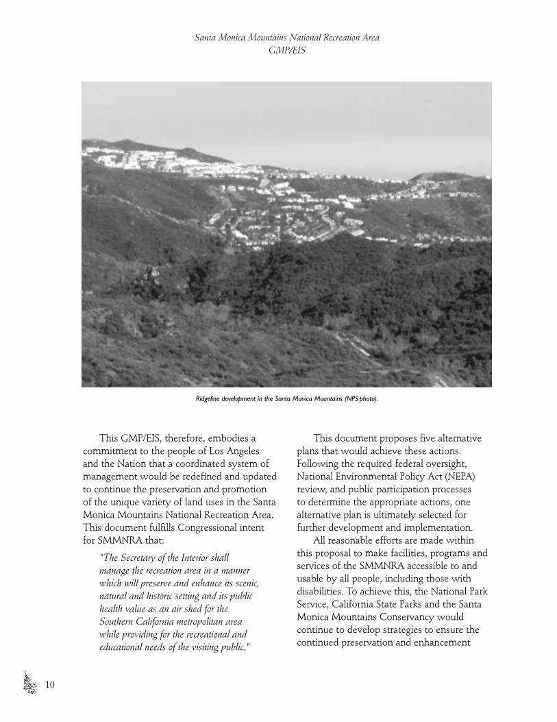
This GMP/EIS, therefore, embodies acommitment to the people of Los Angelesand the Nation that a coordinated system ofmanagement would be redefined and updatedto continue the preservation and promotionof the unique variety of land uses in the SantaMonica Mountains National Recreation Area.This document fulfills Congressional intentfor SMMNRA that:
"The Secretary of the Interior shallmanage the recreation area in a mannerwhich will preserve and enhance its scenic,natural and historic setting and its publichealth value as an air shed for theSouthern California metropolitan areawhile providing for the recreational andeducational needs of the visiting public."
This document proposes five alternativeplans that would achieve these actions.Following the required federal oversight,National Environmental Policy Act (NEPA)review, and public participation processes to determine the appropriate actions, onealternative plan is ultimately selected forfurther development and implementation.
All reasonable efforts are made withinthis proposal to make facilities, programs andservices of the SMMNRA accessible to andusable by all people, including those withdisabilities. To achieve this, the National ParkService, California State Parks and the SantaMonica Mountains Conservancy wouldcontinue to develop strategies to ensure thecontinued preservation and enhancement
Santa Monica Mountains National Recreation AreaGMP/EIS
10
Ridgeline development in the Santa Monica Mountains (NPS photo).

of the recreation area’s scenic, natural andhistoric setting. The strategies would ensurethat all new and rehabilitated buildings,facilities and programs, including thoseoffered by concessionaires and interpreters,would be designed and implemented inconformance with applicable rules,regulations and standards.
Planning Process
Planning provides an opportunity to create a new vision and to define a park’s role inrelation to its national, historic and communalsettings. The planning process is designed to provide decision-makers with adequateinformation about resources, impacts andcosts. Analyzing the SMMNRA in relation to its surrounding natural, historic, andcommunal setting, as well as futurechallenges, helps park managers and staffunderstand how the park could interrelatewith neighbors and others in systems that are ecologically, socially and economicallysustainable. Decisions made within thisplanning context are more likely to besuccessful over time and promote moreefficient use of public funds.
The planning process begins by definingthe mission statement and purpose of thepark, including which goals would fulfill that mission, and descriptions of resourceconditions, visitor uses and managementactions to best achieve those goals. Aftergoals are established, the treatment and use of park resources is considered, based onscientific, technical and scholarly analysesthat employ current scientific research as wellas applied and accepted professional practicesin park management. The planning analysis istiered, focusing first on the park as a whole(on a global, national and regional context),environmental impacts to the park, and then on site-specific details. Management
alternatives are generated based on the goalsand analyses. The alternatives are thenscrutinized with respect to their consistencywith the park purpose and mission, theimpact on park resources, the quality of thevisitor experience, the short and long termcosts, and environmental consequences that extend beyond park boundaries. Theplanning process for SMMNRA is illustrated on Figure 1.
A “core” planning team was assembled inthe spring of 1997. It was comprised of thesuperintendent, deputy superintendent, andchief of resource planning from the NationalPark Service, the district superintendent fromthe Angeles District of the California StateParks, the chief of their Southern ServiceCenter, and the executive director and chiefof planning of the Santa Monica MountainsConservancy. This group met separately andtogether with the staffs of their agencies togather input from those who work in theSMMNRA on a daily basis. The “core” teamagain met in August of 1997 and April 1998with representatives from over 70 state,federal and local agencies and municipalitiesfor ideas on the future of the SMMNRA.
Throughout the planning process, theSMMNRA has requested input from thepublic at critical stages. Public participation in planning ensures that the SMMNRA fullyunderstands and considers the public’sinterests in the park as part of their nationalheritage, cultural traditions, and communitysurroundings. The GMP/EIS effort began in 1997 when the planning team met tofamiliarize team members from outside the park with the resources, discuss issuesand the scope of the plan, and create theSMMNRA mission statement. In August1997, a meeting was held with more than 70 public agencies associated with landmanagement within the SMMNRA boundary,to discuss the issues and future of the park. Inearly September 1997, the public was
Purpose and NeedPlanning Process
11

formally notified of the planning effort andintroduced to the planning process throughpublication of Newsletter One. Subsequentnewsletters kept the public informed ofprogress. Two additional newsletters and twoseries of five public meetings each wereconducted in preparation of this plan. Thepublic participation process is detailed later in the “Consultation and Coordination withOthers” section of this document.
Relationship to Other Planning Documents
The general management plan seeks to define why a park was established and whatresource conditions and visitor experiencesshould be achieved and maintained over timeto conserve that original purpose. The planconsiders various approaches to park use,management and development, some ofwhich may represent competing interests for the same resource base. Ultimately, theGMP/EIS serves to define a series of desiredoutcomes or conditions. The plan covers a broadarea, a wide range of programs and concerns,addresses an array of resources, and must,therefore, function at a general level.
The more specific actions required toattain the goals and outcomes defined in theGMP/EIS are accomplished throughimplementation plans. These plans apply to specific program areas, projects oroperational and development strategies forspecific areas of the park. Because planning is an ongoing and continuous process, theGMP/EIS must be viewed as a dynamicdocument. A number of plans alreadycompleted would remain in effect, and thisGMP/EIS reflects those still deemed to be useful. Future implementation planswould use the goals and conditions defined in this GMP/EIS as their starting point.Implementation plans for actions withpotential to affect the environment wouldrequire formal analysis of alternatives in
compliance with the National EnvironmentalPolicy Act and related legislation, includingthe National Historic Preservation Act.
Other Planning Documents Still Current
Table 3 contains a list of specific plansdeveloped by NPS to date and can be foundin the Appendix. Plans determined to still be current are indicated in that table. Among the implementation plans current and particularly useful in the development of this GMP/EIS are: SMMNRA LandProtection Plan (NPS), Resource Management Plan (NPS), Water Resources Management Plan (NPS), Business Plan (NPS), DevelopmentConcept Plans (NPS), Museum Management Plan (NPS), and California State Parks General Plans.
Implementation of the GMP/EIS
While the SMMNRA general managementplan and accompanying environmentalimpact statement represent the ultimatevision of the National Park Service, CaliforniaState Parks and the Santa Monica MountainsConservancy, the actions called for in thisjoint plan would be accomplished over time. Budget restrictions, requirements foradditional data, legal compliance and/orcompeting SMMNRA priorities preventimmediate implementation of many actions.The GMP/EIS is not an implementation plan but a framework for management and implementation plans. Major or costly actions could be implemented 10 or more years following the finalization of the document.
In the implementation of this GMP/EIS,the NPS, CSP and SMMC have limitedauthority over privately held lands, but wouldattempt to guide the decisions of other publicagencies toward consistency with the joint
Santa Monica Mountains National Recreation AreaGMP/EIS
12

plan, whenever possible. Implementation ofthe SMMNRA GMP/EIS is outlined below.
◗ NPS-Owned Lands
The NPS would implement actions set forthin the GMP/EIS on NPS-owned lands, asfunding becomes available for improvementsand land acquisition.
Improvements to specific facilities onNPS-owned lands, and/or acquisition of
additional lands, would be completedaccording to specific implementation plans.Over time, some of these plans may berevised. A number of specific plans alreadyexist. They would be revised for consistencywith the GMP/EIS as necessary. Whenpossible, future implementation plans wouldbe jointly developed to reflect the cooperativeinterests and management of the SMMNRA.A trail management plan for the park
Purpose and NeedImplementation of the GMP/EIS
13
SMMNRA Planning Process.
agencies of the Santa Monica Mountainswould be among the first plans developed on this broader scale of resource and public interest.
◗ California State Parks
The CSP intends to utilize the GMP/EIS in relation to its own general planning process in the following ways:
The joint GMP/EIS would be used, ineffect, as an advisory document. It would not replace state park general plans (existingand future plans, as well as associatedamendments). Individual CSP general planswould continue to be viable and primaryvehicles for the long-range planning ofindividual units in the Santa MonicaMountains, as specified in the PublicResources Code. The CSP would keep ageneral consistency between the GMP/EISand its general plans. The goals and conceptsset forth in the GMP/EIS would be used to plan and manage areas on behalf of theexisting eight state park units included in the SMMNRA, as well as any future units in this area.
Table 4 in the Appendix contains a list ofplanning efforts in which CSP is engaged.
◗ Opportunities for Interagency Cooperative Relationships
The enabling legislation for the SMMNRAenvisioned a cooperative effort between thestate, local governments, and the NPS topreserve the “significant scenic, recreational,educational, scientific, natural, archeologicaland public health benefits provided by theSanta Monica Mountains and the adjacentcoastline.” Approximately 70 governmentalagencies have some type of jurisdictionwithin the SMMNRA boundary. Cooperativerelationships in the Santa Monica Mountainsare both beneficial and a simple necessity. Nosingle agency or governmental body currentlyor ever would, control the land base.Individually, the lands owned and managed
by the separate agencies are too small, toointerdependent and too vulnerable to sustaintheir biological integrity and absorb theimpacts of natural processes such as fires andlandslides or unnatural processes such asdevelopment. But as inter-linked resources,each supports the existence of others andprovides for a natural system that can protectrare species and maintain an uninterruptedrugged landscape with continuous anddiverse recreational opportunities to challengethe most experienced park visitor. Thepossibilities for cooperation are many and,clearly, available to accomplish every goalcontained within the GMP/EIS. Theadministering agencies of the SMMNRA can provide input to the development of these plans by providing comments duringpublic review periods and participating ontask forces and environmental reviewcommittees. Please refer to Table 2, GeneralAgreements with Other Agencies in theAppendix.
Relationships among SMMNRA-associated agencies are positive with frequentopportunities for cooperation. These are notlimited to the NPS, California State Parks andthe Santa Monica Mountains Conservancy.Los Angeles County Beaches and Harbors, forexample, probably serves more recreationarea visitors on coastal beaches than do theother SMMNRA agencies combined. MuguLagoon, administered by the U.S. Navy,supports one of the recreation area’s mostsensitive and endangered biological resources.
To the extent possible, the goals, policiesand special land designations of thecooperating agencies are reflected in thisGMP/EIS. One of the document’s principalpurposes is to provide a common frameworkwhereby the mission and program objectivesof each agency can be promoted for greaterefficiency, implementation and moreenduring results, to the benefit of humansand park resources alike. The principal means
Santa Monica Mountains National Recreation AreaGMP/EIS
14
by which the GMP/EIS can best beimplemented is through detailed site andprogram plans, as well as annual work plans mutually developed by the parkagencies. As the resources are best managedand preserved by a seamless expanse ofparklands, so the public is best served by aseamless recreational experience that avoidsunnecessary, confusing and wastefulduplication of government services.
Purpose and NeedImplementation of the GMP/EIS
15

T h e P a r k
No other urban
national park
features such a
diversity of natural,
cultural, scenic,
and recreational
resources within
such a densely
populated area.

19
▲ Few nationalparks feature
such a diverse assemblage of natural,
cultural, scenic and recreational resources within
easy access of more than
17 million people(NPS photo).
T H E P A R K
The Congress of the United States, finding that "…there aresignificant scenic, recreational, educational, scientific, natural,archeological, and public health benefits provided by the SantaMonica Mountains and adjacent coastline area," established theSanta Monica Mountains National Recreation Area in 1978. It did so to "…preserve its scenic, natural, and historic setting and itspublic health value as an air shed for the Southern Californiametropolitan area while providing for the recreational andeducational need of the visiting public." A core tenet of the 1978legislation is partnership among federal and state park agencies, as well as local governments and private landowners.
Regional Location and Boundaries
The cooperative framework among agencies also means thatSMMNRA has rather complex boundaries compared to othernational park units. The legislated boundary of this park unitgenerally covers the Santa Monica Mountain region in southernCalifornia (see Figure 2) It totals 150,050 acres, and currentlyencompasses 69,099 acres of protected parkland. Ninety percent ofthe total area within the SMMNRA boundaries is not developed.
The recreation area extends from the Hollywood Bowl on theeast, 46 miles west to Point Mugu, and averages seven miles inwidth (see Figure 3). To the north, the recreation area is bordered bySimi Valley, the San Fernando Valley, and many communities thathave developed along Highway 101. These include Calabasas,Thousand Oaks, Westlake Village and Agoura Hills. The PacificCoast Highway (PCH) crosses the recreation area to the south andincludes Topanga, Malibu and Pacific Palisades. In the east therecreation area begins just north of Hollywood with small,undeveloped canyons. A little farther west, in Topanga State Park,the mountains reach a width of eight miles across, most of which iswithin the city limits of Los Angeles. The further west one travelsthe wilder and less developed the mountains become, ending atPoint Mugu State Park, which encompasses the recreation area’sonly designated wilderness.

Table 1
LANDOWNERSHIP WITHIN SMMNRABOUNDARY
Land Owner (Geographic Area) Total Acreages as of 2002
Other Private Land 72,638
State Dept. of Parks & Recreation 34,909
National Park Service 22,093
Other Los Angeles County Land (non-parkland) 3,258
Mountain Resources Conservation Authority 5,729
Santa Monica Mountains Conservancy Land 2,922
University of CA Reserve 328
Other City of Los Angeles Land (non-parkland) 2,021
Miscellaneous Public Land 265
COSCA Open Space 0
Other Federal Land 936
Mountain Restoration Trust 1,491
Los Angeles County Parkland 328
City of Calabasas Parkland 245
City of Los Angeles Land 447
City of Thousand Oaks Parkland 36
Las Virgenes Municipal Water District 1,198
The Santa Monica Mountain Zone(SMMZ), comprising an additional 75,000acres, was also established by the 1978legislation. It extends beyond the boundariesof the national recreation area and includesthe entire Santa Monica Mountain range.Local and state agencies are responsible forland use regulations within this zone, but the National Park Service retains, by law,reviewing authority on projects involvingfederal funds, permits, or licenses that mayaffect the recreation area. This authority wasprovided by Congress to reduce downstreamimpacts on recreation area resources whenpossible. The SMMZ incorporates watershedsand canyon slopes associated with, but notformally included in the SMMNRA, as well as the easternmost extension of the Santa
Monica Mountains from the Hollywoodfreeway to include Griffith Park.
LANDOWNERSHIP
The Santa Monica Mountains ComprehensivePlanning Act (enacted in 1978) mandated thata comprehensive plan be created to lay theframework for what the recreation areashould be in terms of size and character. Thenas now, the state of California was the largestpublic landowner, with more than 28,000acres of land in four major state parks. Federalland acquisition began in 1980, with anauthorization of $155 million. At that time theNational Park Service targeted approximately70,000 acres for future acquisition. Whencompleted, about 100,000 of the SMMNRA’s150,000 acres would be parkland.
Santa Monica Mountains National Recreation AreaGMP/EIS
20

Currently, some 63,000 acres of openspace lands are held by government andconservation agencies within the SMMNRA.The largest amount of acreage remains inprivate ownership. Landownership statisticswithin the SMMNRA boundary have beenlisted on Table 1.
LAND PROTECTION PLAN
The 1998 Land Protection Plan (LPP) is amongthe most critical to the formulation of thisGMP/EIS. The LPP identifies and spatiallylocates significant natural, cultural andrecreational resource parcels. The recreationarea uses GIS, i.e., geographic information
system software, to organize and analyzenatural, cultural and recreational conservationcriteria established by scientists and parkmanagers throughout southern California.The GIS software groups the criteria andassigns a relative “score” to each parcel – inessence, a ranking of its parkland resourcevalue. The specific resource information foreach parcel can be listed to support its relativeranking for parkland acquisition. The LPP’sinformation provides supportive “resourcereasoning” for efforts to acquire particularproperties.
Because knowledge of the Santa MonicaMountains is ever increasing, the GIS system
The Park
21
Regional location of the Santa Monica Mountains National Recreation Area (SMMNRA).

is intentionally dynamic, ever expanding theresource reasoning in land protection. Whenthis general management plan is finallyadopted, it would be reflected in the databaseused in the land protection process.
All immediate adjustments to therecreation area boundary contained withinthis GMP/EIS are predicated on theassumption of donation, land transfer orpurchase by a non-federal entity.Recommendations for additional boundarystudies do not make this assumption, and theimpact of additional acquisition costs wouldbe one of the factors considered in any future study.
The NPS and its partners continue topursue parkland acquisition within theSMMNRA boundaries. This GMP/EISpresents a broad-brush approach concerningwhich areas in the mountains should beconsidered low, moderate or high intensityuse areas. The SMMNRA Land Protection Plan provides specific parcel-based resourceinformation to substantiate acquisition effortsin the GMP/EIS’s use zones. The LPP providesa better understanding of resource andrecreation values at risk, and enables the NPS to assess alternative approaches toresource protection, such as conservationeasements, land exchanges and habitatconservation plans.
Description of the Park
The planning process for this GMP/EIS hasfocused on understanding and preserving thehuman relationships with the recreationarea’s physical, natural and cultural resources.The following resource descriptions mightprovide an idea of the human values thatwould be at stake if a sustainable plan werenot in place.
PHYSICAL RESOURCES
The mountains and beaches of the recreationarea form a dramatic contrast to the urbansprawl of the San Fernando Valley and the
Los Angeles Basin. The east-west trendingmountain range is geologically complex andcharacterized by steep, rugged mountainslopes and canyons. Elevations range from sea level to more than 3,000 feet. The SantaMonica Mountains are adjacent to 46 miles of scenic California coastline with sandybeaches and rocky tide pools and lagoons.Long, wide, white beaches stretch alongmuch of the coast, occasionally giving way to high bluffs and rocky outcrops juttingseaward. At 1,400 acres, Mugu Lagoon is thelargest coastal wetland outside the SanFrancisco Bay area. Malibu Lagoon and MuguLagoon are important stopovers for neo-tropical and other birds migrating along thePacific flyway.
The diversity of the coastal resourcesalong Santa Monica Bay is magnificent. TheSaddlerock pictograph site is deemed eligibleas a national historic landmark and theParamount Movie Ranch is an historicallysignificant cultural landscape. Will RogersRanch, the Adamson House and Los Encinosare important visitor attractions.
NATURAL RESOURCES
There is tremendous ecological diversitywithin the recreation area. Grassy hills, oakwoodlands, valley oak savannas, rockyoutcrops, and riparian woodlands give way tochaparral-covered slopes, coastal marshes,and rural residential and agricultural areas.Numerous mammals are found in themountains, including bobcats, coyotes,mountain lions, mule deer, golden eagle andbadgers. Nearly 400 species of birds and 35species of reptiles and amphibians are knownto occur in the SMMNRA. More than 20federal or state listed threatened andendangered plant and animal species and four additional state-listed threatened andendangered species find habitat within theSanta Monica Mountains. In addition, 46federal and state animal and 11 plant “speciesof concern” also occur. These plant, animal,
Santa Monica Mountains National Recreation AreaGMP/EIS
22


and habitat types are a part of a diverse andincreasingly rare, complex natural ecosystemthat has adapted to the southern CaliforniaMediterranean-type climate of wet wintersand warm, dry summers.
The global significance of theMediterranean-type ecosystem is becomingincreasingly recognized. A recent mapping of global environments shows this biomeamong the smallest and most rare on earth,and each has experienced intense humanoccupation. As a result, only 18 percent of this ecosystem remain undisturbed in the world (Hannah et al 1995).
Fire has been an especially importantfactor shaping ecosystems of the Santa MonicaMountains. Fire contributes to the control of nutrient cycles and energy pathways.Through much of the past, fire has been anatural process, contributing to the diversity,
productivity and regeneration of ecosystems.The recreation area’s vegetation and wildlifehave evolved over millions of years in partialresponse to naturally occurring fires. Thesefires, in combination with aboriginal burningduring the last 12,000 years, shaped thelandscape.
However, the current proximity andaccessibility of the mountains to millions ofpeople have heavily influenced current fireregimes. All of the major fires since 1925 have been human caused – either by arson oraccidental events (e.g. downed power poles,vehicle emissions, cigarettes tossed out thecar window, etc.). In the southern Californiabrushlands, numbers of fires have increasedand fire rotation intervals have decreased over the 20th century as population densitieshave increased (Keeley, et.al. 1999). Evenaccounting for burning by Native American
The Park
25
The Santa Monica Mountains are adjacent to 46 miles of scenic California coastline with sandy beaches and rocky tide pools and lagoons.

Indians, it was likely that pre-historic firefrequency was lower and return intervalssignificantly longer. Fire has long been used asa tool to intentionally convert shrub lands toclear farmland and produce grasslands moresuitable to grazing livestock. Now, however,high fire frequencies are creating an undesiredeffect. The conversion of native chaparralcommunities to non-native grasslands hasaltered the native vegetation structure, whichfacilitates further invasion of non-nativespecies – particularly exotic species.
The fire season begins in early May,when the non-native annual grasslands dryup. The season continues throughout thesummer, and is comprised of hightemperatures and the long summer drought.The Santa Ana winds, which are prevalent in late summer, also contribute to the highfire hazard.
CULTURAL RESOURCES
Few national parks feature such a diverseassemblage of natural, cultural, scenic andrecreational resources within easy access ofmore than 17 million people. The populationsurrounding the SMMNRA has developed aCalifornia-type of lifestyle and culture thathas influenced the world with innovativecontemporary architecture, literature, musicand recreational pursuits. The California filmindustry has added to the region’s legacy by
capturing the American culture on film andexporting historical images to the world withmany Santa Monica Mountain locations inthe background.
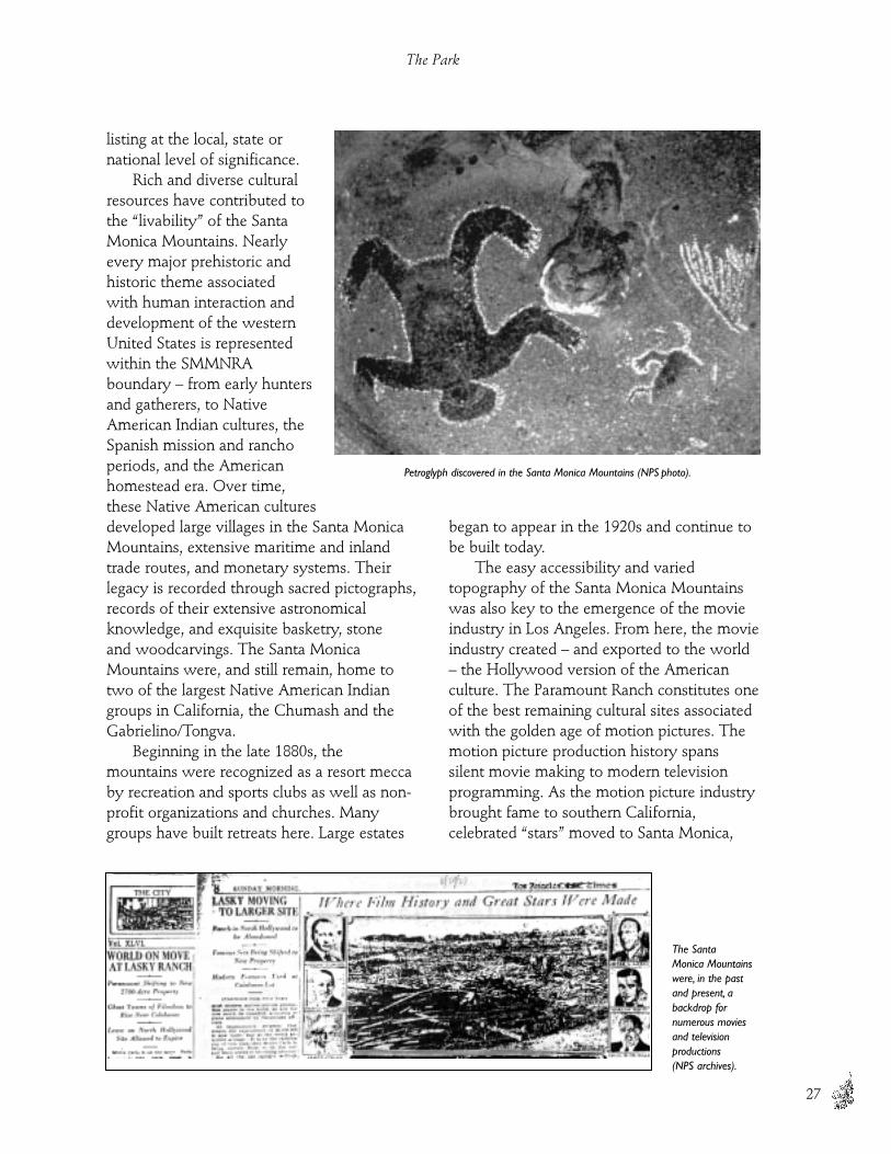
Aside from the contemporary Californiaculture, the Santa Monica Mountainssurround nationally significant ethnographic,archeological, historic and scenic sites. Morethan 1,000 known archeological sites arelocated within the SMMNRA boundary, one of the highest densities of archeologicalresources found in any mountain range in theworld. The 26 known Chumash pictographsites, sacred to traditional Native AmericanIndians, are among the most spectacularfound anywhere. Nearly every majorprehistoric and historic theme associated with human interaction and development ofthe western United States is represented here.Three historice structures in the SMMNRAare listed on the National Register of HistoricPlaces. More than 73 archeological/historicsites in the Santa Monica Mountains arepotentially eligible for listing on the NationalRegister of Historic Places. Among these arerecreation area sites such as ParamountRanch, which continues to be used by thefilming industry.
An estimated 40 percent of all the landthroughout the Santa Monica Mountains hasbeen surveyed for archeological sites, andabout 70 percent of National Park Servicelands in the SMMNRA have been surveyedfor archeological sites. California State Parksconducts similar studies and inventories on state park properties in the course ofpreparing or updating general plans,interpretive or educational plans, resourcemanagement plans, and comprehensivemaster plans.
In 2001, the recreation area will begin anHistoric Resource Study of NPS lands. This isa three-year project that will identify andnominate to the National Register thosestructures, sites and cultural landscapes thatappear to meet National Register criteria for
Santa Monica Mountains National Recreation AreaGMP/EIS
26
View of Sycamore Canyon (NPS photo).
listing at the local, state ornational level of significance.
Rich and diverse culturalresources have contributed tothe “livability” of the SantaMonica Mountains. Nearlyevery major prehistoric andhistoric theme associated with human interaction anddevelopment of the westernUnited States is representedwithin the SMMNRAboundary – from early huntersand gatherers, to NativeAmerican Indian cultures, theSpanish mission and ranchoperiods, and the Americanhomestead era. Over time, these Native American culturesdeveloped large villages in the Santa MonicaMountains, extensive maritime and inlandtrade routes, and monetary systems. Theirlegacy is recorded through sacred pictographs,records of their extensive astronomicalknowledge, and exquisite basketry, stone and woodcarvings. The Santa MonicaMountains were, and still remain, home totwo of the largest Native American Indiangroups in California, the Chumash and theGabrielino/Tongva.
Beginning in the late 1880s, themountains were recognized as a resort meccaby recreation and sports clubs as well as non-profit organizations and churches. Manygroups have built retreats here. Large estates
began to appear in the 1920s and continue tobe built today.
The easy accessibility and variedtopography of the Santa Monica Mountainswas also key to the emergence of the movieindustry in Los Angeles. From here, the movieindustry created – and exported to the world– the Hollywood version of the Americanculture. The Paramount Ranch constitutes oneof the best remaining cultural sites associatedwith the golden age of motion pictures. Themotion picture production history spans silent movie making to modern televisionprogramming. As the motion picture industrybrought fame to southern California,celebrated “stars” moved to Santa Monica,
The Park
27
Petroglyph discovered in the Santa Monica Mountains (NPS photo).
The Santa Monica Mountainswere, in the pastand present, abackdrop fornumerous moviesand television productions (NPS archives).

Pacific Palisades, and Malibu, forming thenucleus of luxurious movie colonies.
VISITOR EXPERIENCE
Visitors to Los Angeles experience the natural beauty and cultural richness of theSMMNRA as a welcome natural and culturalalternative to the highly developed greaterLos Angeles area. It would be the goal of this GMP/EIS to provide guidance for theSMMNRA to continue to provide these experiences.
Just outside the recreation area boundary,the communities surrounding the SantaMonica Mountains have led growth in thestate for the last 15 to 20 years. Residentialand commercial centers have filled the valleyfloors and foothills north of the mountains.The San Fernando Valley, Calabasas, HiddenHills, Agoura Hills, Westlake Village andThousand Oaks communities have developednew tract subdivisions, apartment complexes,large planned communities, and commercialcenters. The desire to live in a rural setting,
void of urban distractions and stresses, is astrong factor in the development within therecreation area boundary.
Each year more than 33 million visitorsenjoy the beaches and mountains within the SMMNRA. Visitors hike, bike or ride onhundreds of miles of mountain trails, or drivethe scenic roads. Communities within andadjacent to the recreation area provide a wide variety of visitor and tourist services.
Implementing any one of the alternativesproposed in this GMP/EIS would allowvisitors to continue to experience the varietyof activities in the recreation area. Any of theplans would be designed to create a feeling of compassion for the treasures of California’spast and to encourage appreciation for theremaining land so that it would continue tobe protected and available for futureenjoyment.
◗ National Park Service
The National Park Service “oversees” the SMMNRA, but currently has directresponsibility for only about 15 percent ofthe land within the boundary. The NPS is apartner, sharing stewardship with the public,other agencies and private landowners. The National Park Service provides for theoperation, maintenance, resourcemanagement, education, and resource andvisitor protection on all NPS lands. Thelegislation establishing the 150,000-acreSMMNRA emphasizes cooperativerelationships. Thus, NPS has a less direct, but very clear duty to support activities onnon-NPS lands consistent with the purposesof the SMMNRA. Please refer to Figure 4 for the existing conditions and recreationalopportunities of the park. National ParkService units include:
• Zuma-Trancas Canyon – This wild coastalcanyon is largely undisturbed by adjacentdevelopment and contains endangeredspecies and rare perennial streams. Thecanyon contains critical core habitat and
Santa Monica Mountains National Recreation AreaGMP/EIS
28
Zuma-Trancas Canyon (NPS photo).

abundant species diversity in large blocksof coastal sage scrub vegetation. Hikingtrails are available. Bicycles are allowedon Zuma Ridge.
• Paramount Ranch – This historic movieranch is used by filmmakers. The ranchfeatures beautiful valley oak savannasand short hiking trails. This site iscurrently used for interpretation andobservation of filmmaking. There areseveral trails at the ranch and it is used as an outdoor classroom forenvironmental education.
• Rancho Sierra Vista/Satwiwa – This is aplace of special significance to NativeAmerican Indians as it contains sites of aChumash habitation and is the crossroadof two Native American Indian trails andtrade routes. Beautiful views of BoneyMountain feature a pastoral ranch-likesetting. The site is currently used for the
Satwiwa Native American CulturalCenter with interpretive programs andrecreational trails. The site is a gatewayto Point Mugu State Park and BoneyMountain Wilderness. There are severaltrails here and it is used as an outdoorclassroom for environmental education.
• Arroyo Sequit – This area contains rollinggrassland mixed with chaparral with a
picnic area and a wood frame ranchhouse serving as a ranger residence. The site is considered a significantexample of the homesteading era. Thearea is excellent for viewing the night sky as it is tucked away from the lightsof Los Angeles.
• Circle X Ranch – One of the fewindividual and group camping sites, thissite is the gateway to the most remoteparts of the Santa Monica Mountains and has the highest peak in the range. It is a secluded mountainous area withimpressive rocky outcrops and a varietyof scenic trails. This site was a Boy Scoutcamp from the 1950s to the 1960s. Theranch has areas for picnicking and aranch house for group use.
• Rocky Oaks – One of the more accessiblesites in the mountains, Rocky Oakscontains scenic oak woodlands with apond and wetlands. It is adjacent to theSaddle Rock pictograph site. This unithas nature trails, an amphitheater and picnic area.
• Castro Crest – Part of the Backbone Trail corridor, this prominent ridgelinehas stunning rock formations and views of the ocean and the mountains.
The Park
29
Culturally significant Paramount Ranch (NPS archives).
Rancho Sierra Vista/Satwiwa (NPS photo).

• Cheeseboro Canyon and Simi Hills – Rolling hills with valley oak savannasand unique rock lands provide nestinghabitat for a tremendous diversity of raptors here. Lush riparian areascomprise the character of this site. Thearea was a significant cattle ranchingdistrict used from the 1780s to the 1900s. Significant Chumash andGabrielino/Tongva religious sites occurvery close to the NPS boundary. Viewsfrom Simi Peak dramatically contrast the surrounding valleys and naturallandscapes with the man-madeenvironment. This area receives a highlevel of use on the trails by mountainbikers, horseback riders and hikers.
• Solstice Canyon – Solstice Canyon is alush, narrow canyon that offers a
perennial stream with an extensiveriparian community. The site providesconditions suitable for the reinroductionof endangered steelhead trout. TheCanyon also features several notablearcheological sites and a stone cabin,built by Mathew Keller, which represents homesteading in the coastalSanta Monica Mountains. There areseveral trails in the canyon that connectthe coastal and mountain habitats. TheCanyon is used as an outdoor classroomfor environmental education.
• Peter Strauss Ranch – A small ranchshowcases the original stone house(1927) and outbuildings built by theoriginal owner, Harry Miller, inventor ofthe carburetor. The Smithsonian refers tohim as the greatest automotive genius ofthe century. This site is used for festivals,picnicking, concerts, and special events.
◗ California State Parks
Of the 150,000 acres included within theboundary of the national recreation area, theCalifornia State Parks manages an estimated33,271 acres.
The CSP administers its lands accordingto the classifications and subclassificationdefined in the State of California PublicResources Code. Classifications includewilderness, reserves, parks, recreation areas,historical units and natural reserves.
Santa Monica Mountains National Recreation AreaGMP/EIS
30
Peter Strauss Ranch (NPS photo).
Upper Cheeseboro Canyon (NPS photo).

Department headquarters islocated in Malibu Creek StatePark. State park units arelisted below and illustrated inFigure 4:
• Point Mugu State Park –This area makes up oneof the largest contiguousundisturbed areas in theSMMNRA. It features alarge wilderness preserveand several perennialstreams. There aresignificant diverse plantcommunities across thearea. The mountain andcoastal interface providesa unique recreationalexperience. The Point Mugu area wasalso an important trade route for NativeAmericans with numerous associatedarcheological sites. There are beach andcanyon campgrounds, a groupcampground area, picnic facilities, andhiking, mountain biking and horsebackriding trails.
• Leo Carrillo State Park – There is a varietyof habitat from significant tide pools toupland vegetative habitats here, with oneof the best areas for viewing wildflowersin this unit in the western part of therecreation area. It is also a monarchbutterfly migration area. There are beachand canyon campground facilities(including group camping). A largearcheological village site is located nearthe beach.
• Point Dume State Beach – Thispromontory defines the northern end ofSanta Monica Bay and providesspectacular views of the entire coastalcorridor of the recreation area. The unitis divided into a popular recreationalbeach area (on the up coast end)operated by the County of Los Angeles,and a natural preserve that includes the
promontory, natural upland habitat, tidepools, a remote beach and a seal haul outarea.
• Malibu Creek State Park – This area has a variety of habitat, perennial creeks,pools, lakes, valley oaks, lush riparianareas and views of rugged mountains. Malibu Canyon is a prominent feature of the area. At its deepest, it isapproximately 1900 feet deep. MalibuCreek State Park has been used for manymovie and television locations. It was asignificant interface site between the twoNative American Indian groups, theChumash and the Gabrielino/Tonga.There is a Chumash village site here aswell as several historic structures.Campground and picnic facilities arescattered throughout the park, as arenumerous hiking trails. This site alsoserves as headquarters for the AngelesDistrict of the California State Parks.
• Malibu Lagoon State Beach – is one of the two significant lagoons in southernCalifornia. It is a habitat for Steelheadtrout and tidewater Goby and is a majorbird flyway. The beach area operated bythe County of Los Angeles is considered
The Park
31
Point Mugu State Park (NPS photo).
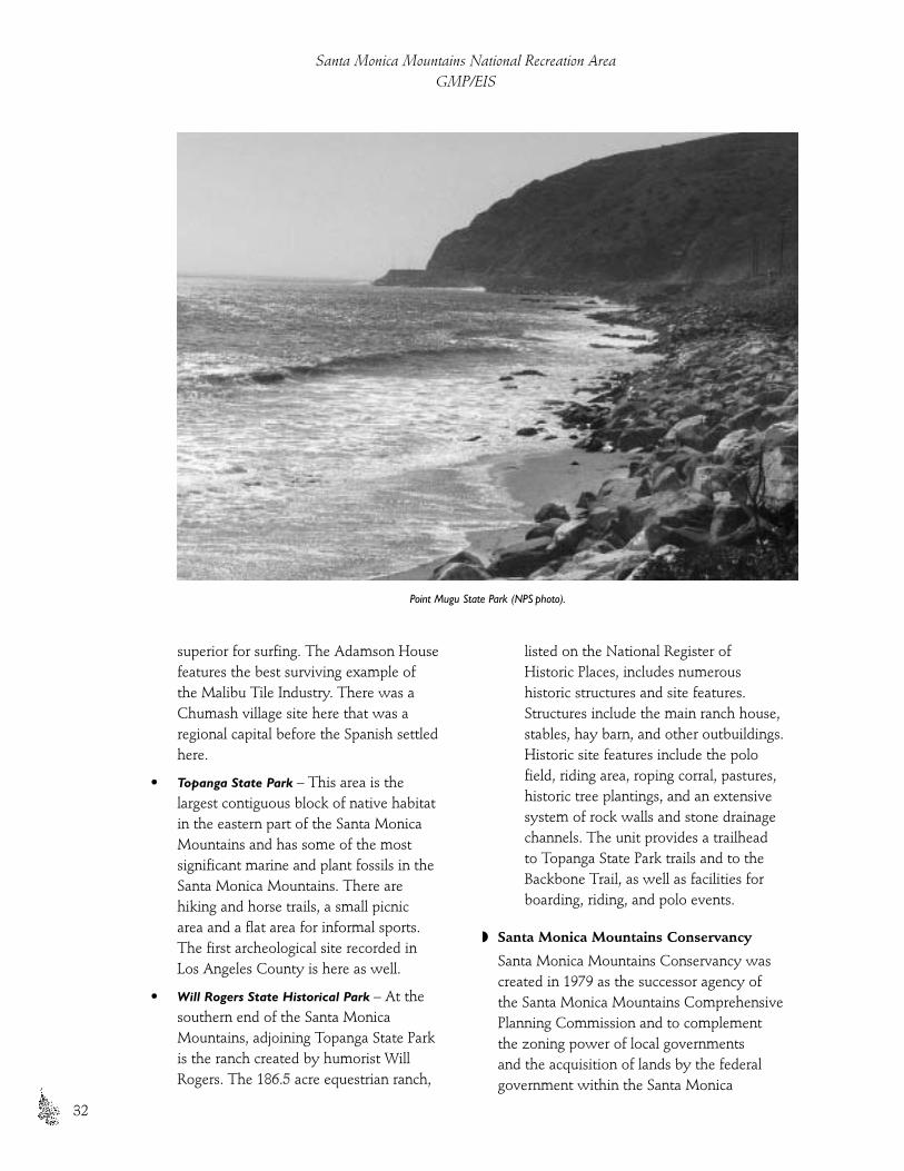
superior for surfing. The Adamson Housefeatures the best surviving example ofthe Malibu Tile Industry. There was aChumash village site here that was aregional capital before the Spanish settledhere.
• Topanga State Park – This area is thelargest contiguous block of native habitatin the eastern part of the Santa MonicaMountains and has some of the mostsignificant marine and plant fossils in theSanta Monica Mountains. There arehiking and horse trails, a small picnic area and a flat area for informal sports.The first archeological site recorded inLos Angeles County is here as well.
• Will Rogers State Historical Park – At thesouthern end of the Santa MonicaMountains, adjoining Topanga State Parkis the ranch created by humorist WillRogers. The 186.5 acre equestrian ranch,
listed on the National Register of Historic Places, includes numeroushistoric structures and site features.Structures include the main ranch house,stables, hay barn, and other outbuildings.Historic site features include the polofield, riding area, roping corral, pastures,historic tree plantings, and an extensivesystem of rock walls and stone drainagechannels. The unit provides a trailhead to Topanga State Park trails and to theBackbone Trail, as well as facilities forboarding, riding, and polo events.
◗ Santa Monica Mountains Conservancy
Santa Monica Mountains Conservancy wascreated in 1979 as the successor agency of the Santa Monica Mountains ComprehensivePlanning Commission and to complement the zoning power of local governments and the acquisition of lands by the federalgovernment within the Santa Monica
Santa Monica Mountains National Recreation AreaGMP/EIS
32
Point Mugu State Park (NPS photo).

Mountains Zone. The SMMC relies on theSanta Monica Mountains Comprehensive Plan(1979), a plan that is compatible with thegoals of the recreation area, to determinewhich land should be acquired. The SMMCalso reviews the consistency of localgovernment actions with the comprehensiveplan as they determine their eligibility forNPS or SMMC managed grant programs.
The primary responsibility of the agencyis to acquire land and turn it over to theappropriate land management agencies. TheSMMC is not a park management agency,although it has acquired many key park andrecreation parcels in the mountains, totaling5,200 acres. The SMMC has also developed aseries of scenic overlooks along MulhollandScenic Corridor and has been very supportiveof the purposes of the national recreationarea. The Mountains Recreation andConservation Authority (MRCA) is the landmanagement arm of the SMMC createdunder a Joint Powers Agreement incooperation with several local park agencies.
Headquarters for the SMMC is at theRamirez Canyon Park in Malibu. Throughthe assistance of its joint powers authority,the MRCA operates the following SMMClands within the national recreation area:
• Coldwater Canyon – Once the mountainpatrol headquarters for the Los AngelesFire Department, it is now anenvironmental education center withseven miles of nature trail andenvironmental displays.
• Corral Canyon – This is the largestundeveloped canyon in the Santa MonicaMountains. It represents a conjunction ofcoastal and mountain habitats andaccesses part of the Pacific Coast trailnetwork running east/west through theSanta Monica Mountains.
• Cross-Mountain Parks – Several pockets ofopen space within surrounding urbanresidential development in the eastern
portion of the Santa Monica Mountainsprovide views and hiking trails. Thesenatural oases contain riparian forests, oakwoodlands and chaparral
• Franklin Canyon Ranch – Cooperativelyadministered by the NPS and the SantaMonica Mountains Conservancy, thisopen space is a natural canyon in theheart of an urban area that features trails(including one fully accessible) and theWilliam O. Douglas Outdoor Center. It is a site for filming with its picturesquesprings, creek and lake. The ranch stillcontains portions of the water deliverysystem to Los Angeles from the OwensValley Aqueduct designed byMulholland, and is potentially eligible forthe National Register.
• Fryman Canyon – A wayside overlook onMulholland Drive provides spectacularviews of Los Angeles, Hollywood, theSan Fernando Valley, Santa SusannaMountains and the west end of the SanGabriel Mountains. There is a mountaintrail connecting to Coldwater Canyonand Wilacre Park, offering an opportunityto experience a chaparral wildernesshiking experience
• Mission Canyon – Part of the originalMulholland Scenic Corridor Park sites, it was formerly attached to the Nikemissile site, and was a landfill for 20years, serving the San Fernando Valley.The canyon is just west of the San DiegoFreeway and south of Mulholland Drive.
• Red Rock Canyon – Large, beautifuleroded boulders of sandstone andconglomerate rock fill this canyon. TheSanta Monica Mountains Conservancyhas converted a pre-existing Boy Scoutsof America building into a wildernesstraining and education center.
• San Vincente Mountain Park – This 10.23-acre park was also the former site of aNike missile tracking station in the 1950s
The Park
33
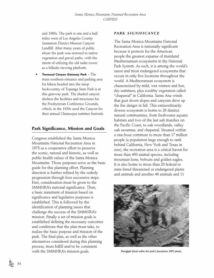
and 1960s. The park is one and a halfmiles west of Los Angeles CountySanitation District Mission CanyonLandfill. After many years of publicabuse the park was restored to nativevegetation and gravel paths, with theintent of utilizing the old radar tower as a hillside-viewing platform.
• Temescal Canyon Gateway Park – Themain southern entrance and parking areafor hikers headed into the steepbackcountry of Topanga State Park is atthis gateway park. The shaded canyonshelters the facilities and structures forthe Presbyterian Conference Grounds,which, in the 1920s used the Canyon fortheir annual Chatauqua summer festivals.
Park Significance, Mission and Goals
Congress established the Santa MonicaMountains National Recreation Area in 1978 as a cooperative effort to preserve the scenic, natural and historic, as well aspublic health values of the Santa MonicaMountains. Those purposes serve as the basicguide for this planning effort. Planningdirection is further refined by the orderlyprogression through four successive steps.First, consideration must be given to theSMMNRA’s national significance. Then, a basic statement of mission based onsignificance and legislative purposes isestablished. This is followed by theidentification of planning issues that challenge the success of the SMMNRA’smission. Finally a set of mission goals isestablished defining the necessary outcomesand conditions that the plan must take, torealize the basic purpose and mission of thepark. The final plan, as well as the otheralternatives considered during this planningprocess, must fulfill and/or be consistent with the SMMNRA’s mission goals.
PA R K S I G N I F I C A N C E
The Santa Monica Mountains NationalRecreation Area is nationally significantbecause it protects for the American people the greatest expanse of mainlandMediterranean ecosystems in the NationalPark System. As such, it is among the world’srarest and most endangered ecosystems thatoccurs in only five locations throughout theworld. A Mediterranean ecosystem ischaracterized by mild, wet winters and hot,dry summers, plus scrubby vegetation called“chaparral” in California. Santa Ana windsthat gust down slopes and canyons drive upthe fire danger in fall. This extraordinarilydiverse ecosystem is home to 26 distinctnatural communities, from freshwater aquatichabitats and two of the last salt marshes onthe Pacific Coast, to oak woodlands, valleyoak savannas, and chaparral. Situated withina one-hour commute to more than 17 millionpeople (a population large enough to rankbehind California, New York and Texas insize), the recreation area is a critical haven formore than 450 animal species, includingmountain lions, bobcats and golden eagles. It is also home to more than 20 federal tostate-listed threatened or endangered plantsand animals and another 46 animals and 11
Santa Monica Mountains National Recreation AreaGMP/EIS
34
Petroglyph found within the park’s boundaries (NPS photo).

plants that are federal or state species ofconcern - among the highest concentrationsof such rare species in the United States.The significance of the Santa MonicaMountains is further established by theexistence of more than 1000 archeologicalsites within the park’s boundaries. These sites reflect human habitations in thesemountains dating back at least 10,000 years.Three structures are listed on the NationalRegister of Historic Places, and more than 73archeological/historical sites are potentiallyeligible for listing on the National Register. In addition, Native American Indians have a long and deeply spiritual history ofinteraction with the Santa Monica Mountains,and many parts of the park are especiallyvalued by them as places to seek spiritualrenewal, conduct traditional ceremonies, andto gather plants for traditional purposes.
The park is also rich in historical themes,ranging from California’s earliest explorationand settlement by Spain, to its subsequentadministration by the Republic of Mexico, as well as the course of Los Angeles’
urbanization, from citrus groves to tracthomes by way of oil development, motionpictures and freeways. Paramount Ranch, as a case in point, is held by some historians tobe the Nation’s best remaining example of a film production facility from Hollywood’s“Golden Era of Motion Pictures.” Continueduse of the Santa Monica Mountains for filmproduction preserves a 75-year tradition thatstill holds the world’s fascination.
PA R K M I S S I O N
Drawing upon the foregoing legislativepurpose and significance, the staff of theNational Park Service, California State Parks and the Santa Monica MountainsConservancy created a joint missionstatement in 1997 to guide the generalmanagement plan and environmental impact statement through its evolution. Over the next year, as ideas and visions forthe future were generated by the public andstaff during meetings and public hearings, all were tested against this statement.
The ParkPark Significance, Mission and Goals
35
The “San Francisco asthe 49ers knew it”movie set at ParamountRanch.The movie,Wells Fargo, was produced by ParamountPictures and directed byFrank Lloyd with JoelMcCrea (NPS archives).
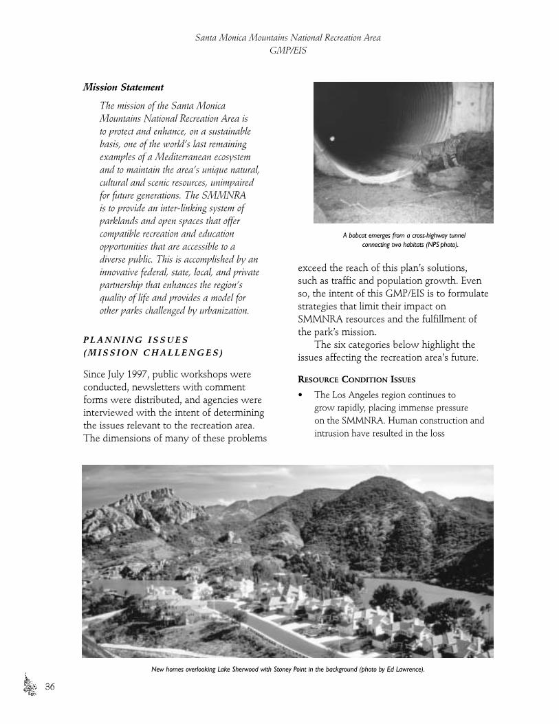
Mission Statement
The mission of the Santa MonicaMountains National Recreation Area is to protect and enhance, on a sustainablebasis, one of the world’s last remainingexamples of a Mediterranean ecosystemand to maintain the area’s unique natural,cultural and scenic resources, unimpairedfor future generations. The SMMNRA is to provide an inter-linking system ofparklands and open spaces that offercompatible recreation and educationopportunities that are accessible to adiverse public. This is accomplished by aninnovative federal, state, local, and privatepartnership that enhances the region’squality of life and provides a model forother parks challenged by urbanization.
P L A N N I N G I S S U E S ( M I S S I O N C H A L L E N G E S )
Since July 1997, public workshops wereconducted, newsletters with comment forms were distributed, and agencies wereinterviewed with the intent of determiningthe issues relevant to the recreation area. The dimensions of many of these problems
exceed the reach of this plan’s solutions, such as traffic and population growth. Evenso, the intent of this GMP/EIS is to formulatestrategies that limit their impact onSMMNRA resources and the fulfillment ofthe park’s mission.
The six categories below highlight theissues affecting the recreation area’s future.
RESOURCE CONDITION ISSUES
• The Los Angeles region continues to grow rapidly, placing immense pressure on the SMMNRA. Human construction andintrusion have resulted in the loss
Santa Monica Mountains National Recreation AreaGMP/EIS
36
New homes overlooking Lake Sherwood with Stoney Point in the background (photo by Ed Lawrence).
A bobcat emerges from a cross-highway tunnel connecting two habitats (NPS photo).
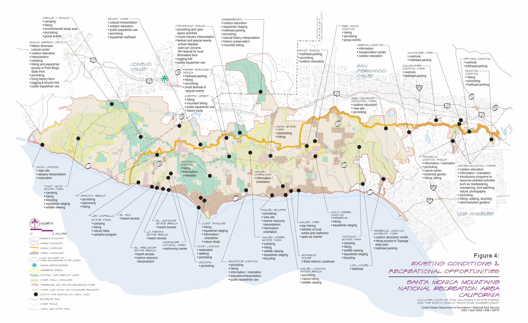
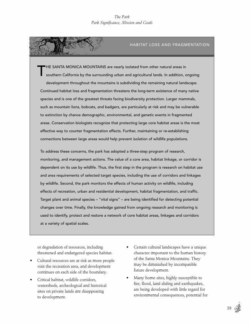
or degradation of resources, includingthreatened and endangered species habitat.
• Cultural resources are at risk as more peoplevisit the recreation area, and developmentcontinues on each side of the boundary.
• Critical habitat, wildlife corridors,watersheds, archeological and historicalsites on private lands are disappearing to development.
• Certain cultural landscapes have a uniquecharacter important to the human history of the Santa Monica Mountains. They may be diminished by incompatible future development.
• Many home sites, highly susceptible to fire, flood, land sliding and earthquakes, are being developed with little regard forenvironmental consequences, potential for
The ParkPark Significance, Mission and Goals
39
HABITAT LOSS AND FRAGMENTATION
HE SANTA MONICA MOUNTAINS are nearly isolated from other natural areas in
southern California by the surrounding urban and agricultural lands. In addition, ongoing
development throughout the mountains is subdividing the remaining natural landscape.
Continued habitat loss and fragmentation threatens the long-term existence of many native
species and is one of the greatest threats facing biodiversity protection. Larger mammals,
such as mountain lions, bobcats, and badgers, are particularly at risk and may be vulnerable
to extinction by chance demographic, environmental, and genetic events in fragmented
areas. Conservation biologists recognize that protecting large core habitat areas is the most
effective way to counter fragmentation effects. Further, maintaining or re-establishing
connections between large areas would help prevent isolation of wildlife populations.
To address these concerns, the park has adopted a three-step program of research,
monitoring, and management actions. The value of a core area, habitat linkage, or corridor is
dependent on its use by wildlife. Thus, the first step in the program is research on habitat use
and area requirements of selected target species, including the use of corridors and linkages
by wildlife. Second, the park monitors the effects of human activity on wildlife, including
effects of recreation, urban and residential development, habitat fragmentation, and traffic.
Target plant and animal species – ”vital signs” – are being identified for detecting potential
changes over time. Finally, the knowledge gained from ongoing research and monitoring is
used to identify, protect and restore a network of core habitat areas, linkages and corridors
at a variety of spatial scales.
T

causing human misery, or consequentburden on taxpayers.
• Competition for remaining open landsdiminishes park values, and ongoingdevelopment continues to escalate land prices.
• Private development of residences alongridgelines and the oceanfront intrude on the scenic vistas.
LAND USE AND OWNERSHIP ISSUES
• Implementation of an effective landmanagement strategy is difficult becausemore than 65 government entities share jurisdiction of land within the park boundary.
• The public land managing partners areoften unable to acquire additional lands due to limited funding and a lengthyacquisition process.
VISITOR EXPERIENCE ISSUES
• Conflicts among different recreational users, such as mountain bikers, horsebackriders and hikers, detract from the qualityof the SMMNRA experience.
• Population growth and increasing visitation require more facilities, parkingareas, and established trails, and decreaseopportunities for solitude in much of therecreation area.
EDUCATION AND INTERPRETATION ISSUES
• Current environmental education programs are too limited in availability to meet the needs and numbers of thediverse population of the Los Angeles area.
ACCESS AND TRANSPORTATION ISSUES
• Mountains and beaches are inaccessible tomany people in the Los Angeles area due to lack of public transportation, insufficientrouting information about how to accessrecreation sites, and heavily congested roadsduring commuter periods and weekends.
• Many of the existing park facilities are not universally accessible.
OPERATIONS ISSUES
• Proximity and similarities in missionsoverlap among the public land managers in the SMMNRA, resulting in a risk ofduplication of facilities and effort.
M I S S I O N G O A L S
The SMMNRA would strive to achieve the following goals regardless of thealternative selected in this planning process.These goals incorporate public commentsabout desired future conditions for the park. The Mission Goals also reflect theplanning issues identified in the previoussection, as well as the mission, law, corevalues and policies of the three principal park agencies joined in this planning effort.
RESOURCE CONDITION GOALS
• Protect and enhance species, habitatdiversity and natural processes.
Santa Monica Mountains National Recreation AreaGMP/EIS
40
Hikers on one of many trails in the SMMNRA (NPS photo).
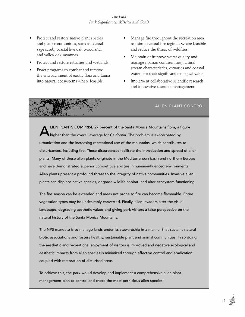
LIEN PLANTS COMPRISE 27 percent of the Santa Monica Mountains flora, a figure
higher than the overall average for California. The problem is exacerbated by
urbanization and the increasing recreational use of the mountains, which contributes to
disturbances, including fire. These disturbances facilitate the introduction and spread of alien
plants. Many of these alien plants originate in the Mediterranean basin and northern Europe
and have demonstrated superior competitive abilities in human-influenced environments.
Alien plants present a profound threat to the integrity of native communities. Invasive alien
plants can displace native species, degrade wildlife habitat, and alter ecosystem functioning.
The fire season can be extended and areas not prone to fire can become flammable. Entire
vegetation types may be undesirably converted. Finally, alien invaders alter the visual
landscape, degrading aesthetic values and giving park visitors a false perspective on the
natural history of the Santa Monica Mountains.
The NPS mandate is to manage lands under its stewardship in a manner that sustains natural
biotic associations and fosters healthy, sustainable plant and animal communities. In so doing
the aesthetic and recreational enjoyment of visitors is improved and negative ecological and
aesthetic impacts from alien species is minimized through effective control and eradication
coupled with restoration of disturbed areas.
To achieve this, the park would develop and implement a comprehensive alien plant
management plan to control and check the most pernicious alien species.
A
• Protect and restore native plant species and plant communities, such as coastal sage scrub, coastal live oak woodland, and valley oak savannas.
• Protect and restore estuaries and wetlands.
• Enact programs to combat and remove the encroachment of exotic flora and faunainto natural ecosystems where feasible.
• Manage fire throughout the recreation areato mimic natural fire regimes where feasibleand reduce the threat of wildfires.
• Maintain or improve water quality andmanage riparian communities, naturalstream characteristics, estuaries and coastalwaters for their significant ecological value.
• Implement collaborative scientific researchand innovative resource management
The ParkPark Significance, Mission and Goals
41
ALIEN PLANT CONTROL

programs among federal, state and localagencies and the private sector to manage,restore, and maintain natural processes.
• Develop scientific geographic informationdata to inform decision-making concerningappropriate parkland development. Sharegeographic information data with privatelandowners and local agencies to promoteand support sustainable development in theSanta Monica Mountains.
• Work with private landowners and localagencies to promote and perpetuatebiological diversity through developmentdensity strategies, such as buffer areasadjacent to significant park resources.
• Preserve the cultural history of the SantaMonica Mountains, and encouragecooperative cultural resource stewardshipwith private landowners and other federal,state, and local agencies.
• Evaluate potentially eligible ethnographicsites, traditional cultural properties,buildings, structures, and culturallandscapes for inclusion in the NationalRegister of Historic Places as required bythe National Historic Preservation Act.
Manage according to policy and legislation.Develop interpretive programs to educatethe public about their significance and tosolicit public and private assistance inpreservation efforts.
• Encourage cooperation between landmanaging agencies, local organizations,and private landowners to protect andpreserve ethnographic and historicresources.
• Create a shared curatorial facility for thethree agencies to preserve the baseline dataof the natural and cultural resources andmuseum collections. Develop a process toprotect significant resource collections thatwould include resources recovered fromprivate lands.
• Develop influential museum partnershipswith other agencies and institutions, andthe Friends of Satwiwa.
• Conduct consultations and oral historieswith Native American Indians and otherethnic groups with historical ties to theSanta Monica Mountains to improveunderstanding of cultural resources.
Santa Monica Mountains National Recreation AreaGMP/EIS
42
Westlake before TriunfoCanyon Road was cut (photo by Ed Lawrence).

• Establish an ongoing dialogue andpartnership with state and localgovernments, agencies, jurisdictions, andprivate landowners to promote sharedresponsibilities to protect open space andhabitat, recreation trails, ethnographic and historical resources, and scenic vistas.
LAND USE AND OWNERSHIP GOALS
• Make the NPS, CSP and SMMC builtenvironments work in harmony with thenatural environment. Use aestheticallypleasing and compatible design principles.
• Apply sustainable design to minimize theshort and long term environmental impactsof NPS, CSP and SMMC development. Use
resource conservation, recycling, wasteminimization, and energy-efficient andecologically responsible materials andtechniques for construction when feasible.
• Work with private landowners and otheragencies to evaluate the cost-effectivenessof using public funding to restore buildingsdestroyed by natural disasters in areas ofknown high hazards (e.g., flood zones,high fire hazard zones, earthquake faultzones, and landslide zones).
• Be a good neighbor to the otherlandowners, helping to protect theirinterests and rights by taking into accounttheir individual concerns.
The ParkPark Significance, Mission and Goals
43
SUSTAINABLE DESIGN AND PRACTICES
HE COST OF CONSTRUCTING and operating facilities and programs in the National
Park Service has come under increasing scrutiny. Regardless, people are looking to the
National Park Service for leadership in developing and promoting more sustainable and
environmentally-friendly programs.
To meet this challenge, each alternative would incorporate goals for planning and
constructing facilities and operating programs that are sustainable and compatible with
environment. Examples include development that harmonizes with the environment,
architectural styles that reflect the cultural heritage, and programs that promote recycling
and low-energy use.
Implementing these principles and practices would enable the park to provide
environmental leadership through example. To this end, a strategy would be developed that
uses environmental audits, expands partnerships with environmental groups and agencies,
creates a “green practices” handbook, adopts a “green” purchasing program, and transitions
operations to a paperless environment.
T

VISITOR EXPERIENCE GOALS
• Complete the Backbone Trail and manage as a scenic corridor to provide non-motorized to diverse points ofopportunity for recreation, interpretation,and appreciation involving natural andcultural resources.
• Anticipate and manage potential conflictsamong recreational uses. Appropriatelyenhance the visitor experience and providea safe and conflict-free environment.
• Accord privacy for the traditional andceremonial uses of the park’s ethnographicresources. Although visitors would gain an appreciation of the Native AmericanIndian history and culture, do not drawattention to the most sensitive of the park’s resources.
• Create a seamless, enjoyable, and safeexperience for visitors.
• Make facilities, programs and services ofthe recreation area reasonably accessible toall people, including those with disabilities.
• Encourage private enterprise to providemany of the necessary services andrecreational developments to supportvisitor enjoyment of the nationalrecreation area. Encourage compatiblerecreational, educational, research, and
other facilities on appropriate private lands as a part of and adjacent to thenational recreation area.
• Plan and develop appropriate recreationand education facilities and amenitiesnecessary to promote and support anenjoyable and safe recreation experience in the national recreation area.
EDUCATION AND INTERPRETATION GOALS
• Provide an educational outreach program to instruct participants on thefunctions, issues, opportunities and value of the ecosystem in an expandingurban community. A formal component of this outreach program would bedeveloped in partnership with the localeducational system.
• Request that members of distinct culturalcommunities provide interpretation andeducation programs.
• Encourage safe and enjoyable resource use and protection. Place information andinterpretation at appropriate locationsthroughout the recreation area and nearbycommunities. Visitors with differing levelsof interest and understanding would easilyfind the area’s cultural and natural features,visitor facilities, activities, and services.
• Create an experience that may increasevisitor appreciation and awareness of theenvironment and historic sites within theSMMNRA and their place in the history of California.
• Place visitor contact facilities strategically at several locations within the recreationarea to detail significant stories and provide information and directions to sites and activities.
ACCESS AND TRANSPORTATION GOALS
• Make SMMNRA facilities universallyaccessible to people of all abilities whenpossible.
Santa Monica Mountains National Recreation AreaGMP/EIS
44
Children participating in the biodiversity program at Satwiwa (NPS photo).

HE 1997 MISSION STATEMENT for the Santa Monica Mountains National Recreation
Area addresses the significance of partnerships as follows:
The park is a cooperative experiment in resource protection and environmentaleducation with non-federal partners, whose successes would enhance the region’squality of life and provide lessons learned to other national park units increasinglychallenged by the forces of urbanization.
Cooperative efforts with regional planning agencies and municipalities have resulted in an
ever-expanding trail system that links municipal parks with the state and federal parks.
Watershed protection committees have been working synergistically for over five years to
improve water quality and protect endangered species such as the southern steelhead trout
and the tidewater goby.
Partnerships also make economic sense. The actions and achievements realized through an
ongoing cooperative partnership among the Santa Monica Mountains Conservancy (SMMC),
the California State Parks (CSP), and the National Park Service (NPS) during the last year are
estimated to be $740,000. The bulk of savings were realized through reduced personnel
services costs. Other savings included technical services and contracts, equipment, utilities,
and supplies. These savings represent a 23 percent increase over the previous year in savings.
In addition to the economic benefits of partnerships, education efforts are improved and
involve the community through active volunteer programs. The Mountains Education Program
(MEP) coordinates the Recreational Transit Program (RTP), which provides Los Angeles schools
with low cost transportation to parks. MEP coordination of this program permits NPS and
MEP educators to focus on offering education programs to schoolchildren. Last year, NPS
redirected funds to education programs that would have otherwise been expended on
transportation coordination needs. The equestrian Mounted Assistance Unit (MAU) was formed
over 25 years ago as the first volunteer patrol program in the Santa Monica Mountains. It
continues to patrol the parklands on horseback. The Mountain Bike Patrol Unit (MBU) provides
resource and visitor assistance patrols on public lands within the recreation area. The MBU
program currently has more than 100 active volunteers.
PARTNERSHIPS
T
The ParkPark Significance, Mission and Goals
45

• Promote development of efficienttransportation to the SMMNRA fromlocations throughout southern California, as well as within the park.
• Work with state and local agencies and thepublic to ensure that environmentallysensitive development and maintenance of public roads in the mountains occurs.
• Work with the surrounding communities toimprove adjoining trail systems as a meansof access to the national recreation area.
• Make the recreation area accessible to agreater portion of the public by providing awider range of transportation alternatives.
• Encourage surrounding communities toexpand their transit systems into the parkby modifying existing visitor facilities and developing new facilities that areaccessible to large transit vehicles.
• Educate the public about the benefits of using transportation alternatives.
• Involve the surrounding communities in a cooperative effort to developpartnerships to assist in fundingtransportation alternatives and achievingcommon transportation objectives.
• Explore the feasibility of providing a low-emission shuttle system within the park.
• Improve the air quality by encouraging theuse of alternative forms of transportationand the use of alternative fuels, includingthe conversion of park vehicles to low-emission fuel sources and financialincentives for employee use of publictransportation.
• Work with surrounding communities toreduce visually intrusive overhead powerand telephone lines and street lighting alongscenic roadway corridors within thenational recreation area.
• Redesign existing trailhead parking facilities and build new ones in known
areas of congestion to increase capacity and efficiency and provide for growinglevels of visitor use.
OPERATIONS GOALS
• Develop and implement a preventativemaintenance program for all historicstructures and cultural landscapes.
• Coordinate operational resources to fosterbetter protection of resources and servicesto the visitor.
• Develop uniform rules and regulations tothe extent possible among the agencies.
• Promote the use of private sector operators and concessionaires to providerecreational services to meet growingdemand.
• Utilize information management andtelecommunication technology to promoterapid, reliable and efficient park operationsand visitor services.
• Provide for increased use and appreciationof museum collections by staff of allagencies, researchers and the public.
• Achieve sustainability in all park operationsand development of park related facilities,resulting in cost savings and reducedimpacts on park resources.
• Recognize and enhance the opportunitiesfor creating partnerships and sharingresponsibilities with state and localgovernments and the private sector for protecting resources and providingrecreational and educational services inways appropriate to the rules, authorities,and capabilities of the partners.
Administrative Commitments
NATIONAL PARK SERVICE
While the National Park Service “oversees”the SMMNRA, it currently has directresponsibility for only about 15 percent
Santa Monica Mountains National Recreation AreaGMP/EIS
46

of the land within the boundary. The NPS is apartner, sharing stewardship with the public,other agencies and private landowners. The National Park Service provides for the operation, maintenance, resourcemanagement, and resource and visitorprotection on all NPS lands. The legislationestablishing the 150,000-acre nationalrecreation area emphasizes cooperativerelationships. Thus, NPS has a less direct but very clear duty to support activities onnon-NPS lands consistent with the purposesof the SMMNRA.
RELATIONSHIPS WITH OTHER AGENCIES
Other opportunities for cooperativemanagement of the recreation area existoutside the working relationship among theprincipal park agencies in the SMMNRA.Seventy local, state and federal agenciesexercise oversight and permitting activitieswithin recreation area boundaries. Someagencies provide very specific services that are, nonetheless, key opportunities for cooperation and mutual assistance.
The ParkPark Significance, Mission and Goals
47