geo-referenced census data from productional and user‘s · 10 km x 10 km grid ... pdf format...
TRANSCRIPT

Geo-referenced census data from
productional and user‘s
perspective Case of Slovenia
Danilo Dolenc, Census Project Manager
&
Barica Razpotnik
Statistical Office of the Republic of Slovenia
WG Population and Housing Censuses, Luxembourg, 12 June 2018

Overview
• Some nostalgia and milestones
• Development of spatial system in Slovenia
• Grid statistics
• Dissemination with spatial reference
• Place names
• Thematic cartography
• GIS interactive tools
– STAGE 1 and STAGE 2

Do you remember…
• Census spatial data till 1991

Census ‘‘cartography‘‘ (1994)

MapInfo – late nineties
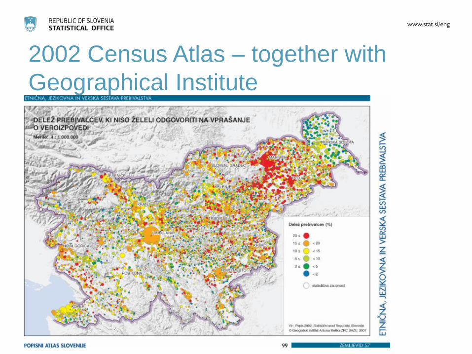
2002 Census Atlas – together with
Geographical Institute
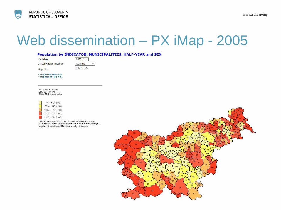
Web dissemination – PX iMap - 2005

KASPeR – introduction of grid statistics
– 2011 Register-based Census

STAGE 1 – grid statistics - 2014

STAGE 2 – grid statistics - 2018

Address Register
• Established by SURS in 1960‘s
– Implemented by the 1971 census including
the complete address
• In 1995 transferred to the GURS
– Graphic part set up at the same time
• Point-based with hierarchical structure
– Administrative part
– Grid part (coordinates)

Address atributes (meta data)
• HS_MID = 12596032
• Slovenija
• SR Osrednjeslovenska
• UE Ljubljana
• MO Ljubljana
• NA Ljubljana
• PO 10305136
• UL Vožarski pot
• HŠ 12
• X_H = 462283
• Y_H = 100165

Grid
• Grid definition
– A grid for representing thematic information is
a system of regular and geo-referenced cells,
with a specified shape and size, and an
associated property
• In Slovenia national grid system
established in 2008
• Part of 2021 EU Census dissemination
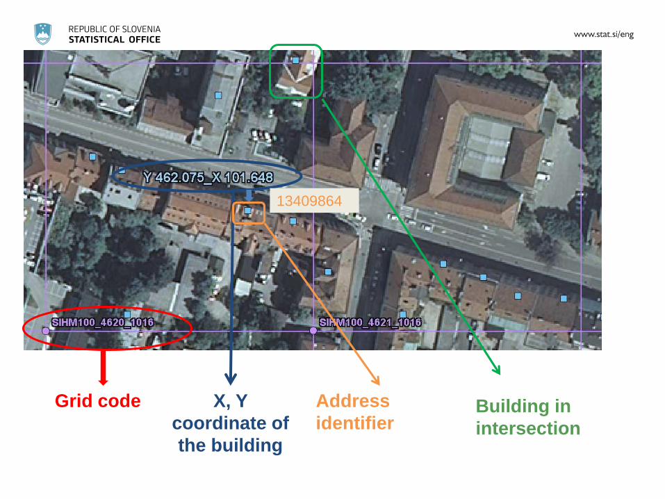
Grid code X, Y
coordinate of
the building
Address
identifier
13409864
Building in
intersection

10 km x 10 km grid 20,997 km2 grid cells – EU grid
Area 20,273 km2
100 m x 100 m grid

Grid - advantages
• Hierarchy and equality of areas
• Independent from administrative changes
• Stable in time allowing comparability over
time (evenly distributed)
• Easy to generate from point-based data
• Additional small area analyses possible

2015 Census grid data (1)
• Empty grid km2 cells
– 31% without building with address + 5% with
no populated addresses
36% of cells without population
– 5% with one occupied building only
• Confidentiality issue

2015 Census grid data (2)
• No SDC methods currently applied for basic
demographic characteristics
• For other topics 30 persons per grid cell is
primary threshold (same as for settlements) 36% cells with no population
24% cells suppressed (3.3% population)
40% cells with 96.7% population disseminated with
educational data


Popular spatial statistics

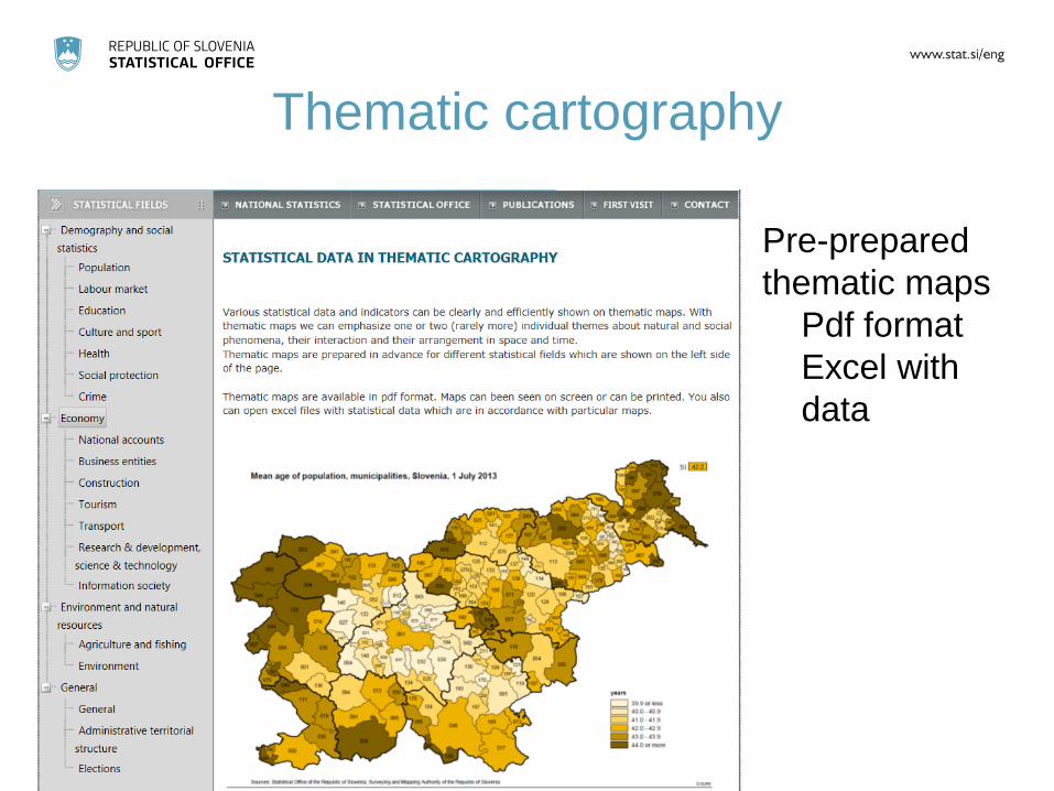
Thematic cartography
Pre-prepared
thematic maps
Pdf format
Excel with
data

• Select spatial level, content, time
• Change legend intervals & colours, transparency
• Downloads – Map (*.png), geospatial data (*.shp), data (*.csv)
• User defined areas/statistics (delineation) – Based on aggregated grid data
STAGE 1 - interactive web-GIS application


STAGE 2 - novelties
• Mostly technical improvements
– Responsive design
– Mobile first
– Improved functionalities
– OpenStreetMap instead of GoogleMap
– STAGE Help

Exposure to noise pollution

Data availability
– Thematic cartography
• http://www.stat.si/TematskaKartografija/Default.aspx
?lang=eng
– Place names (popular statistics)
• http://www.stat.si/KrajevnaImena/en/Settlements/By
Region
– STAGE 1
• http://gis.stat.si
– STAGE 2 (testing application available)
• Access from STAGE 1 - see STAGE2 (beta)

Conclusion
• Relevance of grid data vs administrative
small areas
• Visualisation
• Confidentiality issues
• User‘s needs
– General public – improving geospatial literacy
– Specialized users – spatial planning