geographic information systems using esri arcgis 9.3 advanced editing: attribute table
TRANSCRIPT
GeographicInformation
SystemsUsing
ESRI ArcGIS 9.3Advanced Editing:
Attribute Table
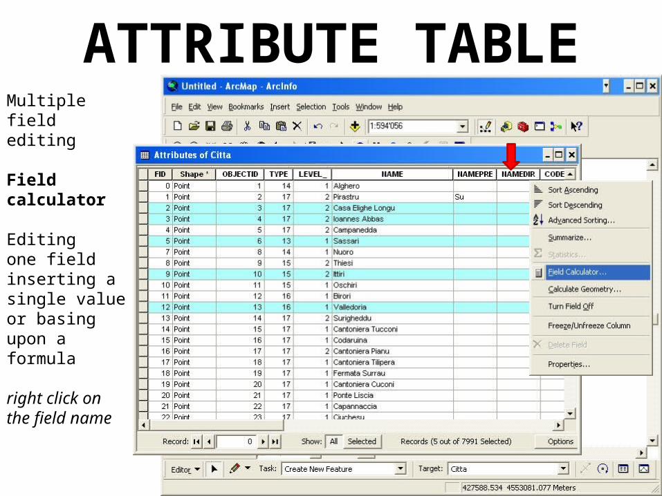
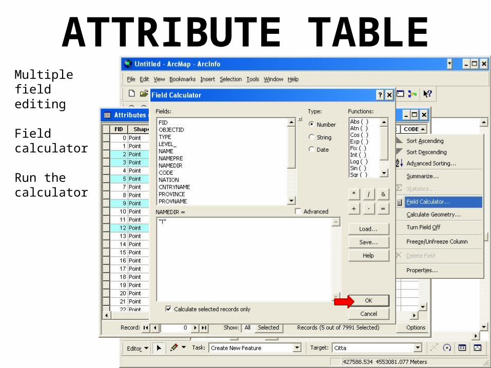
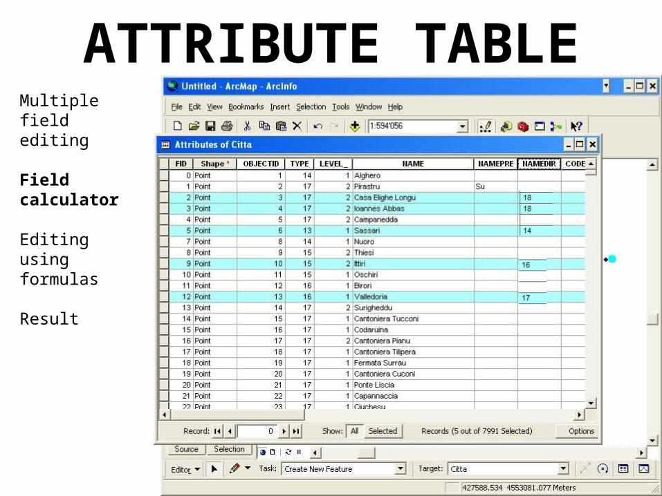
ATTRIBUTE TABLEMultiple field editing
Field calculator
Editing one field inserting a single value or basing upon a formula
right click on the field name
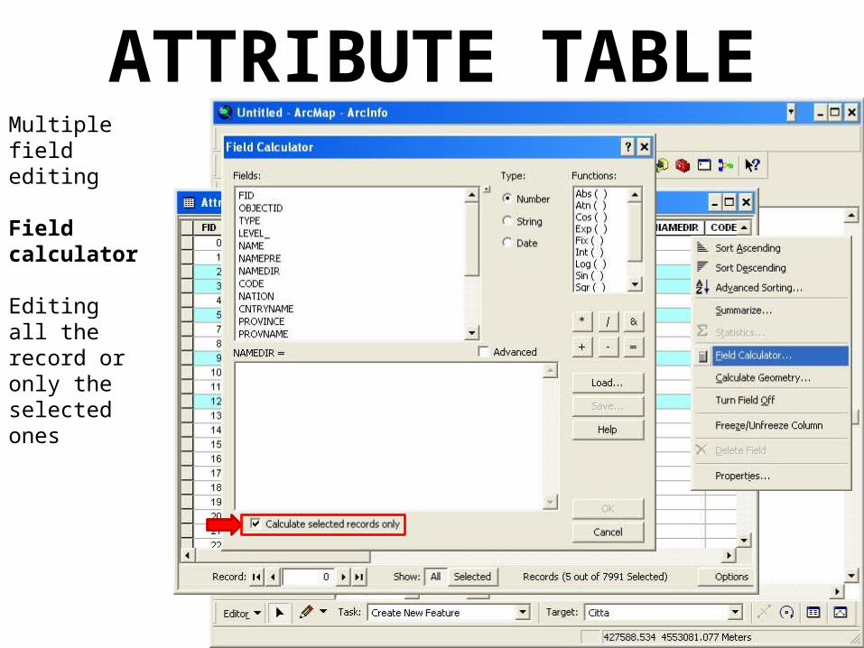
ATTRIBUTE TABLEMultiple field editing
Field calculator
Editing all the record or only the selected ones
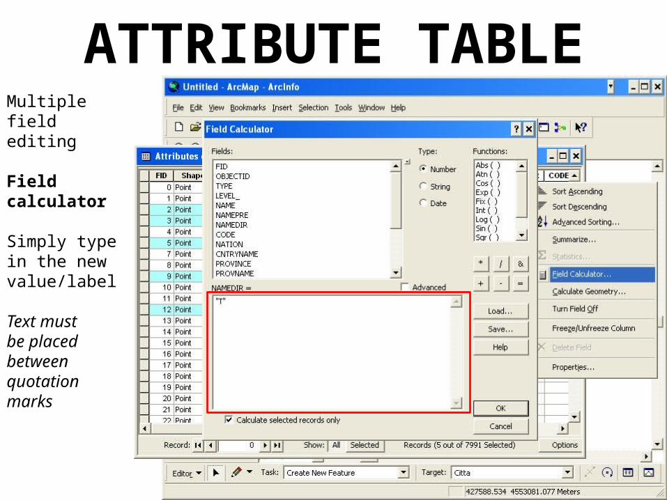
ATTRIBUTE TABLEMultiple field editing
Field calculator
Simply type in the new value/label
Text must be placed between quotation marks
ATTRIBUTE TABLEMultiple field editing
Field calculator
Run the calculator
ATTRIBUTE TABLEMultiple field editing
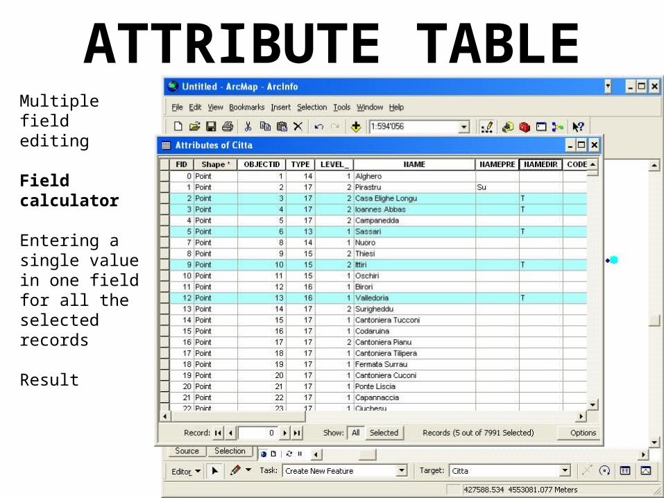
Field calculator
Entering a single value in one fieldfor all the selected records
Result
ATTRIBUTE TABLEMultiple field editing
Field calculator
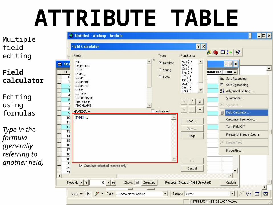
Editing using formulas
Type in the formula (generally referring to another field)
ATTRIBUTE TABLEMultiple field editing
Field calculator
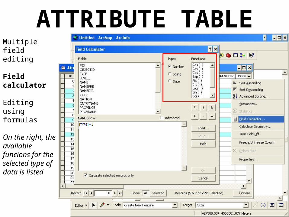
Editing using formulas
On the right, the available funcions for the selected type of data is listed
ATTRIBUTE TABLEMultiple field editing
Field calculator
Editing using formulas
Result
ATTRIBUTE TABLEMultiple field editing
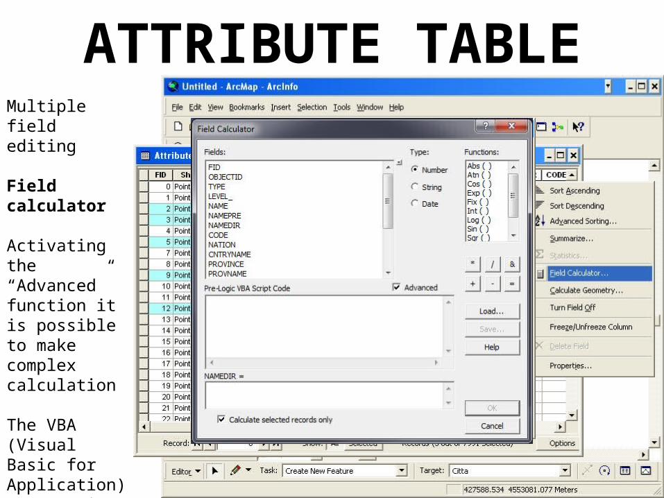
Field calculator
Activating the “Advanced” function it is possible to make complex calculation
The VBA (Visual Basic for Application) programming language is to be used
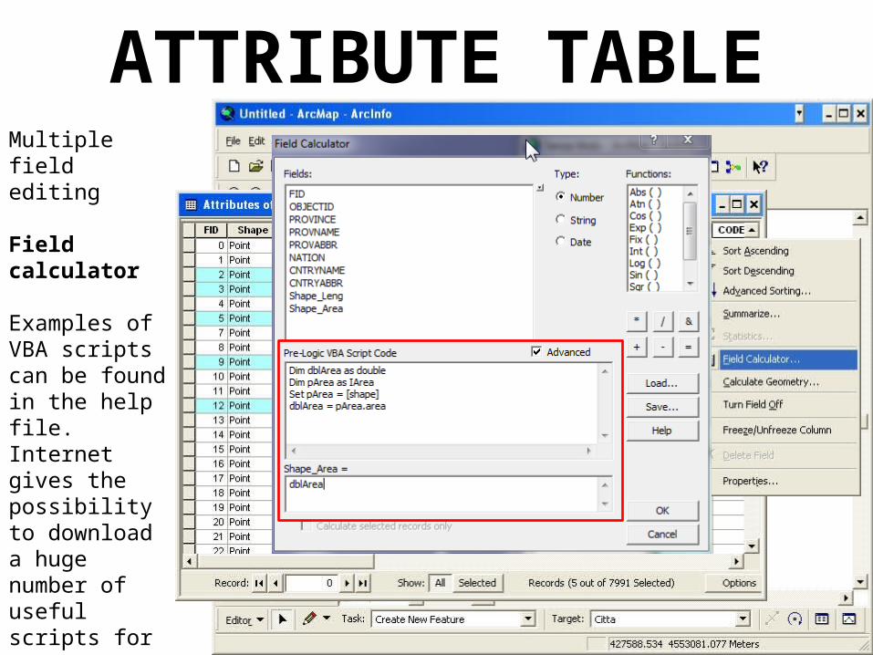
ATTRIBUTE TABLEMultiple field editing
Field calculator
Examples of VBA scripts can be found in the help file.Internet gives the possibility to download a huge number of useful scripts for many purposes.
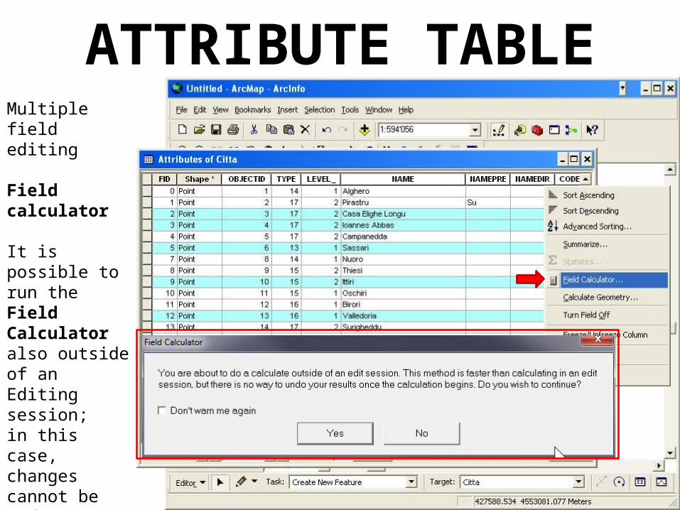
ATTRIBUTE TABLEMultiple field editing
Field calculator
It is possible to run the Field Calculator also outside of an Editing session;in this case, changes cannot be undone.
A warning message is shown
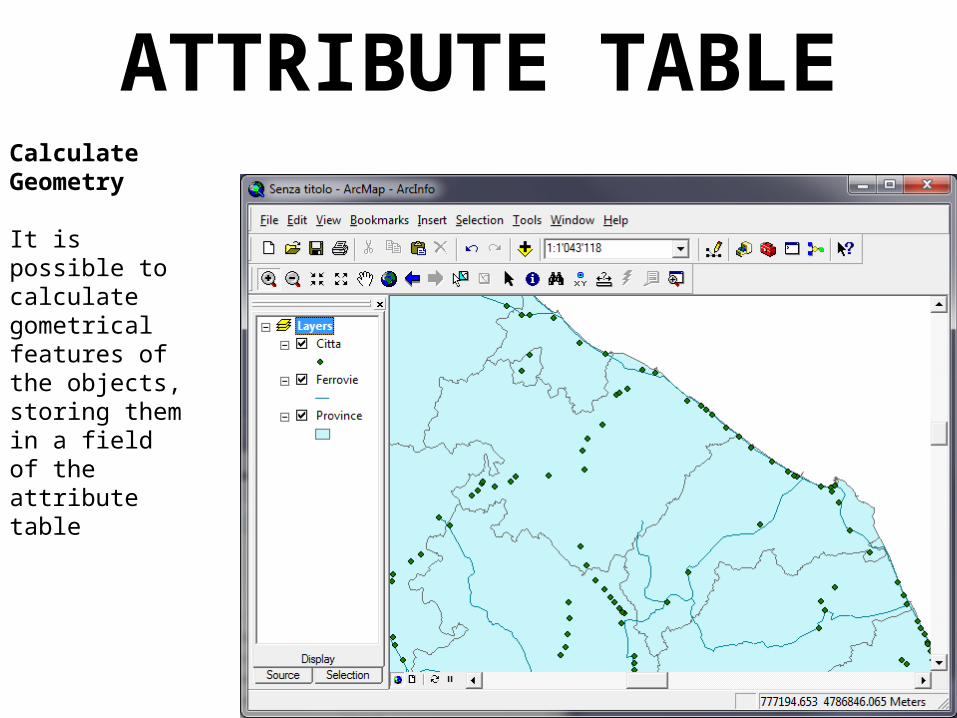
ATTRIBUTE TABLECalculate Geometry
It is possible to calculate gometrical features of the objects, storing them in a field of the attribute table
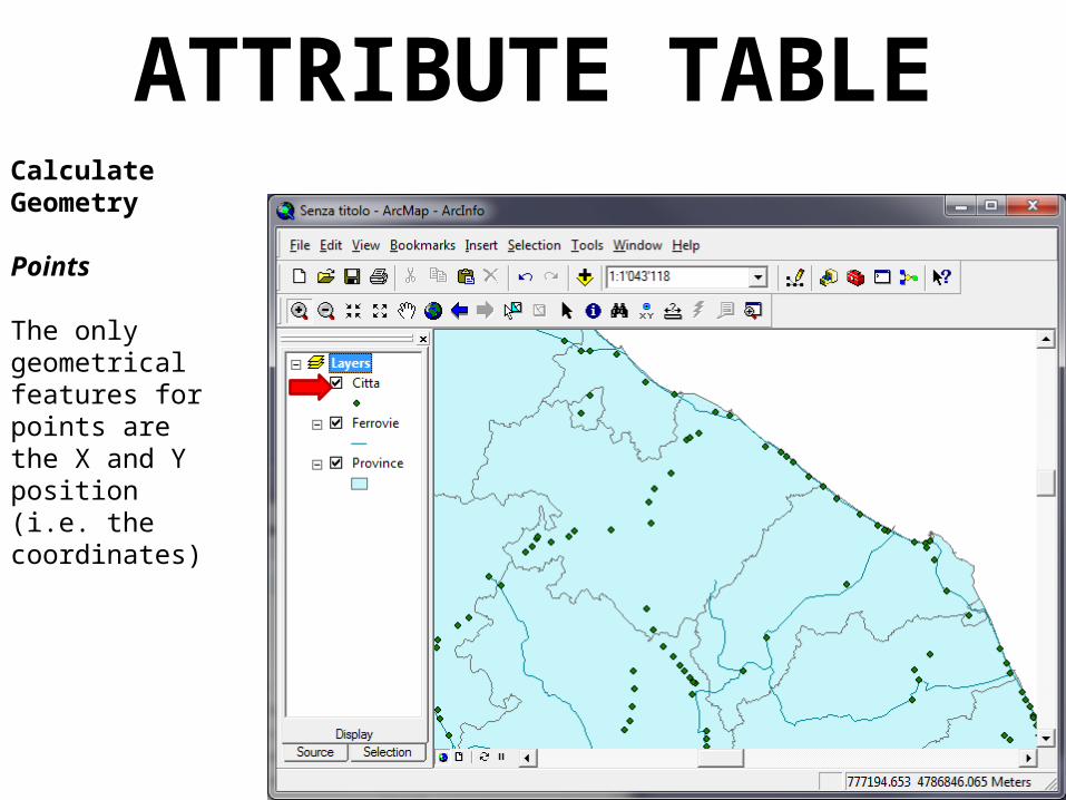
ATTRIBUTE TABLECalculate Geometry
Points
The only geometrical features for points are the X and Y position(i.e. the coordinates)
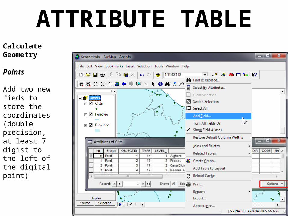
ATTRIBUTE TABLECalculate Geometry
Points
Add two new fieds to store the coordinates (double precision, at least 7 digist to the left of the digital point)
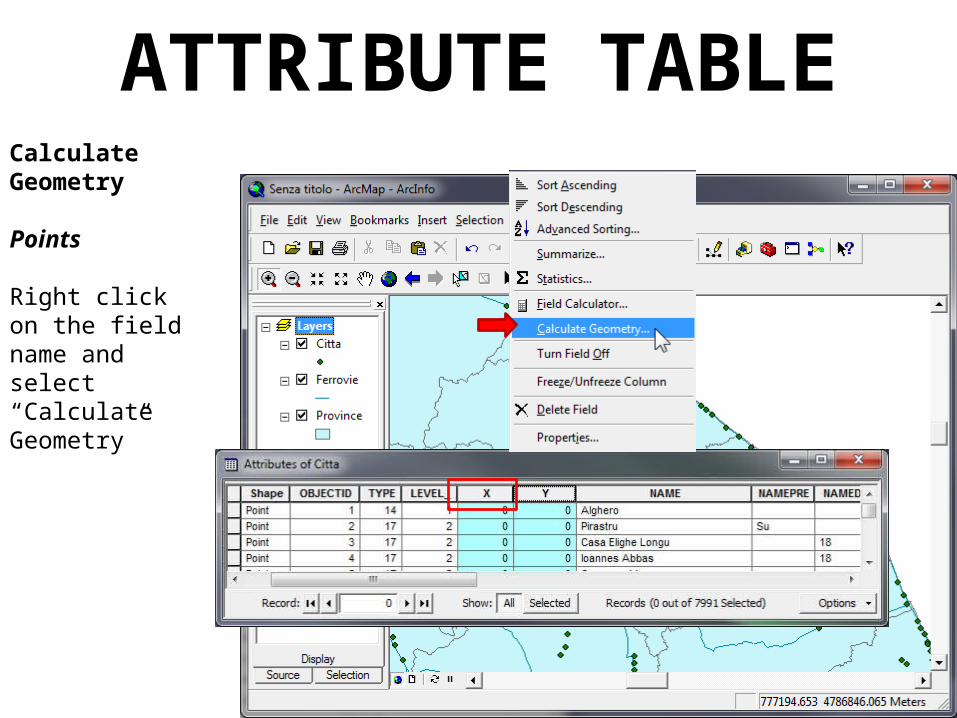
ATTRIBUTE TABLECalculate Geometry
Points
Right click on the field name and select “Calculate Geometry”
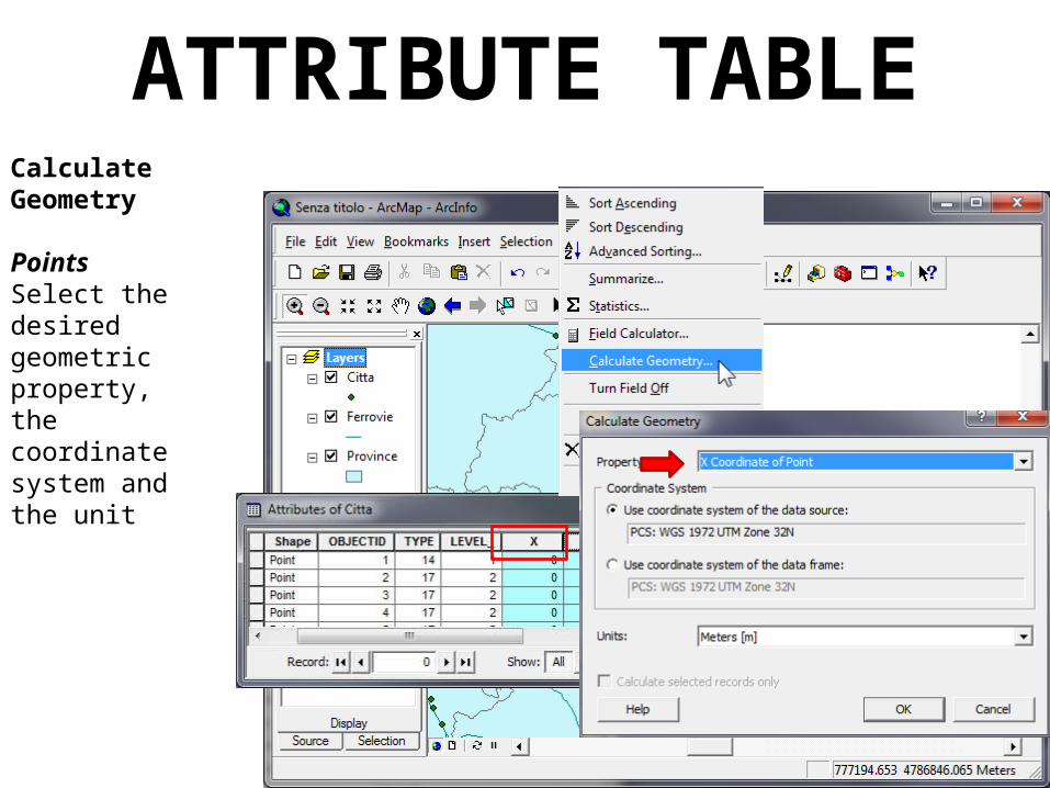
ATTRIBUTE TABLECalculate Geometry
PointsSelect the desired geometric property, the coordinate system and the unit
ATTRIBUTE TABLECalculate Geometry
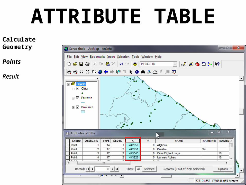
Points
Result
ATTRIBUTE TABLECalculate Geometry
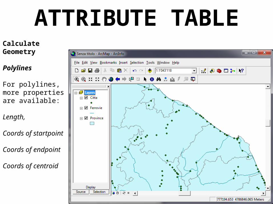
Polylines
For polylines, more properties are available:
Length,
Coords of startpoint
Coords of endpoint
Coords of centroid

ATTRIBUTE TABLECalculate Geometry
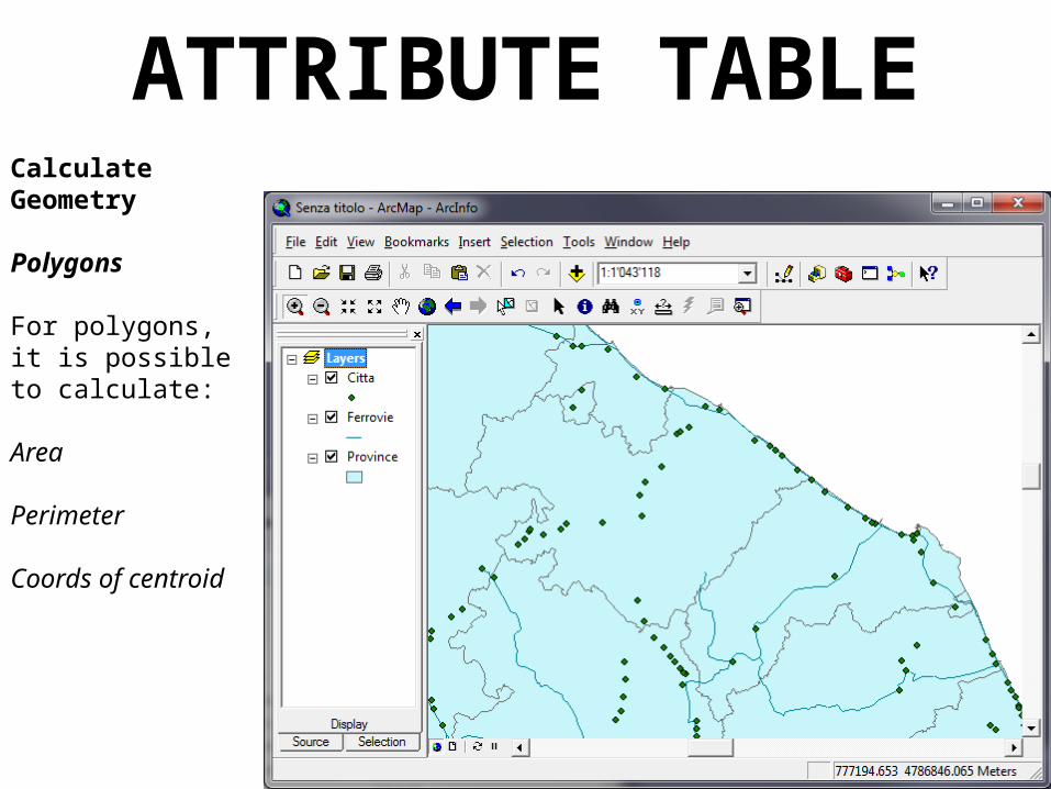
Polygons
For polygons, it is possible to calculate:
Area
Perimeter
Coords of centroid
ATTRIBUTE TABLECalculate Geometry
Polygons
For polygons, it is possible to calculate:
Area
Perimeter
Coords of centroid

ATTRIBUTE TABLEThe attribute table of every shapefile is stored as a .dbf file (i.e. as a file that can be handled by a spreadsheet, such as Excel)
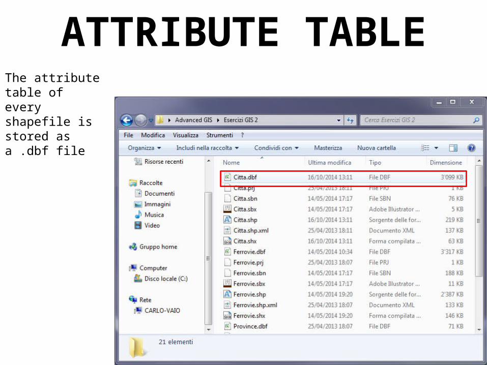
ATTRIBUTE TABLEThe attribute table of every shapefile is stored as a .dbf file
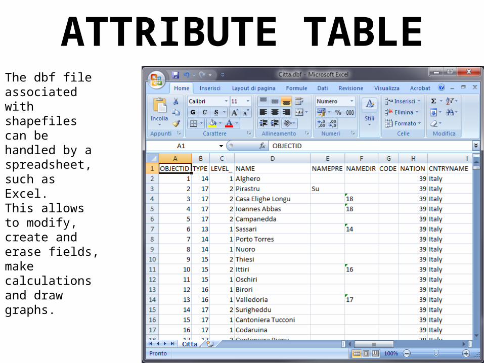
ATTRIBUTE TABLEThe dbf file associated with shapefiles can be handled by a spreadsheet, such as Excel.This allows to modify, create and erase fields, make calculations and draw graphs.