geography - telstar.docx€¦ · web viewshow a series of images from across the world of where...
TRANSCRIPT

GEOGRAPHY OVERVIEW, Semester Two
Unit Title:
Physical Geography Human Geography
Should I Stay Or Should I Go?
Inquiry question:How can I improve the liveability of my school?
This unit focuses on students understanding of the meaning of 'liveability' and the factors that contribute to the liveability of places, assessing the
relative liveability of places they are both familiar and unfamiliar with, working collaboratively with other students and collecting, recording and
analysing data to determine how to improve the liveability of where they live.
Achievement Standard
By the end of Year 7, students describe geographical processes that influence the characteristics of places and how places are perceived and valued differently. They explain interconnections between people, places and environments and describe how they change places and environments. They propose simple explanations for spatial distributions and patterns among phenomena. They describe alternative strategies to a geographical challenge and propose a response, taking into account environmental, economic and social factors.
Students identify geographically significant questions to frame an inquiry. They locate relevant information from primary and secondary sources to answer inquiry questions. They represent data and the location and distribution of geographical phenomena in a range of graphic forms, including large-scale and small-scale maps that conform to cartographic conventions. They analyse geographical data and other information to propose simple explanations for spatial patterns, trends and relationships and draw conclusions. Students present findings and arguments using relevant geographical terminology and graphic representations in a range of communication forms. They propose action in response to a geographical challenge taking account of environmental, economic and social considerations and describe the expected effects of their proposal.
Achievement Standard

Geographical Concepts Content Descriptions Assessment
Place Space Environment Interconnection Sustainability Scale Change
Major focusSecondary focus
Knowledge and Understanding Geographical Skills and Inquiry Formative:
Concept map of my community
Student Journal
Annotated Visual Display
Summative:
Short Responses to Geographical Data Assessment
Proposal
The factors that influence the decisions people make about where to live and their perceptions of the liveability of places (ACHGK043)
The influence of accessibility to services and facilities on the liveability of places (ACHGK044)
The influence of environmental quality on the liveability of places (ACHGK045)
The influence of social connectedness, community identity and perceptions of crime and safety on the liveability of places (ACHGK046)
The strategies used to enhance the liveability of places, especially for young people, including examples from Australia and Europe (ACHGK047)
h
Develop geographically significant questions and plan an inquiry, using appropriate geographical methodologies and concepts (ACHGS047)
Collect, select and record relevant geographical data and information, using ethical protocols, from appropriate primary and secondary sources (ACHGS048)
Evaluate sources for their reliability and usefulness and represent data in a range of appropriate forms, for example, climate graphs, compound column graphs, population pyramids, tables, field sketches and annotated diagrams, with and without the use of digital and spatial technologies (ACHGS049)
Represent the spatial distribution of different types of geographical phenomena by constructing appropriate maps at different scales that conform to cartographic conventions, using spatial technologies as appropriate (ACHGS050)
Analyse geographical data and other information using qualitative and quantitative methods, and digital and spatial technologies as appropriate, to identify and propose explanations for spatial distributions, patterns and trends and infer relationships (ACHGS051)
Apply geographical concepts to draw conclusions based on the analysis of the data and information collected (ACHGS052)

Present findings, arguments and ideas in a range of communication forms selected to suit a particular audience and purpose; using geographical terminology and digital technologies as appropriate (ACHGS053)
Reflect on their learning to propose individual and collective action in response to a contemporary geographical challenge, taking account of environmental, economic and social considerations, and predict the expected outcomes of their proposal (ACHGS054)
Fieldwork Fieldtrip to a local area to look at aspects of liveability in a community. Data collection techniques will include: observing, field sketching, taking photographs for labelling and constructing a map.
Learning Framework
Community Contributor Leader and Collaborator
Active InvestigatorEffective Communicator
Designer and Creator Quality Producer
Cross Curricula Priorities
Catholic Ethos Aboriginal and Torres Strait
Islander Histories and Cultures
Social Emotional Learning Asia and Australia’s Engagement
with Asia
Inclusive Education Sustainability Education
General Capabilities
Literacy Critical and Creative Thinking
Numeracy Ethical Behaviour
Information and Communication Technology
Personal and Social Competence
Links to other LA’s
Maths, English, History, Religion

COMMON CURRICULUM ELEMENTS Recognising letters, words and other symbolsFinding material in an indexed collection Recalling/remembering Interpreting the meaning of words or other symbols Interpreting the meaning of pictures/illustrationsInterpreting the meaning of tables or diagrams or maps or graphs Translating from one form to another Using correct spelling, punctuation, grammar
Using vocabulary appropriate to a context Summarising/condensing written text Compiling lists/statisticsRecording /noting dataCompiling results in a tabular form Graphing Calculating with or without calculator Estimating numerical magnitude Approximating a numerical value Substituting in formulae Setting out /presenting/ arranging/ displaying
Structuring /organising extended written text Structuring /organising a mathematical argument Explaining to others Expounding a viewpoint Empathising Comparing, contrasting Classifying Interrelating ideas/themes/issues Reaching a conclusion which is necessarily true provided a given set of assumptions is true
Reaching a conclusion which is consistent with a given set of assumptions Inserting an intermediate between members of a seriesExtrapolating Applying strategies to trial and test ideas and procedures Applying a progression of steps to achieve the required answer Generalising from information Hypothesising Criticising
Analysing SynthesisingJudging /evaluating Creating /composing /devising Justifying Perceiving patternsVisualising Identifying shapes in two and three dimensionsSearching and locating items/information Observing systematically Gesturing Manipulating /operating /using equipment Sketching /drawing
Link to ACARA Senior Geography Syllabus
• Focus unit 4: Connecting people and places

Learning and Teaching StrategiesWeek 1 Inquiry Question How can I improve the liveability of my school?
Engage ⇒ Explore ⇒ Explain ⇒ Elaborate ⇒ Evaluate
Geographical Concepts K & U Geographical Skills & Inquiry
PlaceSpaceInterconnection
(ACHGK043) (ACHGK044) (ACHGK045) (ACHGK046)
(ACHGS048) (ACHGS052) (ACHGS053)
Engage/Explore RESOURCES Assessment
Activity 1: Look at images of communities
Show a series of images from across the world of where people live: refugee camps, igloos, high-rise, tents, campervans, castles, Aboriginal and/or Torres Strait Islander Community etc.
Ask the students to respond to these images:What do you see? (different places people live)Why do people choose to live there? (friends, family, job = community)Name some different groups that make up a local community.Which groups do you think would be more likely to live in Cairns, the north: Port Douglas, the beaches, or the south: Yarrabah, Innisfail?
Develop and write a definition of community in student journal (Oxford Big Ideas Geography/History 7 p. 118)
Activity 2: Community Concept Map
Students develop a concept map to show the links between different ideas or pieces of information. Each piece of information is represented by a circle or a box, and the relationship between two ideas is shown by an arrow connecting them. Words on the line or arrow explain the link between the two ideas.
Teacher to model how to construct the concept map first – see page 119, Oxford Big Ideas Geography/History 7, Chapter 3: Where People Live.
Images of where people live
Oxford Big Ideas Geography/History 7, Chapter 3: Where People Live
Student Journal
Student JournalCommunity Concept Map

Construct your own concept map to show the communities you are connected to. Place your name in the centre box and then add the types of communities to the connecting lines.
Types of communities:
Past (family history/heritage e.g. Irish, Chinese, war, sport) Place (local community) Practice (activities in common: doctor and nurses belong to health, bookclub) Perspective (share similar beliefs and values: religion and politics) Purpose (share similar goals and visions: Surf Life Saving Australia, St Vincent de Paul
Society, State Emergency Service)
Example of concept map that could be used:
Activity 3. Introducing the liveability conceptRevisit images from beginning of unit to introduce your students to the concept of 'liveability' (see link in resources and page 152 of Big Ideas for definitions). Write definition in student journal.
Using the images consider, what do the photographs tell you about the place and the provision of services such as water, housing and public transport?
Is the provision of services equitable? Why? Why not? (economy, poverty, third world)
Have your class brainstorm the factors likely to influence peoples' perceptions of the relative liveability of places (refer to images).
Question prompts: What characteristics of a place attract us? What do you like to do? Where would be a good place to live to enable you to do this? Where do you like to go? Where would be a good place to enable you to do this?
Note to teacher: the students’ brainstorm needs to be categorised into the following sub headings as
Oxford Big Ideas Geography/History 7, Chapter 3: Where People Live p. 119
Images from Activity One
Oxford Big Ideas Geography/History 7, Chapter 4: Liveable Place p. 142
Liveability Definition: http://geogspace.edu.au/core-units/years-7-8/exemplars/year-7/y7-exemplars-y7-illus5.html
Poster paper for mind maps
Student journal
they will be used throughout the unit: safety and health related issues (for example, personal security, public health, traffic safety,
police) local environmental conditions/climate (for example, cleanliness, noise, dust, air and water
quality) the quality of social interactions (for example, community identity and pride, neighbourliness) opportunities for recreation and entertainment opportunities for employment aesthetics existence of unique cultural environmental characteristics (for example, historic structures,
mature trees, traditional architectural styles, streetscapes). infrastructure factors (roads, education, library, government)
In groups of eight for above categories, develop mind maps summarising the findings of the brainstorming activity.
As a final activity, have the students rank the above categories in order of importance with regards to what makes a place most liveable for them.
GEOGRAPHICAL LANGUAGEenvironmental, social, cultural, economic, infrastructure, services, perceptions, liveability, community, provision, aesthetics, Interconnection
REFLECTION

Learning and Teaching StrategiesWeek 2 Inquiry Question How can I improve the liveability of my school?
Engage ⇒ Explore ⇒ Explain ⇒ Elaborate ⇒ Evaluate
Geographical Concepts K & U Geographical Skills & Inquiry
PlaceInterconnectionSustainabilityScale
(ACHGK043) (ACHGK044)(ACHGK045) (ACHGK046)
(ACHGS047) (ACHGS048) (ACHGS051)
Explore RESOURCES Assessment
Activity 4: Global Liveability Comparison
Each year, the results of a number of studies are released rating cities all over the world in order of liveability. In 2012, the capital city of Bangladesh, Dhaka, was rated as the least liveable city; it scored particularly poorly in health care, public transport, crime and sanitation.
As a class look at the EIU Liveability table and discuss as class. This could be an opportunity to clarify qualitative and quantitative data as this is key concept in geography as outlined in the AC Geography Content Descriptors. Students will be tested on this data at a later date.
Activity 5: Developing a survey
Working in groups, have your class develop a liveability survey instrument based on the identified categories from week one, activity three. Alternatively, use the Neighbourhood liveability survey (PDF, 303 KB) provided.
Suggested homework task: Imagine you can live anywhere in the world, where would you live and why?
Oxford Big Ideas p. 154 & 166
EIU Liveability table
Global Liveability Ratings EIU Report:
http://www.holah.karoo.net/quantitativequalitative.htm
Neighbourhood liveability surveySurvey template: Oxford Big Ideas p. 179
GEOGRAPHICAL LANGUAGEgeographical processes, qualitative data , quantitative data,
REFLECTION

Learning and Teaching StrategiesWeek 3 Inquiry Question How can I improve the liveability of my school?
Engage ⇒ Explore ⇒ Explain ⇒ Elaborate ⇒ Evaluate
Geographical Concepts K & U Geographical Skills & Inquiry
PlaceSpaceEnvironmentInterconnectionScale
(ACHGK043) (ACHGK044)
(ACHGK045) (ACHGK046)
(ACHGS047) (ACHGS048) (ACHGS051) (ACHGS052) (ACHGS054)
Explain RESOURCES Assessment
Activity 6: Conducting the Survey
Ask your students to individually rank the local school neighbourhood, on the scale 1 to 5, using either the Neighbourhood liveability survey (PDF, 303 KB) instrument or the class designed survey.Tally the scores to give the overall liveability ranking score.
Divide the class into even groups where they will discuss the differences in different categories and try to justify reasons for choices. The group must then come to a consensus for a group ranking of the neighbourhood.
Teacher led discussion to then find a class ranking. Groups give rankings to the teacher who displays them in a table format. Teacher then chooses a procedure to come up with a whole class ranking – discussion, voting, secret ballot, and averages.
Name of neighbourhood: ______________________________
Criteria Scores
Your liveability ranking score
Your group's liveability ranking score
The class average liveability ranking score
Activity 7: Further AfieldLook at a map of your local area (e.g. suburb, town) to establish what makes the place liveable (local council maps, whereis.com, Google maps, street directories in phone books). This will enable students determine the liveability of that place using the identified criteria from Activity 3, prior to the field trip.
Activity 8: Conduct Survey for Cairns & Choropleth Map
Ask your students to individually rank Cairns, on the scale 1 to 5, using either the Neighbourhood liveability survey (PDF, 303 KB) instrument or the class designed survey. Tally the scores to give the overall liveability ranking score.
Students to use ranking scale for five additional local suburbs and create a choropleth map.
Introduce/revisit the concept of ‘perception’. Perception (from the Latin perceptio, percipio) is the organization, identification, and interpretation of sensory information in order to represent and understand the environment. (http://en.wikipedia.org/wiki/Perception). Write in Student Journal.Explain that students will take the survey home to parents and ask parents to complete and find ranking. Students should be made aware the importance of allowing parents to complete independently to enable a genuine comparison with their individual results. A discussion will take place in class about the results.
Digital and print mapsAccess to online resources
Survey
Choropleth Map
Student Journal
GEOGRAPHICAL LANGUAGEchoropleth map, perception, ranking
REFLECTION

Learning and Teaching StrategiesWeek 4 Inquiry Question How can I improve the liveability of my school?
Engage ⇒ Explore ⇒ Explain ⇒ Elaborate ⇒ Evaluate
Geographical Concepts K & U Geographical Skills & Inquiry
PlaceSpaceEnvironmentInterconnectionChangeSustainabilityScale
(ACHGK043) (ACHGK044)
(ACHGK045) (ACHGK046)
(ACHGS048) (ACHGS053) (ACHGS054)
Explain/Elaborate RESOURCES Assessment
Activity 9: Annotated MapsIn preparation for the field trip task expose students to annotated maps and/or photos. Explain the assessment task.
Activity 10: Field TripStudents take part in a field trip (e.g. Cairns Esplanade, Yarrabah, Innisfail Esplanade) to collect pieces of information that assess the liveability of their local area. Students are to draw an annotated map of a small identified area indicating the following where possible:
safety and health
local environmental conditions/climate
the quality of social interactions
opportunities for recreation and entertainment
opportunities for employment
Annotated Visual Display Guidelines
Oxford Big Ideas p. 131 Annotated satellite image of Yuendumu
Field Trip: Virtual Tour of Cairns CBD:http://cairnsesplanade.com.au/VirtualTours.aspx
Map of Cairns Esplanade
http://www.cairns-australia.com/cairns-geography.html
Annotated Visual Display
aesthetics
cultural environmental characteristics
infrastructure
Criteria sheet and task sheet
GEOGRAPHICAL LANGUAGEfield trip, annotated map, annotated visual display, recreation, cultural environmental characteristics
REFLECTION

Learning and Teaching StrategiesWeek 5 Inquiry Question How can I improve the liveability of my school?
Engage ⇒ Explore ⇒ Explain ⇒ Elaborate ⇒ Evaluate
Geographical Concepts K & U Geographical Skills & Inquiry
PlaceSpaceEnvironmentInterconnectionChangeSustainabilityScale
(ACHGK043) (ACHGK044) (ACHGK045) (ACHGK046)
(ACHGS051) (ACHGS052) (ACHGS053)
Explain/Elaborate RESOURCES Assessment
Activity 11: Annotated Map Assessment
Following the field tip students will require time to complete the annotated map (teacher may decide to allow students to complete at home if time is an issue).
Activity 12: Short Responses to Geographical Data AssessmentGive students a copy of the EIU Liveability Table and have them answer the following questions:
1. Who scored lowest in Culture and Environment?2. What would Sydney need to do to increase its overall ranking?3. Explain and identify patterns in the data (e.g. Nearly all top ten cities scored 100% for education and health).4. Explain the reason there is no sixth ranking.5. Define the term ‘liveability’
Assessment task sheetAssessment criteria sheet
Assessment task sheetAssessment criteria sheet
Annotated Visual Display Assessment
Short Responses to Geographical Data Assessment
GEOGRAPHICAL LANGUAGEannotated map, liveability, environment, culture, patterns, data, infrastructure,
REFLECTION

Learning and Teaching StrategiesWeek 6-7 Inquiry Question How can I improve the liveability of my school?
Engage ⇒ Explore ⇒ Explain ⇒ Elaborate ⇒ Evaluate
Geographical Concepts K & U Geographical Skills & Inquiry
PlaceSpaceEnvironmentInterconnectionSustainabilityScale
(ACHGK044) (ACHGK045)
(ACHGK046) (ACHGK047)
(ACHGS048) (ACHGS049) (ACHGS051) (ACHGS052)
(ACHGS053) (ACHGS054)
Elaborate RESOURCES Assessment
Activity 13: How does the liveability of an Australia capital city compare with the liveability of a European capital city?
Students can choose a capital city to compare (AC states it must be from Europe) or teacher can stipulate. It is probably worth selecting a few to let students choose from so the teacher can provide reliable resources for research, possibly creating a weebly e.g. Germany (Berlin)/UK (London)/Italy (Rome)/Turkey (Ankara)*.
*Turkey is an intercontinental country (Europe and Asia): http://www.mapsofworld.com/turkey/
At this point the following geographical skill should be addressed:
Evaluate sources for their reliability and usefulness and represent data in a range of appropriate forms, for example, climate graphs, compound column graphs, population pyramids, tables, field sketches and annotated diagrams, with and without the use of digital and spatial technologies (ACHGS049)
Statistics:http://www.worldaudit.org/democracy.htm
Political Rights Civil Liberties Press Freedom Rule of Law Corruption Human Rights
EIU Liveability table Stability Healthcare Culture and Environment Education Infrastructure
Liveability ComparisonStudent Research Template

As with any research students need to consider the reliability of the source and other information about the author/s such as Gender, Religion, Political stance, Job, Age, Agenda.
When determining the liveability of the countries the identified criteria from Activity Three will be condensed to allow for easier comparison:
ClimateInfrastructure (transport, energy, telecommunication)Stability and SafetyHealth & EducationCulture - Recreation and Entertainment
Students will research and note take using the research template provided to guide them to Identify areas from the criteria above to make the place more liveable (e.g. congestion).
http://www.gapminder.org/ 519 categories (suicide, illness,
education, population, economy, salaries, unemployment, resource use, CO2 emissions, Defence,
http://www.nationmaster.com/index.php
Compare 2 countries against a range of categories (democracy, defence, environment, crime, health)
http://www.geohive.com/ Global Population Data
https://itunes.apple.com/za/app/world-in-figures-ipad-edition/id497729555?mt=8
Climate:https://sites.google.com/site/climatetypes/homehttp://www.kidsmaps.com/links.php?id=5&sub=11
Culture:http://www.germany.travel/en/index.htmlhttp://www.visitberlin.de/enhttp://www.italia.it/en/home.htmlhttp://www.turismoroma.it/?lang=enhttp://www.visitengland.com/ee/http://www.visitlondon.com/http://www.goturkey.com/en
All country information:http://www.nationsencyclopedia.com/http://www.youtube.com/watch?v=1XBwjQsOEeg

Turkey:http://www.nationsencyclopedia.com/Asia-and-Oceania/Turkey.htmlhttp://www.invest.gov.tr/en-US/investmentguide/investorsguide/Pages/InfrastructureAndLogistics.aspx
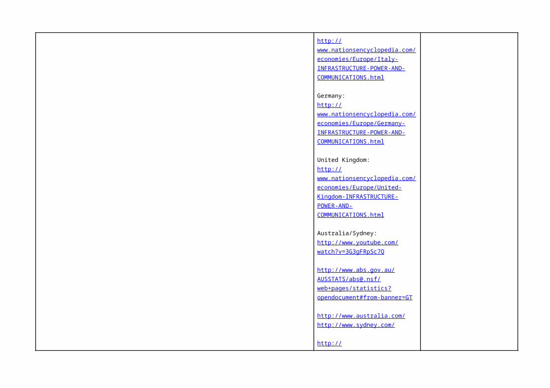
Italy:http://www.nationsencyclopedia.com/economies/Europe/Italy-INFRASTRUCTURE-POWER-AND-COMMUNICATIONS.html
Germany:http://www.nationsencyclopedia.com/economies/Europe/Germany-INFRASTRUCTURE-POWER-AND-COMMUNICATIONS.html
United Kingdom:http://www.nationsencyclopedia.com/economies/Europe/United-Kingdom-INFRASTRUCTURE-POWER-AND-COMMUNICATIONS.html
Australia/Sydney:http://www.youtube.com/watch?v=3G3gFRpSc7Q
http://www.abs.gov.au/AUSSTATS/[email protected]/web+pages/statistics?opendocument#from-banner=GT
http://www.australia.com/http://www.sydney.com/
http://www.nationsencyclopedia.com/Asia-and-Oceania/Australia.html
GEOGRAPHICAL LANGUAGEPolitical stance, stability
REFLECTION

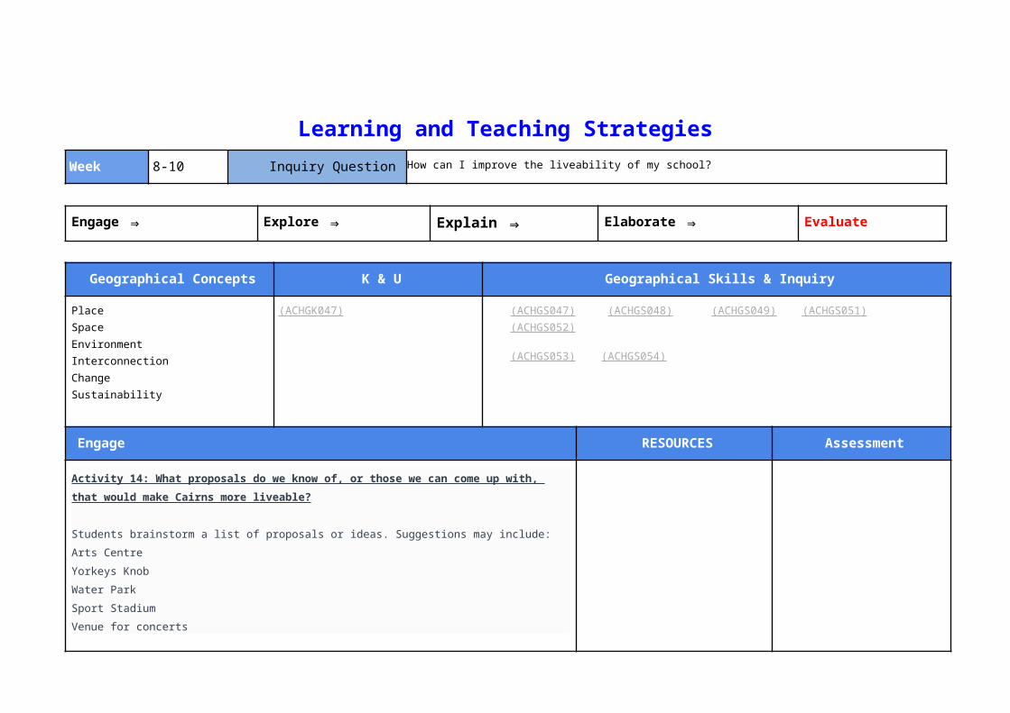
Learning and Teaching StrategiesWeek 8-10 Inquiry Question How can I improve the liveability of my school?
Engage ⇒ Explore ⇒ Explain ⇒ Elaborate ⇒ Evaluate
Geographical Concepts K & U Geographical Skills & Inquiry
PlaceSpaceEnvironmentInterconnectionChangeSustainability
(ACHGK047) (ACHGS047) (ACHGS048) (ACHGS049) (ACHGS051) (ACHGS052)
(ACHGS053) (ACHGS054)
Engage RESOURCES Assessment
Activity 14: What proposals do we know of, or those we can come up with, that would make Cairns more liveable?
Students brainstorm a list of proposals or ideas. Suggestions may include:
Arts Centre
Yorkeys Knob
Water Park
Sport Stadium
Venue for concerts
Theme Park
Skating parks
Better shops

Museums and Galleries
Underwater World
Aquarium
University
Improved facilities: health, education,
Categories of features that make a place liveable: Social Economic Cultural Religious Physical Human
Sustainability
Activity 15: Local Area Case Study
Suggested case study is the Aquis Resort proposal in Yorkeys Knob (resources provided) but there may be a more locally relevant proposal in your area.
Teacher will need to conduct independent research on a suitable case study to be able to model the
proposal (summative assessment) as set out for students with the suggested following headings:
Title PageIntroduction – contextual information of the areaStatement of the problemKey objectivesResearch and Results - positive and negative impact: environmental, economic, political, humanMaterialsCosts and budgetSustainability & MaintenanceConclusionAppendicesReferences
Activity 16: Student proposal for project to improve the liveability of their school
Students must choose a project to improve the liveability of their school that is based on the school’s
current facilities* e.g. turn a section of an undercover area into a gymnasium or theatre or renovate a
vacant classroom into a science lab.
*Teacher note: Costs etc will be too difficult if students are allowed to build structures.
http://aquisgreatbarrierreefresort.com
Aquis Proposal

GEOGRAPHICAL LANGUAGEProposal, case study
REFLECTION
Planning for Differently Abled Students
Student/s Different Ability Australian Curriculum Content Descriptions being
addressed
Learning and Teaching Strategies Assessment Strategies

Year 7 Assessment Task Sheet
Student Name:
Date Commenced:
Date Due:
Name of Task: How can I improve the liveability of my school?
Teacher:
Learning Area/s: Geography, English, ICT
Type of Task: Oral Written Other
Task Conditions: Individual Pair Group Work
In Class Homework Other
Access to: Books Notes Library
Assessed By: Self Peer Teacher
Task Description:
Students will write a proposal to the principal of the school with a budget of $15 000. The proposal should address the inquiry question: How can I improve the liveability of my school?
Students must choose a project to improve the liveability of their school that is based on the school’s current facilities e.g. turn a section of an undercover area into a gymnasium or theatre or renovate a vacant classroom into a science lab.
They are to use the proposal template with the following headings:
Title Page Introduction – contextual information of the area Statement of the problem Key objectives Research and Results - positive and negative impact: environmental, economic, political, human Materials Costs and budget Sustainability & Maintenance Conclusion Appendices References
Procedure:
Your task is to prepare a proposal:
a. Choose a projectb. Is the project viable?c. Conduct a survey to demonstrate support for your projectd. Place data in a tablee. Prepare draft of proposal by researching under the following headings:
Title Page Introduction – contextual information of the area Statement of the problem Key objectives Research and Results - positive and negative impact: environmental, economic, political,
human Materials Costs and budget Sustainability & Maintenance Conclusion Appendices References
f. Conference with your teacher
g. Publish and present your proposal
Resources:
Books/Library
Class Notes
Internet

Geography CRITERIA SHEET Overall Grade:Student name: Date:
CRITERIA Competent Sound Support Required
Unde
rsta
ndin
g an
d Sk
ills
Dim
ensi
ons
Geographical Knowledge and Understanding
Proposal includes all of the required elements and demonstrates clear relevant details and information with supporting evidence of facts and explanations:
Title Page, Introduction, Statement of the Problem, Key Objectives, Research and Results, Materials, Costs and budget, Sustainability and Maintenance, Conclusion, Appendices, References.
Proposal is basic and simple. It includes all of the required elements:
Title Page, Introduction, Statement of the Problem, Key Objectives, Research and Results, Materials, Costs and budget, Sustainability and Maintenance, Conclusion, Appendices, References.
Proposal lacks the required elements and does not provide clear, relevant details and/or has no supporting evidence:
Title Page, Introduction, Statement of the Problem, Key Objectives, Research and Results, Materials, Costs and budget, Sustainability and Maintenance, Conclusion, Appendices, References.
The proposal offers a viable change to the school that improves the liveability.
The proposal offers a viable change to the school that has minimal impact on the liveability.
The proposal is unrealistic.
The proposal addresses the needs two or more groups (age, gender).
The proposal addresses the needs of one group (age, gender).
The proposal only addresses the needs of one small group (age, gender).
Questioning and Researching
Accurately collects, selects and records geographical data from reliable sources.
Geographical questions and research shows a direct link to the proposal.
Collects, selects and records geographical data from reliable sources with some errors.
Geographical questions and research shows some link to the proposal.
Collects, selects and records unreliable geographical data.
Geographical questions and research shows no link to the proposal.
Analysing and Interpreting
Interprets and accurately draws conclusions from the data to explain the impact of the proposed change.
Draws conclusions from the data in an attempt to explain the impact of the proposed change.
Does not use the data to draw conclusions to explain the impact of the proposed change.
Communicating Proposal demonstrates a high level of geographical terminology.
Is written to suit audience and purpose, and is supported by a variety of graphic representations.
Proposal shows use of some geographical terminology.
Is written to suit audience and purpose, and is supported by a form of graphic representations.
No evidence of geographical terminology.
Audience and purpose are unclear and not supported by graphic representations.
Teacher Comment: