geological data management - mgwamgwa.org/meetings/2004_fall/jim-reed-keynote.pdf · geological...
TRANSCRIPT

Geological Data Management(Nailing Jelly To A Tree)
Jim Reed
Director of Research & Development
RockWare Incorporated
Golden, Colorado
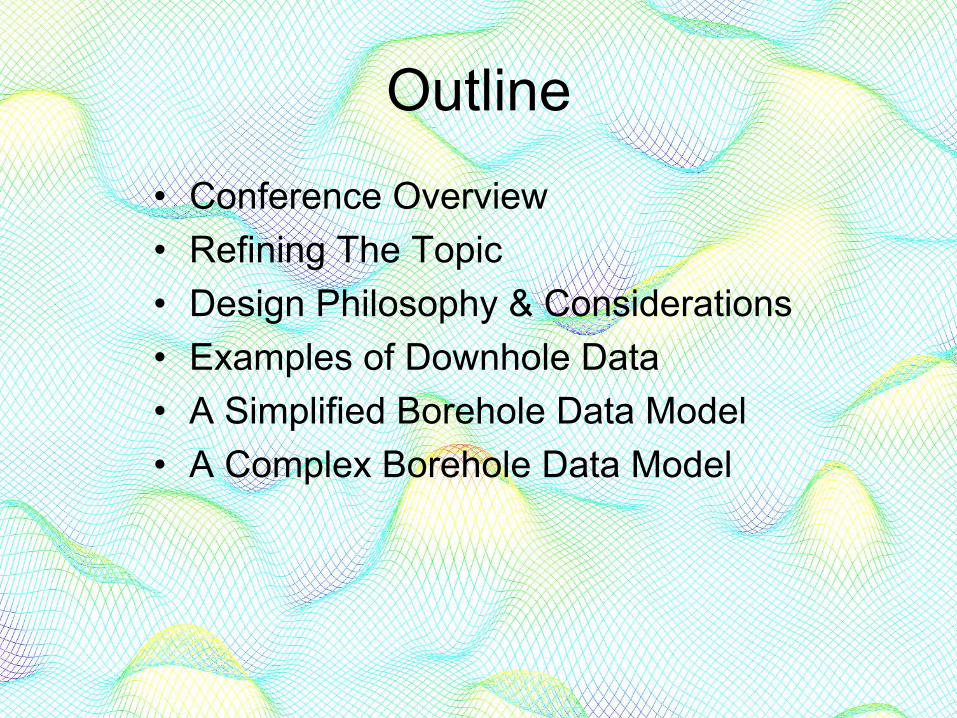
Outline
• Conference Overview• Refining The Topic• Design Philosophy & Considerations• Examples of Downhole Data• A Simplified Borehole Data Model• A Complex Borehole Data Model
Outline
•• Conference OverviewConference Overview• Refining The Topic• Design Philosophy & Considerations• Examples of Downhole Data• A Simplified Borehole Data Model• A Complex Borehole Data Model

Conference Topics
DataCollection
DataManagement
Data Analysis&
Visualization
DataPresentation
(Web)

Conference Topics
DataCollection
DataManagement
DataAnalysis
&Visualization
DataPresentation
(Web)

Jim Reed, RockWare Inc.: Overview of Geologic Data Management - Nailing Jelly to a Tree
Dat
a C
olle
ctio
n
Dat
a M
anag
emen
t
Dat
a An
alys
is &
Vis
ualiz
atio
n
Dat
a Pr
esen
tatio
n (W
eb)
Geoff Delin, US Geological Survey: Real-Time Water Level and Stream Flow Data Acquisition
John Dustman, Summit EnviroSolutions Inc.: Management and Analysis of Groundwater Data
David Odd, Campbell Scientific: Wireless and PDA Telemetry for Remote Data Collection
Melinda Erickson, University of Minnesota: Beyond the Minimum: Purposefully Designing (orRedesigning) Ground Water Sampling Schemes
Brian Johnson, MN Department of Health: Minnesota's County Well Index: current status andfuture plans
Jim Reed, RockWare Inc.: Three-Dimensional Visualization of Geologic Data - Eye Candy orScientific Tool?
Harvey Thorleifson , MN Geological Survey: Implementation of 3D Geologic Mapping
Rich Soule, MN Department of Health: Arsenic Data Presentation and Analysis
Robert Tipping, MN Geological Survey: Bringing the data together: improved characterization ofthe Prairie du Chien Group
Tina Pint, Barr Engineering: Incorporating Public Databases into the development of distributedparameter ground water models
Laurel Reeves, MN Department of Natural Resources: Online Data Retrieval and GIS Data Deli
MGWA Fall 2004 ConferenceManagement and Analysis of Ground Water DataNovember 16, 2004, 8 am - 4:30 pmContinuing Education and Conference CenterUniversity of Minnesota, St Paul

Outline
• Conference Overview•• Refining The TopicRefining The Topic• Design Philosophy & Considerations• Examples of Downhole Data• A Simplified Borehole Data Model• A Complex Borehole Data Model

Refining The Topic
GeologicalData
RemoteData
SubsurfaceData
SurfaceData
DownholeData
OtherSubsurface
Data
Outline
• Conference Overview• Refining The Topic•• Design Philosophy & Design Philosophy &
ConsiderationsConsiderations• Examples of Downhole Data• A Simplified Borehole Data Model• A Complex Borehole Data Model

Primary Design Considerations
Ease-of-Use
FlexibilitySpeed

Ease of Use

The Ultimately Easy-to-Use Product
(Does nothing - Nothing to learn)

The Excel (Flat File) Corner
Initial Phase
Typical Scenario

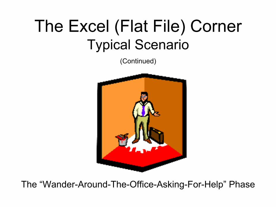
The Excel (Flat File) Corner
The “HEY-THIS-IS-COOL” Phase
Typical Scenario(Continued)

The Excel (Flat File) Corner
The “UH-OH” Phase
Typical Scenario(Continued)
The Excel (Flat File) Corner
The “Wander-Around-The-Office-Asking-For-Help” Phase
Typical Scenario(Continued)

Flexibility
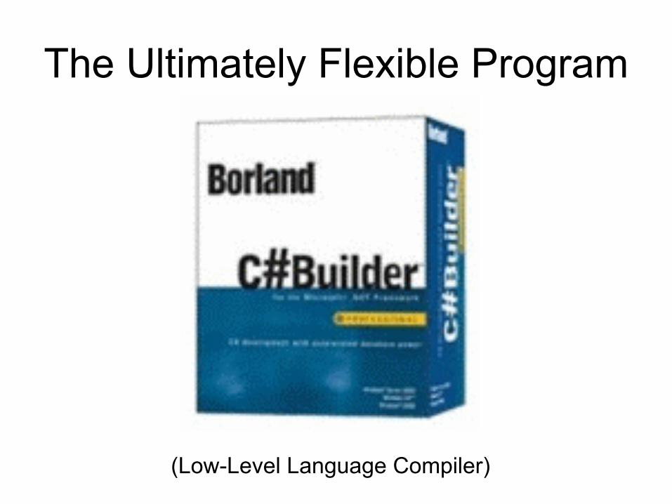
The Ultimately Flexible Program
(Low-Level Language Compiler)
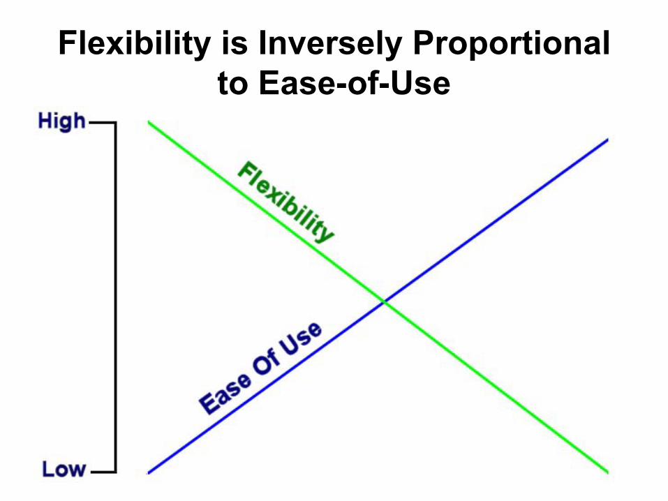
Flexibility is Inversely Proportional to Ease-of-Use

Feature Creep
Version 1.0

Feature Creep
Version 2.0
(Continued)

Feature Creep(Continued)
Version “N”

Feature Creep(Continued)

Feature Creep(Continued)
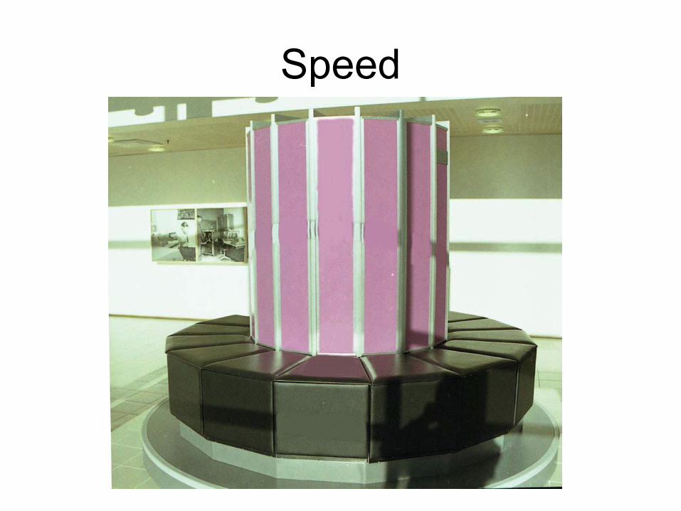
Speed
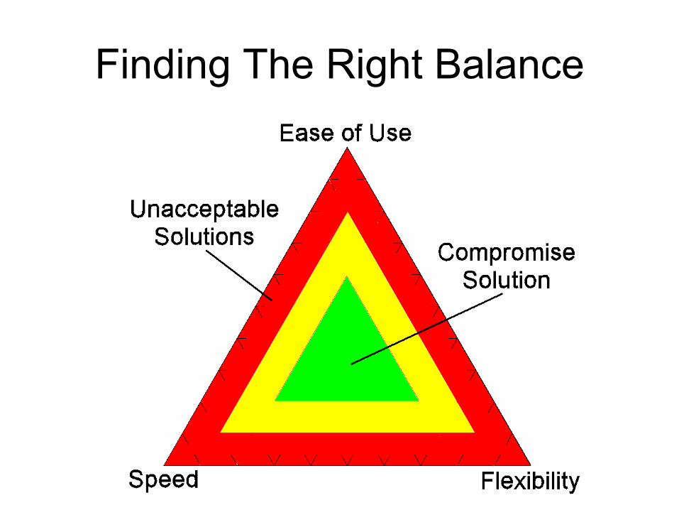
Finding The Right Balance
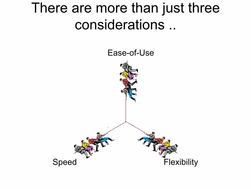
There are more than just three considerations ..
Ease-of-Use
FlexibilitySpeed

Flexibility /
Extensibility
Ease of U
se
Speed
Ease
of
Prog
ramming
Connectivity
PortabilityCost
Rel
i abi
li ty
/In
teg r
i ty
Capability
Using Spider Diagrams To Compare & Design Data Management Systems
Flexibility /
Extensibility
Ease of U
se
SpeedEa
se of
Prog
ramming
Connectivity
PortabilityCost
Rel
i abi
li ty
/In
teg r
i ty
Capability
Microsoft Excel

Using Spider Diagrams To Compare & Design Data Management Systems
Microsoft AccessFlexibility /
Extensibility
Ease of U
se
SpeedEa
se of
Prog
ramming
Connectivity
PortabilityCost
Rel
i abi
li ty
/In
teg r
i ty
Capability

Using Spider Diagrams To Compare & Design Data Management Systems
Flexibility /
Extensibility
Ease of U
se
SpeedEa
se of
Prog
ramming
Connectivity
PortabilityCost
Rel
i abi
li ty
/In
teg r
i ty
Capability
Vertical Commercial Product

Using Spider Diagrams To Compare & Design Data Management Systems
Flexibility /
Extensibility
Ease of U
se
Speed
Ease
of
Prog
ramming
Connectivity
PortabilityCost
Rel
i abi
li ty
/In
teg r
i ty
Capability
Flexibility /
Extensibility
Ease of U
se
Speed
Ease
of
Prog
ramming
Connectivity
PortabilityCost
Rel
i abi
li ty
/In
teg r
i ty
Capability
Vertical Commercial Product
Flexibility /
Extensibility
Ease of U
se
Speed
Ease
of
Prog
ramming
Connectivity
PortabilityCost
Rel
i abi
li ty
/In
teg r
i ty
Capability
Microsoft Excel
Microsoft Access

WISDOM:Knowing when to stop before you start.

Outline
• Conference Overview• Refining The Topic• Design Philosophy & Considerations•• Examples of Downhole DataExamples of Downhole Data• A Simplified Borehole Data Model• A Complex Borehole Data Model

Examples of Downhole Data• Location• Orientation• Lithology• Stratigraphy• Interval Data• Point Data• Directional Data• Imagery

Examples of Downhole Data• Location• Orientation• Lithology• Stratigraphy• Interval Data• Point Data• Directional Data• Imagery

Location

Examples of Downhole Data• Location• Orientation• Lithology• Stratigraphy• Interval Data• Point Data• Directional Data• Imagery

Orientation

Examples of Downhole Data• Location• Orientation• Lithology• Stratigraphy• Interval Data• Point Data• Directional Data• Imagery

Lithology(Interval-based, laterally discontinuous,
qualitative data.)

Examples of Downhole Data• Location• Orientation• Lithology• Stratigraphy• Interval Data• Point Data• Directional Data• Imagery

Stratigraphy(Interval-based, laterally contiguous,
qualitative data.)

Examples of Downhole Data• Location• Orientation• Lithology• Stratigraphy• Interval Data• Point Data• Directional Data• Imagery

Quantitative Interval-Based Data
• Geochemical• Geotechnical

Examples of Downhole Data• Location• Orientation• Lithology• Stratigraphy• Interval Data• Point Data• Directional Data• Imagery

Quantitative Point-Based Data• Geophysics• Point-Based Geochemistry• Point-Based Geotechnical

Examples of Downhole Data• Location• Orientation• Lithology• Stratigraphy• Interval Data• Point Data• Directional Data• Imagery

Directional Data
Fracture Planes
Flow Vectors

Examples of Downhole Data• Location• Orientation• Lithology• Stratigraphy• Interval Data• Point Data• Directional Data• Imagery

Downhole Imagery

Outline
• Conference Overview• Refining The Topic• Design Philosophy & Considerations• Examples of Downhole Data•• A Simplified Borehole Data ModelA Simplified Borehole Data Model•• A Complex Borehole Data ModelA Complex Borehole Data Model
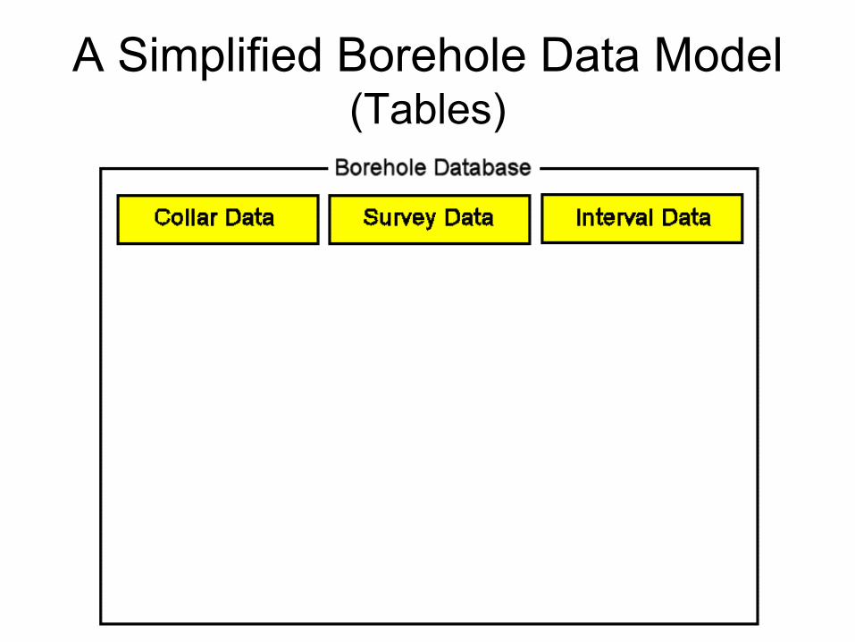
A Simplified Borehole Data Model(Tables)

A Simplified Borehole Data Model(Fields)

A Simplified Borehole Data Model(Calculated Fields)

Outline
• Conference Overview• Refining The Topic• Design Philosophy & Considerations• Examples of Downhole Data•• A Simplified Borehole Data ModelA Simplified Borehole Data Model•• A Complex Borehole Data ModelA Complex Borehole Data Model

A Complex Borehole Data Model
Depth -> XYZComputer
OrientationBorehole IDDepthAzimuthInclination
Point DataBorehole IDDepthPointTypeMagnitudeDateComments
X,Y,Z
PointTypesIndexNameMinimumMaximumUnits
IntervalTypesIndexNameMinimumMaximumUnits
Interval DataBorehole IDDepth-1
IntervalTypeMagnitudeDateComments
X1,Y1,Z1
Depth-2
X2,Y2,Z2
LithoTypesIndexNameBackgroundForegroundPatternNumPatternSizePatternThickFill PercentDensity
StrataTypesIndexNameBackgroundForegroundPatternNumPatternSizePatternThickFill PercentDensity
LithologyBorehole IDDepth-1
LithoTypeComments
X1,Y1,Z1
Depth-2
X2,Y2,Z2
StratigraphyBorehole IDDepth-1
StrataTypeComments
X1,Y1,Z1
Depth-2
X2,Y2,Z2
AquifersBorehole IDDepth-1
CommentsX1,Y1,Z1
Depth-2
X2,Y2,Z2
Date/Time
VectorsBorehole IDDepth
CommentsX,Y,Z
AzimuthInclinationMagnitude
HydroStrat-Types
IndexNameBackgroundForegroundPatternNumPatternSizePatternThickFill PercentDensity
Hydro-StratigraphyBorehole IDDepth-1
HydroStrat-TypeComments
X1,Y1,Z1
Depth-2
X2,Y2,Z2
SymbolLibrary
IndexSegments
X2
X1Y1
Y2PatternLibrary
IndexSegments
X2
X1Y1
Y2
LocationsBorehole IDEastingNorthingElevationTotal Depth
Etc...
Symbol
Symbol ColorSymbol Thick.
PatternsBorehole IDDepth-1
CaptionX1,Y1,Z1
Depth-2
X2,Y2,Z2
PatternNumForegroundBackground
PatternThickPatternSize
SymbolsBorehole IDDepth
CaptionX,Y,Z
SymbolNumColor
FracturesBorehole IDDepth
CommentsX,Y,Z
AzimuthInclinationRadiusApertureColor
BitmapLibrary
BitmapsBorehole IDDepth-1
X1,Y1,Z1
Depth-2
X2,Y2,Z2
File NameFooter TopHeader Base

A Complex Borehole Data Model(The Interface)

The End