geoph rpt on hincks prop - … · b apex parameters max min ii system. ... the hincks property is...
TRANSCRIPT

42A*2SW8421 2.14841 HINCKS 010
GEOPHYSICAL REPORTFOR
CARL FORBESON THE
HINCKS PROPERTY HINCKS TOWNSHIPLARDER LAKE MINING DIVISION
NORTHEASTERN, ONTARIO
Prepared By: John C. Grant Octobi
RECEIVEDEC l 7 1992
MINING LANDS BRANCH

42AB2SW8421 2.14841 HINCKS010C
TABLE OF CONTENTS
INTRODUCTION
PERSONNEL
CLAIM GROUP
GEOPHYSICAL PROGRAMS
MAGNETIC SURVEY
ELECTROMAGNETIC SURVEY
SURVEY RESULTS
CONCLUSIONS AND RECOMMENDATIONS
CERTIFICATE
FIGURES l LOCATION MAP2 PROPERTY LOCATION3 CLAIM SKETCH
MAPS: MAGNETIC SURVEY MAX MIN 1777HZ MAX MIN 444HZ
PAGE
l
1
2
2
2
2
3-4
4
APPENDIX A EDA OMNI IV SYSTEMB APEX PARAMETERS MAX MIN II SYSTEM

INTRODUCTION
Premier Exploration Inc. holds 10C^ interest in a block of claims located in the south central section of Hincks Township,
Northeastern, Ontario. During the early part of September 1992, Carl Forbes retained the services of Exsics Exploration Limited to perform a detailed total field magnetic survey as well as a HLEM electromagnetic survey over the property. The purpose of the program was to locate and trace several airborne targets in the event they related to structure favourable for base metal deposition.
PERSONNEL
The people directly involved with the collection of all field data were as follows:
D. Laforest Timmins, OntarioJ. DerWeduwen South Porcupine, OntarioL. Tipler North Bay, Ontario
The program was carried out under the direct supervision of J. C. Grant. All plotting was done by P. Gauthier.
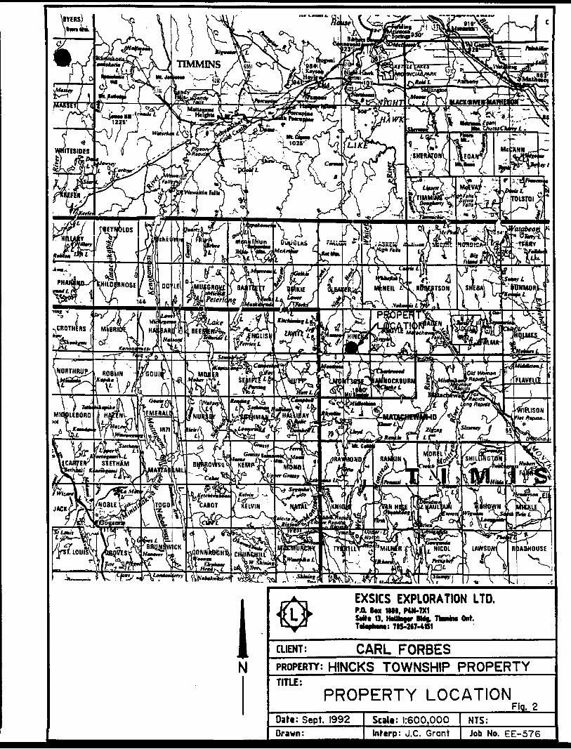
PROPERTY LOCATION AND ACCESS
The Hincks Property is located in the south central section of Hincks Townships of the Larder Lake Mining Division, of Northeastern Ontario.
More specifically it is situated south of the Little Whitefish River. Hincks Township is situated approximately 14 miles northwest of the Town of Matachewan, Ontario.
Access to the property during the survey period was ideal . Matachewan is serviced by Highway 66 which travels west-southwest off of highway 11 south at the Junction of Kenogami and Kirkland Lake.
A gravel road runs northwest from Matachewan and provide drivable access to within 1/2 mile of the property. An easy walk along a good trail will access the northern section of the group.
Refer to figure l and 2 of this report.

QUEBEC
N
•CHBOUQAMAU
OTTAWA
EXSICS EXPLORATION LTD.PA BM HW, P4K-7X1
O. HiMh|g MI 7-4ttt
Ont.
CLIENT: CARL FORBESPROPERTY; HINCKS TOWNSHIP PROPERTYTITLE:
LOCATION MAP Fig.Datt: Sept. 1992 Scalt: r*l25miles NTS:Drawn: P.O. Interp: J.C. Grant Job No. EE-576
EXSICS EXPLORATION LTD.PA Bm 1111, PUMX1
's 705-M7-4B1
CLIENT: CARL FORBESPROPERTY: HINCKS TOWNSHIP PROPERTYTITLE:
PROPERTY LOCATIONFig. 2
Date: Sept. 1992 Scale: 1:600.000 NTS:—-—-—- Drawn: i Inferp: J.C. Grant | Job No. EE-57J"

HINCKS TWFl.
MONTROSE TWP.
EXSICS EXPLORATION LTD.PA lw MM, MN-7X1 S**. O,
7IS-247-4BUf. -4B1
Ont
CUENT: CARL FORBESPROPERTY:J-|]NCKS TOWNSHIP PROPERTYTITLE:
CLAIM SKETCHQati: Sept. 1992 Scalt:t"dX2mile
Inferp: J.C. Grant
Fig. 3NTS:Job No. EE-576
Page 2
CLAIM GROUP
The claim numbers which form the Hincks property are as follows:
L1096654 to L1096659 inclusive 6L1168861 to L1168862 inclusive 2L1168864 to L1168865 inclusive 2L1096667 to L1096668 inclusive 2L1096650 ^
Total 13
Refer to figure 3 of this report.
GEOPHYSICAL PROGRAMS
This program consisted of a Total Field Magnetic survey as well as an HLEM Electromagnetic Survey which was completed over a cut grid which had already been established over the property.
MAGNETIC SURVEY
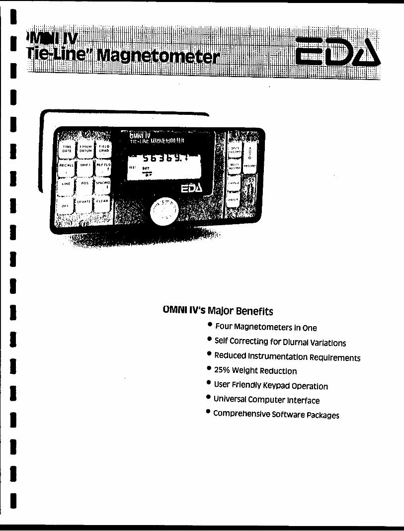
This survey was completed using the EDA OMNI IV system. Specifications for this system can be found as Appendix A of this report.
A reference field of 58,000 gammas was tuned into the unit which represents the local field. A base station recorder was also set and tuned to record and store readings at 30 second intervals throughout the survey period. This would aid in monitoring the variations in the earths duirnal.
A background of 57,500 has been removed from each reading for ease in plotting only.
The corrected data was then plotted onto a base map at 1:2500 and contoured at 25 gamma interval wherever possible.
This base map is included in the back pocket of this report.
ELECTROMAGNETIC SURVEY
This survey was completed using the Apex Parameters Max Min II System. Specifications for this unit can be found as Appendix B of this report.
The following parameters were kept constant throughout the survey:
Coil Seperation: 100 MeterFrequencies 1777 S 444 HzLine Spacing 100 MetersStation Spacing 25 Meters

Page 3
electromagnetic survey con't
Theoretical Search Depth: 50 - 60 meters Side Seeking range: 50 meters
The frequency range allows the survey the capabilities of detecting near surface, weak zones (1777 Hz) and deeper seated targets below conductive horizons, (444 Hz).
The collected data was then plotted onto base maps at a scale of 1:2500, one map for each frequency, and then profiled at lcm to */- 20%.
These maps are included in the back pocket of this report.
SURVEY RESULTS
The program was successful in locating and outlining three structures across the property. Each of these zones will be discussed seperately and in detail below.
The magnetic survey was successful in outlining what appears to be an iron formation running across the northern section of the grid. There does not appear to be any electromagnetic targets within the structure.
Zone A
This feature represents the most predominant structure on the grid. It strikes across the entire property and continues off the grid to the east and west.
The depth range of the zone varies from 15 to 50 meters with a conductivity range of 7 - 16 mhos. The zone appears to dip near vertical.
The feature does not have direct magnetic association except for moderate magnetic highs and lows along the entire strikelength.
Zone B
This feature strikes across lines 300MW to 0+00 and parallels the major structure. This zone is somewhat weaker than A which may suggest it is either deeper or representative of a narrow stringer type response.
The zone lies along the southern flank of the suspected iron formation but does not appear to be contained within the unit. The western tip of the zone runs along the northern flank of moderate magnetic unit which parallels the iron formation.
Page 4
Zone C
This feature i s a somewhat questionable response at this writing. The zone my extend as far as line 0+00.
The zone is situated on strike and to the east of a moderate magnetic unit,
CONCLUSIONS AND RECOMMENDATIONS
The surveys were successful in locating and outlining the expected airborne targets which appear to be represent by Zone A. The zone does not have direct magnetic association but does have areas of magnetic highs and lows which could represent areas of higher sulphide concentrations.
Zone A probably relates to a stratigraphic unit containing electrically charged material of unknown composition, a graphitic horizon should not be ruled out as the source. This assumption is based on the lack of magnetics.
Zone B should be followed up further as it appears legitimate although either deeper or somewhat weaker and narrower than A.
Zone C would be considered a low priority at this time until A and B are investigated further.
A follow up program should consist of prospecting of each zone and possibly extending the cable length of the Max Min Survey to test Zone B and C.
Should any of the targets be tested by drilling, then a Borehole survey should be considered as a follow-up to the drilling.
The following would be suggested drill target areas for each zone.
Zone A
L100ME/150-175MS
Zone B-
L200MW/160MN
Respectfully Submitte
John C. Grant. GET,F

CERTIFICATE
I, John C. Grant, hereby certify that:
1) I am a graduate geophysicist (1975) of the three year program in Geological Technology at Cambrian College of Applied Arts and Technology, Sudbury, Campus. I have worked subsequentely as an Exploration Geophysicist for Teck Exploration Limited (5 years), North Bay office, and as Exploration Manager and Geophysicist for Exsics Exploration Limited from 1980 to present.
2) I am a Member of the Certified Engineering Technologist Association since 1984.
3) I am a member of the Geological Association of Canada.
4) I have been actively engaged in my profession for the last seveenteen (17) years, including all aspects of exploration studies, surveys and interpretations.
5) I have no specfic or special interest in the described property. I have been retained as a Consulting Geophysicist, for property appraisal.
John Charles Grant, GET,

APPENDIX A
lllllllllllllllllll
OMNI (V's Major Benefits* Four Magnetometers in one* Self Correcting for Diurnal variations* Reduced Instrumentation Requirements* 250Xo weight Reduction* User Friendly Keypad operation* universal computer interface* Comprehensive Software Packages

... .... .... ,... ,... ..., . . 1 1 .1 i t iiililJiii ill ililU JIHiilil^^^^•^•H^MHMHHIHHHIHIHHHIIHHHIUHUIHIUIIIIIIIIIIIIIIIIIIIIIIIIIiHIimilllllllllllllllllllllllllUIHI r::- li*'' : ~-i) ; *- •••1" }# r" H? Fr ' ft- ^ i W' t ' f ' 1 ImtHftllH:J-! Bil lil! i !! iii! i ! jji jJ! S i ill 0|! j i! . . .. , If:::- :::: :::: :::: :::: :::: l:!: llti [i;; :iij !:i: sil: ! :! |!j j 1 ;Br
M i^: ii:i ii:i iii; liliiiyiai Hill liill Miall .. j jj± . . . . jj
I 'Fications ic Range . . . . 18,000 to 110,000 gammas. Roll-over display featuresuppresses first significant digit upon exceeding 100,000 gammas. 1 Method . . . Tuning value is calculated accurately utilizing a specially developed tuning algorithm itic Fine Tuning . ± ISH relative to ambient field strength of last stored value 1 Resolution . . . . . . . . . .0.1 gammaing sensitivity . . . . . . . . . . . . . . ± 0.02 gamma.il Error Resolution . . . . . . . 0.01 gamma o Accuracy . . ± 1 gamma at 50,000 gammas at 230C I± 2 gamma over total temperature range r \ Memory Capacity 'ield or Gradient 1,200 data blocks or sets of readings 'e Points 100 data blocks or sets of readings Itatlon 5,000 data blocks or sets of readings Custom-designed, ruggedized liquid crystal display with an operating temperature range from -40"C to -t- 55*C. The display contains six numeric digits, decimal point, battery • status monitor, signal decay rate and signal amplitude monitor and function descriptors, "rial I/O interface 2400 baud, 8 data bits, 2 stop bits, no parity Tolerance 6,000 gammas per meter (field proven) Ile A. Diagnostic testing (data and programmable memory) B. Self Test (hardware)
Optimized miniature design. Magnetic cleanliness is consistent with the specified absolute accuracy. 1 Sensors 0.5 meter sensor separation (standard), normalized to gammas /meter, optional 1.0 meter sensor separation available. Horizontal sensors optional. ible Remains flexible In temperature range specified. Includes 1 strain-relief connector ime (Base Station Mode) . Programmable from 5 seconds up to 60 minutes in 1 second increments q Environmental Range -40cc to + 55"C; D-100% relative humidity,- weatherproof Iipply Non-magnetic rechargeable sealed lead-acid battery cartridge or belt; rechargeable NiCad or Disposable battery cartridge or belt; or 12V DC power source option for base station operation. I.irtridge/Belt Life 2,000 to 5,000 readings, for sealed lead acid power supply, depending upon ambient temperature and rate of .readings md Dimensions Iient Console Only . . . . 2.8 kg, 238 x 150 x 250mm T Alkaline Battery Cartridge . 1.2 kg, 235 x 105 x 90mmT Alkaline Battery Belt . 1 .2 kg, 540 x 100 x 40mm Iid Battery Cartridge . . . 1.8 kg, 235 x 105 x 90mm I id Battery Belt . , . . . . . 1.8 kg, 540 x 100 x 40mm . . . . . . . 1.2 kg, 56mm diameter x 200mm it Sensor • reparation -standard) . . . . 2.1 kg, 56mTi diameter x 790mmit sensor
reparation -optional) . 2.2 kg, 56mm diameter x 1300mm system Complement instrument console; sensor; 3-meter cable, aluminum 1 sectional sensor staff, power supply, harness assembly, operations manual, ition Option Standard system plus 30 meter cable seter option Standard system plus 0.5 meter sensor
1
... i ;:j , . ,. : ...,,
*M Tilt 1 1 ft Til MifffiKffil^p^Bih Brmluffl•B li!i lif^LiliJ^iiliiiliiili
EDA Instruments inc. 4 Thornclif fe Pnrk Drive Toronto OntarioCnnnrtnM/iH 1HITClrx: OG 23222 EDA TORC.ihle: instruments Toronto 14 IGI 425 7800HI USA EDA instruments inc. 5151 Wnrcl RO.KI WhP.it Riflfje. ColOMrto U S.A 80033 (303)4229112

ax r N a d J v

lMAXMIIM II
EM
Five frequencies: 555, 444, BBS, 1777 and 3555 Hz.Maximum coupled C horizontal-loop 3 operation with reference cable.Minimum coupled operation with reference cable. Vertical-loop operation without reference cable.Coil separations: 55, 50,1OO,15O, 5OO and S5Om Cwith cable 3 or 100,500,300,400,BOO and BOO ft.Reliable data from depths of up to ISO m C BOO ft 3. Built-in voice communication circuitry with cable. Tilt meters to control coil orientation.

l l l l l l J
JJ
pRECTIFICATIONS :Frequencies) 222,444, BBS. 1777 and 3555 Hz. Repeatability!
oil Separations:
Parameters Read;
•Vtodes of Opera'
l
l
l
lli
l
t
l8
l
l
l
aadoutsi
Scale Ranges:
aadabllity:
itlon: MAX: Transmitter col l plane snd re ceiver coil plane horizontal (Max-coupled; Horizontal-loop mode). Used with refer, cable.
MIN: Transmitter coil plane horizon tal and receiver coil plane ver tical (Min-coupled mode). Used with reference cable.
V.L. : Transmitter coil plane verti cal and receiver coil plane hori zontal (Vertical-loop mode). Used without reference cable , in parallel linea.
25,50,100,150,200 S 25Om (MMfl) or 1OO. 20O. 300, 40O.6OOand BOO ft. (MMHF). Coil separations in VL.mode not re stricted to fixed values.
- In-Phase and Quadrature compo nents of the secondary field i n MAX and MIN modes.
- Tilt-sngle of the total field in VL. mode .
- Automatic, direct readout on SO mm (3.5 "3 edgewise meters in MAX and MIN modes. No null ing or compensation necessary .
- Tilt angle end null in SO mm edge wise meters in VL.mode.
In-Phase: 12OV.,*1OOV. by push button switch .
Quadrature: i2OV.,±1OOy. by push button switch.
Tilt: ±75V. slope .NullCVLJ: Sensitivity adjustable
by separation switch.
In-Phsse and Quadrature : O.25 V. to O.5V. ; Tilt: 1V. .
±O.25*xttoi1'A normally, depending on conditions, frequencies snd coil separation used.
Transmitter Output i- 222Hz : 22O Atmp- 444HZ :2OOAtms- BBSHz : 12OAtma- 1777 Hz : 8OAtma-3555 Hz: 3OAtms
Receiver Batteries: SV trens. radio type batteries (4). Life: approx. 35hrs. continuous du ty (alkaline , O.5 Ah), less in cold weather. J
Transmitter Batterle s i
Reference Cable t
Voice Link:
12V B Ah Gel-type rechargeable battery. (Charger supplied).
Light weight S-conductor teflon cable for minimum friction. Unshield ed. All reference ceblea optional at extra cost. Please apecify.
Built-in intercom system for voice communication between re ceiver and tranamitter operators in MAX and MIN modea, via re ference cable .
Indicator Lights! Built-in signal end reference warn ing lights to indicate erroneous readings .
TemparaturaRangei -4O*Cto*BO'C C-4O*Fto*14O*F).
Receiver Weight) 8kg (13 IDS.)
Transmitter Weight: 13kg (2Slbs.)
Shipping Weight! Typically BOkg C135lba.), depend ing on quantities of reference cable end batteriea included. Shipped in two field/shipping cases .
Specifications subject to cnange without notification
.J J J
J
J
J
APEXrPAP.AMETRICS LIMITED20O STEELCASE RD. E., MARKHAM, ONT., CANADA , L3R 1G2
Phone: (418) 435-1612 Cables: APEXPARA TORONTO Telex :OS-ase773 NORCVIK TOR
42A82SW8421 2.14641 HINCKS
Ontario900
Ministry ofNorthern Developmentand Mines
Ministere du DeVeloppement du Nord et des Mines
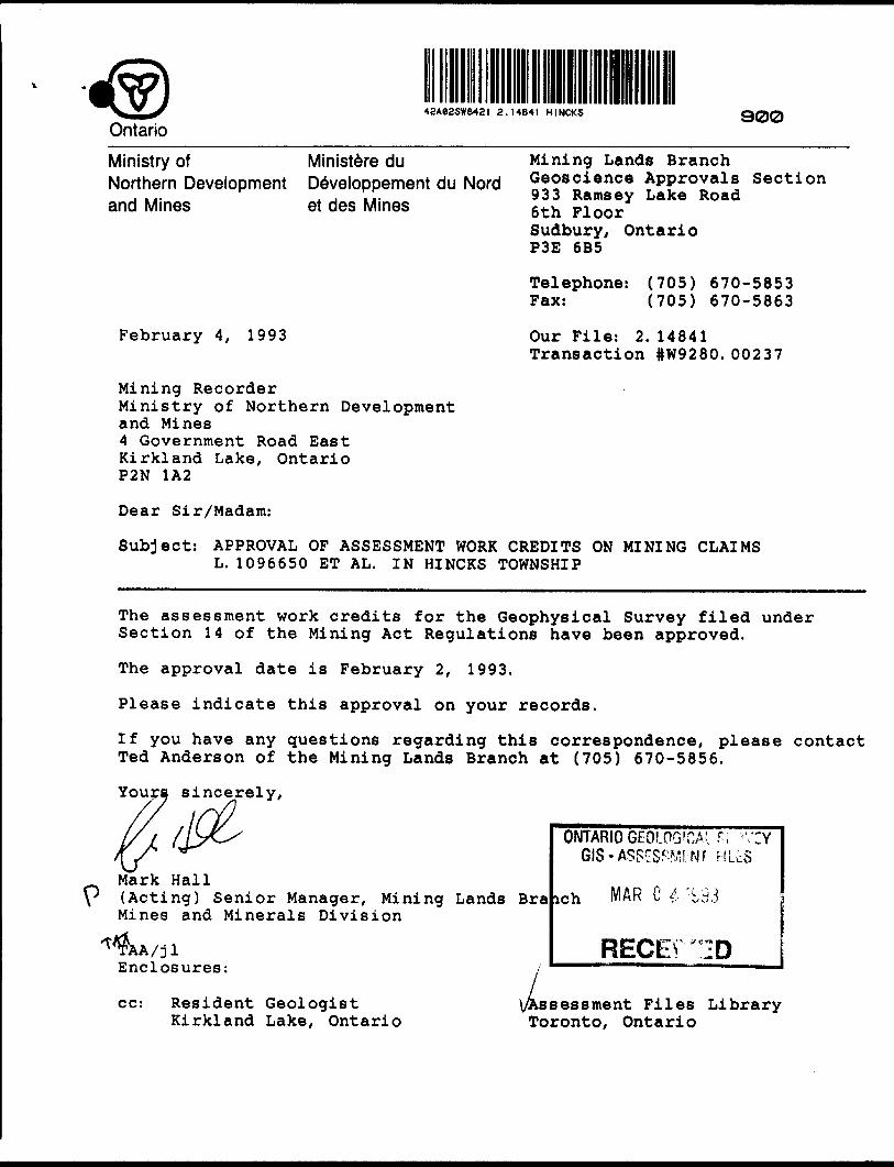
February 4, 1993
Mining Lands Branch Geoscience Approvals Section 933 Ramsay Lake Road 6th Floor Sudbury, Ontario P3E 6B5
Telephone: (705) 670-5853 Fax: (705) 670-5863
Our File: 2. 14841 Transaction #W9280.00237
Mining RecorderMinistry of Northern Developmentand Mines4 Government Road EastKirkland Lake, OntarioP2N 1A2
Dear Sir/Madam:
Subject: APPROVAL OF ASSESSMENT WORK CREDITS ON MINING CLAIMS L. 1096650 ET AL. IN HINCKS TOWNSHIP
The assessment work credits for the Geophysical Survey filed under Section 14 of the Mining Act Regulations have been approved.
The approval date is February 2 , 1 993.
Please indicate this approval on your records.
If you have any questions regarding this correspondence, please contact Ted Anderson of the Mining Lands Branch at (705) 670-5856.
Youra sincerely,
Mark Hall(Acting) Senior Manager, Mining Lands BraMines and Minerals Division
A/j l Enclosures:
ONTARIO GEOLOGICAL ^ 'VEGIS - ASSeSPMI 'NT RLcS
ich MAR C i ' i,9
RECEV "ID
cc: Resident GeologistKirkland Lake, Ontario
Assessment Files Library Toronto, Ontario

Northern Development and* Mines
Ontario
ui worn oonauciea After Recording Claim
Mining ActI I rcnsacuon Numow
Peiaenailnlon.^*iujlHiiiJenlnla form la obtained under the authority of the Mlr^ Act TMalnforniatlonwM be uaad ter ooffaepondanoa-Queatlona about rhJa eotMHon ahoukJ be dkected lo the Provincial Manager, Mining Landa, Mlnlatry of Northern Development and Mkiea, Fourth Floor, 160 Cedar Street, ludbury, Ontario, P3E SAB, telephone (706) 670-7264. ,
4instructions: - Please type or print and submit In duplicate. X- Refer to the Mining Act and Regulations for requirements djHIiln
Recorder.- A separate copy of this form must be completed for each Work Group.- Technical reports and maps must accompany this form In duplicate.- A sketch, showing the claims the work Is assigned to, must accompany this form.
work or consult the Mining
//ve.NO*
S&- C&HtSSNo.
TownahlpMrea or Q Plan No.
To:
Work Pefformed (Check One Work Group Only)WorkGroup
Qeotechntoal Surveyfi*., ia|- ,| MffiAfliyWUV WOrK,Indudbig DrMng
RehabMtatlonOther AuthorizedIftfnalVfVMH
AssaysAssignment fromOjftAAffUArli^P*jnrW
Type
G&GUJJ& MACtJtTlC. *i- Mf^X-Ml*) -3T E LECTm#DS4A'6'JJf"7yC.
HbUblVblJ
DEC 1 7 1992
MINING LANDS BRANCH
^~*2 P **^
Total Aaseesmtnt Work Claimed on the Attached Statement of Costs l .tot*: The Minister may reject for assessment work credit all or part of the assessment work submitted H the recorded
holder cannot verify expenditures claimed in the statement of costs within 30 days of a request for verification.
'ereona and Survey Company Who Performed the Work (Give Name and Address of Author of Report)Name
&XS/CS fxPLoAAT/ojJ
l. J l/ re t*
Address
A o. ^6v /SfiA 7V/////^^ O A/7". ^ IJAJ"7X/
attach a schedule M necessary)
)trtHlc*tlon of Beneficial Interest * See Note No. 1 on reverse aidel certify thai at the time the work waa performed, tha claims covered In We work report ware recorded In tie current hctdor'a name or hakf under a beneficial MereM by the current recorded holder.____________________
neoorded Holder or Agant (Slgnanire)
^unification of Work Reportl eerUfy thai l have a paraonal knowledga of tha facto eat forth In Into Work report, having parformad tha work or wKneaaed tame during and/or after Ma oornpletlon and annexed report la true.^^^^^^^^^ iarae end Addraaa of Pereon Certifying
s-st 7 -^ /ys—. r*-"\i !
or Offloa Use Only•flaMraed
Hi TC I Ud ST 030

1.i *|" ir {i a r| i rx*
M
)f\
N * * *A
1
V. O ON
1 5 •JO
x. ON
OQ ON -
0N
00 ^
Z Oo
00 ON ^
s OS'
^ -
0 JN ^\ ^0 -*
o ON ^ OQ -
0 -0 *0 0 -
•v 0 os Os ON -
0 ^^3
1^\ ^ ^ -
0 ON v\ ^
t
0 9\ ^ U 0 v*
t fi Bil fi if J9f •H
. 1 li i
0 p i r* Sj i O
0
Od
0
0 b 0 H p
-J
O 0 t o - F O 0
1 r* p 8
f 8 ffc 0
0
) ft
*
)0 ) ^ 0 i?
n t* 0 8
, ? 0 0
c l K, ?^. O
O O t O
0 ? C)
O 0 o : 0 Q
30
O -. O o
0 o o
tyi lin m
lv)
V. 8 * 8
GO ? g"A o 8
s..
^0 ? *
uj ^ ? V)
\A)
CX O 8
J &0 sw S o 0
tN * 6
9 fr
flfl . iJ
Oed
ns yo
u are
dalm
lngjn
this r
epor
t may
be cu
t bac
k. In
orde
r to m
inimi
ze th
e adv
erse e
ffects
of su
ch de
letion
s, ple
ase
Indica
te fro
m wh
ich d
alms
you
wish
to pr
tortze
the
delet
ion o
f cred
its. P
lease
mar
k (•J
one
of t
he fo
llowi
ng:
1. D
Cre
dits a
re to
be
cut b
ack s
tartin
g wt
th the
dalm
Rste
d las
t, wo
rking
bac
kward
s.2.
O
Cre
dits
are
to be
cut
bac
k eq
ually
ove
r aR
dalm
s co
ntaine
d hi
this
repo
rt of
work.
3, D
Cre
dits a
re to
be cu
t bac
k as p
riortz
ed on
the
stitch
ed a
ppen
dbc.
hi th
e ev
ent t
hat y
ou h
ave
not s
pecif
ied yo
ur ch
oice o
f prio
rity, o
ption
one
win
be Im
pleme
nted.
tota
l: fa
tsmple
sotD
eflet
kdalt
nter
eetsf
euiire
cord
e^to
tten
***
•4ote
ft
H wo
rk h
as b
een
perfo
rmed
on
pate
nted
or l
ease
d lan
d, p
lease
com
plet
e th
e fo
llowi
ng:
l cer
tify th
at th
t rec
orded
hpM
tr ha
d a b
wwfld
al In
tent
! In t
ht pa
tented
| B
flMtu
rt(D
ate

— Ontario
MktfetryotNorthern Developmentand Mbios
.^atV **duDevetoppement du Nord
Statement of Costs for Assessment CreditEtat des coOts aux fins du credit devaluation
Mining Act/Lol eur lee mines
Transaction NO./N* de transaction
Perwnal Information collected on thU form l* obtained under the authority of the Mining Act. This Information will be used to maintain a record and ongoing status of the mining clalm(s). Questions about this collection should be directed to the Provincial Manager, Minings Lands, Ministry of Northern Development and Mines, 4th Floor, 169 Cedar Street, Sudbury, Ontario WE 6AS, telephone (705) 670-7264.
Les renssignements personnels contenus dana la presents formule son! recueHHs en vertu de la Lot sur lea mines at servlront a. tenlr a jour un reglstre des concessions mlnleres. Adresser toute quesHon sur la coflece de ces renselgnements au chef provincial des terrains mlnters, ministers du Devetoppement du Nord et des Mines, 159, rue Cedar, 4* Mage, Sudbury (Ontario) P3E 6A5, telephone (705) 670-7264.
1. Direct Costs/Couls directs
Type
Wages talakee
Contractor's and Conauttant's Fees Drafts de ('entrepreneuretderexpert-
euppneeUeedCoumrtures
BA*a*Alnvnm
materiel
Description
Ubour **fK? Maln-d'oeuvrsf/ft. Field Supervision Supervision sur le terrain
Typ* LiAfZCLtTTitit.
fSe^/wstfvcs
Type
Type
Amount Montant
/ICO*
2^0*0*
ViStV^o
Total Direct Costs Totsl des coOts directs
Totals Total global
1 too- co
f "
f 8*-. "Jf .
f i -.
Mrfc*M
2. Indirect Coste/CoOte Indlrecte* * Note: When claiming Rehabilitation work Indirect costs are not
allowable as assessment work. Pour le remboursement des travaux de rehabilitation, lee coflts Indlrects ne sont pss admissible* en tant que travaux d'evaluation.
Type
Transportation Transport
Food andLodging Nourrttureet
MobmssUon and MooHlMtlofi *M^ j^—a-SM^^*!^^OajlHOOajllaulOfi
DescriptionTypei- /to k s* @*
.30 y/-^.
Sub Total of Indli Total partW des eoQti
Amount Montant
^y#*a
•ect Costs1 Indlrects M PW" W W
Amount Allowable (not greater than NH el Direct Costs) Montant admissible (n'excedant set M H ose eoOts directs)
(Total ef Mraet and ABowaWa d'evskiettobwOroel eatfe) fTaW 4*t M
IsdueredN n
Totals Total global
k
6Vtf.tc
4ye*.a/vy.aia?2p.4
Hit
Note: The recorded holder will be required to verify expenditures claimed in this statement of costs within 30 days of s request for verification. If verification is not made, the Minister may reject for assessment work aN or part of the assessment work submitted.
Note : Le tttuWre enregWr* sera tenu de verifier toe depenses demandset dans le present etat des coots dans lee 30 jours sutvant une demands a cet effet. 8) la verification n'est pas effectuee, le mlnistre peut rejeter tout ou une partis des travaux d'evaluation presentee.
Flung Discounts
1. Work Died within two years of completion le claimed at 10Mb of the above Total Value of Assessment Credit.
2. Work filed three, four or five years after completion it claimed at SOto of the above Total Value of Assessment Credit. See calculations below:
Total Value of Assessment Credit Total Assessment claimedx 0.50 -
Certification Verifying Statement of Coste
l hereby certify:that the amounts shown are as accurate as possible and these costs were Incurred while conducting assessment work on the lands shown on the accompanying Report of Work form.
that as ^(Recorded Hoktor. Agent, Petition in Company)
to make this certification
Remises pour depot
1. Les travaux deposes dans les deux arts suivant leur achevement sont rembourses a100 *A de la valeur totale susmenoonnee du cred*tf evaluation.
2. Les travaux deposes trots, quatre ou dnq ans apret leur achevement sont rembourses a 50 H de la valeur totale du credit d'evaluation susmentlonne. Voir les calculs cWessous.
rHeur totale du crewt d'evaluationx 0,60
DEC l 7 1992
AtlMt"lon * rtM * e"te MINING 1ANDS BRANCHJ'atteate par la presents :que let montants Indiques sont le plus exact possible et que ces depenses ont ete engagees pour effectuer les travaux d'evaluation sur lea terrains Indiques dans la formule de rapport de travail ci-joint.
l am authorized Et qu'a litre de je auis autorise(mulalr* snraglsM, r*prs*sfltant. posit oeeup* dans la oompagnto)
a falre cette attestation.
Signature Oat*
Nota : Dans catte tormute, tofsqu'H deskjne des personnes, le masculln est utilise au sens neutrc.

CLEAVER TOWNSHIP MCNEIL TOWNSHIP'
95M-- - - '— — L- — --5M
94M
QuX C/)zo
N
NI
1169093 , H69094, 1169095 . U69O96, II69O97
I169IOI IH69IOO 11169099
__ __ __ __ 1 '
II68883T11609071 |i669o"e ~
1)67934 ' ^oTTl'ieS L 1185389
L , i- l 1166905 1167939 l Iff 7936
1168900 1166901 i U68904
— — -,1168899 II689O2 III689O3 l
-I ^ J
G r e e ri w a te
o- - - -H-4M
918092 ' 9160- -- L - -J
L -| U | L - | LW8094 aa3OB-1 i 9I8O93
1177896 9 I9390h."l——
- -,L
l- j- l 1" ' L- l1979476 979471 '979470 1979465 .
L. i L 979475 ,979472 |979469 (979466
L l U
L 'L. L
11096745 1096744S l 97947^5 l 979473 , 979468 | 979467
I [L l 919453 i 919452 l 919441 l 919439
919395 919382 919400
918950 1 919442 L//. - -L - -.
L. ' L.I0967IO i 1096902 ' 1096903(1096904 1I09MOS Il09664e'918952 953922
11096767 |l09676
1096727
--{L--1096735!I09673*1 |096
"~ ~ ~;~ "TL. ~
5795eo l 579579
L i~ — ~"~ ~ ~1096944 lp96943lO9694 1096941 1096660,1096
096737 |109666I , 1096664 | t096668|lO96666 ',096669 WeeA i i096672'io96673 l .O47I48 ''047150 ! j!* '(096732 (1096731 1072337
-r- — —— — — -t- T,. , L. T
''047149 I048S44 ,04e | 919490"1072336 |09666e (1096663 1 76774, 7677251767724
6M IM
MONTROSE TOWNSHIPCOPY OF THIS MYLAR ARCHIVED APR.IO/92
42A02SW8421 2 .14841 H INCKS 200
O
m
ozO)xT)
LEGEND
HIGHWAY AND ROUTE No OTHER ROADS TRAILSSURVEYED LINES:
TOWNSHIPS, BASE LINES, ETCLOTS, MINING CLAIMS, PARCELS, ETC
UNSURVEYED LINES: LOT LINESPARCEL BOUNDARYMINING CLAIMS ETC
RAILWAY AND RIGHT OF WAY
UTILITY LINES
NON-PERENNIAL STREAM
FLOODING OR FLOODING RIGHTS
SUBDIVISION OR COMPOSITE PLAN
RESERVATIONS
ORIGINAL SHORELINE
MARSH OR MUSKEG
MINES
TRAVERSE MONUMENT
DISPOSITION OF CROWN LANDS
TYPE OF DOCUMENT
PATENT, SURFACE St MINING RIGHTS ....
" .SURFACE RIGHTS ONLY..,......
" . MINING RIGHTS ONLY ......,...
LEASt,SURFACE 4 MINING RIGHTS......
" .SURFACE RIGHTSONLY...........
" ,MINING RIGHTSONLY.............
LICENCE OF OCCUPATION ....^...^.....ORDER IN-COUNCIL ............,..... ... .RESERVATION ..^^... . ... ....
CANCELLED .................
SAND ft GRAVE L ..^..^....... . ...........
SYMBOL
0.... e
Q
BQT
OC
O
NOTE: M ININQ BIGHTS IN PARCELS PATENTED PRIOR TO MAY e.1913. V ESTED IN ORIGINAL PATENTEE BY THE -U8L1CLANDS ACT. B S O 1970 CHAP MO. SEC 63, S uBSEC l
tf
SCALE : 1 INCH = 40 CHAJNS
M f TO 1OOO 20OO 4000 6OOO OOOO
O 200 1000 METRES i 1 KM!
20OO(2 KM
ORCULATED FEB. 26.1990
TOWNSHIP
HINCKS
DATE OF 1SSUF
fEB i
LARDER LAKE
M.N.R.-ADMINISTRATIVE DISTRICT
KIRKLAND LAKMINING DIVISION
LARDER LAKE ^6021993
TIMISKAMING
Ministry of Ministry ofNatural Northern DevelopmentResources and Mines
Ontario
Otti DECEM8ER/I986Numb t r
G-3649

5+OON 5+OON
4fOO\
1096650
4+OON
OON
BL 0-00 Az 115
168865RIVER•H
1=697
1168864
3*OON
2+00X1528109665
535
BL o+oo 1096655
2+OOS
5281096657
09666756
1096658
OOS
2+OOS
1096668
3 + OOS
2. 1484T
4+00^ 4^005
LEGEND ————————————
Instrument: EDA OMNMVPgrometres Mtoaurcd: Earth's, total magnetic fieldAccuracy: */- f nono-teslasOiurnals: Corrected by base station recorderContour Interval: 0 ,25,50,75,100,125.......Reference Field: 58,000 Datum Subtracted: 57,50O
5+OOS 5 + OOS
50 100 150
SCALE
1096659
42A02SW842! 2.14841 HINCKS
EXSICS EXPLORATION LIP.O. Box 1880, P4N-7X1Suite 13, Hollinger Bldg, Tinmins Ont.Telephone: 705-267-4151
CLIENT: STRIKE MINERALS INCN
q ^OHN GRANT Q
PROPERTY: HINCKS TOWNSHIP PROPERTYTITLE: CONTOURED
MAGNETOMETER SURVEYDate: Sept. I992Drawn: P.G.
Scale: 1:2500Interp: J.C. Grant
NTS:Job No. EE-576

5+OON
4+OOM
1096650
4+OOS
5+OOS
42A02SW8421 2.14841 HINCKS
LJ O O
4-CO
-l
1168865 1168864
3-OON
2+OON
1096656-R ftessei
8 L
1168862
1096655BL 0+00
I6MHO -16 28m
-13 -2+OOS
1096657
1096667
096654
1096658
1096659
5+OON
4+OON
3+OON
2 + OON
OON
BL 0 + 00 Az 15
OOS
2+OOS
1096668
3+OOS
4+OOS
5+OOS
MAX-MIN H
-p_CONDUCTOR i--13 AXIS
LEGEND
MSTfflJHOfT: Apw PviMfrics Mw-Nn H HOPE: Maxteun CoupUd. HoHzontM Loop Survty PARAMCTOES HEASURED: tephw (W
Out tf ptest FREQUENCY: 444 Hz C01 SffARATtOH: 100mOPERATOR: D. oforest PROH.E SCALE
50 100 150
SCALE
EXSICS EXPLORATIONP.O. Box 1880. POJ-7X1Suite 13, Hollinger Bldg. Tiounins OntTelephone: 705-267-4151
CLIENT: STRIKE MINERALS INCN^uovrPROPERTY: HINCKS TOWNSHIP PROPERTYTITLE:
MAX-MIN 444 HzDate: Sept. 1992Drawn: P.G.
Scale: 1:2500Interp: J.C. Grant
NTS:Job No. EE-576

5+OON
4+OOM
1096650
4+00^
5+00-
42A02SW842I 2.14841 HINCKS 330
LJ OO*
CD
II68865RIVER
l 68864
2+OON
I096656^2 -s
II6886I
II68862
I096G55BL 0+00
2^005
f31096657-83-OOS
109666^3 -7
096654-13
1096658
1096659
5+OON
4+OON
OON
2+OON
+OON
BL O i-OO Az 115
oos
MAX-MIN II
2 + OOS*20 +I3
1096668-30-30
*20
3 + OOS
-+20
-K)--B
CONDUCTOR AXtS
to
v\K 3 5 S
148 41 o
4+OOS
5+OOS
LEGEND
MSTRUMEHT: Apw PvMttric* Mw-Min H HOPE: Ma)5iua Coopltd, Horhonfrt Loop Survey PARXMETRES MEASURED: tophist r/.)
Out of phutT: 1777 Hz
COI. SEPARATION: lOOmOPERATOR: D . Loforest PRORLE SCALE: l cm.20%
O 50 100 15.0
SCALE
EXSICS EXPLORATION LP.O. Box 1880. P4N-7X1Suite 13, Hollinger Bldg, Timmins OntTelephone: 705-267-4151
CLIENT STRIKE MINERALS INC.PROPERTY: H INCKS TOWNSHIP PROPERTYTITLE:
MAX-MIN I777 HzDare: Sept. I992Drawn: P.G.
Scale: 1:2500Interp: J.C. Gran*
NTS:Job No. EC-576
"t l O