geotraining - cgggeotraining the cgg integrated training offer an introduction to cgg geotraining...
TRANSCRIPT

GeoTraining The CGG Integrated Training Offer
May 2017

GeoTraining The CGG Integrated Training Offer
An Introduction to CGG GeoTrainingGeoTraining brings together the full breadth of CGG’s skill development programs to provide the E&P industry with comprehensive geoscience workforce learning path programs.
GeoTraining combines over 85 years of practical expertise training our own employees with the excellence of training provided by our Robertson, Jason, HampsonRussell and CGG University brands. The unique breadth and depth of our capability enables GeoTraining to design and deliver integrated learning path programs covering the disciplines of the global E&P geoscience community.
The GeoTraining offer covers many themes including:
• HSE• Equipment• Seismic Acquisition
& Potential Methods• Subsurface Imaging
• Geophysical Interpretation• Petroleum Geology &
Reservoir Engineering• Reservoir Characterization
& Modeling• Petroleum Management
& Economics
• Data Management• Business skills• Software• Field Courses
CGG GeoTraining leverages the internationally recognized geoscience training and business skill development programs of CGG to deliver customized solutions that best meet the career goals of trainees and the development needs of our global clients.
Jean-Georges Malcor
Chief Executive, CGG


GeoTraining The CGG Integrated Training Offer
“Clear information delivered by a highly experienced teacher”

5
Introduction 2
List of Courses 5
Health, Safety & Environment ....................................... 6
Equipment ................................................................. 12
Seismic Acquisition & Potential Methods......................... 14
Subsurface Imaging ..................................................... 28
Geophysical Interpretation ........................................... 40
Petroleum Geology & Reservoir Engineering..................... 50
Reservoir Characterization & Modeling ............................ 86
Petroleum Management & Economics .............................. 100
Data Management ....................................................... 108
Business Skills ............................................................ 116
Software .................................................................... 124
Field Courses .............................................................. 148Table o
f Cont
ents
GeoTraining The CGG Integrated Training Offer

6 GeoTraining The CGG Integrated Training Offer
CGG is committed to helping our clients achieve excellence and continuously improve all aspects of their activities, including demonstrating leadership and compliance in Health, Safety, Security and Environment (HSE).
HSE training courses are an essential component of workplace HSE. Our HSE courses are aligned with a Management System based on IOGP* recommended practice.
HSE curriculum offerings include:
• HSE-OMS(Operating Management System) for onshore or offshore crews to developand enhance key operational HSE management skills and HSE leadership capabilities
• HSE for office managers to embrace all HSE workplace situations
CGG recognizes that HSE performance ultimately lies with each employee, contractor and client, their ability to work together as a team and their commitment to take responsibility for themselves and for the team.
“I now have a clear picture of HSEpolicies and objectives, how they
originated and their intended purpose. I know what is expected of offshore
crews in terms of HSE and, most importantly, why it is expected.”
* International Association of Oil & Gas Producers
Healt
h, Safe
ty &Env
ironm
ent

Health, Safety & Environment• HSE-OMS for Land Senior Staff 8• HSE-OMS for Land Managers 8• HSE-OMS for Marine Senior Staff 9• HSE-OMS for Marine Managers 9• HSE for Office Managers 10• HSE-Incident/Accident Investigation 10

8 GeoTraining The CGG Integrated Training Offer
AudienceLand Senior Staff and Department Heads.
ContentUnderstand the benefits of the HSE Operating Management System (HSE OMS) and what it delivers in practice. Learn how it helps you in your day-to-day management of your activities. This course teaches HSE responsibilities for each crew position. The 10 elements of the HSE-OMS course are: Commitment and Accountability; Policies, Standards and Objectives; Organization, Resources and Capability; Stakeholders, Clients and Customers; HSE Risk Assessment and Control, Asset Design and Integrity; Plan and Procedures, Execution of Activities; Reporting, Monitoring and Learning; Assurance, Review and Improvement. For each element the training will review in detail the tools that are available to manage HSE in the field: job safety risk analysis, permit to work, safety awareness, communication tools, MOPO
Learning Objectives • Have greater awareness of the company’s HSE Operating Management System
• Understand your role, obligations and responsibilities in the HSE-OMS processes
• Apply the HSE-OMS principals to your team
• Identify hazards, assess risks and learn about the controls you can put in place
*This course requires field experience.
AudienceLand Managers, Party Managers, Deputy Party Managers, and Office Operation Managers
ContentUnderstand the benefits of the HSE Operating Management System (HSE OMS) and what it delivers in practice. Learn how it helps you in your day-to-day management of your activities. This course teaches HSE responsibilities for Land Managers. HSE-OMS 10 elements include; Commitment and Accountability; Policies, Standards and Objectives; Organization, Resources and Capability; Stakeholders, Clients and Customers; HSE Risk Assessment and Control, Asset Design and Integrity; Plan and Procedures, Execution of Activities; Reporting, Monitoring and Learning; Assurance, Review and Improvement. For each element the training will review in detail the tools that are available to manage HSE in the field: job safety risk analysis, permit to work, safety awareness, communication tools, MOPO
Learning Objectives• Understand the importance of planning for and assessing a risk• Control the administrative process and standards associated with the industry in each
country of activity• Recognize the HSE responsibilities within all areas within all areas of each product or
business line• Identify the HSE priorities, to work on the control measure of the major risks identified
HSE-OMS for Land Senior StaffDuration (days) 3-day
Max Number of Participants 12
Prerequisites None
Course Type Attendance-based
HSE-OMS for Land ManagersDuration (days) 4-day
Max Number of Participants 12
Prerequisites None
Course Type Attendance-based
Health, Safety & Environment

9
AudienceMarine Senior Staff: Seismic Department heads, Maritime Chief Engineer, Maritime Chief Officer and Equivalent.
ContentUnderstand the benefits of the HSE-OMS and what it delivers in practice. Learn how it helps senior staff in the day-to-day management of their department. It includes Corporate HSE-OMS and the 10 elements of the HSE-OMS course are: Commitment and Accountability; Policies, Standards and Objectives; Organization, Resources and Capability; Stakeholders, Clients and Customers; HSE Risk Assessment and Control, Asset Design and Integrity; Plan and Procedures, Execution of Activities; Reporting, Monitoring and Learning; Assurance, Review and Improvement. For each element the training will review in detail the tools that are available to manage HSE in the field: job safety risk analysis, permit to work, safety awareness, communication tools, MOPO
Learning Objectives • Understand the structure and purpose of the HSE-OMS and your role in its application
and promotion• Apply HSE-OMS consistently across the Organization• Manage Risk effectively• Understand the purpose of Audits and Investigation
AudienceMarine managers: Party Managers, Masters, and QHSE advisors.
ContentUnderstand the benefits of HSE-OMS and what it delivers in practice. Learn how it helps in the day-to-day management of your Crew, Vessel and Project. Corporate HSE-OMS and the overview of HSE-OMS 10 elements including; Commitment and Accountability; Policies, Standards and Objectives; Organization, Resources and Capability; Stakeholders, Clients and Customers; HSE Risk Assessment and Control, Asset Design and Integrity; Plan and Procedures, Execution of Activities; Reporting, Monitoring and Learning; Assurance, Review and Improvement. For each element the training will review in detail the tools that are available to manage HSE in the field: job safety risk analysis, permit to work, safety awareness, communication tools, MOPO
Learning Objectives • Understand the structure and purpose of HSE-OMS and your role in its application and
promotion• Apply HSE-OMS consistently across the Organization• Manage Risk effectively• Understand the purpose of Audits and Investigation
HSE-OMS for Marine Senior StaffDuration (days) 3-day
Max Number of Participants 12
Prerequisites None
Course Type Attendance-based
HSE-OMS for Marine ManagersDuration (days) 4-day
Max Number of Participants 12
Prerequisites None
Course Type Attendance-based
Health, Safety & Environment

10 GeoTraining The CGG Integrated Training Offer
AudienceOffice Managers
ContentUnderstand the HSE role of and responsibilities for office managers and how HSE helps them in their day-to-day management of their activities.
This course includes: An overview of HSE and its management through the corporate HSE Operating Management System. Multiple topics familiarize participants further: - Office Risks and Controls: Facility and workshop Safety, Occupational Health Risks,
Security, Travel Safety, General Transport Management, Environment. - Emergency Plans: Fire safety and Emergency Response Plans.
Learning Objectives • Recognize the office manager’s HSE responsibilities• Understand the importance of assessing risk• Identify the HSE priorities to work on work on how to measure and control the
major risks identified
HSE for Office ManagersDuration (days) 1/2-day
Max Number of Participants 12
Prerequisites None
Course Type Attendance-based
Health, Safety & Environment
AudienceTraining is suitable for line managers, supervisors, safety representatives – and anyone with the responsibility for investigating incidents.
ContentThis two-day course will provide delegates with a broad understanding of the principles and practice of incident investigation. It will focus on techniques for gathering, accurate and objective accident data used to determine true root causes and examine and analyze data as a means of preventing injuries, property damage and financial losses.
It is estimated that for every serious accident, hundreds of incidents (near misses) will occur. Investigating all accidents/incidents, regardless of severity, contributes to the identification of the basic causes, corrective actions and preventive controls, which reduces future accidents.
Learning Objectives• Be prepared with a scope, team and investigation kit• Conduct a complete investigation, including how to assess the accident scene, collect
evidence and interview witnesses• Conduct an analysis and find the root causes using the 5 whys technique• Develop and categorize specific remedial actions• Report and follow up
HSE-Incident/Accident InvestigationDuration (days) 2-day
Max Number of Participants 12
Prerequisites None
Course Type Attendance-based


12 GeoTraining The CGG Integrated Training Offer
Sercel offers training courses for all levels of technicians, from the basic operator to the experienced field engineer.
Dedicated training facilities are available in our Nantes, Houston, Saint-Gaudens, Surgut, Dehradun and Beijing locations. The latest training aids are on hand in a user-friendly environment with guidance from fully operational field engineers. Complete seismic source and acquisition systems are available on site to simulate field production.
“Having one on one access to experts makes the difference”
Equip
ment

13Sercel Marine TrainingSercel Marine training courses provide observers, electronics engineers and navigators with all the information they need to successfully conduct acquisition of seismic data using the latest generation of Sercel Marine equipment.
Trainees will also learn to operate and maintain the Sercel Nautilus® system. Part of the course is dedicated to the use of the Sercel marine system.
Sercel Land TrainingSercel Land training courses provide users of Sercel’s land equipment with complete knowledge of how to set up, troubleshoot and correctly operate our systems. Our dedicated training centers provide the complete range of Sercel products in order to offer a training experience that is as close as possible to field conditions.
Sercel Repair TrainingSercel Repair training courses provide technicians with the information they need to repair and assure the maintenance of Sercel equipment. Our dedicated repair training centers in Nantes, Houston and Saint-Gaudens and our experienced repair technicians will ensure you have all the information required to repair and maintain your Sercel equipment.
Sercel Navigation TrainingSercel Navigation training courses aim to give operators, chief navigators and support engineers in-depth knowledge and an advanced understanding of the Sercel navigation system. This includes administration and troubleshooting. Navigation skills are a prerequisite.
Sercel Downhole TrainingSercel Downhole Training course provide technicians, maintenance engineers and observers all the key knowledge to properly maintain, set up and operate Sercel Downhole tools. Training is split between theory and practice on real system, including running a job in our test well with G Gun source, use of anchoring press and WTB.

14 GeoTraining The CGG Integrated Training Offer
As a pioneer in the advancement of geoscience education, CGG University offers the most comprehensive industry training based on years of practical experience gained by our own personnel. With proven expertise in any environment, onshore or offshore, our extensive offer ranges from programs covering the basics to the most advanced techniques in the industry today.
Our training solutions cover various programs from specific short courses such as Seismic Survey Design to long-term induction, custom-designed (with client data) and on-the-job training. Our programs are tailored to fit client specifications and match the geophysical experience of participants.
“Not only was the training course an exciting process,
the expertise of your trainers made it an unforgettable
experience that I’d happily repeat.”
Seism
ic Acq
uisitio
n & P
otenti
al Me
thods

15 Geoscience Fundamentals
• Geophysical Acquisition Overview 16• Non Seismic Methods 16
Induction Programs• Field Geophysicist Induction 17• Land Seismic Surveyor Induction 17• Field and Marine Manager Induction 18
Land and Marine Positioning• Geodesy Overview 19• Overview of Global Navigation Satellite Positioning Systems (GNSS) 19• Introduction to Surveying Methods 20• Land Seismic Positioning Overview 20
Land and Marine Acquisition• Basic Survey Planning 21• Advanced Survey Planning 21• Basic Field Processing 22• Advanced Field Processing 22• IT/Network for Field Geophysicists 23• Production Tools and Methods for Field Geophysicists 23• Impact of Equipment on Seismic Performance 24• Seismic Survey Design 24• UltraSeis 25• VibroTech 25
Shallow Water Operations • Ocean Bottom Seismic 26
Onboard Processing• Basic Onboard Processing 27• Advanced Onboard Processing 27

16 GeoTraining The CGG Integrated Training Offer
AudienceAnyone who wants to have a better understanding of the geophysical chain of activities.ContentThis course introduces the geophysical methods used to explore the subsurface, and focuses on the most common method: seismic.We review the different typical geographical environments (desert, swamp, marine) and the different types of equipment used and describe how operations are usually planned and conducted.Key concepts are introduced through examples to understand how acquisition methods (broadband, wide-azimuth surveys, etc.) contribute to the enhanced resolution of seismic images, while maintaining high productivity standards.Learning Objectives • Describe the principles of geophysical acquisition• Understand the need for equipment• Living conditions in the field• List the key criteria which determine the choice of acquisition parameters
Geophysical Acquisition OverviewDuration (days) 1-day
Max Number of Participants 6 - 12
Prerequisites None
Software Used None
Course Format Presentations, videos
Seismic Acquisition & Potential Methods: Induction Programs
AudienceGeologists, geophysicists and engineers who want to understand and use gravity and magnetic data.ContentThis comprehensive course covers many different aspects of practicing gravity and magnetic exploration methods. It starts with fundamentals of the gravity and magnetic fields and ends with several modern technologies and applications. The course includes formal lectures, a great amount of graphics, a rich collection of case histories, and live demonstrations of the concepts and techniques by the industry-standard gravity and magnetic data processing and interpretation software.Learning Objectives
• Review the fundamental theory of gravity and magnetic potential, field and gradient• Explain the instrumentation and field acquisitions in land, marine and airborne magnetic,
gravity and gravity gradient surveys• Understand gravity and magnetic data processing workflow• Describe gravity and magnetic interpretation techniques• Show case histories for solving different geological problems
Non Seismic MethodsThis comprehensive course is for geologists and geophysicists with an interest in gravity and magnetic methods.
Duration (days) 5-day
Max Number of Participants 20
Prerequisites None
Software Used None
Course Format Classroom exercises and presentations
Seismic Acquisition & Potential Methods: Geoscience Fundamentals

17
AudienceNew employees assigned to a quality control department on land crews.
ContentThis course begins with an introduction to UNIX. Participants become familiar with hardware and software through presentations given throughout the course. Additionally a short field assignment is organized (3 weeks).
Study of seismic principles, field tape processing, instrument tests, pre-processing, positioning QC, seismic processing and parameter analysis occur in a classroom environment (6 weeks), where trainers are available at all times to support the participants’ learning experience. Survey planning (2 weeks), mapping (1 week), as well as HSE are also explored within this program.
Learning Objectives • Understand the challenges of a Quality Control Department• Gain the technical knowledge required for the position of Field Geophysicist• Use the methods and software used in a Quality Control Department
AudienceSurveying technicians and new hires assigned to field land surveying.
ContentThis course starts with a HSE induction, and an introduction to the principles of seismic acquisition.
A field assignment of 3 weeks is then undertaken by the participants. The role and duties of the surveyor on a seismic crew are investigated.
This is followed by a theoretical introduction to the theory of Geodesy and Satellite positioning (GNSS) principles. The surveying equipment is presented and practical training is undertaken for seismic lines stake out. Survey data processing including Quality controls with the appropriate software is explored.
This course finishes with data management, and an introduction to mapping and geoprocessing.
Learning Objectives
• Understand the seismic operations and the role of the surveyor• Gain the technical background in seismic acquisition, geodesy and GNSS positioning• Competently perform the conventional method of processing and QC
Field Geophysicist InductionDuration (days) 65-day
Number of Participants 6 - 12
Prerequisites University degree in mathematics or physics
Software Used Geoland, Geovation
Course Format Classroom, site visit, on-the-job, exercises, presentations, group work
Land Seismic Surveyor InductionDuration (days) 50-day
Number of Participants 6 - 12
Prerequisites None
Software Used Arcgis, GPSeismic
Course Format Presentations, demo, exercises, site visit, case study, classroom study
Seismic Acquisition & Potential Methods: Induction Programs

18 GeoTraining The CGG Integrated Training Offer
AudienceNew employees assigned to a party manager or deputy vessel manager position.ContentTrainees spend one week studying the petroleum industry, basic geological principles, HSE issues and basic acquisition principles and operations. They are then assigned to an acquisition crew for three weeks to gain practical experience and knowledge pertaining to acquisition operations and challenges. The basic data processing concepts and sequence applied to seismic data are covered in the following five weeks. The remainder of the course focuses on preparing the participants for their first assignment in the Quality Control department.Learning Objectives • Describe Seismic acquisition principles and operation techniques• Use the processing software to process as well as analyze the results • Describe the results of different processing sequences• Demonstrate initiative, presentation skills and understanding of basic processing techniques
Field and Marine Manager InductionDuration (days) 65-day
Max Number of Participants 5 - 12
Prerequisites University degree in mathematics or physics
Software Used Geovation
Course Format Workshop, classroom, e- learning, site visit, case studies, exercises
Seismic Acquisition & Potential Methods: Induction Programs

19
AudienceAnyone who wants a better understanding of geodetic parameters.
ContentTo begin this course, the ellipsoid shape of the earth is examined. Explanations of datum, international reference system and datum shifts are covered next. Participants then study projection and plane coordinates. A review of ellipsoid height, mean sea level (MSL) and geoid completes this course.
Learning Objectives • Understand and use geodetic information• Know about the different types of projections• Know the impact of geodesy on a project as a whole
AudienceAnyone interested in knowing more about the Global Navigation Satellite System (GNSS).
Content
This course begins with a short description of the Satellite Positioning Systems and their evolution.
Further topics are presented including GNSS signals and measurements, errors related to the GNSS and how to mitigate them through differential GNSS, the relationship between GNSS and geodesy, surveying methods with GNSS and the different GNSS systems.
Learning Objectives• Understand the satellite positioning principles• Description of the different GNSS systems• Identify errors in the GNSS system and Implement improvements• Surveying Methods with GNSS• Relationship between GNSS and geodesy
Geodesy OverviewDuration (days) 1/2-day
Max Number of Participants 20
Prerequisites None
Software Used None
Course Format Classroom and presentations
Overview of Global Navigation Satellite Positioning Systems (GNSS)Duration (days) 1/2-day
Number of Participants 6 - 12
Prerequisites None
Software Used None
Course Format Classroom and presentations
Seismic Acquisition & Potential Methods:Land and Marine Positioning

20 GeoTraining The CGG Integrated Training Offer Seismic Acquisition & Potential Methods:
Land and Marine Positioning
Land and Marine Acquisition
AudienceAnyone wants to have an overview of land positioning methods.
ContentThis interactive course is divided into workshops:
• The RTK workshop begins with an overview of Global Navigation satellite Systems (GNSS) and Rea Time Kinematics (RTK) method, followed by practical applications including: - Setting up an RTK base stations, - Reviewing layout and survey seismic points - Relevant QC steps
• The next module explores GNSS static surveys, looking at how to set up the receiver, record data and calculate the new point position
• Lastly, we review the so-called “conventional surveying” method with respect to surveying in a seismic line using an electronic theodolite, and calculating the points positions
Learning Objectives
• Understand and practice different land positioning methods• Describe the conventional surveying method• Understand the principles of data quality controls
AudienceAnyone who wants learn more about the land seismic positioning process and organization.
ContentThis course begins with a look at the importance of geodetic parameters in the execution of a project, together with a focus on the terrain conditions and HSE rules to apply throughout operations.
Scouting, control network and seismic point lay out are all reviewed. This is followed be a presentation of the various surveying methods with consideration of the terrain - satellite positioning (GNSS), conventional surveying (Total station)
The course concludes with a review of the software for processing and QC and for mapping operations.
Learning Objectives
• Understand the importance of geodetic and seismic parameters and their impacts on a land seismic survey
• Understand the importance of the terrain on surveying operations• Name the chronology of the positioning process • Describe the positioning methods and tools used for specific seismic survey projects
Introduction to Surveying Methods This course introduces the surveying methods and work carried out on a seismic crew.
Duration (days) 1 1/2-days
Number of Participants 4 - 20
Prerequisites Have an idea of the components of a seismic crew, and preliminary experience in the seismic industry
Software Used GPSeismic, GrafNet
Course Format Demo, exercises, presentations, on-the-job, workshop, groupwork, site visit, field practice.
Land Seismic Positioning OverviewDuration (days) 1/2-day
Number of Participants 4 - 20
Prerequisites None
Software Used None
Course Format Classroom and presentations
Seismic Acquisition & Potential Methods: Land Operations and Field Quality Control

21Land and Marine Acquisition
Seismic Acquisition & Potential Methods: Land Operations and Field Quality Control
AudienceAny new hire QC field processor.
ContentThe course starts with a seismic survey introduction and presentation of the software.
Using 2D and 3D case studies the participants will explore all facilities offered by the software.
Participants will become familiar with the creation and management of an acquisition survey, handling and manipulating SPS data, mapping, fold count and output of SPS data.
Using basic sequence, participants will understand and generate an acquisition imprint based on the full fold area.
Learning Objectives • Understand an acquisition survey design• Be familiar with the SPS format• Know how to manipulate SPS using the software in standard and more complex cases
AudienceField geophysicists with at least 1 year familiarity with survey planning and mapping tools.
ContentThe course starts with an open discussion with a survey planning tool expert.
The participants then undertake exercises paying specific attention to zippers, 3D parameters, shooting strategy, QC methods, and utilities for linking survey planning and mapping.
Comprehensive lessons on mapping and geoprocessing tools follow. The final day of the course is spent sharing the experiences of the participants.
Learning Objectives • Use software tools in a variety of scenarios• Be operational with survey planning tools for crew start up and operations
Basic Survey PlanningDuration (days) 10-day
Number of Participants 4 - 12
Prerequisites None
Software Used Geoland
Course Format Presentation, classroom exercise
Advanced Survey PlanningDuration (days) 10-day
Number of Participants 4 - 12
Prerequisites Field Processing and QC or Survey Planning, and at least 1 year’s field practice.
Software Used Geoland, ArcGis
Course Format Software practice, classroom

22 GeoTraining The CGG Integrated Training Offer
AudienceField processing geophysicists with at least 1 year’s experience.
ContentThe course consists firstly of an introduction to the processing tools.The class then reviews processing theory, before focusing on static corrections. Lessons on velocities, post-Stack processing and practical exercises are followed by an introduction of multi-component processing by senior geophysicists.The participants are finally taught to identify QC attributes, and then learn programming via free coding.
Learning Objectives
• Perform conventional surveying on a seismic crew• Use a Total station and associated software for surveying• Process data
AudienceNew hire Field processing geophysicists.
ContentThe course begins with the basics of signal processing followed by an overview of the software used.
The participants create a project and process a simple sequence using 2D and 3D data.
The participants become familiar with geometry, QC of SPS data using the interactive tools, trace header update using the geometry information from the SPS data. Noise attenuation, refraction static computation, velocity analysis and generation of a stack are covered.
At each step of the processing the relevant Quality controls using interactive applications are explained.
Learning Objectives
• Perform conventional processing and QC on a seismic crew
Advanced Field ProcessingDuration (days) 10-day
Number of Participants 4 - 12
Prerequisites It is recommended that the applicants have already taken - Field Geophysicist Induction
Software Used Geocluster, Geovation
Course Format Classroom, exercises, demo, presentations, workshop
Basic Field ProcessingDuration (days) 20-day
Number of Participants 4 - 12
Prerequisites None
Software Used Geovation
Course Format Classroom, exercises
23
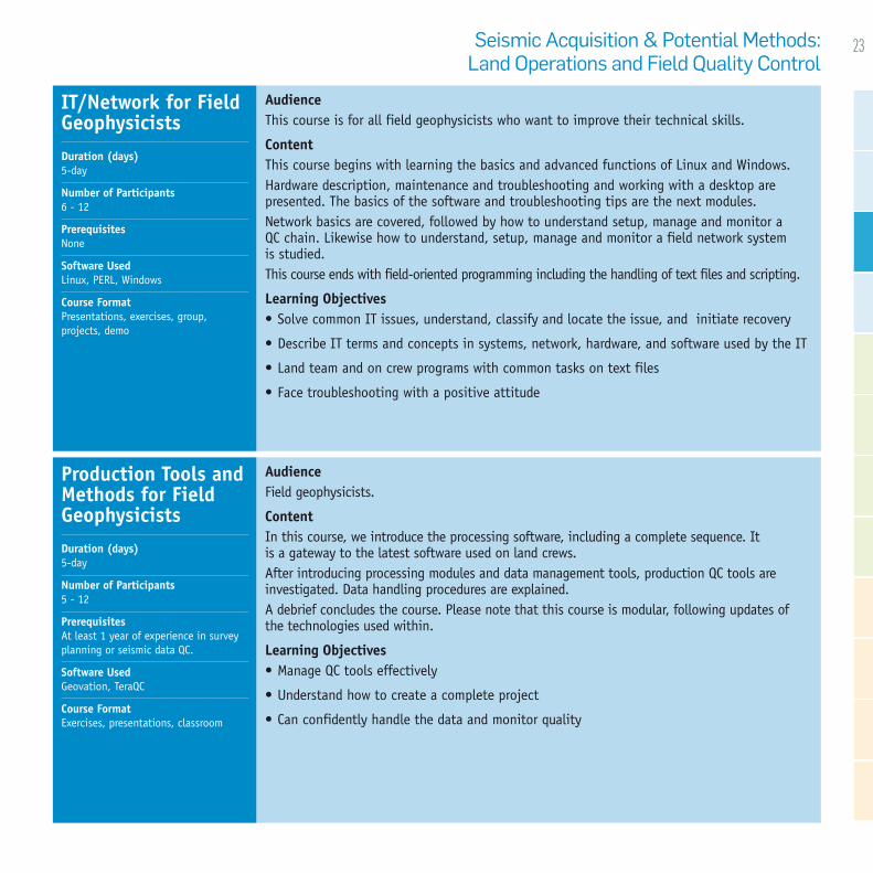
AudienceThis course is for all field geophysicists who want to improve their technical skills.
ContentThis course begins with learning the basics and advanced functions of Linux and Windows.Hardware description, maintenance and troubleshooting and working with a desktop are presented. The basics of the software and troubleshooting tips are the next modules.Network basics are covered, followed by how to understand setup, manage and monitor a QC chain. Likewise how to understand, setup, manage and monitor a field network system is studied.This course ends with field-oriented programming including the handling of text files and scripting.
Learning Objectives • Solve common IT issues, understand, classify and locate the issue, and initiate recovery
• Describe IT terms and concepts in systems, network, hardware, and software used by the IT
• Land team and on crew programs with common tasks on text files
• Face troubleshooting with a positive attitude
AudienceField geophysicists.
ContentIn this course, we introduce the processing software, including a complete sequence. It is a gateway to the latest software used on land crews.After introducing processing modules and data management tools, production QC tools are investigated. Data handling procedures are explained.A debrief concludes the course. Please note that this course is modular, following updates of the technologies used within.
Learning Objectives • Manage QC tools effectively
• Understand how to create a complete project
• Can confidently handle the data and monitor quality
IT/Network for Field GeophysicistsDuration (days) 5-day
Number of Participants 6 - 12
Prerequisites None
Software Used Linux, PERL, Windows
Course Format Presentations, exercises, group, projects, demo
Production Tools and Methods for Field GeophysicistsDuration (days) 5-day
Number of Participants 5 - 12
Prerequisites At least 1 year of experience in survey planning or seismic data QC.
Software Used Geovation, TeraQC
Course Format Exercises, presentations, classroom
Seismic Acquisition & Potential Methods: Land Operations and Field Quality Control

24 GeoTraining The CGG Integrated Training Offer
AudienceNon-geophysicists working for companies related to the seismic industry.
ContentThis course begins with a review of the basics of survey geometry and seismic operations.
This is followed by a discussion of the challenges faced to deliver a better seismic image. Equipment versus recording needs is covered in detail.
This course also includes a review of positioning in seismic operations, the impact on data quality, productivity, and 4D seismic. The course concludes by examining high-density acquisition, broadband solutions and their principles, field implementation, and quality control.
Learning Objectives • Understand the impact on data quality of seismic operations, field constraints, recording,
positioning, and processing
• Understand current trends in the seismic industry; high-productivity acquisition techniques, wide-azimuth / dense acquisition, broadband solutions
• Understand their impact on quality control
AudienceGeophysicists or non-geophysicists involved in survey design.
ContentThis course first provides a land and marine geometry overview, from surface positioning to subsurface coverage.
This is followed by a discussion of land and marine survey design parameters and field constraints, and survey design optimization through wavefield modeling, giving participants an excellent overview of seismic survey design.
Learning Objectives
• List the basics of spatial sampling during operations
• Understand the relationship between spatial sampling and geophysical objectives (target depth, resolution)
• Understand the impact of field constraints on acquisition parameters
• Be aware of other important aspects such as illumination and amplitude at target depth
Impact of Equipment on Seismic PerformanceDuration (days) 2-day
Number of Participants 6 - 12
Prerequisites Basic knowledge of seismic principles
Software Used None
Course Format Presentations, classroom, exercises
Seismic Survey DesignDuration (days) 5-day
Number of Participants 6 - 12
Prerequisites Basic knowledge of seismic data acquisition and processing
Software Used None
Course Format Presentations, exercises, classroom, case studies
Seismic Acquisition & Potential Methods: Land Operations and Field Quality Control

25
AudienceField Processing Geophysicists
ContentThis course outlines UltraSeis, the fully-integrated, comprehensive package that includes acquisition services, in-field processing, advanced processing and imaging and reservoir characterization.
The emphasis is placed on acquisition and real time QC of the Big data and the gains achieved with the new method. You will become familiar with the hardware and software architecture. At the end of the course you will be confident in evaluating the data quality and avoiding errors.
The course concludes with a debriefing.
Learning Objectives • Understand the Ultraseis concept
• Understand the acquisition and QC process
• Be aware of the software configuration and how to set it up
• Know how to evaluate the data and avoid errors
AudienceField Processing Geophysicists
ContentThis course begins with the presentation of the new vibroseis source and how it addresses broadband.
A review of geometry definitions, acquisition, sweep definition, survey design, guidance and the stackless method follow.
The various acquisition shooting methods are discussed enabling an understanding of the latest trends and developments. The impact of simultaneous shooting on the workflow is highlighted.
You will explore how to jointly QC data from vibroseis and dynamite acquisition and attenuate source generated noise.
Learning Objectives
• Understand the vibroseis source as a broadband solution
• Know the complex geometry definitions and acquisition methods
• Become familiar with the sweep description
• Be aware of new technology and latest developments
UltraSeisDuration (days) 5-day
Number of Participants 4 - 12
Prerequisites Preliminary fundamental courses “Field Processing and QC” or “Survey Planning”
Software Used SynApps, Geoland
Course Format Presentations, classroom, exercises
VibroTechDuration (days) 5-day
Number of Participants 4 - 12
Prerequisites Preliminary fundamental courses “Field Processing and QC” or “Survey Planning”
Software Used MatCalc, Target, ArcGis, Vibro QC tools
Course Format Workshop, exercises, presentations
Seismic Acquisition & Potential Methods: Land Operations and Field Quality Control

26 GeoTraining The CGG Integrated Training Offer
AudienceAnyone interested in learning more about seismic acquisition in shallow water or the use of ocean bottom cable or node acquisition surveys.
ContentThis course first provides a basic overview of seismic acquisition before going into more depth with Ocean Bottom Cable and Ocean Bottom Nodal systems. This includes the different equipment used for these types of operation and the methods involved in their use.
The course also covers the following topics in detail:
• Survey design and equipment • Processing overview from and OBS point of view • Data digitization, sampling and wave propagation • Receiver and source arrays, ghosts and the bubble effect • 4 component data • Positioning and QC of equipment • Sensors and sources
The course provides a number of practical exercises that provide an excellent understanding of the theory for every step in the processing workflow. This allows students who may not be familiar with data processing to understand the concepts of the seismic workflow.
Learning Objectives: • Understand the equipment requirements for OBS acquisition
• Know the relationship between spatial sampling and geophysical objectives (target depth, resolution)
• Understand the impact of field constraints on acquisition parameters and the effect on processing
• Be aware of other important aspects including illumination and amplitude at target depth
• Understand the new technology and latest developments
Ocean Bottom Seismic A course that delves deeper into the specific equipment, techniques and technology applications currently used in vibroseis acquisition, and how to best utilize these advances while maintaining better control the data quality and outputs during a land seismic project.
Duration (days) 3 days
Number of Participants 8 - 10
Prerequisites Basic knowledge of seismic data acquisition and processing can be useful, but not necessary.”
Software Used Excel examples
Course Format Workshop, exercises, presentations
Seismic Acquisition & Potential Methods: Shallow Water Operations
Seismic Acquisition & Potential Methods:Onboard Processing

27Seismic Acquisition & Potential Methods:Onboard Processing
AudienceAnyone joining onboard seismic processing teams.
ContentThis course begins with a module on seismic processing fundamentals.It continues with an overview of the different applications making up the infrastructure of the processing software, which include project, production and data management applications, job deck building applications and other interactive applications.This course concludes with an overview of batch processes, job monitoring and quality control steps, and efficient management of datasets.
Learning Objectives • Knowledge of the processing fundamentals (concepts and applications)
• Understand the structure of the processing package and efficiently use the tools required for onboard processing
• Develop a working knowledge of how to processing data i.e. build and run job decks and monitor a processing sequence
• Analyze the quality control outputs of the various steps of a processing sequence
AudienceProcessing geophysicists having a basic knowledge and experience of onboard processing who wish to delve deeper and improve practice and awareness.
ContentThe course covers varies aspects of seismic processing including SEG-D, and SEG-Y formats, and their generation, reformatting, quality controls for archive material,.
Interactive tools are explored. Practice is gained with an Interpretation Workstation to QC data, horizon picking and generation of horizon maps, plus velocity picking.
The theory and practice of 3D SRME by conventional modelling methodology is covered. Bin centering and regularization are presented together with the workflows.
Learning Objectives • Understand SEG-D and SEG-Y formats and the importance of Quality Control
• Ability to QC data, pick horizons and velocities using an Interpretation Workstation
• Be familiar with the methods used to regularize the trace distribution
• Understand 3D SRME principles and methodology of convolutional modeling
Basic Onboard ProcessingDuration (days) 20-day
Number of Participants 6 - 12
Prerequisites A background of geophysics, physics, mathematics.
Software Used Geovation
Course Format Presentations, workshops, group work, exercises
Advanced Onboard ProcessingDuration (days) 5-day
Number of Participants 6 - 12
Prerequisites Previous experience with seismic data processing
Software Used Geovation
Course Format Classroom, exercises, presentations

28 GeoTraining The CGG Integrated Training Offer
As the recognized leader in subsurface imaging, our training programs cover the complete range of time processing and depth imaging expertise, including imaging concepts, technologies, workflows and our own state-of-the-art subsurface imaging software, Geovation.
Our training solutions cover various programs, from specific short courses such as 4D or wide-azimuth processing to long-term induction, custom-designed (with client data) and on-the-job training. Our programs are tailored to fit client specifications and match the geophysical experience of participants.
“I’m seeing a lot of benefits, having grown my understanding of the seismic processing world and consolidated all that knowledge acquired from university, making me eager to introduce this newly enhanced skill into my daily job activities.”
Subsur
face Im
aging

29Geoscience Fundamentals
• Geophysics for Non-Geophysicists 30
Induction Programs• Geophysicist Subsurface Imaging Induction 31
Processing Workflows• 3D Marine Processing 32• 3D Land Processing 32• 5D Regularization Workflow 33• Pre-Stack Time Migration Workflow 33• Modeling and Computation of Static Solutions 34• Land Wide Azimuth Processing Workflow 34• 4D Processing Workflow 35• Multicomponent Processing 35
Depth Imaging• Basic Depth Imaging Workflow 36• Advanced Depth Migration Techniques 36
Special Topics• 3D Surface Related Multiple Elimination 37• Common Offset Cubes Applied to Velocity Analysis 37• Horizon Picking using an Interpretation Workstation 38• Refraction Statics using Tomography 38• 3D Land Processing in the Foothills 39

30 GeoTraining The CGG Integrated Training Offer
AudienceAnyone who wants to have a better understanding of the Oil & Gas Industry.ContentIn this course, you are introduced to the oil exploration cycle, the formation of oil and gas, and the basic principles of geophysics.Both land and marine acquisition are explained, and concepts of fold and geometry are explored. The main steps of basic data processing sequence and reservoir information are detailed.To end the course, there are introductions and explanations of latest technologies including but not limited to depth imaging, Broadband technologies and 4D.Learning Objectives • Understand the concept of using seismic equipment, acquisition, geology, geophysics
and reservoir modeling
• Know the basic steps of the seismic processing sequence
• Have a better understanding of the core work of an integrated geoscience company
Geophysics for Non-GeophysicistsDuration (days) 2-day
Number of Participants 4 - 12
Prerequisites None
Software Used None
Course Format Presentations, videos, exercises, classroom
Subsurface Imaging:Geoscience Fundamentals

31
AudienceAnyone newly hired for a processing geophysicist or research position.
ContentThe program includes a concentrated curriculum of geophysics fundamentals and a solid introduction to working with the processing software tools.Trainees are introduced to the company, its vision and values, its divisions and its position in the marketplace. Additionally, they are exposed to a variety of interpersonal communication training.A general list of modules includes; introduction to seismic exploration, productivity tools, project management fundamentals and quality awareness, professional skills, using a processing package, and a detailed look into a real processing workflowLearning Objectives • Understand products & services, organization and vision & values of a fully Integrated
Geoscience contractor• Obtain an overall background knowledge of geophysics• Understand types of data used in data processing• Understand ways of viewing/sorting/manipulating seismic data• Understand concepts of testing processing parameters and controlling outputs• Become familiar with project management fundamentals• Increase self-awareness and communication skills
Geophysicist Subsurface Imaging InductionDuration (days) 25-day
Number of Participants 4 - 12
Prerequisites A scientific background
Software Used Geovation
Course Format Classroom, exercises, e- learning, presentations
Subsurface Imaging:Induction Programs

32 GeoTraining The CGG Integrated Training Offer
AudienceNew hires with little previous experience in seismic data processing, or experienced land processing geophysicists who are moving to marine processing.
ContentThis course begins with the processing of the navigation data, its format, and input into the processing package. QC of coverage is also detailed.The second part covers: Sail-line processing, reformatting SEG D, QC of shooting and application of 2D geometry. Amplitude recovery noise attenuation, gain computation and application, and 3D velocity analysis complete this module.The third part of this course teaches participants about offset domain processing; bin centering and regularization, pre-stack time migration and final stack.The course concludes with the study of post stack processing; noise attenuation, filtering and SEG-Y archiving.
Learning Objectives • Complete a full 3D sequence to get acquainted with the 3D marine processing modules
• Utilize the processing software confidently
• Understand the steps of managing a processing workflow: job building and running; quality control, production management
3D Marine ProcessingDuration (days) 10-day
Number of Participants 6 - 12
Prerequisites Understanding seismic processing fundamentals and elementary experience with the processing package
Software Used Geovation
Course Format Workshops, classroom, on-the-job, examples
Subsurface Imaging: Processing Workflows
AudienceNew hires with no experience in seismic data processing, experienced geophysicists with little or no 3D land data processing.
ContentA wide range of subjects spanning a land processing sequence are covered. These include; reformatting of the SEG-D field data, QC of SPS field data using the interactive application Onset, trace header update with the geometry information from the SPS and both 3D Linear and random noise attenuation.
Refraction static corrections and repositioning with the interactive refraction analysis tool are investigated. Data sorting, stacking and velocity analysis are probed. 3D surface consistency is explored for deconvolution computation and application of 3D amplitude correction scalars and residual statics. This is followed by data regularization are finally in a Kirchoff pre-stack time migration, stacking and post processing.
Learning Objectives
• Acquire the ability to work on 3D land processing project
• QC 3D data confidently and effectively
3D Land ProcessingDuration (days) 15-day
Number of Participants 4 - 12
Prerequisites Basic knowledge of seismic processing principles, and elementary experience with the seismic processing package
Software Used Geovation
Course Format Classroom, exercise, presentations

33Subsurface Imaging: Processing Workflows
AudienceGeophysicists that will use 5D regularization.
ContentExtension of the regularization to the 5th dimension is explained. Anti Leakage, the Fourier transform, principles of data regularization, the interpolation concept, and extension of the regularization to the 5th dimension are investigated in conjunction with anti-leakage and the Fourier transform in 5D regularization.
Learning Objectives • Understand the need for data regularization
• Set a workflow to perform 5D regularization
• Understand the difference between mapping and full 5D regularization
• Understand the limitation of this method
5D Regularization WorkflowDuration (days) 1-day
Number of Participants 6 - 12
Prerequisites Geophysicists with at least 1 year processing experience
Software Used Geovation
Course Format Presentations, on-the-job, exercises
AudienceJunior processing geophysicists who are about to start running PSTM sequence.
ContentThis course teaches several modules, such as; the effect of dip on velocities, anisotropy, 3D Kirchhoff Pre-Stack time migration (PSTM) module description, workflow and key parameterization, velocity field modeling using non-linear slope tomography and lastly practical exercises on 3D marine data.
Learning Objectives • Run simple processing sequences with Pre-Stack time migration
• List and explain key parameters
• Build a velocity model using tomography and interpretive velocity model building
Pre-Stack Time Migration WorkflowDuration (days) 2-day
Number of Participants 4 - 8
Prerequisites Basic knowledge of the migration workflow. Use of an interpretation Workstation and 3D QC
Software Used Tornado (Geovation)
Course Format Presentations, exercise, classroom

34 GeoTraining The CGG Integrated Training Offer
AudienceModerately experienced processing geophysicists.
ContentFirstly, the basics of Land Wide Azimuth (WAZ) acquisition are explored.A comparison between Narrow Azimuth (NAZ) and WAZ surveys takes place next, followed by several other topics; noise attenuation on cross-spreads and common receivers, azimuthal primary velocities, multiple attenuation,Common Offset Vectors (COV) geometry, regularization and binning, reciprocity, and velocity model building.An overview of a typical WAZ production flow chart concludes the course.
Learning Objectives • Understand Land WAZ acquisition method
• Understand NAZ vs. WAZ
• Define the main processing steps of Land WAZ processing
Land Wide Azimuth Processing WorkflowDuration (days) 3-day
Number of Participants 6 - 10
Prerequisites Basic knowledge of processing Land seismic data
Software Used Geovation
Course Format Presentations, exercises, classroom
AudienceAny processing geophysicist involved in the static computation phase of a land seismic processing project.
ContentThis course begins with an overview of statics.
This is followed by trainees actively picking the first breaks which are used to model the weathering layer by multilayer or tomographic inversion and subsequently to derive statics.
The tomographic inversion is explored through the Geovation interactive application plus through a batch job. In addition using source/receiver delay analysis source/receiver repositioning and statics are derived.
Learning Objectives • Define statics and the various types• Derive first breaks• Create a near surface model using first break picks and derive statics• Load and interpret all auxiliary weathering data to construct a layered near- surface model• Determine source/receiver repositioning and calculate statics from first break stack
inversion
Modeling and Computation of Static SolutionsDuration (days) 3-day
Number of Participants 4 - 12
Prerequisites Participants should have a basic knowledge of static correction fundamentals
Software Used Fbpick, GeOlympus (Geovation)
Course Format Classroom, presentations, exercises

35Subsurface Imaging: Processing Workflows
AudienceAnyone who will process 4D data.
ContentThe course begins with a general introduction on what 4D is, its value and the concept repeatability. 4D acquisition, QC, and processing philosophy are explained in detail. This training course covers the case of datasets with 2 vintages and towed streamer acquisitions. Multi-vintages, OBC and LoFS are not covered here.Processing a 4D dataset is explored; what needs to be known to start a 4D, sail- line processing, global matching, binning and regularization, de striping and differential statistics.Then, QC and repeatability improvement of 4D are investigated, regarding QC of 4D data, QC of navigation, and finally repeatability improvement on a dataset.
Learning Objectives
• Understand the concepts, value and specific vocabulary of 4D• Understand the concept of repeatability and know how to measure it using
the processing tools• Understand the main 4D processing steps, list the associated modules and understand
algorithms and module parameters• QC data efficiently
4D Processing WorkflowDuration (days) 2-day
Number of Participants 6 - 12
Prerequisites A fair knowledge of 3D processing is required
Software Used Geovation
Course Format Presentations, exercises, classroom
AudienceGeophysicists with experience in time processing with little or no multi-component knowledge.
ContentThe course begins with an introduction to Ocean Bottom Survey (OBS) acquisition, OBS data and preprocessing prior to separation to the varied components.
This is followed by further converted wave processing using the X and Y components only.
The course gives an overview of converted waves, what they are and why they are used.
Converted waves processing workflow is the next natural teaching point. The software application is introduced at this point, with reference to reorientation and rotation. Shear wave statics computation and shear wave splitting analysis – derivation of anisotropy parameter are studied.
Learning Objectives • To know the specificities of OBS acquisition
• To understand Yº, Ynmo, Yº vertical and Yº effectif, their usage and derivation
Multicomponent Processing Duration (days) 4-day
Number of Participants 6 - 12
Prerequisites Dedicated to geophysicists working on multicomponent projects.
Software Used Geovation - VectorVista
Course Format Presentations, exercise, demo, on-the-job, classroom, webinar
36 GeoTraining The CGG Integrated Training Offer
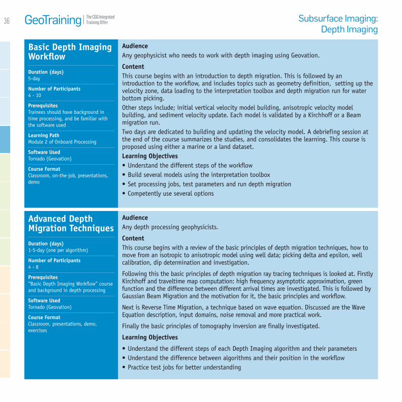
AudienceAny geophysicist who needs to work with depth imaging using Geovation.
ContentThis course begins with an introduction to depth migration. This is followed by an introduction to the workflow, and includes topics such as geometry definition, setting up the velocity zone, data loading to the interpretation toolbox and depth migration run for water bottom picking.Other steps include; initial vertical velocity model building, anisotropic velocity model building, and sediment velocity update. Each model is validated by a Kirchhoff or a Beam migration run.Two days are dedicated to building and updating the velocity model. A debriefing session at the end of the course summarizes the studies, and consolidates the learning. This course is proposed using either a marine or a land dataset.Learning Objectives • Understand the different steps of the workflow• Build several models using the interpretation toolbox• Set processing jobs, test parameters and run depth migration• Competently use several options
AudienceAny depth processing geophysicists.
ContentThis course begins with a review of the basic principles of depth migration techniques, how to move from an isotropic to anisotropic model using well data; picking delta and epsilon, well calibration, dip determination and investigation.
Following this the basic principles of depth migration ray tracing techniques is looked at. Firstly Kirchhoff and traveltime map computation: high frequency asymptotic approximation, green function and the difference between different arrival times are investigated. This is followed by Gaussian Beam Migration and the motivation for it, the basic principles and workflow.
Next is Reverse Time Migration, a technique based on wave equation. Discussed are the Wave Equation description, input domains, noise removal and more practical work.
Finally the basic principles of tomography inversion are finally investigated.
Learning Objectives
• Understand the different steps of each Depth Imaging algorithm and their parameters• Understand the difference between algorithms and their position in the workflow• Practice test jobs for better understanding
Basic Depth Imaging WorkflowDuration (days) 5-day
Number of Participants 4 - 10
Prerequisites Trainees should have background in time processing, and be familiar with the software used
Learning Path Module 2 of Onboard Processing
Software Used Tornado (Geovation)
Course Format Classroom, on-the-job, presentations, demo
Advanced Depth Migration TechniquesDuration (days) 1-5-day (one per algorithm)
Number of Participants 4 - 8
Prerequisites “Basic Depth Imaging Workflow” course and background in depth processing
Software Used Tornado (Geovation)
Course Format Classroom, presentations, demo, exercises
Subsurface Imaging: Depth Imaging

37
AudienceGeophysicists who need to pick velocities and mutes from gathers.
ContentFirstly, participants learn to prepare Common Offset Cubes (COFF) cubes, and then load COFF cubes and geometry.Pick velocity and mutes with the COFF cubes, using maps to select location and QC results, QC stacked data on the fly, smooth velocity in the interpretation toolbox, save velocity and mutes in XPS or ASCII files, and lastly testing and creating COFF cubes on-the-fly are all topics that are covered in this course.
Learning Objectives • Understand COFF (Common Offset) cube and generate
• Load COFF cubes and set up geometry
• Perform COFF-based velocity analysis using Double Square Root
• Pick mutes on the gathers
• QC and save the results using an interpretation toolbox
Common Offset Cubes Applied to Velocity AnalysisDuration (days) 1/2-day
Number of Participants 6 - 10
Prerequisites Participants should have attended: “Use of an Interpretative Workstation and 3D QC”
Software Used Tornado (Geovation)
Course Format Presentations, classroom, exercises
AudienceGeophysicists with 2-3 years marine processing experience already familiar with multiple attenuation basics and binning/regularization processing.
ContentThis course is composed of one of the main methodologies used in 3D Surface Related Multiple Elimination (SRME): Convolutional modeling.This course discusses principles and fundamentals of the convolutional modeling module. It also addresses generalities, multiple attenuation toolbox, and understanding multiples.Some overviews of 3D SRME techniques, an overview of Delft SRME principle are examined.Theory and principles of the 3D SRME is the core module, supported by the 3D SRME by convolutional modeling user guide.Further study into; pre-processing of input data, binning and mapping files, 3D regularization, convolutional modeling and model subtraction concludes the course.
Learning Objectives • Understand 3D SRME principles methodology of convolutional modeling
• Confidently replicate the practical exercises from the course
• Comprehend the theoretical aspects of 3D SRME
3D Surface Related Multiple EliminationDuration (days) 1-day
Number of Participants 6 - 8
Prerequisites Previous lectures about this topic are recommended. Please consult SEG Technical Journals on the CGG University web-page (e-Geophysical library)
Software Used Geovation
Course Format Classroom, presentations, exercise, demo
Subsurface Imaging:Special Topics

38 GeoTraining The CGG Integrated Training Offer
AudienceGeophysicists in land processing (time and depth).
Content2D and 3D refraction tomography are widely used in land processing.
The principles and fundamentals of tomography and how to build a near surface velocity model from first breaks using tomography is covered. Through hands-on exercises trainees learn the practical techniques to create a more reliable refraction models in challenging situations by optimizing the key processing parameters. QC is carried out using an interpretive workstation.
Learning Objectives• Describe how to build a near surface model using tomography• Know how to QC the tomographic refraction model using an interpretive workstation• Understand how to improve the refraction model by optimizing the key module parameters• Create a reliable refraction model in challenging situations (noisy data, permafrost, gaps in
offsets, strong lateral velocity changes, etc.)• Improve refraction models using offset iterations
Refraction Statics using TomographyDuration (days) 1/2-day
Number of Participants 6 - 10
Prerequisites Trainees should have a basic understanding of the processing sequence
Software Used Geovation, Tornado, TOM2D/TOM3D
Course Format Presentations, exercises, classroom, case studies
AudienceGeophysicists who need to pick and work on horizons in building depth models, calculating TOMO statics, applying trim statics, etc.
ContentHorizon picking is one of the most used features on an interpretation workstation.Through various practical exercises you become familiar with these different topics; Loading data and display setup, create horizons and horizon groups, pick horizons using waveform tracking or ISO value tracking, picking horizons using freehand mode or control profile, pick horizons on seismic data, pick horizons on attribute FDM, QC and save horizons, import horizons in external format, interpolate and smooth horizons, merge, split, shift, separate horizons, trim and close horizons, load horizons from seismic data trace header, working on horizons with regions and finally extract attributes from horizons.
Learning Objectives • Describe the procedures of horizon picking
• Pick horizons proficiently using automatic or manual methods
• Know how to QC horizons and work on horizons with various functions
• Choose the best strategy for horizon picking
Horizon Picking using an Interpretation WorkstationDuration (days) 1 1/2-day
Number of Participants 6 - 8
Prerequisites Participants should have attended: Use of an Interpretation Workstation and 3D QC
Software Used Tornado (Geovation)
Course Format Demo, exercises, classroom, presentations

39
AudienceLand processing geophysicists (time and depth).
ContentThis course teaches the land processing workflow from a floating datum (a smoothed version of the topographical surface) using the double square root equation for NMO and velocity analysis.This method is best used in areas of large elevation changes (more than a few hundred meters), as it minimizes errors introduced by non-surface consistent static corrections and conventional NMO.It may yield more robust velocities and better continuity of events on stack sections, and it uses surface consistent statics which are required for data input to pre-stack migration. Furthermore, the DSR NMO equation is the same as the one used in pre-stack time migration, so should we want to apply such migration, we will be maintaining consistency throughout.
Learning Objectives • Describe how this technique works
• Know all Geovation modules and interactive applications used in the workflow
• Process a real 3D land dataset in Geovation using this workflow
• Know the advantages and limitations of the method
3D Land Processing in the FoothillsDuration (days) 5-day
Number of Participants 6 - 8
Prerequisites Familiarity with the Geovation system; basic processing experience
Software Used Geovation
Course Format Presentations, exercise
Subsurface Imaging: Special Topics

40 GeoTraining The CGG Integrated Training Offer
CGG’s geophysical interpretation training programs focus on integration of geophysical concepts with geology to ensure industry relevance and emphasize practical applications. The courses cover the processes and methodologies of the complete range of geophysical surveys including 2D/3D/4D seismic, potential fields and remotely sensed imagery.
The courses are authored and delivered by trainers with considerable experience working in the geophysical industry. The courses employ extensive use of real examples, and focus on techniques and technology at the forefront of the geophysical industry.
“This has been my first introduction to
electrical image logs and has provided me
with a general view of what can be done
with them.“Ge
ophysi
cal
Interp
retati
on

41Geophysical Interpretation
• Advanced Seismic Interpretation 42• Advanced Seismic Stratigraphy 42• Basic Seismic Interpretation 43• Geoexperts: Advanced Training in Geophysics 44• Introduction to Seismic Sequence Stratigraphy 46• Mapping Subsurface Structures 46• Non-Seismic Geophysical Interpretation 47• Overview of Reservoir Activities 47• Quantitative Seismic Interpretation 48

42 GeoTraining The CGG Integrated Training Offer
AudienceGeologists and geophysicists who are familiar with seismic interpretation.Content• Multicomponent seismic interpretation.• Fundamentals of what can be gained from
advanced interpretation process• Seismic sequence stratigraphy• Seismic geomorphology and palaeogeography• Classifications and neural network inversion• Uses, including fluid analysis, microstructures,
enhanced petroleum recovery geology and reservoir characterization
• Rock physics, geomechanics and seismic attributes and inversion
• Attribute modeling, including: AVO, Post-stack seismic attributes (PSTM & PSDM), reflective attributes and transmissive attributes, trace similarity and stratigraphic volume attributes, texture and curvature modeling etc
• Pitfalls and limitations of attribute and inversion modeling
• Depth conversion and uncertainties• Troubleshooting for seismic interpretation
Learning Objectives• Fundamental concepts of seismic data, and
the extensions to traditional petroleum geology
• Application and advantages of advanced seismic interpretation
• Techniques for processing seismic data sets to enhance geological features
• Assessing the suitability of seismic data to be used for attribute modelling
• Methodology for interpreting various
attribute volumes• Seismic sequence stratigraphy• Compiling palaeogeographical
interpretations from seismic data• Enhanced structural modelling and volume
reconstructions• Critical analysis skills for review of
advanced seismic interpretations• Reservoir optimization geology
AudienceExploration geoscientists who have a working knowledge of basic seismic stratigraphy and want to improve their exploration and development skills.Content• Review of seismic stratigraphy objectives.• Comparison of “Vail” and “Galloway”
approaches to sequence stratigraphy• Shallow water siliciclastic sequences• Deep water siliciclastic sequences• Carbonate sequences• Integrating high resolution
micropaleontology and seismic• Time-depth relationships
• Fault modeling – creating robust fault geometries
• Application of Waveform Analysis (amplitude, phase and frequency, velocity)
• Amplitude Variation with Offset (AVO; indication of lithologies, fluids, porosities and pressures)
• Geovalidation, Synthetics, Seismic Inversion and VSP
Practical Exercises: • Determine rock-fluid from waveform analysis• Geovalidate selected intervals using synthetic seismograms, seismic inversion and VSP• Create sea-level curves from micropalaeontology• Integrate micro-palaeontological data and seismic• Generate seismic facies maps within a sequence stratigraphic framework• Constrain reservoir architecture from seismic: robust fault geometries and representative
stratigraphic layering
Advanced Seismic Interpretation The workshop emphasizes how seismic data sets can be interpreted beyond basic horizon and structure, using combinations of concepts from seismic processing and traditional sequences and facies analysis.
Duration (days) 5-day
Max Number of Participants 20
Prerequisites None
Course Format Classroom exercises and presentations
Advanced Seismic StratigraphyDuration (days) 5-day
Max Number of Participants 20
Prerequisites None
Software Used None
Course Format Classroom exercises and presentations
Geophysical Interpretation

43
Basic Seismic Interpretation This course provides the fundamentals of seismic interpretation and concentrates on the role of the seismic interpreter in the search for oil and gas.
Duration (days) 5-day
Max Number of Participants 20
Prerequisites None
Software Used None
Course Format Classroom exercises and presentations
Geophysical Interpretation
AudienceThis course provides the fundamentals of seismic interpretation and concentrates on the role of the seismic interpreter in the search for oil and gas. The course covers the geophysics of seismic data, interpretation methods and representations of structure and stratigraphy on seismic data sets. Content Seismic Geophysics: Seismic waves; Normal Reflection; Acoustic Impedance, Reflection Coefficients; Wavelets; Vertical / Horizontal Resolution; Thinnest beds to be resolved Seismic data: Seismic; Well data; Non-seismic geophysical data Acquisition & Processing: Land and marine Seismic Acquisition and Processing Incorporating Geological information: Surface geology and other geophysical methods Picking and mapping horizons: Reflection; Interpretation pitfalls; Migration effects; Mapping Structural interpretation: Structural geology terminology; Classification of structures Sequence Stratigraphy: Controls and basic concepts; Parasequence sets and flooding surfaces; Sequences and systems tracts Seismic stratigraphic analysis: Recognition of Sequences in Seismic Advanced seismic interpretation techniques: Post-stack amplitude analysis; Seismic attributes; Surface attributes; Other techniques; AVO; Impedance inversion Depth conversion: Estimates of depth on seismic data; time / depth data from wells and stacking velocities

44 GeoTraining The CGG Integrated Training Offer
Geoexperts: Advanced Training in Geophysics The GeoExperts Workshop combines practical exercises with software interpretation. It goes through the process of how seismic data are acquired, processed, interpreted and used in structural interpretation, sequence stratigraphy and prospect evaluation.
Duration (days) 25-day
Max Number of Participants 20
Prerequisites None
Software Used This training can take place using a variety of geophysics software packages. The programme can be based around non-exclusive Robertson datasets or on relevant datasets provided by the client.
Course Format Workshop and presentations
AudienceAimed at geophysicists who have a basic understanding of principles and practices in geophysics.Content
Module 1: Seismic Acquisition and ProcessingThe first week comprises a mixture of Powerpoint lectures and practical paper exercises. The emphasis is on marine seismic acquisition and processing with land data being only briefly covered. As well as the Powerpoint slides in paper form and on CD the participants are given a copy of Robertson’s Interactive Seismic Processing CD as part of the course. A binder containing copies of the processed marine seismic line from shot records through to final display is also provided.• Basic Reflection Theory • Acquisition methods • Processing fundamentals and QC – 3 1/2 days
Module 2: Introduction to Seismic Interpretation and Workstation Interpretation Before starting to interpret• Data inspection and evaluation• Data display• Seismic versus log resolution• Well tops and check shot surveys• Synthetic seismograms• Choice of reflections• Horizon selection
Pitfalls in interpretation• Acquisition footprints• Sideswipe and migration problems• Multiples• Tuning effects• Velocity effects• Diagenetic surfaces and gas hydrates• Limits of interpretation packages
First stages of interpretation
• Creating horizons• 2D autotracking• Character correlation• Flattening• Tying loops• Gridding and extrapolating

45Geophysical Interpretation
Further interpretation techniques• Basic 3D methodology• 3D autotracking (ASAP) – including paintbrushing• Grid libraries• Atributes• Variance cubes and multiversions
Fault interpretation and visualistion• Fault cuts, contacts and boundaries• Gridding faults• Interpretation from attributes and other grid manipulations• Visualisation packages
Module 3: Structural Interpretation and Tectonics• Introduction to interpreting structural features on seismic• Extensional/compressional/strike-slip tectonics• Structural inversion• Basement reactivation• Structural traps• Fault sealing and reservoir compartmentalisation• Fracture modelling• Salt tectonics
Module 4: Seismic Sequence Stratigraphy• Introduction and Methodology, Seismic Facies mapping • Sequence Stratigraphy - Principles and Concepts• How to identify sequences on seismic data• Systems Tract identification• Sequence development in various depositional settings: Paralic, Deep Marine, Carbonate, Fluvial
Module 5: Prospect Evaluation and AVO/Inversion Analysis• Introduction to prospect analysis • Introduction to the key components of the petroleum system - source, reservoir, seal, trap formation and timing• Trap identification on seismic data – structural, stratigraphic and combination traps• Identification of potential source, reservoir and seal on seismic data • Direct Hydrocarbon Indicators• Calculating volumes in place and recoverable reserves• Risking and Ranking• Prospect Evaluation Exercise• AVO and inversion analysis
Learning ObjectivesThis program aims to increase and consolidate the geophysics knowledge of the participants through a mixture of theoretical lectures and practical hands-on sessions.

46 GeoTraining The CGG Integrated Training Offer
Introduction to Seismic Sequence StratigraphyThis course is designed to introduce participants to seismic sequence stratigraphy. It begins with a basic introduction to the main concepts and covers the theoretical application of the technique through working examples.
Duration (days) 5-day
Max Number of Participants 20
Prerequisites None
Software Used None
Course Format Classroom exercises and presentations
Mapping Subsurface StructuresA subsurface structure map is a map whose contours represent the elevation of a particular formation, reservoir or marker. This program will teach the attendees how to map subsurface structures in relation to the petroleum system.
Duration (days) 5-day
Max Number of Participants 20
Prerequisites None
Software Used None
Course Format Classroom exercises and presentations
AudienceDevelopment geologists and those exploring mature areas; early-career geologists and technologists who make structure maps; those who need to judge the validity of maps and cross sections.Content• Contouring techniques• Triangulation • Using dip in mapping• Different measures of thickness • Thickness in deviated wells • Isopach and isocore maps • Dip-domain cross sections • Data projection• Trend and plunge of folds on tangent
diagrams • Composite-surface maps• Fault shapes and displacement distributions• Heave and throw from stratigraphic
separation• Stratigraphic seperation from structure
contour map
• Constructing fault-plane maps • Faults on isopach maps • Combining fault and horizon maps • Contouring across faults• Structural quality-control techniques• Multiple-surface map compatibility • Map validation using implied fault contours • Finding faults and fault orientations with
SCAT analysis of dipmeters• Juxtaposition diagrams for trap and seal
analysis • Fault-cutoff lines in computer mapping • Soft linked and hard linked faults• Relay and branching fault patterns• Mapping sequential cross-cutting faults
AudienceGeophysicists, geologists, explorationists, and managers who are interested in an introduction or review of the theory and application of contemporary seismic stratigraphic techniques to exploration.
ContentThe course covers the following topics:• Introduction: Philosophy and History • Geophysical Fundamentals• Breaking Out Operational Sequences• Introduction to Fault Interpretation• Chronostratigraphy Construction and Interpretation• Sea Level Curves, Accommodation Space, and Cycle Orders • Vail Sequence Theory and Sequence Hierarchy• Carbonate Sequences• Siliciclastic Sequences• Seismic Facies• Paleo-Environmental Analysis• Geohistory Reconstruction• Optimizing Exploration

47
AudiencePetroleum geologists, geophysicists and engineers involved in oil and gas exploration and development.ContentNon-Seismic Geophysics: An IntroductionFundamentals:• Rock physical properties• Gravity vs magnetic studies
Gravity and Magnetic Fields:• Physical principles• Gravity field of the earth• Geomagnetic field• Basic processing and survey techniques• Topography and isostasy• Manual interpretation methods• Summary of advanced and interpretive
gravity and magnetic processing• Summary of recent developments
Preparation of Survey Specifications:• Objectives; physical properties; test
modelling; land gravity• Accuracy: instrumental effects, tidal
correction, latitude, Free-Air and Bouguer Correction, terrain effects, specifications for accuracy
• Marine surveys: survey and processing• Aeromagnetic surveys: accuracy, data
distribution, processing and interpretation• Quality control
Introduction to Advanced Non-Seismic Interpretation Techniques: • Electrical; Induced; Magnetotellurics;
Remote sensing methods• Integration: Workflow and integration
Non-Seismic Geophysical InterpretationThe course is designed to familiarize those using non-seismic geophysical techniques and data with different methods and to optimise this blended approach to geophysical interpretation. The course will integrate practical paper-based exercises to reinforce the theory taught.
Duration (days) 5-day
Max Number of Participants 20
Prerequisites None
Course Format Classroom exercises and presentations
AudienceAnyone who wants to have a better understanding of the Geophysical chain of activities.
ContentProper development of recovery strategies from oil & gas reservoirs requires a good understanding of the rock and fluid properties of which the reservoirs are made. This course introduces the reservoir activities that follow the processing of seismic data, introducing basic reservoir engineering concepts and methods to enable cross-disciplinary exchange of ideas and experience.It starts with an overview of reservoir characterization, from basic petrophysics concepts through the importance of geostatistics in data integration. The course touches on the workflow used in data preparation and analysis to build a coherent 3D static model of the reservoir. The course also helps understanding questions crucial to the reservoir : How much oil & gas is there (accumulation)? How much can be recovered (reserves)? How fast can it be recovered (rate)?Learning Objectives• Understand how geological, petrophysical, seismic, rock properties and reservoir data are
integrated in a consistent manner, using judicious techniques, to construct a reservoir model• Provide participants with a basic understanding of porous media fundamentals: how oil or gas
are trapped or mobilized in porous media• Introduce reservoir engineering concepts and terminology• Create awareness of how recovery factors and reserves are being estimated and predicted• Understand typical assumptions and simplifications required to predict reservoir performance
Overview of Reservoir ActivitiesDuration (days) 1-day
Number of Participants 6 - 12
Prerequisites None
Software Used None
Learning Path Module 3 of “Overview Oil & Gas Activities”
Course Format Presentation and videos

48 GeoTraining The CGG Integrated Training Offer
AudienceThis course is for personnel who are familiar with seismic interpretation and who wish to extend their knowledge on how they can further utilize seismic data sets to constrain and characterise reservoir units, fluid properties and refine structural interpretation for development phase evaluations. This course is suitable for geologists, geophysicists, explorationists and petroleum engineers.ContentSeismic Potential• Understanding seismic sections and volumes• Understanding the limitations and balances
of seismic sections and volumes• Impact of seismic quality and geological
constraints on prospect attribute modeling• Reprocessing applications
Petroleum systems Analysis• Introduction to seismic reservoir
characterization• Introduction to seismic seal characterization• Dynamic properties and modeling potential• Identifying fluid on seismic
Quantitative Analysis• Statistical rock physics, attributes for
prospect analysis, multi-attribute analysis• Fracture modeling and conduit analysis• Fluid modeling and conduit analysis• Lithological mapping and lithological
variations• Direct Hydrocarbon Indicators and advanced
hydrocarbon modeling• Play-fairway mapping and reservoir
distribution, geostatistics, fluid modeling• The effect of temperature on velocity
Advanced Volumetrics• Defining column height• Porosity and flow realization• Reservoir potential gross rock volume
calculations and interpretations• Reduction in volumetric uncertainty
Applications for engineering portfolios• Well optimization, steering and dilations• Locational risk assessments and mitigation
techniques calculations and interpretations• Reduction in volumetric uncertainty
Applications for engineering portfolios• Well optimization, steering and dilations• Locational risk assessments and mitigation
techniques
Learning Objectives• Use seismic data, and seismic attributes to enhance reservoir features such as subtle and
small faults, lithological variations and lithological signatures, define zones of known reservoir quality and potential fluid pathways
• Continuity and impermeable sedimentological review using seismic data• Evaluate and assign attribute volumes that best define specific sequences and facies models• Multi-attribute analysis for specific and confined prospect characterisation• Geostatistics and Interpolation methods and techniques• Refined play-fairway mapping techniques using seismic attributes
Quantitative Seismic InterpretationThis course emphasizes the underlying geological and geophysical principles of seismic reservoir characterization, continuity and integrity, distribution and mapping, micro-scale structural interpretation and quantitative iterations of seismic data. This course is specifically for high resolution definitions, using information contained within seismic volumes and sections specific for development geology. Concepts and applications of attribute modelling and inversion modelling that define features such as lithological variations, micro-structure, fluid, secondary porosity and permeability and distribution will be presented.
Duration (days) 5-day
Max Number of Participants 20
Prerequisites None
Course Format Classroom exercises and presentations
Geophysical Interpretation


50 GeoTraining The CGG Integrated Training Offer
Petroleum geology and reservoir engineering courses incorporate industry-specific theory with practical applications for comprehensive petroleum geology and engineering solutions.
The courses include broad technical concepts such as petroleum geology and reservoir engineering and specific subject matter in a variety of geological and engineering disciplines, such as biostratigraphy and facilities engineering.
Our programs are taught by geoscientists and engineers who specialize in these fields and have extensive industry experience. Courses are offered as theory-based classes or practical workshops, or as a combination that best suits client needs.
“The course helped me to bridge the geology gap in my knowledge as a petrophysicist, and also understand where to drill and know what to expect in reservoir exploration.”
Petrol
eum Ge
ology
& R
eservo
ir Engi
neerin
g
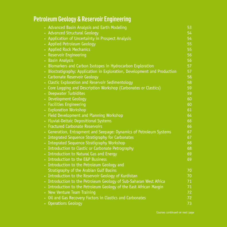
51Petroleum Geology & Reservoir Engineering
• Advanced Basin Analysis and Earth Modeling 53• Advanced Structural Geology 54• Application of Uncertainty in Prospect Analysis 54• Applied Petroleum Geology 55• Applied Rock Mechanics 55• Reservoir Engineering 56• Basin Analysis 56• Biomarkers and Carbon Isotopes in Hydrocarbon Exploration 57• Biostratigraphy: Application in Exploration, Development and Production 57• Carbonate Reservoir Geology 58• Clastic Exploration and Reservoir Sedimentology 58• Core Logging and Description Workshop (Carbonates or Clastics) 59• Deepwater Turbidites 59• Development Geology 60• Facilities Engineering 60• Exploration Workshop 61• Field Development and Planning Workshop 64• Fluvial-Deltaic Depositional Systems 66• Fractured Carbonate Reservoirs 66• Generation, Entrapment and Seepage: Dynamics of Petroleum Systems 67• Integrated Sequence Stratigraphy for Carbonates 67• Integrated Sequence Stratigraphy Workshop 68• Introduction to Clastic or Carbonate Petrography 68• Introduction to Natural Gas and Energy 69• Introduction to the E&P Business 69• Introduction to the Petroleum Geology and
Stratigraphy of the Arabian Gulf Basins 70• Introduction to the Reservoir Geology of Kurdistan 70• Introduction to the Petroleum Geology of Sub-Saharan West Africa 71• Introduction to the Petroleum Geology of the East African Margin 71• New Venture Team Training 72• Oil and Gas Recovery Factors in Clastics and Carbonates 72• Operations Geology 73
Courses continued on next page

GeoTraining The CGG Integrated Training Offer Petroleum Geology & Reservoir Engineering
• Palaeozoic Reservoirs – Key Factors in Distribution, Characterization and Controls on Reservoir Quality 73
• Petroleum Exploration for Non-Geoscientists 74• Petroleum Geochemistry for Explorationists 74• Petroleum Geology for Engineers 75• Oil and Gas Reserves Evaluation 75• Petroleum Systems Modeling 76• Play Fairways Analysis & Prospect Evaluation Workshop 77• Well Test Analysis 78• Petroleum Engineering 78• Postgraduate Diploma in Applied Petroleum Geoscience 79• PVT Analysis 80• Rift Basins – Key Factors in Exploration, Development and Production 80• Sandstone Reservoirs 81• Shale Gas and Shale Oil Exploration (also available: Shale Gas Exploration) 81• Structural Geology Workshop 82• Thermal Modeling 84• UK Shale Gas Exploration 84• Unconventional Gas Exploration 85• Reservoir Engineering for Non-Engineers 85

53
AudienceExploration geoscientists who require in-depth understanding to integrated basin analysis in exploration.ContentThe Context• Petroleum systems analysis, fundamentals of basin formation and basin classification• Play fairway analysis: sources, reservoirs, traps and seal distribution • Paleoclimatic modeling to predict source and reservoir rock distribution, analogues, plate
tectonic reconstruction as a means to constrain basin configurations
The Components and Mechanisms• Source Rock Presence and Potential - classification (organofacies), distribution, analysis,
organic richness and potential, organic quality, kinetics, estimating UEP• Access to charge / source effectiveness, basin geometry, generation and expulsion history,
migration styles, timing, fluid flow concepts • Overpressure and effective stress, compaction, effect of pressure on migration, faults, fetch
and focus, lag time, structural restoration, fetch area and volume, fill and spill vs leak • Seal effectiveness / column capacity – presence, distribution, trap style, types of seals,
effect on migration style• Reservoir deliverability / effectiveness - porosity and permeability, thickness, fluid
viscosity, effect of burial history, development and production• Basin Modeling – Concepts, 1-D modeling, map-based modeling, geological input. Maturity,
thermal stress and UEP maps. Migration, fetch and focus, sensitivity analysis, 2D modeling workflow
Learning Objectives• Define the petroleum systems• Deconstruct the basin history and create representative models (structural,
sedimentological, paleogeographical, geochemical) for key stages of the basin evolution• Establish geohistories for selected example basins (including thermal histories)• Evaluate hydrocarbon generation potential and migration models• Construct and evaluate petroleum systems events charts for selected basins• Characterise the potential reservoirs, sources and seals• Quantify petroleum system risk (deterministically and stochastically)
Advanced Basin Analysis and Earth ModelingThe aim is to follow an integrated basin analysis workflow in theory and in practice, which provides the opportunity to understand the principals of integrated basin analysis and put them in to practice.
Duration (days) 5-day
Max Number of Participants 20
Prerequisites None
Course Format Classroom exercises and presentations
Petroleum Geology & Reservoir Engineering

54 GeoTraining A CGG Integrated Training OfferGeoTraining The CGG Integrated Training Offer
AudienceGeologists and structural geologists with a good basic understanding of structural geology who wish to further develop their skills in this area.Content• Geological analysis of field data: stereographic analysis, cross section construction,
restoration and balancing, 4D cross section evolution• Geodynamics: lithospheric extension models, development of rift basins and passive margins
and stretching factors, lithospheric compression models and development of foreland fold and thrust belts
• Rock mechanics: force, strain and stress (including Mohr diagram and strain analysis methods)• Reservoir geomechanics: wellbore breakouts, hydraulic fracturing and reservoir depletion • Experimental rock deformation tests and failure criteria: uniaxial, triaxial, hydrostatic and
shear rock deformation, role of temperature, water, strain rate• Deformation dynamics, kinematics and structures: simple shear and pure shear• Deformation modes and mechanisms: cataclasis, diffusive mass transfer, crystalline plasticity,
brittle-ductile transition • Role of fluids, fluid pressure and fluid flow in hydrocarbon exploration• Brittle rock deformation: faulting (including fault rock development, fault seal analysis and
palaeostress analysis from fault slip data) and fracturing (including joint development) in the upper crust
• Ductile rock deformation: folding and shear zone development
Advanced Structural GeologyThe course involves an in-depth study of Structural Geology theories and applications. With a considerable practical element, this course enables the trainee to analyze and assess faults and fractures and their role in Petroleum Geology.
Duration (days) 5-day
Max Number of Participants 20
Prerequisites None
Course Format Classroom exercises and presentations
AudienceGeologists, explorationists and reservoir engineers involved in prospect analysis.
ContentThis course covers the following topics: Prospect definition – leads and prospects Prospect volumetric calculation Bulk Rock Volume Rock parameters – Reservoir cut-off, net
reservoir and porosity Fluid parameters – Hydrocarbon saturation
and formation volume factor Recovery factor Assessment of uncertainty in volumetric
input definition Prospect risking Basic probability Risk factors Source Reservoir Trap/seal
Timing Systematic application of probabilities and
benchmarking Quantification of volumetric uncertainty Monte Carlo Analysis technique Inputs and probability distribution Outputs and application of results Uncertainty in hydrocarbon charge Quick-look methods of volume estimation Application of results in Monte Carlo
analysis of prospects Development of structured work-flows
Application of Uncertainty in Prospect AnalysisThe course demonstrates techniques for analysis of uncertainty in the volumes of hydrocarbons present, the probability of hydrocarbon occurrence and the adequacy of hydrocarbon charge.
Duration (days) 3-day
Software Used Crystal Ball™
Max Number of Participants 20
Prerequisites None
Course Format Classroom exercises and presentations

55
Applied Petroleum GeologyA combination of lectures, practical exercises and a case study are used to ensure that participants gain a full understanding of the all aspects of hydrocarbon exploration, discovery and extraction.
Duration (days) 5-day
Max Number of Participants 20
Prerequisites None
Course Format Classroom exercises and presentations
Petroleum Geology & Reservoir Engineering
AudienceEntry level E&P professional staff and technical support staff who do not have formal training in geology, geophysics or engineering.ContentThis course covers the following:• History of the oil industry, current issues. • Geological concepts, global distribution
of hydrocarbons, nature and geometry of hydrocarbon reservoirs, geological requirements for hydrocarbon accumulation, origin of hydrocarbons, rock types and origins
• Field appraisal and static models of reservoirs• Assessing amounts of hydrocarbons-in-place and uncertainties• Methods and tools used for hydrocarbon
exploration, including drilling, geological mapping; satellite imagery and remote sensing; gravity-magnetic surveys; seismic reflection geophysics acquisition, processing and interpretation; seismic mapping; play fairway mapping; prospect evaluation and risking• Dynamic models and subsurface development options, surface engineering and field operations
• Project economics • Environmental issues
Participants will develop a good understanding of the upstream oil and gas industry: how hydrocarbons are found, developed, produced and treated prior to sales. Participants work in teams on an actual field case, and go through all steps that lead to a field development plan, including an economic assessment.
AudienceThe course is aimed at all geologists, explorationists and reservoir engineers involved in exploration, appraisal and development.ContentThe aim of the course is to give the participant the necessary skills to undertake a detailed evaluation of stress and strain data to improve well planning, aid understanding and prevention of borehole instability, and enhance recovery by hydraulic fracturing.• Introduction to rock mechanics: definitions• Stress and strain: tectonic stress field, normal and shear stress, effective stress • Pore pressure: pore pressure at depth, overpressure, effect on rock strength• Elasticity: elastic strains, seismic wave velocities, Poisson’s ratio, elastic moduli, poroelasticity• Brittle failure criteria: uniaxial, triaxial, direct /indirect tensile strength rock deformation testing• Fracturing: fracture initiation, propagation and development, controls on fracturing• Ductile rock deformation: deformation mechanisms, creep tests• Strain analysis: determining plane and non-plane strain, volume changes, Fry method• Structural Geology: plate tectonic environments, regional and local stress fields• Reservoir planning: determining well trajectories, reservoir performance, reservoir pressure• Reservoir deformation: role of temperature, pore fluid pressure prediction and monitoring• Borehole stability: effects of principal stress directions, mud weight, borehole breakouts• Fault seal: Allan diagrams, shale:gouge ratio, pressure gradients
Applied Rock MechanicsThe course is designed to provide participants with a working knowledge of rock mechanics and how understanding rock mechanics can aid reservoir development, improve hydrocarbon production and lower risk.
Duration (days) 5-day
Max Number of Participants 20
Prerequisites None
Course Format Classroom exercises and presentations

56 GeoTraining The CGG Integrated Training Offer
AudiencePetroleum engineering team leaders, production and reservoir engineers, petrophysicists and geologists involved with exploration and development of oil and gas reservoirs.Content• Geometry of oil & gas accumulations• Reservoir rock properties• Distribution of hydrocarbon fluids• Hydrocarbon composition, properties and
phase behaviour, gas reservoir engineering concepts
• PVT parameters, basic laboratory experiments, reservoir fluid sampling, formation water properties
• Pressure regimes, fluid gradients and contacts, capillary pressures, surface tension, wettability
• Hydrocarbons in-place estimation,
uncertainties, probabilistic methods• Relative permeability, movable oil,
mobility, drainage and imbibition• Viscous flow, flow conditions• Reservoir heterogeneity and sweep• Recovery drive-energy, general material
balance equation, recovery factors and production forecasts
• Radial differential fluid flow equation• Introduction to analysis and interpretation
of pressure tests: drawdown and build-up• Skin: source and how to minimize it
At the end of the course, participants will have an understanding of the physics of oil and gas in reservoirs, and will be able to apply reservoir engineering methods and appreciate the construction and use of reservoir models. They will have acquired the skills necessary for estimation of petroleum reserves, development planning and to assess uncertainties.
Reservoir EngineeringIn the E&P business, integrated petroleum engineering studies and field development plans are management tools which are used to maximize economic production of hydrocarbons. In this course fundamental concepts and a broad spectrum of modern practical reservoir engineering methods are addressed.
Duration (days) 5-day
Max Number of Participants 20
Prerequisites None
Course Format Classroom exercises and presentations
Basin AnalysisThe workshop emphasizes the practical geological applications of basin analysis studies to petroleum exploration. It stresses the importance of basin evolution to petroleum generation, migration and accumulation. It includes examples in rift basins, foreland basins and wrench basins and emphasises the combined roles of tectonics and eustasy.
Duration (days) 5-day
Max Number of Participants 20
Prerequisites None
Course Format Classroom exercises and presentations
AudienceGeologists and geophysicists involved in new ventures or exploration who require the skills to evaluate petroleum systems and their hydrocarbon potential.Content• Plate tectonics - lithosphere, asthenosphere,
and crust/mantle• Basin formation - rift, passive margins, sag
basins, foreland flexure, piggy-back basins, wrench basins and thermal evolution
• Controls on basin stratigraphy - role of tectonics, role of sea level, eustasy versus isostasy, palaeoclimatic influences, global tectonic influences and an introduction to sequence stratigraphy. Depositional environments
• Classification of basins - classification schemes and classification associated with evolutionary style
• Datasets• The concept of megasequences• Introduction to play fairway analysis -
techniques, burial history, petroleum systems and play fairway analysis
• Analogue basin identification
Learning Objectives• Understand basin-forming processes and
basin architecture• Evaluate controls on sediment generation,
transport and deposition
• Review key analytical techniques with a focus on burial history analysis
• Apply and integrate datasets to model basin evolution

57Petroleum Geology & Reservoir Engineering
Biomarkers and Carbon Isotopes in Hydrocarbon ExplorationThe course is intended to provide an understanding of key petroleum geochemistry concepts, source rock, oil and gas analysis and the principles of key geochemical techniques.The aim of the course is to enable the participant to undertake a detailed geochemical evaluation of potential source rocks and hydrocarbon fluids.
Duration (days) 5-day
Max Number of Participants 20
Prerequisites None
Course Format Classroom exercises and presentations
AudienceThe course is primarily aimed at geologists and geophysicists with little previous knowledge of petroleum geochemistry, biomarkers and carbon isotopes.Content• General principles of Oil-Source Correlation• Environmental controls on source rock
deposition• Basic oil and source rock chemistry, fluid
analysis, extraction, fractionation• Gas chromatography, simple biomarkers• Gas chromatography-mass spectrometry (GC-
MS), geochemical fossils, complex biomarkers
• Evaluation of GC-MS fragmentograms• Application of biomarkers to maturity
studies, oil-source correlation and Principal Component Analysis
• Carbon isotopes, principles and methods• Carbon isotopes of petroleum fluids (source
rocks and oils) in correlation studies Carbon isotopes of petroleum gases
Learning Objectives• Gain an understanding of key petroleum
geochemistry concepts, source rocks and their depositional environments
• Understand the principles of gas chromatography-mass spectrometry, it interpretation and application to petroleum exploration
• Learn about stable carbon isotope (CIR) analysis
• Correlate petroleum-source rocks using biomarkers and CIR
AudienceExplorationists involved in the assimilation and use of biostratigraphic data during sequence stratigraphic studies, basin analysis and drilling, and development geologists investigating correlation of reservoir units.Content• Introduction: Sampling techniques/programs; types of microfossils to use; analytical
techniques; integration with other disciplines• High-resolution biostratigraphy: What it is; areas of application; identification of
chronostratigraphic events; environmental reconstruction; problems and data presentation• Horizontal wells: Biosteering Theory; development of method; creation of high resolution
zonation schemes; wellsite operations, problems and case histories• Correlation, depositional sequences and sequence stratigraphy: Correlation and interpretation
problems; precision and flexibility; grouping rocks with depositional sequences; identification of sequence boundaries and integration with chronostratigraphic control; integration of environmental data and interpretation of depositional patterns of sequences and systems tracts; integration with wireline log data
Learning Objectives• Become familiar with the range of biostratigraphic analyses available• Understand the application of high resolution biostratigraphic data and techniques • Apply techniques to determine age of lithostratigraphic, log and seismic units• Interpret palaeoenvironments and recognize post-depositional alteration
Biostratigraphy: Application in Exploration, Development and ProductionThe course enables the explorationist\development and production geologist to evaluate and integrate biostratigraphic data. This course emphasises how to apply biostratigraphic data to enhance well/field correlations, seismic interpretation and environmental control within sequences and biosteering.
Duration (days) 5-day
Max Number of Participants 20
Prerequisites None
Course Format Classroom exercises and presentations

58 GeoTraining The CGG Integrated Training Offer
Clastic Exploration and Reservoir SedimentologyThis course has been developed to provide an understanding of the geometry and hydrocarbon potential of clastic depositional systems and facies, and how they are affected by such important features as basin configuration, tectonics and eustasy.
Duration (days) 5-day
Max Number of Participants 20
Prerequisites None
Course Format Classroom exercises and presentations
Carbonate Reservoir GeologyThis course is designed to develop skills in understanding the geometry and petrophysical characteristics of carbonate reservoirs. The course demonstrates the value of the reservoir model in volumetric assessment and development of carbonate reservoirs.
Duration (days) 5-day
Max Number of Participants 20
Prerequisites None
Course Format Classroom exercises and presentations
AudiencePetroleum geologists, explorationists, petrophysicists, geophysicists and engineers involved with exploration of carbonate plays and development of carbonate reservoirs. Previous knowledge of carbonate sedimentology is not required.Content• Carbonate reservoirs: Basic principles;
depositional concepts; grain types; textures and fabrics; environmental reconstruction
• The reservoir model—depositional and diagenetic characteristics: Sabkha/tidal flat; lagoon; shelf; reef (rudist and coral/algal); barrier/shoal; slope and redeposited; aeolian and lacustrine; karst plays
• Carbonate diagenesis: Primary and secondary porosity; compaction; pressure solution; cementation; dolomitisation; porosity generation and destruction; fractures
• Carbonate and evaporite sequence stratigraphy: Systems tracts; key surfaces; contrasting windward and leeward stacking patterns; carbonate—evaporite cycles; seismic stratigraphy
• Log response in carbonate rocks: Gamma; sonic; neutron; density; FMS
• Reservoir assessment: Fracture reservoirs; reservoir modeling; volumetric assessment in correlation and mapping; effects of capillary pressure; interface with engineering
Learning Objectives• Understand carbonate depositional systems and controls• Recognise and model controls on reservoir quality and pore systems including diagenesis and
fracturing• Understand and apply carbonate and evaporate seismic stratigraphy
AudienceThe course is aimed at exploration geologists and geophysicists involved in clastic exploration studies.Content• Clastic facies analysis and depositional environments: ancient and modern - desert, fluvial,
deltaic, estuarine, marine shoreline, shallow marine shelf and deep marine environments; geometry of clastic reservoirs; depositional modeling and mapping. Integration of the models with tectonics and seismic sequence stratigraphy
• Log response in clastic sequences: Core logging; lithology determination from wireline logs; core to wireline log correlation; palaeoenvironmental mapping
• Clastic petrography and diagenesis: Detrital mineralogy and texture; diagenetic petrography - recognition and quantification, cement types, porosity destruction and enhancement; diagenetic/porosity modeling and mapping
• Exploration sedimentology in play fairway mapping and basin analysis: Methods of basin-wide correlation and layering and the production of isochore, N:G, porosity and permeability maps
• Volumetric assessment in clastic reservoirs Learning Objectives• Interpret clastic depositional environments using data from core images, cutting images and
wireline logs• Apply new sequence stratigraphic concepts to clastic reservoirs• Correlate wells using knowledge of depositional environment• Predict reservoir size, shape, trend and quality

59Petroleum Geology & Reservoir Engineering
AudienceGeologists wishing to acquire the skills necessary to effectively describe and log cores and enable their logs to be applied in the future development stages of a field or discovery well.Content• Introduction to the principles of core logging (theory): Extraction and reasons for coring• Review of physical and biogenic sedimentary structures (theory)• Introduction to core descriptions including a review of different types of core description
and sampling procedures• Core logging workshop at 1:50 scale with examples from different depositional
environments (approximately 20-30m of core for each attendee)• Core logging workshop at 1:200 scale with examples from different depositional
environments (approximately 50m of core for each attendee)• Identify facies and facies associations from core• Implement sampling schemes based on the core intervals
Learning Objectives• Understand the principles of core logging, sampling and analysis, and review sedimentary
structures• Learn to describe core from different depositional environments and identify facies• Apply sampling schemes
Core Logging and Description Workshop (Carbonates or Clastics)This course teaches attendees to log core in a geologically realistic manner, at different scales (1:50 & 1:200) from a variety of depositional environments/geological settings.
Duration (days) 5-day
Max Number of Participants 20
Prerequisites None
Course Format Classroom exercises and presentations
Deepwater TurbiditesThe course provides an opportunity to examine analogue data from turbidite reservoirs. The course reviews depositional settings and sequences associated with clastic deepwater systems, geological controls on reservoir quality and architecture.
Duration (days) 5-day
Max Number of Participants 20
Prerequisites None
Course Format Classroom exercises and presentations
AudienceExploration and production geologists and geophysicists, stratigraphers, reservoir engineers and petrophysicists.Content• Review of Deepwater Depositional Systems:
Controls on deepwater sedimentation, deepwater locations, depositional characteristics, classification of processes, bouma sequences, diapirism and tsunamis, key depositional settings and models; Problems associated with modeling deep water systems,subsurface recognition.
• Extrabasinal controls: Tectonic regimes, eustacy, circulation and currents, climate, hinterland topography
• Sequence Stratigraphy: Seismic character, models, analysis workflow, facies mapping
• Petroleum System: Hydrocarbon charge potential: models of source rock development; maturation and migration; trapping mechanisms
• Implications for production from deepwater reservoirs
• Geological controls on reservoir quality and architecture: Textural controls on reservoir quality, diagenetic modification of pore, depositional controls on reservoir architecture; Injectites - implications for reservoir geometries; correlation
• Modern Deepwater Systems: A review of modern deepwater depositional environments
• Subsurface and Outcrop Analogues and Recognition: A review of selected subsurface examples from around the world. Data sources and type
• Uncertainties and Exploration Risk: key uncertainties and risks in deepwater exploration; problems with modeling

60
AudienceGraduate engineers and (sub-surface) team members of prospects/FDP’s.Content• Setting the scene (interface definition, on
and offshore, oil and gas, sweet and sour)• Field development contributions (facilities
definition, cost database, timing, level of accuracy, etc.)
• Project management overview• Feasibility/conceptual engineering• Detailed design• Fabrication and construction• Commissioning• Project organization and technical support
(examples)• Project execution plans (areas to be covered)• Financial planning and cost control• Planning, scheduling (MS-project, critical
path, resourcing, etc.)
• Contracts (strategies, tendering, change control, regulations)
• New technologies in facilities design• (De-)manning study approach• Safety, HSE management (overview,
risk management, QC, permit systems, organization, etc.)
• Safety engineering (F & G detection, platform escape, fire protection, etc.)
• Quality management• Certification, certifying authorities
(inspection, design codes, etc.)• Interface with operations and maintenance
Facilities EngineeringSmooth operations require an understanding of all technical disciplines in facility design and their deliverables as well as of specific new technologies. Participants will gain understanding about common practices and new technology developments in facilities engineering. They will acquire practical experience on some of the management tools.
Duration (days) 5-day
Max Number of Participants 20
Prerequisites None
Course Format Classroom exercises and presentations
GeoTraining The CGG Integrated Training Offer
Development GeologyThe “development life cycle” of an oil or gas field starts with an understanding of the subsurface; from the gathering and interpretation of geological data, the preparation of geological models and the quantification of subsurface uncertainty. Attention is given to impact on field operations and on field management during its entire cycle.
Duration (days) 5-day
Max Number of Participants 20
Prerequisites None
Course Format Classroom exercises and presentations
AudiencePetroleum engineers and geologists involved with exploration and development of oil and gas reservoirs.Content• Planning, gathering and management of
geological data• Geological concepts, global tectonics• Geophysical methods, production seismic• Sequence stratigraphy, log correlation• Environments of deposition (clastic,
carbonates)• Mapping of reservoir parameters and structure• Structural styles, trapping conditions
• Reservoir fluids, initial conditions• Reservoir architecture, geological modeling• Oil and gas volumetric calculations• Subsurface uncertainty and risk analysis• Case histories• Vertical and horizontal well applications,
operational geology• Field excursion (optional): illustration
of clastic and carbonate sedimentary environments and structural geology in 3-D
At the end of the course participants will be able to apply geological concepts, construct maps and sections and validate computer-generated interpretations. They will be able to calculate subsurface volumes and assess their uncertainties, and review their impact on project economics. They will acquire practical experience by working on an actual field study in teams.

61
Exploration WorkshopThis workshop is designed to provide a thorough understanding of modern concepts of assessment of a basin for hydrocarbon potential, from initial data gathering, to integration of all data sources to define play types, identify prospects and assess risk.
Duration (days) 20 - 60 day
Max Number of Participants 20
Prerequisites None
Course Format Workshop and presentations
AudienceMultidisciplinary teams (4-5 persons with a maximum of 20 per workshop) of petroleum geologists, geophysicists and engineers (from 0-10 years’ experience) who are involved in integrated regional projects, basin evaluations and prospect identification.
ContentWeek 1: Regional investigation• Introduction to the workshop• Data gathering and organisation phase• Introduction and tectonic/stratigraphic development• Biostratigraphic framework:Objectives: - To generate a stratigraphic framework for your field - To identify all potential reservoir, source rock and seal developments - To identify and quantify all potential hiatusesItinerary:Taught component:- Introduction to (bio)stratigraphy as the vital, initial step in basin studies- Outline of what to look for in the stratigraphic contribution- How to generate a general stratigraphic framework for the study- The gross stratigraphy of the study area- Structural geology and seismic interpretationAttendee’s component:- Generate stratigraphic columns for outcrop and subsurface- Identify all levels of potential reservoir and seal development- Identify all levels of potential source rock development- Individual group presentations on the stratigraphy of the study area- Begin seismic interpretationDeliverables:- Understanding of the stratigraphy of the study area, with regards timing, duration and
depositional setting of each stratigraphic unit- Stratigraphic relationship between each depositional/stratigraphic package- Regional stratigraphy - Tectonic-stratigraphic evolution and basin outline- Major structural elements of the study area
Petroleum Geology & Reservoir Engineering
Course continued on next page

62
Week 2: Sedimentology, structural geology and seismic interpretation • Structural geology • Reservoir / seal facies identification and mapping• Reservoir distribution • Continue geophysical assessment (seismic and non-seismic)
- Define prospects using seismic data, identify main horizons, tying well data to seismic - Picking seismic horizons - Loop tying - Identifying DHIs - Complete picking horizons
• Seismic Evaluation - Identify and correlate faults - Identify leads - Time contour mapping - Time/depth conversion and contouring - Identify spill points - Volumetric calculation
• Team Presentations - Reservoir correlation - Reservoir description and properties - Static reservoir model - Seismic interpretation - Identification of leads
Week 3: Continue sedimentological investigation and Geochemistry • Stratigraphy and basin profile continuation of week 1, day 5 tasks. • Reservoir/Seal facies identification and mapping and Reservoir distribution and properties.The sedimentological component will build upon the basin knowledge gained from the data organisation, structural, geophysical and stratigraphy components. This aims to achieve an understanding of the potential reservoir and seal distribution and characteristics within the study area, over a two-day period. The following aspects will be covered through a mixture of taught and practical sessions: - Introduction to sedimentology and its role in basin studies - Types of sedimentological data, their uses and integration - Depositional and diagenetic models (clastic and carbonate) - Identifying, predicting and mapping reservoir and seal distribution - Reservoir properties
GeoTraining The CGG Integrated Training Offer
Exploration WorkshopThis workshop is designed to provide a thorough understanding of modern concepts of assessment of a basin for hydrocarbon potential, from initial data gathering, to integration of all data sources to define play types, identify prospects and assess risk.
Duration (days) 20 - 60 day
Max Number of Participants 20
Prerequisites None
Course Format Workshop and presentations

63
Week 3: Continue sedimentological investigation and Geochemistry (part 2) During this phase the following will be identified/generated:- Depositional and diagenetic models - Main reservoir and seal facies from those identified in depositional and diagenetic models- Likely distribution and geometry of main reservoir and seal facies - Calculate and map (contours) thicknesses for each reservoir or seal facies- Integrate structural data for relevant time slices- Combined reservoir-seal couplet maps- Mapping of net pay from composite logs - Overlying of net pay for each reservoir or seal facies identified- Integration of diagenetic model data onto maps- Final product: maps for each identified reservoir and seal showing facies thickness, net pay distribution and seal
distribution to predict where effective reservoir-seal couplets exist.
Week 4: Play Fairway Mapping, Risking and Ranking • Play fairway mapping• Prospect identification • Risking• Ranking • Preparation and delivery of prospect memorandum, final presentations and results. During this final week all
pertinent interpretations generated during the previous weeks will be integrated into a series of key play fairway maps. Petroleum system events charts will also be created. Resultant maps will be used to evaluate, risk and rank prospects within the study area.
• Volumetric calculations• Final team presentations
Learning Objectives:The trainees will be put into teams and given a dataset comprising 2D seismic lines, composite logs, geochemical data, core analysis data, research papers, reports and various maps. They will work up the data under the guidance of the instructors. Teaching will comprise short taught lectures and guidance and discussion regarding the data. Understanding and knowledge gained will be tested during preparation of the end of week presentations and during the workshop through discussions and questions.
Petroleum Geology & Reservoir Engineering

64
AudienceMultidisciplinary teams (4-5 persons with a maximum of 20 per workshop) of petroleum geologists, geophysicists and engineers (from 0-10 years’ experience) who are involved in integrated regional projects, basin evaluations and prospect identification.
ContentGroups will conduct the project work themselves under the supervision and guidance of Robertson staff:Module 1 – Project Management and Field Review • Identification of project objectives.• Formation of a work programme plan.• Budget/time considerations.• Critical Path Analysis• Identification of individual responsibilities and formulation of deadline dates.• Assessment of the database.• Data collection and assimilation.Participants will learn how to:- Review Field by analysing static model from Exploration course.- Interpret data, material balance, estimate recovery factor.- Interpret cased hole logs, interpret decline curves- Establish measure of compartmentalisation, drainage radius- Estimate recoverable reserves.
Module 2 – Reservoir Modelling, dynamic model Understand the distribution of fluids (oil, water gas) and fluid movement within the reservoir:- Refresher on well test analysis, interpretation of open and cased hole logs.- Introduce the concepts of reservoir description and the building of dynamic models.- Review and update structural interpretation and depth conversion based on results of all
available wells and any new seismic.- Analyse log and core data to categorise the reservoir into different flow units and develop
preliminary view of connectivity.- Based on inflow performance set up completion design- Set up facilities design.- Build a dynamic reservoir model.Module 3 – Economic analysis and scenario design This module introduces the concept of uncertainty and how many factors have impact on the productivity and profitability of the Field. This will probably include:- Refresher on oil in place and recoverable reserves calculations.- Introduction to the concept of uncertainty and how it could impact the size of the reserves
and the future development plan.- Integration of Modules 1 and 2 to calculate remaining recoverable reserves.- Identify key sources of uncertainty and options for addressing them.- Built economic scenarios
GeoTraining The CGG Integrated Training Offer
Field Development and Planning WorkshopThe Field Development and Planning Workshop takes the teams through the work process and assists them in understanding the building blocks in Field Development and Planning. The workshop will allow the attendees to consider the wide range of relevant issues and their implications.
Duration (days) 4 – 6 Weeks (20 – 30 days)
Max Number of Participants 20
Prerequisites None
Course Format Classroom exercises and presentations

65
Module 4 – Development drilling At this stage participants integrate all previous data in order to formulate a development plan for drilling production wells. This includes:- Assessment of all results from Modules 2, 3 and 4.- Refresher on material balance techniques and interpretation of OH logging.- Setting casing, cement bond logs, repair jobs- Design and interpretation of well tests. - Perforations strategy, formation damage control- Stimulation of reservoir. Module 5 – Production Operations Participants investigate different techniques to improve production. This incorporates:Assess field and well performance to predict future performance.• Estimate production forecasts for oil, water and gas.• Review production logging tools and well test procedures.• Assess rate, pressures, GOR and interpret production logs, tests and pressure data. • Diagnose common production problems and design work-over strategy.• Review the techniques to estimate HC in place, recoverable reserves and remaining recoverable reserves, based on first series
of production wells.
Module 6 - Final Presentation At the end of the programme, team members are expected to make a detailed presentation of their results and present their recommendations to management.Learning Objectives:- Assess reservoir productivity and ultimate oil recovery based on reservoir geological model, rock and fluid properties and
stipulated drive mechanism- Identify and manage uncertainties in terms of hydrocarbon volumes, reservoir variability, productivity, and drive mechanism- Calculate well inflow performance, design completion in accordance to well deliverability, consider environmental and facilities
issues, and assess economic benefits- Come up with field development and further appraisal/data gathering strategy to develop a robust plan that minimises
exposure, and maintains flexibility
Petroleum Geology & Reservoir Engineering

66
Fluvial-Deltaic Depositional SystemsThis course aims to review the fundamentals of fluvial and deltaic depositional systems, as a basis for their sequence stratigraphic evaluation. Once the fundamentals of the sedimentology and sequence stratigraphy are established the implications for play fairway analysis, prospect evaluation and reservoir modelling are considered.
Duration (days) 5-day
Max Number of Participants 20
Prerequisites None
Course Format Classroom exercises and presentations
AudienceExploration geologists and geophysicists involved in clastic exploration in fluvio-deltaic systems.ContentFluvial Depositional Systems• Depositional Processes• Classification of Fluvial Depositional Systems• Modern and Ancient Analogues• Recognition in the Subsurface• Key Petrophysical Characteristics
Deltaic Depositional Systems• Depositional Processes• Classification of Deltaic Systems• Modern and Ancient Analogues• Recognition in the Subsurface• Key petrophysical characteristicsFluvio-Deltaic Sequence Stratigraphy Implications for Play Fairway Analysis, Prospect Analysis and Reservoir Modelling
Learning Objectives• Understand fluvio-deltaic systems and their depositional controls• Evaluate the sequence architecture of fluvio-deltaic systems using sequence stratigraphic
principles.• Apply key paper and digital exploration analysis and modelling techniques
GeoTraining The CGG Integrated Training Offer
Fractured Carbonate ReservoirsThis course is designed to develop skills in understanding the geometry and petrophysical characteristics of fractured carbonate reservoirs. It is shown how the complex inter-relationship of the depositional and burial history can be unravelled to allow prediction of reservoir facies and reconstruction of three-dimensional reservoir models.
Duration (days) 5-day
Max Number of Participants 16
Prerequisites None
Course Format Classroom exercises and presentations
AudiencePetroleum geologists, explorationists, petrophysicists, geophysicists and engineers involved with exploration of carbonate plays and development of carbonate reservoirs.Content• Carbonate Reservoirs. Basic principles; depositional concepts; grain types; textures and
fabrics; environmental reconstruction• The reservoir model - depositional and diagenetic characteristics. Sabkha/tidal flat; lagoon;
shelf; reef; barrier/shoal; slope and redeposited; aeolian and lacustrine; karst plays• Carbonate diagenesis. Primary and secondary porosity; compaction; pressure solution;
cementation; dolomitisation; porosity generation and destruction; fractures• Carbonate sequence stratigraphy. Log response in carbonate rocks• Fracture analysis. Fracture mechanics; data collection; analysis of fracture orientations; scaling
relationships; fracture spacing; temporal relationships; controls on fracturing (including stratigraphy, faults and folds); complex fracture networks; brecciated carbonate rocks
• Faults in carbonate rocks. Damage zones; styles of fault propagation; interaction and linkage in fault zones; fault reactivation; fault sealing and fluid flow
• Stylolites in carbonate rocks. Mechanics of stylolites; controls on stylolites (lithological, tectonic, hydrocarbons); relationships between stylolites and fractures
• Field analogues. Comparison between oil fields and exposed analogues• Reservoir assessment. Reservoir modeling; volumetric assessment in orrelation and mapping;
effects of capillary pressure; interface with engineering

67
AudienceGeophysicists, geochemists, geologists and petroleum engineers involved in integrated exploration projects.
ContentUnderstanding of petroleum system dynamics is a key part of play and prospect risk management and involves an understanding of the processes of hydrocarbon generation, migration, entrapment, leakage and seepage. A multi-disciplinary workflow is emphasised, drawing on direct and indirect observation of hydrocarbon occurrence, both surface and subsurface. Use of the results of modelling of subsurface hydrocarbon generation and movement is incorporated.The Petroleum System• Generation: Biogenic and Thermogenic• Migration: Primary, Secondary, Tertiary• Creation of seals: Fracturing and leaky
systems.• Evolving hydrocarbon fluids:
compositional/physical changesSurface hydrocarbons• Physical and biological manifestation of
seepage
• Remote sensing detection• Surface geochemistrySubsurface detection• Seismic character of DHIs• ModelingGeochemical modeling of petroleum systemsIntegrated exploration workflows
Generation, Entrapment and Seepage: Dynamics of Petroleum SystemsThis course is designed to provide an overview of the dynamic processes involved in the generation, migration and entrapment of hydrocarbons.
Duration (days) 5-day
Max Number of Participants 20
Prerequisites None
Course Format Classroom exercises and presentations
Integrated Sequence Stratigraphy for CarbonatesThis course will examine the importance of sequence stratigraphy in helping us understand the sedimentary record and reconstruct past depositional history. It will focus on the different approach required when studying carbonate (as opposed to clastic) systems.
Duration (days) 5-day
Max Number of Participants 20
Prerequisites None
Course Format Classroom exercises and presentations
AudienceThe course is aimed at petroleum geologists, explorationists, petrophysicists, geophysicists and engineers who are involved with exploration in carbonate provinces or the development of carbonate reservoirs. Attendees should have previous knowledge of carbonate sedimentology. Content• Basic concepts of carbonate deposition• Chronostratigraphy, seismic stratigraphy, sequence stratigraphy, controls on sequence
development, accommodation space, parasequences and carbonate cycles, identification of surfaces, types of bounding discontinuities
• Sequences and systems tracts: sequence boundaries and their significance, sequences in time and space, orders of cyclicity
• Integrating well data: Key data types for sequence identification, typical work flow• Seismic Stratigraphy: Identification of boundaries and stacking patterns in carbonate
sequences, attribute analysis and ‘Stratal slices’• Mixed carbonate siliciclastic sequences, mixed carbonate evaporate sequences• Systems tracts and petroleum explorationLearning Objectives• Understand the concepts of carbonate sequence stratigraphy at different scales• Be able to apply sequence stratigraphic interpretation for well and seismic data in
carbonate environments• Be able to use a sequence stratigraphic approach to predict seal and reservoir quality
Petroleum Geology & Reservoir Engineering

68 GeoTraining The CGG Integrated Training Offer
Integrated Sequence Stratigraphy WorkshopThe workshop emphasizes the underlying geological principles, processes and terminology related to the interpretation and use of seismic sequence stratigraphy and its integration with well log sequence stratigraphy and biostratigraphy.
Duration (days) 5-day
Max Number of Participants 20
Prerequisites None
Course Format Classroom exercises and presentations
AudienceExplorationists, geologists, stratigraphers and geophysicists who wish to extend their knowledge through integration of seismic sequence stratigraphy with well log sequence stratigraphy and the application of biostratigraphy to sequence stratigraphy.Content• Introduction - Concepts; eustatic controls; assumptions; definition of key terms.• Eustatic controls on depositional stratal patterns – accommodation and equilibrium types;
systems tract boundaries• Seismic expression of sequence – criteria and approach for picking sequence boundaries• Interpretation of seismic reflections in depositional sequences – definition of seismic sequence, seismic facies• Sequence and systems tracts – highstand, falling stage, lowstand, transgressive, shelf margin • Sequence expression in well logs - Log characters of parasequences, maximum flooding surfaces
and criteria for picking sequence boundaries• Clastic and carbonate depositional environments - Depositional responses to changes in relative sea level• Variation on the model: Application and exploration significance Learning Objectives• Understand sequence stratigraphic concepts and controls• Identify systems tracts and stratigraphic sequences from depositional facies, well logs and
seismic facies.• Construct a sequence stratigraphic model by integrating lithological, biostratigraphical, seismic
and well data.
AudienceGeologists with a good basic understanding of geology who wish to further develop their skills in this area.ContentThe course covers the following aspects:• An introduction to clastic / carbonate petrography• Grain textures• Clastic / carbonate grain types (detrital
mineralogy)• Classification• Diagenetic mineralogy• PorosityClastic Petrography covers• Thin section preparation• Staining techniques• Thin section petrography basics• Identification of grains• Texture (grain size, sorting, shape and fabric)• Point counting (modal) analysis• Classification of sandstones• Packing, porosity and permeability
• Factors controlling diagenesis• Diagenetic processes in relation to sandstone
porosity• Porosity enhancement• Environmental indicators and provenance Carbonate Petrography covers• Lithology • Depositional texture (Dunham classification) • Grain size and texture (sorting, roundness,
grain contacts)• Present versus original rock components (e.g.
grain types, mud, fossils, cements, pores, diagenetic minerals)
• Pore types and cements (identification, distribution and relationships)
• Diagenesis and advanced petrographic techniques
Introduction to Clastic or Carbonate PetrographyThis course covers the theory and application of the latest petrographic techniques with reference to clastic or carbonate rocks.
Duration (days) 5-day
Max Number of Participants 20
Prerequisites None
Course Format Classroom exercises and presentations

69Petroleum Geology & Reservoir Engineering
AudienceStaff who need a better understanding of the gas business, to enhance the effectiveness of their own organization.Content• History of the oil and gas industry, current issues• Geological concepts, global distribution of
hydrocarbons, nature and geometry of gas reservoirs
• Methods and tools used for hydrocarbon exploration, including drilling
• Static and dynamic models of reservoirs, how to assess amounts of hydrocarbons-in-place, and uncertainties of these
• Field appraisal and development, gas composition, technical specifications.
• Gas treatment and processing• Production performance and production
forecasts• Surface engineering and field operations -
markets, commercial issues• Project - life cycle - economics• Shale gas development• Environmental impact of gas projects
Learning, methods and tools:At the end of the course participants will have a good but general understanding of all issues involving the gas business: how hydrocarbons are found, developed, produced and treated prior to sales. Participants will work in teams on an actual field case, and will go through all steps that lead to a field development plan, including an economic and commercial evaluation.
Introduction to Natural Gas and Energy This course provides a full overview of the project life cycle: exploration for gas, gas field development and operations, treatment and processing and transportation of gas. Sales, production contracts and project economics are explained. The history, present global issues, markets, future trends and emerging markets are also discussed.
Duration (days) 3-day
Max Number of Participants 20
Prerequisites None
Course Format Classroom exercises and presentations
Introduction to the E&P BusinessThis course provides a full overview of the exploration for hydrocarbons, field development and operations, processing and transportation of oil and gas. The history of the business, project economics and global and political issues are also discussed.
Duration (days) 5-day
Max Number of Participants 20
Prerequisites None
Course Format Classroom exercises and presentations
AudienceNew technical staff and administrative staff in the oil & gas business. Staff in organizations working with the oil industry (investment banks, service industry).Content• History of the oil industry, current issues • Geological concepts, global distribution of hydrocarbons, nature and geometry of hydrocarbon
reservoirs • Methods and tools used for hydrocarbon exploration, including drilling • Field appraisal and static models of reservoirs • Assessing amounts of hydrocarbons-in-place and its uncertainties • Dynamic models and subsurface development options, surface engineering and field operations • Project economics • Environmental issuesCourse design options: Depending on the participants and learning objectives, the course may be run as a three day short event. Alternatively, for new technical staff, the course can be extended to a basic technical E&P introduction module of two to three weeks duration. At the end of the course participants have a good but general understanding of the ‘upstream’ oil and gas business: how hydrocarbons are found, developed, produced and treated prior to sales.

70 GeoTraining The CGG Integrated Training Offer
Introduction to the Petroleum Geology and Stratigraphy of the Arabian Gulf BasinsThis one-week course covers the structural evolution of the Arabian Gulf basins in a dynamic sense as well as integrating the major structural elements into the tectono-stratigraphy of the region. A review of the region’s key oil and gas fields is included.
Duration (days) 5-day
Max Number of Participants 20
Prerequisites None
Course Format Classroom exercises and presentations
AudienceThis course is designed for petroleum professionals who wish to become more informed about the petroleum geology of the oil and gas-bearing basins of the Arabian Gulf.Content• The Tethyan petroleum realm, the Arabian
Plate and its major tectonic elements, their geologic history and development
• The Arabian-Iranian mega-basin and the tectono-stratigraphic evolution of the Arabian Gulf petroleum systems (source rocks, reservoirs, cap-rocks and traps)
• The tectono-stratigraphic evolution and petroleum system of the following megasequences will be examined:- Mega-sequence One, Proterozoic, Eo-Cambrian (Vendian) to Cambrian- Mega-sequence Two, Cambrian to Carboniferous- Mega-sequence Three, the Permo-Triassic (Khuff)
- Mega-sequence Four, the Jurassic to Mid Cretaceous- Mega-sequence Five, Mid Cretaceous to the Present Day
• The Habitat of Oil and Gas: This section of the course describes key oilfields which hold the key to the petroleum systems of these Mega-sequences
AudiencePetroleum geologists, explorationists, petrophysicists, geophysicists and engineers involved in the exploration of carbonate plays and development of carbonate reservoirs. Previous knowledge of carbonate sedimentology is not required.
Content• Carbonate reservoirs: Basic principles; depositional concepts; grain types; textures and fabrics;
environmental reconstruction• The reservoir model - depositional and diagenetic characteristics• Carbonate diagenesis• Carbonate sequence stratigraphy• Log response in carbonate rocks• Reservoir assessment: Fracture reservoirs; reservoir modeling; volumetric assessment in
correlation and mapping; effects of capillary pressure; interface with engineering• Characteristics of key reservoirs such as the Qamchuqa Formation, Aqra-Bekhme Formation
and Shiranish Formation• Characteristics of key sealing units, e.g. Lower Fars, Aaliji and Shiranish Formations• Characteristics and maturity of key source horizons, e.g. Sargelu and Chia Gara
Introduction to the Reservoir Geology of KurdistanThis course is designed to give a regional overview of the petroleum systems in the Kurdistan region of northern Iraq. This region is a carbonate dominated area, and so the focus is on the properties of carbonate reservoirs, how fracturing affects reservoir quality, and diagenetic processes.
Duration (days) 3-day
Max Number of Participants 20
Prerequisites None
Course Format Classroom exercises and presentations

71Petroleum Geology & Reservoir Engineering
AudienceThis course is designed for petroleum professionals who wish to become more informed about the petroleum geology of the oil and gas-bearing basins in Sub-Saharan Africa, from Senegal to South Africa.
Content• Pre-rift source rocks and reservoirs: Top-class pre-Jurassic source rocks are known along
parts of the African margin and on its conjugate South American margin. Locally, oil and gas production comes from pre-rift sediments and basement rocks.
• Syn-rift petroleum systems: Syn-rift source rocks, reservoirs, traps and seals provide closely coupled petroleum systems. The lacustrine to marginal marine syn-rift facies also provide world-class source kitchens that have charged the post-rift plays.
• Early drift petroleum systems: Early drift source rocks, reservoirs, traps and seals provide tightly linked petroleum systems
• Cenozoic plays: Away from the mega-deltas, success depends upon marrying prediction of sand distribution from sedimentological modeling and seismic interpretation, with prediction of migration paths from Mesozoic kitchens
• Compare and contrast exercises: Strike-slip margins: Benin to Liberia versus the South African Agulhas Basin Extensional margins 1: Senegal to Liberia versus Cameroon to Congo Extensional margins 2: Angola verus Namibia to western South Africa Mega-deltas: the Niger versus the Congo
Introduction to the Petroleum Geology of Sub-Saharan West Africa This course covers the dynamic structural evolution of the southern Atlantic basins and the petroleum geological implications of this evolution. This course includes areas of world-class production such as Nigeria and parts of Angola.
Duration (days) 5-day
Max Number of Participants 20
Prerequisites None
Course Format Classroom exercises and presentations
AudienceThis course is an introduction to the East African margin and its petroleum systems. Previous knowledge of the area or petroleum geology is not required.ContentThis course aids attendees in recognising potential source rock systems and ascertaining controls on their maturity, and helps them to understand the petroleum systems and their controls, using play fairway and prospectivity mapping.• Regional geology: tectonostratigraphic and palaeogeographic evolution of the area, illustrated
with seismic, isopach mapping, and gravity and magnetics data• Overview of the stratigraphy of the area and how knowledge of this can reduce exploration risk • Identification and explanation of the components of the petroleum systems tract: reservoir,
source, seal, trap, migration and charge • Insight into charge and migration, quality and maturity illustrated by selected key intervals• Outlining of the distribution of play fairways in the area, highlighting known fields,
discoveries and hydrocarbon shows• Prospectivity mapping
Introduction to the Petroleum Geology of the East African MarginThis course provides an overview of the regional geology of the East African coastal basins of Kenya, Tanzania and Mozambique, and the sedimentary basins developed along the western margin of Madagascar.
Duration (days) 3-day
Max Number of Participants 20
Prerequisites None
Course Format Classroom exercises and presentations

72 GeoTraining The CGG Integrated Training Offer
Oil and Gas Recovery Factors in Clastics and CarbonatesAbout 60% of the oil and gas reserves in the world’s giant fields occur in the clastics (sandstone) reservoirs and about 33% occur in the carbonate. Hydrocarbon recovery from these two fundamentally different formation types needs a good understanding in terms of their geological architecture and the associated displacement processes.
Duration (days) 5-day
Max Number of Participants 20
Prerequisites None
Course Format Classroom exercises and presentations
New Venture Team TrainingThe workshop is designed to increase the attendees knowledge of new ventures strategy. The program will simulate a data room and aims to show participants what to do and what to look for in this scenario. The course will be largely hands on practical work with minimal formal lectures.
Duration (days) 3 - 5-day
Max Number of Participants 20
Prerequisites None
Course Format Workshop and presentations
AudienceThis course is designed for subsurface G&G staff and reservoir development & engineering staff.ContentDataset 1 exercise: The teams will work through dataset 1• Data characteristics: this dataset is messy and light on data but makes the participants focus
quickly on the key issues• Tasks: assess what is there and make a judgement based on the data provided; participants
will need to be creative• The focus will be kept on the following limited principles:- You haven’t got much data so what are you going to do?- What assessment do you make?- What risks are associated with your judgement?- What recommendations will you make… reject, shoot more seismic or drill a well and why
have you decided this?
Dataset 2 exercise: provide the teams with a more complex dataset (more data, but not all of it positive), each team is provided with the same dataset to evaluate.• Key questions are similar to Dataset 1• Present a final overview to management to consolidate knowledge gained and demonstrate
learning outcomes
AudienceReservoir engineers with a few years practical experience.ContentThe primary focus of the course is to explain the underlying problems in dealing with clastics and carbonates and highlight the fundamental differences between them in terms of their reservoir architecture, permeability distribution, and overall reservoir production performance.• The role and influence of geological
environments on oil and gas reservoirs• Basic understanding of clastics and
carbonates and reservoir characterization• Porosity and permeability distribution and
associated displacement processes • Understanding of relevant reservoir
parameters and fluid properties• Volumetric hydrocarbon initially-in-place
estimation techniques• Concepts of drive mechanisms, hydrocarbon
recovery processes and recovery factors
• Estimation of oil and gas recovery factors with respect to formation type and recovery mechanism
• Reserves estimations from historical production performance
• Field subsurface development including well spacing, secondary recovery methods, and horizontal vs. vertical well development
• Identification and acquisition of critical data • Identification and management of subsurface
uncertainties• Field case studies and worldwide analogue

73Petroleum Geology & Reservoir Engineering
Palaeozoic Reservoirs – Key Factors in Distribution, Characterization and Controls on Reservoir QualityHydrocarbons from Palaeozoic reservoirs constitute a significant proportion of known reserves in the world and this course provides further understanding of the geological controls on their distribution, sedimentological character and the controls on reservoir quality.
Duration (days) 5-day
Max Number of Participants 20
Prerequisites None
Course Format Classroom exercises and presentations
Operations GeologyThe course emphasizes the underlying geological principles, processes and terminology related to operations geology. Geological concepts, paired with reporting criteria and stakeholder engagements will all be discussed, as will troubleshooting concepts and hazard mitigation.
Duration (days) 5-day
Max Number of Participants 20
Prerequisites None
Course Format Classroom exercises and presentations
AudienceExplorationists, geologists, stratigraphers, rig operators, engineers, geophysicists and financers who wish to gain an understanding of the fundamentals of operations geology and wellsite geology are all suited to this course.
Content• First principals and fundamental concepts of
operations geology• Health, safety and environment• Roles and responsibilities at a wellsite• Data management and the distribution of data• Well planning: methodologies and
considerations for exploration, development and production
• Subsurface Hazard identification, mitigation and trouble shooting
• Petrophysical data acquisition and wellsite processing and logging
• The fundamentals of formation pressure evaluation at the wellsite including pore, fracture and overburden pressures
• Geological sampling: coring, sampling and sidewall analysis
• Contractor management and quality assurance• Extended Reach Drilling (ERD) and
GeoSteering• Closure requirements and rehabilitation
processesLearning Objectives• Fundamental concepts of operations geology
focusing on well planning, drilling and completion
• Basic concepts in occupational Health, Safety and Environment for operational geology
• Well planning and required geological support services
• Petrophysical logging:acquisition, processing and interpretations
AudiencePetroleum and reservoir geologists, stratigraphers, and explorationists involved with exploration and production in Palaeozoic reservoirs of the world.ContentThis course determines how Palaeozoic reservoirs are identified through age dating and correlation, wireline log interpretation and sedimentological recognition from core.• General introduction on the distribution
of Palaeozoic reservoirs and the relevance of Palaeozoic plate configurations and palaeogeographies
• Classification and recognition: extensive investigation of core, FMI and wireline logs in order to identify environmental and structural aspects of various Palaeozoic reservoirs
• Reservoir quality: with recognition of key sedimentological factors, the course examines how these influence reservoir quality, with demonstrative examples taken from petrographic thin sections, scanning electron microscopy, all related to available
conventional core analysis data
• Exploration: a review of specific issues encountered in Palaeozoic reservoirs, the difference between Palaeozoic reservoirs and other younger plays and implications for future exploration
• Case studies: all aspects of this course utilize various case studies from across the world that illustrate the variation in geological controls and implications for exploration. Examples range from the Ordovician glaciomarine sediments of North Africa to the Permian aeolian sediments of the North Sea

74 GeoTraining The CGG Integrated Training Offer
Petroleum Geochemistry for ExplorationistsThe explorationist may be required to estimate the amount and timing of oil and gas generation, evaluate migration paths, and explain hydrocarbon occurrences. The course is intended to provide an understanding of geochemistry that can be applied by explorationists in prospect appraisal and exploration decision making.
Duration (days) 5-day
Max Number of Participants 20
Prerequisites None
Course Format Classroom exercises and presentations
Petroleum Exploration for Non-GeoscientistsThis course is designed to provide an insight into how oil and gas are formed, how they are found and how they are extracted. It provides an introduction to fundamental geological concepts, to exploration techniques, prospecting, drilling, well logs and recovery methods.
Duration (days) 3-day
Max Number of Participants 20
Prerequisites None
Course Format Classroom exercises and presentations
AudienceThis course is designed for petroleum support staff who do not have formal training in geology, geophysics or engineering. ContentPetroleum Geology• Geological requirements for hydrocarbon
accumulationOrigin of Hydrocarbons• Source rocks, Kerogen types, Thermal
maturation and hydrocarbon generation, Oil and gas types
Reservoir Rocks• Sandstones and limestones, Depositional
environment, Porosity and permeability, Cementation, Stratigraphy, Stratigraphic column, Biostratigraphy, Correlation Traps, Structural, Stratigraphic, Combination, Faults, Folds, Unconformities, Salt domes, Pinch-outs
Processing and Interpretation• Seismic mapping, Play fairway mapping,
Prospect evaluation and risking
Rock Types and Origins• The rock cycle and classification of rocks
Seals, Shales and evaporites, Plate Tectonics, Crustal processes and sedimentary basins
Exploration• Geological mapping, Satellite imagery and
remote sensing, Gravity-magnetic surveys, Seismic reflection geophysics acquisition
Drilling• Rotary drilling, Cuttings, Cores, Sidewall
cores, Wireline logs, Log interpretation, The discovery, Appraisal drilling, Volumetrics, Reserves calculations, Recovery- primary, secondary, EOR, Production, Development drilling
AudienceThe course is primarily aimed at geologists and geophysicists with little previous knowledge of geochemistry, although it also includes advanced concepts of geochemistry including biomarker analysis.Content• Fundamental concepts and basic applications• Thermal/maturation modeling• Relationship of geothermal gradients,
thermal conductivities and heat flux; measured and calculated thermal maturity values; interpretation of thermal history; misapplications
• Interpretation of pyrolysis data/source rock productivity
• Effects of kerogen type, maturity kerogen composition; potential and hydrocarbon productivity
• Hydrocarbon composition/oils/biomarkers
• Control of hydrocarbons on physical properties of petroleum; source type, maturity, mixing and alteration processes reservoir geochemistry
• Source rock/basin modeling• Source rock facies, palaeoenvironments and
geochemical signatures; the geochemical approach to basin modeling; case histories.
• Geochemical evaluation• Range of geochemical analyzes; organization
of analytical programs; combinations of analyzes to solve specific problems; case histories

75Petroleum Geology & Reservoir Engineering
Petroleum Geology for EngineersThis course is designed to provide petroleum and reservoir engineers, who are unfamiliar with geological concepts and work practices, with a background in structural development and the characteristics of source rocks, reservoirs and seals.
Duration (days) 3-day
Max Number of Participants 20
Prerequisites None
Course Format Classroom exercises and presentations
AudiencePetroleum engineers and reservoir engineers with no formal geological training.ContentIt covers problems of predicting reservoir geometry and connectivity in three dimensions in heterogeneous rocks penetrated by a limited number of widely spaced wells, problems associated with mineral composition on the pore scale, and the contribution that geology can make to volumetric assessment of reserves.• Source Rocks and the origin of oil and gas:
Depositional environment; kerogen; thermal maturation; migration of hydrocarbons; classification of natural gases and crude oil
• Reservoir and seals: Clastic and carbonate reservoir sedimentology; Depositional environments; Sandbody geometry and connectivity; Permeability profiles; Porosity and the effects of diagenesis; Formation damage and clays; 3-D modeling;
• Structural geology: Basin types and plate tectonics; Trap types: structural; stratigraphic; combination; Geological maps; Reservoir, structure and isopach maps; Seismic mapping; Generating cross-sections
• Exploration geology: Wireline logs; Play fairways and prospects
• Seismic stratigraphy• Volumetrics: Geological input to reserves
estimates
AudienceGeologists, geophysicists, reservoir engineers and managers involved in reserve reporting.Content• Purpose of reserves • Reserve studies • Reserve reports • Reserve definitions – history, SEC, SPE/WPC • Reserve estimation methods – analogies,
volumetrics and performance analysis
• Supplemental techniques • Economics and reserves • Special topics – reserves management,
software, regional uniqueness, FMV, risk, yardsticks, financing
Learning Objectives• Understand the differences in the various published reserve definitions • Apply the reserve definitions as well as published guidelines to correctly classify reserves • Use traditional methods and supplemental techniques to estimate reserves and determine
the impact of economics on those estimates • Understand the various uses of reserves
Oil and Gas Reserves EvaluationThe key objective of oil and gas reserve evaluation is to learn the various methods of preparing reserve estimates, determine the impact of economics on those estimates and properly classify those reserves using the various reserve definitions.
Duration (days) 5-day
Max Number of Participants 20
Prerequisites None
Course Format Classroom exercises and presentations

76 GeoTraining The CGG Integrated Training Offer
Petroleum Systems ModelingThis course provides you with expert skills on the principles of basin and petroleum system analysis and applied modeling techniques in 1D, 2D and 3D to support exploration in present and future frontiers and to reduce uncertainties in evaluating frontier basins, play-fairway analysis and prospect risks.
Duration (days) 5-day
Max Number of Participants 20
Prerequisites None
Course Format Classroom exercises and presentations
AudiencePetroleum geologists, geochemists and exploration geologists involved in the petroleum systems evaluation of frontier basins, play-fairway analysis and prospect risks.ContentIntroduction: Key aspects of petroleum systems modeling and sedimentary basin analysis, petroleum system elements evaluation, benefits of 1D vs. 2D vs. 3D modeling Source Rocks: Depositional environments, kerogen types; geochemical parameters - TOC, Rock Eval, Pyrolysis GC; kinetic models, timing of hydrocarbon generation; petroleum properties Heat Sources & Heat Flow: Crustal heat flow and temperature-time histories, radiogenic heat production, heat transfer, effect of different heat flows on maturity evolutionCalibration Parameter: Temperature data, paleo temperature data, maturity data and other calibration data
Fluid Flow: Petroleum generation and expulsion; primary, secondary and tertiary migration; migration methods in basin modeling; migration losses; material parameters and pressure prediction Overview on the Workflow in 1D Modeling*: Input data and boundary conditions, burial history, temperature and maturity modeling 2D & 3D Migration Modeling: Case studies on real petroleum system models: facies distribution,source rock and seal distribution; hydrocarbon generation, migration, accumulation and preservation; simulation and sensitivity analysis *Participants will learn how to build and calibrate 1D models
Learning ObjectivesThis course provides you with expert skills on the principles of basin and petroleum system analysis and applied modelling techniques in 1D, 2D and 3D to support exploration in present and future frontiers and to reduce uncertainties in evaluating frontier basins, play-fairway analysis and prospect risks.The course covers the fundamentals of source rock geochemistry, heat sources, input parameters and calibration data used for thermal modeling, as well as the most important principles of petroleum migration modelling.

77Petroleum Geology & Reservoir Engineering
Play Fairways Analysis & Prospect Evaluation WorkshopThe aim of the course is to provide the exploration geology and play fairway context for prospect evaluation, and then concentrate on the geological understanding of the specific risks associated with hydrocarbon charge, seals, traps, reservoirs and timing, with special attention paid to the risks associated with geophysical evaluation.
Duration (days) 5-day
Max Number of Participants 20
Prerequisites None
Course Format Classroom exercises and presentations
AudienceGeologists and geophysicists with a background in exploration and field appraisal who wish to extend their knowledge by undertaking a fully integrated, multi-disciplinary analysis of a hydrocarbon-bearing basin.Content• Exploration Geology: Sedimentology and structural geology of source rocks, reservoirs, seals
and traps
• Play Fairway Analysis: Overview of the petroleum systems and play fairways analysis method
• Hydrocarbon Charge: Source-rock evaluation methods, the hydrocarbon generation process and expulsion and migration mechanisms.
• Seals & Fault Seals: Fundamentals of seals, including an assessment of waste zones vs caprocks and methods for evaluating the integrity of fault seals
• Traps and Reservoirs: Classification of structural and stratigraphic trapping styles
• Timing: Consideration of petroleum systems event timing and the importance of decompaction and structural restoration with respect to hydrocarbon generation.
• Geophysical Risks: Evaluation of geophysical risks covering potential errors relating to closure relief, seismic data density, time-depth conversions, misties and faults
• Prospect Generation and Evaluation: Method of prospect appraisal with detailed treatment of volumetrics and risking, including a detailed demonstration of the Monte Carlo method for reserves estimation
• Economics: Review of economic approaches in the context of prospect risk, outline of the economic planning process
Learning ObjectivesThe aim of the course is to provide the exploration geology and play fairway context for prospect evaluation, and then concentrate on the geological understanding of the specific risks associated with hydrocarbon charge, seals, traps, reservoirs and timing, with special attention paid to the risks associated with geophysical evaluation.

78 GeoTraining The CGG Integrated Training Offer
AudienceReservoir or Petroleum engineers with a few years practical experience.Content• Reservoir fluid properties• Reservoir rock properties• Fundamentals of fluid flow• Well bore storage• Skin factor• Radius of investigation in well test design• MDH plot
• Horner’s plot• Type curve method• Bourdet derivative• Gas well testing• Modern well test analysis• Production data analysis
Learning Objectives• Understand principles behind well test interpretation• Understand different pressure build up and fall-off analysis techniques the differences in
the various published reserve definitions • Apply these techniques for well test interpretation of oil and gas wells
Review of modern well test methods
AudienceReservoir or petroleum engineers with a few years practical experience.Content• Reservoir drive mechanisms• Reservoir fluid distribution • Reservoir decline characteristics• Fundamentals of fluid flow in porous media• Vertical lift performance• Nodal analysis
• Completion design• Artificial lift selection and design• Gas well deliquification• Perforating practices• Hydraulic fracturing
Learning Objectives• Understand basic principles including nodal analysis, vertical lift performance and flow
through porous media• Understand basic reservoir engineering concept that can effect well performance• Different types of well architecture and design• Basic understanding of stress analysis and its application for casing design• Study production enhancement techniques including artificial lift, stimulation including
acidizing and hydraulic fracture • Develop concepts of perforations• Review of different artificial lift mechanisms including ESP, gas lift and jet pump
Well Test AnalysisReservoir engineering course is designed to help the participants develop understanding of fundamental principles of well test analysis and design. The course covers the governing flow equations and principles behind well test analysis. It gives a brief over view of evaluation of well test data over time to latest numerical methods. Practical examples are given of challenges in real world scenarios.
Duration (days) 11/2 - day
Max Number of Participants 20
Prerequisites None
Course Format Classroom exercises and presentations
Petroleum EngineeringThe five days course is introduction to the practical aspects of Petroleum Engineering. The course focuses on the practical approach and covers reservoir, production, and completion engineering as well as related topics. The course provides the necessary skills needed to optimize the well productivity as well as reservoir-wellbore interface.
Duration (days) 5-day
Max Number of Participants 20
Prerequisites None
Course Format Classroom exercises and presentations

79Petroleum Geology & Reservoir Engineering
Postgraduate Diploma in Applied Petroleum GeoscienceOur Robertson training center has formed an exciting alliance with Royal Holloway University of London to offer this Postgraduate course to provide industry focused, university validated training to the oil and gas sector.
Duration (days) 5-day
Max Number of Participants 20
Prerequisites Participants will have undertaken some prior training at undergraduate level in the subject area, either through courses or work experience.
Course Format Classroom exercises and presentations
AudienceE&P professional staff who wish to gain more comprehensive knowledge of petroleum exploration Content• The award of a PG Diploma will be achieved
when the participant has attended and successfully completed all assessments for six short taught programs over a period of 6 months to 3 years
• The candidate can choose what topics will be covered from the following list (note: they can be taken in any order). These are each delivered as 5-10 day programs
Candidates must complete 6 courses from the following list:• Seismic Interpretation• Structural Geology• Geophysical Reservoir Characterization• Log Interpretation• Petroleum Geochemistry for Explorationists• Basin Modeling• Carbonate Reservoir Geology• Clastic Reservoir Geology• Play and Prospect Workshop• Integrated Sequence• Stratigraphy Workshop• Basin Analysis• Formation Evaluation
Teaching, learning activities and assessment:• Each course program follows a similar format
of lectures, classroom practical activities, discussion and feedback sessions carried out as a full-time intensive activity over 5-10 consecutive days
• Each course will have 3 elements of assessment
- Completion of practical exercises during the intensive teaching period (30%)
- Completion of an online assessment (30%)- A theory examination taken at a regional examination centre (40%)
- Overall pass mark of 50%
The qualification is a Postgraduate Diploma in Applied Petroleum Geoscience awarded by the university. It can be upgraded to a masters degree upon completion of a thesis/dissertation (subject to university approval).
Benefits to the candidates:• Provides participants with the opportunity to
obtain a higher degree whilst continuing to work full-time
• The candidate decides which modules they want to take and in what order.
• The candidate can study at their own pace: up to 3 years to complete this course
• This qualification could make a significant difference to the candidate’s career pathway
• Offers the candidate a chance to improve their employment prospects
• Provides industry recognition of a range of competencies in Petroleum
• Geoscience• Delivery mechanism: programs are delivered
on a public basis or a proprietary
Benefits to employers:• Achieve a body of highly motivated and
trained staff with the minimum of operation downtime
• Confidence in the quality of training undertaken
• Attract potential employees with the prospect of certified training
• Put a large number of candidates through the program at a reduced cost

80 GeoTraining The CGG Integrated Training Offer
PVT AnalysisDuration (days) 5-day
Max Number of Participants 20
Prerequisites None
Course Format Classroom exercises and presentations
AudienceThe target audiences for this field of training are petroleum and reservoir engineers.
ContentThe following topics are covered:• Importance of PVT and who needs PVT• Hydrocarbon chemistry• Types of reservoir fluids and their phase
behaviour• Sampling of reservoir fluids• Reservoir fluid characterization• Wellsite testing• PVT analysis – wet and dry gases• Detailed analysis on any one fluid: black oils
or volatile oils, or gas condensates• Detailed analysis on two fluids: black oils or
volatile oils, or gas condensates
• Detailed analysis - black oils• Detailed analysis - volatile oils• Detailed analysis – gas condensate• Introduction to enhanced oil recovery (EOR/
IOR)• Available equations of state (EOS)• PVT report consistency check• Equilibrium ratios• Solid deposition studies (asphaltene, wax,
hydrates)• Recovery calculations
Rift Basins – Key Factors in Exploration, Development and ProductionThis course is designed to provide an understanding of the importance of rift systems, and the potential issues surrounding exploration and development in these settings.
Duration (days) 5-day
Max Number of Participants 20
Prerequisites None
Course Format Classroom exercises and presentations
AudienceGeophysicists, geologists and petroleum engineers involved with exploration and development in rift basins.
ContentRift petroleum systems are particularly complex. This course aims to identify the uncertainties surrounding deposition of reservoir, seal and source facies, in relation to rift structures, formation of traps, and hydrocarbon migration paths. The objective is to provide a geologic basis for improved strategies for rift exploration and development.• Rift basins: this is an extensive investigation of sedimentation in relation to structure
in continental and marine depositional setting – across a range of climatic zones, mostly illustrated by modern systems
• Exploration: in the light of our understanding of rift basins, we examine case histories of exploration in rift basins. This includes both under-explored and developed rift settings
• Development: we follow a series of real world case studies examining development of rift system reservoirs
• Production: a review of particular production issues encountered in selected rift settings

81Petroleum Geology & Reservoir Engineering
Sandstone ReservoirsThis course has been developed to provide an understanding of the geometry and hydrocarbon potential of clastic depositional systems and facies. Each of the major clastic environments is covered in terms of lithology, facies, log response and reservoir quality and the depositional models related to seismic sequences.
Duration (days) 5-day
Max Number of Participants 20
Prerequisites None
Course Format Classroom exercises and presentations
AudienceGeologists, geophysicists, petrophysicists, reservoir and production engineers, exploration & production managers, all team members involved in reservoir characterization, technicians working with clastic reservoirs.Content• Genetic stratigraphic analysis• Depositional architecture• Basins and units• Quantitative facies mapping• Wireline logs and conventional cores• Seismic and sequence stratigraphy• Recognition of depositional systems• Process-response facies models• Integrated genetic stratigraphy• Analysis of clastic depositional systems:
Alluvial fan; Fluvial; Aeolian; Lacustrine; Deltaic; Shoreline; Shelf; Slope and basin
• Incised sequences• Shelf margins and linked downslope systems• Characteristic log patterns• Flow units• Prediction of reservoir size, shape, trend,
quality• How to select optimum well locations• Lateral continuity and quality of seals• Diagenesis• Sedimentary controls on porosity,
permeability, saturation• Reservoir exploration and production case
historiesLearning Objectives• Interpret clastic depositional environments using data from cores, cuttings and wireline logs• Prepare quantitative facies maps• Apply sequence stratigraphic concepts to clastic reservoirs• Predict reservoir size, shape, trend and quality
Shale Gas and Shale Oil Exploration (also available: Shale Gas Exploration)Natural gas reservoired in situ in petroleum source rocks have become an increasingly important source of natural gas over the past decade. This course reviews the fundamental principles of shale gas and oil formation, reserves estimations and exploration.
Duration (days) 5-day
Max Number of Participants 20
Prerequisites None
Course Format Classroom exercises and presentations
AudienceGeologists, explorationists and reservoir engineers who want to improve their knowledge of shale gas and shale oil exploration.Content• What is shale gas and shale oil? • Shale gas generation process and environment, Shale gas and oil systems and classifications,
Source rock characterization, application of geochemistry in shale gas assessment• Evaluation of reservoir potential• How to classify evaluation of shale oil and shale gas resources and reserves based
on the SPE-PRM• Classification of how to determine petrophysical parameters including: porosity, water saturation,
FVF, brittleness, kerogen volume fraction, bulk volume hydrocarbon and sweet spot.• Estimated Ultimate Recovery (EUR)• Reserves, Contingent Resources and Prospective Resources evaluation:• Classification based on SPE- PRMS, P/C/U, Categorization based on SPE-PRMS• Global scenario of shale gas and oil exploration and real case studies
SHALE GAS EXPLORATION: 3 DAYS What is Shale Gas? Shale Gas generation process and environment. Shale Gas systems and classifications. Source rock characterization. Application of geochemistry in Shale Gas assessment. Evaluation of reservoir potential. Gas in Place (GIP) estimation. Global scenario of Shale Gas exploration.

82
AudienceThe course is aimed at all geologists, geophysicists, reservoir engineers, explorationists and seismic interpreters involved in exploration, appraisal and development.
Content• Introduction to structural geologyAn overview of what structural geology is and the application of structural geology to hydrocarbon exploration, production and development.
• Introduction to geomechanicsStress and strain. Regional and local stress fields. Stress measurements. Borehole breakout and hydraulic fracturing. Lithospheric and hydrostatic states of stress. Role of pore fluid pressure. Changes in rock properties with depth. Brittle and ductile deformation in low and high porosity rocks. Homogeneous grained rock deformation.
• Plate tectonicsPlate tectonic theory and the evidence for plate tectonics. The composition and rheological properties of the Earth’s plates. The different types of plate boundaries. Plate reconstructions throughout the Earth’s history. The driving forces for plate tectonics. Tectonic settings for sediment accumulation and petroleum provinces.
• Faulting Fault terminology and definition. The effects of principal stresses on faulting. Fault seal analysis and the implications for hydrocarbon migration.
• FoldingFold terminology, classification and definition. The formation of folds. Describing folds and faults. Map interpretation and cross section construction. Gravitational tectonics. The effect of pore fluid pressures on faulting and folding.
• Introduction to interpreting geological structures on seismicRecognising and picking faults, unconformities, flower structures (positive and negative). Velocity distortions.
• Extensional tectonicsThe development and geometry of normal faults. Geometry of extensional faults in 2 and 3 dimensions. Rift systems. Effects of deposition and subsidence for basin modelling. Recognition of normal faults on seismic cross sections and maps. Analogue modelling of extensional faults. Lithospheric stretching models.
GeoTraining The CGG Integrated Training Offer
Structural Geology WorkshopThe course is designed to provide participants with a working knowledge of structural geology, the geometry of the major structures and the techniques used to evaluate them within the petroleum industry. The aim of the course is to give the participant the necessary skills to undertake a detailed structural evaluation of a geological dataset and to understand its relevance to each part of the exploration and production life cycle. The format is one of short lectures and extensive practical workshop sessions using geological maps, cross sections, seismic time and depth images, satellite Landsat imagery, outcrop photographs, analysis of orientation data and geometrical reconstructions. Wherever possible the course includes field visits to demonstrate relevant structural concepts. The course covers plate tectonics, folding, faulting, extensional tectonics, compressional tectonics, inversion, wrench (strike-slip) tectonics and salt tectonics. Datasets are focused on those tectonic regimes in which the world’s oil reserves are concentrated..
Duration (days) 5-day
Max Number of Participants 20
Prerequisites None
Course Format Classroom exercises and presentations

83
• Compressional tectonicsThe development and geometry of thrust faults and their control on fold type. The development of crustal duplexes and imbricate fans. Cross section validation using balancing and restoration techniques. Recognition of folds and reverse faults on seismic cross sections and maps. Cross section construction techniques to interpret sub-surface structure using incomplete data. Mountain belt and foreland basin formation.
• Wrench (strike-slip) tectonics
Tectonic settings of strike-slip faults. Strike-slip fault geometries: flower structures, pop-up structures, pull-apart basins, releasing and restraining bends. Recognition of strike-slip faults on seismic cross sections and maps. Analogue modelling of strike-slip faults. Fault damage zones. Potential hydrocarbon trapping geometries in strike-slip regions.
• Salt tectonicsPhysical properties of salt and shale. The development and geometries of salt structures. Recognition of salt structures on seismic cross sections and maps. Effect of salt structure development on sedimentary deposition. Models for salt sheet growth. Salt control of extensional and compressional structures during gravity spreading within passive margins. Shale tectonics: mud diapirs and mud volcanoes.
• Inversion tectonicsPositive and negative inversion. Recognition of inversion structures on seismic cross sections and maps. Geometry of inversion structures in 2 and 3 dimensions. Interpretation of structural data to determine the tectonic history of an area. Analogue modelling of inversion. Potential hydrocarbon trapping geometries caused by inversion structures.
Learning Objectives• Provide participants with a working knowledge of structural geology, the geometry of major structures and the techniques
used to evaluate them within the petroleum industry.
• Provide participants with the necessary skills to undertake a detailed structural evaluation of a geological dataset and to understand its relevance to each part of the exploration and production life cycle.
• Interpret maps, create geologic cross sections and assess their feasibility by section restoration and balancing.
• Understand the use of detailed structural analysis techniques such as stereographic analysis to assist in visualising geological structures.
• Understand the use of fault seal analysis to assess potential for fluid flow across faults.
• Integrate geological and geophysical datasets to understand the structural development of a region.
• Understand how rock mechanic principles influence the formation of various types of geological structures.
Petroleum Geology & Reservoir Engineering

84 GeoTraining The CGG Integrated Training Offer
Thermal ModelingThe course is intended to provide an understanding of petroleum geochemistry and petroleum systems analysis that can be applied by explorationists in regional evaluations, prospect appraisal and exploration decision making.
Duration (days) 5-day
Max Number of Participants 20
Prerequisites None
Course Format Classroom exercises and presentations
AudienceThe course is primarily aimed at geologists and geophysicists.ContentBasic Overview of Geochemistry• Fundamental concepts and basic applications, Interpretation of total organic carbon/Rock-Eval
pyrolysis data; source rock potential and productivity; kerogen type• Geochemical evaluation; range of geochemical analyzes; organization of analytical programs;
combinations of analyzes to solve specific problemsThermal Modeling in Hydrocarbon Exploration• General principles of thermal modeling and applications to hydrocarbon exploration• Burial history; porosity and decompaction methods for back-stripping; forward porosity modeling• Porosity-permeability relationships and pore pressure modeling• Heat transfer and thermal modeling, BHT data correction methods• Temperatures and burial history, surface temperatures, heat flux and palaeo-heat flux• Chemical reaction kinetics; single and multiple parallel first-order reactions • TTI-based vitrinite reflectance calculation and calibration• Kinetic-based vitrinite reflectance calculation and calibration; EasyRo• Overview of PetroMod software environment• Application to petroleum systems analysis, timing of hydrocarbon generation etc• Overview of 2D and 3D modeling• Overview of apatite fission track analysis and apatite helium dating
UK Shale Gas ExplorationShale gas is natural gas reservoired in situ in petroleum source rocks. Shale gas exploration in the UK is increasing, and this course examines the relevant source rocks and reviews the fundamental principles of shale gas formation, reserves estimations and exploration. The course is combined with a field trip to examine Carboniferous shales of the north of England.
Duration (days) 4-day
Max Number of Participants 20
Prerequisites None
Course Format Classroom presentations and field excursion
AudienceGeologists, explorationists and reservoir engineers who want to improve their knowledge of shale gas exploration in the UK.
ContentThe 2 day course covers the following topics:• What is Shale Gas?• Shale Gas generation process and environment• Shale Gas systems and classifications• Source rock characterization• Evaluation of reservoir potential
• Application of geochemistry in Shale Gas assessment
• Gas in Place (GIP) estimation• Source rocks of the UK: Carboniferous
and Jurassic
2 Day Field Trip: Derbyshire - Bowland Shales
Overview: A field trip to Derbyshire (UK) to examine the Edale and Bowland Shales, the focus of shale gas exploration in the North of England. The objectives of this part of the programme are to view outcrops of the Dinantian/Namurian Bowland Shales, a prolific shale gas source rock, and to understand the stratigraphic and depositional context of these units.
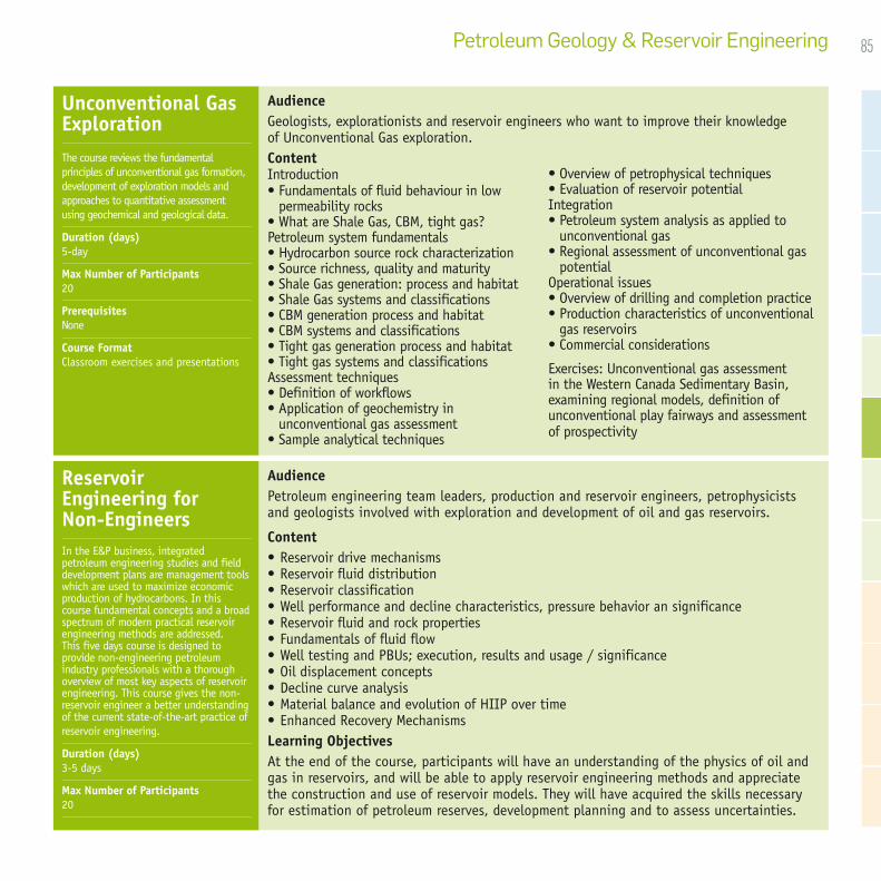
85Petroleum Geology & Reservoir Engineering
Unconventional Gas ExplorationThe course reviews the fundamental principles of unconventional gas formation, development of exploration models and approaches to quantitative assessment using geochemical and geological data.
Duration (days) 5-day
Max Number of Participants 20
Prerequisites None
Course Format Classroom exercises and presentations
AudienceGeologists, explorationists and reservoir engineers who want to improve their knowledge of Unconventional Gas exploration.ContentIntroduction• Fundamentals of fluid behaviour in low
permeability rocks• What are Shale Gas, CBM, tight gas?Petroleum system fundamentals• Hydrocarbon source rock characterization• Source richness, quality and maturity• Shale Gas generation: process and habitat • Shale Gas systems and classifications• CBM generation process and habitat• CBM systems and classifications• Tight gas generation process and habitat• Tight gas systems and classificationsAssessment techniques• Definition of workflows• Application of geochemistry in
unconventional gas assessment • Sample analytical techniques
• Overview of petrophysical techniques• Evaluation of reservoir potentialIntegration• Petroleum system analysis as applied to
unconventional gas• Regional assessment of unconventional gas
potentialOperational issues• Overview of drilling and completion practice• Production characteristics of unconventional
gas reservoirs• Commercial considerations
Exercises: Unconventional gas assessment in the Western Canada Sedimentary Basin, examining regional models, definition of unconventional play fairways and assessment of prospectivity
AudiencePetroleum engineering team leaders, production and reservoir engineers, petrophysicists and geologists involved with exploration and development of oil and gas reservoirs.
Content• Reservoir drive mechanisms• Reservoir fluid distribution • Reservoir classification• Well performance and decline characteristics, pressure behavior an significance• Reservoir fluid and rock properties• Fundamentals of fluid flow• Well testing and PBUs; execution, results and usage / significance• Oil displacement concepts• Decline curve analysis• Material balance and evolution of HIIP over time • Enhanced Recovery MechanismsLearning ObjectivesAt the end of the course, participants will have an understanding of the physics of oil and gas in reservoirs, and will be able to apply reservoir engineering methods and appreciate the construction and use of reservoir models. They will have acquired the skills necessary for estimation of petroleum reserves, development planning and to assess uncertainties.
Reservoir Engineering for Non-EngineersIn the E&P business, integrated petroleum engineering studies and field development plans are management tools which are used to maximize economic production of hydrocarbons. In this course fundamental concepts and a broad spectrum of modern practical reservoir engineering methods are addressed. This five days course is designed to provide non-engineering petroleum industry professionals with a thorough overview of most key aspects of reservoir engineering. This course gives the non-reservoir engineer a better understanding of the current state-of-the-art practice of reservoir engineering.
Duration (days) 3-5 days
Max Number of Participants 20

86 GeoTraining The CGG Integrated Training Offer
CGG’s reservoir teams offer courses that range from basic reservoir concepts to mapping and modeling for reservoir geology. The concepts explored in these programs focus on the integration of geophysical, petrophysical and geological data to develop detailed models of reservoirs.
“I truly feel lucky to be part of the team that participated in the training, I know I will use my newly acquired skills to enact positive changes in my company.”
Reserv
oir Ch
aracte
rizatio
n & M
odeli
ng

87Reservoir Characterization & Modeling
• Geological Principles of Integrated Static Reservoir Modeling 88• Practical Reservoir Data Integration in Reservoir Characterization 89• Geophysical Reservoir Characterization 90• Seismic Reservoir Characterization 90• Applied Petrophysics (Basic & Advanced Courses) 91• Wireline Log Interpretation 91• Formation Evaluation & Petrophysics 92• Formation Microscanner (FMS) Log Interpretation Workshop 92• Geological Characterization of Reservoirs 93• Fundamentals of Quick-Look Log Analysis 93• Reservoir Geochemistry 94• Carbonate Petrophysics 94• Subsurface Facies Analysis 95• Shaly Sand Petrophysics 96• Understanding Fractured Reservoirs 97

88 GeoTraining The CGG Integrated Training Offer
AudienceReservoir modellers who need to understand the diverse range and geological significance of data provided to them for the model build.
Technical specialists who supply data to modellers and want to provide the best possible input data (e.g. geologists, geophysicists, petrophysicists, stratigraphers, engineers).
ContentFollowing the introduction of the static modeling process, each of the data input streams is reviewed in terms of the following: the available analytical methods; quality control issues; the integration of the analytical methods; key uncertainties with the combined methods, including strategies for dealing with those uncertainties. The following sessions take place over the 5 days of the course:
• Static Reservoir Modeling Overview: Explanation and discussion of the modeling process
• Fault and Fault Seal Analysis: Recognition of faults in seismic and core, fault displacement models, fault seal analysis
• Stratigraphic Analysis: core- and log-based sequence stratigraphy; seismic stratigraphy; biostratigraphy, chemostratigraphy, magnetostratigraphy, pressure data, residual salt analysis
• Facies Analysis: Facies analysis using cores and logs; constructing depositional models; constraining models with biofacies and ichnofacies; use of analogues in facies analysis; defining the most appropriate scale for facies; geological analysis of seismic
• Reservoir Body Characterization: Depositional models; sandbody architectures; geological analysis of seismic sandbody analogues (ancient and modern) with examples from the FRL analogue database (ERGOTM)
• Petrophysical Characterization: Review of petrophysical logging tools (conventional and advanced); Archie and non-Archie formation evaluation; conventional and special core analysis; seismic attributes and seismic inversion
Learning Objectives• Understand the modeling process
• Identify faults and understand displacement and sealed faults
• Use a variety of disciplines to conduct stratigraphic and facies analysis
• Model depositional environments and sandbody architectures
• Integrate petrophysical data from logs, formation evaluation, core analysis and seismic data
Geological Principles of Integrated Static Reservoir ModelingThis course is designed to identify and understand the geological interpretation and integration processes linking in to the structural, stratigraphic, lithofacies and object model components of a typical static reservoir model. This evaluation leads to recommended approaches for incorporating greater geological understanding into static reservoir models. The course aims to establish a common language that better enables specialists and modellers to collaborate effectively.
Duration (days) 5-day
Max Number of Participants 20
Prerequisites None
Software Used None
Course Format Classroom exercises and presentations
Reservoir Characterization & Modeling
89
AudienceReservoir modellers who need to understand the diverse range and geological significance of data provided to them for the model build.
Technical specialists who are in the business of supplying data to modellers and want to provide the best possible input data (e.g. geologists, geophysicists, petrophysicists, stratigraphers, engineers).
The course aims to establish a common language that better enables specialists and modellers to collaborate effectively.
ContentThe mechanics of building a static reservoir model are relatively straightforward with the sophisticated modeling software now available. However, in the headlong rush to gain software-based modeling skills, basic geological concepts are being overlooked. Reservoir modeling software provides any number of sophisticated ways of correlating wells, interpolating rock properties, creating reservoir bodies, generating maps and so on, but are they based on sound geological reasoning? After all, the reservoir modeling software is there to help us represent the geology.
The course begins by describing and discussing the static reservoir modeling process which provides the basis for the subsequent sessions.
The remaining sessions in the course describe the key methods and recommended approaches for each of the main data input streams to the model building process and cover the following:
• Fault Analysis
• Depositional Modeling
• Determination of Geological Controls on Rock Properties
• Stratigraphic Correlation
• Mapping
Practical Reservoir Data Integration in Reservoir CharacterizationThis course aims to provide practical experience of common data integration issues encountered in the business of reservoir description. The course focusses on the process of building a static reservoir model and look at the key data preparation and interpretation processes that need to be undertaken as part of the model building process.
Duration (days) 5-day
Max Number of Participants 20
Prerequisites None
Software Used None
Course Format Classroom exercises and presentations
Reservoir Characterization & Modeling

90 GeoTraining The CGG Integrated Training Offer
Seismic Reservoir CharacterizationThis course emphasizes the underlying geological and geophysical principles of seismic reservoir characterization, continuity and integrity, distribution and mapping.
Duration (days) 5-day
Max Number of Participants 20
Prerequisites None
Course Format Classroom exercises and presentations
AudienceGeologists, geophysicists, stratigraphers and sedimentologists who are looking to develop skills in petroleum systems interpretation and distribution mapping and who are familiar with seismic interpretation. ContentThis course is specifically for high resolution definitions using information contained within seismic volumes. Concepts and applications of attribute modelling and inversion modelling that define features such as lithological variations, micro-structure, fluid, secondary porosity and permeability and distribution will be presented.
• Introduction to seismic reservoir characterization• Introduction to seismic seal characterization• Impact of seismic quality and geological constraints on prospect attribute modeling• Dynamic properties and modeling potential• Statistical rock physics• Attributes for prospect analysis• Multi-attribute analysis• Volumetrics• Fracture modeling and conduit analysis
• Lithological mapping and lithological variations• Fluid modeling and conduit analysis• Direct Hydrocarbon Indicators and advanced hydrocarbon modeling• Play-fairway mapping and reservoir distribution• Geostatistics• Quality control and limitations of the petroleum characterization using seismic data• Other applications
AudienceExploration geologists, structural geologists and geophysicists wishing to expand their knowledge of geophysics at the reservoir scale. Any geologist or reservoir engineer who is trying to build a better picture of their reservoir for production purposes would also find this course beneficial.
ContentThe concept of reservoir geophysics is relatively new. In the past, the role of geophysics was largely confined to exploration and, to a lesser degree, the appraisal of discoveries. In recent years, however, geophysics has been increasingly used as a tool for refining development strategies and improving production efficiency. Fundamental to this approach are the availability of good quality seismic data and well control, and the integration of rock physics data from petrophysics and engineering studies.
Traditional geophysics• Well to seismic ties• Seismic interpretation• Mapping• Depth conversion• Reserves estimates• Fault interpretationReservoir geophysics
• Seismic attributes• Seismic inversion• AVO analysis• 4D seismic• Reservoir geostatistics geology
Geophysical Reservoir CharacterizationThis course deals with the various aspects of the traditional approach of exploration geophysics before moving on to some of the more advanced aspects of reservoir geophysics.
Duration (days) 5-day
Max Number of Participants 20
Prerequisites None
Course Format Classroom exercises and presentations

91Reservoir Characterization & Modeling
Applied Petrophysics (Basic & Advanced Courses)In the E&P business, integrated petroleum engineering studies and field development plans are used to maximise economic recovery of hydrocarbons. Understanding the methods used in petrophysical analysis, the related uncertainty of the results and hence the derived models is essential knowledge for all E&P technical staff
Duration (days) 5-day
Max Number of Participants 20
Prerequisites None
Course Format Classroom exercises and presentations
AudiencePetroleum engineers, seismologists, petrophysical engineers, reservoir engineers, drilling engineers and geologists.ContentThis course covers fundamental petrophysical relations, tool principles, modern interpretation methods and core measurements. Depending on the petrophysical know-how of the participants more emphasis can be given to particular subjects. Principles, quality, editing and responses of the
major open hole logging devicesLithology including shale volume, porosity,
permeability and hydrocarbon content using Archie, Simandoux, Indonesia, Waxman-Smits, Dual-Water and capillary pressure curves; wireline formation testing
Core analysis program for exploration and development wells
Cutoff criteria to arrive at average reservoir properties
Uncertainty analysis Crossplots for lithology, porosity and oil/water/
gas saturations
Additionally the advanced course will cover:Comparison of shale volume, porosity, saturation
and permeability methodsCapillary pressure curvesRock property derivation for seismic applications
Sessions will emphasize the importance of interaction between seismology, geology, well log analysis, reservoir engineering and other disciplines. By the end of the course a quick-look petrophysical evaluation of a typical well will have been performed.
AudienceThe course has been designed to enable the explorationist, development and production geologist to evaluate and integrate wireline log data. Content• The logging environment, introduction to
the borehole.• Conventional wireline logs: Caliper,
Tension, Gamma ray, Spectral Gamma ray, Spontaneous potential, Resistivity, Density, Neutron porosity, PEF, Sonic
• Data QA and depth matching • Interpretation of lithologies from
conventional logs• The dipmeter log
• Quick look interpretation of porosity and hydrocarbons• Some sedimentological indications from
wireline log patterns• Zoning a section for reservoir engineering
purposes• Interwell correlation using logs and other
data, including advanced techniques• Borehole imaging logs (FMI, ATS) etc.
Learning Objectives• Understand tool theory, uses and limitations• Interpret lithologies and reservoir characteristics• Identify depositional sequences and correlate wells• Determine porosity, saturation and reservoir fluid type• Employ quicklook methods of formation evaluation
Wireline Log Interpretation The course program includes exercises to provide participants with hands-on experience and confidence in handling log and petrophysical data and interpretation. The extensive practical element emphasises how to apply wireline log data in order to enhance well, field correlations, sequence recognition, lithology and reservoir characteristics.
Duration (days) 5-day
Max Number of Participants 20
Prerequisites None
Course Format Classroom exercises and presentations

92 GeoTraining The CGG Integrated Training Offer
AudienceThis course is designed for staff in the exploration and production department with no or limited petrophysical background: petroleum engineers, seismologists, petrophysical engineers, reservoir engineers, drilling engineers and geologists.
ContentPart 1: Background. This section reviews the geological controls on reservoir properties and the basic functions of the wireline logging tools.
Part 2: Petrophysical Methods. This section comprises a detailed description of the full formation evaluation method workflow. The full method covers the general characteristics of clastics and carbonates. Consideration is also given to special methods required for fractured reservoirs, thin-beds and shaly sands.
Part 3: Further Analysis. This section introduces the integration of conventional petrophysics with more advanced petrophysical logging methods, seismic interpretation and engineering techniques.
Formation Evaluation & PetrophysicsDuration (days) 5-day
Max Number of Participants 20
Prerequisites None
Course Format Classroom exercises and presentations
AudienceThe course is intended for sedimentologists, structural geologists, petrophysicists, engineers and geophysicists who are concerned with the downhole recognition of lithological sequences, structures and reservoir characteristics.ContentTheoretical considerations of FMS and other micrologs are presented followed by interpretive aspects including the recognition of and methods of determining rock lithologies, lithological sequences, sedimentary structures and palaeocurrent measurement, tectonic structures, borehole damage and artefacts.• FMS and other borehole micrologs e.g. CYBL, Televiewer, DUALDIP, MSD, principles, operating conditions, output, resolution• FMS interpretation including recognition of structures• Methods of determining orientation of dipping features, correction for borehole drift, reorientation of cores• Recognition of structures in cores - slab/outside surfaceLearning Objectives• Understand tool form and function and learn about the principles of FMS image processing• Interpret sedimentary and tectonic structures and lithology• Recognise and assess borehole damage and other operational/processing artefacts• Use FMS to constrain and correct data from other logs and core
Formation Microscanner (FMS) Log Interpretation WorkshopIf correctly calibrated, good quality borehole image logs can provide a wealth of information on reservoir quality. The course aims to demonstrate to geoscientists and engineers how to extract information from manual interpretation of borehole image logs.
Duration (days) 5-day
Max Number of Participants 20
Prerequisites None
Course Format Classroom exercises and presentations

93Reservoir Characterization & Modeling
Fundamentals of Quick-Look Log AnalysisThis course will begin by establishing a fundamental understanding of the geological and petrophysical properties of rocks, followed by familiarisation with the borehole environment, logging process and the fundamentals of the logging tools.
Duration (days) 5-day
Max Number of Participants 20
Prerequisites None
Course Format Classroom exercises and presentations
AudienceAnyone who needs to grasp the essential features of petrophysical data and how to use it quickly and effectively, qualitatively and quantitatively, to reveal the commercial significance of a well. Content• Rocks: Sedimentological controls on grain size, sorting, clay content, mineralogy and the trends
that can be observed in sedimentary sequences• Rock and Fluid Properties and Interactions: Fundamentals of petrophysical rock properties
including: porosity, permeability, relative permeability, wettability, capillary pressure, cation exchange capacity, fluid saturations.
• Drilling and Logging Process: Understanding the nature of the borehole and how the logging tools are run in order to understand the limitations and uncertainties in the log data.
• Review of Conventional Logging Tool Theory: Each tool is measuring a different rock property (e.g. neutron density, electron density, gamma-ray abundance), which in turn is transformed to another property (e.g. porosity, bulk density, lithology).
• Quick-Look Log Analysis Workflow: All of the above will be used to undertake quick-look analysis of several log suites. The methods will include: data quality control, lithology assessment (including Vshale), porosity estimation, fluid saturation estimation (hydrocarbon indicators), permeability indicators, and reservoir summation and integration with mud logging data
AudienceGeologists, geophysicists and reservoir engineers responsible for evaluating reservoir quality and performance.Content• Reservoir properties of sandstones and carbonates at microscale• Reservoir properties of sandstones and carbonates at lamina/bed and formation scale• Petrophysical aspects• 3-D reservoir geological modeling workshop• Volumetrics• Modeling techniques and upscaling for simulation• Secondary recovery and stimulation
Learning Objectives• Understand the depositional and diagenetic controls on reservoir properties• Apply geophysical and geological evaluations of integrated data from a variety of
disciplines.• Understand and quantify the uncertainties in reservoir evaluation and volumetric
calculations.• Apply facies modelling and simulation techniques• Understand the principles of recovery and stimulation techniques
Geological Characterization of ReservoirsThis course has been developed to demonstrate to petroleum engineers and geoscientists the procedures employed by geologists in assessing the quality of a reservoir. As such it integrates geological, petrophysical and engineering data and relates these to primary and enhanced recovery methods.
Duration (days) 5-day
Max Number of Participants 20
Prerequisites None
Course Format Classroom exercises and presentations

94 GeoTraining The CGG Integrated Training Offer
Reservoir GeochemistryThe application of reservoir fluid geochemistry to the understanding of discovered fields, reservoir continuity, compartmentalisation and connectivity is an evolving technique of great value. This course is intended to promote confidence in the application of petroleum geochemistry techniques to reservoir scale problems.
Duration (days) 5-day
Max Number of Participants 20
Prerequisites None
Course Format Classroom exercises and presentations
AudiencePetroleum geologists, reservoir geologists and engineers involved in the assessment of reservoir heterogeneity and connectivity; petroleum exploration geochemists who wish to expand their knowledge into reservoir geochemistry.Content• Introduction to general concepts
- Reservoir fluid properties and characteristics- Rate and mechanism of reservoir filling and mixing- Engineering versus geochemical nomenclature- Hydrocarbons and non-hydrocarbons- Relationship of hydrocarbon composition to petroleum properties- Analytical methods
• Applications of petroleum geochemistry to the understanding of reservoir fluids- Tested oil: Interpreting gas chromatograms and GC-MS; non-hydrocarbons/ interpretation;
application to reservoir continuity/connectivity- Gas: Non-hydrocarbon gases (compositions/sources); hydrocarbon compositions/
interpretations; isotope studies- Water: API analysis; Stiff diagrams; action on reservoir matrix; effect on hydrocarbon
composition/petroleum properties; water in sub-surface (variations/perturbations)- Residual oil: Extraction data/interpretations (relationship of poroperm and logs; interpreting
fractionation, GC-MS; oil-saturated non-flowing reservoirs; tarmats and reservoired oils)
AudienceEngineers in exploration and production departments. geologists, seismologists, and petroleum, petrophysical, reservoir and drilling engineers.Content• Overview of Carbonates: depositional
processes; controls on primary and secondary pore systems
• Carbonate Sequence Stratigraphy: controls on the distribution of facies and geological controls on reservoir quality
• Rock Properties and Fluid-Rock-Interactions: porosity, permeability, saturation, wettability, capillary pressure
• Conventional and Special Core Analysis: laboratory measurement techniques; limitations and uncertainites in each analytical technique
• Borehole Environment: drilling and logging process
• Conventional Logging Tool Theory• Data Preparation and Quality Control: issues
relating to borehole quality; log quality issues; missing data; depth matching
• Log Interpretation Process : Review theory and application of conventional openhole logs
• Carbonate Log Exercise• Advanced Logging Tools: Theory of
advanced downhole tools e.g. NMR log, Borehole Images and DSI
• Fractures and Vugs: Identifying and describing these features in the subsurface
• Integration and Flow Unit Integration: Flow unit model
Learning Objectives• This course deals with fundamental petrophysical relations, principles, modern interpretation methods and core measurements in relation to carbonates.
Carbonate PetrophysicsPetrophysics and well log analysis help geologists to quantify and understand the distribution of reservoir properties in the subsurface. This course deals with fundamental petrophysical relations, principles, modern interpretation methods and core measurements in relation to carbonates.
Duration (days) 5-day
Max Number of Participants 20
Prerequisites None
Course Format Classroom exercises and presentations

95Reservoir Characterization & Modeling
Subsurface Facies AnalysisThis course has been developed to demonstrate to geoscientists and petroleum engineers the procedures employed by geologists in defining depositional facies and developing geological models through the interpretation of sedimentology and sequence stratigraphy and integration with log, core and seismic data.
Duration (days) 5-day
Max Number of Participants 20
Prerequisites None
Course Format Classroom exercises and presentations
AudienceGeologists, geophysicists and reservoir engineers who want to analyze and interpret subsurface data to understand exploration plays.
Content• Introduction: Surface and subsurface facies analysis, depositional architecture, basins• Clastic depositional facies: Clastic sediments and structures, depositional environments• Carbonate depositional facies: Carbonate sedimentology, depositional environments• Sequence stratigraphy: Sequence development, sequences and systems tracts• Uses of well logs in lithological and lithofacies analysis: Typical log curve shapes,
identifying marker beds and bounding discontinuities from logs; correlating logs for facies analyses
• Core data: Identifying facies in core, key surfaces and marker beds, correlating with log data
• Seismic reflection data: Seismic sequence stratigraphy, identification of reflector terminations, seismic facies analysis and mapping
• Calibration and integration of seismic, core and log data • Mapping and refining stratigraphic and structural cross sections
Learning Objectives• Understand clastic and carbonate depositional systems and controls
• Interpret clastic and carbonate depositional environments using data from core images, cuttings images and wireline logs
• Apply sequence stratigraphic concepts
• Interpret log responses
• Correlate wells using knowledge of depositional environments
• Predict reservoir size, shape, trend and quality
• Understand and interpret seismic reflections
• Generate stratigraphic and structural cross sections and facies maps from subsurface data
96 GeoTraining The CGG Integrated Training Offer
Shaly Sand PetrophysicsPetrophysics and well log analysis help geologists to quantify and understand the distribution of reservoir properties in the subsurface. This course deals with fundamental petrophysical relations, principles, modern interpretation methods and core measurements in relation to Shaly Sands.
Duration (days) 5-day
Max Number of Participants 20
Prerequisites None
Course Format Classroom exercises and presentations
AudienceEngineers in exploration and production departments. Geologists, seismologists and petroleum, petrophysical, reservoir and drilling engineers.
Content• Rock Properties: overview of depositional systems
• Fluid -Rock-Interactions: porosity, permeability, saturation, wettability, capillary pressure
• Conventional and Special Core Analysis: laboratory techniques to measure physical properties in core
• Drilling and Logging Process: review drilling and logging process
• Conventional Logging Tools: logging tools theory
• Advanced Logging Tools: advanced downhole tools e.g. NMR log and Borehole Images
The second part of the programme will focus on an Excel-based practical exercise, which will enable attendees to work through a full petrophysical evaluation of a shaly sand sequence, and in doing so, compare and contrast a variety of methods for Vsh, porosity and saturations in shaly sands.
• Full Interpretation Workflow
• Data Preparation and Quality Control
• Shale Volume Analysis
• Porosity Analysis
• Water Saturation Analysis
• Saturation Height
• Permeability
• Recovery Factors
• Reservoir Summation
Learning Objectives:This course deals with fundamental petrophysical relations, principles, modern interpretation methods and core measurements in relation to Shaly Sands.

97Reservoir Characterization & Modeling
Understanding Fractured ReservoirsThis course is designed to provide participants with a working knowledge of what fractures are, how they form and the techniques used to evaluate them within the petroleum industry.
Duration (days) 5-day
Max Number of Participants 20
Prerequisites None
Course Format Classroom exercises and presentations
AudiencePetroleum geologists, explorationists, petrophysicists, geophysicists and engineers involved with exploration, appraisal and development of fractured reservoirs.
Content• Introduction to fracturing: Basic principles, fracturing in tight reservoirs
• Fracture terminology
• Fracture mechanics: Stress and strain, deformation mechanisms, brittle deformation, propagation and arrest of fractures
• Fracture classification: Joints, shear fractures, compression fractures, stylolites
• Controls on fracture formation: Lithology, sedimentary structures, bed thickness, mechanical stratigraphy, bedding planes, tectonic setting, palaeostress, subsidence and uplift history, proximity to faults, position in a fold, timing of structural events, mineralisation, fracture evolution, orientations of in situ stresses, fluid pressure, depth
• Fracturing in different lithologies
• Fracture identification: Seismic, wireline logs, core, outcrop, satellite imagery
• Data collection and analysis: Fracture orientations, scaling relationships, fracture spacing, temporal relationships, frequency and density calculation
• Fracture analogues: Kurdistan, Bristol Channel
• Fracture modeling: Modelling approaches, modelling platforms, discrete fracture network modelling and modelling considerations
• Basic fractured reservoir engineering: Basic principles, well testing and productivity, fluid flow, reservoir stimulation, recovery mechanisms
Learning Objectives:The course will cover fracture terminology, fracture mechanics, fracture classification, controls on fracture formation, fracturing in different lithologies, fracture identification, data collection and analysis, fracture analogues, fracture modelling and a basic introduction to fractured reservoir engineering. Datasets will be focused on those tectonic regimes in which the world’s oil reserves are concentrated.


100 GeoTraining The CGG Integrated Training Offer
CGG GeoTraining’s multidisciplinary approach to petroleum exploration and development includes economic assessment, contracting and project management. The combination of our technical engineering and science disciplines with finance options provides our clients with a thorough understanding of the full economic lifecycle of the field. Knowledge of this aspect of the project lifecycle allows for collaborative and well-informed fiscal decisions.
Courses combine theoretical aspects of petroleum economics and management with practical applications, using examples and exercises based on real projects worldwide. Courses can be tailored to use client data if required. Location and geopolitical specifics can be incorporated into training courses on request.
All CGG trainers delivering petroleum management and economics courses are experienced economists who have careers within the petroleum industry.
“Good fundamental course, very clear objectives and good instructor knowledge on the topics.”
Petrol
eum Ma
nagem
ent
& Econ
omics

101Petroleum Management & Economics
• Introduction to Upstream Petroleum Economics 102• The Fundamentals of Upstream Petroleum Economics and Risk Analysis 103• Advanced Petroleum Economics and Risk Analysis 104• Economic Aspects of Production Sharing Contracts 104• Economic Aspects of Taxation & Royalty Systems 105• International Petroleum Fiscal Systems 105• Petroleum Economics Integrated with Decision and Uncertainty Analysis 106• The Economics of Unconventional Resources & LNG Projects 106• Introduction to Strategic Management in Exploration and Production 107• Petroleum Contracts and Practice in Negotiations 107

102 GeoTraining The CGG Integrated Training Offer Petroleum Management & Economics
AudienceThe course is designed to be at an introductory level for those new to the subject of upstream petroleum economics. It is suitable for personnel from all technical and commercial disciplines.
ContentThe primary aim of this course is to equip delegates with the necessary skills to:• Understand the theory of petroleum economics based on discounted cashflow• Calculate with confidence the key economic metrics used in investment decision making• Appreciate the geological and engineering inputs to the cashflow model• Understand oil and gas pricing • Understand the principles and appreciate the diversity of worldwide fiscal systems • Interpret the economic results and quantify the risks so as to put values to prospects,
fields and companies
Introduction to Upstream Petroleum EconomicsThis two-day course provides an introduction to upstream petroleum economics through a mixture of theory and question and answer exercises.
Duration (days) 2-day
Max Number of Participants 20
Prerequisites None
Course Format Classroom exercises and presentations

103Petroleum Management & Economics
AudienceThe course is suitable for delegates of all technical and commercial disciplines from oil and gas companies, governments, banks, legal and accounting organizations.
ContentThe primary aim of this course is to equip delegates with the necessary skills to:• Understand the theory of petroleum economics based on discounted cashflow• Calculate with confidence the key economic metrics used in investment decision making• Appreciate the geological and engineering inputs to the cashflow model• Understand oil and gas pricing• Understand the principles and appreciate the diversity of worldwide fiscal systems • Build Excel-based economic models in both a Tax/Royalty and Production Sharing
Contract fiscal system• Interpret the economic results and quantify the risks so as to put values to prospects,
fields and companies• The fundamentals of discounted cashflow including real vs nominal economics and the
derivation of a company’s hurdle discount rate• The calculation and application of economic metrics NPV, EMV, IRR, Payback and DPIR for
investment decision making• The components of an oil or gas cash flow; revenue, tariffs, costs and pricing• Global international fiscal systems: structure, comparisons, fiscal take• Government and oil company perspectives and the role of the National Oil Company• The financial structure and mechanisms of production sharing contracts including the
calculation of cost recovery and profit oil splits• Production Sharing Contract and Tax/Royalty model building workshop sessions. • Incremental, project consolidation and ringfencing analysis• Quantification of risk; both deterministic and probabilistic techniques including decision
trees and Monte Carlo analysis• Workshop session applying risk and a decision tree to make a drill or drop decision on an
exploration prospect• Delegates are provided with electronic copies of all model solutions and exercises at the
end of the course
The Fundamentals of Upstream Petroleum Economics and Risk AnalysisOur flagship economics course is unique in its field; delegates gain a tangible skill, that of economic model building. This is achieved over the five days with a mixture of theory, question and answer, and practical workshop sessions.
Duration (days) 5-day
Max Number of Participants 20
Prerequisites Excel™ : working knowledge
Course Format Classroom delivery with presentations, practical exercises and modelling workshop

104 GeoTraining The CGG Integrated Training Offer
AudienceThe course is suitable for delegates of all technical and commercial disciplines from oil and gas companies, governments, banks, legal and accounting organizations.ContentThe primary aim of this course is to equip delegates with an understanding, both theoretical and practical, of advanced economic techniques around valuation metrics, M&A, fiscal design and risk quantification. It covers three main areas:• Cashflow and corporate valuation
After a refresher of cashflow fundamentals the topic is expanded to cover the importance of both cashflow and accounting- based metrics in order to value assets for acquisitions/divestments. To this end the accounting fundamentals around P&L account, balance sheets and earnings are discussed , particularly where they interact with economics
• Fiscal Design After a refresher of the fundamentals of tax/Royalty, Production sharing contracts and risk service contracts, we aim to provide the delegate with an in-depth understanding of the fiscal levers particularly those that are biddable or negotiated. The last day workshop is a team based exercise: A “negotiation scenario” is played out where the team has to select a suitable set of fiscal terms for the production sharing contract and argue its case
• Risking Techniques The more advanced risking topics are discussed around sensitivity analysis, decision trees, Value of Information (VOI) and Monte Carlo simulation
Delegates will be provided with electronic copies of workshop solutions and examples. They will all have a comprehensive hard copy course manual.
AudienceThe course is designed for those working in the upstream industry who are not familiar with PSCs and who require either a working or practical knowledge of the financial mechanics and economic aspects of the contracts. Content• Understand the principles of economic analysis (cashflow, cost of capital, NPV, rate of
return etc)• Application of sensitivity analysis to incorporate risk• Understand the structure of the PSC contract and comparison with the tax/Royalty fiscal
system• Calculations of cost recovery and specific issues to consider• Learn about bonuses and bonus calculations• Examine sliding scale fiscal mechanisms including R Factor and rates of return methods• Calculation of taxation including allowances, depreciation and tax losses • Understand profit sharing• Taking advantage of tax and PSC ring fencing terms to add value to the asset• Booking of reserves in a PSC (including tax barrels)• Contractor/Government/National Oil Companies relationship: cost carries, fiscal take• How to optimise fiscal terms from both contractor and government perspective• Construction of a production sharing contract spreadsheet model, the derivation of relevant
economic metrics, application of sensitivities and the drawing of conclusions to aid decision-making
Advanced Petroleum Economics and Risk AnalysisStrategic management requires us to make sense of complex and dynamic situations in the Upstream part of the Oil and Gas business where the emphasis lies in getting access to increasing volumes of HC’s on a regional or global scale.
Duration (days) 4-day
Max Number of Participants 20
Prerequisites Economic fundamental, Intermediate Excel
Course Format Classroom delivery with presentations, practical exercises and modelling workshop
Economic Aspects of Production Sharing Contracts This three day course reviews the upstream economic aspects of Production Sharing Contracts (PSCs). It describes in detail the financial structure and mechanisms of PSCs across the world and the economic and value implications of the various terms.
Duration (days) 3-day
Max Number of Participants 20
Prerequisites Excel™ : working knowledge
Course Format Classroom delivery with presentations, practical exercises and modelling workshop

105Petroleum Management & Economics
AudienceThis course is designed for those working in the upstream industry who are not familiar with taxation and royalty systems and require a working knowledge and practical application of the structure, fiscal calculations and economic outputs. The course has a global outlook where numerous worldwide examples are drawn on and fiscal take comparisons made. It is suitable for delegates from all technical and commercial disciplines.
Content• Understanding of the evolution of global fiscal systems• The fundamentals of economic analysis (cashflow, cost of capital, NPV, rate of return etc)• Different methods of applying government royalty• Field based taxes• Calculation of taxation including allowances, depreciation and tax losses• Taking advantage of tax ring fencing terms to add value to the asset • Examine sliding scale fiscal mechanisms including R Factor and rates of return methods• How to optimise fiscal terms from both investor and government perspective• Construction of a tax/royalty spreadsheet model, the derivation of relevant economic
metrics, application of sensitivities and the drawing of conclusions to aid decision-making
AudienceThe course is suitable for delegates of all technical and commercial disciplines from oil and gas companies, governments, banks, legal and accounting organizations.ContentThe aim is provide delegates with a thorough understanding of petroleum fiscal systems to enable them to interpret contracts, negotiate terms and build economic models. Delegates will:• Understand the evolution of, and differences between, petroleum fiscal systems globally:
production sharing contract (PSC), tax & royalty systems, risk service contracts and pure service contracts
• Understand the structure of the PSC• Calculate with confidence cost recovery, profit sharing and bonuses• Examine sliding scale fiscal mechanisms including R-factor and rates of return methods• Carry out taxation and royalty calculations applying capital allowances and depreciation• Understand the key differences in reserve bookings under the different systems• Look at examples across the globe illustrating the different concepts drawing on CGG’s
extensive fiscal database• Construct a PSC model, derive relevant economic metrics, apply sensitivities and draw
valuation conclusions to aid decision-making• Understand government take and the different methods of calculation• Design their own fiscal system to assess contractor/government take in a ‘classroom
competitive bid’• Understand how PSC and tax ring-fencing can add value to the assetDelegates will be provided with electronic copies of workshop solutions and examples. They will all have a comprehensive hard copy course manual.
Economic Aspects of Taxation & Royalty SystemsThe mission of this three day course is to provide an understanding of: • The structure of tax and royalty systems • The range and diversity of fiscal terms • How to analyze and apply the economic
model outputs
Duration (days) 3-day
Max Number of Participants 20
Prerequisites Excel™ : working knowledge
Course Format Classroom delivery with presentations, practical exercises and modelling workshop
International Petroleum Fiscal SystemsThis course describes the different types of structures/contracts that are applied to the Upstream Oil and Gas industry globally. The course will enable delegates to apply the theory learnt during the course through excel-based economic model building and the designing of fiscal systems.
Duration (days) 5-day
Max Number of Participants 20
Prerequisites Excel™ : working knowledge
Course Format Classroom delivery with presentations, practical exercises and modelling workshop

106 GeoTraining The CGG Integrated Training Offer
AudienceThe course is suitable for delegates of all technical and commercial disciplines from oil and gas companies, governments, banks, legal and accounting organizations.ContentThe course focuses on three main areas:• The Fundamentals of petroleum project economics, fiscal systems and valuation• The economics of unconventional projects• The economics of LNG projectsThe first part of the course provides delegates with a thorough understanding of petroleum economics, fiscal systems and valuation techniques. We draw on CGG’s extensive global database of fiscal systems in order to provide delegates with case studies. Techniques learnt are then applied over the next two days when the specifics of unconventional and LNG projects are discussed. The unconventionals part of the course discusses all the types of unconventional projects that are currently in operation around the world before moving on to the specifics of Shale Gas/ Oil and Coalbed Methane (CBM). We consider the characteristics of the reservoirs which in turn determine the development plan, facilities requirements and project economics.LNG is a method of developing large gas structures providing flexibility of supply. It comes with its own unique characteristics around contracts, pricing and fiscal terms. Overall project economics can only be determined by considering project returns across the whole value chain. Delegates will partake in a modelling workshop to consolidate their understanding of this subject. Delegates will be provided with electronic copies of all workshop solutions and examples. They will all have a comprehensive hard copy course manual.
The Economics of Unconventional Resources & LNG ProjectsThis three day practical course introduces delegates to petroleum economics and its application in both an unconventionals and LNG project setting.
Duration (days) 3-day
Max Number of Participants 20
Prerequisites Excel™ : working knowledge
Course Format Classroom delivery with presentations, practical exercises and modelling workshop
AudienceThe course is suitable for delegates of all technical and commercial disciplines from oil and gas companies, governments, banks, legal and accounting organizations.ContentThe course is unique in its field; delegates gain tangible skills to take back to their workplaces: economic model building integrated with practical decision and uncertainty analysis. This is achieved over the five days through a mix of theory, question and answer, case studies and hands on practical workshop sessions.• Understand the theory of petroleum economics based on discounted cashflow• Calculate with confidence the key economic metrics used in investment decision
making (NPV, rates of return, PIR, payback etc)• Appreciate the geological, engineering and pricing inputs to the cashflow model• Understand the principles and appreciate the diversity of worldwide fiscal systems• Build Excel-based economic models, in both a Tax/Royalty and Production Sharing
Contract fiscal system• Learn about the power of practical decision and uncertainty analysis• Discover the benefits of tornados, decision trees and cumulative probabilities plots• Gain new insights and confidence from your use of uncertainty data• Identify key risks and uncertainties for your projects• Develop an appreciation for the value of information• Make better recommendations and improve the quality of your decision making
Petroleum Economics Integrated with Decision and Uncertainty AnalysisThe course combines the fundamentals of petroleum economics and fiscal modeling with deterministic and probabilistic risk techniques.
Duration (days) 5-day
Max Number of Participants 20
Prerequisites Excel™ : working knowledge
Course Format Classroom delivery with presentations, practical exercises and modelling workshops

107Petroleum Management & Economics
AudienceThe course is valuable for all those in E&P who are interested and involved in strategic decision making. These can be general- and functional managers and planning managers, who need a good grasp of modern concepts of strategic management in terms of:• Tools and techniques to be used.• Developing plans to realize the aims and purposes of the organization.• Developing strategies to adequately respond to the forces in the outside world.• Contributing and participating valuably in the strategic decision making process. Content• Introduction to strategy• E&P business environment• Strategic analysis• Visioning• Strategic Decisions
• Managing value in E&P• Performance measurement• Balanced scorecard• Roadmap to determine the strategies
During the course the participants focus on topics such as; Strategic Analysis (i.e. to identify key questions to evaluate and understand the industry and market around you), Visioning (i.e. to understand the capabilities of your enterprise, creating a vision), Decisions, Creative Thinking, Managing Value, Performance Measurement (i.e. value drivers, key success factors and performance indicators) and Balanced Scorecards. Appropriate case studies and exercises clarify the theory.
Introduction to Strategic Management in Exploration and ProductionStrategic management requires us to make sense of complex and dynamic situations in the Upstream part of the Oil and Gas business where the emphasis lies in getting access to increasing volumes of HC’s on a regional or global scale.
Duration (days) 5-day
Max Number of Participants 20
Prerequisites None
Course Format Classroom exercises and presentations
AudiencePetroleum managers and administrators in the International Oil Companies, the IOCs, as well as G & G specialists and engineers; technical, legal, financial and other specialists in the oil and gas ministries of the Host Governments and in the State Oil Companies.Content• Sovereignty, the state and the ownership of the petroleum resource• The petroleum legislation and key issues within it: the Ministry of Petroleum and the
Petroleum Licensing and Monitoring Unit, PLMU. The State Oil Company: two modern examples: Pertamina and EGPC. Ten key steps in petroleum licensing and an example of modern petroleum legislation
• Petroleum leases, concessions, agreements and contracts. The modern Equity (Royalty-Tax) Agreement, the modern Contractor (Production Sharing) Agreement and the Iranian Buy-Back Agreement
• Technical issues in petroleum agreements: term (duration), work program (duration and content: seismic and wells), exploration periods and relinquishment, exploration and production licences, discovery , the development plan
• Legal and contractual issues in petroleum agreements: the rights, duties, obligations and liabilities of the parties
• Financial issues in negotiations: lease/signature bonuses, royalty, tax, additional profits taxes, OPEX, CAPEX, cost oil, profit oil, the Equity Agreement versus the Contractor
• Negotiating strategies, seeking the agreement and closing the deal
Petroleum Contracts and Practice in NegotiationsThis course develops an in-depth knowledge of the legal and contractual framework in which the upstream oil industry conducts its operations.
Duration (days) 2-day
Max Number of Participants 20
Prerequisites None
Course Format Classroom exercises and presentations

108 GeoTraining The CGG Integrated Training Offer
The main purpose of E&P Data Management is to make sure that the data available for analysis and interpretation are of the highest quality. In addition, the data must be kept secure and accessible without delay to authorized users.
E&P data have a wide variety of formats ranging from large-scale seismic surveys to core collected during well drilling. Specialized technologies are used to browse, manage and view selections of data.
“CGG believes in the principle of significant investment focused on people to achieve genuine Learning for Development success. Our courses are aligned with the strategies of both CGG and our clients.”
Data M
anagem
ent

109Data Management
• Fundamentals of E&P Data Management 110• Overview of E&P Data Management 110• Well Data Management 111• Physical Asset Management 111• ArcGIS for Geoscientists 112• National Data Repositories 112• PleXus Fundamentals – End User Induction Training 113• PleXus for Administrators 113• Trango Fundamentals – End User Induction Training 114• Trango Enterprise – End User Induction Training 114• Trango for Administrators 115• Map Projections and Datum Transformations 115

110 GeoTraining The CGG Integrated Training Offer
AudiencePracticing Data Managers. Geoscientists and Engineers from all related disciplines. Technical managers such as IT specialists. Librarians and Administrators that deal with an organization’s E&P data.
ContentThe course consists of 16 modules, each of which examines a different aspect of E&P data management. An introduction to the value of effective data management is followed by familiarization with seismic, well, reservoir and production data domains. An analysis of Data Operations (Data Lifecycle, Cataloguing & Data Standards, Physical Data Handling, Digital Data Management, Data Quality Assurance & Control, Data Transformation, Data Integration and Archive Management) is followed by topics that focus on how these data operations contribute to the execution of effective Business Processes (Business Process Management, Data Governance and Business Continuity). An evaluation of learning outcomes and the capture of a personal action plan finalizes the course.
Learning Objectives• The importance of E&P data management• The role of the primary data domains• The value of E&P data as an asset• Data transformation processes• The role of technology
• Operational workflows and procedures essential for managing E&P data
• Data governance requirements and standards• Business continuity, including recovery
from disaster
Fundamentals of E&P Data Management This course provides a practical awareness of current E&P Data Management, providing an insight into the governance and operations for efficient and effective management of data assets.
Duration (days) 4-day
Number of Participants 6 - 12
Prerequisites Academic qualifications related to the above roles; experience and practical working experience of the E&P business sector.
Software Used None
Course Format Classroom delivery with presentations, practical exercises and activities
AudiencePracticing Data Managers. Geoscientists and Engineers from all related disciplines. Technical managers such as IT specialists. Librarians and Administrators that deal with an organization’s E&P data.
ContentThe course consists of 4 modules that examine the highlights of E&P data management. Firstly, an introduction to the value of effective data management demonstrates why good data management contributes to improving business perfomance; secondly, a summary of best practice for physical and digital data handling is given; thirdly, a module focusing on the importance of data quality assurance and control. Finally, the topic of data governance shows how data management operations contribute to the execution of effective business processes. An evaluation of learning outcomes finalizes the course.
Learning Objectives • The logistics of well drilling and related data
• The architecture of a well
• Well completions
• Physical and digital well data management
Overview of E&P Data ManagementIt is designed to provide an awareness of the E&P data management landscape and how managing data efficiently can provide benefits to the business.
Duration (days) 1-day
Number of Participants 6 - 12
Prerequisites Academic qualifications related to the above roles; experience and practical working experience of the E&P business sector.
Software Used None
Course Format Classroom delivery with presentations, practical exercises and activities.
Data Management

111
AudiencePracticing Data Managers, especially those working in Storage Facilities. Geoscientists and Engineers from all related disciplines. Technical managers such as IT specialists. Librarians and Administrators that deal with an organization’s E&P data.
ContentThe course consists of 4 modules concerned with the various aspects of physical E&P data management. Firstly, the principles of data storage are examined; secondly, the best practices for storage facility operations are described; and thirdly, the methods by which storage facility operations are translated into efficient business processes are discussed. Lastly, trainees are able to put their new learning into practice during the storage facility tour. An evaluation of learning outcomes finalizes the course.
Learning Objectives • The principles of storing physical E&P data
• The best practices for storage facility operations
• Efficient business processes for storage facilities
• How to put the theory into practice
Physical Asset ManagementTrainees will gain an insight into the different storage requirements for the various physical E&P data types.
Duration (days) 1-day
Number of Participants 6 - 12
Prerequisites Academic qualifications related to the above roles
Software Used None
Course Format Classroom delivery with presentations, practical exercises and activities; this will be virtual unless course held within a short distance from one of CGG DMS’s storage facilities
AudiencePracticing Data Managers. Geoscientists and Engineers from all related disciplines. Technical managers such as IT specialists. Librarians and Administrators that deal with an organization’s E&P data.
ContentThe course consists of 4 modules that examine the management of E&P well data. Firstly, the logistics of well drilling are summarized, together with the relevant data generated; secondly, the architecture of a well is described in the context of the types of data related to each section of the well; and thirdly, well completion techniques are described. Lastly, details of appropriate management of physical and digital data are provided. An evaluation of learning outcomes finalizes the course.
Learning Objectives • The logistics of well drilling and related data
• The architecture of a well
• Well completions
• Physical and digital well data management
Well Data ManagementThe course focusses on the lifecycle of well data, both physical and digital, from creation through capture, editing and archiving to eventual disposal.
Duration (days) 1-day
Number of Participants 6 - 12
Prerequisites Academic qualifications related to the above roles; experience and practical working experience of the E&P business sector
Software Used None
Course Format Classroom delivery with presentations, practical exercises and activities
Data Management

112 GeoTraining The CGG Integrated Training Offer
AudienceGeoscientists and Engineers from all related disciplines. Practicing Data Managers. Technical assistants.
ContentThe course consists of a series of modules that feature usage techniques that apply directly to E&P data, both modern and legacy, in the GIS context.
Learning Objectives• Discover the capabilities and uses of GIS
• Become competent users of the functions most useful to Geoscientists
• Access, manipulate and add data
• Build presentation-quality montages
• Build project databases
• Amalgamate data types to improve understanding of plays and petroleum systems
ArcGIS for Geoscientists This course has been designed specifically for Geoscientists, and will accelerate their effective use of GIS.
Duration (days) 3, plus 1 optional day
Number of Participants 6 - 10
Prerequisites Academic qualifications related to the above roles. Experience and practical working experience of GIS in the E&P business sector is useful but not essential
Software Used ArcGIS (ESRI)
Course Format Classroom delivery with presentations, practical exercises and activities
AudiencePracticing Data Managers, especially at senior level. Geoscientists and Engineers from all related disciplines. Technical managers such as IT specialists. Librarians and Administrators that deal with the nation’s E&P data.
ContentThe course consists of a series of modules that begin by examining all the relevant aspects of E&P data collection as well as the correct handling and storage requirements for such data. Covering all topics from the legal to the technical, the course provides a ‘how-to’ guide for initiating, designing and specifying an NDR. The course includes lectures, case studies and group exercises and encourages trainees to apply the principles to their own country’s circumstances.
Learning Objectives • The definition and purpose of a data repository
• The requirements for staff resources
• The typical legal frameworks used for NDR’s
• Strategy for successful operational procedures
• Audits and reviews
National Data RepositoriesThe course highlights the benefits of operating the NDR effectively by establishing the appropriate operations required to support the NDR environment
Duration (days) 5-day
Number of Participants 6 - 12
Prerequisites Academic qualifications related to the above roles
Software Used None
Course Format Classroom delivery with presentations, practical exercises and activities

113
AudiencePleXus Users, such as: Data Managers. Geoscientists and Engineers from related disciplines. Technical managers such as IT specialists. Librarians and Administrators that deal with an organization’s E&P data.ContentAdministrators will become familiar with the processes to set permissions and entitlements for every User working with the organization’s PleXus installation.
Learning Objectives Trainees will learn how to:• Search for data via map interface
• Search for data via text
• Customize data entry screen to suit low or high volume data loading
• Browse for required data via dictionaries
• Group data into hierarchies
• Order data required for use in projects
AudiencePleXus Users, such as: Data Managers. Geoscientists and Engineers from related disciplines. Technical managers such as IT specialists. Librarians and Administrators that deal with an organization’s E&P data.ContentThis course begins with a brief introduction to the SEG-Y format. Participants then prepare a processing job, to write 3D marine processed data from processing format to SEG-Y format.Learning Objectives Trainees will learn how to:• Select conditions for the data model• Establish data registration process• Maintain corporate data governance policy• Customize data entry screen to suit low or high volume data loading• Maintain database dictionaries• Create drop-down lists in data-entry screens• Create key performance indicators to gauge overall data quality as well
as project management
PleXus Fundamentals – End User Induction TrainingThis induction on PleXus Data management services guides the trainee through the initial steps data Management and data governance
Duration (days) Variable
Number of Participants Variable
Prerequisites Academic qualifications related to the above roles
Software Used PleXus
Course Format Training provided in person, or via online tuition
PleXus for AdministratorsThe training for administrators follows on from the induction training program and addresses higher level topics
Duration (days) Variable
Number of Participants Variable 6 - 12
Prerequisites Academic qualifications related to the above roles; experience and practical working experience of the E&P business sector
Software Used PleXus
Course Format Training provided in person, or via online tuition
Data Management

114 GeoTraining The CGG Integrated Training Offer
AudienceTrango Users, such as: Data Managers. Geoscientists and Engineers from related disciplines. Technical managers such as IT specialists. Librarians and Administrators that deal with an organization’s E&P data.ContentThe induction training familiarizes new End Users with the management of a variety of data types, from legacy data to modern media, including formats, accepted standards and data sources. The helpdesk is available at all times to offer additional support.
Learning ObjectivesTrainees will learn how to:• Search for data via map interface• Search for data via text• Customize data entry screen to suit low or high volume data loading• Creation of database dictionary• Apply values to data attributes• Group data into hierarchies
Trango Fundamentals – End User Induction Training This induction on Trango gives the trainee an efficient and easy-to-access petro-technical way to manage data via an ESRI ArcGIS ® interface
Duration (days) Variable
Number of Participants Variable
Prerequisites Academic qualifications related to the above roles
Software Used Trango
Course Format Training provided in person, or via online tuition
AudienceTrango Users, such as: Data Managers. Geoscientists and Engineers from related disciplines. Technical managers such as IT specialists. Librarians and Administrators that deal with an organization’s E&P data.
ContentThe induction training familiarizes new End Users with the management of a variety of data types, from legacy data to modern media, including formats, accepted standards and data sources. The helpdesk is available at all times to offer additional support.
Learning Objectives Trainees will learn how to:• Search for data via ESRI ArcGIS ® interface• Register data• Customize data entry screen to suit low or high volume data loading• Browse for data via dictionaries• Apply values to data attributes• Perform data quality checks• Order data required for use in projects
Trango Enterprise – End User Induction TrainingThis induction on Trango gives the trainee an efficient and easy-to-access petro-technical way to manage data via an ESRI ArcGIS ® interface
Duration (days) Variable
Number of Participants Variable
Prerequisites Academic qualifications related to the above roles
Software Used Trango
Course Format Training provided in person, or via online tuition

115
AudienceTrango Users, such as: Data Managers. Geoscientists and Engineers from related disciplines. Technical managers such as IT specialists. Librarians and Administrators that deal with an organization’s E&P data.ContentThe training for administrators follows on from the induction training program and addresses higher level topics. Administrators will become familiar with the processes to set permissions and entitlements for every User working with the organization’s Trango.
Learning Objectives Trainees will learn how to:• Select conditions for the data model• Maintain corporate data governance policy• Customize data entry screen to suit low or high volume data loading• Maintain database dictionaries• Create drop-down lists in data-entry screens• Create key performance indicators to gauge overall data quality as well as project
management
AudienceGeologists, Geophysicists, Surveyors, Practicing Data Managers and Technical assistants.
ContentThe course consists of a series of modules which feature usage techniques that apply directly to E&P data, both modern and legacy, in the Geodetic and GIS context.A basic introduction to Geodetic theory covering map projections and Datums is presented at the start of the course. The specifications and impact of the use of different Coordinate Reference Systems (CRS’s) is discussed and illustrated with hands-on exercises. Practical examples of transformations between different Geodetic Datums and the use of the EPSG Geodetic Parameter Dataset to find the best available transformation for the area and coordinate systems in question are presented to and exercised by the participants.Learning Objectives Trainees will learn how to:• Learn the basics of Geodetic theory• Understand and use the EPSG database• Learn the context and use of map datums and projections• Become familiar with the effect of changing map projections• Convert data using predefined EPSG transformations• Assemble data with different Coordinate Reference Systems into onedataset with a common CRS for further processing
Trango for AdministratorsThe training for administrators follows on from the induction training program and addresses higher level topics
Duration (days) Variable
Number of Participants Variable
Prerequisites Academic qualifications related to the above roles; experience and practical working experience of the E&P business sector
Software Used Trango
Course Format Training provided in person, or via online tuition
Map Projections and Datum TransformationsThis course has been designed specifically for Geoscientists to enlarge their Geodetic awareness in order to improve the quality and the accuracy of their positioning and map data.Duration (days) 1 days basic geodetic theory, practical exercises and usage of the EPSG Geodetic Parameter Dataset. Number of Participants 6 - 10Prerequisites Academic qualifications in (petroleum) geology or practical E&P mapping and datamanagement experience. Working experience of GIS at the level of the CGG-DMS ‘ArcGIS for Geoscientist’ course.Software Used TrangoCourse Format Training provided in person, or via online tuition
Data Management

116 GeoTraining The CGG Integrated Training Offer
CGG GeoTraining provides world-class Business Training, driven by a philosophy of offering the best development opportunities. It is of strategic value to be well prepared to manage the business aspects of a technology company and CGG University provides comprehensive programs, focused on performance and innovation, which enable technical managers to develop skills that are critical for success.Our faculty has vast in-depth experience in business and soft skills development as well as in the international oil and gas industry.Business skills curriculum offerings include:• Development of interpersonal effectiveness, communications and presentation skills
required to manage diverse, high-technology teams.• Management & Leadership programs to develop and enhance key management skills and
leadership capabilities such as leadership skills, project management, finance, first-timemanagers, emotional intelligence, etc.
These programs provide our clients with valuable insight and hands-on practical application of CGG’s leadership and management knowledge, enabling trainees to be better prepared to lead high-performing teams.
“Achieving ambitious goals requires ability
and engagement. Peak performance, for individuals and for the company, can be reached only through strong
leadership at all levels.”
Busin
ess Sk
ills

117Business Essentials
• The Essentials of Project Management 118• Finance for Non-Financial Managers 119
Interpersonal Effectiveness• Interpersonal Communication 120• High Impact Presentation & Public Speaking 120• Bridging Cultures 121
Leadership & Management• Managing Teams Effectively 122• Introduction to Emotional Intelligence 122• People & Performance for Managers 123

118 GeoTraining The CGG Integrated Training Offer
AudienceAnyone with little or no project management experience.
ContentThe Essentials of Project Management is designed to provide you with a broad understanding of project management principles, concepts, tools and techniques. It covers the theory and core methodology you will need to manage projects or participate on project teams. This course examines the core elements of project management and emphasizes the importance of organization, communication, leadership and team development.
The key processes include:
• defining the project• project organization• project initiation• stakeholder involvement and contribution• project planning - from scope to schedule• monitoring and controlling the project• the importance of closure, handover and value creation
Learning Objectives• Manage a project through each stage of the project management life cycle• Document the needs and priorities of key stakeholders• Develop an execution strategy that will fulfill stakeholders’ expectations• Develop a project plan that balances scope, time, cost and risk• Assess project complexity and analyze scope to a suitable degree of granularity• Establish project controls to ensure a successful outcome• Monitor project activities and effectively assess progress• Report status and performance efficiently and effectively• Understand essential project management terminology, models, tools and methods
The Essentials of Project Management Learn what it takes to develop the Project Management mindset. Project Management is a professional discipline with a well-defined set of processes. This course builds your knowledge of Project Management tools, processes and methods. Moreover, it emphasizes the importance of organization, communication, leadership and team development during the whole project.
Duration (days) 2-day
Number of Participants 12
Prerequisites ”Project Management” e-Learning module
Software Used None
Course Format Lecture, classroom exercises, groupwork, case study
Business Skills: Business Essentials

119
AudienceNon-financial managers and functional experts who want to develop their knowledge of financial practices to complement their existing professional or technical skills.
ContentMore than ever before, today’s managers are required to understand and speak the language of finance and accounting in order to achieve their goals, objectives and bottom-line results. In this non-technical, real-world-oriented training, you’ll gain the finance and accounting savvy you need to plan budgets, justify requests, spot problems before they get out of hand and much more. You’ll learn the practical financial concepts and skills that will help you make better management decisions.
Learning Objectives• How to focus quickly on the figures that matter most in reports, budgets and balance
sheets• How to avoid problems and recognize opportunities that can affect the bottom line of your
organization• How to use basic financial tools to measure results and plan for growth• How to present reports and plans in sound financial terms for greater impact and
acceptance at all levels of management• How to gain confidence and increase your comfort level in working with financial facts and
figures• How to save money, time and frustration by learning the standard practices, language and
fundamentals of finance and accounting• How to use the numbers to gain perspective for strategic planning and decision makingHow basic skills in finance and accounting positively affect all parts of your job, including managing people, setting shortand long-term objectives and controlling costs
Finance for Non-Financial Managers This program provides an understanding of financial information, particularly the profit and loss statement, balance sheet and cash flow statement. Participants will be more aware of how their decisions impact the business, both in the short and long term.
Duration (days) 3-day
Number of Participants 12 - 16
Prerequisites None
Software Used None
Course Format Lecture, classroom exercises, groupwork, case study
Business Skills: Business Essentials

120 GeoTraining The CGG Integrated Training Offer Business Skills:
Interpersonal EffectivenessAudienceEmployees who need to understand the key basics of communication and want to improve their relationships at work.
ContentThis course provides participants with the fundamentals of communication necessary to become an effective contributor to the organization and the team.
Throughout the course participants get peer and faculty feedback and an opportunity to network.
The ABC’s of communication are taught. Individual preferences and how they impact team communications are reviewed.
Learning Objectives• Understand your fundamental relationship orientation and needs
• Know how to effectively handle emotionally charged situations
• Know how to say “No” and set limits
• Understand the role of inferences in our actions and reactions
Interpersonal CommunicationDuration (days) 2-day
Number of Participants 8 - 12
Prerequisites “MGT-Interpersonal communication” e-Learning and pre-work: identify a difficult conversation topic
Software Used None
Course Format Classroom, exercises, role play, on-the-job
AudienceThis course is recommended for anyone who needs to develop their presentation skills, speak in front of groups or sell ideas to others.
ContentHigh Impact Presentations & Public Speaking will help you develop your presentation impact by practicing:
• Your presentation style - eye contact, gestures, voice, posture, facial expressions, emotions
• How to structure your presentation - define an effective objective, structuring your presentation around the benefits for the audience
• PowerPoint tips
• How to deal with unexpected situations or questions
Learning Objectives • Improve Presentation Skills
• Master Powerpoint and visuals
• Highlight the audience needs while delivering a presentation
High Impact Presentation & Public SpeakingDuration (days) 2-day
Number of Participants 6 - 8
Prerequisites None
Software Used None
Course Format Classroom, exercises, role-play

121Business Skills: Interpersonal Effectiveness
AudienceAnyone whose role includes working with colleagues, customers and suppliers from different countries and cultural backgrounds.
ContentThis course helps participants recognize differences between key business cultures and develop strategic options to manage them proactively.
The golden rules for cross-cultural communication, in particular for French and Anglo-Saxon cultures, are introduced. The value of this course is significantly enhanced when participants come from diverse cultures.
This program provides individuals and entire teams with a highly interactive experience that develops skills, knowledge and personal attributes for succeeding in the global workplace.
Learning Objectives • Appreciate the role culture backgrounds plays in the global workplace
• Apply an understanding of cultural differences to increase effectiveness in the workplace
• Learn how to apply cultural RISK analysis (Recognize, Impact, Strategize, Know-how)
• Increase cross-cultural communication, thereby enhancing relationship-building
Bridging CulturesDuration (days) 1-day
Number of Participants 6 - 12
Prerequisites Pre-course assignment:TMA Country Navigator Worldprism Profiler (e-learning questionnaire). Companion reference:TMA Country navigator (e-resource)
Software Used None
Course Format Workshop, presentations, group work, e-learning

122 GeoTraining The CGG Integrated Training Offer Business Skills:
Leadership & ManagementAudienceNewly appointed team leaders, project leaders, or supervisors.
ContentGain the essential skills and knowledge you need to become an effective manager, supervisor or team leader - delegating, communicating, developing effective skills for giving feedback and actively listening and resolving conflicts, addressing under-performance, working with challenging people and more.
Learning Objectives• Understand the role and challenges of a first-time team/project leader
• Identify potential sources of motivation and practice discovering what motivates others
• Be aware of what helps create a good team climate
Managing Teams EffectivelyDuration (days) 2-day
Number of Participants 8 - 12
Prerequisites Ideally, participants should attend this program within the first 6 months of their appointment as team or project leader/supervisor
Software Used None
Course Format Workshop
AudienceAll employees.
ContentIntroduction to Emotional Intelligence introduces participants to the basics of Emotional Intelligence: What it is, how it impacts behaviour, and how to harness the power of your emotional brain--now known to be more important than IQ in predicting future levels of individual performance, both personally and professionally.
This course teaches participants how to recognize disruptive emotions and how to diffuse them, get hands-on communication practice, learn about the importance of body language and how best to present themselves, as well as learn how to become a better manager of others through developing a better understanding of one’s.
Learning Objectives • Develop your understanding of emotional intelligence• Identify the negative consequences of unmanaged emotions on your personal effectiveness• Grasp the importance of emotional intelligence to build good relationships• Increase your empathy and social skills• Practice techniques to achieve greater self-awareness, self-control and self-motivation• Understand how emotional intelligence can be applied in the workplace to enhance
employee relationships and increase productivity
Introduction to Emotional IntelligenceDuration (days) 1-day
Number of Participants 8 - 16
Prerequisites e-Learning “MGT-Emotional Intelligence” and some pre-work sent by mail
Software Used None
Course Format Lecture, participant interaction, front-of-the-group presentations, experiential leaning, personal assessment, reflection

123Business Skills: Leadership & Management
AudienceSupervisors, new managers or those leading projects/teams who want to improve their team management skills.
ContentThis course helps participants to understand how to build high-performance teams, the impact of trust on teams, and knowing the difference between leadership and management and the skills needed for leadership.
The course continues with a discussion about thinking outside the box and the process of change, the five styles of team leadership, the roles of high-performance teams and communicating and creating clarity.
Learning Objectives PART 1:• Develop strategies for effective leadership• Build the conditions for a collaborative working environment• Create value through individual performance coaching
PART 2:• Facilitate collaboration across the organization• Know how to develop employee talent and motivation• Clarify team direction, team roles and build high-performance teams
People & Performance for ManagersDuration (days) 2 + 2-day
Number of Participants 8 - 12
Prerequisites Some managerial experience recommended
Software Used None
Course Format Workshop, role play, team exercises, reflection

124 GeoTraining The CGG Integrated Training Offer
GeoSoftware offers a comprehensive solution for your integrated geophysical, geological, petrophysical, rock physics and interpretation needs. Our extensive portfolio includes HampsonRussell, Jason, InsightEarth, PowerLog, EarthModel FT and VelPro. We offer four types of training programs:• Public Training Courses – Workflow-based training classes covering the entire range
of petrophysics, rock physics, AVO, deterministic inversion, geostatistical inversion andinterpretation.
• Customized training programs – Dedicated longer-term training classes, with more timefor hands-on practice using the client’s actual study data. Test, certification and finalpresentation of study results to management.
• Mentoring/coaching consultancy – Using the client’s data and projects within their ownoperating environment.
• Workplacement experience programs – Within CGG GeoSoftware’s office for selectedclient staff.
“Our training solutions cover concepts from basic
software functionality to highly integrated workflows so each student maximizes
the value of the software and your companys return
on investment.”
Softwa
re

125
Courses continued on next page
HampsonRussell – Seismic Reservoir Characterization• HR-100 Foundations of HampsonRussell Software 127• HR-210 Strata Workshop 127• HR-215 MapPredict Workshop 128• HR-220 AVO Workshop 128• HR-225 Seismic Lithology & AVO Workshop 129• HR-230 Emerge Workshop 130• HR-235 ProAZ Azimuthal Attributes Workshop 130• HR-240 Seismic LithoSI Workshop 131• HR-245 LithoSI & Emerge Workshop 131• HR-250 Pro4D (Time-Lapse Seismic Analysis) Workshop 132• HR-255 ProMC Multi-Component Data Analysis Workshop 132• HR-260 RockSI Workshop 133• HR-265 GeoSI Workshop 133
InsightEarth – Advanced Interpretation• IE-100 Introduction to InsightEarth® 134• IE-120 Structural Interpretation of Geology with InsightEarth® 134• IE-130 Interpretation of Depositional Systems with InsightEarth PaleoSpark 135• IE-150 Solving Interpretation Problems with InsightEarth® 136
Jason – Seismic Inversion Workbench • JW-120 Rock Physics for Seismic Interpretation 137• JW-100 Basic Interpretation Techniques for Seismic Inversion 137• JW-101 Introduction to Acoustic Impedance Inversion 138• JW-110 Introduction to Constrained Sparse Spike Inversion 138• JW-130 Basic Rock Physics Modeling in Largo 139• JW-201 Introduction to Simultaneous Inversion 139• JW-203 Anisotropic Inversion in the Jason Workbench 140• JW-220 Introduction to Geostatistical Inversion 140• JW-310 Deterministic Inversion – Advanced 141• JW-320 Partial Stack Geostatistical Inversion and Advanced Workflows 142• JW-420 Modeling Reservoir Properties Using Geostatistical Inversion 142

126 GeoTraining The CGG Integrated Training Offer
PowerLog - Petrophysics and Rockphysics • PL-100 PowerLog® Basic Training 143• PL-200 PowerLog® Advanced Training 144• PL-210 PowerLog: StatMin™ Training 144• PL-220 PowerLog: Rock Physics Module™ Training 145• PL-230 PowerLog: Capillary Pressure Training 146• PL-110 PowerLog® Frac 146
EarthModel FT - Geological Modeling• EM-100 Introduction to EarthModel® FT 147• EM-110 Introduction to Low Frequency Modeling using EarthModel FT 147

127
AudienceGeophysicists, geologists, engineers and technical staff who want to understand the theory and learn how to apply these increasingly critical techniques.
ContentThis course presents an introduction to the practical use of the common features of HRS, an interactive program from software. Topics covered include:• Loading of logs, tops, deviated geometry, XY coordinates, horizons, 2D and 3D seismic• Crossplotting of logs and seismic• Arbitrary lines and area zones• Project structure, moving and deleting of data• Log display options and log operations
Learning Objectives• Explains essential operations that are common to most applications, but which are not
specifically taught in the specialized classes such as Strata or AVO• Includes Geoview, Well Explorer, eLog, Seisloader and View3D• Contains no geophysical theory. The theory is taught in the Strata, AVO and Emerge workshops
HR-100 Foundations of HampsonRussell Software Duration (days) 1/2 day & 1-day versions (Full-day versions include loading data.)
Prerequisites None
Software Covered All Software Products
Course Format Instructor-led courses
AudienceGeophysicists, geologists, engineers and technical staff who want to understand the theory and learn how to apply these increasingly critical techniques.ContentThis course covers the theory and practical use of Strata, an interactive program that is fully linked within HampsonRussell software and performs pre-stack and post-stack inversion. Topics covered include:• Introduction: Convolutional models, wavelets, reflectivity and noise• Theory: Recursive, sparse-spike, model-based and colored inversion. Pre-stack methods of
Elastic Impedance and Lambda-Mu-Rho• Analysis: Seismic and wavelet processing, amplitude recovery, noise attenuation and imaging• Practical: Examples of band-limited, sparse-spike and model-based inversion• Includes pre-stack Simultaneous InversionLearning Objectives • Covers both pre-stack and post-stack inversion, with a largely non-mathematical overview
of current seismic inversion methods• Demystifies many of the different methods that are used today to invert seismic data• Combination of theory and practical exercises using the Strata software. Exercises comprise
approximately 50 percent of the course content
HR-210 Strata WorkshopDuration (days) 1-day
Prerequisites None
Software Covered Strata
Course Format Workshop
Software:HampsonRussell – Seismic Reservoir Characterization
128 GeoTraining The CGG Integrated Training Offer
AudienceGeophysicists, geologists, engineers and technical staff who want to understand the theory and learn how to apply these increasingly critical techniques.
ContentThis course covers the theory and practical use of MapPredict, an interactive program that is fully linked to the HRS-10 program and performs geostatistical analysis of map data. Users will learn the basics of variogram analysis, kriging, cokriging, sequential Gaussian simulation (SGS), and multi-attribute map analysis.
Learning Objectives The student will gain experience in:• Analyzing map data for both errors and trends (histograms, crossplots, variograms)• Producing optimal maps from sparse datasets (kriging)• Improving the fit between two related sets of measurements about the same parameter
(cokriging, KED, combining maps using Emerge)• Simulating a number of possible maps and make quantitative predictions about their
probability of occurrence (sequential Gaussian simulation)• Creating multi-attribute map combinations using multivariate statistics
AudienceGeophysicists, geologists, engineers and technical staff who want to understand the theory and learn how to apply these increasingly critical techniques.ContentThis course covers the theory and practical use of AVO, an interactive program that are fully linked within HampsonRussell software and performs Amplitude versus Offset modeling and analysis. Topics covered include:• Introduction: Basic seismic wave principles, Poisson’s ratio, gas saturation, Biot-
Gassmann equations, and lithologic examples• AVO Theory: Zoeppritz’s equations, Aki-Richards and Shuey’s approximation, elastic wave
modeling, and impact of anistropy• AVO Analysis: AVO attributes, processing concerns, interpretation of AVO measurements,
AVO crossplotting and polarization, AVO Inversion: Simultaneous pre-stack inversion, Lambda-Mu-Rho, and elastic impedancee
Learning Objectives • Explains the Rock Physics framework for the study of the AVO method • Introduces AVO Inversion methods: Simultaneous Inversion, LMR and EI• Emphasizes practical AVO examples from a number of regions around the world• Explains both the advantages and potential pitfalls of the AVO method• Consists of both lectures and hands-on exercises, using the AVO software. The exercises comprise
approximately 65% of the course
HR-215 MapPredict WorkshopDuration (days) 1-day
Prerequisites None
Software Covered MapPredict
Course Format Workshop
HR-220 AVO WorkshopDuration (days) 2-day
Prerequisites None
Software Covered AVO
Course Format Workshop

129Software: HampsonRussell
HR-225 Seismic Lithology & AVO WorkshopDuration (days) 5-day
Prerequisites None
Software Covered Strata, AVO, Emerge, ProAZ & LithoSI
Course Format Workshop
AudienceGeoscientists, explorationists, and technical staff wanting to understand the theory behind essential reservoir characterization techniques and how to implement this knowledge into practical E&P project workflows.ContentThis course covers the theory and practical use of Strata, AVO, Emerge, ProAZ and LithoSI, interactive programs that are fully linked within HampsonRussell software. Topics covered include:• Seismic Inversion • AVO Modeling & Analysis • Seismic Attribute Analysis • Advanced Topics - Discusses advanced reservoir characterization methods such as
stochastic and azimuthal inversions, anisotropy, fracture attributes and detection, and the new HRS-10 product – LithoSI
Learning Objectives • Covers both pre-stack and post-stack inversion.• Introduces AVO Inversion methods: Simultaneous Inversion, LMR and EI. • Application of neural network technology in well log prediction and petrophysical volume
generation• Provides a comprehensive look at the theory and application of the AVAZ method• Basic introduction to Bayesian classification, multivariate Probability Density Functions
(PDFs) and their optimization, Kernel Density Estimation

130 GeoTraining The CGG Integrated Training Offer
AudienceGeophysicists, geologists, engineers and technical staff who want to understand the theory and learn how to apply these increasingly critical techniques.
ContentThis course covers the theory and practical use of Emerge, an interactive program that are fully linked within HampsonRussell software and performs multi-attribute seismic analysis for seismic reservoir characterization using multivariate statistics and neural networks. Topics covered include:• Theory of seismic attributes, linear, non-linear and neural network methodologies for
attribute selection, cross-validation and attribute ranking• Application of attributes to convert seismic data volumes into geological or petrophysical
volumes • Application of attributes to predict missing log data • Attributes exercises using seismic data and well logs Learning Objectives• A comprehensive overview of the generation of seismic attributes• Understanding how to recognize reliable attributes when estimating reservoir parameters • Application of neural network technology in well log prediction, petrophysical volume
generation and seismic lithology classification
HR-230 Emerge Workshop Duration (days) 1-day
Prerequisites None
Software Covered Emerge
Course Format Workshop
HR-235 ProAZ Azimuthal Attributes WorkshopDuration (days) 1-day
Prerequisites None
Software Covered ProAZ
Course Format Workshop
AudienceGeophysicists, geologists, engineers and technical staff who want to understand the theory and learn how to apply these increasingly critical techniques.Content• Introduction: Basic seismic wave principles, anisotropy, the relationship between
fractures and anisotropy, observing anisotropy in prestack seismic data, Common Offset / Common Azimuth (COCA) Gathers.
• AVAZ Theory and Modeling and: - AVAZ Analysis: AVAZ attribute volume generation and considerations, processing concerns,
interpretation of AVAZ measurements and examples from published case studies. - VVAZ Theory and Analysis: Azimuthal NMO and RMS velocities, azimuthal NMO
corrections, inverting for interval properties using the generalized Dix equation, and examples from published case studies.
Learning Objectives • Explains the Rock Physics framework linking fractures and anisotropy for the study of the
Amplitude versus Azimuth (AVAZ) and Velocity versus Azimuth (VVAZ)• Provides a comprehensive look at the theory and application of the AVAZ method, • Emphasizes practical AVAZ and VVAZ examples from a number of regions around North America• Explains both the advantages and potential pitfalls of the AVAZ method
131
AudienceGeophysicists, geologists, engineers and technical staff who want to understand the theory and learn how to apply these increasingly critical techniques.
ContentLithoSI is a relatively new, interactive package which complements our very successful Emerge software. Together with Emerge, they both allow the transformation of seismic volumes and/or elastic attributes (from Strata and/or AVO) to geological or reservoir properties such as facies, saturation and porosity. Note that in this one-day workshop, we will not cover all of the material in our standard LithoSI and Emerge workshop.
Learning Objectives • Basic introduction to Bayesian classification, multivariate Probability Density Functions
(PDFs) and their optimization, Kernel Density Estimation (LithoSI)• Teaches the theory and application of linear and multi-linear regression in well log
prediction and seismic lithology classification (Emerge)• Practical exercises comprise 65% of the unit content• LithoSI: Defining litho-classes, selecting attributes, optimizing PDFs, validating the
results, volume application• Emerge: Combining optimal attributes to predict volumes of log data from seismic, cross-
validation techniques, volume application, predicting logs from logs
HR-240 Seismic LithoSI WorkshopDuration (days) 1-day
Prerequisites None
Software Covered LithoSI
Course Format Workshop
HR-245 LithoSI & Emerge WorkshopDuration (days) 1-day
Prerequisites None
Software Covered LithoSI, Emerge
Course Format Workshop
Software: HampsonRussell
AudienceGeophysicists, geologists, engineers and technical staff who want to understand the theory and learn how to apply these increasingly critical techniques.
ContentThis course covers the theory and practical use of LithoSI, an interactive program that are fully linked within HampsonRussell software and is used to analyze combinations of inversion results (typical pre-stack inversion results) to describe classes or lithologies. The outputs are litho-probability cubes, transforming inversion results into geological properties.
Learning Objectives • Discussion of the LithoSI workflow for facies and fluid classification using multiple elastic
parameters from the inversion of the seismic data• Basic introduction to Bayesian classification, multivariate Probability Density Functions
(PDFs) and their optimization through Kernel Density Estimation• Teaches how to design complex multi-variate probability distribution functions to ensure
proper classification of lithologies and accurate definition of litho-probabilities• Shows how to understand the quantification of uncertainty in seismic lithology and fluid
prediction• Practical Exercises: Defining litho-classes, selecting attributes, optimizing PDFs, validating
the results and volume application

132 GeoTraining The CGG Integrated Training Offer
AudienceGeophysicists, geologists, engineers and technical staff who want to understand the theory and learn how to apply these increasingly critical techniques.ContentThis course covers the theory and practical use of Pro4D, an interactive program that are fully linked within HampsonRussell software and performs time-lapse, or 4D, modeling and analysis. Topics include: • Time-Lapse Modeling: Log editing and synthetics, Biot-Gassmann fluid replacement
modeling, Zoeppritz and elastic techniques, systematic methods and the wedge model• Seismic Comparison, Calibration and Interpretation: Survey regridding, volume comparison
using correlation, difference and cross-plotting, seismic calibration with time and phase shift, application of gain, shaping filters and simultaneous phase and time matching, cross-normalization, volumetrics and interpretation
Learning Objectives• This course covers the theory behind 4D analysis: modeling reservoir changes and
comparing seismic volumes• Rock and fluid properties are discussed in detail. Practical application to modeling log data
for a range of time-lapse scenarios, such as saturation or pressure changes• Volumetric analysis and matching mapped 4D response with known production information• 50% of the course comprises practical exercises using the Pro4D software
HR-250 Pro4D (Time-Lapse Seismic Analysis) WorkshopDuration (days) 2-day
Prerequisites None
Software Covered Pro4D
Course Format Workshop
HR-255 ProMC Multi-Component Data Analysis WorkshopDuration (days) 1-day
Prerequisites None
Software Covered ProMC
Course Format Instructor-led
AudienceGeophysicists, geologists, engineers and technical staff who want to understand the theory and learn how to apply these increasingly critical techniques.ContentThis course covers the theory and practical use of ProMC, an interactive program that are fully linked within HampsonRussell software and performs multi-component(MC) seismic analysis and inversion. Topics covered include: • Theory: What is MC data? Its acquisition, processing and uses• Modeling: PP and PS synthetic generation; correlating PS synthetic and seismic data• MC Seismic Analysis: Event and horizon matching; domain conversion (PP- or PS-time, or
depth); generation of Vp/Vs volumes• Interpretation Techniques: Mapping Vp/Vs ratios for lithology identification, comparing PP
and PS reflectivityLearning Objectives • Detailed, largely non-mathematical overview of current multi-component techniques. • Highlights the benefits of MC data, such as imaging through gas clouds, lithology and fluid
discrimination • Interpretation techniques provide Vp/Vs ratio and difference between P and S wave
reflectivity that can be directly related to lithology and fluids• Combination of both lectures and practical exercises, using the PROMC software. Exercises
comprise 60% of the course content

133Software: HampsonRussell
AudienceGeophysicists, geologists, engineers and technical staff who want to understand the theory and practice of rock physics and Petro-Elastic models and learn how to apply these increasingly critical techniques.
ContentThis course presents an introduction to the practical use of RockSI, an interactive rock physics program from HampsonRussell, as well as an overview of rock physics theory. Topics covered include: • Introduction to rock physics and the RockSI software program.• Log analysis using RockSI.• Rock Physics Template (RPT) and Petro-Elastic Model (PEM) theory.• Facies creation using Petro-Elastic Models (PEMs).• Uncertainty analysis using Monte Carlo simulations of PEMs.• Combining LithoSI and RockSI (Note that LithoSI is a seismic petro-facies program which is
a companion program to RockSI).
Learning ObjectivesThis course explains both the theory and practice of rock physics using the RockSI (and LithoSI) modules. Shows how RockSI is fully integrated into the HampsonRussell Geoview interface and teaches the user how to apply RockSI (and LithoSI) using a real North Sea oil sand example.
AudienceGeophysicists, geologists, engineers and technical staff who want to understand the theory and practice of stochastic inversion and learn how to apply these increasingly critical techniques.ContentThis course presents an introduction to the practical use of GeoSI, a stochastic inversion program from HampsonRussell, as well as an overview of relevant inversion theory. Topics covered include: • Introduction to inversion methods – deterministic and stochastic.• Log correlation and Model Building on both seismic and stratigraphic grids• Basic stochastic inversion theories: Sequential Gaussian Simulation, Bayesian Stochastic
inversion and GeoSI inversion theory• Correlation and Variogram modelling • Facies classification theory• Stochastic lithology prediction• Stabilizing the results• 3D visualizationLearning ObjectivesThis course explains both the theory and practice of stochastic inversion using GeoSI modules. Shows how GeoSI is fully integrated into the HampsonRussell Geoview interface and teaches the user how to apply GeoSI using a real North Sea oil sand example.
HR-260 RockSI WorkshopDuration (days) 1-day
Prerequisites None
Software Covered RockSI
Course Format Instructor-Led
HR-265 GeoSI Workshop Duration (days) 1 day
Prerequisites None
Software Covered GeoSI
Course Format Instructor-Led

134 GeoTraining The CGG Integrated Training Offer
AudienceGeoscientists and geotechnicians familiar with seismic interpretation and new to InsightEarth.ContentUpon successful completion of this course students will be able to apply the tools available within InsightEarth to:• Understand the advantages of using InsightEarth’s 3D interpretation technology• Proficiently navigate the intuitive user interface within InsightEarth• Successfully condition data for structure and stratigraphy• Effectively accomplish selected interpretation goals using the workflow guide• Easily import and export files from/to InsightEarth• Effectively use InsightEarth HelpLearning ObjectivesThis course is intended to provide geoscientists and geotechnicians with an understanding of the data and visualization management tools within InsightEarth Ignition.
• InsightEarth Overview• InsightEarth’s approach to 3D
Interpretation• System Overview - Demo & student lab• The Importance of Data Conditioning
• Workflow Guide - Demo & student lab• Data Conditioning - Demo & student lab• Importing Files into and Exporting Files
from InsightEarth – Demo & student lab• Additional Student Resources
IE-100 Introduction to InsightEarth® Duration (days) 4 hours (1/2 day)
Prerequisites Geosciences background recommended but not required
Software Covered InsightEarth Ignition
Course Format Instructor-Led - Discussion / Demonstration / Hands-on lab
IE-120 Structural Interpretation of Geology with InsightEarth®Duration (days) 1 1/2-day
Prerequisites TS-100 Introduction to InsightEarth
Software Covered InsightEarth FaultFractureSpark® InsightEarth SaltSpark®
Course Format Instructor-led
AudienceGeoscientists familiar with seismic interpretation and new to InsightEarth.
ContentThis course is intended to provide geoscientists with the skills necessary to apply InsightEarth in a structured workflow to interpret structure in a 3D seismic volume.
Learning Objectives Upon successful completion of this course students will be able to apply the tools available within InsightEarth to:• Understand the advantages of using InsightEarth’s 3D interpretation technology
• Effectively accomplish interpretation goals using the workflow guide
• Rapidly construct a 3D structural models of salt bodies, faults and horizons in seismic volumes
• Efficiently apply InsightEarth technology including Surface Wrapping, Automated Fault Extraction and Autotracking using multiple stopping conditions
• Accurately Q/C and refine structural interpretations
Software:InsightEarth – Advanced Interpretation

135
AudienceGeophysicists, geologists, engineers and technical staff who want to understand the theory and learn how to apply these increasingly critical techniques.
ContentUpon successful completion of this course students will be able to apply the tools available within InsightEarth to:• Understand the advantages of using InsightEarth’s 3D interpretation technology
• Apply domain transformation concepts to more rapidly recognize depositional features
• Efficiently convert a time/depth domain volume to the Stratal domain
• Rapidly create a 3D volume of depositional surfaces
• Realistically image, interpret and analyze stratigraphic features in the Stratal domain
• Convert Stratal domain interpretation back to the time/depth domain
Learning Objectives This course is intended to provide geoscientists the skills necessary to apply InsightEarth in a structured workflow to interpret stratigraphy in a 3D seismic volume.
IE-130 Interpretation of Depositional Systems with InsightEarth PaleoSparkDuration (days) 1-day
Prerequisites TS-100 Introduction to InsightEarth TS-200 Interpretation of Structural Geology with InsightEarth
Software Covered InsightEarth PaleoSpark
Course Format Instructor-led - Discussion / Demonstration / Hands-on lab
Software:InsightEarth – Advanced Interpretation

136 GeoTraining The CGG Integrated Training Offer
AudienceGeoscientists familiar with seismic interpretation and new to InsightEarth.
ContentThis course is the combination of the TS-100, TS-200, and TS-300 courses. Upon successful completion of this course students will be able to apply the tools available within InsightEarth to:• Understand the advantages of using InsightEarth’s 3D interpretation technology
• Efficiently navigate the intuitive user interface within InsightEarth
• Easily import and export files from/to InsightEarth
• Effectively accomplish interpretation goals using the workflow guide
• Rapidly construct 3D structural models of salt bodies, faults and horizons in seismic volumes
• Efficiently apply InsightEarth technology including Surface Wrapping, Automated Fault Extraction, Autotracking using multiple stopping conditions and domain transformation
• Accurately Q/C and refine structural interpretations
• Apply domain transformation concepts to more rapidly recognize depositional features
• Efficiently convert a time/depth domain volume to the Stratal domain
• Rapidly create a 3D volume of depositional surfaces
• Realistically image, interpret and analyze stratigraphic features in the Stratal domain
• Convert Stratal domain interpretation back to the time/depth domain
Learning ObjectivesThis course is intended to provide geoscientists with an advanced understanding of the benefits of InsightEarth’s 3D interpretation technology, and the skills necessary to apply InsightEarth in a structured workflow to interpret structure and stratigraphy in a 3D seismic volume.
IE-150 Solving Interpretation Problems with InsightEarth® Duration (days) 3-day
Prerequisites Geosciences background recommended but not required
Software Covered InsightEarth Ignition, InsightEarth FaultFractureSpark®, InsightEarth SaltSpark®, InsightEarth PaleoSpark®
Course Format Instructor-led - Discussion / Demonstration / Hands-on lab
Software: InsightEarth – Advanced Interpretation

137Software: Jason – Seismic Inversion Workbench
AudienceThis course is geared towards geoscientists who wish to understand the rock physics behind reservoir characterization, reservoir delineation, hydrocarbon detection and reservoir development. It is suitable for geophysicists, geologists and petrophysicists.
ContentThis two-day course is based on a series of lectures supported by basic exercises using Jason’s Geoscience Workbench running on Windows. The course is designed to provide a basic understanding of the relationships between elastic and reservoir properties of rocks, and demonstrate how rock physics is used to interpret and analyze seismic data. The course will cover the following topics:• Seismic wave propagation• Elastic properties of rocks• Empirical rock physics relationships• Numerical rock physics models• Fluid models• Problems of scale• Applying rock physics to well data• Rock physics based interpretation of seismic
• Seismic anisotropy• Seismic attenuation• Applying rock physics to well data• Rock physics-based interpretation
of seismic• Seismic anisotropy• Seismic attenuation
Learning Objectives• Effective and efficient use of the software• Ability to manage and QC projects• Understanding of methods for improved reservoir characterization
JW-120 Rock Physics for Seismic Interpretation Duration (days) 2-day
Prerequisites None
Software Covered Jason Workbench
Course Format Instructor-led - Discussion
JW-100 Basic Interpretation Techniques for Seismic InversionDuration (days) 2-day
Prerequisites None
Software Covered Jason Workbench
Course Format Instructor-led
AudienceThis course is intended for those who want to learn how to interpret and analyze inversion results.
ContentThere are many benefits to using elastic properties such as P-Impedance and Vp/Vs produced with the Workbench. You will learn how to achieve:• More accurate structural and stratigraphic interpretations• More accurate maps and volumetrics• Conversion of elastic properties into petrophysical reservoir properties• A more effective drilling program based on the clearer interpretation of the reservoir• Advanced reservoir description and characterizationThis course begins with a basic introduction to elastic parameters and how to qualify and interpret the seismic inversion results. After this, discussion turns to methods for analyzing inversion results for qualitative and quantitative reservoir characterization.
Learning Objectives Enhanced interpretation quality and productivity using seismic inversion data, interpretation concepts for effective analysis on seismic workstations, and more effective prospect presentations to management.

138 GeoTraining The CGG Integrated Training Offer
JW-101 Introduction to Acoustic Impedance InversionDuration (days) 3-day
Prerequisites None
Software CoveredJason Workbench
Course Format Instructor-led
JW-110 Introduction to Constrained Sparse Spike InversionDuration (days) 4-day
Prerequisites None
Software CoveredJason Workbench, Inversion with RockTrace; Quantitative analysis with BodyChecking and Facies and Fluids Probability (FFP)
Course Format Instructor-led
AudienceThis training course is intended for people who want to start working with Jason software, or for those who want to learn more about Inversion.
ContentYou will learn the workflow and QC procedures to perform an Acoustic Impedance inversion using InverTracePlus. Through a combination of lectures and exercises on a 3D Gulf of Mexico data set, students will learn the following skills:
• How to load and QC data• How to perform a feasibility analysis to verify that the data is suitable for this technology• How to tie wells, build low-frequency models, and estimate multi-well wavelets• How to select and test parameters and generate Acoustic Impedance data with
InverTracePlus• How to QC, analyze, and interpret the Acoustic Impedance dataLearning Objectives • Effective and efficient use of the software• Ability to manage QC projects• Understanding of methods for improved reservoir characterization
AudienceThis training course is intended for people who want to start working with Jason software, or for those who want to learn more about Simultaneous AVO/AVA Inversion.ContentConstrained Sparse Spike Inversion (CSSI) is a technique to invert seismic data to elastic property volumes. The Jason™ Workbench provides the RockTrace® module to perform Simultaneous AVA/AVO Inversion based on CSSI. In RockTrace, the objective is to solve for shear impedance and where possible density in addition to acoustic impedance. The resulting volumes of absolute rock properties are tightly calibrated to the well log data. These results are most commonly used to delineate lithology, porosity, fluid content and other petrophysical parameters.Learning Objectives This course will teach the participants to independently run the RockTrace’ Simultaneous Inversion software, QC, interpret and analyses the results. You will learn the workflow and QC procedures to perform an inversion using RockTrace. Through a combination of lectures and exercises on a 3D Gulf of Mexico data set, students will learn the following skills:• How to load and QC data• How to perform a feasibility analysis to verify that the data is suitable for this technology• How to tie wells, build low-frequency models, and estimate multi-well wavelets• How to select and test parameters and generate elastic property volumes with RockTrace• How to QC the elastic property volumes• How to interpret these volumes in terms of reservoir bodies, facies probability and net pay

139
AudienceThis course is intended for people who have a geophysics background and who need to perform rock physics modeling in their seismic reservoir characterization job.
ContentThis training course gives an introduction on how to perform rock physics modeling using the Largo™ module. It also explains some basic rock physics modeling concepts. The main focus of this course is on velocity modeling for different fluids (Fluid substitution). Upon completion of this course, participants will have the ability to use the different Largo™ sheets to manipulate well curves, to perform basic velocity modeling and fluid mixture modeling, and to QC the results.
JW-130 Basic Rock Physics Modeling in LargoDuration (days) 1-day
Prerequisites Basic understanding of rock physics Experience working with the Jason Workbench Basic knowledge of seismic reservoir characterization
Software Covered Jason Workbench, RockTrace® and Largo
Course Format Instructor-led
AudienceThis training course is intended for people who have experience with acoustic impedance inversion projects and need to learn more about simultaneous inversion.
ContentSeismic data responds to both the acoustic impedance and the shear impedance contrasts in the subsurface. This additional information within the seismic data can be exploited using the variation in seismic reflection amplitude with angle or offset.Jason’s Simultaneous Inversion overcomes most of the disadvantages of standard AVO analysis and integrates the best of inversion while exploiting the full information within the seismic data. RockTrace is the module within the Jason Workbench that performs simultaneous inversion. RockTrace builds on Jason’s InverTracePlus full stack inversion technology by extending it to the AVO domain. The result is three volumes of absolute rock properties tightly calibrated to the well log data: P-impedance, S-impedance and Density. These results are most commonly used to delineate lithology, porosity, fluid content and other petrophysical parameters. This course will teach the participants to independently run the RockTrace Simultaneous Inversion software, QC, interpret and analyze the results.Learning Objectives Acquire the ability to perform Simultaneous Inversion projects with basic settings and QC analysis. Through practice and experience, you will be able to understand and take full advantage of RockTrace functionalities and capabilities.
JW-201 Introduction to Simultaneous InversionDuration (days) 4-day
Prerequisites Introduction to Acoustic Impedance Inversion (JW-101)
Software Covered Jason Workbench and RockTrace®
Course Format Instructor-led
Software: Jason – Seismic Inversion Workbench

140 GeoTraining The CGG Integrated Training Offer
JW-220 Introduction to Geostatistical InversionDuration (days) 4-day
Prerequisites Introduction to Acoustic Impedance Inversion (JW-101) Experience performing inversion projects
Software Covered StatMod
Course Format Instructor-led
AudienceThis course is intended for those who want to learn to perform geostatistical inversion using StatMod.
ContentThis course covers the basic theoretical concepts and software components necessary to perform geostatistical inversion in Jason. Since knowledge of various geostatistical principles such as multivariate distributions and variograms is necessary, pertinent introductions to these topics are included in the course lectures.
Learning Objectives Upon completion of this course, participants will have the ability to run basic StatMod.
JW-203 Anisotropic Inversion in the Jason WorkbenchDuration (days) 1-day
Prerequisites You will gain the most from this course if you are experienced in running Jason’s pre-stack inversion tool (RockTrace®) or completed JW-110 Introduction to Constrained Sparse Spike Inversion or JW-201 Introduction to Simultaneous Inversion.
Software CoveredJason Workbench: SEG-Y loader, FunctionMod, CoCa View, Elastic Volumes Evaluator, Synthetics Toolbox, Inversion with RockTrace®
Course Format Instructor-led
AudienceThis training course is intended for experienced RockTrace people who want to invert WAZ seismic data in a quantitative manner, or for those who want to learn more about Azimuthal Inversion.ContentCGG has a novel patented method to calculate effective elastic parameters in a variety of anisotropic media. These effective elastic parameters allow you to use isotropic modeling and inversion in an anisotropic environment. You can use existing tools such for Well Tying, Wavelet Estimation and Pre-stack Inversion in a quantitative manner. This course uses a synthetic Wide Azimuth (WAZ) data set that contains several HTI (Azimuthal Anisotropy) features. On these data several hands-on exercises are offered to acquaint yourself with the available HTI-related functionality in the Jason Workbench:
• Creating azimuthally-sectored synthetics• Inverting and analyzing azimuthally-
sectored seismic data• Updating the Azimuthal Low Frequency
Model (ALFM)
• Loading and viewing WAZ data• Calculating the expected anisotropy• Calculating and analyzing the effective
elastic parameters
Learning Objectives Acquire the ability to perform Simultaneous Inversion projects on azimuthally-sectored seismic data. Through practice and experience, you will be able to understand the Azimuthal Inversion workflow and interpret its results. In doing so, you will learn to take full advantage of Jason’s HTI-related functionality and capabilities.

141
AudienceThis training course is intended for people who already have gained experience with Jason’s deterministic inversion projects and need to work on more complex projects.
ContentThe advanced course for deterministic inversion captures different techniques that can be added to and used as part of the standard CSSI workflow. The proposed methods are recommended in cases where the results of the conventional approach are not satisfactory. The course material is divided into several stand-alone modules. Each module focuses on a technique or a specific Jason tool and explains the background of the technique or tool and advises on how to use them in specific cases.
Course modules include:• AVO Attribute Extraction—provides instruction on classification of AVO responses based on
the present lithology and type of substituting fluid
• Multi-Attribute Well Interpolator —provides instruction on how to apply attribute-guided well log interpolation in Jason
• LFM Trend Update—provides instruction on the role the low frequency model plays in deterministic inversion. This is demonstrated on a simple Wedge model
• 4D Inversion—consists of lectures on workflow for performing 4D deterministic inversion, how to generate time-lapse synthetic data, assessing technical risks and using inverted 4D parameters to map different production effects
• Wavelet Variations—provides instruction on how to measure the effect of Q attenuation and to compensate for it during deterministic inversion
• Spectral Decomposition—provides instruction on the basics of spectral decomposition and how to perform in Jason
Learning Objectives:• Knowledge of how to use some of the more advanced techniques with the Jason software
• More flexibility in solving problems in deterministic inversion projects
JW-310 Deterministic Inversion – AdvancedDuration (days) 3-day
Prerequisites Introduction to Simultaneous Inversion (JW-201) Knowledge of modeling Working experience with Jason and performing deterministic inversion projects
Software Covered Map View, Section View, Well Editor (AVO/AVA), Crossplots and Histograms, AVO Attribute Extraction, Attribute Estimation, ViewMaster, FunctionMod, Horizon Manager, InverTracePlus, Multi-Attribute Well Interpolator, Graph View, Well Manager, WaveletTools, Processing Toolkit, File Manager, InverTrace® Plus
Course Format Instructor-led
Software: Jason – Seismic Inversion Workbench
142 GeoTraining The CGG Integrated Training Offer
AudienceThis course is intended for those who want to learn advanced geostatistical inversion techniques.
ContentStudents will learn how to run RockMod® Partial Stack Geostatistical Inversion to generate engineering properties for subsequent usage in flow simulation. Special emphasis is placed on integrating more geological constraints into reservoir models, particularly in terms of imposing prior facies distributions and including rock physics models to link engineering properties to seismic data. The course begins with an overview of geostatistical inversion in the context of geocellular grids and then proceeds with lectures and exercises on modeling geological trends and fluid contacts, inverting directly for engineering properties and enhancing prior information with statistical rock physics. The course concludes with transferring and upscaling engineering properties onto a geocellular grid required for flow simulation.
Learning Objectives Upon completion of this course, participants will have a grasp of the key aspects of the workflow required for generating seismically-constrained engineering properties on a geocellular grid using RockMod. Participants will be able to use advanced features of the software to integrate key components of geology, geophysics, rock physics and reservoir engineering into reservoir models.
JW-420 Modeling Reservoir Properties Using Geostatistical Inversion Duration (days) 2-day
Prerequisites Partial Stack Geostatistical Inversion and Advanced Workflows ( JW-320) Introduction to Geostatistical Inversion (JW-220) Introduction to Simultaneous Inversion (JW-201) Experience performing (partial stack) inversion projects in Jason
Software Covered RockMod
Course Format Instructor-led
JW-320 Partial Stack Geostatistical Inversion and Advanced WorkflowsDuration (days) 1-day
Prerequisites Introduction to Geostatistical Inversion (JW-220) Introduction to Simultaneous Inversion (JW-201) Experience performing (partial stack) inversion projects in Jason
Software Covered RockMod®
Course Format Instructor-led
AudienceThis course is intended for those who want to learn how to perform geostatistical inversion using RockMod.
ContentStudents will learn to independently run the RockMod® Partial Stack Geostatistical Inversion software, QC, interpret and analyze the results. Advanced options are also presented in lectures and exercises, such as incorporating geological trends and taking into account spatially-varying seismic quality. At the beginning of this course, the geostatistical inversion workflow steps are recalled. Exercises follow to introduce the students to using RockMod, the partial stack geostatistical inversion module of Jason. Emphasize is set on QC’ing and analyzing the results. The last part is focused on including large-scale geological trends and spatially-varying seismic data quality in the inversion.
Learning Objectives Upon completion of this course, participants will have the ability to run basic RockMod® projects, in conjunction with other modules of Jason, to perform partial stack geostatistical inversion, QC the parameters and analyze the results with minimal expert supervision.
Software: Jason – Seismic Inversion Workbench

143Software:PowerLog - Petrophysics and Rockphysics
AudienceThis course introduces you to PowerLog’s extensive capabilities and easy-to-use interface. Through a series of hands-on exercises, you learn to use the PowerLog viewers and computation modules as you follow a typical petrophysical workflow.ContentPowerLog offers robust tools for every phase of well log analysis from data loading and initial evaluation to interactive editing, data conditioning, and petrophysical interpretation. This two-day course introduces you to PowerLog’s extensive capabilities and easy-to-use interface. Specific topics covered are:• PowerLog Administration• PowerLog Overview• Tools• Loading Data• Viewing Data in Logplot• Viewing and Editing Curve Data• Computing True Vertical Depth
• Working with Tops and Zones• Editing Log Curves• Preparing Data for Interpretation• Sample Highlighting• Interpreting Data• Quality Checking the New Curves• Creating a Collage• Presenting Your Data
PL-100 PowerLog® Basic TrainingDuration (days) 3-day
Prerequisites None
Software Covered PowerLog
Course Format Instructor-led
Learning ObjectivesUpon completion of this course, you will be able to take full advantage of PowerLog®. You will be able to use the software more efficiently so you can perform your log analysis more quickly and with confidence in the results.

144 GeoTraining The CGG Integrated Training Offer
AudienceThis course is intended for experienced PowerLog users who want to apply PowerLog’s more sophisticated tools to complex interpretation projects.
ContentThis two-day course focuses on the advanced tools in PowerLog for petrophysical editing, computation, and interpretation. Techniques involving multiwell computations are emphasized. You’ll gain hands-on experience through a series of guided exercises and then apply what you have learned in an independent workshop.Specific topics are:• Splicing, baseline shifting, and patching
curves• Applying environmental corrections• Interactive parameter picking• Generating synthetic curves• Normalizing curves in Multiwell Histogram
• Writing and running your own programs• Composing image logs and picking dips
using PowerBatch• MultiMin/Complex Lithology analysis• Creating a model in EarthModel Builder • Demo using GeoSoftware Launcher,
PowerLog Enterprise, and EarthModel FT
Learning ObjectivesKnow when and how to use the more sophisticated tools offered by PowerLog, and gain confidence and flexibility to handle complex interpretation projects.
PL-200 PowerLog® Advanced TrainingDuration (days) 2-day
Prerequisites PowerLog PL-100: Basic Training or experience using PowerLog
Software Covered PowerLog
Course Format Instructor-led
AudienceThis course is intended for experienced PowerLog users who need to delineate formation components in complex environments quickly and reliably, using statistical log analysis.ContentStatMin is a statistical program that calculates lithology, mineralogy, and porosity. It is especially useful for modeling complex environments such as those containing sandstones of various mineralogies or carbonate environments in general. In this two-day course, the theory and principles behind StatMin are discussed first; then students set up and run StatMin jobs for two wells. Some of the key topics covered are:• Mathematical foundation of statistical log
analysis• How StatMin computes PHIE, PHIT, Vshale,
Vclay, and Sw. Iteration in StatMin• Advantage of using linear log responses
as inputs• Using the Compute Endpoints module to obtain
linear endpoint curves from nonlinear logs
• Defining prior, main, and alternate matrices for StatMin
• Evaluating the model by comparing the original input curves and the reconstructed curves output by StatMin
• Evaluating the output volume curves in PowerLog
Learning ObjectivesDelineate formation components in complex environments quickly and reliably, using statistical log analysis, an iterative approach, and alternative models.
PL-210 PowerLog: StatMin™ TrainingDuration (days) 2-day
Prerequisites PowerLog PL-200: Advanced Training or extensive experience using PowerLog
Software Covered PowerLog StatMin
Course Format Instructor-led

145Software: PowerLog - Petrophysics and Rockphysics
AudienceThis course is intended for advanced PowerLog users who want to effectively use the Rock Physics Module.
ContentRock Physics Module (RPM) is a calculation engine for computing rock physics models. It works in conjunction with PowerLog, using log curves from a PowerLog well as input and generating output curves that are written back to the PowerLog project. This two-day course is designed to teach you to use Rock Physics Module (RPM) effectively through hands-on experience. After a brief discussion of the kinds of petrophysical analysis needed to prepare input data for rock physics modeling, you will build a simple model (that is, an RPM workflow or directed graph). While continually checking the output in PowerLog, you will use a variety of strategies to refine the model.Key topics include:• Conventional petrophysics vs. seismic petrophysics
• Integrating petrophysics and rock physics
• Building a simple RPM workflow (model)
• Checking the RPM results in PowerLog
• Using a predefined workflow to assess the error in the model and crossplots to identify the source of the error
• Applying various strategies to refine the model, including curve fitting and parameter tuning to determine optimal settings for input parameters
• Using predefined workflows to calculate bulk density, compressional velocity, shear velocity, fluid properties, and Gassmann fluid substitution
• Calculating a workflow for multiple wells and zones
• Customizing the display and printing workflows
Learning Objectives
A rock physics model is your key to integrating petrophysical data and seismic data to arrive at a consistent inversion and accurate rock property volumes. It also enables you to combine petrophysical data, core data, and reservoir data to generate rock mechanical properties for applications such as fracturing design and sanding analysis.
PL-220 PowerLog: Rock Physics Module™ TrainingDuration (days) 2-day
Prerequisites PowerLog PL-200: Advanced Training or extensive experience using PowerLog
Software Covered PowerLog Rock Physics Module (RPM)
Course Format Instructor-led

146 GeoTraining The CGG Integrated Training Offer Software:
PowerLog - Petrophysics and Rockphysics AudiencePetrophysicists.
ContentThis is a 2-day course that teaches students how to build a saturation model for calculating water saturation based only on porosity, permeability and height above free water level using Capillary Pressure data. The students learn how to load capillary pressure data, convert laboratory measurements to equivalent reservoir properties, correct the data for reservoir conditions, compute J-functions, and construct models of saturation vs pressure and saturation vs height.
Learning ObjectivesThe student will learn how to use the Capillary Pressure Module in PowerLog.Upon completion of this course, participants will be familiar with loading capillary pressure data, converting laboratory measurements to equivalent reservoir properties, correcting the data and construct and apply capillary pressure models to build reservoir saturation models.
PL-230 PowerLog: Capillary Pressure TrainingDuration (days) 2-day
Prerequisites PL-100 PowerLog Basic training. Also, some background experience is required on Petrophysics and Capillary Pressure
Software Covered PowerLog Capillary Pressure Importer Capillary Pressure Module
Course Format Workshop
AudienceThis course is intended for Completions engineers and new PowerLog users interested in fracture modeling.
ContentPowerLog Frac offers robust tools for on-the-spot analysis of your fracking projects. This three-day course is intended to introduce the completion engineer or other interested parties to basic petrophysical analysis and interpretation along with the determination of the rock and fluid properties needed for fracture stimulation.Learning ObjectivesThe first two days will cover basic petrophysical concepts and methods like data loading, log editing, depth shifting, and computation of water saturation and porosity using PowerLog. The final day will cover the generation of rock and fluid properties using FracRAT and the techniques of exporting these properties in customized formats for use in commercial fracture simulation packages.Topics include:• Basic petrophysical workflows for engineers • Hands-on experience with the new Zone Average Calculator (ZAC) • Determining rock and fluid properties needed for fracture simulation • Quickly exporting results for easy integration into fracture modeling platforms
PL-110 PowerLog® FracDuration (days) 3-day
Prerequisites None
Software Covered PowerLog Frac PowerLog FracRAT
Course Format Instructor-led

147Software: EarthModel FT - Geological Modeling
AudienceNew EarthModel FT users that need to construct 3D grids to do inversions in Jason .
ContentThis course teaches Jason Workbench users how to build solid models and solid model properties that can be used for low frequency modeling in Jason. Upon completion of the course, you will be able to create finely tuned solid models that accurately represent the geologic structure of the reservoir of interest, including clean and orderly truncations of faults and horizons. EarthModel FT breadth and basic components:• Loading and viewing input data - data
organization
• Introduction to building complex structural models, make corner point grids
• Velocity data preparation, conditioning and interpolating velocities
• Transforming interval velocities to a low frequency P-Impedance model
• Merging low-frequency P-Impedance model with the broadband P-Impedance model
Learning Objectives• Understand how to load and quality control the data• Build complex structural and 3D model grids• Using 3D grids in low-frequency models
EM-110 Introduction to Low Frequency Modeling using EarthModel FTDuration (days) 4-day
Prerequisites Basic knowledge about geologic modeling & inversion Jason 101
Software Covered EarthModel FT and Jason Workbench
Course Format Instructor-led
AudienceNew EarthModel FT users that need to construct 3D models and properties.
ContentThis introductory EarthModel FT course includes background information and specific examples to help you learn the philosophy and functions of the software. EarthModel FT is a powerful, flexible, and fully integrated geological reservoir modeling and visualization software package. EarthModel FT has tools to perform the following tasks:• Basic user interface introduction• Structural modeling including building the
fault framework• Building the 3D grid mesh
• Lithology and facies interpretation• Deterministic & stochastic modeling,
including Sequential Indicator Simulation and Sequential Gaussian Simulation
Learning Objectives• Understand how to load and quality control the data• Build complex structural and 3D model grids• Use or processes and assistants to rapidly build a model• How to do property modeling for use in volume computations
EM-100 Introduction to EarthModel® FTDuration (days) 3-day
Prerequisites Basic knowledge about geologic modeling
Software Covered EarthModel FT
Course Format Instructor-led

148 GeoTraining The CGG Integrated Training Offer
The GeoTraining Petroleum Training Centre offers technical specialists the opportunity to take part in a range of UK and international field trips covering all aspects of petroleum geology. The programs include an introduction to outcrop analysis; source, reservoir, seal or trap analogue studies.
The excursions can be used to introduce geoscientists to outcrop analogues of fields that they are currently operating and enable them to put production issues into context. They can also be very effective team-building exercises. GeoTraining experience extends into almost all petroleum provinces worldwide, providing access to specialists capable of answering many production and exploration questions.
The field courses can be combined with introductory programs.
“I can’t believe how much information I have learned in just 2 days, thank you so much!”
Field C
ourses

149Europe - UK• Arid Shallow-Marine Carbonate Environments in North-East England, UK 150• Basin-Fill Carbonates and Evaporites in Southern England, UK 150• Basin-Fill Sedimentation on the Isles of Raasay and Skye, Scotland, UK 151• Braided Rivers and Shallow-Marine Carbonates and Evaporites in Northern England, UK 151• Carbonate Reef Facies of the Craven District, Northern England, UK 152• Carbonate Reefs and Facies Models in Derbyshire, Northern England, UK 152• Deltaic Reservoir Geology, South Wales, UK 153• Fluvial and Aeolian Reservoirs of the East Irish Sea Basin, Wales and NW England, UK 153• Integrated Clastic Reservoir Description in North East England, UK 154• Introduction to Depositional Environments, South-West England, UK 154• Tropical Carbonates of Anglesey, North Wales, UK 155• Lower Carboniferous Shallow-Marine Limestone of the Great Orme, North Wales, UK 155• Marine Clays and Fluvio-Deltaic Sands in Yorkshire, North-East England, UK 156• Palaeozoic and Mesozoic Reservoirs and Source Rocks, South-West England, UK 156• Shale Gas Source Rocks in Derbyshire, Northern England, UK 157• Subduction and Deformation on Anglesey, North Wales, UK 157• Terrestrial to Basinal Environments and Structural Geology in South-West England, UK 158• Subtropical Clastic Reservoirs in North-East Scotland, UK 158
Europe - France• Extension and Inversion in the French Alps 159• Turbidite Systems of the French Maritime Alps 159• Clastic Basin-Fill Sedimentation in the Pyrenees 160
Europe - Spain• Shelf and Terrestrial Clastics and Carbonates in the Cantabrian Mountains, Spain 161
Europe - Greece• Petroleum Systems in Western Greece 162
Europe - Middle East• Carbonate Reservoir Geology of Oman 163• Shallow-Marine and Continental Palaeozoic Reservoirs of Oman 163
USA• Sequence Stratigraphy of the Book Cliffs of Utah, USA 164
Africa• Rift Basin Geology, Kenya 165• Rift Sedimentation in the Atlas Mountains of Morocco 165

150 GeoTraining The CGG Integrated Training Offer Field Courses:
Europe - United KingdomContentThe famous Permian rocks along the coast of north-east England comprise a sequence of limestone, anhydrite, halite and desert sands deposited when this region lay at around 20ºN. These outcrops give us a window on lagoonal, reef and platform carbonate depositional environments and processes, and illustrate the role of eustasy as a dominant control. Some of the units to be observed are equivalent to reservoir units of the Southern North Sea hydrocarbon province.
This field trip can also be delivered in conjunction with our Carbonate Reservoir Geology and Integrated Sequence Stratigraphy courses.
ContentThe association of evaporites and carbonates in arid environments can result in reservoir and seal facies in close proximity, as in the Middle East. Evaporites and carbonates deposited in extensive shallow lagoons during the late Jurassic are exposed along the Dorset coast in southern England, where a shallowing-up succession can be investigated from basin-centre evaporites through ooid shoals, algal tidal flats and sabkhas to palaeosols. This region is distinguished by the exceptional preservation of fossil forest environments. The preservation of the trees allows us to investigate the nature of the hinterland environment and climatic conditions governing the carbonate—evaporite system.
This field trip can also be delivered in conjunction with our Carbonate Reservoir Geology course.
Arid Shallow-Marine Carbonate Environments in North-East England, UK Duration (days) 3-day
Course Format Field excursion
Basin-Fill Carbonates and Evaporites in Southern England, UK Duration (days) 2-day
Course Format Field excursion

151Field Courses:Europe - United Kingdom
ContentWest Cumbria in northern England, comprising a series of Permo-Triassic sandstones and limestones and parts of the Zechstein evaporite series, exhibits some of the best karstic and mineralisation features in the UK. Localities visited illustrate the evolution of classic sandy braided river sequences and the association of carbonates and evaporites as reservoir and seal units. This trip also provides the opportunity to view the Pennine fault system, which formed during the Hercynian Orogeny and represents a major control on the structure of northern England; Ordovician volcanics of the Borrowdale Group, thought to represent the remains of a volcanic island arc; and the last working deep iron ore mine in Western Europe.
This field trip can also be delivered in conjunction with our Carbonate Reservoir Geology course.
Braided Rivers and Shallow-Marine Carbonates and Evaporites in Northern England, UK Duration (days) 3-day
Course Format Field excursion
ContentThe rugged islands of the Inner Hebrides, western Scotland, include some of the most spectacular natural scenery in the UK. Their geology is beautifully displayed in extensive coastal outcrops that illustrate a complete basin fill history that has parallels in all the basins of the Atlantic seaboard. Details of potential Jurassic reservoirs, source rocks and tilted fault block traps are explained in detail and the course also includes Palaeogene intrusive and extrusive igneous rocks that were emplaced in the early phases of creation of the North Atlantic.
This field trip can also be delivered in conjunction with our courses on Clastic Reservoir Geology, Rift Basins or Basin Analysis.
Basin-Fill Sedimentation on the Isles of Raasay and Skye, Scotland, UK Duration (days) 3-day
Course Format Field excursion

152 GeoTraining The CGG Integrated Training Offer
ContentThe rolling moorlands of the south eastern Peak District in central England exhibit a succession of Viséan shelf, reef and lagoonal carbonate lithologies that have been subject to significant quarrying, providing extensive exposures of limestone cyclothems. The cyclic nature of the succession, which formed in Equatorial conditions, illustrates how sequence stratigraphy can be applied to carbonate systems and the dominance of eustatic sea level variation as a control on sedimentary deposition.
This field trip can also be delivered in conjunction with our courses on Carbonate Reservoir Geology or Integrated Sequence Stratigraphy.
Carbonate Reefs and Facies Models in Derbyshire, Northern England, UK Duration (days) 3-5-day
Course Format Field excursion
ContentRocks of the Craven District in Northern England are instructive in illustrating structurally-controlled facies variations within the Lower Carboniferous marine carbonate geology of northern England. Reefs accumulated in fluctuating marine environments, with interbeds of shale reflecting periodic low energy sedimentation in deeper marine environments and interbeds of well sorted crinoid debris reflecting higher energy periods associated with shallower marine environments. Karstic surfaces reflect periods of Emergence with boulder beds representing erosion. The extensive carbonate exposures also contain an abundance of marine fossil faunas useful for biostratigraphic correlation.
This field trip can also be delivered in conjunction with our Carbonate Reservoir Geology and Integrated Sequence Stratigraphy courses.
Carbonate Reef Facies of the Craven District, Northern England, UK Duration (days) 2-day
Course Format Field excursion

153Field Courses:Europe - United Kingdom
ContentThe Carboniferous sandstones and siltstones of coastal Tenby in South Wales were deposited in a range of Equatorial deltaic depositional environments. Participants will gain an understanding of sedimentary structures and processes with applications to reservoir geology. The successions exposed in the Tenby area also allow for biostratigraphic correlation of goniatite faunas.
This field trip can also be delivered in conjunction with our courses on Clastic Reservoir Geology or Fluvial-Deltaic Reservoirs.
Deltaic Reservoir Geology, South Wales, UK Duration (days) 2–3-day
Course Format Field excursion
ContentThe fluvial and aeolian Permo-Triassic reservoirs of the East Irish Sea Basin have proven accumulations of both oil and gas. These sediments, which represent facies equivalents to major gas-bearing intervals in the North Sea, are exposed onshore along with the underlying Carboniferous limestones in some of the most picturesque areas of Britain: North Wales, Cheshire, and Cumbria. This field trip provides a unique opportunity to study aeolian and low-sinuosity fluvial environments in three-dimensional exposure.
This field trip can also be delivered in conjunction with our courses on Clastic Reservoir Geology or Fluvial-Deltaic Reservoirs or our Exploration Workshop.
Fluvial and Aeolian Reservoirs of the East Irish Sea Basin, Wales and NW England, UK Duration (days) 3-4-day
Course Format Field excursion

154 GeoTraining The CGG Integrated Training Offer
ContentThis excursion is designed to sample a range of clastic depositional environments, including shallow marine, fluvio-deltaic and aeolian, from a range of localities including classic Permian, Carboniferous and Jurassic sequences. These deposits showcase a wide range of depositional processes, ranging from unidirectional and bidirectional to oscillatory and combined flow bedforms, water-borne and windblown. The overall aims of the excursion are to observe, describe and interpret the depositional processes and environments, create appropriate depositional and sequence stratigraphic models, consider the implications for reservoir quality and sand body architecture and visualise the likely expression of these sequences in wireline logs and seismic. All of the sequences visited provide analogues to equivalent Strata in the Southern North Sea hydrocarbon province.
This field trip can also be delivered in conjunction with our courses on Clastic Reservoir Geology, Fluvial-deltaic Depositional Systems and Integrated Sequence Stratigraphy.
Integrated Clastic Reservoir Description in North East England, UK Duration (days) 5-10-day
Course Format Field excursion
ContentThe south-west coast of England is famous for its rolling landscapes and its spectacular exposures of folded sedimentary Strata. This field trip covers an almost complete stratigraphic section from the Devonian to the Cenozoic, with examples of almost every major depositional environment: deltaic and marine sandstones and shales, conglomerates, alluvial fans, lake sediments, fluvial and aeolian red beds, and restricted, shallow marine, pelagic and freshwater limestones.
This field trip can also be delivered in conjunction with our courses on Clastic Reservoir Geology, Fluvial-deltaic Depositional Systems, and Carbonate Reservoir Geology.
Introduction to Depositional Environments, South-West England, UK Duration (days) 3-day
Course Format Field excursion

155Field Courses:Europe - United Kingdom
ContentThe carbonate geology of the Isle of Anglesey in North West Wales is both beautiful and instructive. The Lower Carboniferous Dinantian carbonates of the Clwyd Group provide an excellent opportunity to study the role of eustatic sea level in carbonate deposition. They comprise a well-exposed succession of tropical cyclothems, illustrating cycles of depositional environments from shoals to open marine shelf, with periods of Emergence marked by palaeokarstic surfaces and local dolomitisation. The cycles reflect climate variations and the advance and retreat of polar ice during the Carboniferous. The carbonates of Anglesey also host an abundance of marine fossils and some interesting structural features. This trip can also be combined with our “Subduction and Deformation on Anglesey, North Wales” field trip for a complete structural and sedimentological picture of the area.
This field trip can also be delivered in conjunction with our courses on Carbonate Reservoir Geology, Integrated Sequence Stratigraphy or our Exploration Workshop.
Tropical Carbonates of Anglesey, North Wales, UK Duration (days) 1-day
Course Format Field excursion
ContentSpectacular cyclothems of Asbian to Brigantian limestones are exposed on the Great Orme peninsula in Llandudno, North Wales. These rocks were deposited on a shallow carbonate shelf during the later stages of the Lower Carboniferous transgression, and display the well-bedded cyclicity characteristic of shallow-water carbonate factories. The shallowing up succession is capped by karst and the deposition of calcareous sandstone in a shoreface setting. Dolomitised and mineralised fractures are in evidence, as are a range of fossil biotas. This trip can also be combined with one or both of our Anglesey field trips for a fuller picture of Carboniferous geology.
This field trip can also be delivered in conjunction with our Carbonate Reservoir Geology course or our Exploration Workshop.
Lower Carboniferous Shallow-Marine Limestone of the Great Orme, North Wales, UK Duration (days) 1-day
Course Format Field excursion

156 GeoTraining The CGG Integrated Training Offer
ContentThe Jurassic outcrops of North Yorkshire illustrate the roles of fluctuating eustatic sea level and regional tectonics on clastic Mesozoic stratigraphy. They include both reservoir and source rocks and are in part age and facies equivalent to the Jurassic reservoir and source rock geology of the North Sea Basin, exhibiting outcrops of the widely studied Kimmeridge and Oxford Clays, the Lias Group and the Toarcian Mudstones around the Scarborough and Whitby areas. Unique coastal outcrops that clearly demonstrate the reservoir sand body geometries and connectivities of fluvio-deltaic reservoirs are a highlight of this course, as is the Whitby Mudstone Formation, which contains some of the most spectacular fossil fauna in the UK.
This field trip can also be delivered in conjunction with our courses on Clastic Reservoir Geology or Fluvial-deltaic Depositional Systems.
ContentThe Jurassic Coast of south-west England, a World Heritage site that includes spectacular outcrops of Devonian to Cretaceous sediments, is the focus of this course. An almost continuous sequence that reflects local tectonic and eustatic sea level variations includes reservoir rocks from a wealth of depositional settings: fluvio-deltaic, lacustrine, shallow marine, shelfal and deep marine basinal. This excursion also provides the opportunity to view extensive world class outcrops of Kimmeridge Clay source rocks.
This field trip can also be delivered in conjunction with our Clastic Reservoir Geology and Fluvial-deltaic Depositional Systems courses.
Marine Clays and Fluvio-Deltaic Sands in Yorkshire, North-East England, UK Duration (days) 3-day
Course Format Field excursion
Palaeozoic and Mesozoic Reservoirs and Source Rocks, South-West England, UK Duration (days) 4-7-day
Course Format Field excursion

157
ContentIn the Lower Carboniferous, rifting in the area of Central/Northern England produced a number of sub-basins that were subsequently filled by giant delta systems prograding from the north. A transgression in the middle Carboniferous resulted in the deposition of the Bowland Shale, now a prolific shale gas source rock, across Northern England. This trip to the picturesque Peak National Park is an unusual opportunity to view the shale in its stratigraphic and depositional context. We traverse the entirety of the Dinantian/Namurian succession, from the initial algal-reef carbonates through the Bowland Shales into turbidites, delta-slope facies, and finally marginal marine interdistributary channels.
This field trip can also be delivered in conjunction with our courses on Unconventionals, Shale Gas, Clastic Reservoir Geology, Carbonate Reservoir Geology or Fluvial-Deltaic Reservoirs.
Shale Gas Source Rocks in Derbyshire, Northern England, UK Duration (days) 2-day
Course Format Field excursion
ContentThe Precambrian subduction of Laurentia beneath Gondwana and closure of the Iapetus Ocean has resulted in exposures of an ophiolitic melange, blueschists and volcanics. The outstanding exposures of Precambrian and Palaeozoic successions on Holyhead Island, Western Anglesey, display spectacular examples of polydeformed metamorphosed turbiditic sequences with large antiforms and associated minor structures (e.g. minor fold asymmetry and crenulation cleavage). This trip offers an opportunity to study an ancient subduction zone and to unravel the complex deformation history experienced by the sediments deposited in a forearc basin.
This field trip can also be combined with our “Tropical Carbonates of Anglesey, North Wales” field trip, and can be delivered in conjunction with our Structural Geology course or our Exploration Workshop.
Subduction and Deformation on Anglesey, North Wales, UK Duration (days) 1-day
Course Format Field excursion
Field Courses:Europe - United Kingdom

158 GeoTraining The CGG Integrated Training Offer
ContentThe outstanding coastal sections of Somerset, Devon and Cornwall in south-west England comprise exceptional exposures of sedimentary rocks deposited in a variety of settings, from fluvial and lacustrine to shallow marine shelfal and deep marine basinal. These rocks represent the most complete exposure of the Upper Carboniferous Culm Basin succession. The exposures also display a diverse range of structural features that provide valuable information about fault geometries and fold development relating to increasing basin extension and later contraction.
This field trip can also be delivered in conjunction with our courses on Structural Geology, Clastic Reservoir Geology or Basin Analysis.
Terrestrial to Basinal Environments and Structural Geology in South-West England, UK Duration (days) 5-day
Course Format Field excursion
ContentThe coastal margin exposures of the Moray Firth basin, north-east Scotland, include important outcrops of Permo-Triassic to Jurassic sediments deposited in sub-tropical aeolian, fluvial and marine environments. The reservoir and source-rock potential of these rocks is equivalent to that of the Mesozoic Strata of the prolific North Sea hydrocarbon province. The Strata display a diverse range of sedimentary and diagenetic structures, as well as Caledonian fold systems and tetrapod trace fossils. The more recent effects of basin faulting on sedimentation patterns and mineralisation may also be observed.
This field trip can also be delivered in conjunction with our Clastic Reservoir Geology.
Subtropical Clastic Reservoirs in North-East Scotland, UK Duration (days) 3-day
Course Format Field excursion
Field Courses:Europe - United Kingdom

159Field Courses:Europe - France
The complex tectonic history of the French Alps is beautifully exposed in the Briançonnais Zone. Extensional features in the external zone reveal how a complex series of fault-controlled sub-basins controlled the deposition of Mesozoic marine carbonates and shales. We then travel towards the core of compression to investigate changes in structural style with increasing deformation. The structures evident in this region provide insight into how basin-forming structures can be inverted and deformed during periods of compression.
This field trip can also be delivered in conjunction with our courses on Structural Geology, Rift Basins or Basin Analysis.
Extension and Inversion in the French AlpsDuration (days) 5-day
Course Format Field excursion
ContentThe Eocene—Oligocene deep-water turbidites exposed in the spectacular Peira Cave—Contes and Annot regions of the French Maritime Alps provide an excellent analogue to some of the more prolific oil and gas reservoirs of the North Sea. These deposits share both facies types and sedimentological characteristics with the North Sea rocks, and allow a detailed, close-up examination of the evolution of such depositional systems, as well as an excellent opportunity to investigate the effects of basin-floor topography on deep-water sedimentation.
This field trip can also be delivered in conjunction with our courses on Clastic Reservoir Geology or Deepwater Turbidites.
Turbidite Systems of the French Maritime AlpsDuration (days) 4-day
Course Format Field excursion

160 GeoTraining The CGG Integrated Training Offer Field Courses:
Europe - SpainField Courses:
Europe - FranceContentThe exceptional exposures of the southern Pyrenees exhibit Eocene to Miocene sedimentary basin fill deposits of predominantly clastic material, deposited in a range of continental to shelfal and marine depositional settings. Also to be examined are the complex Late Cretaceous to Pliocene extensional and compressional structures and their relation to sedimentation patterns. The quality of exposure allows for sand body geometry and connectivity to be examined in 3 dimensions, providing an analogue for some of the producing units of the Central Graben of the North Sea petroleum system.
This field trip can also be delivered in conjunction with our courses on Clastic Reservoir Geology or Structural Geology.
Clastic Basin-Fill Sedimentation in the Pyrenees Duration (days) 5-day
Course Format Field excursion

161Field Courses:Europe - Spain
ContentThe Cantabrian Mountains of Northern Spain are known for their spectacular outcrops of Palaeozoic clastic and carbonate rocks. From the Cambrian to the Upper Devonian, calcareous sediments were deposited here in relatively shallow water on the continental shelf. Trilobites, corals and brachiopods are all in evidence. During the Variscan Orogeny in the Carboniferous, this region underwent a transition from marine to continental sedimentation. Strike slip tectonics exerts an influence on sedimentation patterns during the late Carboniferous, resulting in the preservation of a thick succession of clastic sediments deposited in a variety of continental environments. A well preserved palaeotopography with deeply incised palaeovalleys preserves proximal red bed alluvial fan and fluvial deposits. Coal beds and lacustrine sediments also abound in this part of the succession, indicating warm, humid climate conditions with an abundance of vegetation.
This field trip can also be delivered in conjunction with our courses on Clastic Reservoir Geology or Carbonate Reservoir Geology.
Shelf and Terrestrial Clastics and Carbonates in the Cantabrian Mountains, Spain Duration (days) 5–7-day
Course Format Field excursion

162 GeoTraining The CGG Integrated Training Offer Field Courses:
Europe - Middle EastField Courses:
Europe - GreeceContentThe fold and thrust belt of the external Hellenides in western Greece comprises sedimentary successions of Mesozoic carbonates and Cenozoic clastics with source and reservoir potential. Faulted anticlinal trap structures associated with the Cenozoic collision of the Apulian (African) and Eurasian plates complete the petroleum system. Thus, the regional geology provides an overview of petroleum systems, demonstrating important aspects of the relationships between tectonics, sea level and stratigraphy.
This field trip can also be delivered in conjunction with our Structural Geology course.
Petroleum Systems in Western Greece Duration (days) 5-day
Course Format Field excursion

163Field Courses:Europe - Middle East
ContentThe striking geology of the Oman Mountains comprises Late Palaeozoic and Mesozoic carbonate successions that illustrate in detail the effect of sea level on carbonate deposition and are known to be prolific producers of oil and gas throughout the Gulf region. The successions include platform, margin, slope and deep marine carbonates, and the field trip also includes visits to modern examples of reef, lagoon and sabkha facies that have been modified by aeolian and evaporitic processes. The regional geology also displays structural features of interest, such as the Semail Ophiolite suite, which illustrates the tectonic development of the Tethyan Margin.
This field trip can also be delivered in conjunction with our Carbonate Reservoir Geology course.
ContentThe Huqf Area of eastern Oman is the only area of the country where pre-Permian rocks are exposed in situ. Here we see glacio-lacustrine, fluvial and shallow marine clastic sediments, along with Permian shallow marine mixed carbonate and siliciclastic systems. Further north, in the Oman Mountains, the Permian Saiq carbonates, lateral equivalents of the famous Khuff Formation, are beautifully exposed.
This field trip can also be delivered in conjunction with our courses on Clastic Reservoir Geology and Carbonate Reservoir Geology.
Carbonate Reservoir Geology of Oman Duration (days) 5-day
Course Format Field excursion
Shallow-Marine and Continental Palaeozoic Reservoirs of Oman Duration (days) 5-day
Course Format Field excursion

164 GeoTraining The CGG Integrated Training Offer Field Courses:
USAContentThe Palaeozoic and Mesozoic sequences of the famous Book Cliffs outcrops of Utah display beautiful examples of most clastic depositional environments, including fluvio-deltaic, shoreface, shelf, incised valley, channel and shallow marine sands and muds. This trip offers a world-class opportunity to study the effects of sea-level change on lithology and architecture. A high-resolution sequence stratigraphic analysis may then be applied to the understanding of the spatial relations of source, reservoir and seal units within a petroleum system.
This field trip can also be delivered in conjunction with our courses on Integrated Sequence Stratigraphy, Clastic Reservoir Geology, or Basin Analysis.
Sequence Stratigraphy of the Book Cliffs of Utah, USADuration (days) 7-day
Course Format Field excursion
Field Courses:Africa

165
ContentThis Nairobi-based course is a combination of field trips, class-based workshops and lectures. The East African rift is an ideal setting to explore the controls on deposition of source and reservoir facies in a rift-basin setting. Despite the relatively arid climate, this region displays a range of basin hydrologies, with depositional environments ranging from freshwater to hypersaline. The field trip will investigate how controls on source facies type and relationships between structure and reservoir deposition vary in different hydrological settings. We will also examine microbialite carbonate-silicate reservoir deposition at hot and cold spring sites. These sites are excellent analogues for the new Pre-Salt plays which are emerging in the South Atlantic. The class-based workshops and lectures will cover equivalent relationships in volcanic-poor rift basins, such as Malawi and Tanganyika.
This field trip can also be delivered in conjunction with our courses on Rift Basins or Basin Analysis.
Rift Basin Geology, Kenya Duration (days) 5-8-day
Course Format Field excursion
ContentThis field trip takes us from the Tethys to the Atlantic, demonstrating how important the underlying Palaeozoic units were to the distribution and nature of sedimentation in the Mesozoic. This is a superb example of rift sedimentation, with depositional environments ranging from alluvial plains in the early phase to shallow marine and fully marine carbonate environments. Modern equivalents for the ancient environments are also on display.
This field trip can also be delivered in conjunction with our courses on Rift Basins, Structural Geology or Basin Analysis.
Rift Sedimentation in the Atlas Mountains of Morocco Duration (days) 5-7-day
Course Format Field excursion
Field Courses:Africa

167

168GeoTraining The CGG Integrated
Training Offer
• Abu Dhabi
• Al Khobar
• Beijing
• Cairo
• Calgary
• Conwy
• Dubai
• The Hague
• Houston
• Kuala Lumpur
• Llandudno
• London
• Massy
• Moscow
• Muscat
• Nantes
• Singapore
• Villahermosa
For additional information, please contact:
Francois Riff Director, Training Programs for External Clients, CGG University
Cell: + 1 713 423 9725 Office: +1 832 351 8155 Email: [email protected]
OT-G
T-19
1-V1
_Geo
trai
ng c
atal
og 2
017