giorgio poretti, professor of mathematics and informatics …poretti/curriculumagg.pdf · ·...
TRANSCRIPT
Giorgio Poretti, Professor of Mathematics and Informatics at the University of Trieste Department of Mathematics and Informatics Via A. Valerio 12/1 34127 Trieste - IT [email protected] Tel. 0039 040 5582641 Fax. 0039 040 5582678
Giorgio Poretti Professor of Mathematics at the University of Trieste since 1969 when he started a Fourier
analysis of tidal data recorded at the Trieste Mareograph and developed a numerical model for
the computation of water movements in semi-closed basins (Adriatic see).
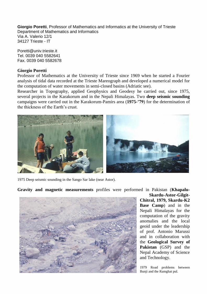
Researcher in Topography, applied Geophysics and Geodesy he carried out, since 1975,
several projects in the Karakorum and in the Nepali Himalayas. Two deep seismic sounding
campaigns were carried out in the Karakorum-Pamirs area (1975-’79) for the determination of
the thickness of the Earth‟s crust.
1975 Deep seismic sounding in the Sango Sar lake (near Astor).
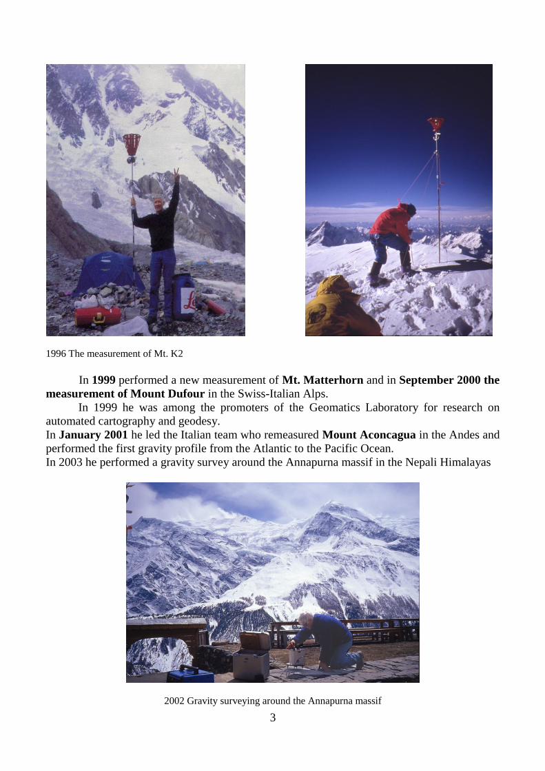
Gravity and magnetic measurements profiles were performed in Pakistan (Khapalu-
Skardu-Astor-Gilgit-
Chitral, 1979, Skardu-K2
Base Camp) and in the
Nepali Himalayas for the
computation of the gravity
anomalies and the local
geoid under the leadership
of prof. Antonio Marussi
and in collaboration with
the Geological Survey of
Pakistan (GSP) and the
Nepal Academy of Science
and Technology.
1979 Road problems between
Bunji and the Ramghat pul.

2
More gravity and magnetism profiles were observed in
Nepal during the „80ies ((Trisuli River Valley 1983,
Arun Valley 1986, Terai plains 1987, Kathmanndu-
Tatopani, Kathmandu-Lukla-Everest Base Camp
1992)) in collaboration with the Royal Nepal Academy
of Science and Technology (RONAST). Since 1987 he
is member of the Nepal Academy for Geological
sciences.
Nominated by Prof. Ardito Desio as member of
the EV-K2-CNR Committee for high altitude research,
participated in the construction of the High Altitude
Pyramid Laboratory near Everest Base Camp, and
carried out in 1991 an extensive GPS campaign in
Nepal and Southern Tibet in collaboration with the
National Bureau of Surveying and Mapping of China.
(NBSM).
In 1992 led the italian scientific team in a joint project
with NBSM and performed the first GPS measurement
of the summit of Mt Everest.
In 1995 he was awarded in Koeln (Germany) the price “Das Goldenen Lot” from the
“Verband der Vermessungsinjenieure” (Union of the German Surveyors) for the
measurement of Mt. Everest performed in 1992.
1992 The first measurement of Mt. Everest with topographic instruments on the summit and Benoit Chamoux
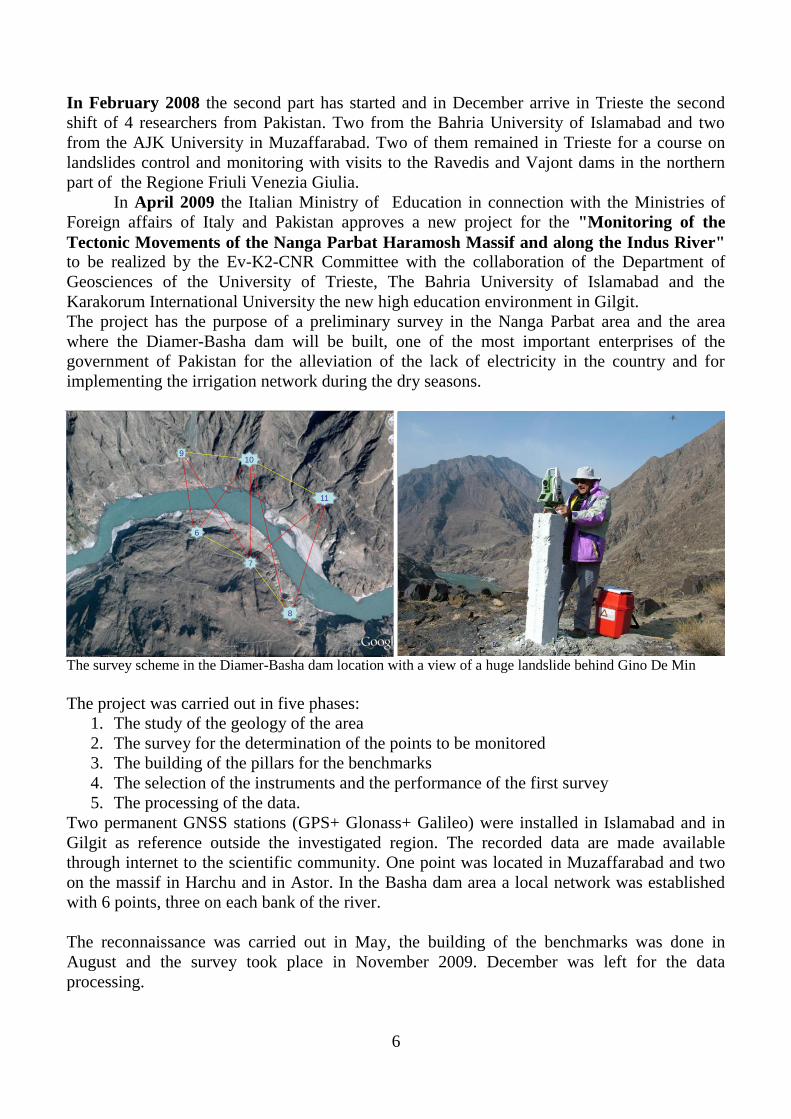
In 1996 carried out the measurement of Mt. K2 with classical and GPS technology in
collaboration with the PAGS and the Geological Survey of Pakistan.
3
1996 The measurement of Mt. K2
In 1999 performed a new measurement of Mt. Matterhorn and in September 2000 the
measurement of Mount Dufour in the Swiss-Italian Alps.
In 1999 he was among the promoters of the Geomatics Laboratory for research on
automated cartography and geodesy.
In January 2001 he led the Italian team who remeasured Mount Aconcagua in the Andes and
performed the first gravity profile from the Atlantic to the Pacific Ocean.
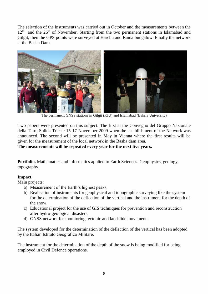
In 2003 he performed a gravity survey around the Annapurna massif in the Nepali Himalayas
2002 Gravity surveying around the Annapurna massif

4
In the years 2000-04 he realized a new system (ASTRA) for the establishment of
astrogeodetic stations and the determination of the deflection of the vertical. This instrument
was tested in the Alps, used during the campaign in Argentina and in a survey around the
Annapurna Massif in Nepal. ASTRA was also adopted by the Istituto Geografico Militare, the
official cartographic institute of Italy.
Since 2003 he is leading the project that realised a Ground Penetrating Radar (GPR)
coupled with a GPS for the measurement of the depth of the snow on the summit of snow
covered mountains and tested it on Mt. Everest (24th
May 2004) and Mont Blanc (September
2004).
2004 Surveying the depth of the snow on the summit of Mt Everest
With the participation of researchers appointed by the Pakistan Academy of Geological
Sciences, during the July 2004 Italian expedition to K2 he performed a geodetic link between
Base Camp (Gilkey Memorial), Urdukas, Askole and the trigonometric point in Skardu with
GPS instruments. The measurement of flow velocity of the Godwin Austen glacier was also
repeated.
2004 In Lahore with prof. F. A. Shams and Beth Shommer
In Decenber 2004 he was appointed as Fellow of the Pakistan Academy of
Geological Sciences and member of the committee on "short term disasters".

5
Following the 2005 announcement for Scientific Research Programmes of Relevant
National Interest (PRIN) the research programme was funded on "Statistical and Cinematic
GPS (Mobile Mapping Systems) and Geotechnical Methods for Monitoring Slopes and
Coasts" for which he was local scientific referent.
In the Summer 2006 the Region Friuli-Venezia Giulia approved his proposal of
International Cooperation for a technical-scientific aid to the reconstruction of earthquake
hit of area Kashmir. The project named "Realisation of a Geomatics Laboratory at the Azad
Jammu and Kashmir University (AJKU) for the Management of the Hydro-Geologic and
Seismic Risk" aims at establishing contacts between researchers of the University of Azad
Kashmir and the scientists who took part in the reconstruction of Friuli after the '76
earthquake. The project is based on a three years programme.
2006 Visit to the AJK University in Muzaffarabad
The first part of this project, involving the training in Italy of four Pakistani researchers, was
carried out between April and October 2007.
On the Ravedis dam (PN-Italy) Near the Vajont dam (PN-Italy)
6
In February 2008 the second part has started and in December arrive in Trieste the second
shift of 4 researchers from Pakistan. Two from the Bahria University of Islamabad and two
from the AJK University in Muzaffarabad. Two of them remained in Trieste for a course on
landslides control and monitoring with visits to the Ravedis and Vajont dams in the northern
part of the Regione Friuli Venezia Giulia.
In April 2009 the Italian Ministry of Education in connection with the Ministries of
Foreign affairs of Italy and Pakistan approves a new project for the "Monitoring of the
Tectonic Movements of the Nanga Parbat Haramosh Massif and along the Indus River" to be realized by the Ev-K2-CNR Committee with the collaboration of the Department of
Geosciences of the University of Trieste, The Bahria University of Islamabad and the
Karakorum International University the new high education environment in Gilgit.
The project has the purpose of a preliminary survey in the Nanga Parbat area and the area
where the Diamer-Basha dam will be built, one of the most important enterprises of the
government of Pakistan for the alleviation of the lack of electricity in the country and for
implementing the irrigation network during the dry seasons.
6
7
910
11
8
32
The survey scheme in the Diamer-Basha dam location with a view of a huge landslide behind Gino De Min
The project was carried out in five phases:
1. The study of the geology of the area
2. The survey for the determination of the points to be monitored
3. The building of the pillars for the benchmarks
4. The selection of the instruments and the performance of the first survey
5. The processing of the data.
Two permanent GNSS stations (GPS+ Glonass+ Galileo) were installed in Islamabad and in
Gilgit as reference outside the investigated region. The recorded data are made available
through internet to the scientific community. One point was located in Muzaffarabad and two
on the massif in Harchu and in Astor. In the Basha dam area a local network was established
with 6 points, three on each bank of the river.
The reconnaissance was carried out in May, the building of the benchmarks was done in
August and the survey took place in November 2009. December was left for the data
processing.

7
"Aspettami laggiù, non mancherò d'incontrarti in quella vuota valle …." E. A. Poe
August 2009 at the Diamer- Basha
dam area: 48°C, 0% humidity
8
The selection of the instruments was carried out in October and the measurements between the
12th
and the 26th
of November. Starting from the two permanent stations in Islamabad and
Gilgit, then the GPS points were surveyed at Harchu and Rama bungalow. Finally the network
at the Basha Dam.
23
22
The permanent GNSS stations in Gilgit (KIU) and Islamabad (Bahria University)
Two papers were presented on this subject. The first at the Convegno del Gruppo Nazionale
della Terra Solida Trieste 15-17 November 2009 when the establishment of the Network was
announced. The second will be presented in May in Vienna where the first results will be
given for the measurement of the local network in the Basha dam area.
The measurements will be repeated every year for the next five years.
Portfolio. Mathematics and informatics applied to Earth Sciences. Geophysics, geology,
topography.
Impact.
Main projects:
a) Measurement of the Earth‟s highest peaks,
b) Realisation of instruments for geophysical and topographic surveying like the system
for the determination of the deflection of the vertical and the instrument for the depth of
the snow.
c) Educational project for the use of GIS techniques for prevention and reconstruction
after hydro-geological disasters.
d) GNSS network for monitoring tectonic and landslide movements.
The system developed for the determination of the deflection of the vertical has been adopted
by the Italian Istituto Geografico Militare.
The instrument for the determination of the depth of the snow is being modified for being
employed in Civil Defence operations.

9
The complete list of Publications can be seen on the web-site giorgio poretti.
1. I. Finetti, F. Giorgetti, G. Poretti - The Pakistani segment of the DSS Profile Nanga Parbat-Karakul (1974-1975).
Bollettino di Geofisica Teorica e Applicata, Vol. XXI, n. 83, Trieste, 1979.
2. I. Finetti, F. Giorgetti, G. Poretti - Seismicke Isledovanje na ugiatske profilie Zorkul-Nanga Parbat. The Pamirs-
Himalayas Deep Structure of the Earth Crust. Nauka, Moskow, 1982.
3. C. Ebblin, A. Marussi, G. Poretti, M. Rahim, P. Richardus - Gravity Measurements in the Karakorum. Boll. di
Geofisica Teorica e Applicata, n. 99-100, Trieste, 1983.
4. I. Finetti, G. Poretti, M. A. Mirza - Crustal Structure of the Karakorum Range along the DSS Profile Nanga Parbat-
Karakul. Boll. Geofisica Teorica e Applicata, n. 99-100, Trieste, 1983.
5. G. Poretti - Magnetic Profiles along the Karakorum Range. Bollettino di Geofisica Teorica e Applicata, n. 99-100,
Trieste 1983.
6. G. Poretti. - Gravity Anomalies in North Eastern Afghanistan and on the Pamirs Syntaxis. Himalaya-Karakorum
Workshop 13-15 February 1987. di "Rendiconti Lincei. Scienze Fisiche e Naturali, vol. II 1990".
7. G. Poretti, G. Baticci. - Gravity Models of the Deep Structures of the Karakorum Range. Himalayan-Karakorum-Tibet
Workshop meeting. 5-6 October 1988. "Rendiconti-Sez. B: Scienze Chimiche e Fisiche, Geologiche e Minerarie", vol.
124 (1990), dell'Istituto Lombardo Accademia di Scienze e Lettere.
8. G. Poretti, G. Baticci & P. Signanini. - Gravity anomaly Profiles in Central and Eastern Nepal. Himalayan-
Karakorum-Tibet Workshop meeting. 5-6 October 1988. (Pubblicato il solo abstract a cura del convegno).
9. N. Cingolani, F. Pergolani, G. Poretti e P. Signanini. Prospezioni sismiche a ridotta profondità: nuovi metodi di
acquisizione ed elaborazione dati in relazione alle problematiche connesse con la pianificazione territoriale. Memorie
della Società Geologica Italiana vol. n. 37, 1987.
10. M. Anzidei, G. Poretti et al. La rete Geodetica GPS del Nepal Orientale nell'ambito del progetto EV-K2-CNR. Atti
dell'11° convegno annuale del gruppo Nazionale di Geofisica della Terra Solida. Roma 9-11 dicembre 1992.
11. Giorgio Poretti. Das Mt. Everest Abenteuer. Der Vermessungsingenieur 4/93. Verlag Chemielorz, Wiesbaden 1993.
12. Giorgio Poretti. The new measurement of Mt. Everest. Dal volume “Everest minus 2 metres”. Ed. Initiative Paris 1993.
Italian-German e Franch-English
13. Giorgio Poretti, C. Marchesini e A. Beinat. GPS Surveys Mount Everest. GPS World October 1994. Pgg. 32-44
14. Giorgio Poretti, Agostino da Polenza. La medicion del Siglo dell’Everest. Universitad Politecnica de Madrid, III
Jornadas tecnicas 15. Abril 1996.
15. G. Poretti, C. Marchesini, A. Beinat, F. Palmieri, A. Fatmi, A. Marchesini & I. H. Shah. Misure geodetiche in
Himalaya e nuova misura del K2. Dal volume “Ragni sul K2” Ed. Ferrari, 1996.
16. R. Purrucherr, M. Eckardt, B. Kettling & G. Poretti. Misure glaciologiche sul Ghiacciaio Godwin Austen. Dal volume
“Ragni sul K2” Ed. Ferrari, 1996.
17. Giorgio Poretti. High altitude surveying in the Himalayas. Proceedings of the First Meeting on Cartography around
15° East. Supplemento al n. 1/1998 della Rassegna Tecnica del FVG. Pp.15-17.
18. Giorgio Poretti. Geophysical, Geological and Geographycal features of the Himalayas. Ecovision World Monograph
Series, Backhuys Publishers, Leiden 1998; pp.19-34.
19. Giorgio Poretti. 150 years of measuring in the Himalayas. Reporter n. 41, Leica Heerbrugg, 1999; pp 13-19
10
20. G. Poretti. Das Mt. Everest Abenteuer-wie die neue Hohe errechnet würde. Der Vermessungsingenieur 2/2000. Verlag
Chemielorz, Wiesbaden; pp. 100-101.
21. Giorgio Poretti, R. Purrucherr, C. Marchesini, A. Beinat, M. Eckart & A. Marchesini. Geodetic Measurements in the
Himalayas and New Measurement of Mount K2. Bollettino di Geofisica Teorica ed Applicata.Vol. 41 n. 3-4, pp. 219-
231, 2000.
22. Marco Lipizer, Claudio Marchesini and Giorgio Poretti. ASTRA: a new system for the measurement of the deflection of
the vertical in Nepal. Proceedings of the 3rd
International Workshop on the Mountains Kathmandu 3-9 March 2002.
23. G. Poretti, M. Lipizer, C. Marchesini, A. Marchesini e J. Suarez . La misura dell'Aconcagua. Atti del XXI Convegno
Nazionale GNTGS (19-21 novembre 2002). ISBN 88-900385-5- 1.
24. G. Poretti. Gravity Profiles in Central and Eastern Nepal. Proceedings of the 4th
International Conference on the
Mountain Research; Kathmandu 7-9 March 2004.
25. G. Poretti, R. Mandler, M. Lipizer. Exakte Bestimmung des Mount Everest. Verlag Chemielorz. Der
Vermessungsingenieur. 5/2005 pp. 414-23.
26. G. Poretti. The Height of the Karakorum-Himalaya Mountain Range. Proceedings of the International Karakorum
Conference 26-28 Aprile 2005.
27. G. Poretti, R. Mandler, G. Targa, M. Bertoli, Riaz ul Hassan, G. Donegà and M. Poretti. The GPS Link Between the
Trigonometric Point in Skardu and the Gilkey-Puchoz Memorial at K2 Base Camp. Proceedings of the Internatinal
Karakorum Conference Islamabad 26-28 aprile 2005.
28. G. Poretti, R. Mandler, M. Lipizer. The Height of Mountains. Bollettino di Geofisica Teorica ed Applicata; vol n. 47
12/2006.
29. G. Poretti, R. Mandler, M. Lipizer. The GPS Station at the Pyramid Geodetic Laboratory. Bollettino di Geofisica
Teorica ed Applicata. vol. n. 47; 12/2006.
30. G. Poretti. Il metodo gravimetrico per conoscere il sottosuolo. Rassegna Tecnica del Friuli-Venezia Giulia. n. 3;
giugno-luglio 2006; pp. 15-18
31. G. Poretti. Is Mt. Everest Higher than 100 Years Ago. Su "The Seventy great Misteries of the Natural World" Ed.
Thames & Hudson London pp.68-70, 12/2007.
32. Poretti, G., C. Calligaris, S. Tariq, H. Khan, F. Zubair and G. De Min. 2010. Geological, Geophysical and
Topographic Measurements in the Diamer Basha Dam Area. European Geosciences Union General
Assembly 2010, Vienna, Austria, 2-7 May, 2010 (Abstract)
33. Poretti, G., C. Calligaris, S. Tariq, H. Khan, F. Zubair, & A. Mereu. 2009. The Monitoring of the Nanga
Parbat-Haramosh Massif. GNGTS Conference, Trieste, Italy, 16-19 November, 2009.