gis 1 gis lecture 4 geodatabases. gis 2 outline administrative data example data tables data joins...
TRANSCRIPT
GIS 1
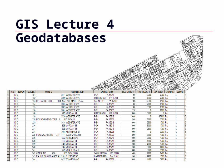
GIS Lecture 4Geodatabases
GIS 2
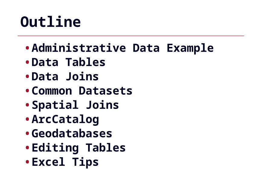
Outline
•Administrative Data Example•Data Tables•Data Joins•Common Datasets•Spatial Joins•ArcCatalog•Geodatabases•Editing Tables•Excel Tips
GIS 3
Administrative Data Example
GIS 4
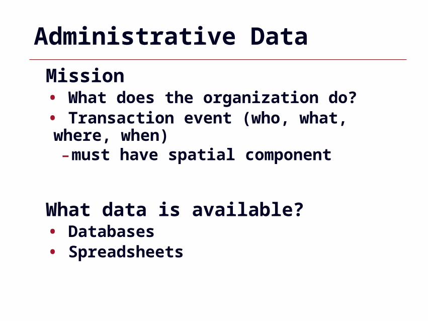
Administrative Data
Mission • What does the organization do?• Transaction event (who, what, where, when)-must have spatial component
What data is available? • Databases• Spreadsheets
GIS 5
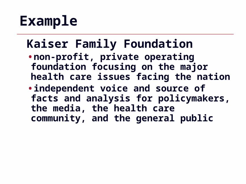
Example
Kaiser Family Foundation•non-profit, private operating foundation focusing on the major health care issues facing the nation
•independent voice and source of facts and analysis for policymakers, the media, the health care community, and the general public
GIS 6
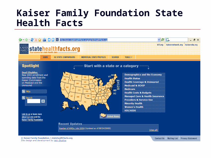
Kaiser Family Foundation State Health Facts
GIS 7
Collects Data on all 50 States
•Demographics and the Economy•Health Status•Health Coverage and Uninsured•Medicaid and SCHIP•Medicare•Health Costs and Budgets•Managed Care and Health Insurance•Providers and Service Use•Minority Health •Women’s Health•HIV/AIDS
GIS 8
Data Tables
GIS 9
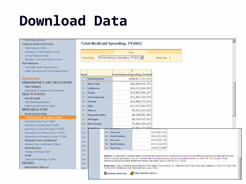
Download Data
GIS 10
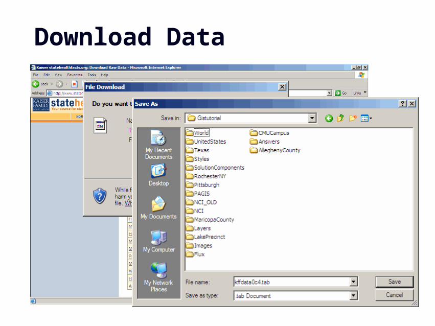
Download Data
GIS 11
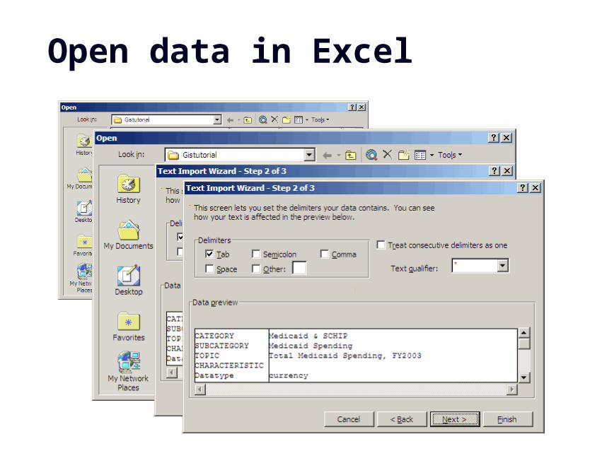
Open data in Excel
GIS 12
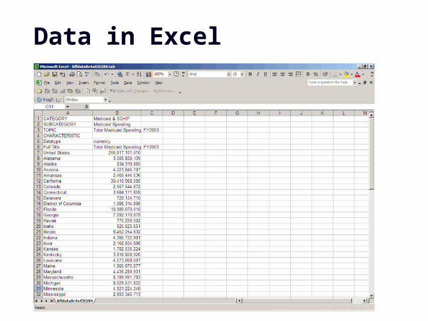
Data in Excel
GIS 13
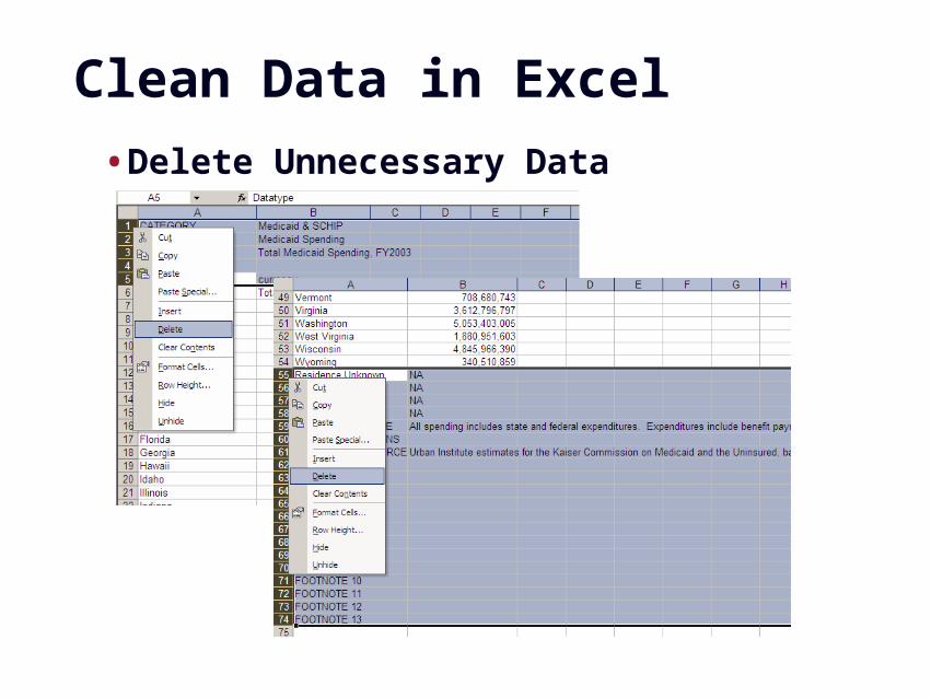
Clean Data in Excel
•Delete Unnecessary Data
GIS 14
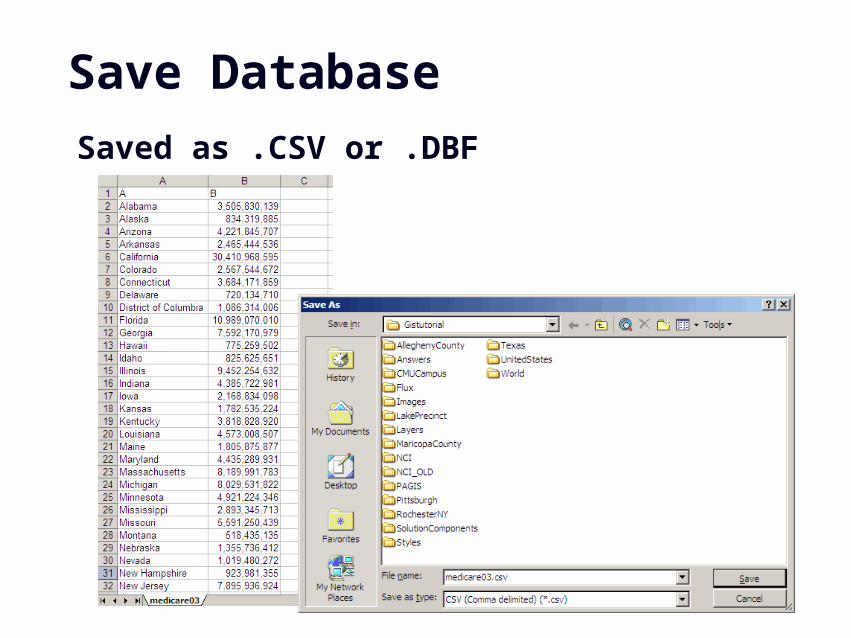
Save Database
Saved as .CSV or .DBF
GIS 15
Data Joins
GIS 16
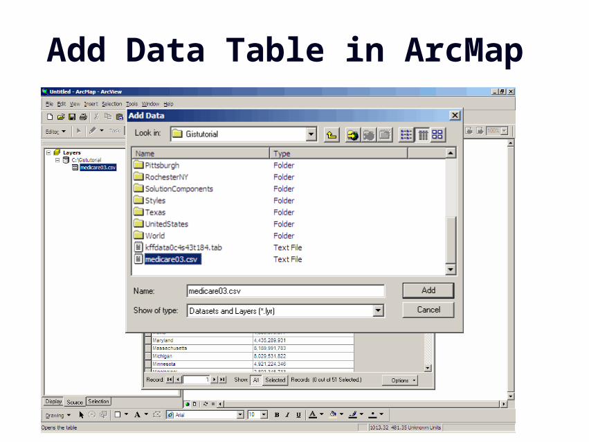
Add Data Table in ArcMap
GIS 17
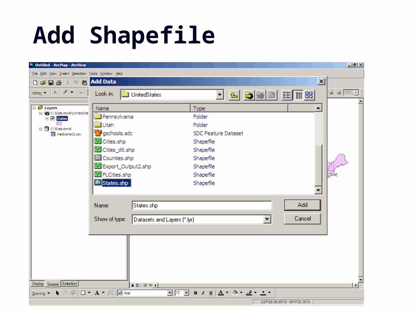
Add Shapefile
GIS 18
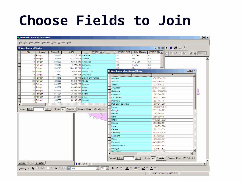
Choose Fields to Join
GIS 19
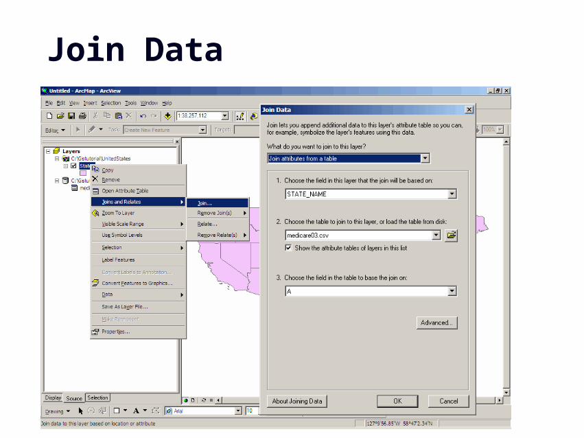
Join Data
GIS 20
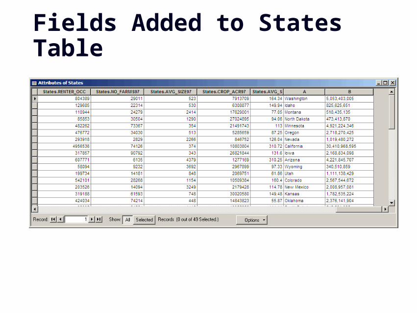
Fields Added to States Table
GIS 21
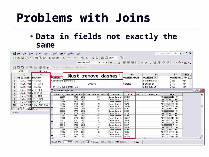
Problems with Joins
Must remove dashes!
• Data in fields not exactly the same
GIS 22
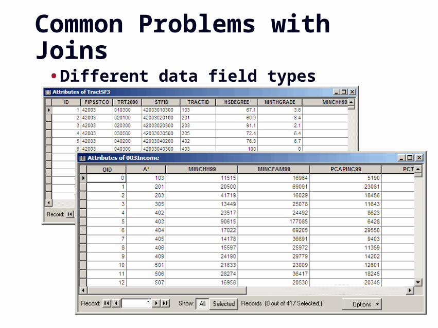
Common Problems with Joins
•Different data field types
GIS 23
Problems with Joins
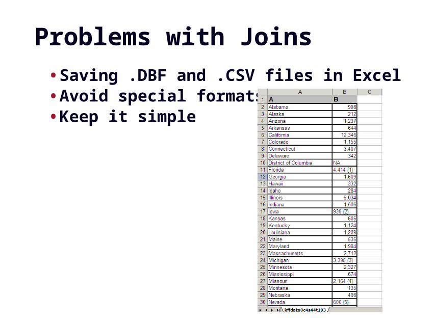
•Saving .DBF and .CSV files in Excel•Avoid special formats•Keep it simple
GIS 24
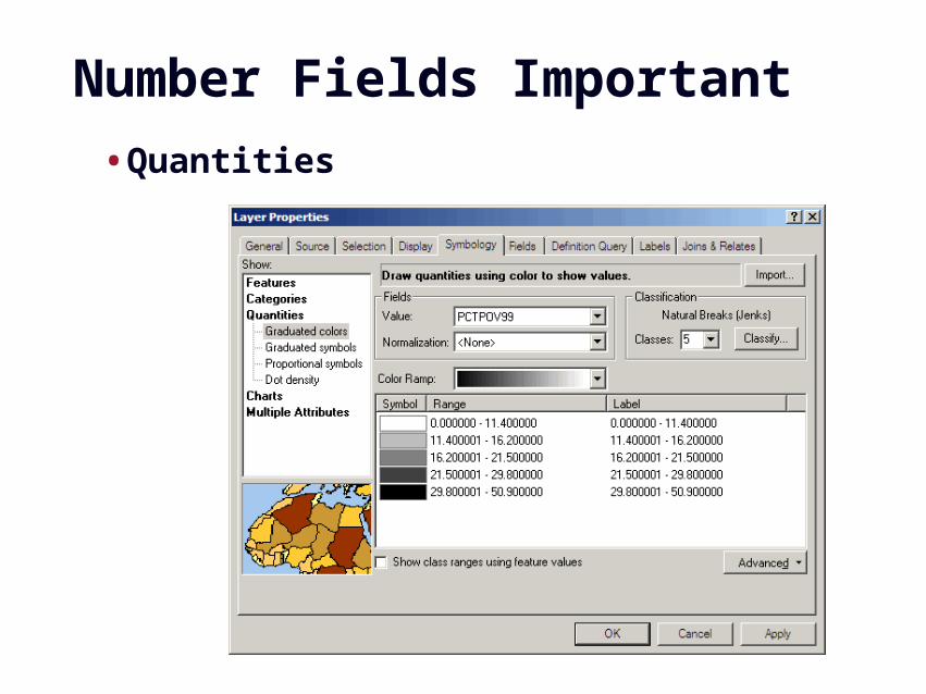
Number Fields Important
•Quantities
GIS 25
Common Datasets
GIS 26
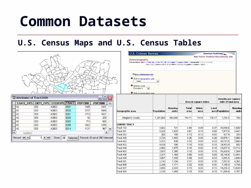
Common Datasets U.S. Census Maps and U.S. Census Tables
GIS 27
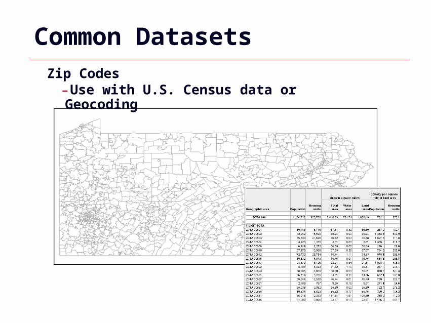
Common DatasetsZip Codes-Use with U.S. Census data or Geocoding
GIS 28
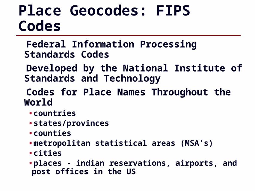
Place Geocodes: FIPS Codes
Federal Information Processing Standards Codes
Developed by the National Institute of Standards and Technology
Codes for Place Names Throughout the World•countries•states/provinces•counties•metropolitan statistical areas (MSA’s)•cities•places - indian reservations, airports, and post offices in the US
GIS 29
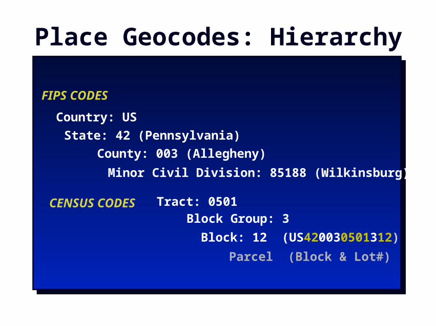
Place Geocodes: Hierarchy
Country: US
FIPS CODES
County: 003 (Allegheny)
State: 42 (Pennsylvania)
Tract: 0501
Block: 12 (US420030501312)
Block Group: 3CENSUS CODES
Minor Civil Division: 85188 (Wilkinsburg)
Parcel (Block & Lot#)
GIS 30
Other Datasets
•Contact agencies•Obtain data on-line

GIS 31
Spatial Joins
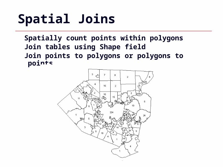
GIS 32
Spatial JoinsSpatially count points within polygonsJoin tables using Shape fieldJoin points to polygons or polygons to points
GIS 33
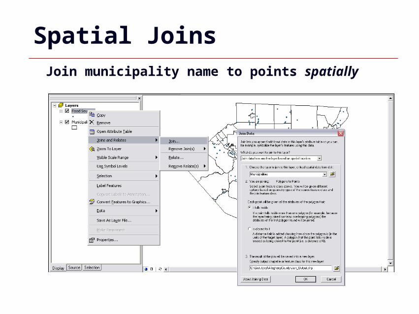
Spatial JoinsJoin municipality name to points spatially
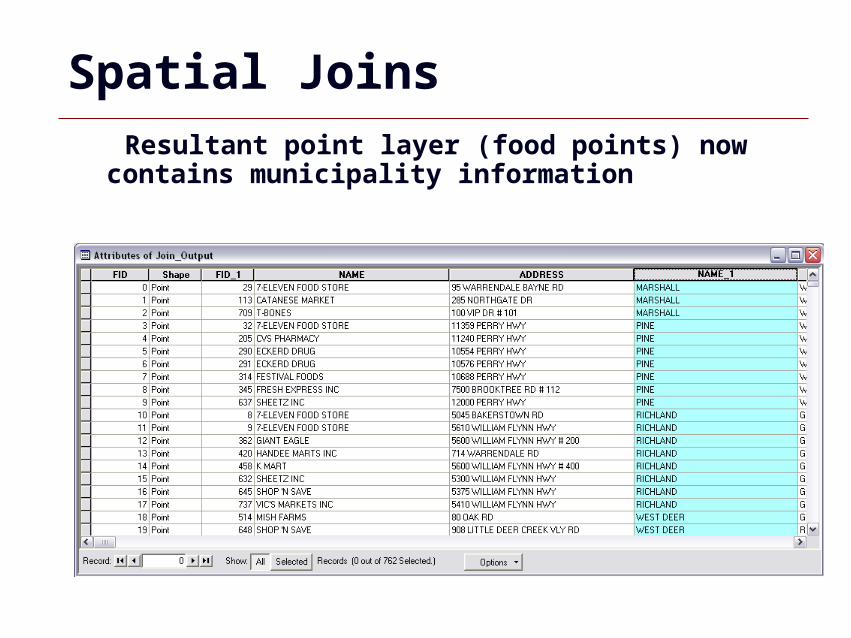
GIS 34
Spatial Joins Resultant point layer (food points) now contains municipality information
GIS 35
Aggregate Data
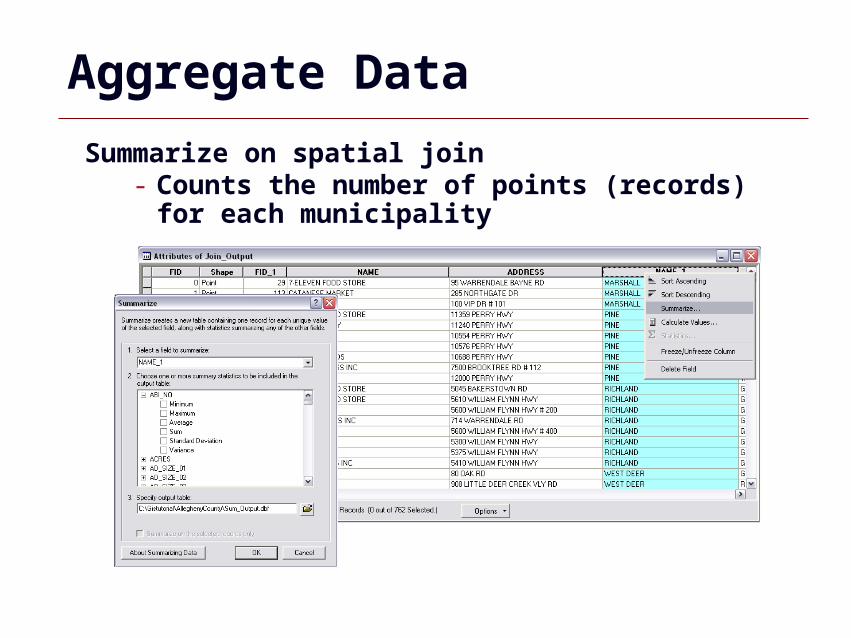
Summarize on spatial join- Counts the number of points (records) for each
municipality
GIS 36
Aggregate Data
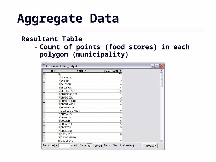
Resultant Table- Count of points (food stores) in each polygon
(municipality)
GIS 37
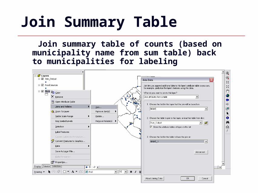
Join Summary Table Join summary table of counts (based on municipality name from sum table) back to municipalities for labeling
GIS 38
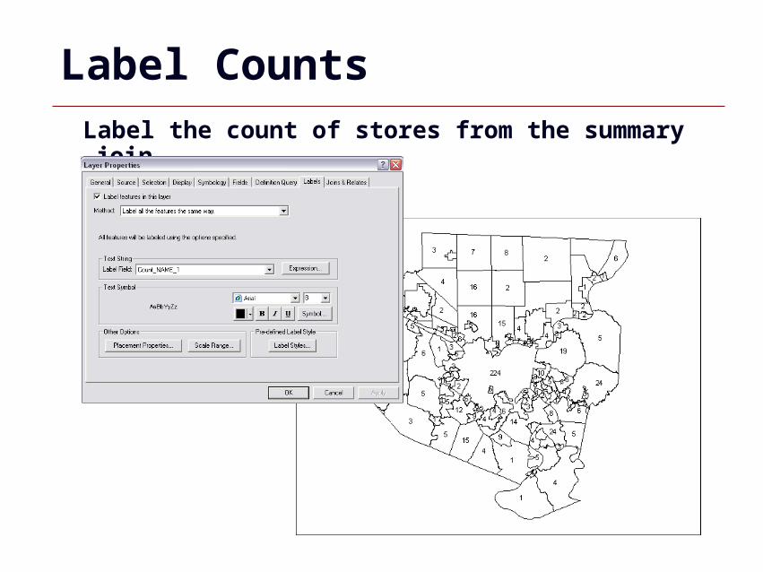
Label CountsLabel the count of stores from the summary join
GIS 39
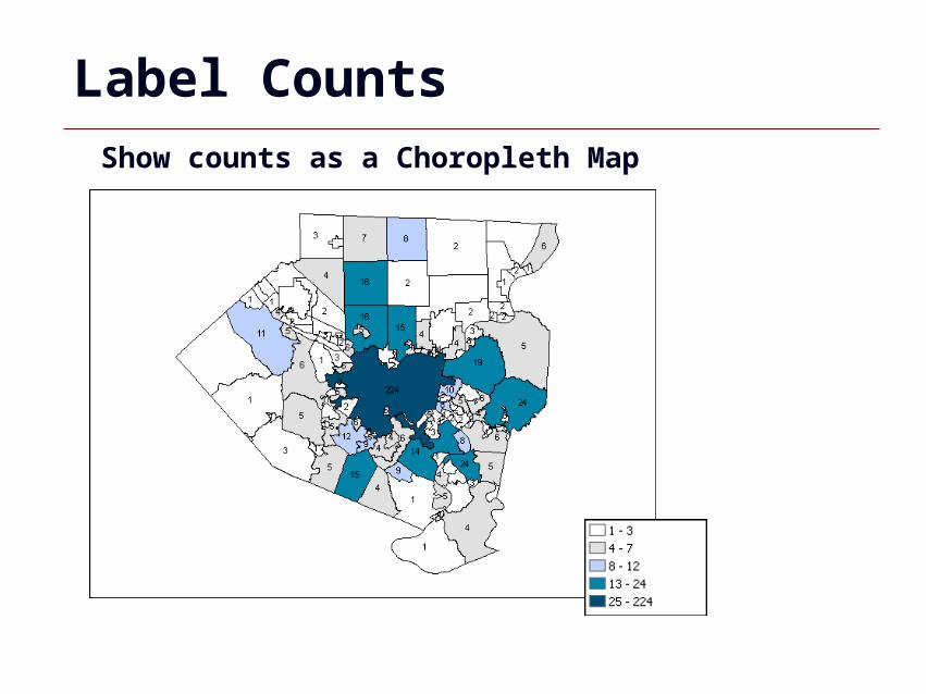
Label CountsShow counts as a Choropleth Map
GIS 40
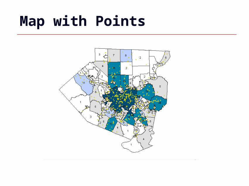
Map with Points
GIS 41
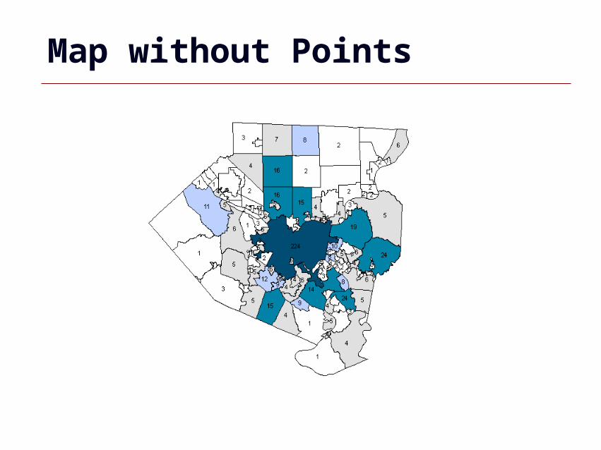
Map without Points

GIS 42
ArcCatalog
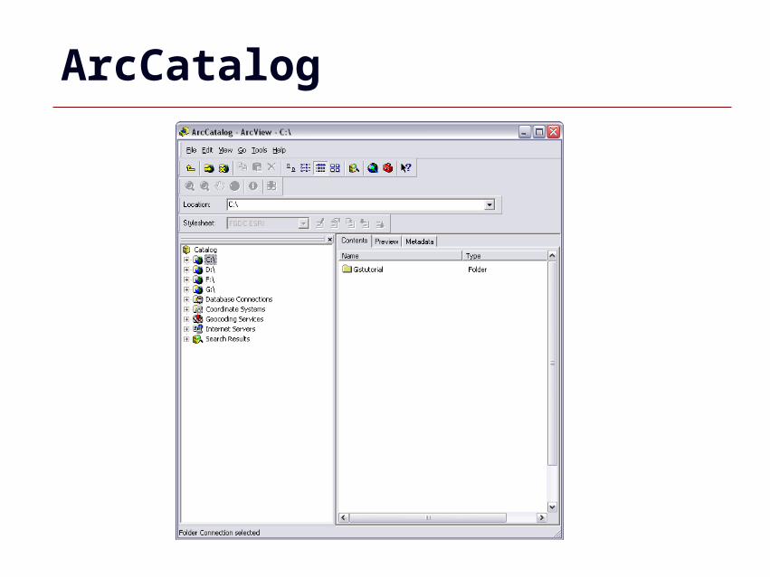
GIS 43
ArcCatalog
GIS 44
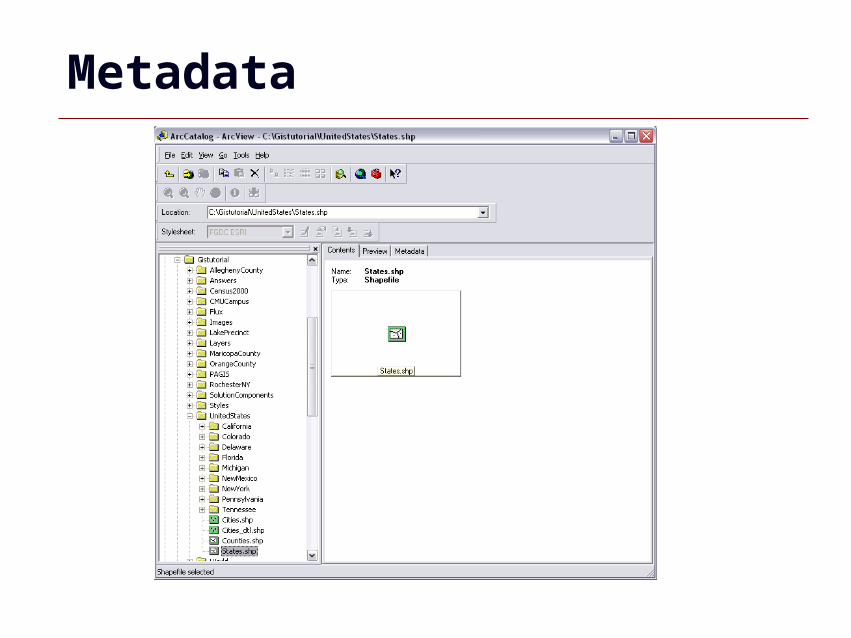
Metadata
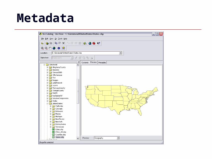
GIS 45
Metadata
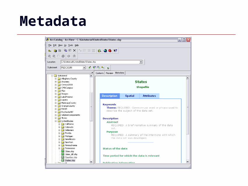
GIS 46
Metadata
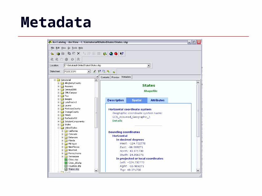
GIS 47
Metadata

GIS 48
Metadata
GIS 49
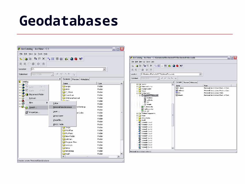
Geodatabases
GIS 50
Geodatabase
•Represents geographic features and attributes as objects and is hosted inside a relational database management system
•Manages coverages, grids, and shapefiles inside a database management system, or DBMS
GIS 51
Enterprise Geodatabases
•Requires a ‘host’ DBMS -SQL Server, Oracle, or IBM DB2
GIS 52
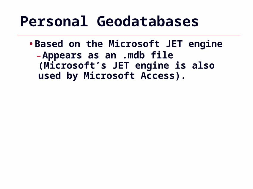
Personal Geodatabases
•Based on the Microsoft JET engine -Appears as an .mdb file (Microsoft’s JET engine is also used by Microsoft Access).
GIS 53
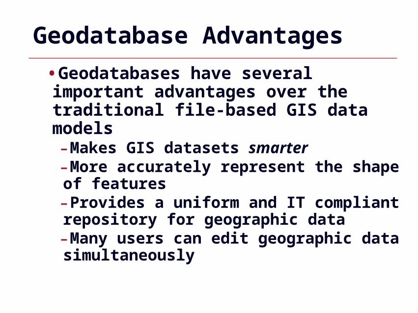
Geodatabase Advantages
•Geodatabases have several important advantages over the traditional file-based GIS data models-Makes GIS datasets smarter-More accurately represent the shape of features-Provides a uniform and IT compliant repository for geographic data-Many users can edit geographic data simultaneously
GIS 54
Geodatabases
GIS 55
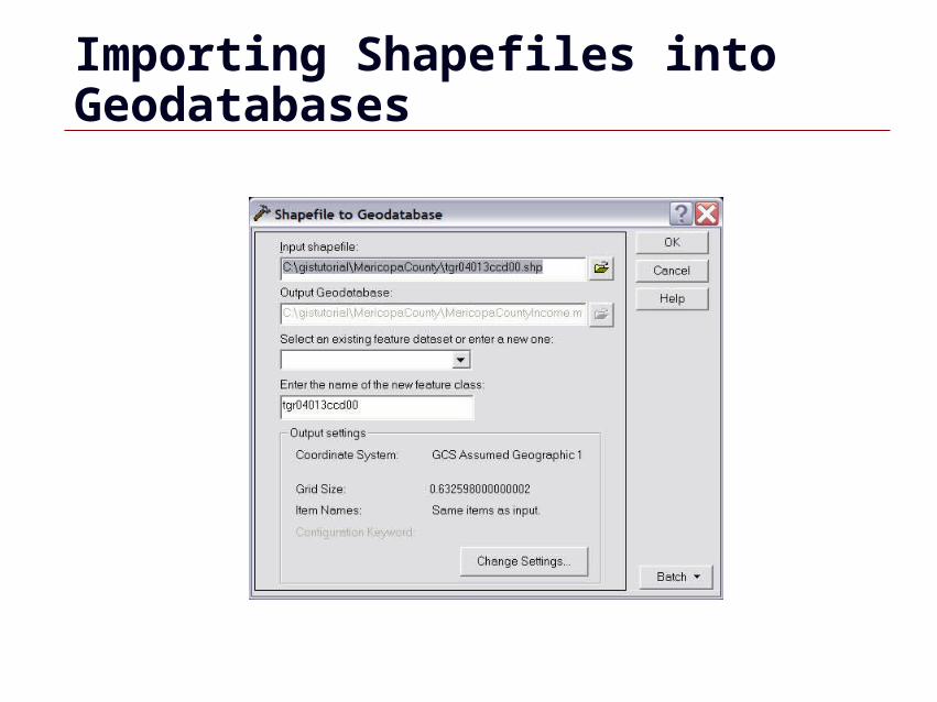
Importing Shapefiles into Geodatabases
GIS 56
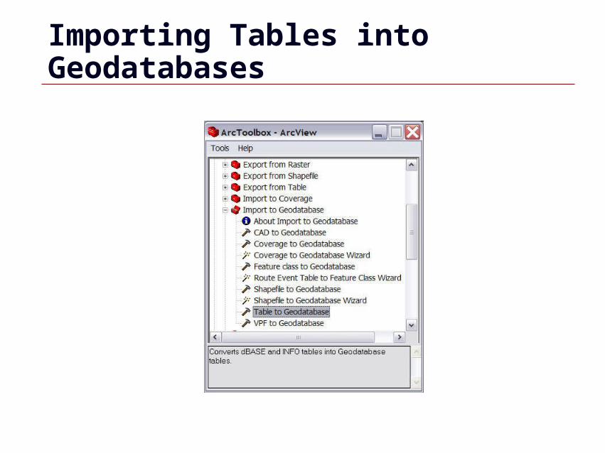
Importing Tables into Geodatabases
GIS 57
dBASE and Tables
GIS 58
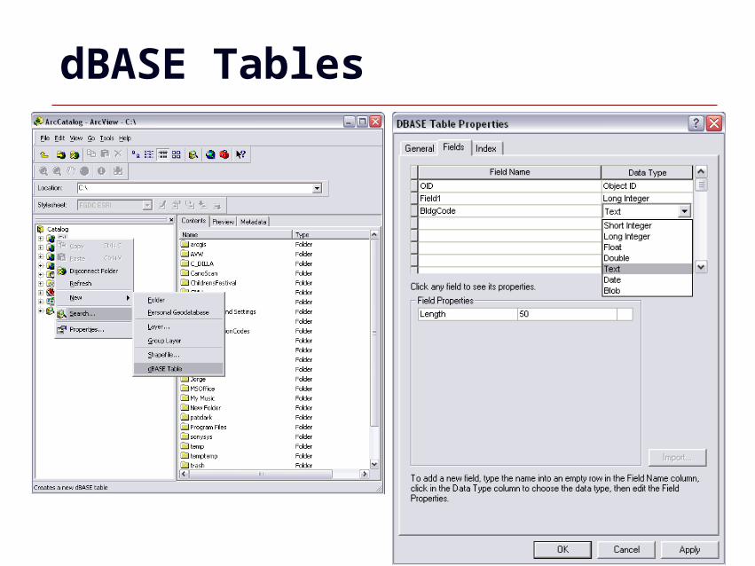
dBASE Tables
GIS 59
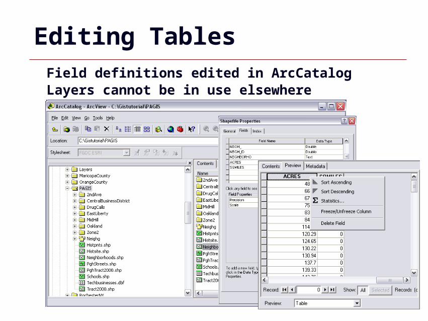
Editing TablesField definitions edited in ArcCatalogLayers cannot be in use elsewhere
GIS 60
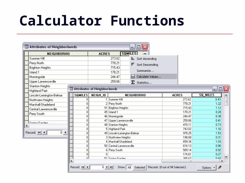
Calculator Functions
GIS 61
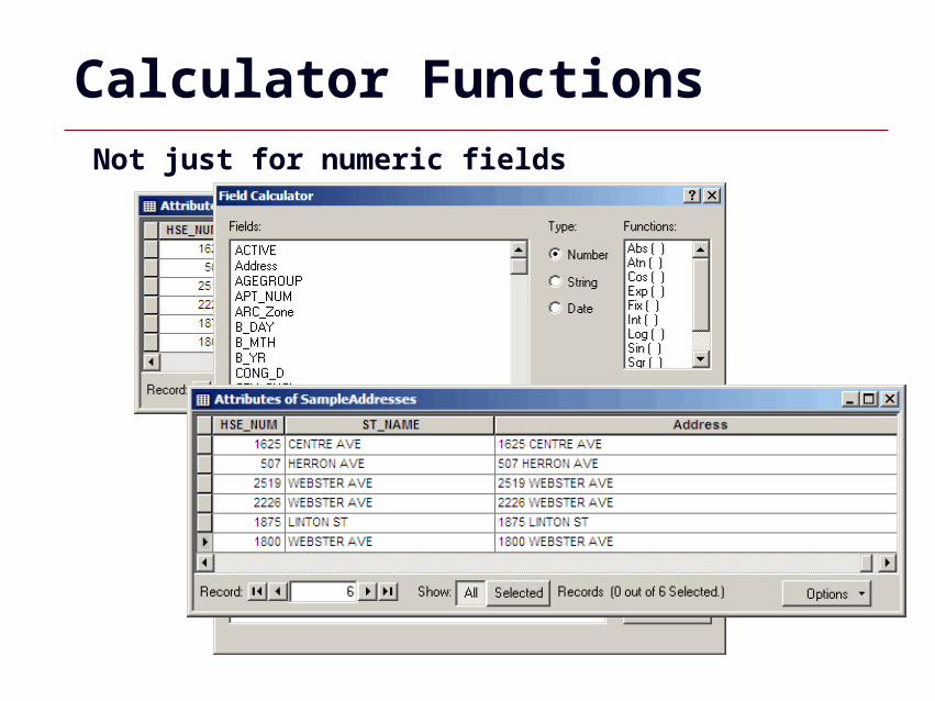
Calculator FunctionsNot just for numeric fields

GIS 62
Excel Tips and Tricks
GIS 63
Excel Tips and Tricks
•Formatting•Find and Replace•Transpose•MID Function•Concatenate
GIS 64
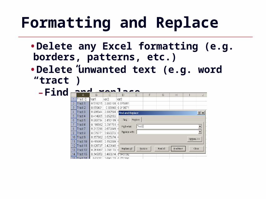
Formatting and Replace
•Delete any Excel formatting (e.g. borders, patterns, etc.)
•Delete unwanted text (e.g. word “tract”)-Find and replace
GIS 65
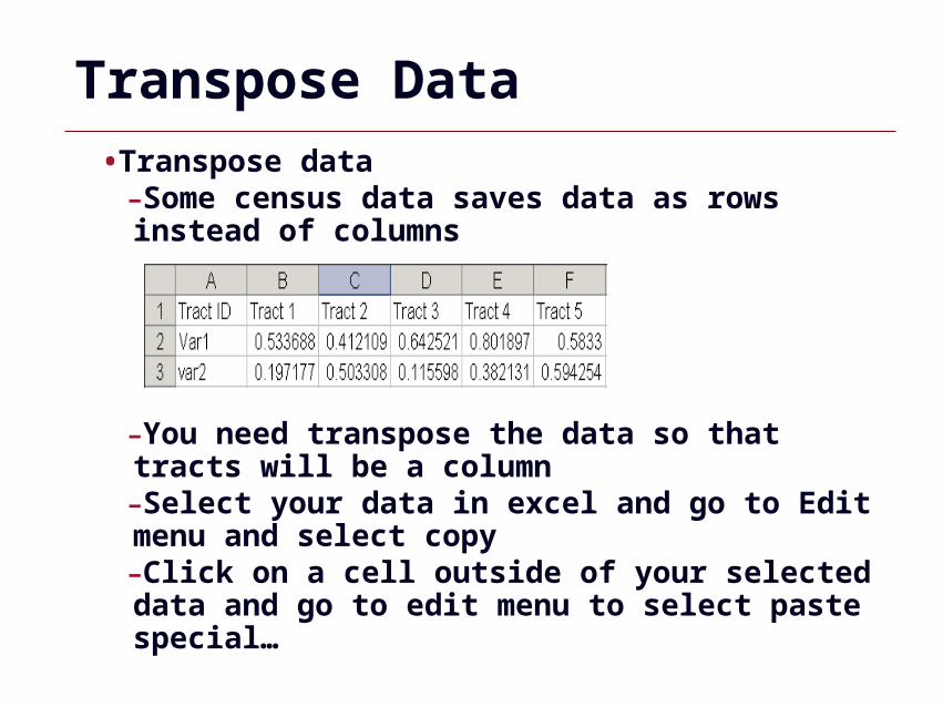
Transpose Data
•Transpose data-Some census data saves data as rows instead of columns
-You need transpose the data so that tracts will be a column-Select your data in excel and go to Edit menu and select copy-Click on a cell outside of your selected data and go to edit menu to select paste special…
GIS 66
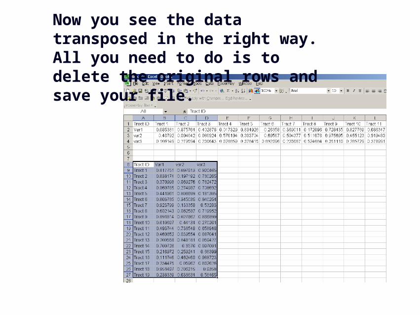
Now you see the data transposed in the right way. All you need to do is to delete the original rows and save your file.
GIS 67
Mid Function
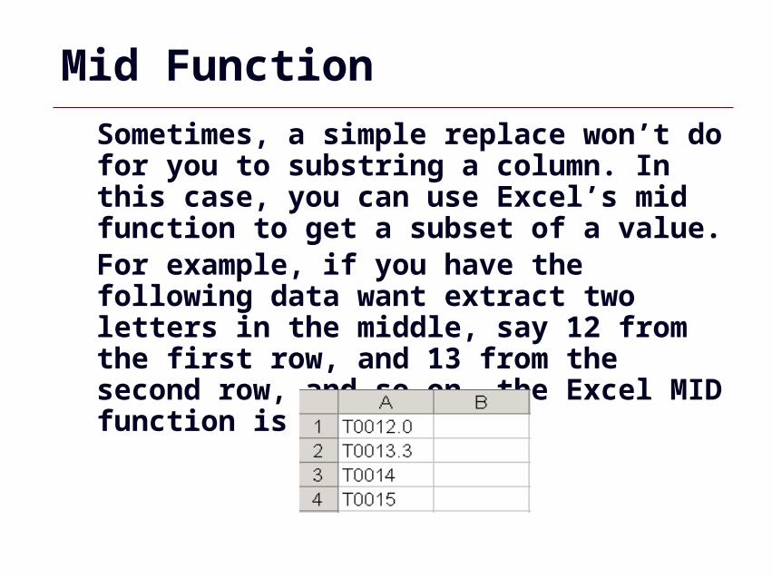
Sometimes, a simple replace won’t do for you to substring a column. In this case, you can use Excel’s mid function to get a subset of a value.For example, if you have the following data want extract two letters in the middle, say 12 from the first row, and 13 from the second row, and so on, the Excel MID function is your choice.
GIS 68
Mid Function
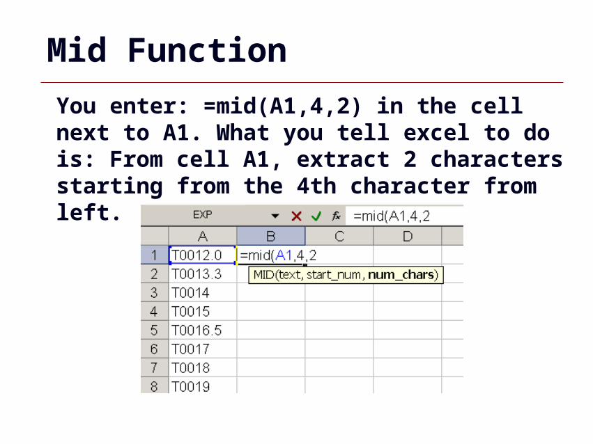
You enter: =mid(A1,4,2) in the cell next to A1. What you tell excel to do is: From cell A1, extract 2 characters starting from the 4th character from left.
GIS 69
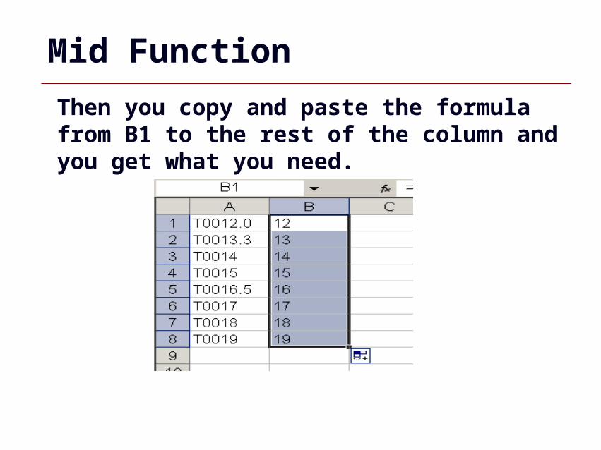
Mid Function
Then you copy and paste the formula from B1 to the rest of the column and you get what you need.
GIS 70
Concatenate Strings
Sometimes you need add certain string before or after a value, and sometimes you want to combine two values. The excel CONCATENATE function makes that happen for you.
GIS 71
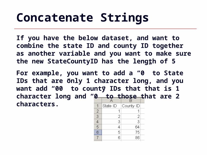
If you have the below dataset, and want to combine the state ID and county ID together as another variable and you want to make sure the new StateCountyID has the length of 5
For example, you want to add a “0” to State IDs that are only 1 character long, and you want add “00” to county IDs that that is 1 character long and “0” to those that are 2 characters.
Concatenate Strings
GIS 72
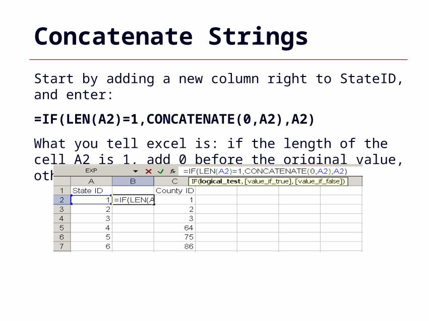
Start by adding a new column right to StateID, and enter:
=IF(LEN(A2)=1,CONCATENATE(0,A2),A2)
What you tell excel is: if the length of the cell A2 is 1, add 0 before the original value, otherwise, keep the original value
Concatenate Strings
GIS 73
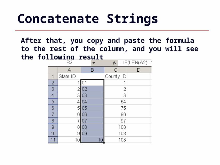
After that, you copy and paste the formula to the rest of the column, and you will see the following result
Concatenate Strings
GIS 74
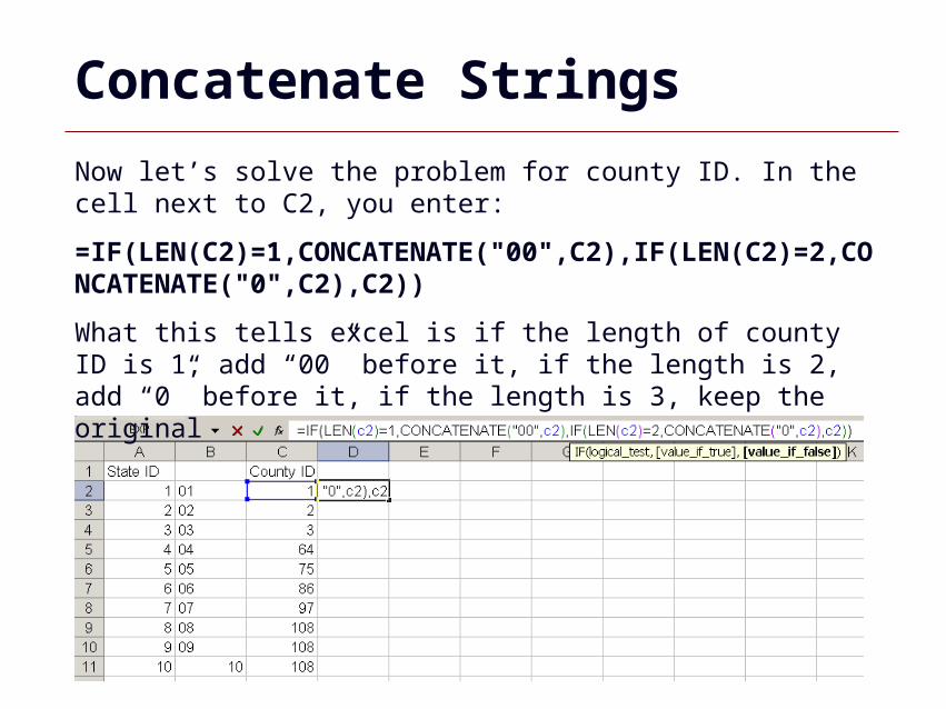
Now let’s solve the problem for county ID. In the cell next to C2, you enter:
=IF(LEN(C2)=1,CONCATENATE("00",C2),IF(LEN(C2)=2,CONCATENATE("0",C2),C2))
What this tells excel is if the length of county ID is 1, add “00” before it, if the length is 2, add “0” before it, if the length is 3, keep the original
Concatenate Strings
GIS 75
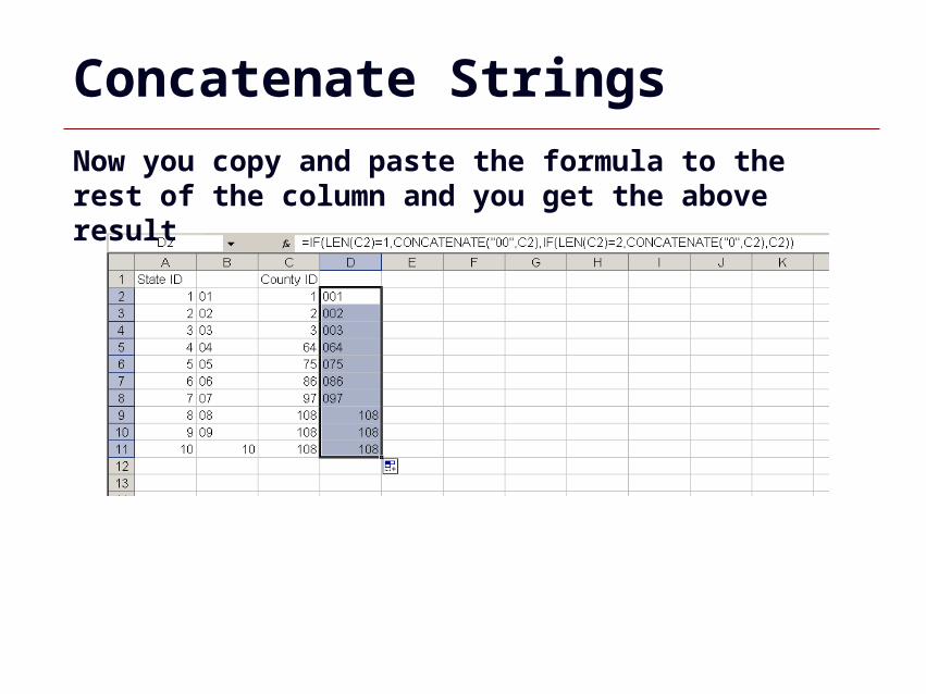
Now you copy and paste the formula to the rest of the column and you get the above result
Concatenate Strings
GIS 76
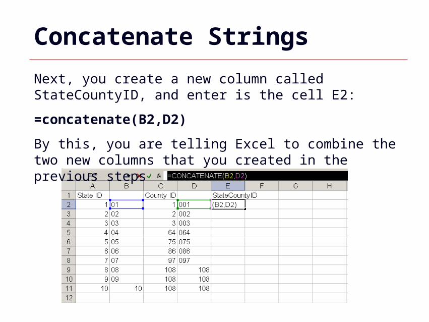
Next, you create a new column called StateCountyID, and enter is the cell E2:
=concatenate(B2,D2)
By this, you are telling Excel to combine the two new columns that you created in the previous steps
Concatenate Strings
GIS 77
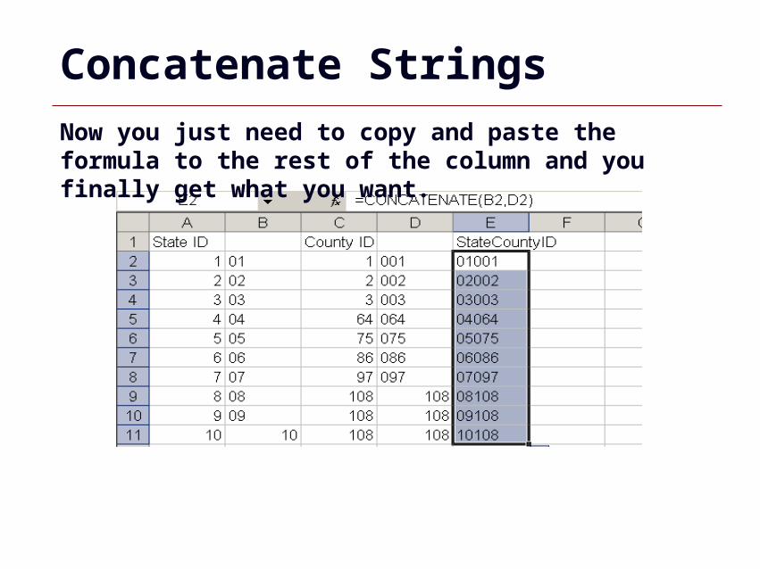
Now you just need to copy and paste the formula to the rest of the column and you finally get what you want.
Concatenate Strings
GIS 78
Other Excel Functions
You might want to learn some other excel functions that could help you clean the data, such as:• Right()• Left()• Exact()
GIS 79
Summary
•Administrative Data Example•Data Tables•Data Joins•Common Datasets•Spatial Joins•ArcCatalog•Geodatabases•Editing Tables•Excel Tips