gis: an overview - wordpress.com · 1/6/2017 · a geographic information system or ... on...
TRANSCRIPT
GIS: An Overview Mr. Mic Ivan V. Sumilang, EnP
Senior Research Specialist Phil LiDAR 2
January 14, 2017Calapan City, Oriental Mindoro
Short Course on Environmental PlanningDCERP & HUMEIN Phils. Inc.
1
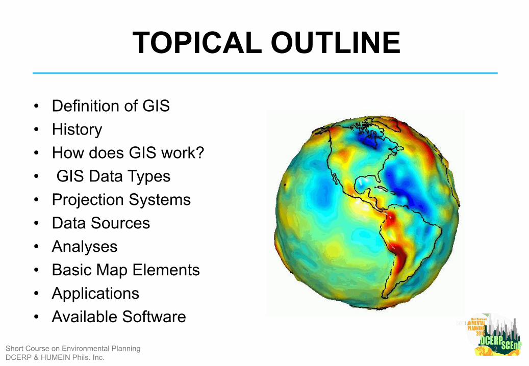
TOPICAL OUTLINE
• Definition of GIS • History• How does GIS work?• GIS Data Types • Projection Systems • Data Sources • Analyses• Basic Map Elements• Applications • Available Software
Short Course on Environmental PlanningDCERP & HUMEIN Phils. Inc.
2
DEFINITION OF GIS
3Short Course on Environmental PlanningDCERP & HUMEIN Phils. Inc.
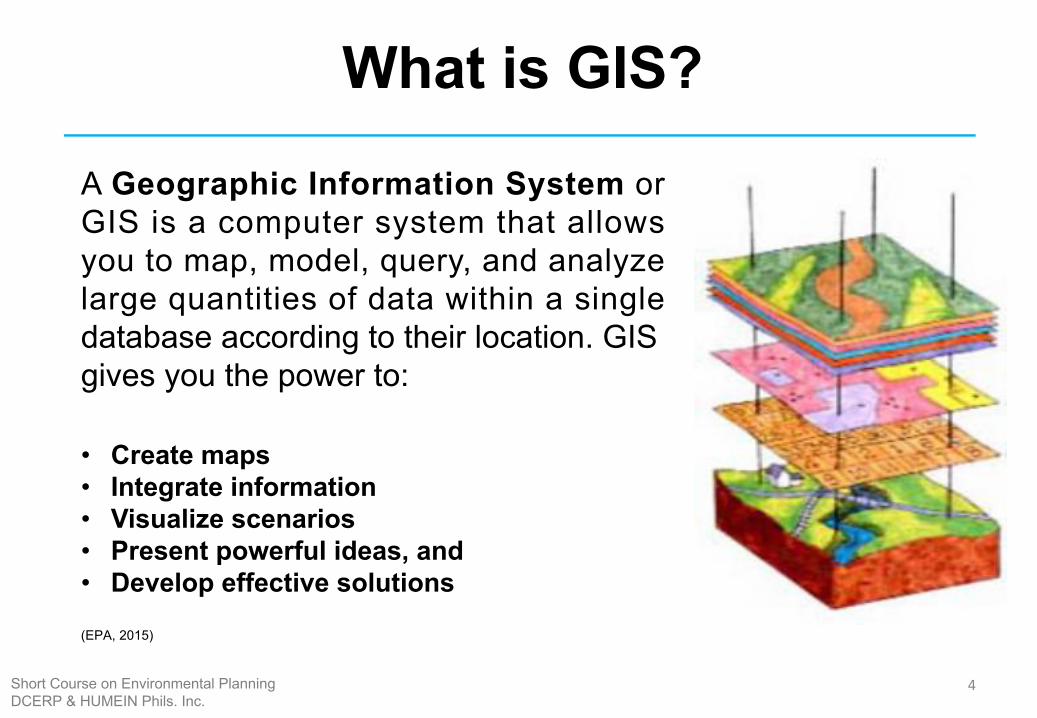
What is GIS?
A Geographic Information System or GIS is a computer system that allows you to map, model, query, and analyze large quantities of data within a single database according to their location. GIS gives you the power to:
• Create maps• Integrate information• Visualize scenarios• Present powerful ideas, and• Develop effective solutions
(EPA, 2015)
4Short Course on Environmental PlanningDCERP & HUMEIN Phils. Inc.
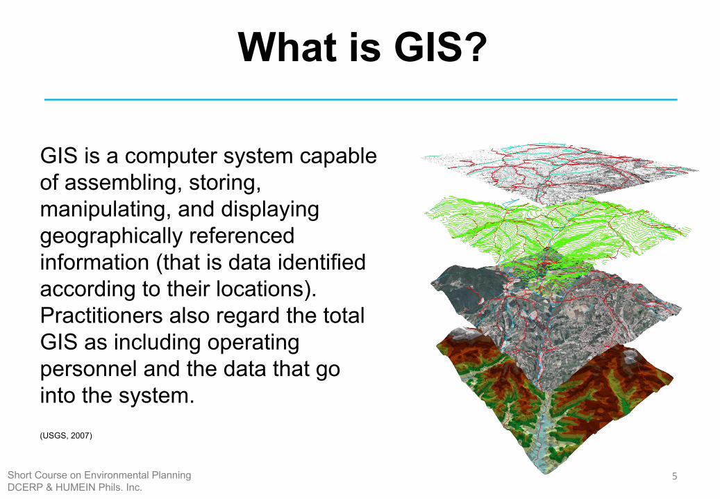
GIS is a computer system capable of assembling, storing, manipulating, and displaying geographically referenced information (that is data identified according to their locations). Practitioners also regard the total GIS as including operating personnel and the data that go into the system.(USGS, 2007)
What is GIS?
5Short Course on Environmental PlanningDCERP & HUMEIN Phils. Inc.
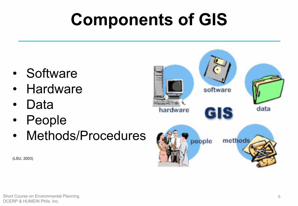
Components of GIS
• Software • Hardware • Data • People• Methods/Procedures (LSU, 2003)
6Short Course on Environmental PlanningDCERP & HUMEIN Phils. Inc.
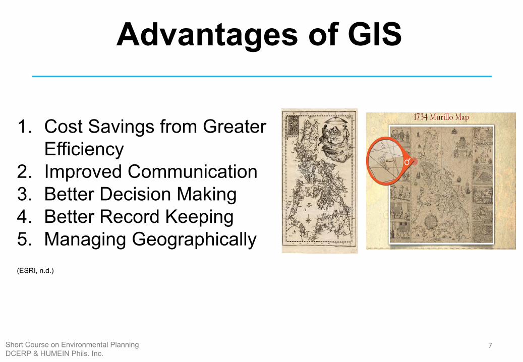
Advantages of GIS
1. Cost Savings from Greater Efficiency
2. Improved Communication3. Better Decision Making4. Better Record Keeping5. Managing Geographically(ESRI, n.d.)
7Short Course on Environmental PlanningDCERP & HUMEIN Phils. Inc.
General History of GIS
8Short Course on Environmental PlanningDCERP & HUMEIN Phils. Inc.
9Short Course on Environmental PlanningDCERP & HUMEIN Phils. Inc.
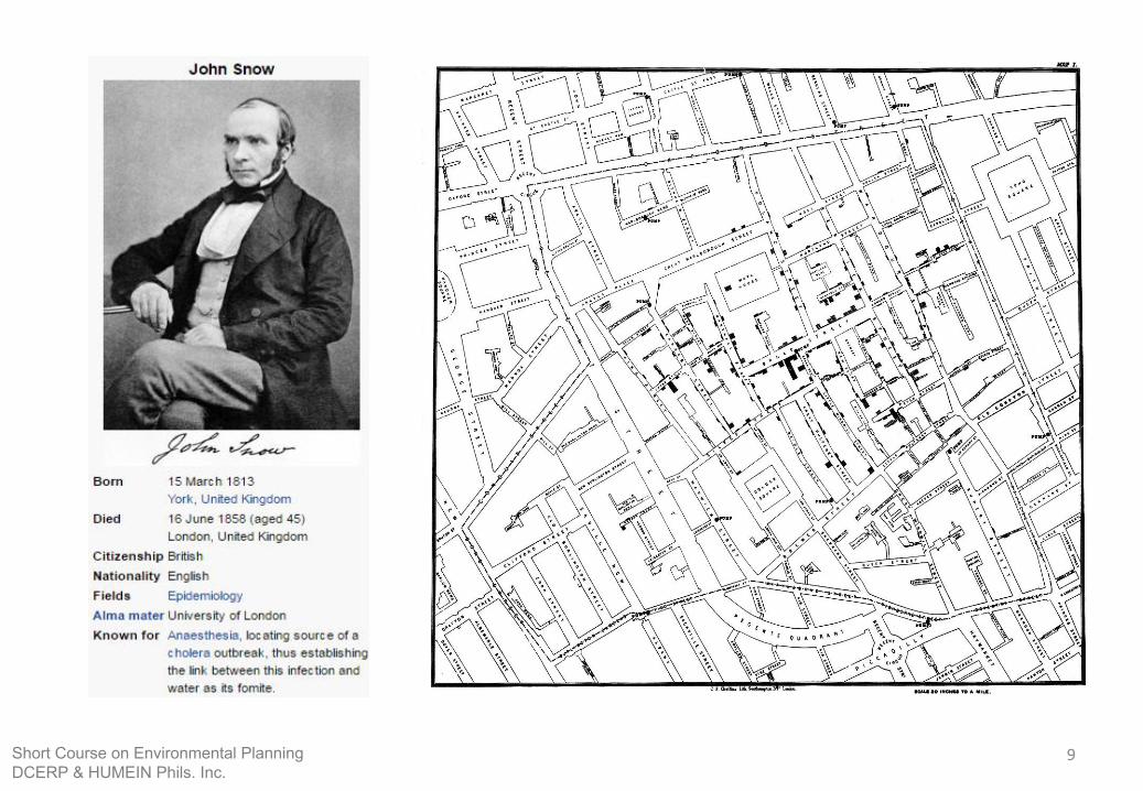
The First Use of GIS – 1854 Broad Street Cholera
• September 1854 (Centered in Soho district close to Snow’s house)
• Mapped 13 public wells and all known deaths• Noted the spatial clustering of cases around one
particular water pump • He examined water samples from various wells • Halted the outbreak despite the authorities’ skepticism
10Short Course on Environmental PlanningDCERP & HUMEIN Phils. Inc.
11Short Course on Environmental PlanningDCERP & HUMEIN Phils. Inc.
General History of GIS
• Difficult to chronicle due to the paucity of well-documented evidence
• Computer-based GIS have been used by people since late 1960s. But, their manual predecessors started 100 years earlier.
• Development started in North America (USA and Canada)
• G r o w t h w a s p i e c e m e a l , s p o r a d i c , a n d uncoordinated.
(Bato, 2010)
12Short Course on Environmental PlanningDCERP & HUMEIN Phils. Inc.
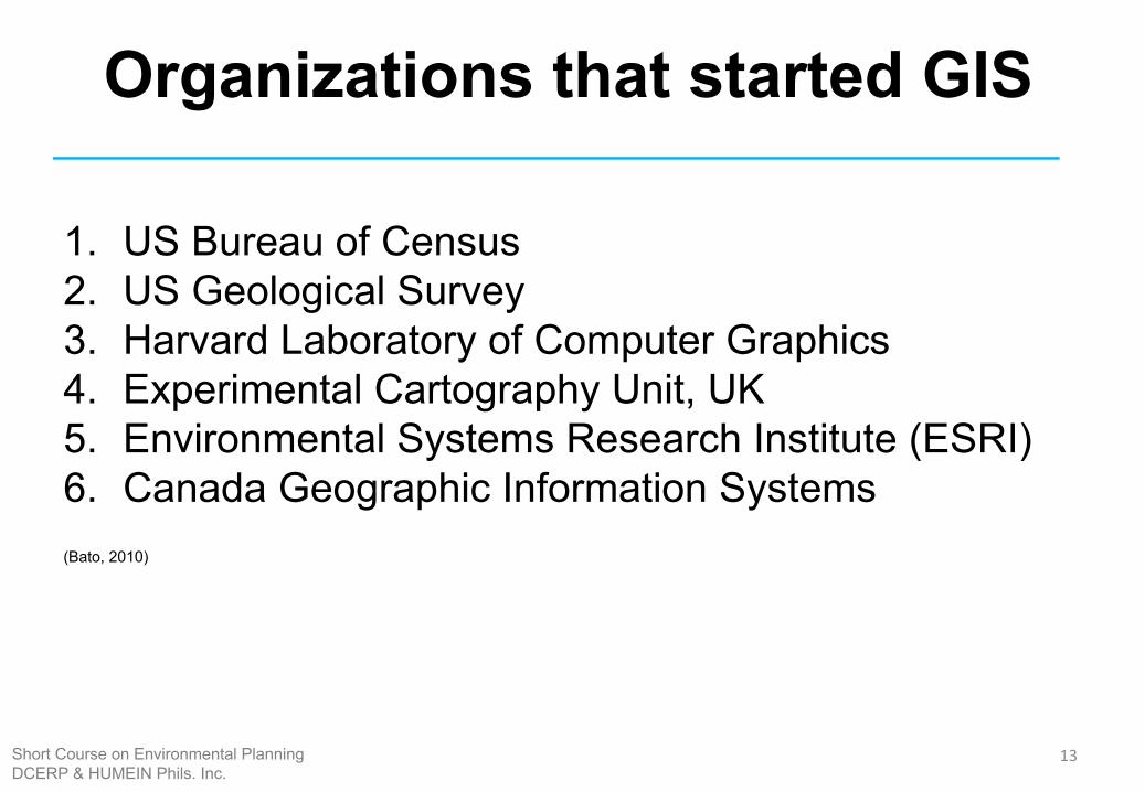
Organizations that started GIS
1. US Bureau of Census2. US Geological Survey3. Harvard Laboratory of Computer Graphics4. Experimental Cartography Unit, UK5. Environmental Systems Research Institute (ESRI)6. Canada Geographic Information Systems(Bato, 2010)
13Short Course on Environmental PlanningDCERP & HUMEIN Phils. Inc.
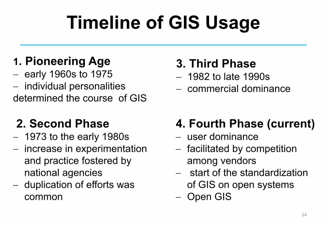
Timeline of GIS Usage
2. Second Phase- 1973 to the early 1980s- increase in experimentation
and practice fostered by national agencies
- duplication of efforts was common
1. Pioneering Age- early 1960s to 1975- individual personalities determined the course of GIS
4. Fourth Phase (current)- user dominance- facilitated by competition
among vendors- start of the standardization
of GIS on open systems- Open GIS
3. Third Phase- 1982 to late 1990s- commercial dominance
14
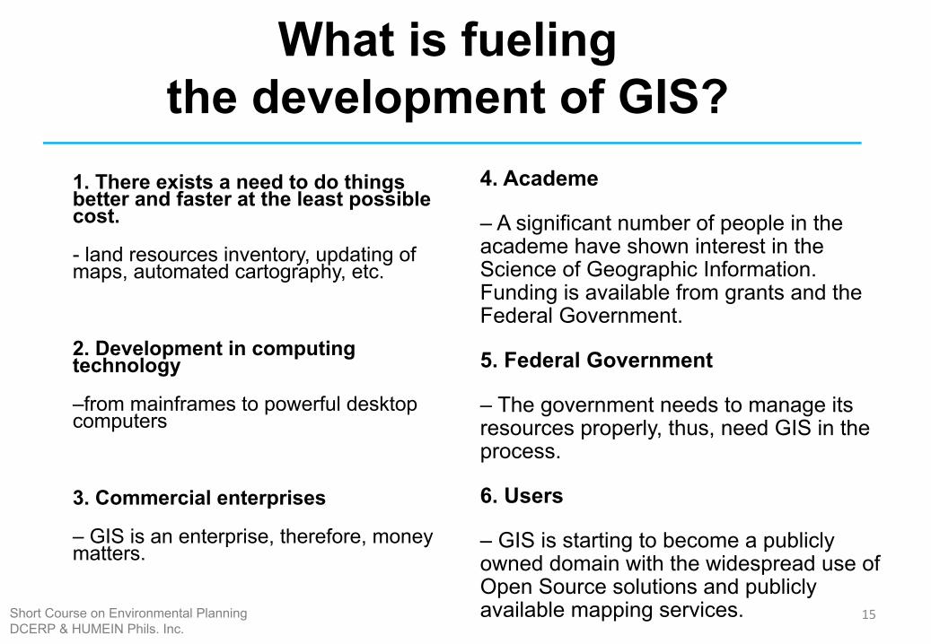
What is fueling the development of GIS?
1. There exists a need to do things better and faster at the least possible cost.
- land resources inventory, updating of maps, automated cartography, etc.
2. Development in computing technology
–from mainframes to powerful desktop computers
3. Commercial enterprises
– GIS is an enterprise, therefore, money matters.
4. Academe
– A significant number of people in the academe have shown interest in the Science of Geographic Information. Funding is available from grants and the Federal Government.
5. Federal Government
– The government needs to manage its resources properly, thus, need GIS in the process.
6. Users
– GIS is starting to become a publicly owned domain with the widespread use of Open Source solutions and publicly available mapping services. 15Short Course on Environmental Planning
DCERP & HUMEIN Phils. Inc.
History of GIS in the Philippines
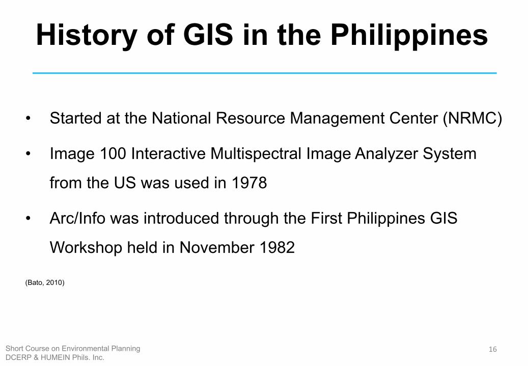
• Started at the National Resource Management Center (NRMC)
• Image 100 Interactive Multispectral Image Analyzer System
from the US was used in 1978
• Arc/Info was introduced through the First Philippines GIS
Workshop held in November 1982
(Bato, 2010)
16Short Course on Environmental PlanningDCERP & HUMEIN Phils. Inc.
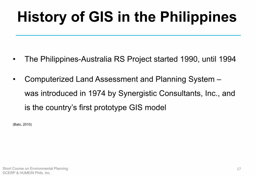
History of GIS in the Philippines
• The Philippines-Australia RS Project started 1990, until 1994
• Computerized Land Assessment and Planning System –
was introduced in 1974 by Synergistic Consultants, Inc., and
is the country’s first prototype GIS model
(Bato, 2010)
17Short Course on Environmental PlanningDCERP & HUMEIN Phils. Inc.
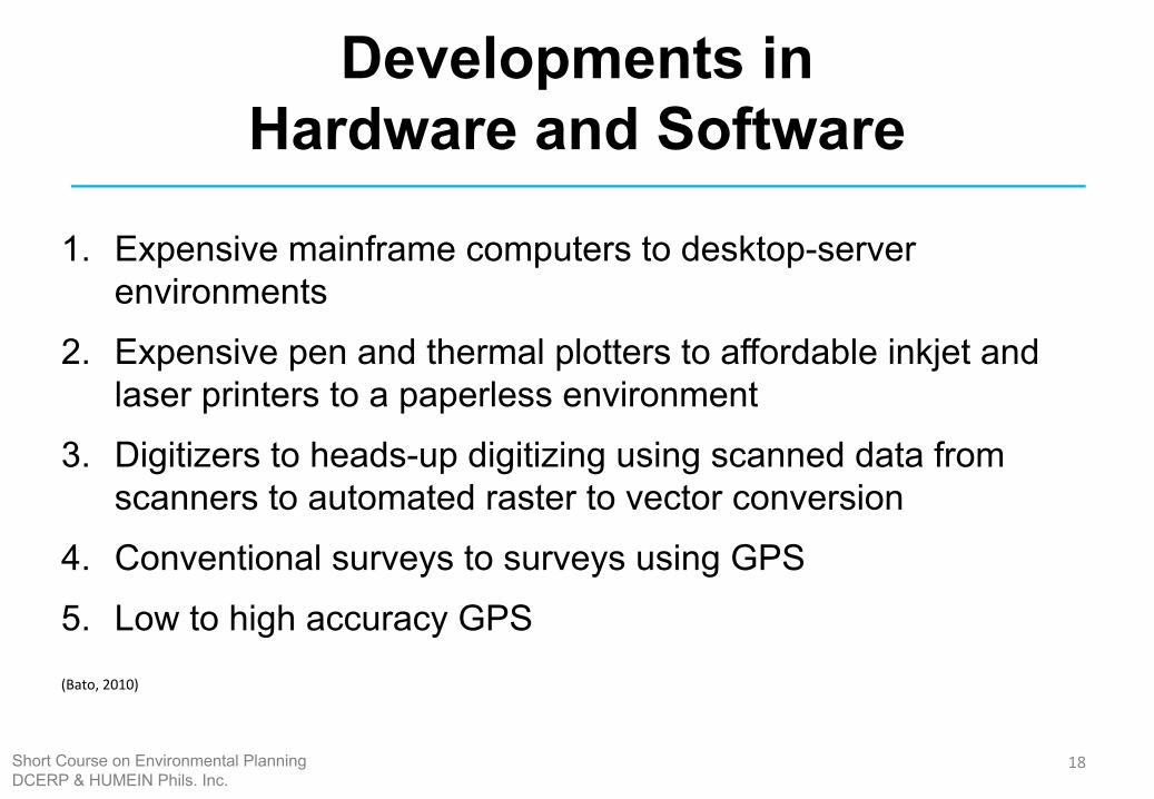
Developments in Hardware and Software
1. Expensive mainframe computers to desktop-server environments
2. Expensive pen and thermal plotters to affordable inkjet and laser printers to a paperless environment
3. Digitizers to heads-up digitizing using scanned data from scanners to automated raster to vector conversion
4. Conventional surveys to surveys using GPS5. Low to high accuracy GPS(Bato, 2010)
18Short Course on Environmental PlanningDCERP & HUMEIN Phils. Inc.
HOW DOES GIS WORK?
19Short Course on Environmental PlanningDCERP & HUMEIN Phils. Inc.
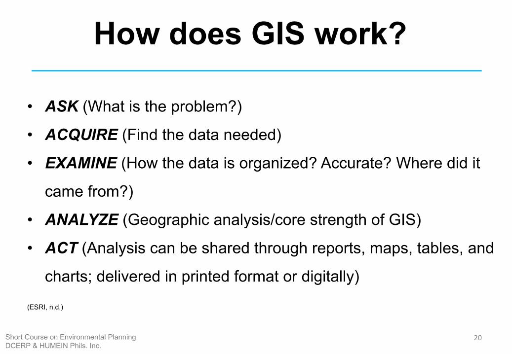
How does GIS work?
• ASK (What is the problem?)
• ACQUIRE (Find the data needed)
• EXAMINE (How the data is organized? Accurate? Where did it
came from?)
• ANALYZE (Geographic analysis/core strength of GIS)
• ACT (Analysis can be shared through reports, maps, tables, and
charts; delivered in printed format or digitally)
(ESRI, n.d.)
20Short Course on Environmental PlanningDCERP & HUMEIN Phils. Inc.
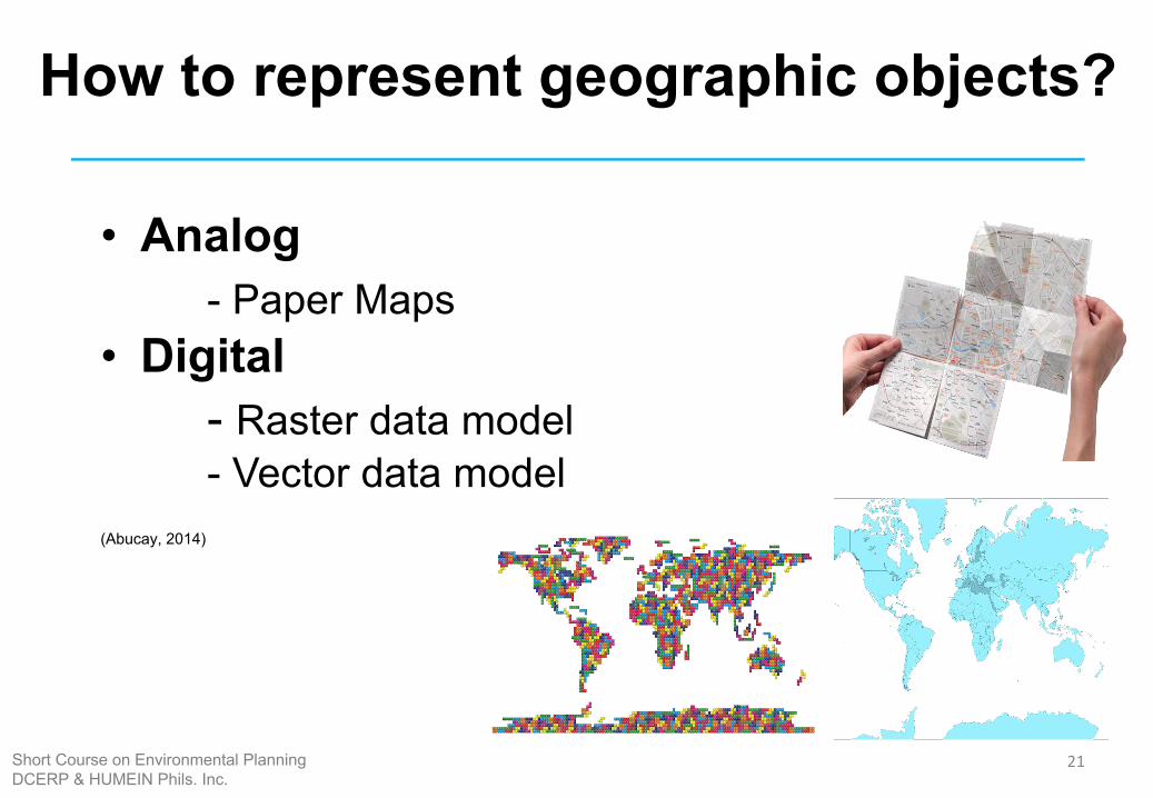
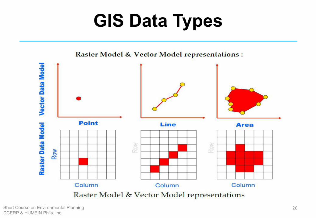
How to represent geographic objects?
• Analog- Paper Maps
• Digital - Raster data model- Vector data model
(Abucay, 2014)
21Short Course on Environmental PlanningDCERP & HUMEIN Phils. Inc.
GIS Data Types
22Short Course on Environmental PlanningDCERP & HUMEIN Phils. Inc.
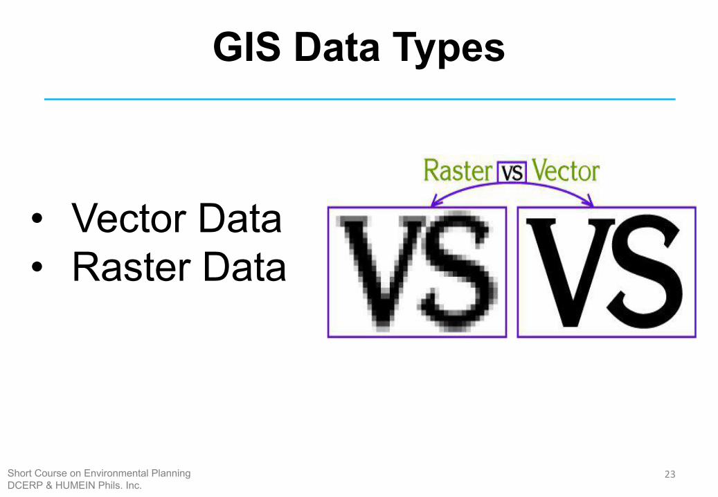
GIS Data Types
• Vector Data • Raster Data
23Short Course on Environmental PlanningDCERP & HUMEIN Phils. Inc.
GIS Data Types
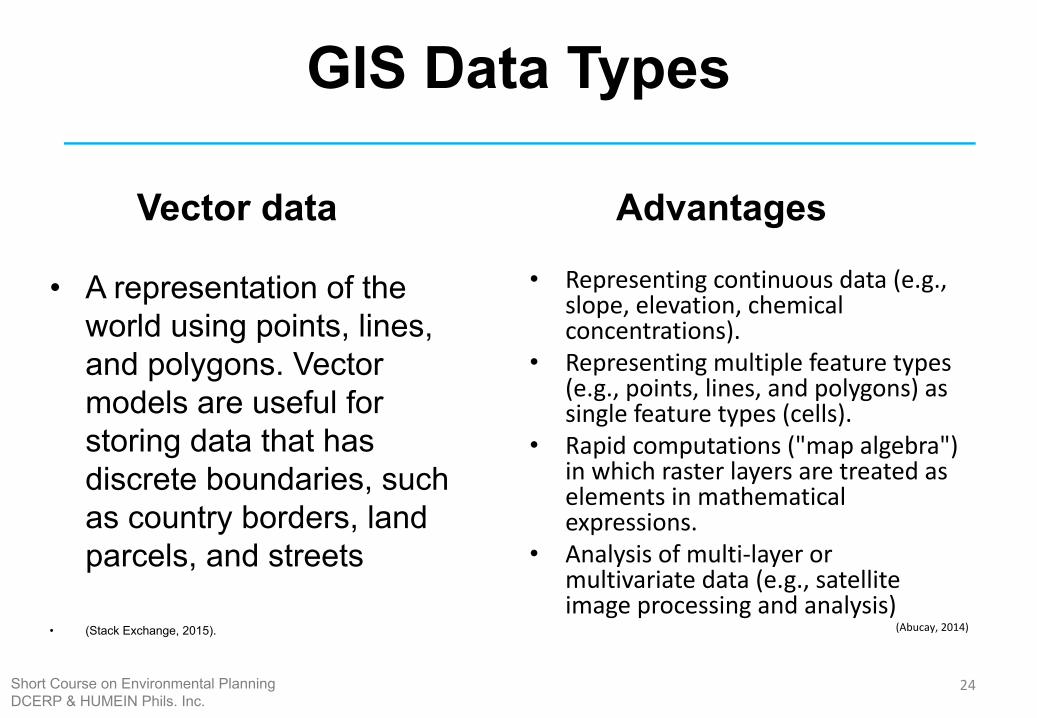
Vector data
• A representation of the world using points, lines, and polygons. Vector models are useful for storing data that has discrete boundaries, such as country borders, land parcels, and streets
• (Stack Exchange, 2015).
Advantages
• Representing continuous data (e.g., slope, elevation, chemical concentrations).
• Representing multiple feature types (e.g., points, lines, and polygons) as single feature types (cells).
• Rapid computations ("map algebra") in which raster layers are treated as elements in mathematical expressions.
• Analysis of multi-layer or multivariate data (e.g., satellite image processing and analysis)
(Abucay, 2014)
24Short Course on Environmental PlanningDCERP & HUMEIN Phils. Inc.
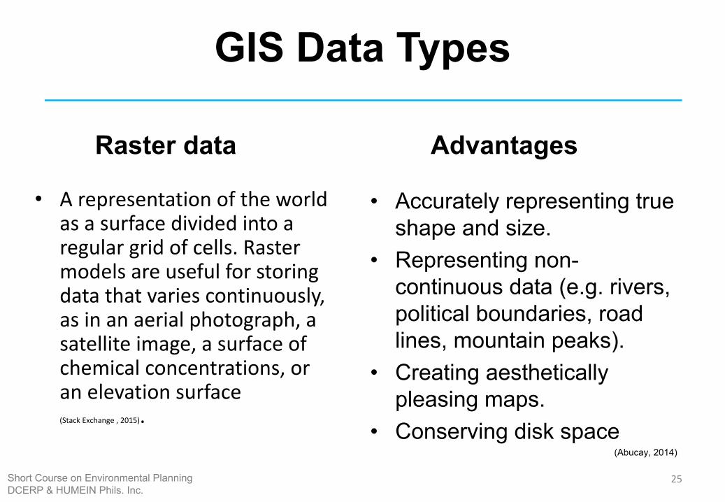
GIS Data Types
Raster data
• A representation of the world as a surface divided into a regular grid of cells. Raster models are useful for storing data that varies continuously, as in an aerial photograph, a satellite image, a surface of chemical concentrations, or an elevation surface (Stack Exchange , 2015).
Advantages
• Accurately representing true shape and size.
• Representing non-continuous data (e.g. rivers, political boundaries, road lines, mountain peaks).
• Creating aesthetically pleasing maps.
• Conserving disk space(Abucay, 2014)
25Short Course on Environmental PlanningDCERP & HUMEIN Phils. Inc.
GIS Data Types
26Short Course on Environmental PlanningDCERP & HUMEIN Phils. Inc.
Projection Systems
27Short Course on Environmental PlanningDCERP & HUMEIN Phils. Inc.

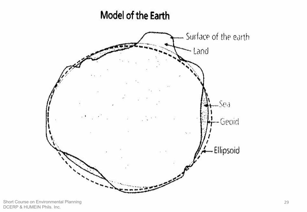
SPHERE GEOID SPHEROID/ELLIPSOID
28Short Course on Environmental PlanningDCERP & HUMEIN Phils. Inc.
29Short Course on Environmental PlanningDCERP & HUMEIN Phils. Inc.
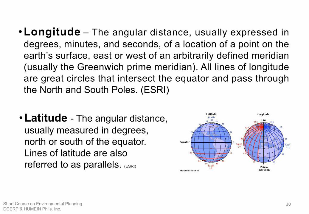
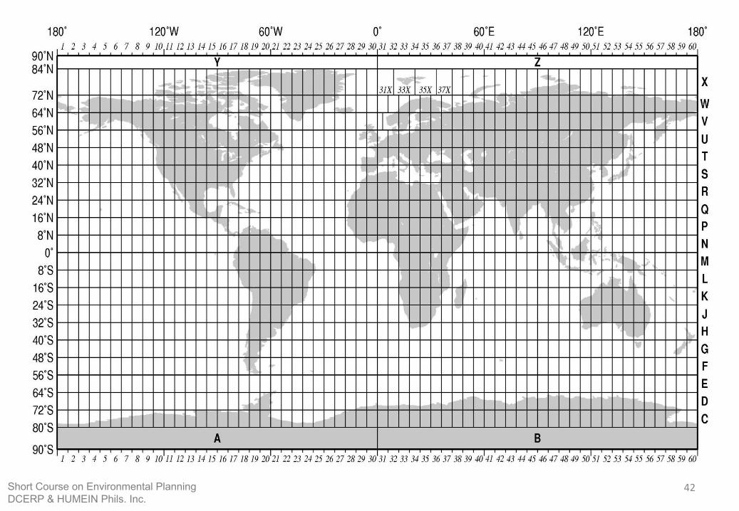
•Latitude - The angular distance, usually measured in degrees, north or south of the equator. Lines of latitude are also referred to as parallels. (ESRI)
•Longitude – The angular distance, usually expressed in degrees, minutes, and seconds, of a location of a point on the earth’s surface, east or west of an arbitrarily defined meridian (usually the Greenwich prime meridian). All lines of longitude are great circles that intersect the equator and pass through the North and South Poles. (ESRI)
30Short Course on Environmental PlanningDCERP & HUMEIN Phils. Inc.
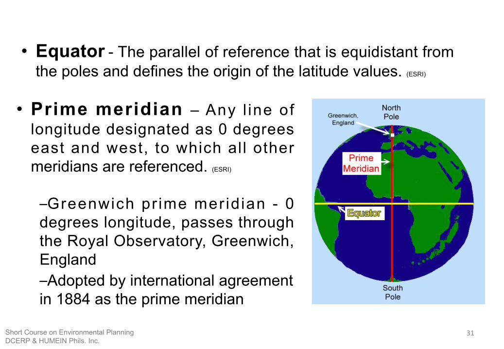
• Prime meridian – Any l ine of longitude designated as 0 degrees east and west, to which al l other meridians are referenced. (ESRI)
–Greenwich pr ime mer id ian - 0 degrees longitude, passes through the Royal Observatory, Greenwich, England–Adopted by international agreement in 1884 as the prime meridian
• Equator - The parallel of reference that is equidistant from the poles and defines the origin of the latitude values. (ESRI)
31Short Course on Environmental PlanningDCERP & HUMEIN Phils. Inc.
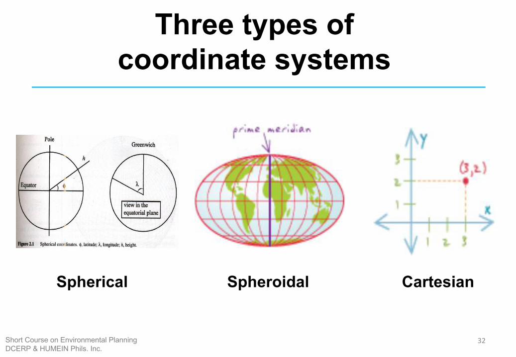
Three types of coordinate systems
Spherical Spheroidal Cartesian
32Short Course on Environmental PlanningDCERP & HUMEIN Phils. Inc.
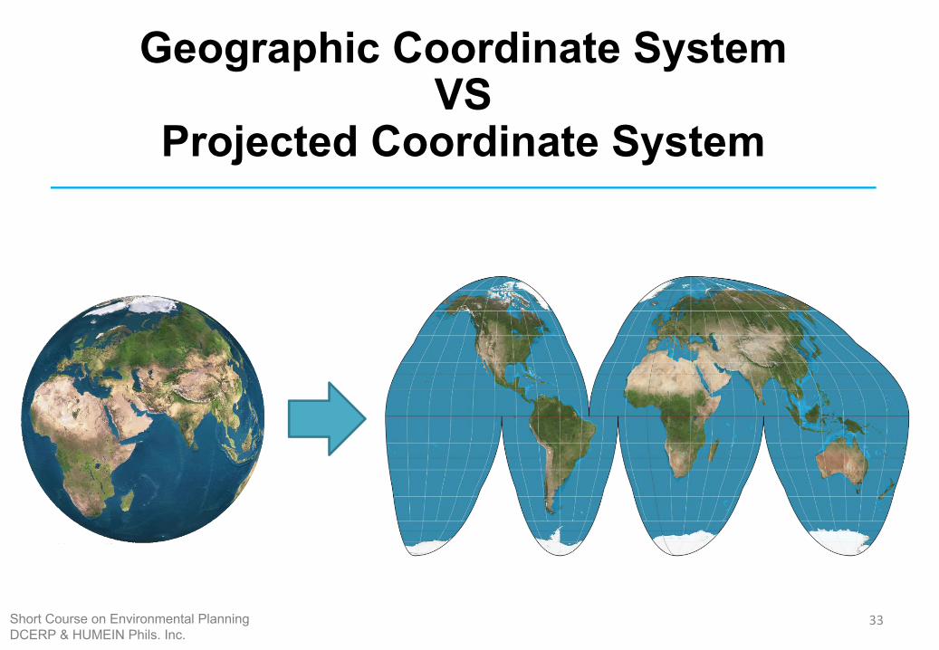
Geographic Coordinate System VS
Projected Coordinate System
33Short Course on Environmental PlanningDCERP & HUMEIN Phils. Inc.
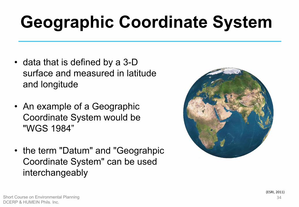
Geographic Coordinate System
• data that is defined by a 3-D surface and measured in latitude and longitude
• An example of a Geographic Coordinate System would be "WGS 1984”
• the term "Datum" and "Geograhpic Coordinate System" can be used interchangeably
(ESRI, 2011)34Short Course on Environmental Planning
DCERP & HUMEIN Phils. Inc.
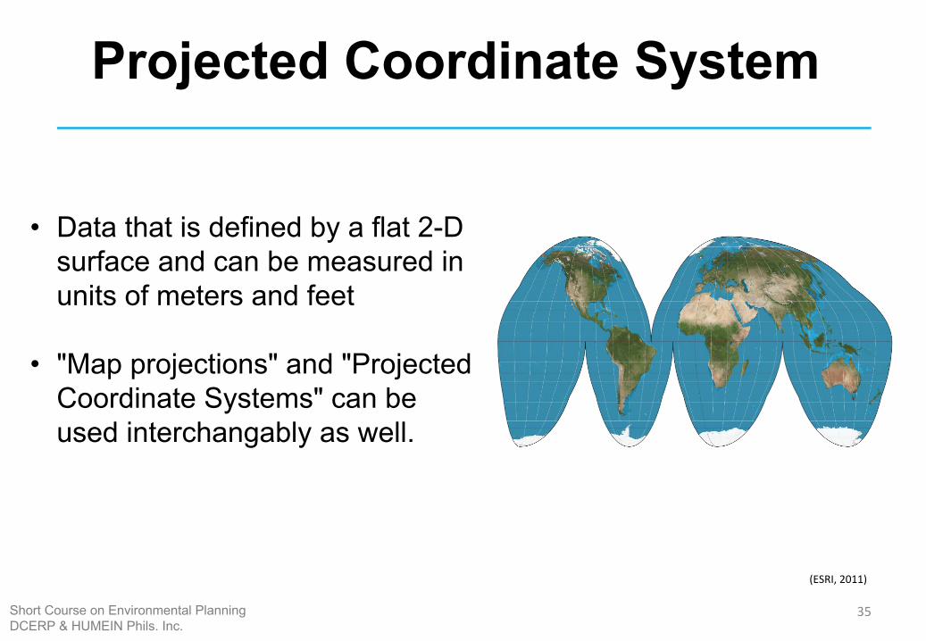
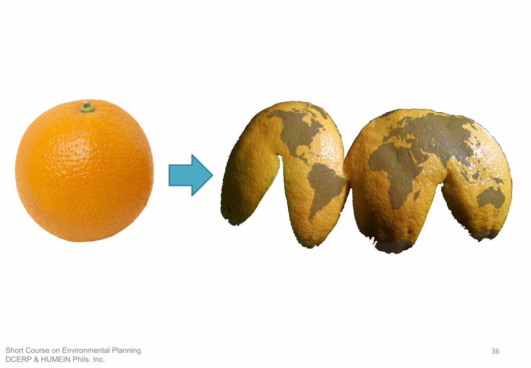
Projected Coordinate System
• Data that is defined by a flat 2-D surface and can be measured in units of meters and feet
• "Map projections" and "Projected Coordinate Systems" can be used interchangably as well.
(ESRI, 2011)
35Short Course on Environmental PlanningDCERP & HUMEIN Phils. Inc.
36Short Course on Environmental PlanningDCERP & HUMEIN Phils. Inc.
37Short Course on Environmental PlanningDCERP & HUMEIN Phils. Inc.
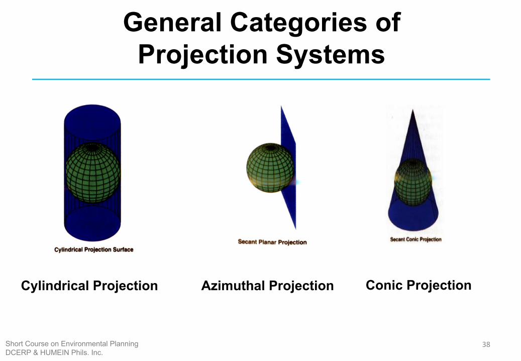
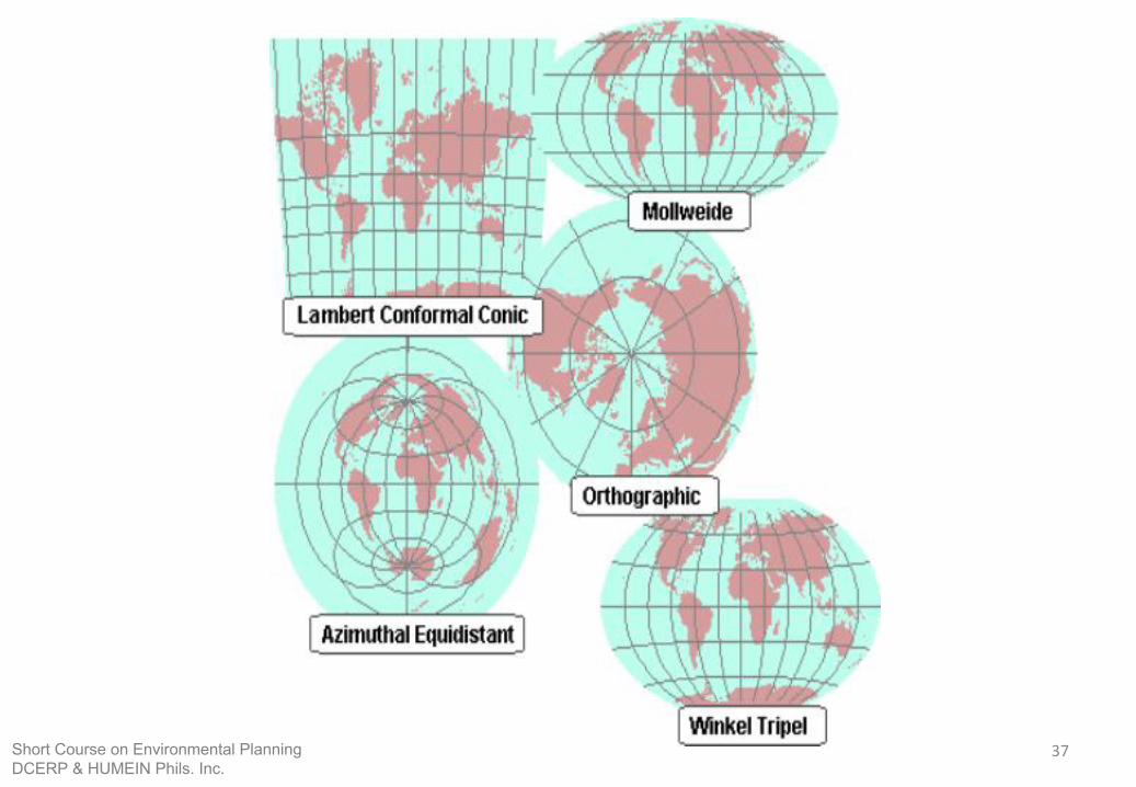
General Categories of Projection Systems
38
Cylindrical Projection Azimuthal Projection Conic Projection
Short Course on Environmental PlanningDCERP & HUMEIN Phils. Inc.
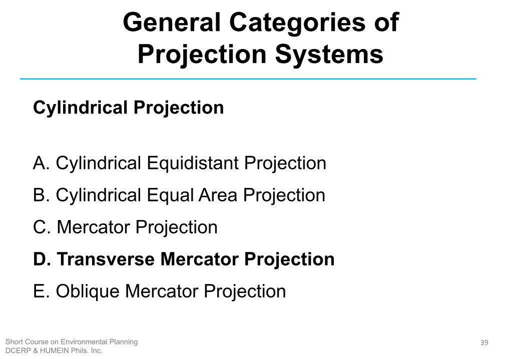
Cylindrical Projection
A. Cylindrical Equidistant Projection
B. Cylindrical Equal Area Projection
C. Mercator Projection
D. Transverse Mercator ProjectionE. Oblique Mercator Projection
39
General Categories of Projection Systems
Short Course on Environmental PlanningDCERP & HUMEIN Phils. Inc.
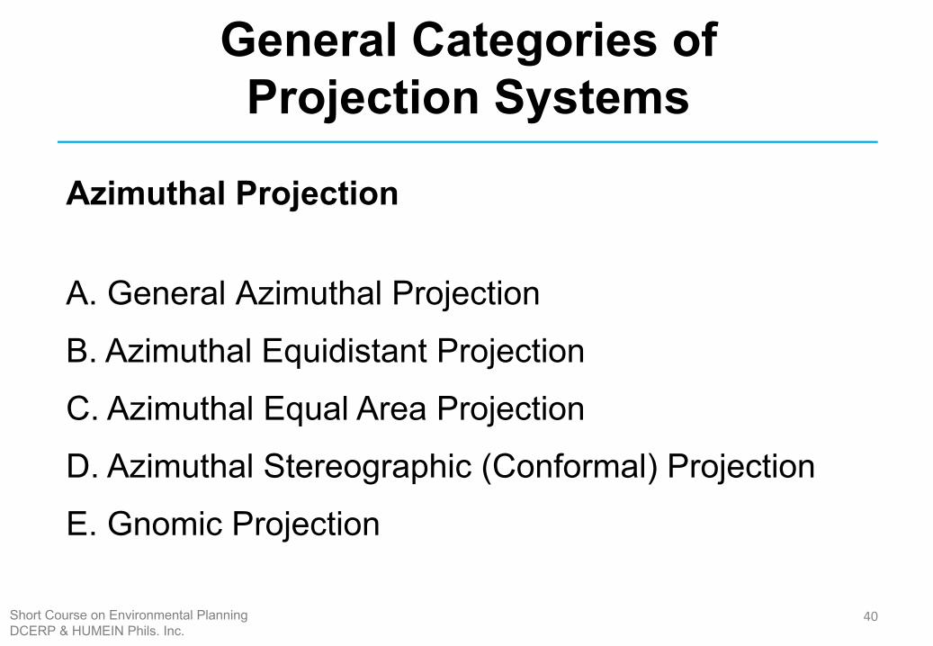
Azimuthal Projection
A. General Azimuthal Projection
B. Azimuthal Equidistant Projection
C. Azimuthal Equal Area Projection
D. Azimuthal Stereographic (Conformal) Projection
E. Gnomic Projection
40
General Categories of Projection Systems
Short Course on Environmental PlanningDCERP & HUMEIN Phils. Inc.
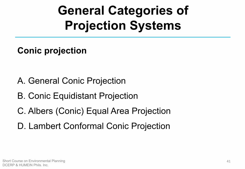
Conic projection
A. General Conic Projection
B. Conic Equidistant Projection
C. Albers (Conic) Equal Area Projection
D. Lambert Conformal Conic Projection
41
General Categories of Projection Systems
Short Course on Environmental PlanningDCERP & HUMEIN Phils. Inc.
42Short Course on Environmental PlanningDCERP & HUMEIN Phils. Inc.
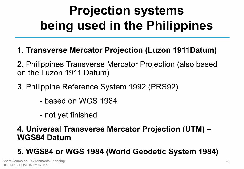
Projection systems being used in the Philippines
1. Transverse Mercator Projection (Luzon 1911Datum)
2. Philippines Transverse Mercator Projection (also based on the Luzon 1911 Datum)
3. Philippine Reference System 1992 (PRS92)
- based on WGS 1984
- not yet finished
4. Universal Transverse Mercator Projection (UTM) – WGS84 Datum
5. WGS84 or WGS 1984 (World Geodetic System 1984)43Short Course on Environmental Planning
DCERP & HUMEIN Phils. Inc.
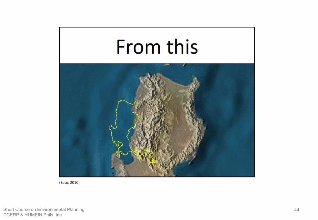
(Bato, 2010)
44Short Course on Environmental PlanningDCERP & HUMEIN Phils. Inc.
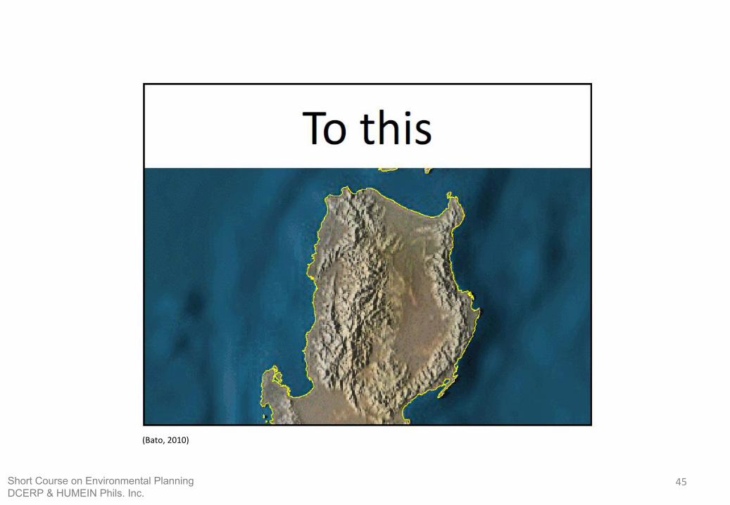
(Bato, 2010)
45Short Course on Environmental PlanningDCERP & HUMEIN Phils. Inc.
Data Sources
46Short Course on Environmental PlanningDCERP & HUMEIN Phils. Inc.
47
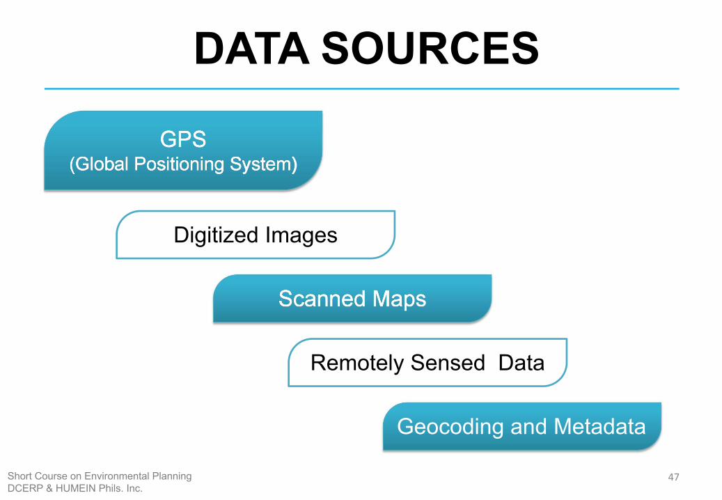
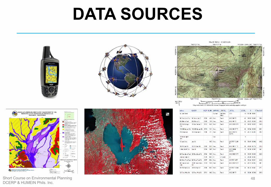
DATA SOURCES
GPS (Global Positioning System)
Digitized Images
Scanned Maps
Remotely Sensed Data
Geocoding and Metadata
Short Course on Environmental PlanningDCERP & HUMEIN Phils. Inc.
48
DATA SOURCES
Short Course on Environmental PlanningDCERP & HUMEIN Phils. Inc.
49
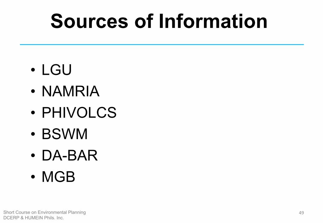
Sources of Information
• LGU• NAMRIA• PHIVOLCS• BSWM• DA-BAR• MGB
Short Course on Environmental PlanningDCERP & HUMEIN Phils. Inc.
50
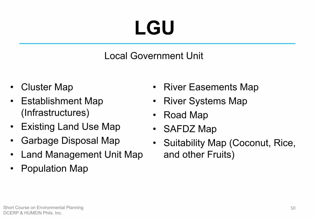
LGU
• Cluster Map • Establishment Map
(Infrastructures) • Existing Land Use Map • Garbage Disposal Map • Land Management Unit Map • Population Map
• River Easements Map • River Systems Map • Road Map • SAFDZ Map • Suitability Map (Coconut, Rice,
and other Fruits)
Local Government Unit
Short Course on Environmental PlanningDCERP & HUMEIN Phils. Inc.
51
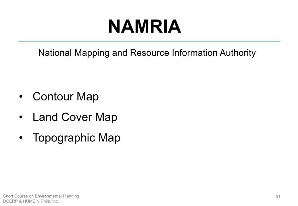
NAMRIANational Mapping and Resource Information Authority
• Contour Map
• Land Cover Map
• Topographic Map
Short Course on Environmental PlanningDCERP & HUMEIN Phils. Inc.
52
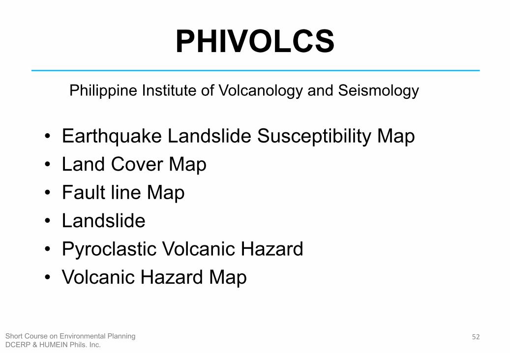
PHIVOLCS
• Earthquake Landslide Susceptibility Map• Land Cover Map • Fault line Map • Landslide • Pyroclastic Volcanic Hazard • Volcanic Hazard Map
Philippine Institute of Volcanology and Seismology
Short Course on Environmental PlanningDCERP & HUMEIN Phils. Inc.
53
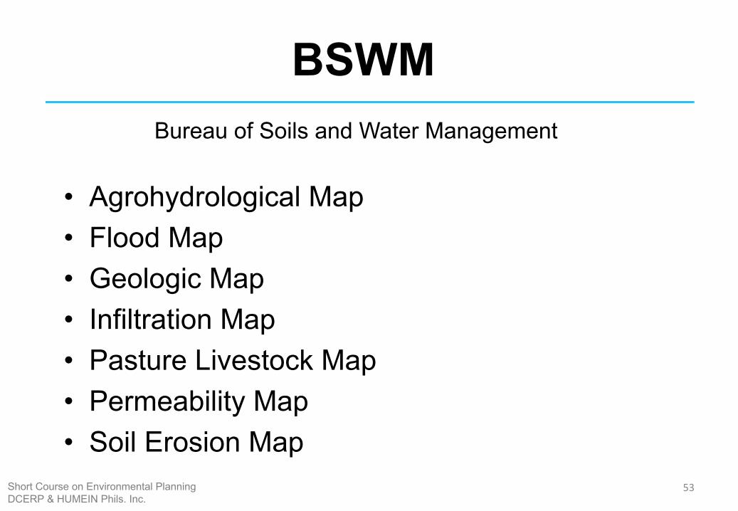
BSWM
• Agrohydrological Map • Flood Map • Geologic Map • Infiltration Map • Pasture Livestock Map • Permeability Map • Soil Erosion Map
Bureau of Soils and Water Management
Short Course on Environmental PlanningDCERP & HUMEIN Phils. Inc.
54
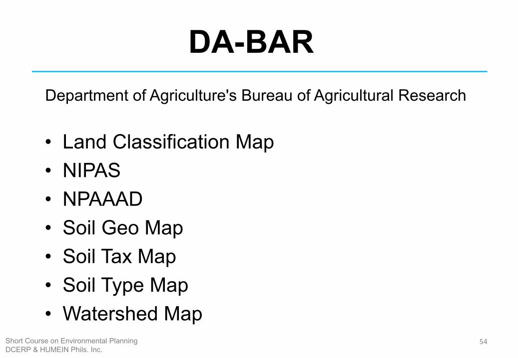
DA-BAR
• Land Classification Map• NIPAS • NPAAAD • Soil Geo Map • Soil Tax Map • Soil Type Map • Watershed Map
Department of Agriculture's Bureau of Agricultural Research
Short Course on Environmental PlanningDCERP & HUMEIN Phils. Inc.
55
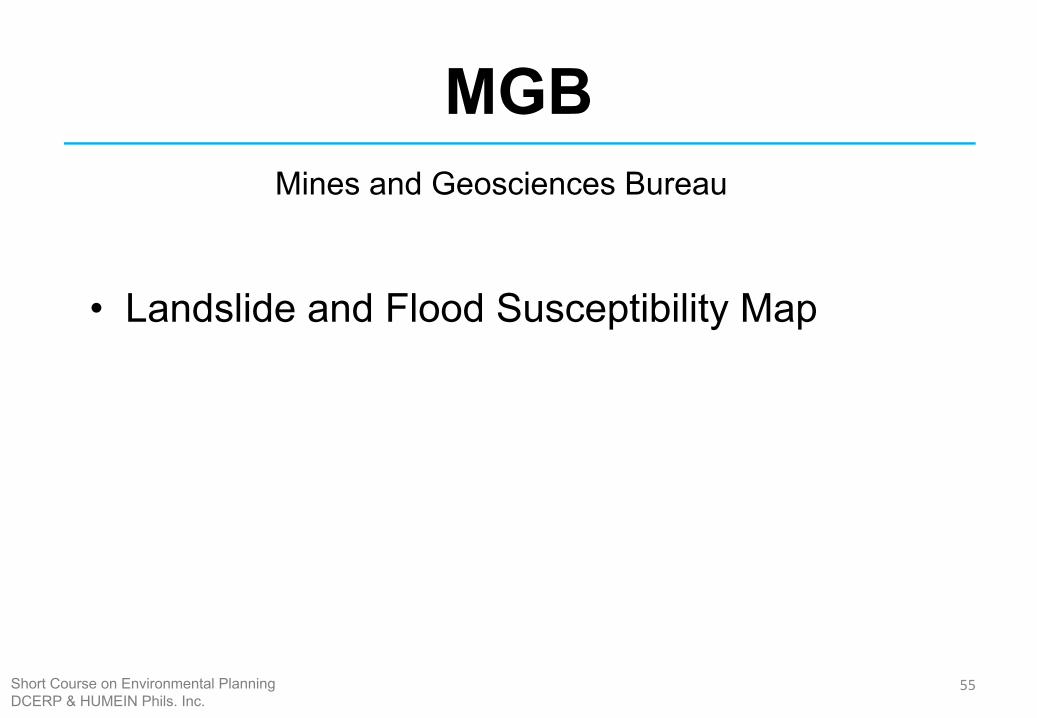
MGB
• Landslide and Flood Susceptibility Map
Mines and Geosciences Bureau
Short Course on Environmental PlanningDCERP & HUMEIN Phils. Inc.
56
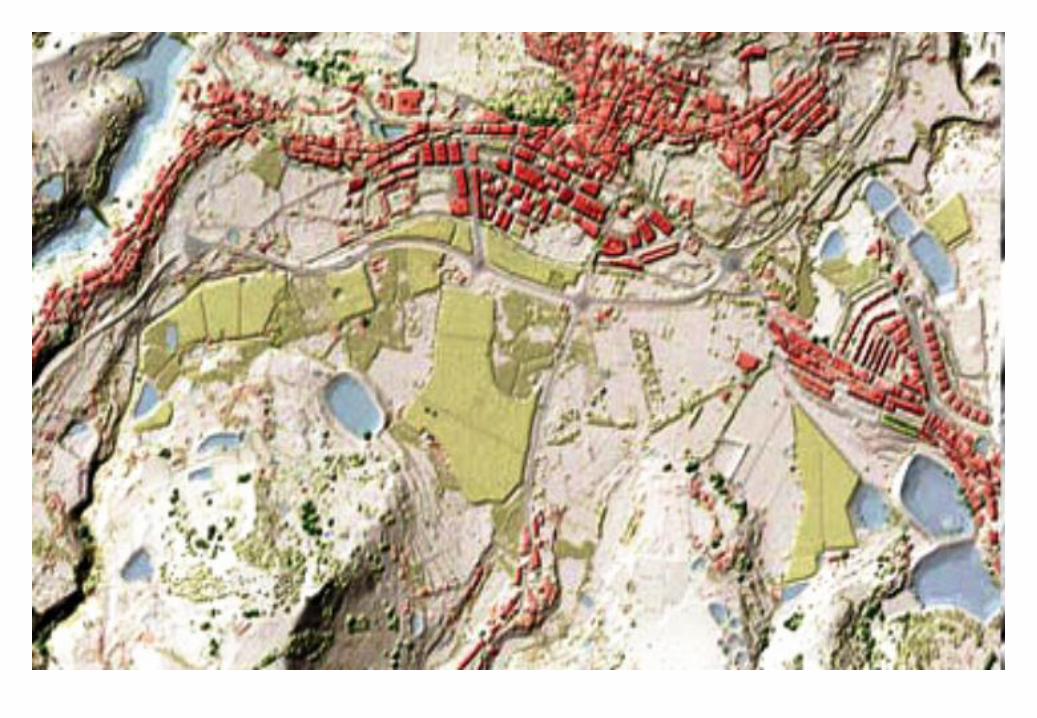
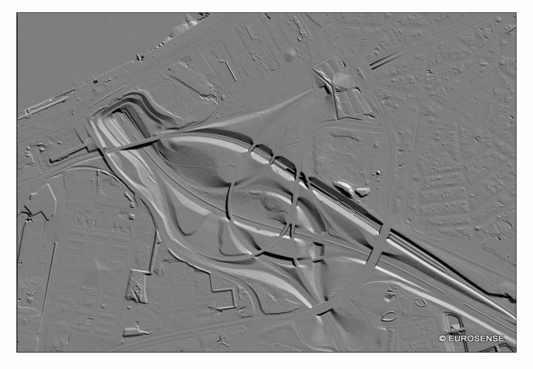
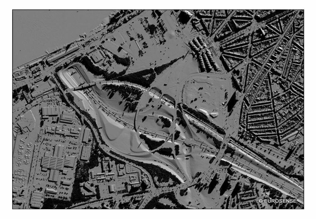
ANALYSIS
Short Course on Environmental PlanningDCERP & HUMEIN Phils. Inc.
57
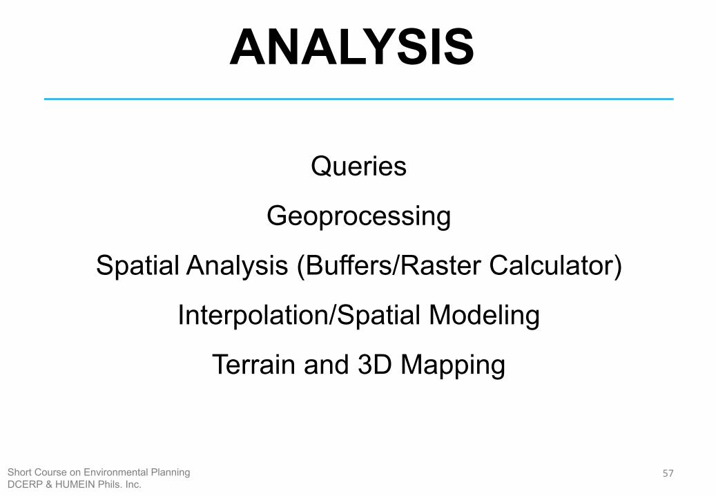
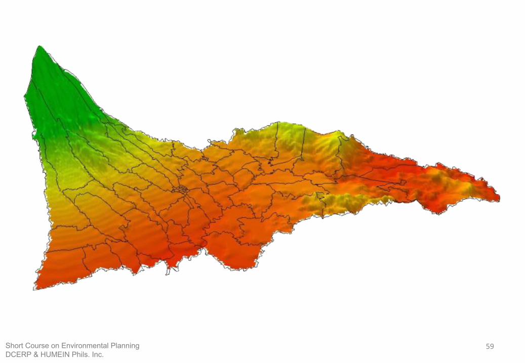
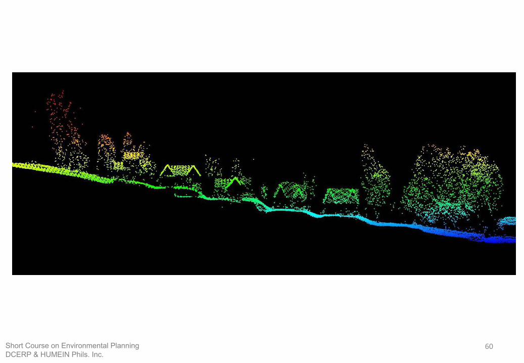
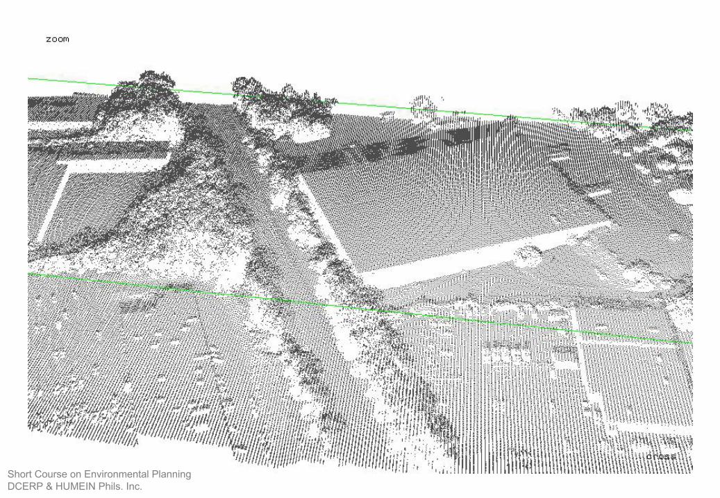
ANALYSIS
Queries
Geoprocessing
Spatial Analysis (Buffers/Raster Calculator)
Interpolation/Spatial Modeling
Terrain and 3D Mapping
Short Course on Environmental PlanningDCERP & HUMEIN Phils. Inc.
58
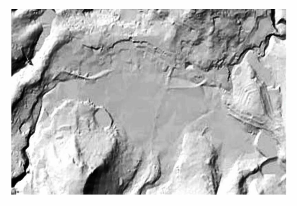
59Short Course on Environmental PlanningDCERP & HUMEIN Phils. Inc.
60Short Course on Environmental PlanningDCERP & HUMEIN Phils. Inc.
Short Course on Environmental PlanningDCERP & HUMEIN Phils. Inc.

66
67
Basic Map Elements
Short Course on Environmental PlanningDCERP & HUMEIN Phils. Inc.
68
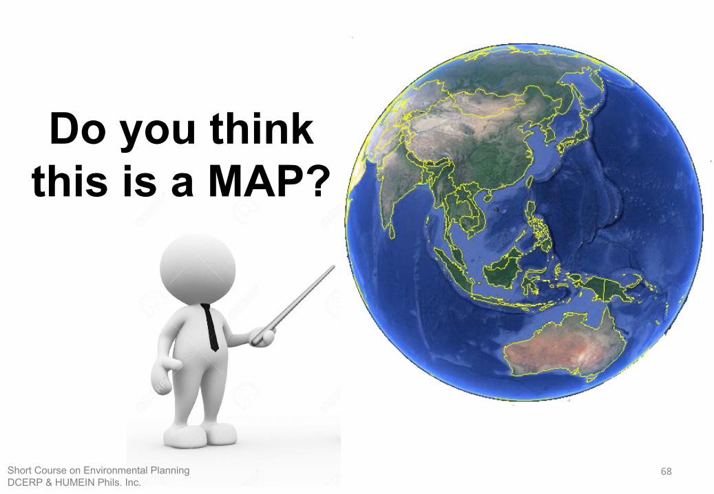
Do you think this is a MAP?
Short Course on Environmental PlanningDCERP & HUMEIN Phils. Inc.
69
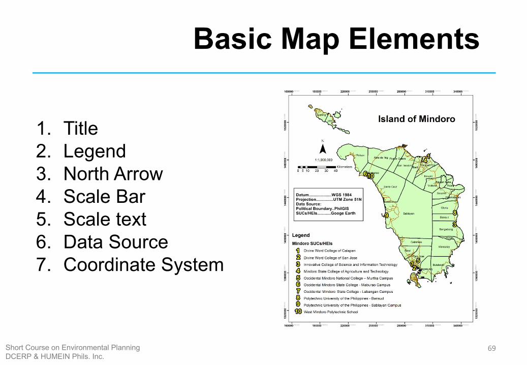
Basic Map Elements
1. Title2. Legend 3. North Arrow4. Scale Bar5. Scale text 6. Data Source 7. Coordinate System
Short Course on Environmental PlanningDCERP & HUMEIN Phils. Inc.

70
APPLICATIONS
Short Course on Environmental PlanningDCERP & HUMEIN Phils. Inc.
71
Applications
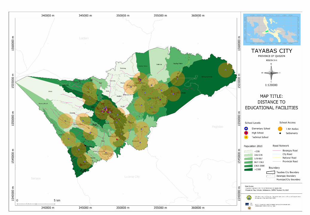
1. Land Use Planning 2. Hazard Mapping 3. Resources Inventory/Management 4. Pre/Post Disaster Assessment5. Flood Modeling 6. Infrastructure Planning and Development 7. Tourism 8. Tax Mapping
Short Course on Environmental PlanningDCERP & HUMEIN Phils. Inc.
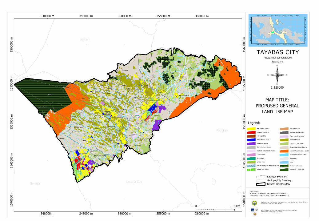
72
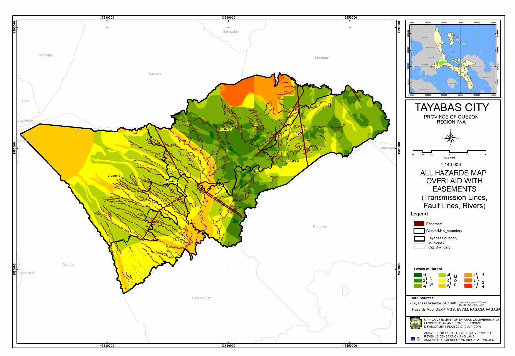
73
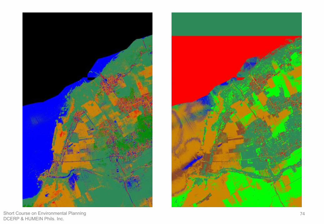
74Short Course on Environmental PlanningDCERP & HUMEIN Phils. Inc.
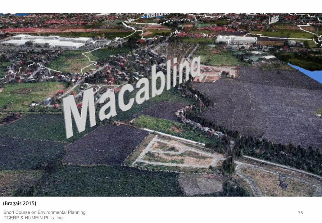
75
(Bragais 2015)Short Course on Environmental PlanningDCERP & HUMEIN Phils. Inc.
76
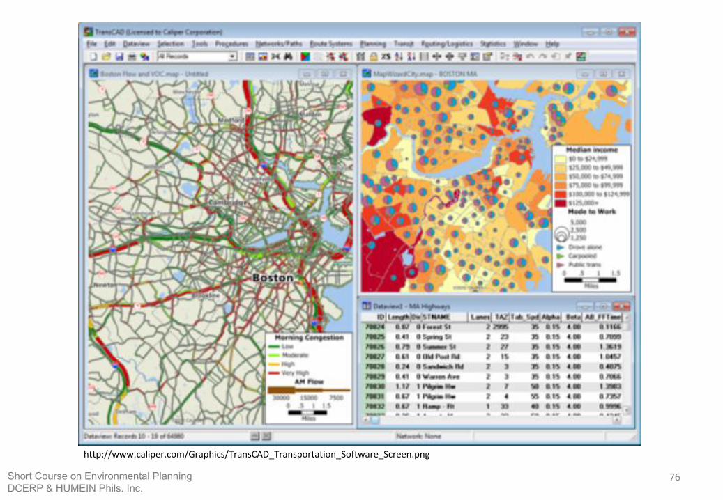
http://www.caliper.com/Graphics/TransCAD_Transportation_Software_Screen.png
Short Course on Environmental PlanningDCERP & HUMEIN Phils. Inc.
77
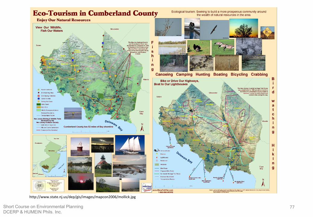
http://www.state.nj.us/dep/gis/images/mapcon2006/mollick.jpg
Short Course on Environmental PlanningDCERP & HUMEIN Phils. Inc.

78http://content.satimagingcorp.com/static/galleryimages/arcgis-high-resolution-gis-geographic-information-systems-friendswood.jpg
79
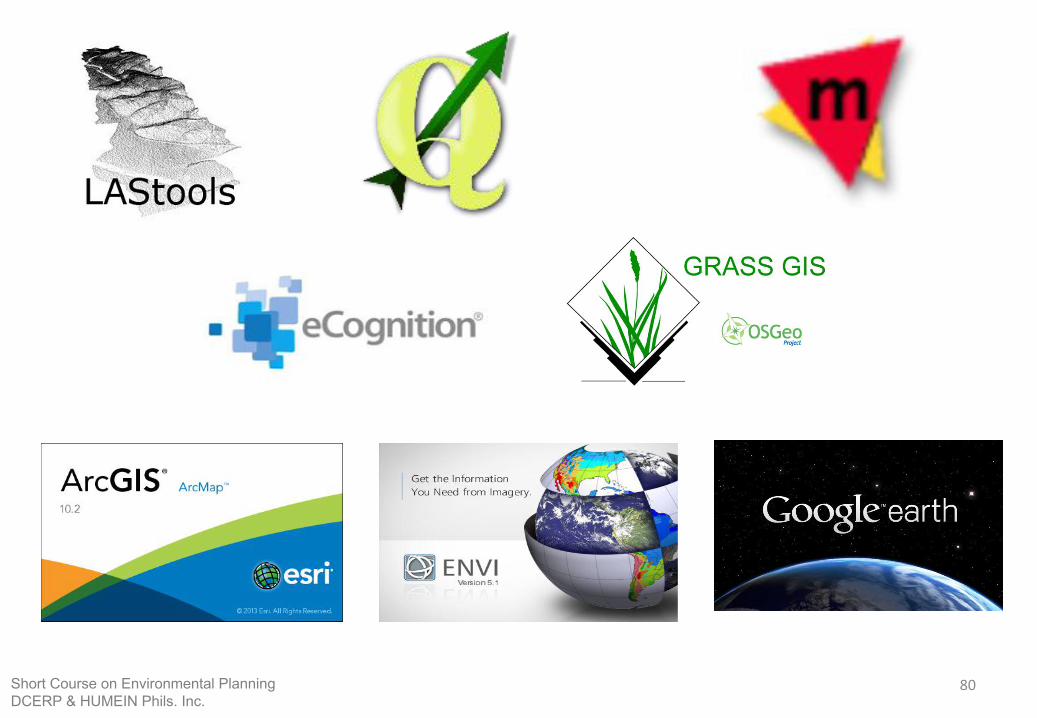
Available Software for GIS
Short Course on Environmental PlanningDCERP & HUMEIN Phils. Inc.
80Short Course on Environmental PlanningDCERP & HUMEIN Phils. Inc.
81
References
Abucay, E. R. (2014). Mapping with ArcGIS.
Bato, V. A. (2010). Introduction to GIS: History, Applications, and Components of GIS.
EPA. (2015, February 3). Retrieved from United States Environmental Protection Agency : http://www.epa.gov/reg3esd1/data/gis.htm
ESRI. (n.d.). Retrieved from esri.com: http://www.esri.com/what-is-gis
ESRI. (2011, March 1). Retrieved from https://geonet.esri.com/thread/23160
LSU. (2003, February 21). Retrieved from Luisiana Geographic Information Center : http://lagic.lsu.edu/gisprimer/whatsgis.asp?topic=howitworks
Stack Exchange . (2015). Retrieved from Stack Exchange : http://gis.stackexchange.com /questions/57142/what-is-the-difference-between-vector-and-raster-data-models
USGS. (2007, February 14). Retrieved from USGS: Science for a changing world: http://webgis.wr.usgs.gov/globalgis/tutorials/what_is_gis.htm
Short Course on Environmental PlanningDCERP & HUMEIN Phils. Inc.

82
THANK YOU!
Short Course on Environmental PlanningDCERP & HUMEIN Phils. Inc.