gis in the cloud: implementing a web map service on google app engine jon blower reading e-science...
TRANSCRIPT

GIS in the cloud: implementing a Web Map Service on Google App
Engine
Jon BlowerReading e-Science Centre
University of ReadingUnited Kingdom
http://code.google.com/p/gae-wms/

http://www.reading.ac.uk/godiva2

Scalability is a major concern
• Web Map Services are quite “heavy” on the server
• Many infrastructures now moving into operational phase
• How to serve many simultaneous clients?– Tile caching is a widely-used option, but reduces
flexibility
• Load is typically “bursty”, so we’d like to be able to scale the back end up and down
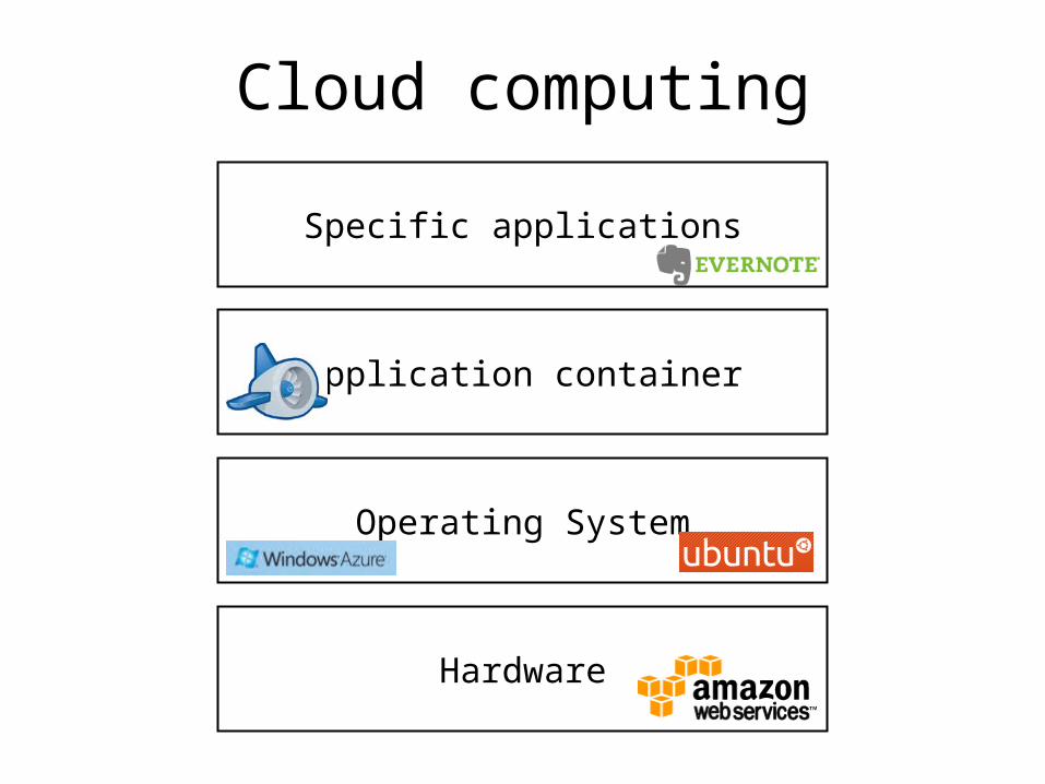
Cloud computing
Hardware
Operating System
Application container
Specific applications

Google App Engine overview• Virtual application-hosting environment
– Python, Java (servlets)• Machines are brought up and taken down
automatically• Built-in services, including:
– User authentication– Distributed memcache– Distributed persistent store– Image transformation
• Free within certain quotas
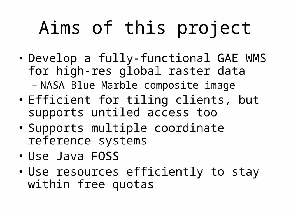
Aims of this project
• Develop a fully-functional GAE WMS for high-res global raster data– NASA Blue Marble composite image
• Efficient for tiling clients, but supports untiled access too
• Supports multiple coordinate reference systems• Use Java FOSS• Use resources efficiently to stay within free
quotas
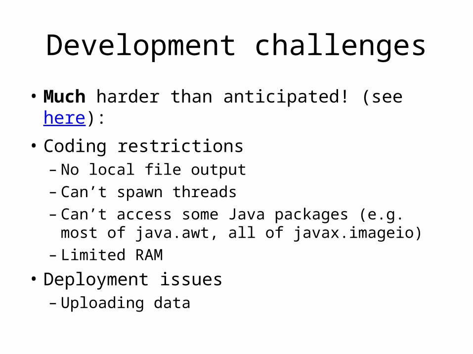
Development challenges
• Much harder than anticipated! (see here):• Coding restrictions
– No local file output– Can’t spawn threads– Can’t access some Java packages (e.g. most of
java.awt, all of javax.imageio)– Limited RAM
• Deployment issues– Uploading data

Blue Marble image courtesy of NASA Earth Observatory

Testing• Three “modes”:
– Fully-dynamic (all images generated from scratch)– Self-caching (duplicate requests are served from cache)– Static tiles (all images pre-generated)
• All images 256x256 pixels• Apache JMeter scripts
– Many client threads, requesting images in random order from preselected list
– Single client machine • GAE is “black box” so can’t control all aspects of the
experiments

Results: Throughput
Fully-dynamic
Self-caching
Static tiles
“Service not available” errors increase with load

Results: Latency
Fully-dynamic
Self-caching
Static tiles
Unpredictable latency spikes!

Some notes about quotas
• Outgoing bandwidth quota (1GB/day) runs out fastest– Hence serving JPEGs is more cost-effective than
PNGs– Can serve 100,000 256x256 JPEGs per day for free
• But it’s easy to code in such a way that some per-minute quotas are also exceeded– E.g. quota on output from the distributed data
store• Quotas can be increased!
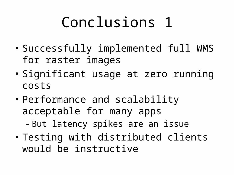
Conclusions 1
• Successfully implemented full WMS for raster images
• Significant usage at zero running costs• Performance and scalability acceptable for
many apps– But latency spikes are an issue
• Testing with distributed clients would be instructive

Conclusions 2: further potential?
• Hard to host lots of images in same instance using our method– Relies on storing data in local files, with a tight quota
• Restrictions on Java servlet environment make it hard to run standard software stacks– E.g. GeoServer
• Expansion to vector dataset is probably hard– Would need a spatial index on top of the distributed
data store

Thank you!
All code, full paper, results and more details about the experiments:
http://code.google.com/p/gae-wms/