gis solutions for fttx design - bicsi · pdf filegis solutions for fttx design david nelson,...
TRANSCRIPT

GIS Solutions for FTTx Design
David Nelson, GISPTelecom GIS Manager, Black & Veatch

Agenda• Intro to GIS• Telecom GIS Vision• GIS Strategy• Project Execution• Mobile• Online Services• Dashboards• Client Deliverables• Questions

Intro to GISWhat is it?
A Geographic Information System (GIS) is a computer-based system designed to collect, store, integrate, manipulate, analyze & display data in a spatially referenced environment. It allows you to manage and analyze data visually and see patterns, trends, and relationships that might not be visible in tabular or written form.

Intro to GISWhat can it do?
Typical questions a GIS can answer
• Location: Where is ... ?
• Condition: How big is ... ? Is it open or closed?
• Relations: How many ... are near … ?
• Integrations: Can we combine this with data from …?
• Visualizations (2D-3D): What does it look like? What spatial patterns exist?
• Trends (4D): What has changed ? When did it … ? When will it … ?
• Modeling: What if ... ?

Intro to GISHow does it work?
• Information organized into Layers
• Can query any data directly or indirectly tied to a location / area
– How many connected NAPs in a neighborhood / distribution area?
– Where have utility strikes occurred?
• Can “look” above, below, next to, adjacent to, within / without, near to, etc.
• Can combine a variety of data to create new information and relations

Intro to GISHow is it applied?
• Information Management: Asset inventory, data collection, maintenance, work orders• Attribute analysis: Show me all fiber lines having the following attributes…• Spatial analysis: How many customers are inside this service area?• Proximity analysis: Which substations are within 1000 feet of a major highway?• Data overlays: Which lots are “commercial”, are not within 500 feet of a major highway, and have a
rocky soil type?• Mapping: Hard Copy, Electronic, Online

B&V Vision PlanIntegration with OSP Engineering and Information Technology
• GIS centric approach for all OSP projects• File based vs. Data based transition• Geospatial archives of all data• Integration with other technology platforms (CAD, LiDAR, BIM, Signal Tracing)• End to End Tool for EPC projects
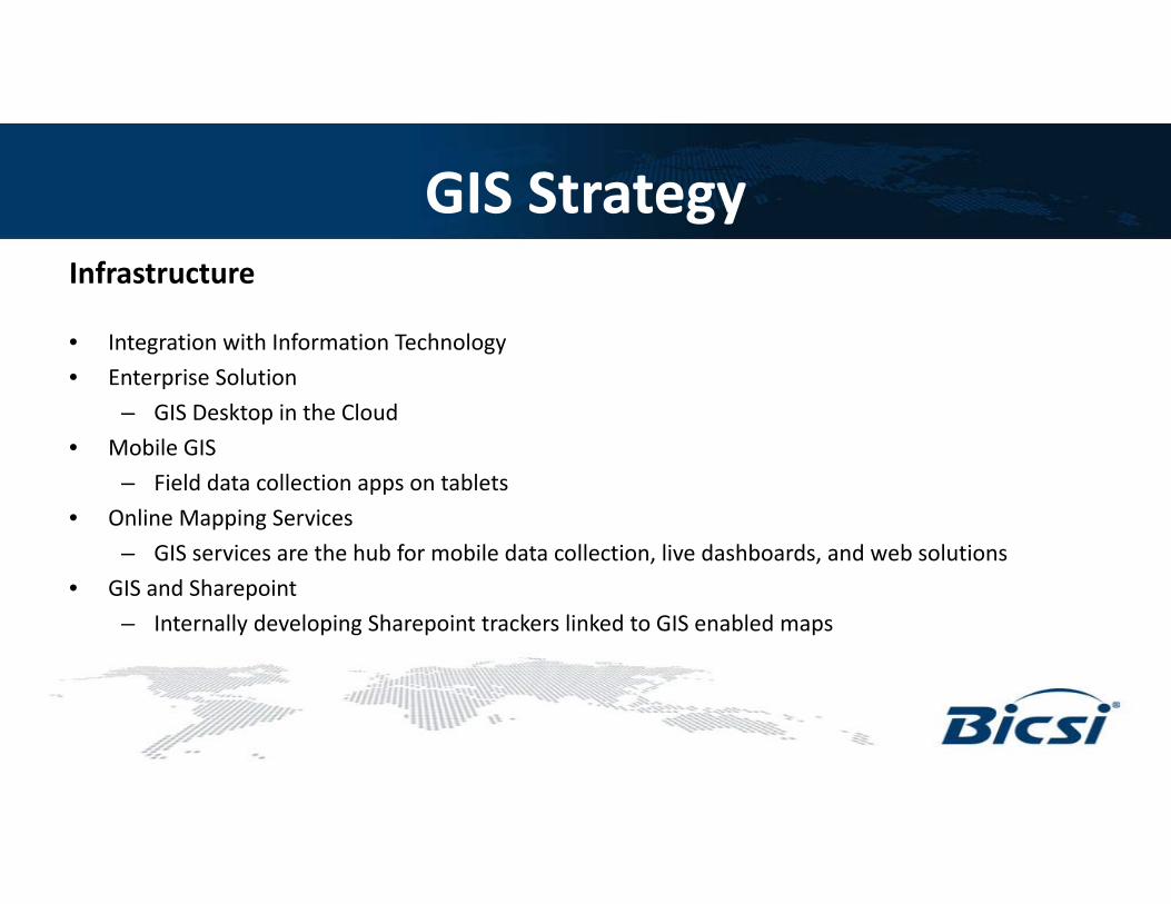
GIS StrategyInfrastructure
• Integration with Information Technology• Enterprise Solution
– GIS Desktop in the Cloud• Mobile GIS
– Field data collection apps on tablets• Online Mapping Services
– GIS services are the hub for mobile data collection, live dashboards, and web solutions• GIS and Sharepoint
– Internally developing Sharepoint trackers linked to GIS enabled maps

GIS StrategyTraining Workflows

GIS StrategyTraining Plan

GIS StrategyTraining Matrix

GIS StrategyDatabase Structure and Naming Conventions

Project ExecutionFTTH Example

Project Execution• End to End Project Tool
– Conceptual Design– Preliminary Design– Make Ready Engineering / Data Collection– Construction Ride Out– Project Controls / Schedule– Permitting– Final Design– Finance– Procurement– Construction Work Orders / Subcontractor True Up– As-Builts– Operations and Maintenance

Project Execution• Conceptual Design
– Route optimization– Terrain analysis (hydrology, rock percentages)– Utility analysis (pole availability, existing fiber)– Initial quantities for estimating– Identify high risk areas and provide options for the client– Dynamic design review for client approval

Project ExecutionBill of Materials Reporting
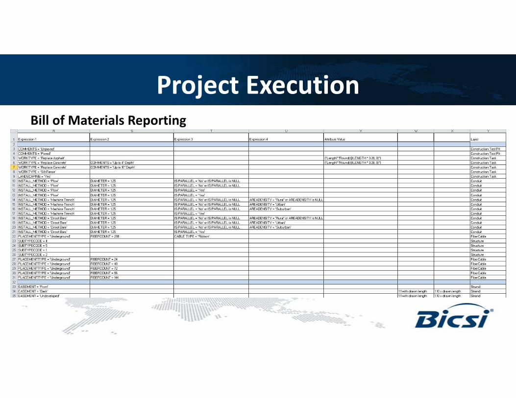
Project ExecutionBill of Materials Reporting

Project Execution• Project Controls
– Capable of tying design features to the schedule database– Allows Project Management and Controls the ability to visualize the project during construction– Multidimensional GIS: Forecast schedule problems before they affect the project
• Permitting / Regulatory– Identify amount of route in national forests, jurisdictions, in/out of RoW, and special permit
areas– Railroad and water crossings– Permitting status maps

Project ExecutionTracker Integration

Project ExecutionTracker Integration

Project ExecutionTracker Integration

Mobile and Field Data Collection• Tablets (Windows, iOS, and Android)
– Bluetooth enabled GPS enhancers for accuracy– Engineers analyze and perform QC through GIS– Live and disconnected editing– GeoEvent Processing– AR Design
• Mobile LiDAR– Fast run rates for pole collection (7000 poles / day)– Able to incorporate post processed data in PLA– Feature extraction– Still working out the data requirements

Mobile and Field Data Collection• QA/QC Tool
– Calculate span distances and standard deviations– Accounts for land classification– Flags anything out of bounds with the expected average
• Results– Comparing non GIS collection techniques vs. GIS centric workflows– B&V experienced efficiency increases across projects

Mobile and Field Data Collection

Mobile and Field Data Collection
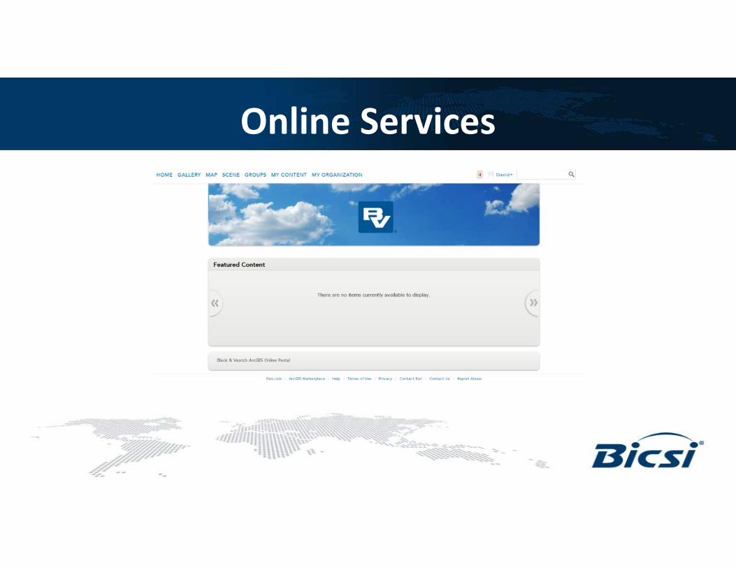
Online Services

Online Services

Dashboards

Dashboards
Client Deliverables• GIS Deliverables
– .gdb, .pdf, .kmz formats– Metadata set to FGDC standards
• Integrated CAD / GIS Solutions– Combining CAD and GIS through database services– 3D CAD and 3D GIS– Plan & Profile, Typicals and Design– .dwg outputs if needed

Questions