gitews wp 4430 ground based hf-radar system · 2013-12-12 · continuous wave (cw) modus f=10mhz...
TRANSCRIPT
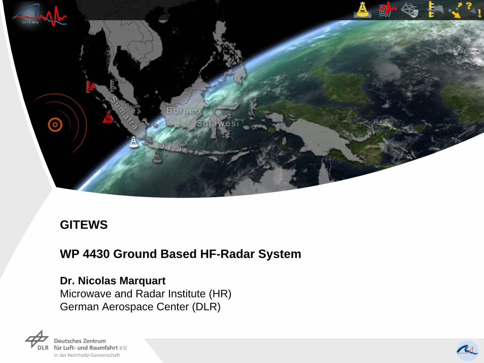
GITEWS
WP 4430 Ground Based HF-Radar System
Dr. Nicolas MarquartMicrowave and Radar Institute (HR)German Aerospace Center (DLR)

• Introduction• Background – HF Radar Observables - Motivation
• Surface Model • Ocean Wave Spectra (2D)
• Calculation-PO-Bragg Lines-Doppler Shift
• Principle of HF Surface Waves
• Numerical Results• Tsunami induced currents: Vc=18cm/s and 5.1cm
• Commercial Ground Based System• Ocean Remote Sensing System WERA-Configuration
• HF-OTHR Radar
• Conclusions

Tectonic Activity
Oceanic Litosphere 5-7km Continental Litosphere 30-60km
Divergence
Convergence

Boxing Day 2004 (Sunda Trench)
© Nature Jan.2005
Uplift Process

© Nature Jan.2005

20min
Warning(26.12.2004)

• Earth/Seequakes M >7 (90%)
• Vulcanic Eruption and/or Landslide
• Meteorit Impact
Date Cause Height (m) Site Deaths
12. December 1992 Earthquake 26 Indonesia <1000
02. June 1994 Earthquake 14 Indonesia 238
26. December 2004 Earthquake 5 Indonesia >230.000
Date CauseHeight
(m) Site Deaths
27. August 1883 Krakatau Eruption 35 Indonesia 3600
Causes for Tsunami

Tsunami
Shallow water: Friction force!
Ocean Wave Types

H=1km
H=100m
H=1.9km
H=2.8km
H=3.7km
Dispersion Relation
Case 1: Deep Water (H >>λ)
Dispersion !
J.R. Apel, Principles of Ocean PhysicsAcademic Press, 1987

Case 2: Shallow Water (H << λ)
No Dispersion !
„Waterberg“
Phenomenonf=1.4mHz
f=2.45mHz
f=0.35mHz
T: [4.7min – 47,6min]
f=3.5mHz

4m
2m
0
-2m
-4m
0 50km 100km 150km 200km
kSeasurface height
Upwelling effects
Orbital motion
Current fielddisturbance
Geophysical Observabels

Tsunami Parameters
A: amplituded: water depthU: horizontal velocityV: vertical velocityλ: wave length
Distance [km]
Am
plitu
de [m
]
k
http://de.wikipedia.org/wiki/Tsunami

d=40 m
d=4000 m λ=150 km
λ=15 km
a=0.7 m
a=5 m
Deep Ocean
Coastal Area
Benny Lautrup, Tsunami PhysicsKvant, Jan 2005
U=0.08 m/s
U=2.5 m/s
Tsunamis are more easily detectable in coastal areas
Tsunami Scale

The spatial propagation of a tsunami is done in such a way that all the water particles of the water column undergo an elliptical orbital motion. The tsunami-induced horizontal water column motion and upwelling effects in the coastal area offshore Indonesia will give an additional horizontal water flow superimposed to the actual surface current field. The WP 4430 investigates the requirements of a possible ground based tsunami early warning radar system as required for a continuous observation over a large ocean area. Here, the observable interaction of a High Frequency field HF (3–30 MHz) with ocean waves is of particular interest.
Can we seperate the current pertubations due to an approaching Tsunami from the effective surface current field?
Ocean Surface ModelHF-Radar
ScatteredHF Field
Doppler Spectrum(VB)
Ocean Surface ModelHF-Radar + Tsunami
ScatteredHF Field
Doppler Spectrum(VB + VT)

• Introduction• Background – HF Radar Observables - Motivation
• Surface Model• Ocean Wave Spectra (2D)
• Calculation-PO-Bragg Lines-Doppler Shift
• Principle of HF Surface Waves
• Numerical Results• Tsunami induced currents: Vc=18cm/s and 5.1cm
• Commercial Ground Based System• Ocean Remote Sensing System WERA-Configuration
• HF-OTHR Radar
• Conclusions

Joint North Sea Wave Project (1968-69) (JONSWAP)
1D ocean surface spectrum for a single bouy at
wind/wave equilibrium [U10=5m/s]
λpeak=24m
E(f)
[m²/H
z]
f [Hz]
(K. Hasselmann et al)

Wind direction dependence of theJONSWAP spectrum E(f) according to Mitsuyasu D(f,θ)
θ= θwind - θk-wave
E(f)
*D(f,
θ)
kx
ky
a [m
]Wind direction
θwind
Amplitude Distribution
Ω
f [Hz]
θ [rad]
upwind
downwind

kx
ky
Spectrum Dispersion

H(kx,ky,ωi,j) h(x,y,t)
Fourier Cube Snapshots Cube
FFT-1
±∆φ ±∆t
The temporal variation of the sea surface is calculated by a direct phase modulation in the wave number space instead of sequential computed time steps in the time domain.

F
PO DB
f =10MHz; U10 = 8.0m/s; λmin = 8.1m
λpeak= 61.4m; λmax= 164.2m; Grid: 402;
Width: 1.0m; Triangles: 321 602
The total field is given by the Physical Optic field (PO) and the double bounced waves (DB) for a monostatic transmitter-receiver alignment.
EM-Scattering

Im
Re
Bragg Resonance
(Constructive superposition)
Bragg-Wave:
where
Doppler Shifts
Transceiver
r1
r3rn
r4
r2rRes

Wind direction
LOS
Surface Current Measurements
12
Underlyingsurface current vC
Additional Doppler shift
Two oppositetravelling waves

Surface Waves
Sommerfeld Identity (1909) Hörschelmann (1911)

Resonant Bragg Scattering
Ezroug_tot
(1) - (2) = Bragg scattering
_ _( ) ( ) ( )bragg rough tot flat totz z zE t E t E t= −
Ezflat_tot
Continuous Wave (CW) Modus f=10MHz ∆grid =0,4m,
∆t=0,5ns,Tmax=2000ns

• Introduction• Background – HF Radar Observables - Motivation
• Surface Model • Ocean Wave Spectra (2D)
• Calculation-PO-Bragg Lines-Doppler Shift
• Principle of HF Surface Waves
• Numerical Results• Tsunami induced currents: Vc=18cm/s and 5.1cm
• Commercial Ground Based System• Ocean Remote Sensing System WERA-Configuration
• HF-OTHR Radar
• Conclusions

T=0s
T=50s
T=90s
Tmeas=90sec; f=10MHzVc = 18cm/s (12mHz)

Vc = ±18cm/s (12mHz)T=90s; f=10MHz; fB=0.3220Hz; A=25cm
Vc = +18cm/sVc = 0cm/sVc = -18cm/s
Dennis B. Trizna, Microwave and HF Multi-Frequency Radars, U.R.S.I. Proceedings 2005

Vc = 18cm/s (12mHz)T=90s; f=10MHz; fB=0.3220Hz; A=25cm

Vc = -18cm/s (-12mHz)T=90s; f=10MHz; fB=0.3220Hz; A=25cm

Vc = ±18cm/s (12mHz)T=90s; f=10MHz; fB=0.3220Hz; A=25cm
Vc = 18cm/s
Vc = -18cm/s
Δf = 11,4mHz
Δf > 11,4mHz

Vc = 5.1cm/s (3.4mHz)T=300s; f=10MHz; fB=0.3220Hz; A=10cm

Δf = 3,1mHz
Vc = 5.1cm/s (3.4mHz)

Vradial
fDoppler [mHz]fRadar: 5MHz (λ=60m)
10MHz (λ=30m)Tmin. [s] Bathymetry
5 cm/s 1,6673,333
10min5min
10 cm/s 3,3336,667
5min2min30s
20 cm/s 6,66713,667
2min30s1min15s
50 cm/s 16,66733,333
1min30s
100 cm/s 33,33366,666
30s15s
Shelf-edgee.g.Phuket
Indonesia?
Observation Time

• Introduction• Background – HF Radar Observables - Motivation
• Surface Model • Ocean Wave Spectra (2D)
• Calculation-PO-Bragg Lines-Doppler Shift
• Principle of HF Surface Waves
• Numerical Results• Tsunami induced currents: Vc=18cm/s and 5.1cm
• Commercial Ground Based System• Ocean Remote Sensing System WERA-Configuration
• HF-OTHR Radar
• Conclusions

The WERA system (WavE RAdar) is a shore-based HF radar to monitor ocean surface currents, waves and winddirection. The system is manufactured by Helzel GmbH. The vertically polarised radiated wave couples to the conductive ocean surface and propagates as a surface wave with a maximum range of about 200 km and a field of view of about 120°. Radar performance depends on site geometry, system configuration and environmental conditions. There is a trade-off between Doppler resolution and Integration time.
Helzel L.L.C.Germany

Ran
ge in
km
Frequency in MHZ

Possible Configuration(Banda Aceh)
Possible WERA configurations fornorthern Sumatra. After a hypothetical seaquake (red dot marks the epicenter) the tsunamialters the local surface current field. The tsunami-induced pattern can beobserved over time.

• Introduction• Background – HF Radar Observables - Motivation
• Surface Model • Ocean Wave Spectra (2D)
• Calculation-PO-Bragg Lines-Doppler Shift
• Principle of HF Surface Waves
• Numerical Results• Tsunami induced currents: Vc=18cm/s and 5.1cm
• Commercial Ground Based System• Ocean Remote Sensing System WERA-Configuration
• HF-OTHR Radar
• Conclusions

HF-OTH Radar

101 1
0 1
2sin cos4c rh t
c t−⎡ ⎤⎛ ⎞
= ⎢ ⎥⎜ ⎟⎝ ⎠⎣ ⎦
1 2( )h t h hΔ = −
HF-OTH Radar
102 2
0 2
2sin cos4c rh t
c t−⎡ ⎤⎛ ⎞
= ⎢ ⎥⎜ ⎟⎝ ⎠⎣ ⎦
Continuous mapping of the temporal variance of the em mean sea level
Problems: • Sensitive to frequency• F2 layer instability• Military frequency range•…

Reflection at the F2-Layer
h=273km h=288km
WERA HF Radar System (Capo Grosso-Marina di Camerota)

• Introduction• Background – HF Radar Observables - Motivation
• Surface Model • Ocean Wave Spectra (2D)
• Calculation-PO-Bragg Lines-Doppler Shift
• Principle of HF Surface Waves
• Numerical Results• Tsunami induced currents: Vc=18cm/s and 5.1cm
• Commercial Ground Based System• Ocean Remote Sensing System WERA-Configuration
• HF-OTHR Radar
• Conclusions

Conlusions
• The used 2D Wave spectra is suitable for HF-Radar signatures according to the PO
• The implemented algorithm computes either approaching or outgoing waves relative to the LOS
• The surface waves couple at the sea water and follow the curvature of the ocean
• The measurement period is reciprocal to the Doppler frequency resolution
• Current field perturbation vc > 10cm/s, where Ttot=Tmeas + Tproc, should be accurately timed. What’s about vc < 10cm/s?
• Current field estimations can be integrated with the buoy system

• Combination with other remote sensing data
• The continuously generated current maps assure the reliability of the hardware
• Multipurpose use of such a ground based system e.g. WERA (ship tracking, current and wave information)
• Recommendation: Installation of a basic HF-systemand performing in situ measurements
Final Remarks

Thanks for your attention! Questions?

GITEWS
WP 4430 Grond Based Hf-Radar System
Nicolas MarquartMicrowave and Radar InstituteGerman Aerospace Center (DLR)