global data and tools for flood and drought risk ... data and tools for flood and drought risk...
TRANSCRIPT
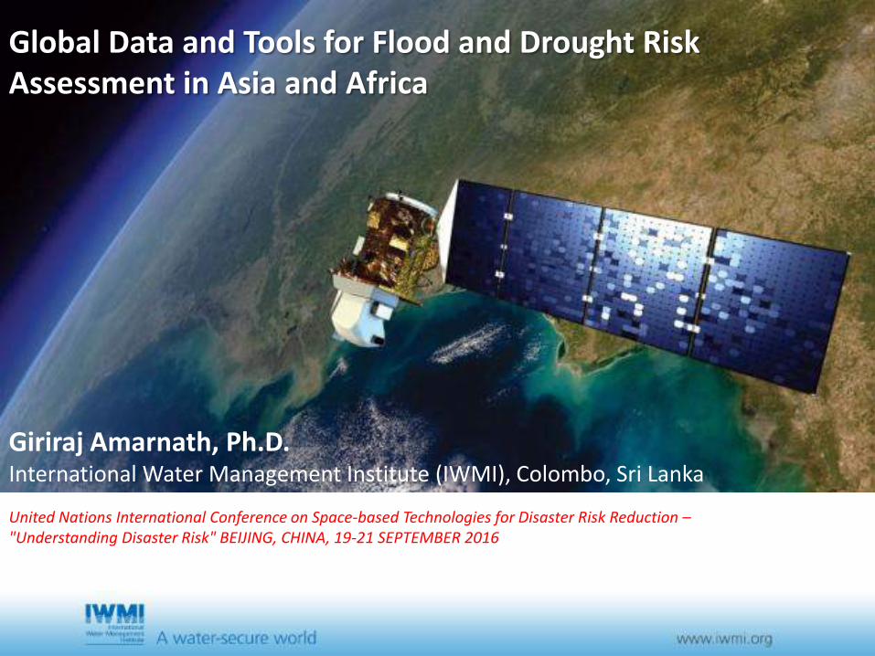
Global Data and Tools for Flood and Drought Risk Assessment in Asia and Africa
Giriraj Amarnath, Ph.D. International Water Management Institute (IWMI), Colombo, Sri Lanka
United Nations International Conference on Space-based Technologies for Disaster Risk Reduction – "Understanding Disaster Risk" BEIJING, CHINA, 19-21 SEPTEMBER 2016
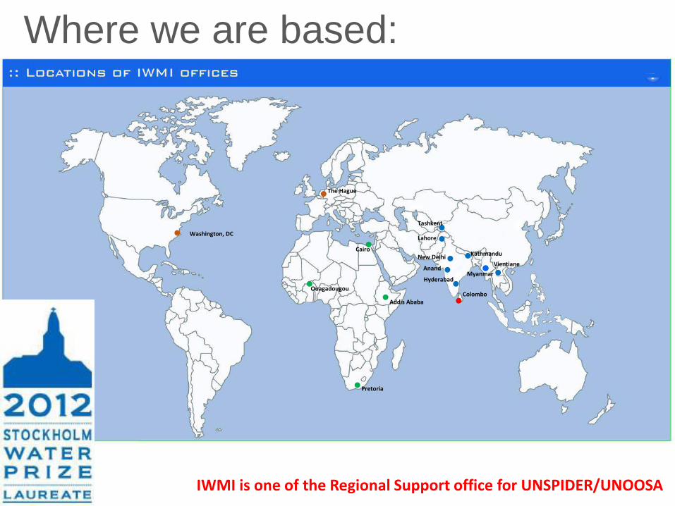
Where we are based:
Colombo
Pretoria
Ouagadougou
Cairo
Addis Ababa
Hyderabad
Anand
New Delhi
Tashkent
Lahore
Kathmandu
Vientiane
Washington, DC
The Hague
Myanmar
IWMI is one of the Regional Support office for UNSPIDER/UNOOSA
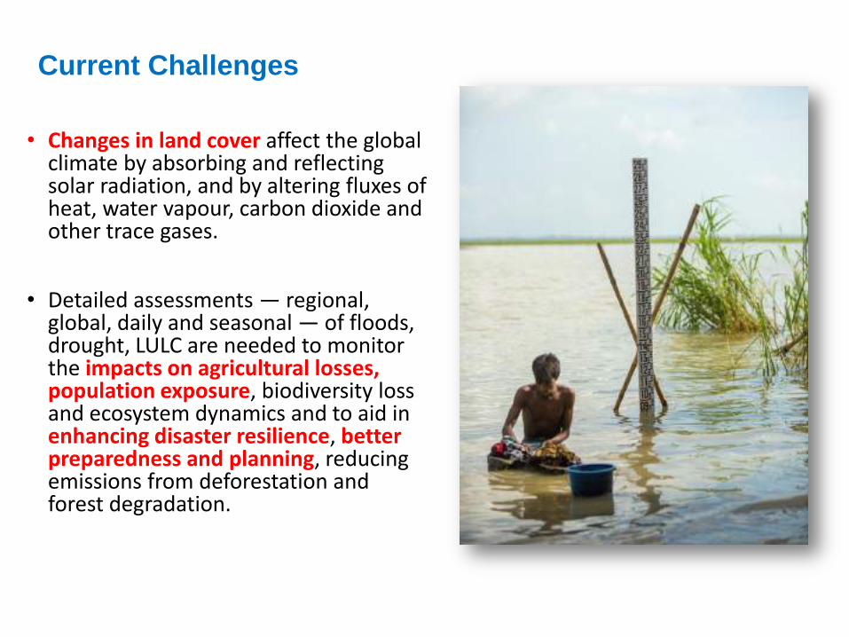
• Changes in land cover affect the global climate by absorbing and reflecting solar radiation, and by altering fluxes of heat, water vapour, carbon dioxide and other trace gases.
• Detailed assessments — regional, global, daily and seasonal — of floods, drought, LULC are needed to monitor the impacts on agricultural losses, population exposure, biodiversity loss and ecosystem dynamics and to aid in enhancing disaster resilience, better preparedness and planning, reducing emissions from deforestation and forest degradation.
Current Challenges
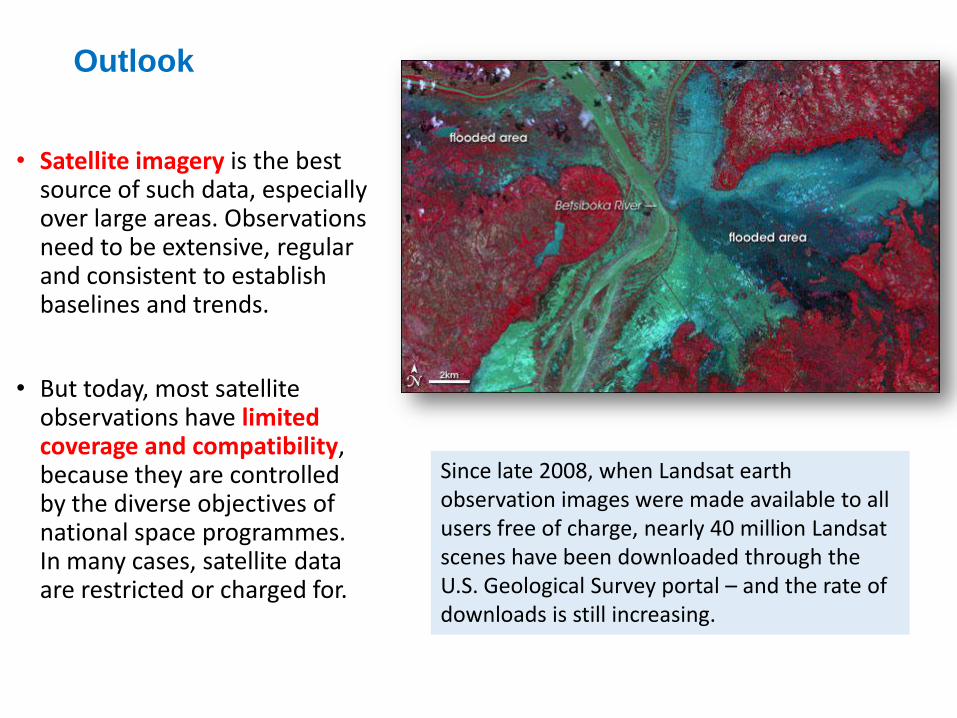
• Satellite imagery is the best source of such data, especially over large areas. Observations need to be extensive, regular and consistent to establish baselines and trends.
• But today, most satellite observations have limited coverage and compatibility, because they are controlled by the diverse objectives of national space programmes. In many cases, satellite data are restricted or charged for.
Outlook
Since late 2008, when Landsat earth observation images were made available to all users free of charge, nearly 40 million Landsat scenes have been downloaded through the U.S. Geological Survey portal – and the rate of downloads is still increasing.

That’s a lot of free data about the state of the planet. But what is it
worth? How valuable can something free possibly be?
• The worth of many things is related to scarcity. If there are too many houses or diamonds, loads of food grain or barrels of oil for sale, the price for these items falls. A free market determines the market value of what we might hope is a $500,000 house or a $5,000 diamond.
• The concept of market value breaks down for goods and services that society has determined should be freely available to everyone.
• Free data for earth observation fits into this category. It is a public good – along with public education, public roads, and public parks. While these services are not actually free (they are, of course, funded with public money), we know that the broad use of such services benefits all of society so the cost to each individual user is largely borne by all.
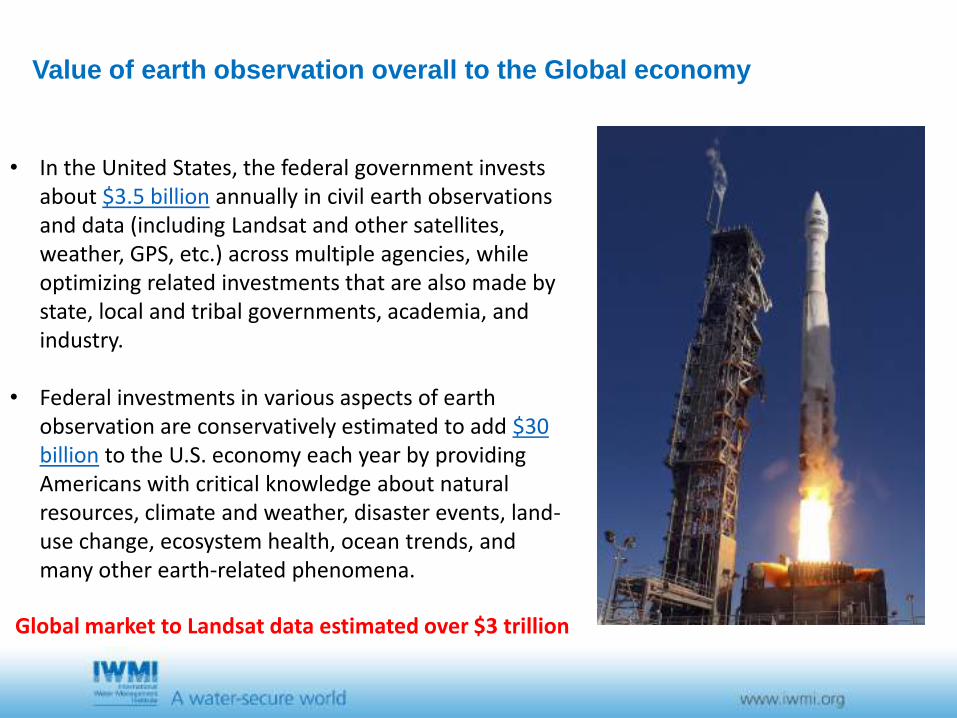
Value of earth observation overall to the Global economy
• In the United States, the federal government invests about $3.5 billion annually in civil earth observations and data (including Landsat and other satellites, weather, GPS, etc.) across multiple agencies, while optimizing related investments that are also made by state, local and tribal governments, academia, and industry.
• Federal investments in various aspects of earth observation are conservatively estimated to add $30 billion to the U.S. economy each year by providing Americans with critical knowledge about natural resources, climate and weather, disaster events, land-use change, ecosystem health, ocean trends, and many other earth-related phenomena.
Global market to Landsat data estimated over $3 trillion
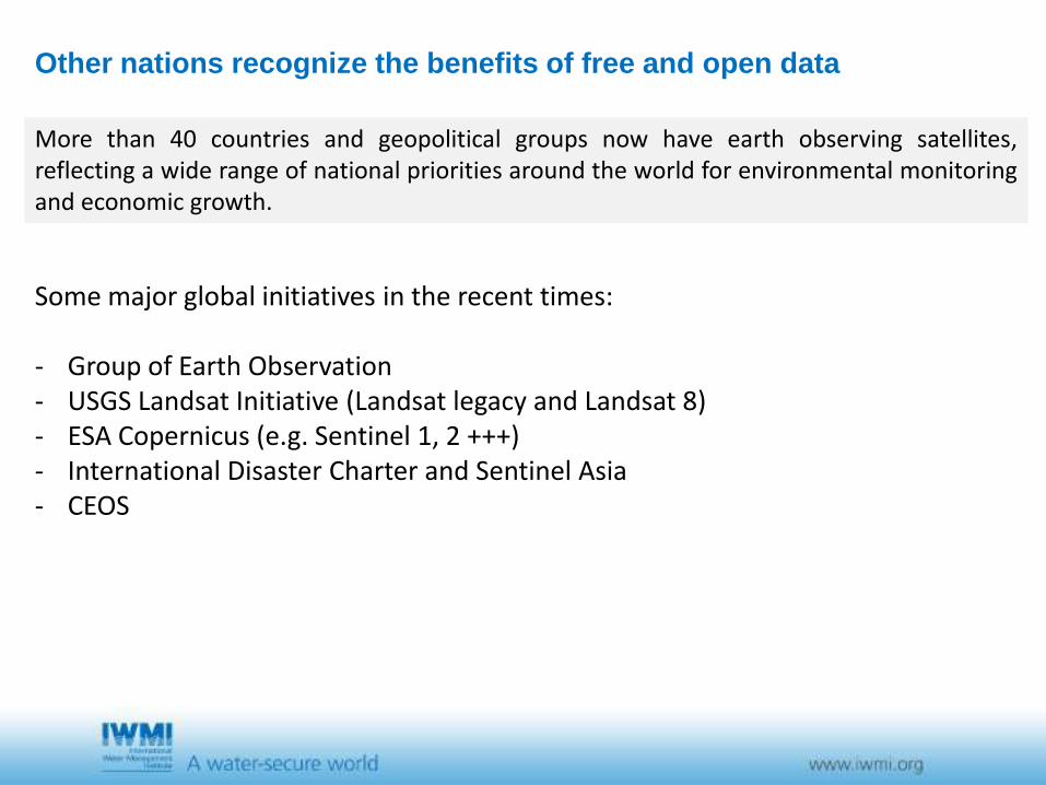
Other nations recognize the benefits of free and open data
More than 40 countries and geopolitical groups now have earth observing satellites, reflecting a wide range of national priorities around the world for environmental monitoring and economic growth.
Some major global initiatives in the recent times: - Group of Earth Observation - USGS Landsat Initiative (Landsat legacy and Landsat 8) - ESA Copernicus (e.g. Sentinel 1, 2 +++) - International Disaster Charter and Sentinel Asia - CEOS
Some Examples from IWMI’s Mapping Products

REGIONAL FLOOD RISK MAPPING - SA and SEA • Maping algorithm based on
MODIS data • 8-days maps of inundation
extent • Annual maps of maximum
inundation • Inter-annual variation of
regional flooding extent
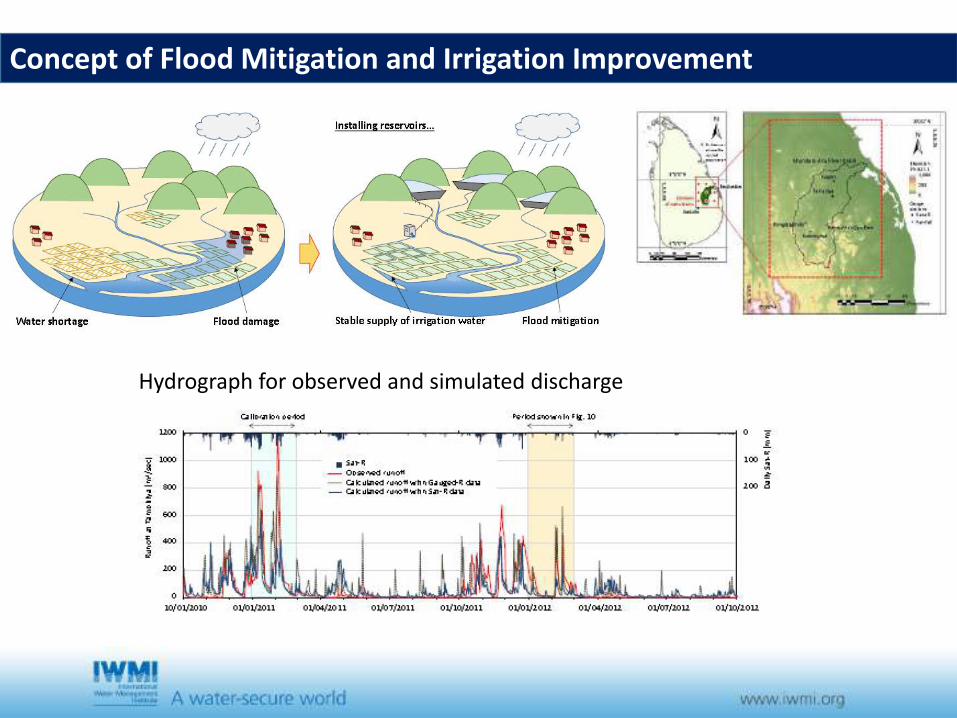
Concept of Flood Mitigation and Irrigation Improvement
Hydrograph for observed and simulated discharge
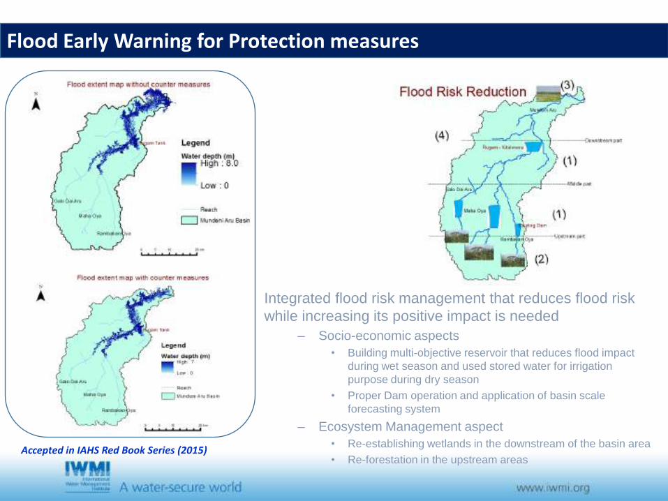
Accepted in IAHS Red Book Series (2015)
Integrated flood risk management that reduces flood risk while increasing its positive impact is needed
– Socio-economic aspects • Building multi-objective reservoir that reduces flood impact
during wet season and used stored water for irrigation purpose during dry season
• Proper Dam operation and application of basin scale forecasting system
– Ecosystem Management aspect • Re-establishing wetlands in the downstream of the basin area • Re-forestation in the upstream areas
Flood Early Warning for Protection measures
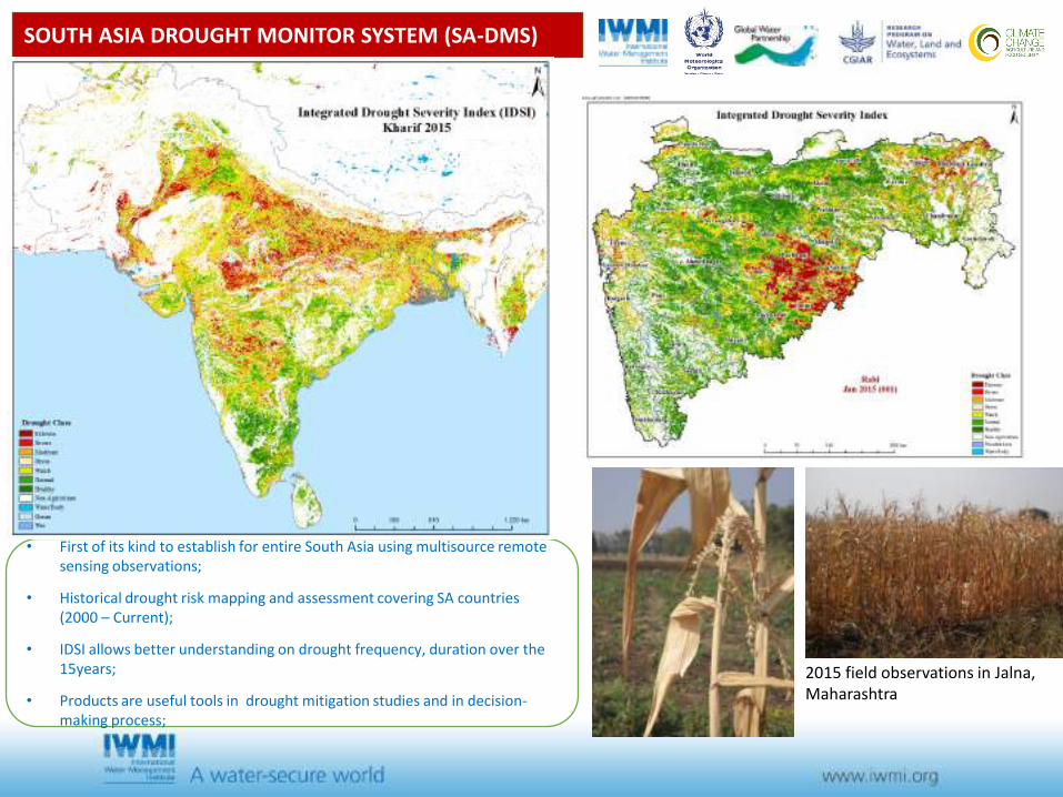
SOUTH ASIA DROUGHT MONITOR SYSTEM (SA-DMS)
• First of its kind to establish for entire South Asia using multisource remote sensing observations;
• Historical drought risk mapping and assessment covering SA countries (2000 – Current);
• IDSI allows better understanding on drought frequency, duration over the 15years;
• Products are useful tools in drought mitigation studies and in decision-making process;
2015 field observations in Jalna, Maharashtra
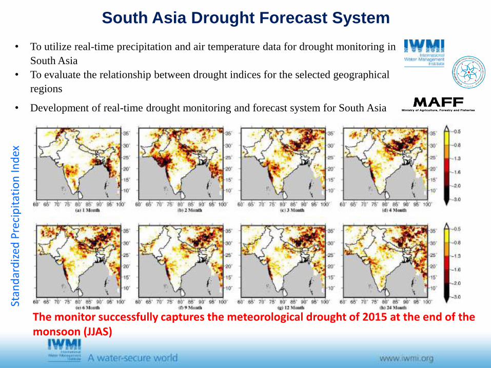
South Asia Drought Forecast System
• To utilize real-time precipitation and air temperature data for drought monitoring in South Asia
• To evaluate the relationship between drought indices for the selected geographical regions
• Development of real-time drought monitoring and forecast system for South Asia
Stan
dar
diz
ed P
reci
pit
atio
n In
dex
The monitor successfully captures the meteorological drought of 2015 at the end of the monsoon (JJAS)
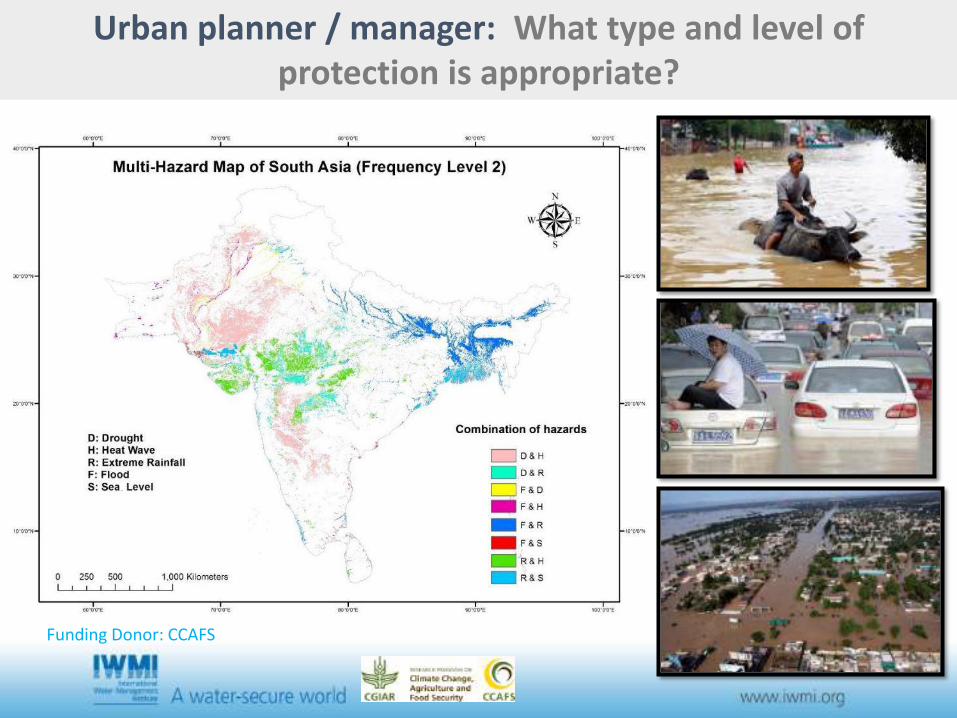
Urban planner / manager: What type and level of protection is appropriate?
Funding Donor: CCAFS
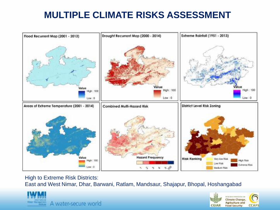
MULTIPLE CLIMATE RISKS ASSESSMENT
High to Extreme Risk Districts: East and West Nimar, Dhar, Barwani, Ratlam, Mandsaur, Shajapur, Bhopal, Hoshangabad
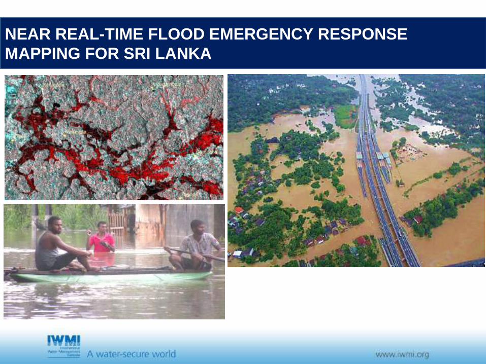
NEAR REAL-TIME FLOOD EMERGENCY RESPONSE MAPPING FOR SRI LANKA
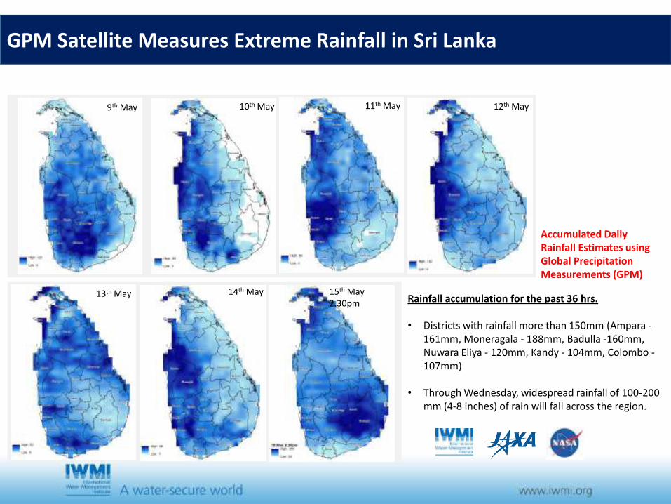
9th May 10th May 11th May 12th May
13th May 14th May Rainfall accumulation for the past 36 hrs. • Districts with rainfall more than 150mm (Ampara -
161mm, Moneragala - 188mm, Badulla -160mm, Nuwara Eliya - 120mm, Kandy - 104mm, Colombo - 107mm)
• Through Wednesday, widespread rainfall of 100-200 mm (4-8 inches) of rain will fall across the region.
15th May 2.30pm
Accumulated Daily Rainfall Estimates using Global Precipitation Measurements (GPM)
GPM Satellite Measures Extreme Rainfall in Sri Lanka
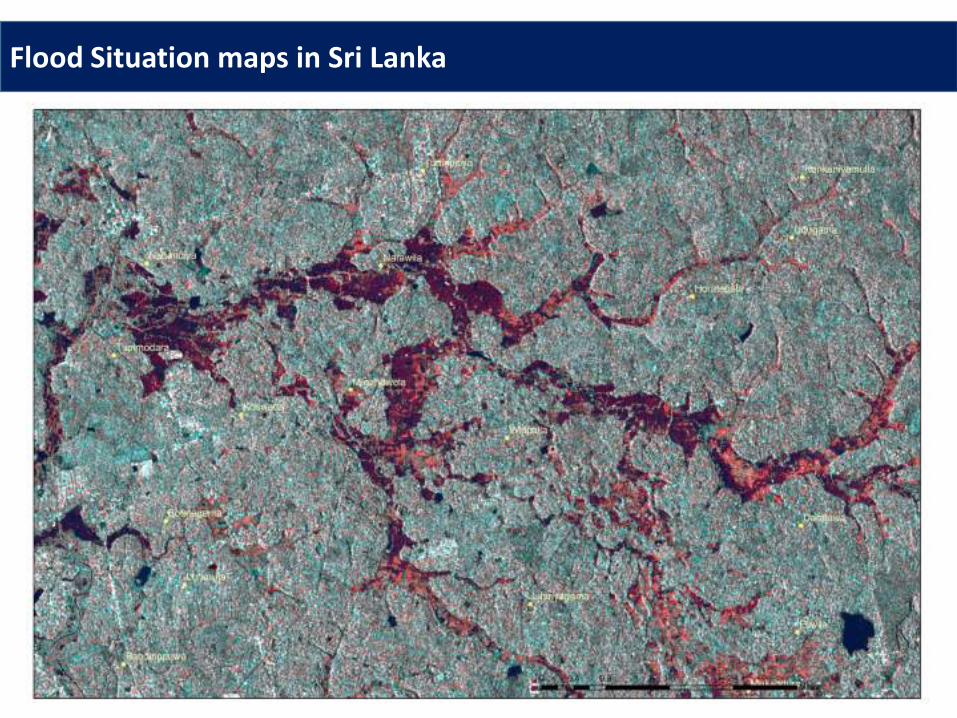
Flood Situation maps in Sri Lanka
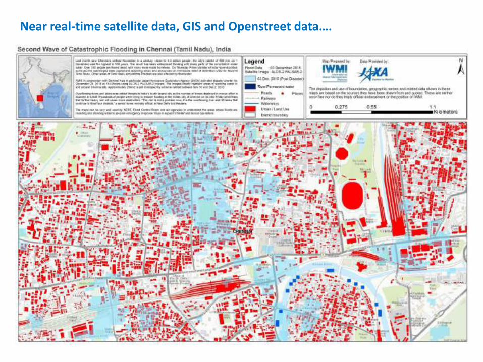
Near real-time satellite data, GIS and Openstreet data….
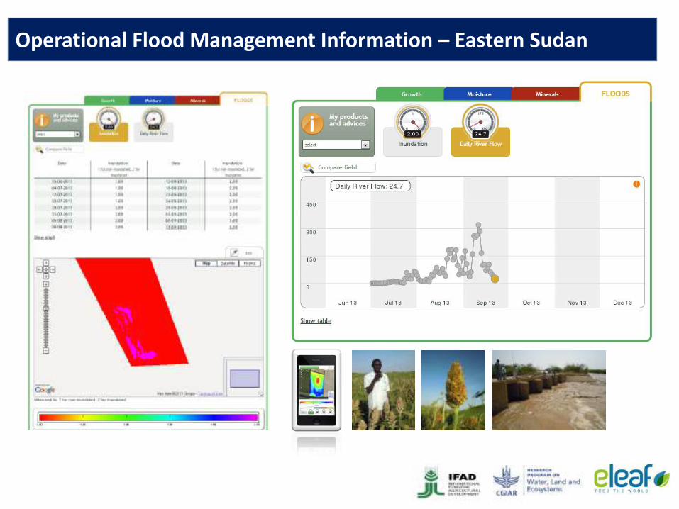
Operational Flood Management Information – Eastern Sudan
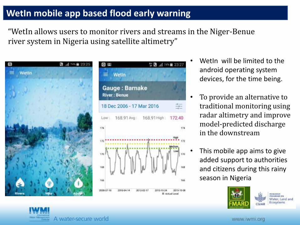
WetIn mobile app based flood early warning
• WetIn will be limited to the android operating system devices, for the time being.
• To provide an alternative to traditional monitoring using radar altimetry and improve model-predicted discharge in the downstream
• This mobile app aims to give added support to authorities and citizens during this rainy season in Nigeria
“WetIn allows users to monitor rivers and streams in the Niger-Benue river system in Nigeria using satellite altimetry”
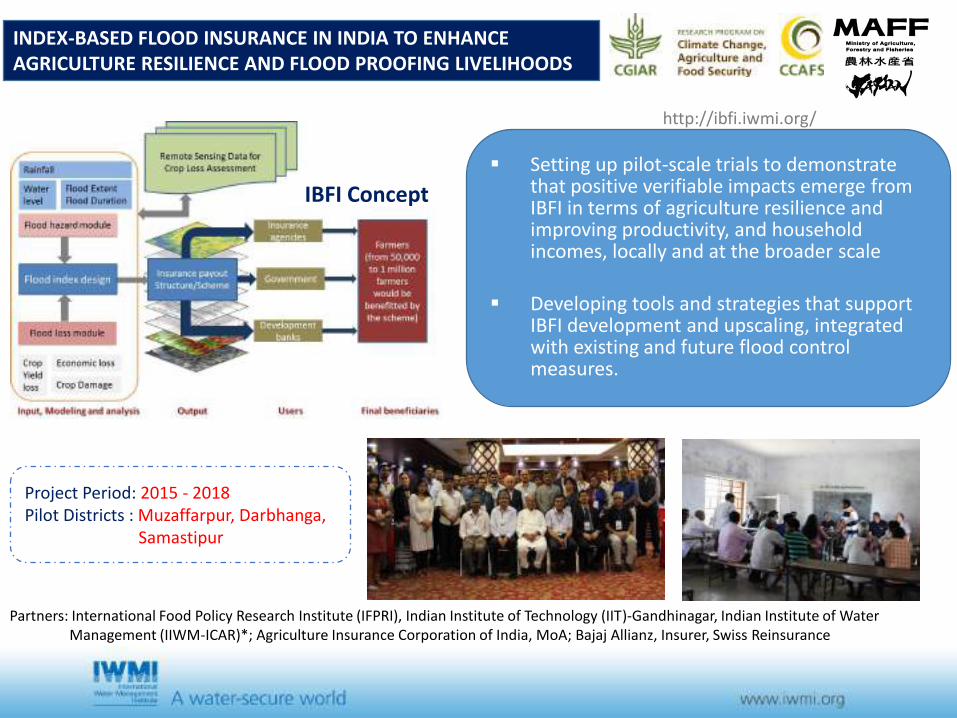
INDEX-BASED FLOOD INSURANCE IN INDIA TO ENHANCE AGRICULTURE RESILIENCE AND FLOOD PROOFING LIVELIHOODS
Setting up pilot-scale trials to demonstrate that positive verifiable impacts emerge from IBFI in terms of agriculture resilience and improving productivity, and household incomes, locally and at the broader scale
Developing tools and strategies that support IBFI development and upscaling, integrated with existing and future flood control measures.
Partners: International Food Policy Research Institute (IFPRI), Indian Institute of Technology (IIT)-Gandhinagar, Indian Institute of Water Management (IIWM-ICAR)*; Agriculture Insurance Corporation of India, MoA; Bajaj Allianz, Insurer, Swiss Reinsurance
Project Period: 2015 - 2018 Pilot Districts : Muzaffarpur, Darbhanga,
Samastipur
IBFI Concept
http://ibfi.iwmi.org/
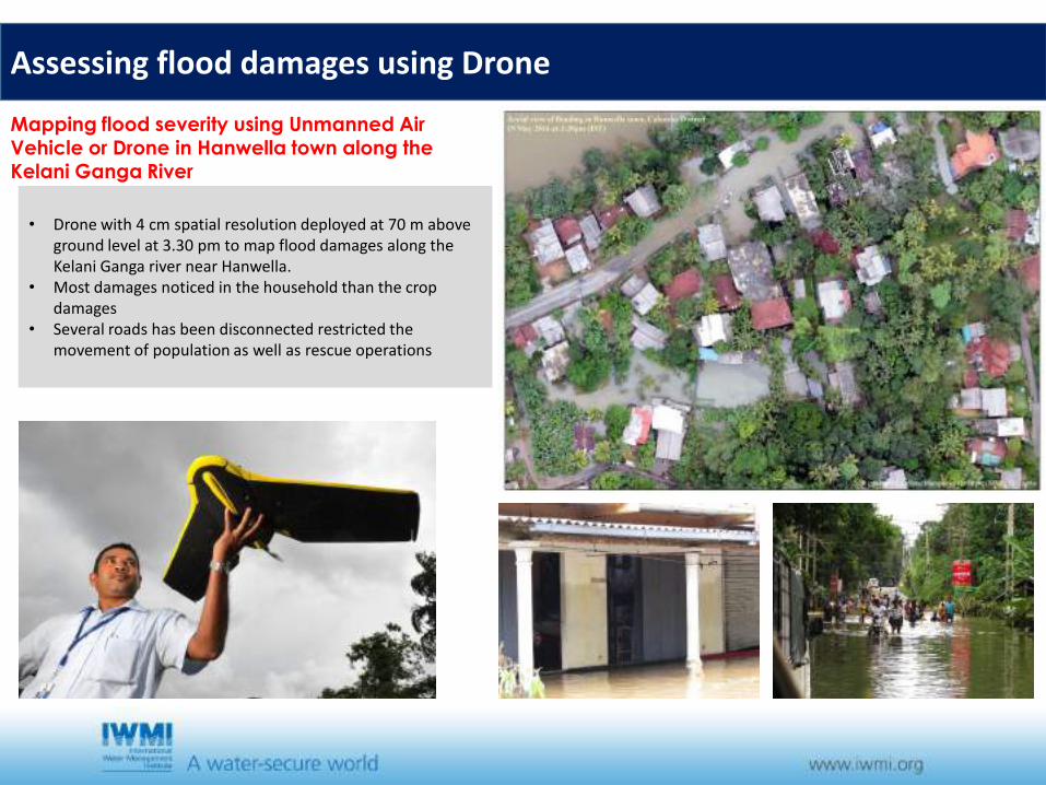
Mapping flood severity using Unmanned Air Vehicle or Drone in Hanwella town along the Kelani Ganga River
• Drone with 4 cm spatial resolution deployed at 70 m above ground level at 3.30 pm to map flood damages along the Kelani Ganga river near Hanwella.
• Most damages noticed in the household than the crop damages
• Several roads has been disconnected restricted the movement of population as well as rescue operations
Assessing flood damages using Drone
• Freely available satellite imagery will improve science and environmental-monitoring products
• Governments and the remote-sensing community should now seize the opportunity to develop a unified strategy for DRM.
• The remote-sensing community must advocate the development and maintenance of data archives and innovative processing methods.
• Best-practice approaches and standards can be developed by the GEO, a voluntary partnership between governments and international organizations to promote global collaboration around EO, and offshoots such as the IDC.
• Finally, researchers, policy-makers, non-governmental organizations and land managers need to use and promote more widely the capacity of the satellite data for DRM.
Conclusions