global mapping newsletter - github pages. bouchra asri ayoub ... surveyor, department of lands and...
TRANSCRIPT
40No.40 -Dec . 25, 2005 International Steering Committee for Global Mapping
GLOBAL MAPPINGNEWSLETTEROpen Meeting on the Human Dimensions of Global Change in Bonn
Dr. Karen Kline Assistant Secretary General of ISCGM
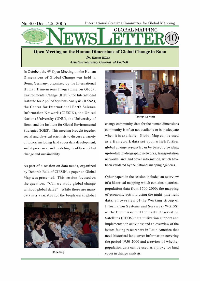
In October, the 6th Open Meeting on the Human Dimensions of Global Change was held in Bonn, Germany, organized by the International Human Dimensions Programme on Global Environmental Change (IHDP), the International Institute for Applied Systems Analysis (IIASA), the Center for International Earth Science Information Network (CIESIN), the United Nations University (UNU), the University of Bonn, and the Institute for Global Environmental Strategies (IGES). This meeting brought together social and physical scientists to discuss a variety of topics, including land cover data development, social processes, and modeling to address global change and sustainability.
As part of a session on data needs, organized by Deborah Balk of CIESIN, a paper on Global Map was presented. This session focused on the question: “Can we study global change without global data?” While there are many data sets available for the biophysical global
change community, data for the human dimensions community is often not available or is inadequate when it is available. Global Map can be used as a framework data set upon which further global change research can be based, providing up-to-date hydrographic networks, transportation networks, and land cover information, which have been validated by the national mapping agencies.
Other papers in the session included an overview of a historical mapping which contains historical population data from 1700-2000; the mapping of economic activity using the night-time light data; an overview of the Working Group of Information Systems and Services (WGISS) of the Commission of the Earth Observation Satellites (CEOS) data utilization support and implementation activities; and an overview of the issues facing researchers in Latin America that need historical land cover information covering the period 1950-2000 and a review of whether population data can be used as a proxy for land cover in change analysis.Meeting
Poster Exhibit
Global Mapping NewsLetterP a g e No. 40- Dec. 25, 20052
Global Mapping Seminar in DakarMitsuo Iwase
Head of Advanced Surveying Dept., College of Land, Infrastructure and Transport, MLIT
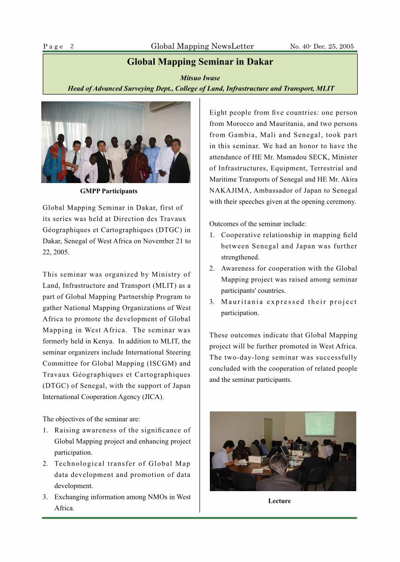
Global Mapping Seminar in Dakar, first of its series was held at Direction des Travaux Géographiques et Cartographiques (DTGC) in Dakar, Senegal of West Africa on November 21 to 22, 2005.
This seminar was organized by Ministry of Land, Infrastructure and Transport (MLIT) as a part of Global Mapping Partnership Program to gather National Mapping Organizations of West Africa to promote the development of Global Mapping in West Africa. The seminar was formerly held in Kenya. In addition to MLIT, the seminar organizers include International Steering Committee for Global Mapping (ISCGM) and Travaux Géographiques et Cartographiques (DTGC) of Senegal, with the support of Japan International Cooperation Agency (JICA).
The objectives of the seminar are:1. Raising awareness of the significance of
Global Mapping project and enhancing project participation.
2. Technologica l t ransfer of Global Map data development and promotion of data development.
3. Exchanging information among NMOs in West Africa.
Eight people from five countries: one person from Morocco and Mauritania, and two persons from Gambia, Mali and Senegal, took part in this seminar. We had an honor to have the attendance of HE Mr. Mamadou SECK, Minister of Infrastructures, Equipment, Terrestrial and Maritime Transports of Senegal and HE Mr. Akira NAKAJIMA, Ambassador of Japan to Senegal with their speeches given at the opening ceremony.
Outcomes of the seminar include:1. Cooperative relationship in mapping field
between Senegal and Japan was further strengthened.
2. Awareness for cooperation with the Global Mapping project was raised among seminar participants' countries.
3. M a u r i t a n i a e x p r e s s e d t h e i r p r o j e c t participation.
These outcomes indicate that Global Mapping project will be further promoted in West Africa. The two-day-long seminar was successfully concluded with the cooperation of related people and the seminar participants.
GMPP Participants
Lecture

P a g e No. 40- Dec. 25, 2005 Global Mapping NewsLetter 3
Technical Session II・ Creation and Utilization of Global Map data Mr. Shin'ichi SAKABE・Contribution of Global Mapping in a Regional
Cooperation for Geographic Data Management Dr. Massaer MBAYE, RECTAS, Nigeria
Technical Session III ・Comparative studies and contribution of Global
Mapping in harmonization and standardization of geographical data using GIS software Dr. Ibrahima Almamy WADE, Staff Member of CSE
Day 2 Nov. 22
LecturersMr. Shin’ichi SAKABE:
C h i e f C o o r d i n a t o r , G l o b a l M a p p i n g Partnership Program (GMPP)
Mr. Mitsuo IWASE: International Steering Committee of Global Mapping (ISCGM), College of Land, Infrastructure and Transport, MLIT
Mr. Youssou NDONG: Director, Direction des Travaux Géographiques et Cartographiques (DTGC)
Dr. Massaer MBAYE: Deputy Director, Regional Centre for Training in Aerospace Survey and Earth Sciences (RECTAS)
Dr. Ibrahima Almamy WADE: Staff member, Ecology Monitoring Centre (CSE)
Dr. Mamadou THIAM: In charge of Cartography Unit, Direction des Travaux Géographiques et Cartographiques (DTGC)
Participants of Global Mapping Seminar
Mr. Mohamed Ould Brahim (Mauritania): Directeur Topographie et Cartographie, Ministere Equipement et Transports
Ms. Bouchra Asri Ayoub (Morocco): Chef de Service des Etudes Cartographiques Agence Nationale de la Conservation Fonciere, du Cadastre et de la Cartographie
Mr. Baba Cham (Gambia): Surveyor, Department of Lands and Surveys
Mr. Modou Lamin A. S Jammeh (Gambia): Map Librarian, Department of Lands and Surveys
Mr. Issiaka Dembele (Mali): Cartographer, Institut Géographique du Mali
Mr. Chaka Fore (Mali): Geodesist, Institut Géographique du Mali
Mr. Abdou Galaye Diouf (Senegal): Technologist Photogrammetry, Direction des Travaux Géographiques et Cartographiques
Mr. Baba Keita (Senegal):Technologist Photogrammetry, Direction des Travaux Géographiques et Cartographiques
・State of Global Mapping data in Senegal: Goals and perspectives in the strategy of the implementation of NSDI
Dr. Mamadou THIAM, Staff Member of DTGC
Closing Ceremony Certificate Presentation
Mr. Youssou NDONG, Director of DTGC
List of Attendees: Global Mapping Seminar in DakarNovember 21-22, 2005
09:00 - 12:30
10:10 - 12:15
14:00 - 16:30
14:00 - 15:00
16:30 - 16:45
Day 1 Nov. 21 Opening Ceremony and Keynote Speeches : Mituso IWASE, Secretariat of ISCGM Mr. Shin’ichi SAKABE, GMPP, MLIT HE Mr. Akira NAKAJIMA Ambassador of Japan to Senegal
HE Mr. Mamadou SECK Minister of Infrastructure, Equipment, Terrestrial and Maritime Transports of Senegal
Keynote Speech Mr. Youssou, NDONG, Director of DTGC
Technical Session I Outline of Global Mapping Project Mitsuo IWASE
Country Report Presentation on Spatial Data Infrastructure of the seminar participants’ countries
Adjourn
15:30 - 17:00
16:45
17:00
Close

Global Mapping NewsLetterP a g e No. 40- Dec. 25, 20054
Australian Contribution to Global MapMr. Phil Tickle
Manager National Mapping, Geoscience Australia
Australia has been a significant contributor to the
Global Map Project since its inception in 1992.
Geoscience Australia’s past involvement includes
assisting to draft the global mapping specifications,
hosting the fifth meeting of the International
Steering Committee for Global Mapping, held in
Canberra in 1998, and provision of a complete
and consistent 1:1,000,000 Global Map dataset
in 2001. Currently, Geoscience Australia’s Peter
Holland is interim vice-chair of the International
Steering Committee for Global Mapping (ISCGM).
Future support of the Global Map Project is
being realised through Geoscience Australia’s
collaboration: with Airservices Australia, revising
World Aeronautical Charts (WAC-1:1,000,000);
and the Australian Defence Force, revising Tactical
Pilotage Charts (TPC-1:500,000 scale) and
Operational Navigation Charts (ONC -1:1,000,000
scale).
Previous WAC, TPC and ONC revisions involved
traditional manual cartographic techniques on
film. Today, Geoscience Australia is deriving these
products from the National Topographic Database
(NTDB), which provides a consistent, “seamless”
source of data for the nation at 1:250,000 scale.
Following several years of intensive production
and revision, this database now has an average
currency of less than 5 years old for the entire
nation. It is freely available to the public, and
industry value-adders in digital form and hardcopy
maps are sold through a national distributor
network.
This new collaboration involves extracting the
1:250,000 scale topographic data from Geoscience
Australia’s seamless geographic database. Using
the previous edition maps as a guide, features
are then tagged for future use at 1:1,000,000
scale. Updated aeronautical information is then
incorporated into the new database. The revised
data is then symbolised, cartographically offset and
annotated to produce WACs, TPCs and ONCs with
the same look and feel as previous editions.
While Defence Aeronautical Chart mapping is
on-going, Geoscience Australia is working with
Airservices Australia to completely revise the
1:1,000,000 WAC series by the end of 2006 in both
digital and hardcopy map form. This topographic
database will then be made available to the Global
Map Project.
Other work current ly being undertaken in
Australia includes the recent release of a 250m
bathymetric elevation model, and a revised 250m
Digital Elevation Model (DEM) to be released by
Extract of 1:1 million scale World Aeronautical Chart
for Hobart, Tasmania

P a g e No. 40- Dec. 25, 2005 Global Mapping NewsLetter 5
Geoscience Australia in early 2006. A number of Australian Government agencies are also working on national vegetation and landuse databases which will ultimately feed into the Global Map process.
In response to the information needs of emergency management, critical infrastructure protection, and natural hazard and risk assessment, Geoscience
Australia has also recently established a number of on-going collaborative mapping programs with State and Local Governments to improve the quality of Australia Spatial Data Infrastructure using a “collect once, use many” approach. The outcome will be an up-to-date multi-scale database for the country capable of meeting local, regional, national and global needs.
I ’ v e j u s t r e c e n t l y c o m p l e t e d a 6 m o n t h post-doctoral fellowship at the Geographical Survey Institute which was supported by the Japan Society for the Promotion of Science (JSPS). It was a great opportunity to actually work with the staff of the ISCGM Secretariat on a daily basis and to become more familiar with how the Secretariat operates as well as how GSI works.
While at GSI, I worked closely with the Secretariat staff in preparing for the ISCGM 12 (Cairo) meeting, assisting in the preparation and review of documents, and interacting with the staff on the
day to day activities of the Secretariat. Also, I was able to meet with the trainees attending the Global Map training sessions supported by JICA, as well as give some lectures on the history of Global Map and global data sets. I also went to Chiba University and met with Prof. Ryutaro Tateishi’s students and staff. Prof. Tateishi is the Chair of Working Group 4, and the leader of the land cover data development and validation part of the Global Map project.
While at GSI, I worked on expanding the user model I had developed while a t UC Santa Barbara, identifying where users are located, what applications they use Global Map data for, and what issues might be inhibiting or promoting use. A key issue is that many users are not necessarily from non-governmental agencies or from governments, a key audience that was expected based upon the fact that Global Map was created as a result of the call for data in Chapter 40 of Agenda 21, the document resulting from the United Nations Conference on the Environment and Development held in 1992.
Overall, the experience was a wonderful one, both professionally and personally.
JSPS Post-doctoral Fellowship at GSI
Dr. Karen Kline Assistant Secretary General of ISCGM
Dr. Karen Kline

Global Mapping NewsLetterP a g e No. 40- Dec. 25, 20056
1. Overview
PCGIAP Fundamental Data Working Group
(WG) 2 held an open workshop and an Executive
Board meeting in Bandar Seri Begawan, Brunei
Darussalam, on 24 Nov. and 26 Nov. 2005
respectively, where other important events
including 8th South East Asia Survey Congress
(SEASC) and UNGEGN took place concurrently.
The workshop, as a response to a resolution of
the 11th PCGIAP in Bali, Indonesia, was designed
to understand various initiatives for fundamental
data development and how best collaboration
can be pursued and implemented among them to
contribute to the region in its efforts for raising
preparedness to natural disasters.
2. Fundamental Data Development Workshop
Based on the shared recognition of the importance
of geographic information of an extensive
coverage as was demonstrated at the time of the
tsunami on 26 Dec. 2004 across South Asia, the
Workshop sought to define specific requirements
for creation of seamless Asia Pacific datasets,
ultimate goal of PCGIAP. Reports were made
from PCGIAP WG2, Global Map, UN Second
Administrative Level Boundaries Project (SALB),
and other regions. Brunei Darussalam and
Indonesia presented their efforts for Global Map
data development. It was understood that those
initiatives of different levels, global, regional
and national, could be mutually beneficial and
synergic. PCGIAP Regional Geodesy WG1 also
presented a report on studies on the effects of the
tsunami conducted through Extraordinary Geodetic
Campaign by PCGIAP WG 1. After intensive
discussions the Workshop adopted two resolutions,
one calling for strengthened linkage among
PCGIAP, Global Map and SALB, while the other
for development and implementation of a pilot
project for seamless data layers for the tsunami
affected area. It was chaired by Prof. Chen Jun,
China, Vice Chair of WG2 and attended by about
40 delegates from 10 countries.
3. Executive Board Meeting
Executive Reports and reports from four WGs
were presented, summarizing major events
including 11th PCGIAP in Bali, WG 2 Workshop in
Brunei Darussalam, and WG4 SDI course in India.
Reports from Global Map, GSDI and SALB were
also introduced. Discussed were preparations for
the 17th UNRCC-AP/12th PCGIAP, on 18-22 Sep.
2006 in Bangkok, Thailand, in terms of theme,
program, keynote speakers as well as Board
membership for the period 2006-2009. The next
Board meeting will be in Bangkok, immediately
before the17th UNRCC-AP/12th PCGIAP.
PCGIAP Fundamental Data Workshop and Executive Board Meeting Mr. Peter Holland President PCGIAP
Board Meeting Participants

P a g e No. 40- Dec. 25, 2005 Global Mapping NewsLetter 7
Activities of ISCGM at PCGIAP WG2 (Fundamental Data) WorkshopHiromichi Maruyama
Secretary General of ISCGM
On behalf of ISCGM, I part icipated in PCGIAP WG2 Workshop held in Bandar Seri Begawan, Brunei Darussalam in the afternoon of 24th November 2005. It had been proposed to develop pan Asia Pacific framework dataset based on Global Map at the joint workshop between PCGIAP WG1 and WG2 held in Chengdu, China in September 2004. Most significant difference between Asia Pacific dataset and Global Map is that Asia Pacific data set is seamless. Therefore, I stressed in my presentation that collaboration between PCGIAP WG2 and Global Map is beneficial for both initiatives. After 7 presentations from various perspectives, the way move forward was discussed. As a result, it was agreed to set up a task force to conduct a pilot study on Asia Pacific dataset focusing on the area affected by Indian Ocean Tsunami which occurred in December 2004. ISCGM joined the task force.
Proceeding to the workshop, in the morning of 24th, I made a presentation on Global Map especially focusing on the new scheme of land cover data development of Global Map at the 8th South East Asia Survey Congress (SEASC2005) which was the central event among several others held concurrently at the same venue. Global Map was accepted favorably among the audience.
On 26th PCGIAP Executive Board Meeting was held where I attended as an observer
representing ISCGM. I made a report on recent activities of ISCGM, in which I asked a help from PCGIAP to the project in inviting 19 PCGIAP member countries which have not participated in Global Mapping Project.
The main topic of the Board Meeting was the preparat ion of the 17 th UNRCC-AP which is scheduled for September 2006 in Bangkok, Thailand. In this regard, I proposed to hold a workshop focusing on the use of geo-information such as Global Map for mitigating large scale natural disasters and attaining sustainable development as a part of UNRCC-AP. This proposal was accepted by the Board.
Through the participation of WG2 and other meetings, it was felt that Global Map has become more related with regional initiatives and that collaboration with them makes Global Map more useful and sustainable.
Author at Presentation

Global Mapping NewsLetterP a g e No. 40- Dec. 25, 20058
core business as in the examples listed here below:・ Planning of Cellular phone network・ Planning for the AFREF project・ Population Census・ Wildlife distribution and monitoring・ Kenya’s Telcom・ Research work・ The Global Map was extensively used in
the compilation of the Kenya’s National Atlas.
・ Used as a tool for disaster mapping and mitigation. (Clashes and epidemics)
・ Ecological condition.・ Monitor destruction of the forest cover.
Inhibiting Factors
It is the wish of the SOK to develop a web portal for the Global Map but are constrained in the following ways.・ Inadequate and unstable power supply
Global Map as we understand it refers to a Global archive of Spatial Datasets at a small scale. Kenya’s Global Map was at production designed and compiled at scale 1:1mn and was limited to fundamental data sets, that are core to the Global Map framework. Kenya’s engagement in GM has been quite beneficial in many aspects as enumerated hereunder.
1. The experience gained in the development of GM has naturally become an asset in the establishment of the Core Spatial Data framework.
2. Through GM SOK has been able to build sizeable capacity in the form of manpower and resources to meet most challenges involved in the exercise. Through the same project we were able to apply the experience in the establishment of the Spatial Data framework for the City of Nairobi. Currently we are in planning to scale up the activity to cover other major cities. Similarly there has been an increase in the demand for training to enable staff remain relevant in the new dispensation.
3. Staff are highly sensitized, motivated and feel challenged by the subject matter as they respond to the demands of the new paradigm in dealing with the core data sets.
4. The Global Map has been quite useful as a decision support tool and in planning the National programmes.
5. Generally many organizations use the Global Map as the base map on which to showcase their individual Geo-referenced core data sets as they develop Institutional Information Management Systems for planning and regulating their respective
Global Mapping KENYA’S EXPERIENCE
Mr. Kombo MweroPermanent Secretary, Ministry of Lands, Kenya
Global Map KENYA

P a g e No. 40- Dec. 25, 2005 Global Mapping NewsLetter 9
Global Mapping Group Training Course - 2005Mr. Malakai Vakautawale
Technical Officer GIS, Ministry of Lands and Mineral Resource, Fiji
On behalf of my fellow participant and my Government, please allow me to express a small token of appreciation to the Director General, Directors and staff of the Institute, for the warm welcome and unforgettable gesture expressed during our enjoyable days of training in GSI. Words can never do justice to the memory we will always have of our unleashed experience in your Institute. Your kindness and care for each one of us made this experience something we will always cherish and talk about as long as we live.
Eight participants from different countries namely: Afghanistan, Algeria, Brazil, Fiji, Nepal, Palestine, Macedonia, and Uzbekistan aimed for one goal and that is to produce Global Map for our countries. I can honestly say that we have acquired the skills in developing a Global Map and we are confident that we will complete our individual map before the schedule time – 2007.
We n o t o n l y g a i n e d t h e e x p e r i e n c e a n d technicalities, however we shared and learned new cultures, traditions and beliefs, which I believe open and broadens our views toward life and also learn to appreciate each individual lifestyle. We left our own countries without any knowledge of the people we will meet; however we have no regrets as we were surprised by the warm-hearted and kindness of the staff here and also the community of Tsukuba which we were always part of. We left behind our families, loved ones but by your smiles, we easily made friends here as well.
My appreciation goes to the government of Japan,
JICA for the opportunity to attend the course, to the Director General, the Deputy Director, Directors, the two hard working staff Mr. Sugimoto Oki (Program Officer) and Mr. Katsuyuki Ajima (Coordinator) of Tsukuba International Center (TBIC). Your good coordination and arrangement of study trips and technical visits are something that has to be admired.
To my Global Mapping friends Mr. Obaid, Mr. Amine, Miss Renata, Mr. Narayan, Mr. Bashar, Mr. Baskim and Mr. Alisher, thank you for your time. No one will dispute that this group is the best one. We laughed, we cried, we played, we joked, we debated and we help each other thus showing the close relationship like brothers and sisters that we had together……once again thank you very much for your company.
My sincere appreciation goes to my Government and Ministry for having the confidence in me. Lastly to my Chief Executive Officer, Director and Supervisor for submitting my name and assisted me in preparation, given the short notice to participate.
Participants of JICA GM course
to sustain the GM on an internet based platform.
・ Telecommunication poor.・ Questionable Internet Connectivity that
may not support web-mapping capability.
・ Lack of dedicated electronic networks as a means for data capture and distribution to users.
・ Poor ICT infrastructure.

Published by : The Secretariat of the International Steering Committee for Global Mapping (ISCGM) Geographical Survey Institute (GSI) 1 Kitasato, Tsukuba-shi, 305-0811 Japan Phone : +81-29-864-6910 Fax : +81-29-864-6923 Homepage : http://www.iscgm.org E-mail : [email protected]
No. 40- Dec. 25, 2005P a g e 1 0 Global Mapping NewsLetter
Global Map and Related MeetingsFollowings are Global Map and related meetings. Information on related meetings will be highly appreciated.
2006・ 25-26 May, Orland, Florida, USA
ISO/TC 211 22nd Plenary
・ 29 August - 1 September, Bangkok, ThailandMap Asia 2006
・ 18 - 22 September, Bangkok, Thailand 17th UNRCC-AP
・ 6 – 10 November, Santiago, Chile GSDI 9th Conference
・ 11 November, Santiago, Chile 13th Meeting of ISCGM
・ 14 - 15 November, Riyadh, Saudi ArabiaISO/TC 211 23rd Plenary
2007・15 - 20 July, Cambridge, England
Cambridge Conference
l Technical Note for Global Map Third Round : Composition and Characteristics of Transportation Layer
Transportation is an important layer to compose Global Map. The more optional i tems are obtained, the better the data are.<Composition of Transportation Layer>Transportation layer is made up mainly of airport, railroad and road. In addition, there are bridge, tunnel and ferry route.<Points to acquire line data>In principle, objects of "1km or longer" are obtained. Those shorter than this size are omitted. (See Figure 1)In order to obtain bridge and tunnel, cut the road of the relevant part and replace it with these features. Line of road to line of bridge and tunnel shall not overlap. Definition between road and bridge/tunnel is made by attribute, not by line. (See Figure 2)
Figure 2
l Six countries: Republic of Bolivia on October 13th, Kingdom of Morocco on October 14th, Afghanistan on October 31st, Palestine on November 8th, Mauritania on December 2nd, and Syria Arab Republic on December 5th, newly participated in the Global Mapping project. The project currently has the participation of 155 countries/regions.
l Global Map of Iran was released on October 24th and now Global Map of 21 countries are available on the ISCGM Home Page.
From the Secretariat
Figure 1Standards for obtaining bridge and tunnel
Way of obtaining bridges and tunnels