global partnership on output base aid project sub project
TRANSCRIPT

Global Partnership on Output Base Aid Project
Sub – Project Environmental Assessment Report – NO 01
Waste Water Collection, Decentralized Treatment and Disposal
System for Fisheries Houses at Diyawarapura
GPOBA Project
National Water Supply and Drainage Board
Sri Lanka

1.0 Project Description
The Diyawarapura fisheries housing scheme is situated near the 5th km post along the new Galle road in
the Moratuwa divisional secretary area of the southern part of the Colombo city. It is about 50m away
from the main road. This is a low income housing settlement provided for fisheries families by the
Ministry of fisheries. There are for flats and each flat consist of 16 housing units. The total of 64 housing
units are occupying by approximately 300 people. This is located 150m away from the sea in a low lying
flat surface area with a high water table of approximately 1 meter.
These people are severely suffering from lack of sanitation facilities as they are not having proper waste
water disposal system. Existing septic tanks are frequently overflowing. Most of ground floor toilets are
overflowing over the year.
DEWAT system was proposed for this scheme as it is approximately more than 5 kilometers away from
the existing sewerage network.
1.1 Proposed system
All toilets are connected to proposed gravity sewer and collected wastewater will be connected to
rehabilitated existing septic tanks. Effluent from the septic tank will filter from the anaerobic filter and
filtered waste water will be disinfect at the wet well of the pump house and it will be pumped to the
existing canal which is 150m away from the site.
Collection Network
• Wastewater collection
Septic Tanks
• BOD reduction By 55%
Anaerobic Filters
• Further BOD reduction (By 75% From AF Influent)
Chlorination
• Disinfect the Pathogens (At PS Sump)
Pumping • Treated W/W pump to the Existing canal which
directed to the Sea

2.0 Required approvals and permits
Environmental clearance from the Central Environmental Authority (CEA).
Construction Approval from Department of Coast Conservation
Construction Approval from Moratuwa Municipal Council
Land Clearance from Ministry of fisheries and consent letter from Divisional secretariat,
Moratuwa
All approvals which have taken are attached in the annexure 1-4
3.0 Existing Environmental Condition in project area
3.1 Geology
The general topography of the Diyawarapura area consists of largely flat low lying terrain. Elevations
vary only from 0m MSL to 1m MSL.
3.2 Stratigraphy and sub soil condition
Top most top layer is consisting of loose sand layer and there is a dense sand layer 3m below from the
ground level. Due to the sandy sub soil layers permeability of sub soil is higher.
3.3 Rainfall characteristics and monthly average rainfall
Rainfall in the area is peaks in May to October. The general rainfall is monsoonal, conventional and
digressional origin. The average annual rainfall for the project area is around 2000 – 3000 mm. Daily

rainfall is measured at the principal meteorological station Ratmalana maintained by the Department of
Meteorology.
As the ground water table is close to the ground level surface runoff is high.
Monthly Runoff for Moratuwa/ Ratmalana area is as follows.
Month Jan Feb March April May June July Aug Sep Oct Nov Dec
Runoff (mm)
49 54 99 173 252 139 93 98 178 260 220 124
3.4 Wind Speed and Direction
Average wind speed is in the range of 7-10km/hr according to the data recorded at the Colombo
meteorological station.
Month Wind Speed (km/hr) Dominant Direction
January 9 North East
April 7 South West
July 10 South West
October 8 South West
0
50
100
150
200
250
300
350
400
Jan Feb March April May June July Aug Sep Oct Nov Dec
Monthly Rainfall - Moratuwa/Ratmlana Area(mm)
Monthly Rainfall -Moratuwa/Ratmlana Area(mm)

3.5 Temperature
Average annual temperature is in the area is in the range of 25-27.5 0C
3.6 Relative Humidity
Relative humidity data are available for Ratmalana meteorological station, which is in the project area.
Relative humidity is from 66% to 75% during the daytime, and it varies from 84% to 90% during the
nighttime.
3.7 Hydrology
Surface drain pattern
There is no better surface drain for the Diyawarapura housing scheme as it is low lying area and Egoda
uyana area surface drain is largely determined by the sea and Bolgoda Lake.
Surface water availability & uses
Close to the site there some small canal which are draining surface runoff and domestic wastewater
(Grey water) to the sea. There is a canal which carries surface runoff and wastewater close to the
proposed site 150m away from the north bound. It is highly polluted. There is no surface water source
close to the site, which stores portable water.
Height of Ground water table
Rounda water table is high in the Diyawarapura area as it is close to the sea and low lying area. Ground
water is contaminated by domestic wastewater due to partial treatment of domestic waste water in
septic tanks and untreated wastewater by overflowed septic tanks and toilets.

Groundwater Uses
The quality of Groundwater is degraded in the area because of the domestic wastewater contaminated
with the groundwater. Further to that groundwater is salty as the site is located very close to the sea.
Hence there is hardly any use of groundwater in the project area.
Marine Outfalls
The shoreline within the proposed project area is a bare sandy beach with beach vegetation. Human
settlements and carpentry shops can be seen along the beach and domestic sewerage and other waste
have ruined the scenic value of the beach. Visual pollutants are scattered in the beach and in the surface
water of the near shore area.
3.8 Water quality
NWSDB have established a water quality monitoring programme with sampling point located closer to
the site (Annex . Samples will be taken quarterly basis.
Water quality testing for the first quarter of the year 2013 was done and results as follows.
Parameter Value
1 BOD5 480 mg/l
2 DO Nil
3 E-coli5 18 x 105
4 Total fecal coliforms 18 x 105

Possible Environmental Impacts
As we are discharging treated water in to existing canal water quality parameters of the existing
canal can be changed
Playing area of the scheme is disturbed due to the construction of anaerobic filters.
Dust can be generated during the construction period.
Possibility of odor from the anaerobic filters, discharge points and Pumping station
EMMP including preventing, Monitoring, Mitigation measures and identification of responsible parties
Key Impacts Mitigation Measures Monitoring actions Responsible parties
1 Water quality of existing Water canals
At the design stages follow up the marine standards as the canal is directed to sea and better operation and maintenance of the DEWAT system
Existing water quality testing prior to the project and post quality testing and quality testing for effluent from the treatment system quarterly.
NWSDB
2 Disturbance to the playing area of the scheme
Structures of the system finished at the ground level and landscaping at the end of construction and use minimum space during the construction
Site inspection, observations and sociological surveys before, during and after the construction.
NWSDB and contractor
3 Dust generation during the construction period
Dust control measures such as spaying water in the dry seasons during construction period
Monitoring during site inspection and feedback from the community around the area
NWSDB and Contractor
4 Possibility of odor from filters, Pumping stations and discharge points
Better operation and maintenance of the DEWAT system, O&M shall be done by NWSDB. Discharge the effluent through a seal Manhole
NWSDB

Modes of Public Consultation and Disclosure
Public consultation and awareness programmes were conducted with the participation of Honorable
Mayer and Municipal council members and GS. There were no any objections from the community in
the Diyawarapura scheme and they wanted to hurry up the implementation of the project as early as
possible.

Annexure 05
Sampling Point
Diyawarapura Flats

Annex - 01


Annex – 2
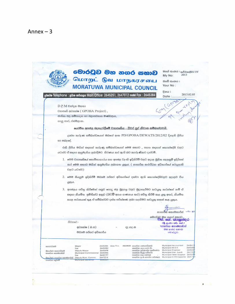
Annex – 3

Annex - 4