global positioning system gps fully functional for military use in 1995 frequencies of operation l1...
TRANSCRIPT

Global Positioning System GPS
Fully functional for Military use in 1995
Frequencies of operation L1 = 1575.42 MHz and L2 = 1227.6 MHz.
SPS (Civil) uses L1
PPS (Military) uses L1 and L2
Data is encrypted to prevent spoofing
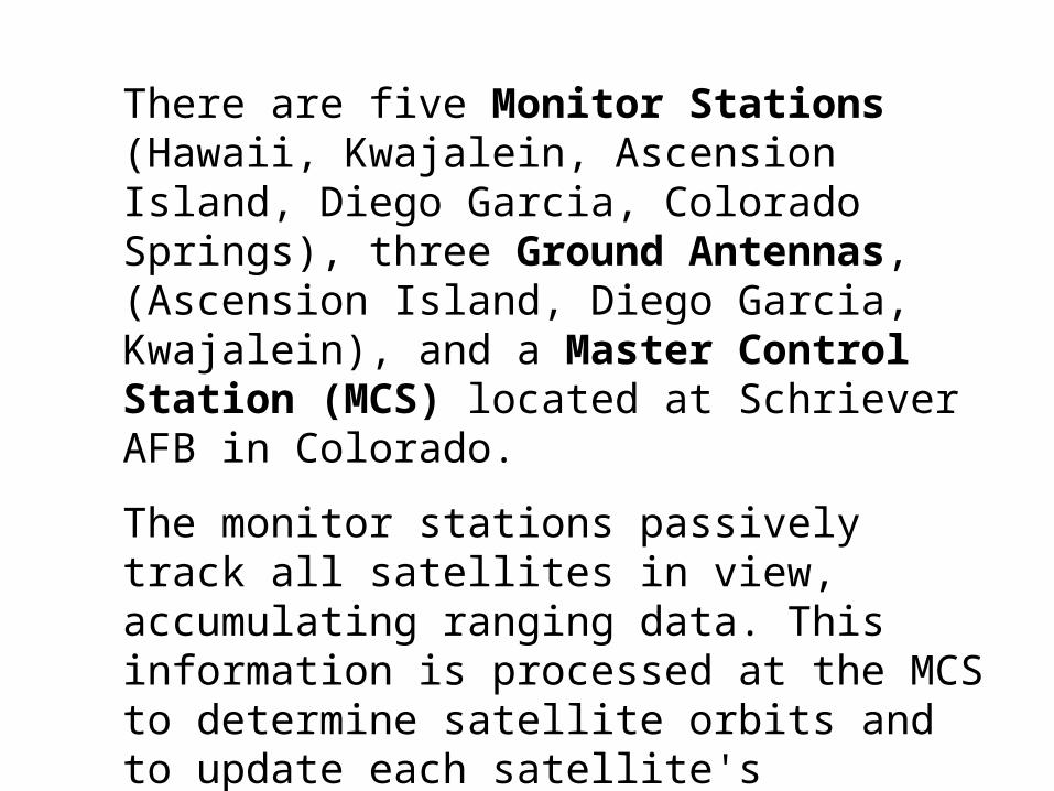
There are five Monitor Stations (Hawaii, Kwajalein, Ascension Island, Diego Garcia, Colorado Springs), three Ground Antennas, (Ascension Island, Diego Garcia, Kwajalein), and a Master Control Station (MCS) located at Schriever AFB in Colorado.
The monitor stations passively track all satellites in view, accumulating ranging data. This information is processed at the MCS to determine satellite orbits and to update each satellite's navigation message. Updated information is transmitted to each satellite via the Ground Antennas.


The satellites provide a highly reliable time reference.
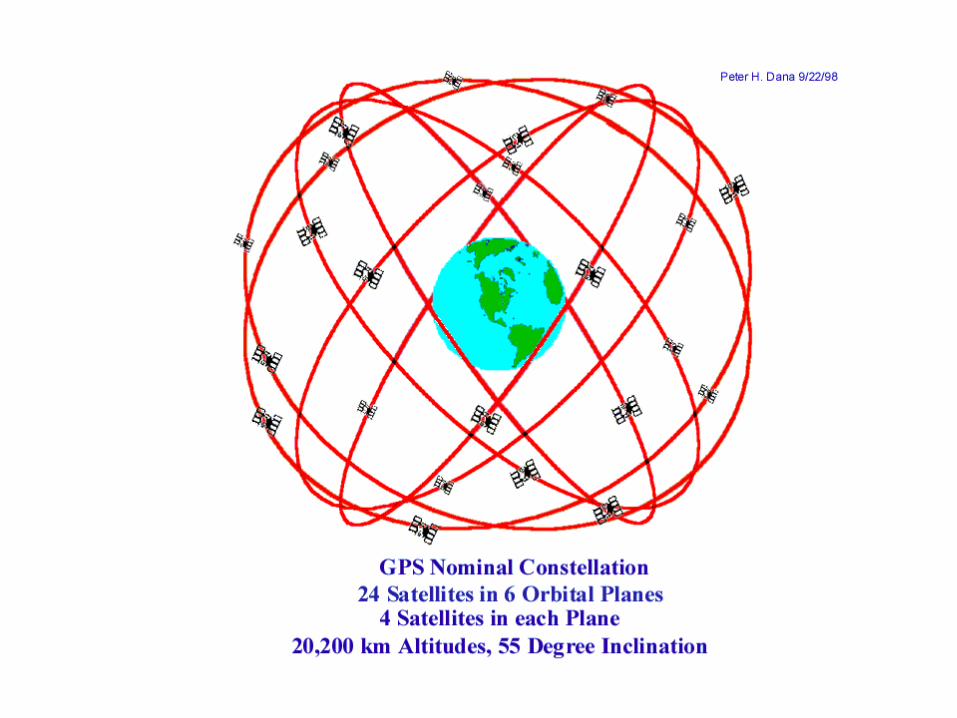
Four satellites are needed for a position fix in three dimensions.
Position is calculated by comparing the time of arrival (TOA) of the transmitted signals from the satellites by the receiver.


If altitude is known (i.e. for a surface user), then THREE satellites are sufficient.
If time is being kept by a stable clock, then TWO satellites in view are sufficient for a fix at known altitude.
If just time is required, only ONE satellite is needed.

GPS Receiver and Antenna

GPS Receivers either display information on integrated displays or output serial data (EIA-232 or USB) to computer devices (laptop, handheld device, etc) usually in NMEA format National Marine Electronics Association.

GPS Uses:
Military
Location - weapons
- vehicles
- troops

Civil
Time
Location - hikers
- mapping
- vehicle tracking - theft
- trucks
- emergency vehicles
- in-car navigation
- shipping, aircraft
- emergency


Precise Positioning Service (PPS)Authorized users with cryptographic
equipment and keys and specially equipped receivers use the Precise Positioning
System. U. S. and Allied military, certain U. S. Government agencies, and selected
civil users specifically approved by the U. S. Government, can use the PPS.
PPS Predictable Accuracy 22 metre Horizontal accuracy 27.7 metre vertical accuracy
200 nanosecond time (UTC) accuracy

Standard Positioning Service (SPS)Civil users worldwide use the SPS without charge
or restrictions. Most receivers are capable of receiving and using the SPS signal. The SPS
accuracy is intentionally degraded by the DOD by the use of Selective Availability.
SPS Predictable Accuracy 100 metre horizontal accuracy
156 metre vertical accuracy 340 nanoseconds time accuracy

Selective Availability (SA) SA is the intentional degradation of the SPS
signals by a time varying bias. SA is controlled by the DOD to limit accuracy for non-U. S. military and
government users. The potential accuracy of the Coarse/Acquisition code of around 30 metres is
reduced to 100 metres (two standard deviations).

The SA bias on each satellite signal is different, and so the resulting position solution is a function of the combined SA bias from each SV used in the navigation solution. Because SA is a changing bias with low frequency terms in excess of a few hours, position solutions or individual SV pseudo-ranges cannot be effectively averaged over periods shorter than a few hours.
SA was turned off by the US Government May 1, 2000.
March 21, 2003 US Government indicated SA for Civil GPS could be reactivated in emergencies.
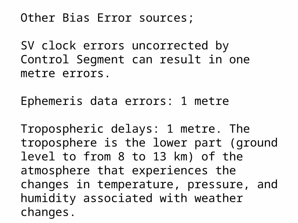
Other Bias Error sources;
SV clock errors uncorrected by Control Segment can result in one metre errors.
Ephemeris data errors: 1 metre
Tropospheric delays: 1 metre. The troposphere is the lower part (ground level to from 8 to 13 km) of the atmosphere that experiences the changes in temperature, pressure, and humidity associated with weather changes.

Other Bias Error sources ctd; Ionosphere delays: 10 metres. The ionosphere is the layer of the atmosphere from 50 to 500 km that consists of ionized air. The transmitted model can only remove about half of the possible 70 ns of delay leaving a ten meter un-modeled residual.

Other Bias Error sources ctd; Multipath: 0.5 metres.
Multipath is caused by reflected signals from surfaces near the receiver that can either interfere with or be mistaken for the signal that follows the straight line path from the satellite.
Multipath is difficult to detect and sometimes hard to avoid.
Noise and bias errors combine, resulting in typical ranging errors of around fifteen metres for each satellite used in the position solution.

The EU is developing Galileo to provide an alternative to the United States' Global Positioning System.Scheduled for operation by 2010.
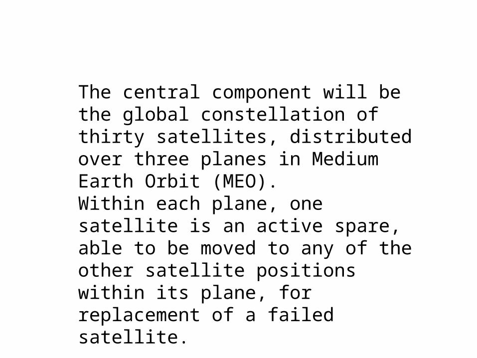
The central component will be the global constellation of thirty satellites, distributed over three planes in Medium Earth Orbit (MEO). Within each plane, one satellite is an active spare, able to be moved to any of the other satellite positions within its plane, for replacement of a failed satellite.

Emergency Position Indicating Radiobeacon (EPIRB)
Designed for emergency situations
lost hikers, skiers
crashed aircraft
shipping emergencies
Satellite-based detection of activated beacons
121.5/243 MHz EPIRBs

Because of location ambiguities and frequency congestion in this band, two or more satellite passes are necessary to determine if the signal is from an EPIRB and to determine the location of the EPIRB, delaying rescue by an average of 4 to 6 hours. In some cases, a rescue can be delayed as long as 12 hours.

406 MHz EPIRBs
The 406 MHz EPIRB was designed to operate with satellites. The signal frequency (406 MHz) has been designated internationally for use only for distress.
Accuracy 2 to 5 km.
A new type of 406 MHz EPIRB, having an integral GPS navigation receiver, became available in 1998. This EPIRB will send accurate location as well as identification information to rescue authorities immediately upon activation through both geostationary (GEOSAR) and polar orbiting satellites. Accuracy 100 m.


Location-based Services in 802.11 networks
It is possible to use the information passed between APs and clients in an 802.11 environment to locate clients.
This can be done to support location as an information resource [eg, where are you], as well as location-based services [eg, you are near me, so I will send you some information/advertising].


Each sample point contains received signal intensity (RSSI) and the related map coordinates, stored in an area-specific Positioning Model for accurate tracking.
Uses bayesian positioning algorithms with up to 1 meter average accuracy.
Proposed Uses:
Advertising, computer-guide (eg library, museum), etc