global positioning systems wing · 2012-09-11 · global positioning systems wing 15 september 2008...
TRANSCRIPT

GPSW Update CGSIC Sep 08
Global PositioningSystems Wing
15 September 2008
Tom PowellThe Aerospace Corporation
GPS Systems Engineering
GPS Program Update to48th CGSIC Meeting
2GPSW Update CGSIC Sep 2008
Outline
• Constellation Status• System Performance• GPS Modernization• International Cooperation• Support to Civil Users• Upcoming Events

3GPSW Update CGSIC Sep 2008
Recent Successes
• Operational Control Segment (OCS)• Architecture Evolution Plan (AEP)/Launch & Early Orbit, Anomaly Resolution
& Disposal Operations (LADO) switch over – Sep 07• Alternate Master Control Station fully functional at VAFB, CA
• Next Generation Operational Control Segment (OCX)• Awarded Phase A contracts to Northrop Grumman & Raytheon, Nov 07
• GPS IIR(M)• 3 Successful launches since Oct 07
• GPS IIIA• Awarded to Lockheed Martin Space Systems Company (Newton, PA), May 08

4GPSW Update CGSIC Sep 2008
GPS Constellation
• 29 space vehicles currently in operation
• 11 GPS IIA
• 12 GPS IIR
• 6 GPS IIR-M
• Transmitting new second civil signal (L2C)
• Continuously assessing constellation health to
determine launch need
• 2 Block IIR(M) satellites remaining
• Global GPS civil service performance commitment
met continuously since December 1993
5GPSW Update CGSIC Sep 2008
Current GPS Accuracy
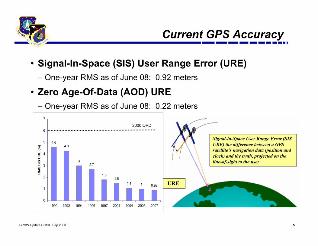
• Signal-In-Space (SIS) User Range Error (URE)– One-year RMS as of June 08: 0.92 meters
• Zero Age-Of-Data (AOD) URE– One-year RMS as of June 08: 0.22 meters
Signal-in-Space User Range Error (SISURE) the difference between a GPSsatellite’s navigation data (position andclock) and the truth, projected on theline-of-sight to the user
URE
4.6
4.3
3
2.7
1.8
1.5
1.1 1 0.92
0
1
2
3
4
5
6
7
1990 1992 1994 1996 1997 2001 2004 2006 2007
RM
S S
IS U
RE
(m
)
2000 ORD

6GPSW Update CGSIC Sep 2008
Snapshot: Typical UE
Max 4.92 m95th Percentile 3.16 mMedian 2.34 m
Horizontal Position Error at 2008-09-10 16:55:00UEE = 2.6 m
“Typical UE” = MAGR-2000 Specification

7GPSW Update CGSIC Sep 2008
Block IIA/IIR Block IIIBlock IIR-M, IIF• Backward compatibility• 4th civil signal (L1C)• Increased accuracy• Increased anti-jam power• Assured availability• Navigation surety• Controlled integrity• Increased security• System survivability
IIR-M: IIA/IIR capabilities plus• 2nd civil signal (L2C)• M-Code (L1M & L2M)
IIF: IIR-M capability plus• 3rd civil signal (L5)• Anti-jam flex power
Basic GPS• Standard Service
• Single frequency (L1)• Coarse acquisition (C/A)
code navigation• Precise Service
• Y-Code (L1Y & L2Y)• Y-Code navigation
Increasing System Capabilities Increasing Defense / Civil Benefit
GPS Modernization Program

8GPSW Update CGSIC Sep 2008
GPS Modernization – New Civil Signals
• Second civil signal “L2C”• Designed to meet commercial needs
• Higher accuracy through ionospheric correction
• 1st launch: Sep 2006 (GPS IIR-M); 24 satellites: ~2016
• Third civil signal “L5”• Designed to meet demanding requirements for transportation safety-of-life
• Uses highly protected Aeronautical Radio Navigation Service (ARNS) band
• 1st launch: ~ 2009 (GPS IIF); 24 satellites: ~2018
• Fourth civil signal “L1C”• Designed with international partners for GNSS interoperability
• Begins with GPS Block III
• 1st launch: ~2014; 24 satellites: ~2021

9GPSW Update CGSIC Sep 2008
Second Civil Signal (L2C)
• Designed to meet commercial needs• Higher accuracy via ionospheric correction
• Expected to generate over $5B in user productivity benefits
• Available since 2005
• On 24 satellites by 2016
Increases accuracyfor consumers
Benefits existing professional receivers
Supports miniaturization, possible indoor use
10GPSW Update CGSIC Sep 2008
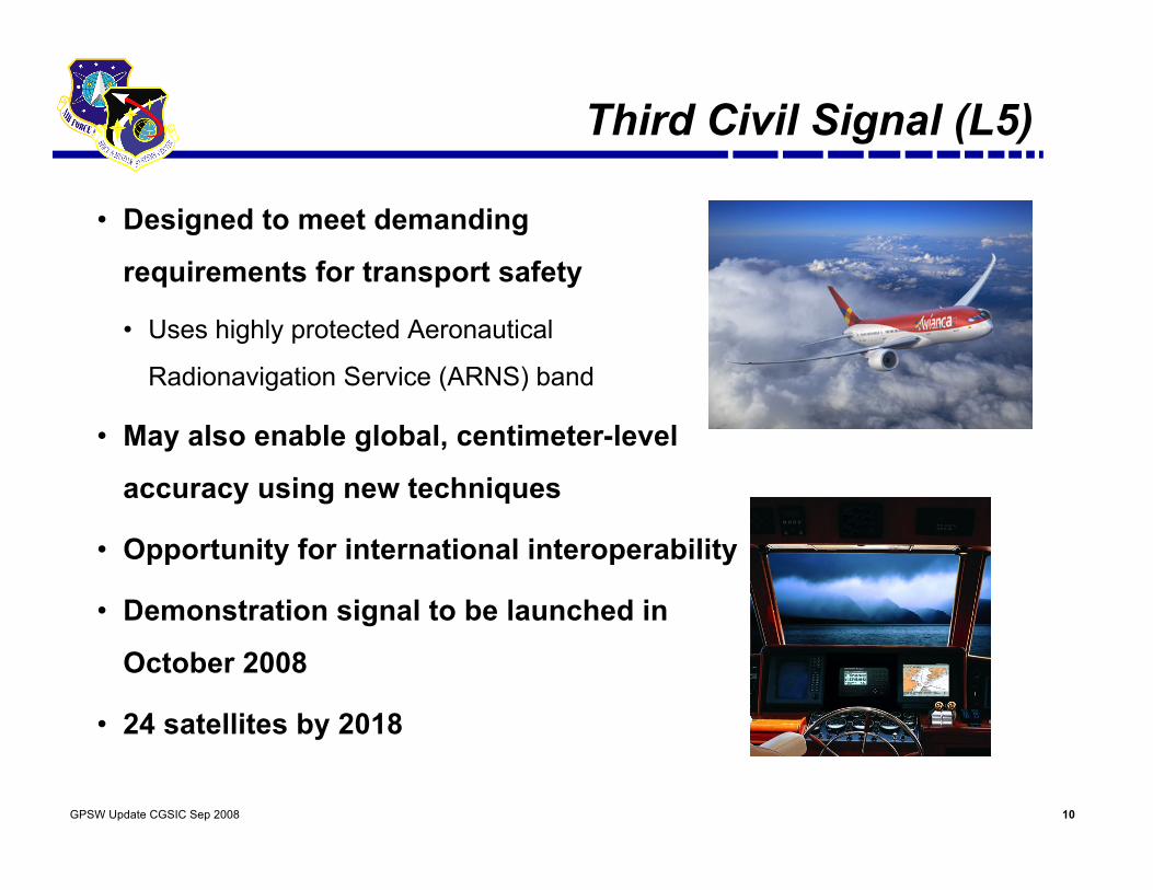
Third Civil Signal (L5)
• Designed to meet demanding
requirements for transport safety
• Uses highly protected Aeronautical
Radionavigation Service (ARNS) band
• May also enable global, centimeter-level
accuracy using new techniques
• Opportunity for international interoperability
• Demonstration signal to be launched in
October 2008
• 24 satellites by 2018
11GPSW Update CGSIC Sep 2008
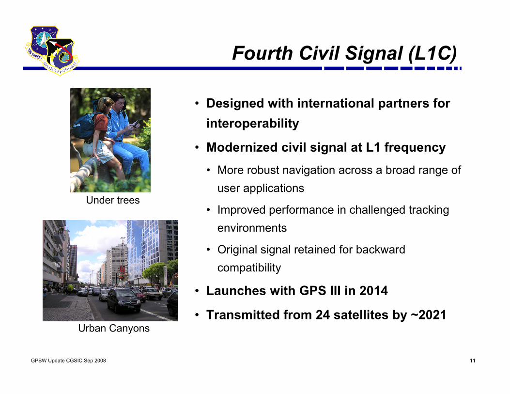
Fourth Civil Signal (L1C)
• Designed with international partners forinteroperability
• Modernized civil signal at L1 frequency
• More robust navigation across a broad range ofuser applications
• Improved performance in challenged trackingenvironments
• Original signal retained for backwardcompatibility
• Launches with GPS III in 2014
• Transmitted from 24 satellites by ~2021
Under trees
Urban Canyons
12GPSW Update CGSIC Sep 2008
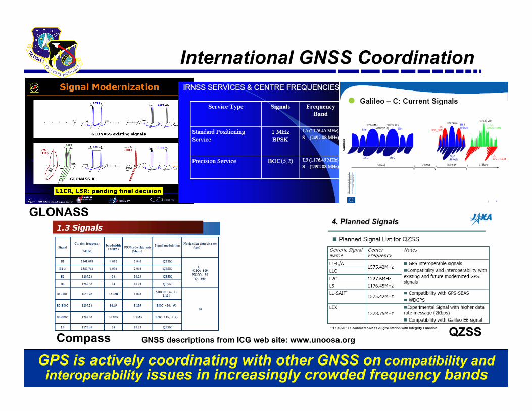
International GNSS Coordination
GPS is actively coordinating with other GNSS on compatibility andinteroperability issues in increasingly crowded frequency bands
GNSS descriptions from ICG web site: www.unoosa.org
GLONASS
Compass QZSS
13GPSW Update CGSIC Sep 2008
GPS GNSS Coordination Activities
• Galileo– Ongoing technical working groups– Signed major agreement in 2004, including common civil L1 signal
• QZSS– Ongoing technical working groups
• GLONASS– Ongoing technical working groups– Signed joint statement in 2006 promoting GLONASS/GPS interoperability
• Compass– Ongoing ITU coordination meetings
• IRNSS– Ongoing technical working groups
14GPSW Update CGSIC Sep 2008
Performance Standards
• The AF, DoD, and U.S. Government are committed tobeing good stewards of GPS
• GPS Performance Standards define the levels ofperformance the U.S. Government commits to provideGPS users– Precise Positioning Service Performance Standard for military users– Standard Positioning Service Performance Standard for civil users– Revised SPS PS to be released end of September 2008
• SPS PS available on US Coast Guard NavigationCenter website: http://www.navcen.uscg.gov/
GPS Committed to Maintaining & Improving Services For All Users
15GPSW Update CGSIC Sep 2008
Support to Civil Issues via NPEF
• National Space-Based PNT Systems Engineering Forum (NPEF)created by US National Policy for Space-based PNT in 2004
• Permanent technical forum, co-chaired by FAA and GPSW• Define technical issues and make recommendations• Major study in 2007 and 2008: “Assess Dual Frequency GPS Use
and Military Flexible Signal Power implementation”– Civil codeless/semi-codeless users and backward compatibility– Extensive coordination with FAA, NASA, NOAA, DOC, DOT, other agencies– Primary Findings
• Over 300,000 civil semi-codeless users world wide• GPS will continue enabling codeless/semi-codeless GPS access until
December 31, 2020• Details available at: www.space.commerce.gov/gps/semicodeless/
16GPSW Update CGSIC Sep 2008
FY09 Planned Events• Space Segment
– Three launches planned in FY09: IIRM-20,IIRM-21 and IIF-1
– L5 demo payload on IIRM-20• Current Ground Segment
– Support for IIF launch and operations– Support to SAASM UE and functions– Remote site equipment upgrade– Position Training Emulator release
• Next Generation Ground Segment– OCX Modernized Capability Engineering
Model (MCEM) demonstration– OCX System Design Review with two contractors and down-select
• User Segment– MGUE Phase A testing

17GPSW Update CGSIC Sep 2008
L5 Demo Payload on GPS IIR-20
• Purpose is to secure GPS L5 ITU-R filing• Will not affect primary or secondary missions• Signal is not intended for navigation• Dataless IS-GPS-705 Q5 modulation• PRN 63• Scheduled for launch into slot B2

18GPSW Update CGSIC Sep 2008
Summary
• GPS has continuously met is commitments to allusers since FOC
• GPS has had multiple operational and acquisitionsuccesses in the past year
• Modernization of all GPS Segments is on track
Maintaining And Improving GPS Services For All Users Is Job #1