gloucestershire 1911
TRANSCRIPT

8/2/2019 Gloucestershire 1911
http://slidepdf.com/reader/full/gloucestershire-1911 1/174

8/2/2019 Gloucestershire 1911
http://slidepdf.com/reader/full/gloucestershire-1911 2/174

8/2/2019 Gloucestershire 1911
http://slidepdf.com/reader/full/gloucestershire-1911 3/174

8/2/2019 Gloucestershire 1911
http://slidepdf.com/reader/full/gloucestershire-1911 4/174

8/2/2019 Gloucestershire 1911
http://slidepdf.com/reader/full/gloucestershire-1911 5/174

8/2/2019 Gloucestershire 1911
http://slidepdf.com/reader/full/gloucestershire-1911 6/174

8/2/2019 Gloucestershire 1911
http://slidepdf.com/reader/full/gloucestershire-1911 7/174
CAMBRIDGE COUNTY GEOGRAPHIESGeneral Editor: F. H. H. GUILLEMARD, M.A., M.D.
GLOUCESTERSHIRE

8/2/2019 Gloucestershire 1911
http://slidepdf.com/reader/full/gloucestershire-1911 8/174
Camtrttrge :
PRINTED BY JOHN CLAY, M.A.
AT THE UNIVERSITY PRESS

8/2/2019 Gloucestershire 1911
http://slidepdf.com/reader/full/gloucestershire-1911 9/174

8/2/2019 Gloucestershire 1911
http://slidepdf.com/reader/full/gloucestershire-1911 10/174
vi CONTENTS
PAGE
1 6. Antiquities Prehistoric, Roman . . .
-8317. Architecture (a) Ecclesiastical. Churches, Cathedrals,
Abbeys 88
1 8. Architecture (b) Military. Castles . . . 102
19. Architecture (c) Domestic. Famous Seats, Manor
Houses . . . . . . . .105
20. Communications Past and Present.
Roads, Railways,Canals . . . . . . . . . 1 10
21. Administration and Divisions . . . . .120
22. Roll of Honour of the County . . . .126
23. The Chief Towns and Villages of Gloucestershire . 135

8/2/2019 Gloucestershire 1911
http://slidepdf.com/reader/full/gloucestershire-1911 11/174
ILLUSTRATIONS
PAGE
Gloucester Cathedral. (Phot. Frith) . . . 3
Golden Valley. (Phot. Taunt, Oxford) .... 5
The Shire Stones near Bath ...... 7
Cleeve Hill, near Cheltenham. (Phot. Frith) ... 9
Cross at Condicote. (Phot. Taunt, Oxford) . . . ic
View of the Cotswolds from above Newnham. (Phot.Pitcher,
Gloucester) . . . . . . . .12The Speech House, Forest of Dean. (Phot. Pitcher,
Gloucester) . . . . . . . .14Thames Head in Winter. (Phot. Taunt, Oxford) . . 16
Seven Springs, near Coberley. (Phot. Taunt, Oxford) . 1 7
The Windrush above Bourton. (Phot. Taunt, Oxford) . 18
The Meeting of the Severn and Avon at Tewkesbury.
(Phot. Frith) 19
The Peninsula of Lancaut. (Phot. Ballard) . . .23The Devil's Chimney, Cheltenham in the distance.
(Phot. Bedford, Cheltenham) 31
Westington Quarry, near Campden. (Phot. Taunt, Oxford) 33
The Double Bend of the Wye. (Phot. Ballard) . .38Salmon "Putchers" at Low Water, Beachley. (Phot. Ballard) 41
The Avon from the Suspension Bridge, Clifton. (Phot.
Valentine) . . ... . . . .44Bristol Cathedral. (Phot. Frith) ... .46

8/2/2019 Gloucestershire 1911
http://slidepdf.com/reader/full/gloucestershire-1911 12/174
viii ILLUSTRATIONS
PAGE
Old Dutch House and Wine Street,Bristol.
(Phot. Valentine) 48Avonmouth Docks. (Phot. Frith) . . . . .52The Agricultural College, Cirencester. (Phot. Frith) . 60
A Cotswold Homestead. (Phot. Taunt, Oxford) . . 62
Windrush, Oxen ploughing. (Phot. Taunt, Oxford) . 64
Threshing with the Flail. (Phot. Taunt, Oxford) . . 66
Chipping Campden Market House and old Guild Chapel
now the Town Hall. (Phot. Taunt, Oxford) . . 68
Morris Dancers, Chipping Campden. (Phot. Taunt, Oxford) 70
Speech House Colliery. (Phot. Pitcher, Gloucester) . . 72
Hypocaust of Roman Villa, Chedworth. (Phot. Taunt,
Oxford) . . . . . . . . -75The Abbey Gate, Cirencester. (Phot. Frith) . . .76Berkeley Church and Bell Tower. (Phot. Frith) . .78The Bear Inn, Tewkesbury. (Phot. Frith) . . .79The Bell Inn, Tewkesbury. (Phot. Frith)
...80
Market Cross, Stow-on-the-Wold. (Phot. Taunt, Oxford) 81
Palaeolithic Flint Implement ...... 84
Neolithic Celt of Greenstone ...... 84
Wagborough Bush Barrow, Bourton-on-the-Water. (Phot.
Taunt, Oxford) 86
The Font, Deerhurst Church. (Phot. Bedford, Cheltenham) 90
NormanDoorway,
Lower Guiting. (Phot.
Taunt,Oxford) 9 1
Cloisters and"Carrells," Gloucester Cathedral. (Phot.
Valentine) . . . . . . . -93Gloucester Cathedral, East End of Choir. (Phot. Bedford,
Cheltenham) ........ 94
The Chapter House, Bristol Cathedral. (Phot. Valentine) 95
Tewkesbury Abbey, the Nave looking East. (Phot. Valentine) 96
Deerhurst Church, Saxon Windows in Belfry. (Phot. Bedford,
Cheltenham) 98
Odda's Chapel, Deerhurst, looking East. (Phot. Bedford,
Cheltenham) ........ 99

8/2/2019 Gloucestershire 1911
http://slidepdf.com/reader/full/gloucestershire-1911 13/174
ILLUSTRATIONS ix
PAGE
St Mary Redcliffe, Bristol 100
Cirencester Church, the South Porch. (Phot. Frith) . 101
Berkeley Castle. (Phot. Frith) 103
The Market Hall, Minchinhampton. (Phot. Frith). . 106
The New Inn, Gloucester. (Phot. Pitcher, Gloucester) . 107
Ablington Village and Manor House. (Phot. Taunt, Oxford) 108
Owlpen Manor House. (Phot. Frith) . . . .109The Fosseway near Stow. (Phot. Taunt, Oxford) . .inOld Bridge over the Avon at Tewkesbury. (Phot. Taunt,
Oxford) . . . . . . . . .114Mouth of the Canal Tunnel, Saperton. (Phot. Taunt,
Oxford) . . . . . . . . .119The Thames and Severn Canal. (Phot. Taunt, Oxford) . 120
Joseph Butler . . . . . . . . .126
John Keble .. . . . . . . .127Edward
Jenner. . . . . . .
.131Sir Thomas Lawrence . . . . . . 133
Clifton and the Suspension Bridge . . . . .138The Market Place, Chipping Sodbury. (Phot. Frith) . 139
Fairford Church. (Phot. Taunt, Oxford) . . . 141
Lechlade from the River . . . . . .144Tewkesbury Abbey . . . . . . -149Yate Church. (Phot. Frith) i 5I
Diagrams . . . . . . . . -153
MAPS
Gloucestershire, Topographical . . . Front Cover
Geological .... Back Cover
England and Wales, showing annual rainfall . . -55

8/2/2019 Gloucestershire 1911
http://slidepdf.com/reader/full/gloucestershire-1911 14/174
The Author desires to thank his friend, Mr James
G. Wood, M.A., F.G.S., for the section treating of
the
geologyof the
County.
H. A. E.

8/2/2019 Gloucestershire 1911
http://slidepdf.com/reader/full/gloucestershire-1911 15/174
i. County and Shire. Origin and
Meaning of the Words.
If we take a map of England and contrast it with
a map of the United States, perhaps one of the first things
we shall notice is thedissimilarity
of thearbitrary divisions
of land of which the countries are composed. In America
therigidly straight boundaries and rectangular shape of
themajority of the States strike the eye at once
; in
England our wonder is rather how the boundaries have
come to be so tortuous and complicated to such adegree,
indeed, that until recently many counties hadoutlying
islands, as it were, within their neighbours' territory.We
may guess at once that the conditions under which the
divisions arose cannot have been the same, and that while
in America these formal square blocks of land, like vast
allotment gardens, were probably the creation of a central
authority, and portioned off much about the same time;
the divisions we find in England own no such simple
origin. Our guess would hot have been wrong, for such,
in fact, is more or less the case. The formation of the
English counties in many instances was (and is for they
have altered up toto-day) an affair of slow growth.
King Alfred is credited with having made them, but
E. G. I

8/2/2019 Gloucestershire 1911
http://slidepdf.com/reader/full/gloucestershire-1911 16/174
2 GLOUCESTERSHIRE
inaccurately,for some existed before his time, others not
till
long
after his death, and their origin was as their
names tell us of very diverse nature.
Let us turn once more to our map of England. Col-
lectively,we call all our divisions counties, but not every
one of them is accurately thus described. Gloucestershire,
as we shall see, is not. Some have names complete in
themselves, such as Kent and Sussex, and we find these
to be old English kingdoms with but little alteration
either in their boundaries or their names. To others
the terminal shire is appended, which tells us that they
were shorn from a largerdomain- shares of Mercia or
Northumbria or some other of the great English king-
doms. The term county is of Norman introduction,
the domain of a Comte or Count.
County and shire are now practically synonymous,
and we can talk of"Gloucestershire
"or the co$riy of
Gloucester," but not of"the county of Gl6i.:esterslik~."
Gloucestershire is a shire of'the ancient great central
Anglian kingdom of our land Mercia. The chief
towns of Mercia had long beenmilitary centres, their
governors levying menfrom the
surrounding district,
and in 918, when Ethelfleda(./Ethelflead)
was Lady of
the Mercians, we first hear of Gloucester as one of these
centres. The name "Gloucestershire
"is not heard
of till 1016, when the Saxon Chronicle records that
after the battle with the English at Ethandun "went
King Cnut up with his army to Gloucestershire where he
learned that King Eadward was." Now the fact that wehave no mention of the shire for nearly 100 years after the

8/2/2019 Gloucestershire 1911
http://slidepdf.com/reader/full/gloucestershire-1911 17/174
COUNTY AND SHIRE 3
first mention of the town makes it probable that Mercia
was first divided into shires at the time of the last Danish
invasion, about the year 1000, when measures were being
taken to resist the invaders, and the" hundreds
"about
which we shall learn later were grouped into shires,
each group taking its name from its chief town. Thus
the division into shires was primarily a military measure,
Gloucester Cathedral
but, as we shall see, the boundary of a particular shire
was liable to be modified to suit the convenience of great
landowners, especiallyif they were great monastic houses.
As to the name of the town whichgives its name to
the county the Welsh Gloui (Caergloui) became the
Roman Glevum, and this the Saxon Gleauanceaster, now
Gloucester.

8/2/2019 Gloucestershire 1911
http://slidepdf.com/reader/full/gloucestershire-1911 18/174
4 GLOUCESTERSHIRE
2. General Characteristics. Position
and Natural Conditions.
What we now call the Bristol Channel was in pre-
historic times a marsh through which the Severn found
its way to the Atlantic;but when the land subsided the
sea took its place and drowned the ancient bed of the
river, till at high water it pushed up to Gloucester and
even beyond. At low water you may see the shoals and
rocks which mark the present course of the river when
unaffected by the tide.
Now the fact that it is penetrated by an arm of the
sea gives Gloucestershire a unique position among English
counties. If we look at other counties which have a tidal
river, Kent, Essex, Lincolnshire, Lancashire, we find that
they all have a sea coast and are in the fullest sense
maritime counties, but Gloucestershire has no coast at all.
It is essentiallya midland county, yet at the same time its
tidal river gives it many of the advantages of a maritime
county, for large merchantmen are carried by the flowing
tide to Bristol and with the aid of the Berkeley canal
to Gloucester.
But, like other midland counties, its main features are
agricultural.The
hillydistricts grow corn, and pasture
sheep, while the lowlands consist of a rich deep soil which
is divided between orchards and large dairy farms. This
description, however, applies to the country east of the
Severn only. West of the river we find ourselves in another
world : dairy farms and apple orchards still abound, but
the character of the scenery and the accent of the natives

8/2/2019 Gloucestershire 1911
http://slidepdf.com/reader/full/gloucestershire-1911 19/174
GENERAL CHARACTERISTICS 5
soon tell us that we have reached the borderland of
Wales. Moreover, about half of this peninsula between
the Wye and Severn is covered by forest, and here are
coal and iron mines, which have given rise to the indus-
trial settlements of Coleford and Cinderford.
Thus we see that, alone among midland counties,
Gloucestershire is at once agricultural, industrial, and
Golden Valley
maritime. If a man were to travel in a straight line from
Burford, on the Oxfordshire border of thecounty, to
Monmouth, or from Moreton to Chepstow, the character
of the country he would pass through would be morediversified than in any other journey of the same length
in England.

8/2/2019 Gloucestershire 1911
http://slidepdf.com/reader/full/gloucestershire-1911 20/174
GLOUCESTERSHIRE
3. Size. Shape. Boundaries. Detached
Portions.
The length of the county from Clifford Chambers to
Bitton is 60 miles, its breadth from Lechlade to Lancaut,
not including the estuary of the Severn which is three
miles across, is 40 miles. The circumference of the
county, including the two sides of the estuary up to Awre,
is about 270 miles, and this encloses an area of 1258
square miles or 805,482 acres.
The shape of Gloucestershire is extremely irregular.
On the north and north-west its outline is very much
indented, but we may describe it roughly as a five-sided
figure, of which the south side is the shortest. Beginning
from the mouth of the Bristol Avon and proceeding
northwards we may define its sides as follows:(i)
from
the mouth of the Avon to Preston, near Ledbury,
(2)from Preston to Clifford Chambers, (3)
from Clifford
Chambers to Lechlade, (4)from Lechlade to the Shire
Stones near Marshfield, and(5)
from Marshfield to the
mouth of the Avon.
The boundaries of the county correspond with those of
the southern portion of the ancient diocese of Worcester,
with the addition of the Forest Peninsula, which was in
the diocese of Hereford. The adjacent counties, beginning
at the mouth of the Wye, are Monmouth, Hereford,
Worcester, Warwick, Oxford, Berks (for about two miles
near Lechlade), Wilts, and Somerset. With the excep-
tion of the Avon on the south, and the Wye on the west,

8/2/2019 Gloucestershire 1911
http://slidepdf.com/reader/full/gloucestershire-1911 21/174
SIZE SHAPE BOUNDARIES 7
the county boundary is rarelyformed by rivers
;the
northern boundary, which separatesthe
countyfrom
Worcestershire and divided the old diocese of Worcester
into twoparts,
is extremely irregular. This irregularity
The Shire Stones near Bath, where the counties of
Somerset, Wilts, and Gloucester meet
ischiefly
due to the fact that the ancient estates of the
church of Worcester were included in Worcestershire,
and those of the church of Deerhurst Todenham and
Little Compton in Gloucestershire.
There were formerly five detached portions of the

8/2/2019 Gloucestershire 1911
http://slidepdf.com/reader/full/gloucestershire-1911 22/174
8 GLOUCESTERSHIRE
county, but about 60 years ago they were incorporated
with the counties in which they are situated, but not
always with the diocese; thus, Little Compton and
Sutton-under-Brailes, now in Warwickshire, remain in
the diocese of Gloucester;
and Shennington, now in
Oxfordshire, in the diocese of Worcester. The other
two portions are Widford, now in Oxfordshire;and the
greater part of Minety, now in Wiltshire. For the
transference the consent of both the counties interested
was necessary and this was not always obtained. Hence
we have in Gloucestershire the long Worcestershire island
of Cutsdean, and except for a mile on the north-east,
where it is bounded by Warwickshire, another Worcester-
shire island of Blockley. Indeed so mixed are the counties
near Moreton thata
well-known monument, the fourshire stone, marks the meeting of the four counties of
Worcester, Warwick, Oxford, and Gloucester.
Like the outliers of the Cotswolds which occur in the
vales of Gloucester and Evesham, so these islands were
outlying portions of the possessions of some landowner of
the adjacent county, and they would also belong to the
" hundred " in which this landowner's chief possessions
were situated. Thus Little Compton, belonging to the
priory of Deerhurst, was in Deerhurst hundred, and
Shennington, belonging to the abbey of Tewkesbury,
in that of Tewkesbury. The island of Cutsdean is a
chapelry of the parish of Bredon in Worcestershire, at
least twelve milesdistant,
and wasgiven by
OfFa in the
eighth century to the monastery which his grandfather
had founded there. It afterwards belonged to thepriory

8/2/2019 Gloucestershire 1911
http://slidepdf.com/reader/full/gloucestershire-1911 23/174
SIZE SHAPE BOUNDARIES 9
of Worcester, but has always remainedparochially attached
to Bredon. It is therefore in the same "hundred," but
of the hundreds we shall have to write in a later chapter.
4. Surface and General Features.
On a general view the county falls into three main
divisions hill, vale, and forest each division running
Cleeve Hill, near Cheltenham
from north-east to south-west. It must not be supposed,
however, that there are no vales in the hill district or no
hills in the forest. The Hilldistrict, then, extends from
Chipping Campdento Bath
;
it is arough stony country,
formerly consisting almost wholly of sheep-down, but now
for the most part brought under the plough. Its general

8/2/2019 Gloucestershire 1911
http://slidepdf.com/reader/full/gloucestershire-1911 24/174
10 GLOUCESTERSHIRE
altitude varies from 900 to 550 feet,but at Cleeve Cloud,
near Cheltenham, it reaches a height of 1070 feet, and
at Broadway Hill on the old" Buckle Street," a height of
1048 feet. From these points extensive views may be
Cross at Condicote
obtained across the Vale to the Malverns and the Welsh
mountains, while behind the spectator lies a vast tract of
upland dividedinto
enclosures by stone walls, and pene-trated by soft green valleys
watered by clear and gentle
streams. Here and there tufts of firs have been planted,
8/2/2019 Gloucestershire 1911
http://slidepdf.com/reader/full/gloucestershire-1911 25/174
SURFACE- AND GENERAL FEATURES 11
while the sides of the valleysare often clothed with
hanging woods. It is in these valleys that the villages are
mainly situated, but a few like Condicote and Cutsdean,
mentioned in the last chapter, lie up on the open down.
These hills have always been a favourite field for the
chase of wild animals. They are now hunted by several
packs of foxhounds, but inearly times, in Shakespeare's
day for example, they were the home of the wild deer.
But now, as then, you may walk for miles without seeing
a house until you drop abruptly upon some village or out-
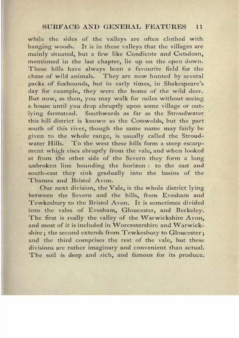
lying farmstead. Southwards as far as the Stroudwater
this hill district is known as the Cotswolds, but the part
south of this river, though the same name may fairlybe
given to the whole range, is usually called the Stroud-
water Hills. To the west these hills form a steep escarp-ment which rises abruptly from the vale, and when looked
at from the other side of the Severn they form a long
unbroken line bounding the horizon : to the east and
south-east they sink gradually into the basins of the
Thames and Bristol Avon.
Our next division, the Vale, is the whole district lying
between the Severn and the hills, from Evesham and
Tewkesbury to the Bristol Avon. It is sometimes divided
into the vales of Evesham, Gloucester, andBerkeley.
The first isreally
the valley of the Warwickshire Avon,
and most of it is included in Worcestershire and Warwick-
shire;the second extends from Tewkesbury to Gloucester
;
and the third
comprisesthe rest of the
vale,
but these
divisions are rather imaginary and convenient than actual.
The soil is deep and rich, and famous for its produce.

8/2/2019 Gloucestershire 1911
http://slidepdf.com/reader/full/gloucestershire-1911 26/174

8/2/2019 Gloucestershire 1911
http://slidepdf.com/reader/full/gloucestershire-1911 27/174
SURFACE AND GENERAL FEATURES 13
Dairy farms and orchards, interspersed with arablefields,
cover most of the surface;
in the former is made the
famous Gloucestershire cheese, and in the latter grow the
apples which make the no less famous Gloucestershire
cider. The cheese made in the vale ofBerkeley, where
the pastures are particularly rich, is the kind called double
Gloucester. In the lower parts of this vale, south of
Berkeley, between the hills and the river, is a tract of
undulating country, from 200 to 300 feet in altitude,
hardly less fertile than the valeitself, and varied with
woods and plantations.
The Forest is the peninsula between the Severn and
the Wye. It is many centuries since the whole district
was covered by trees. The part which may now practically
(though not technically) be termed the forest reaches from
Mitcheldean to Lydney, a distance of 10 miles, and a
straight line carried through the centre from Newnham
to the Wye, near Monmouth, would also be 10 miles.
A long backbone of hills runs down the peninsula from
May Hill, near Longhope, to Tidenham, which is the
principal feature of the landscape from the other side of
the Severn. These hills
varyfrom
400to
900feet in
height. May Hill itself is 969 feet, and the highest
point of Tidenham Chace reaches 778 feet. Beyond the
Wye, which has worked its way through it,this range
extends in a south-westerly direction as far as Caerleon in
Monmouthshire. The whole chain from May Hill to
Caerleon is 33 miles in length, and for the beauty and
variety of its surface, the richness of its fauna and flora,
and the wide sweep of land and water commanded by its

8/2/2019 Gloucestershire 1911
http://slidepdf.com/reader/full/gloucestershire-1911 28/174
14 GLOUCESTERSHIRE
numerous elevations, it is one of the most delightful parts
of all England.
From this Forest of Dean, as it is called, was formerly
drawn a considerable part of the timber for the navy, but
by 1783 the greater part of it had been felled and the
site had become a barren heath. Since then these waste
The Speech House, Forest of Dean
places have been replanted, and the forest at the present
day mainly consists of oaks about 100 years old. Here
and there, however, there are clumps of aged beeches, and
near the Speech House is a large thicket of some of the
oldest hollies to be found in England. Here too are
many veteran oaks, and others are sprinkled over the
whole forest. This Speech House is situated in the very

8/2/2019 Gloucestershire 1911
http://slidepdf.com/reader/full/gloucestershire-1911 29/174
SURFACE AND GENERAL FEATURES 15
centre of the forest and is the place of meeting of the
Court Verderers, who manage the" Vert and Venison
"
of the forest under the Crown. The deer were all killed
off half a century ago, so that the Vert, i.e. the timber
and pasture, alone remains. This court has been held
ever since the introduction of the Norman forest law.
Of the mines we shall have to speak in a later chapter;
they have of course left their mark upon the appearance
of the forest where they occur, and round Cinderford andColeford one might almost be in the mining districts of
Cheshire or South Wales. In spite of this the general
aspect is that oflofty
wooded hills separated by deep
dales, down which run streams generally reddened by
iron ore. Here and there are open commons on which
the cottages of the miners are built.
There remains the spacious projection of the county
north of May Hill watered by the river Leadon, which
deserves to rank as a fourth division. It is rich in
meadows, orchards, and woodlands, and in its general
features resembles the adjacent parts of Herefordshire. It
might almost be called a little county of itself, with
Newent for its
capital.
5. Watersheds and Rivers.
The principal watershed is the range of the Cotswolds,
which separates the basins of the Severn and the Thames.
Owing to the slope of these hills to the south-east most of
the streams north of Stroud flow into the Thames the

8/2/2019 Gloucestershire 1911
http://slidepdf.com/reader/full/gloucestershire-1911 30/174
16 GLOUCESTERSHIRE
Thamesitself,
the Churn, the Coin, the Leach, and the
Windrush. The Thames, which has no more claim
than the Bristol Avon or the Wye to be regarded as a
Thames Head in Winter
Gloucestershire river, is generally considered to have its
source at Thames Head, near Kemble;
other people
claim the Seven Springs at Coberley, or Ullen farm as the
source, as the farthest point from the mouth;but call it

8/2/2019 Gloucestershire 1911
http://slidepdf.com/reader/full/gloucestershire-1911 31/174
WATERSHED AND RIVERS 17
Thames or Churn, a copious outflow issues from these
springs and,after
wateringone of the most
picturesque
valleysin the Cotswolds, flows round Cirencester, and at
Cricklade in Wiltshire is unmistakably the Thames.
The Coin rises at Charlton Abbots, flows past
Andoversford, Withington, Bibury, and Fairford, and
Seven Springs, near Coberley
joinsthe Thames at Lechlade. The famous Roman
station of Chedworth is upon its banks.
The Leach rises near Northleach, and after flowing
between the twin villages of Eastleach (Turville and
Martin) joins the Thamesjust below Lechlade. Some
two miles below the confluence, the Thames, which for a
E. G. 2
8/2/2019 Gloucestershire 1911
http://slidepdf.com/reader/full/gloucestershire-1911 32/174
18 GLOUCESTERSHIRE
short distance here divides Gloucestershire from Berkshire,
takes its finalleave of our county.
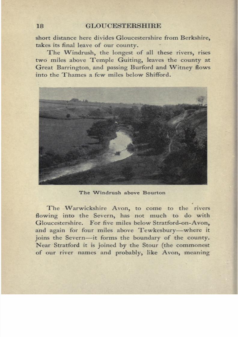
The Windrush, the longest of all these rivers, rises
two miles above Temple Guiting, leaves the county at
Great Barrington, and passing Burford and Witney flows
into the Thames a few miles below Shifford.
The Windrush above Bourton
The Warwickshire Avon, to come to the rivers
flowing into the Severn, has not much to do with
Gloucestershire. For five miles below Stratford-on-Avon,
and again for four miles above Tewkesbury where it
joinsthe Severn it forms the boundary of the county.
Near Stratford it is joined by the Stour (the commonest
of our river names andprobably, like Avon, meaning

8/2/2019 Gloucestershire 1911
http://slidepdf.com/reader/full/gloucestershire-1911 33/174
WATERSHED AND RIVERS 19
"river
"or
" water"),
which for a short distance in the
latterpart of
its
course claims to be a Gloucestershireriver. A couple of miles above Shipston it receives the
Knee Brook, a rivulet which rises in the hills above
Chipping Campden, and for about three miles divides the
county from Warwickshire and Worcestershire. A glance
at the map will show how complicated the county
The Meeting of the Severn and Avon at Tewkesbury
boundaries are at this point. But the chief Gloucester-
shire tributaryof the Avon is the Isbourne : this rises at
Charlton Abbots, only half a mile from the source of the
Coin, and flows northwards past Winchcombe and Tod-
dington to join the Avon at Evesham. The little ridge
which here separates the basins of the Thames and Severn
forms a capital study of a watershed in miniature.
2 2

8/2/2019 Gloucestershire 1911
http://slidepdf.com/reader/full/gloucestershire-1911 34/174
20 GLOUCESTERSHIRE
The Severn itself enters the county at Tewkesbury ;
and two miles aboveGloucester,
not far from the
pointto which the tide reaches, it separates into two branches
which unite again opposite Gloucester and form the fertile
Isle of Alney. It then follows a very sinuous and gradually
widening channel as far as Framilode, where it suddenly
bends westwards and flows past Newnham round to
Fretherne, a course of ten miles, thus forming a peninsula
the neck of which is only a mile and a quarter across.
Below Fretherne the river expands considerably, to a width
of a mile and a half or more, and then with two contrac-
tions, at Sharpness and at Beachley, it loses itself in the
Bristol Channel. The exact place where the river ends
and the channel begins is merely a question of names, but
it is convenient to speak of "the Severn" above the mouth
of the Avon, and of the " Bristol Channel " below it.
There is a remarkable phenomenon in connexion with
the tides on the Severn which though seen on other rivers
is here unusually well-marked. This is the "bore." A man
standing in Awre churchyard would at low water look
down upon a large sandbank, called the Noose, filling up
the greater part of the bed of" the river, and leaving only a
narrow channel for the water on either side of it. At
spring tides the body of water rushing in from the
Atlantic acquires an increased velocity as it is contracted
in its passage through the narrow strait at Sharpness ;then
as soon as it strikes this Noose island it is backed and
ponded up. But it soon rises high enough to cover the
sandbank, and then rushing on with greater violence than
ever it encounters the sudden contraction of the river bed
8/2/2019 Gloucestershire 1911
http://slidepdf.com/reader/full/gloucestershire-1911 35/174
WATERSHED AND RIVERS 21
at Fretherne. This causes it to mount up to the height
of threefeet
or more, and to rush roaring up the narrowedchannel. Frank Buckland's vivid account of the pheno-
menon is worth quoting :
"In a few minutes I saw a
curved white line stretched right across the channel
coming round the corner of the river. With a fearful
velocitythis white line advanced
steadily up the river, and
as it neared us I saw that it consisted of a wave about
three feet high curling over with foam at its summit, and
forming a distinct wall The roar that it made was like
nothing I ever before heard Behind the first wave wall
came a second, and then a third, and then the full body
of the tide boiled like a caldron. Behind this again swept
a broad sheet of water the main army of the flood in
rear of the advanceguard."
Smaller bores occur at
everySpring tide, but the highest are at the
" Palm tides"
in
March.
After the Avon the Severn receives on its left bank
the Chelt, the Frome or Stroudwater, and the Little
Avon. The Chelt rises at Dowdeswell not far from
Andoversford, and flowing westward gives its name to
Cheltenham and falls into the Severn between Deerhurst
and Ashleworth.
The Frome rises in the hills above Miserden, makes a
bend to the west at Saperton, passes Stroud and Stone-
house, and reaches the Severn at Framilode;
in its
comparatively short course it descends some 750 feet.
The convenient situation of the Stroudvalley
and the
suitable nature of the river water long ago made this the
chief centre of the clothing trade in the western midlands.

8/2/2019 Gloucestershire 1911
http://slidepdf.com/reader/full/gloucestershire-1911 36/174
22 GLOUCESTERSHIRE
The Little Avon rises at Newington Bagpath, issues
into the level
countryat
Alderleyand flows in a
northerlydirection to join the Severn at Berkeley. The little
creeks into which the tinybrooks flow on both sides of
the estuary are called"
pills."
As for the Avon, it has but the faintest claim to be
reckoned among the Gloucestershire rivers : it rises at
Tetbury, forms the county boundary for a couple of miles,
and then starts away on a long tour through Wilts and
Somerset to touch our county again at Bitton and bound
it as far as to the Bristol Channel. On its way it takes
up on its right bank three little rivers, the Boyd, the
Frome, and the Trym.
The only Gloucestershire tributaryof the Severn on
its rightbank is the Leadon. This rises at Evesbatch in
Herefordshire at a height of 551 feet, skirts that county a
couple of miles below Ledbury, passes Dymock, forms
the Worcester boundary for three or four miles, and
finallyenters the Severn at Alney Island.
The Wye, a Welsh river, forms the boundary of the
county for about four miles near English Bicknor, and
again from Redbrook to Beachley. For most of the wayit is accompanied on the English side by Offa's Dyke, and
the precipitous cliffs, along the summit of which the dyke
is carried, seem to warn the Welshman to advance no
farther, in fact the English county seems in scorn to turn
its back upon the Celt.

8/2/2019 Gloucestershire 1911
http://slidepdf.com/reader/full/gloucestershire-1911 37/174

8/2/2019 Gloucestershire 1911
http://slidepdf.com/reader/full/gloucestershire-1911 38/174
24 GLOUCESTERSHIRE
6. Geology and Soil.
By Geology we mean the study of the rocks, and we
must at the outset explain that the term rock is used by
the geologist without any reference to the hardness or
compactness of the material to which the name is applied ;
thus he speaks of loose sand as a rockequally with a hard
substance like granite.
Rocks are of two kinds, (i) those laid down mostly
under water, (2) those due to the action of fire.
The first kind may be compared to sheets of paper
one over the other. These sheets are called beds^ and such
beds areusually
formed of sand (often containing pebbles),
mud orclay,
and limestone, or mixtures of these materials.
They are laid down as flat or nearly flat sheets, but mayafterwards be tilted as the result of movement of the
earth's crust, just as you may tilt sheets of paper, folding
them into arches and troughs, by pressing them at either
end. Again, we may find the tops of the folds so pro-
duced wasted away as the result of the wearing action of
rivers, glaciers,and sea-waves upon them, as you might
cut off the tops of thefolds
of the paper with a pair ofshears. This has happened with the ancient beds forming
parts of the earth's crust, and we therefore often find them
tilted, with the upper parts removed.
The other kinds of rocks are known as igneous rocks,
which have been melted under the action of heat and
become solid on cooling. When in the molten state
they have been poured out at the surface as the lava of
volcanoes, or have been forced into other rocks and cooled

8/2/2019 Gloucestershire 1911
http://slidepdf.com/reader/full/gloucestershire-1911 39/174
GEOLOGY AND SOIL 25
in the cracks and other places of weakness. Much
material is also thrown out of volcanoes as volcanic ash
and dust, and is piled up on the sides of the volcano.
Such ashy material may be arranged in beds, so that it
partakes to some extent of the qualities of the two great
rock groups.
The production of beds is of great importance to
geologists,for by means of these beds we can
classifythe
rocks according to age. If we take two sheets of paper,
and layone on the top of the other on a table, the upper
one has been laid down after the other. Similarly with
two beds, the upper is also the newer, and the newer will
remain on the top after earth-movements, save invery
exceptional cases which need not be regarded by us here,
and for general purposes we
mayregard any bed or set of
beds resting on any other in our own country as being
the newer bed or set.
The movements which affect beds may occur at
different times. One set of beds may be laid downflat,
then thrown into folds by movement, the tops of the
beds worn off, and another set of beds laid down upon the
worn surface of the older beds, the edges of which will
abut against the oldest of the new set offlatly deposited
beds, which latter may in turn undergo disturbance and
renewal of their upper portions.
Again, after the formation of the beds many changes
may occur in them. They may become hardened, pebble-
beds being changed into conglomerates, sands into sand-
stones, muds and claysinto mudstones and shales, soft
deposits of lime into limestone, and loose volcanic ashes

8/2/2019 Gloucestershire 1911
http://slidepdf.com/reader/full/gloucestershire-1911 40/174
NAMES OFSYSTEMS

8/2/2019 Gloucestershire 1911
http://slidepdf.com/reader/full/gloucestershire-1911 41/174
27
into exceedingly hard rocks. They may also become
cracked, and the cracks are often very regular, running in
two directions at right angles one to the other. Such
cracks are known as joints,and the
jointsare very important
in affecting thephysical geography of a district. Then,
as the result of great pressure applied sideways, the rocks
may be so changed that they can besplit
into thin slabs,
which usually, though not necessarily, split along planes
standing at high angles to the horizontal. Rocks affected
in this way are known as slates.
If we could flatten out all the beds of England, and
arrange them one over the other and bore a shaft through
them, we should see them on the sides of the shaft, the
newest appearing at the top and the oldest at the bottom,
as in the annexed table. Such a shaft would have a depth
of between 10,000 and 20,000 feet. The strata beds are
divided into three great groups called Primary or Palaeozoic,
Secondary or Mesozoic, and Tertiary or Cainozoic, and
the lowest Primary rocks are the oldest rocks of Britain,
which form as it were the foundation stones on which
the other rocks rest. These may be spoken of as the
Pre-Cambrian rocks. The three great groups are dividedinto minor divisions known as systems. The names of
these systems are arranged in order in the table. Onthe right hand side, the general characters of the rocks of
each system are stated.
With thesepreliminary remarks we may now proceed
to a brief account of the geology of the county.
Gloucestershire contains a longer range of stratified
rocks than any other county ;and so presents a
typical field

8/2/2019 Gloucestershire 1911
http://slidepdf.com/reader/full/gloucestershire-1911 42/174
28 GLOUCESTERSHIRE
for the study of geology. The igneous or unstratified rocks
however occuronly
in a limited area near Tortworth and
Charfield in the south-west part of the county where the
Greenstone has been forced up through the stratified
Llandovery rocks of the Upper Silurian series.
The rocks in this county follow a law which will be
found to prevail generally throughout England and Wales;
that is that the older rocks, which were first deposited and
so are lowest down among the series, are to be found to
the westward;and "
dip"
or slope downwards towards
the east and (except in cases where they cease altogether)
pass under and are overlaid by the newer rocks. As we
pass eastward across the county we are therefore con-
tinuously passing over newer and newer formations.
Thisregularity however is broken in one line
by
a
great faulting or dislocation connected with the formation
of the Malvern Hills. This line passes nearly due N. and
S. commencing at the Abberley Hills in Worcestershire,
follows the line of the Malverns, enters our county near
Ledbury, continues through May Hill, crosses the Severn
near PurtonPassage,
and passing by Tortworth reaches
Mangotsfield.
This dislocation has had a most important effect. It
has brought to the surface, near the point where it enters
the county and again near Huntley on the flanks of May
Hill, rocks of Pre-Cambrian age ;that is of the oldest series
known in England or Wales;and also the upper Silurian
Beds in the May Hill and Berkeley districts;and has let
up the intrusive Greenstone dykes at Tortworth already
mentioned.
8/2/2019 Gloucestershire 1911
http://slidepdf.com/reader/full/gloucestershire-1911 43/174
GEOLOGY AND SOIL 29
With these exceptions the formations in the county
proceed regularlyin an ascending scale from the Old
Red Sandstone on the banks of the Wye and Avon in the
west, to the Oxford Clay the newest formation to be
found in the county on the banks of the Coin and
Thames near Fairford in the east.
Another geological fact which has produced prominent
physicalfeatures in the aspect of the county is that by
reason of elevations in one direction and depressions in the
other, due to upheavals and shrinkages, the edges of the
lower beds or strata are commonly found to be tilted up
to higher actual elevations than any part of the more
recent beds that in other parts overlie them. Thus the
Old Red Sandstone at the Buckstone on the west of Dean
Forest attains a height exceeded west of Severn only by
the still older Silurian rocks of May Hill. Again on the
east of Severn the summits of the highest points of the
Cotswold range, or the hills that originally belonged toit,
such as Bredon, Cleeve Cloud, Leckhampton, Birdlip and
Kimsbury, are composed of the lower beds of the Oolitic
series; while the upper and newer beds of the same series
whichlie
on the slopes of the Cotswolds eastwards neverattain the same elevation.
We will now consider the extent and situation of the
various deposits as they are exposed on the surface be-
ginning from the west.
The Old Red Sandstone is to be found on the banks of
the Wye between Tintern and Redbrook. Northward,
southward, and eastward it immediately dips under and
is overlaid by the Carboniferous series of the Dean

8/2/2019 Gloucestershire 1911
http://slidepdf.com/reader/full/gloucestershire-1911 44/174
30 GLOUCESTERSHIRE
Forest, at the base of which is the Carboniferous Lime-
stone, forming the magnificent cliffs near Symond's Yatand between Tintern and Chepstow. This again dips
under the Millstone Grit, which caps Tidenham Chace;
and that again is overlaid within the Forest area by the
coal measures, or rocks which contain the coal beds. In
this case the whole series rise again and crop out along
the eastern face of the Forest hills over the Old Red and
are cut out by the Severn valley. The limestone however
continues southward to Tidenham and then turns east-
ward across the Severn and takes in and passes under the
Bristol coalfield, as it did the Forest coalfield, and again
returns by the Avoncliffs, crosses the Bristol Channel
into Monmouthshire, and so reunites with the cliffs on the
Wye;but its
passageunder the Severn in both cases can-
not be seen.
These older series do not recur again in the county.
In places the Old Red (denuded of its burden of the coal
measures) passes under, and in other places is cut off by
a fault against, the New Red Marls and Sandstones which
are exposed in the cliffs of Aust, Sedbury, and Westbury-
on-Severn (capped however in all three cases by Lias clays
and limestone) and cover a large tract of country in the
valleyof the Leadon.
We next find a broad band of Lias Clay extending
along the western base of the Cotswold range in an
unbroken line from near Tewkesbury to the county
boundary near Bath. That this extended originally much
further westward is apparent from its being found in
many isolated positions towards, and along, the Severn.

8/2/2019 Gloucestershire 1911
http://slidepdf.com/reader/full/gloucestershire-1911 45/174
The Devil's Chimney, Cheltenham in the distance

8/2/2019 Gloucestershire 1911
http://slidepdf.com/reader/full/gloucestershire-1911 46/174
32 GLOUCESTERSHIRE
The Lias Clay then passes under the Midford Sands,
a valuable
water-bearing
stratum which throws out its
water over the underlying clay and so gives rise to a
number of springs and streams along the face of the
hills.
We have now reached the base of the Oolitic or free-
stone series; the lowest bed of which (calledtherefore the
Lower Oolite) forms the"Edge
"by which name the
escarpment of the Cotswolds has been known from the
earliest times 1. The face of the range is deeply furrowed
by combes andvalleys
formed by the washing out of the
underlying clays and sands, which are consequently exposed
in them(notably
in the Stroud Valley) at great distances
from the face of the range.
Passing eastward we meet in succession and over large
surfaces the Great Oolite usually called Bath Stone and
largely quarried at Box and Corsham, just beyond the
county boundary and the Forest Marble and the Corn-
brash, which extend to the county boundary except so far
as they are overlaid by the Oxford Clay near Fairford, as
already mentioned.
Considerable parts of this district are, however, so
deeply furrowed by the Windrush river and its tributaries
that the underlying Midford Sands and Lias Clay are
again exposed in the bottoms of theirvalleys
and form
the source of many streams which run into the Thames.
This is not the place to speak of fossils; they would
1
Hence Edgehill in Warwickshire, Weston-sub-Edge near Campden,the Edge near Stroud and Wotton-under-Edge, besides other instances.

8/2/2019 Gloucestershire 1911
http://slidepdf.com/reader/full/gloucestershire-1911 47/174
GEOLOGY AND SOIL 33
require a volume to themselves. It must suffice to explain
that fossils are animals and plants, either of extinct species
or of species still surviving, embedded in the various strata
Westington Quarry, near Campden
of rock. Igneous rocks of course have no fossils. The
pit heaps
in the Forest afford
good specimensof the ferns
and other vegetation of the coal period ;the cliffs of Aust
and Westbury-on-Severn are noted for their remains of
E. G. 3

8/2/2019 Gloucestershire 1911
http://slidepdf.com/reader/full/gloucestershire-1911 48/174
34 GLOUCESTERSHIRE
fishes and the animals of the Triassic and Liassic periods;
and the Oolitic series supply almost endless varieties of
the ammonite.
7. Natural History.
Various facts, which can only beshortly
mentioned
here, go to show that the British Isles have not existed
as such, and separated from the continent, for any great
length of geological time. Around our coasts, for instance,
are in several places remains of forests now sunk beneath
the sea, and only to be seen at extreme low water.
Between England and the continent the sea is very
shallow, but a little west of Ireland we soon come to
very deep soundings. Great Britain and Ireland werethus once part of the continent, and are examples of
what geologists call recent continental islands. But we
also have no less certain proof that at some anterior
period they were almostentirely submerged. The fauna
and flora thus being destroyed, the land would have to be
restocked with animals and plants from the continent
when union again took place, the influx of course coming
from the east and south. As, however, it was not long
before separation occurred, not all the continental species
could establish themselves. We should thus expect to
find that the parts in the neighbourhood of the continent
were richer in species and those furthest off poorer, and
this
proves
to be the case both in
plantsand animals.
While Britain has fewer species than France or Belgium,
Ireland has still less than Britain.

8/2/2019 Gloucestershire 1911
http://slidepdf.com/reader/full/gloucestershire-1911 49/174
NATURAL HISTORY 35
From what has already been said about thediversity
of
the surface of Gloucestershire, we should expect that the
fauna and flora would be extensive, and this isjust
what
we find. The wide table-lands of the Cotswolds, the deep
combes with which they are penetrated, the rich pastures
of the Vale, the tidal waters of the Severn, the heathy
commons of the Forest, and the steep rocky woods of the
limestone districts on either side of the Severn, have each
their characteristic plants, and each have their own attrac-
tions to offer to wandering bird or beast. In some of the
Cotswold combes, to mention the rarer animals only, the
badger still makes his home, and in the dense rocky
woods along the Wye he still has an occasional marten
and the polecat as his neighbours. The deer in the
Forest were destroyed more than half a century ago, onaccount of the encouragement they gave to poachers
an expedient easy and effectual. In Norman times the
Forest was a favourite hunting ground of our kings.
On the Cotswolds too, then unenclosed, the red deer was
hunted, as we may read in Mr Justice Madden's delight-
ful book, The Diary ofMaster William Silence. In those
daystoo the great bustard, which still roamed over the
downs, was hunted with greyhounds. The beasts of the
chase are now the fox, the hare, and the otter. Half a
dozen packs of foxhounds, of which the Duke of Beaufort's
is the most famous, hunt the country east of the Severn.
West of the river, though the fox abounds, it is not
huntedowing
to the natural difficulties of thecountry.
Hares are not so abundant as they used to be, but they
have been coursed on the downs ever since the time when
32

8/2/2019 Gloucestershire 1911
http://slidepdf.com/reader/full/gloucestershire-1911 50/174
36 GLOUCESTERSHIRE
Justice Shallow's fallow greyhound was " outrun on
Cotsall."
As for the larger birds of prey Gloucestershire has the
samestory
to tell as other counties, viz. gradual extinction
owing to game preserving, and to the decrease of woods
and wastes. In the Forest peninsula however some of
them survived later than in most parts of England, and
sixtyor seventy years ago the kite was
occasionally to be
seen soaring over the open spaces in the Forest and the
rough country to the south of it. Ravens nested in the
cliffs overhanging the Wye in Tidenham, and were only
driven away by the making of the Wye Valley Railway
in 1873.
The valleyof the Severn being a continuation of the
migration route fromthe
Wash south-westwards we are
visited by most of the spring and winter migrants ;some
of the rarer ones, such as the ring ousel, which goes to the
hills of Devon or Wales to breed, rest with us for a few
days on their journey, wherever they find a supply of
their favourite food. All the commoner warblers may be
seen in their proper haunts;the nightingale for example,
which shuns the bleak uplands of the wolds, may be heard
all over the Newent district and in every copse on either
side of the forest down to Beachley. This is one of the
most westerly districts reached by this bird.
The shores of the Severn are visited by the ordinary
shore-birds and waders, gulls, plovers, dunlins, geese and
ducks,
but the characteristic bird of the
grassy
mud-flats
knownlocally
as wharfs, is the sheld-duck, or, as the
natives callit,
the burrow-duck, from its habit of nesting

8/2/2019 Gloucestershire 1911
http://slidepdf.com/reader/full/gloucestershire-1911 51/174
NATURAL HISTORY 37
in a rabbit warren. It arrives in April andstays
till the
autumn. One of its favouritenesting-places
is in the red
cliffs at Tidenham, in the lower part of which are deep holes,
just above high-water mark, exactly adapted for its home.
There is no very characteristic bird of the Vale that
we need mention, for the rarer waders have long ago
departed, nor is there any remarkable bird to be noticed
on the wolds, now that the stone-curlew has practically
disappeared ; but the combes watered by clear and
sheltered streams are the favourite haunt of the dipper,
and here too the beautiful gray wagtail sometimes makes
its nest.
Few counties are richer in wild flowers. The road-
sides and uncultivated parts of the Cotswolds are clothed
with
thyme, milkwort,
andspeedwell,
while acres of
saintfoin make a blaze of colour unlike anything else in
the county. Then on the sides of every disused quarry
and every broken bank may be found the handsome
woolly-headed thistle (Cnicus eriophorus], a plant which
unlike most of its fellows soon disappears before cultiva-
tion. In the rest of the county it is very seldom found.
On some of the grassy slopes several of the rarer orchises
occur, and in the darker beechwoods the curious scaly
monotropa or"yellow bird's nest." The beech is the
characteristic tree of the Cotswolds, and the one that
thrives best in its stony soil;the ash also flourishes where
it can get a deeper hold. But the great stretches of the
surface of the hills would now be quite bare of trees if it
were not for the massive clumps and lines of firs which
have been planted in modern times.

8/2/2019 Gloucestershire 1911
http://slidepdf.com/reader/full/gloucestershire-1911 52/174
38 GLOUCESTERSHIRE
Along the Leadon, in the Newent district, the meadows
in early spring are yellow with daffodils, and from this
district southwards to the extremity of the Forest peninsula
is the paradise of the Gloucestershire flora. The southern
portion of the peninsula alone, south of St Briavels and
Lydney, contains over 760 species of flowering plants out
The Double Bend of the Wye as seen from
Winter's Leap, Tidenham
of some 2OOO species found in the United Kingdom, and
25 kinds of fern. It would probably be difficult to find
in England (Wales is another matter) an area of the same
size containing so large a number of plants : the whole of
Oxfordshire has only about 800. The fact is that, like
Herefordshire, its flora has a western and south-western

8/2/2019 Gloucestershire 1911
http://slidepdf.com/reader/full/gloucestershire-1911 53/174
NATURAL HISTORY 39
character, witness the abundance of the mistletoe and the
pennywort (Cotyledon). Then there is thediversity
of
the soil limestone rock, sandstone, rich loam and salt
marshy flats,the steep damp woods overhanging the Wye,
the open heath at their summit, and the rough copses and
meadows which slope down towards the Severn.
We cannot go into any details here respecting the
insects of the county, but to take one order alone, the
Lepidoptera (butterflies and moths) are very numerous.That this should be so is only what might be anticipated
from the diversityof the flora which supplies the food of
the caterpillars. More than half the British butterflies
may be found without muchdifficulty,
and several other
species have been recorded. The most notable of them
all is the Large Blue (Lycaena Arlon] which occurs here
and there in the Cotswolds. The number of moths is
also considerable, though no doubt less than that of manycounties in the east of England where large marshy tracts
are left.
8. The Estuary of the Severn.
An estuary, it has been well said, is a drowned river
valley.There must therefore have been a time when the
Severn below Gloucester was not much wider than it was
above., andfinally
lost itself in a vast morass, which then
occupied the space now filled by the Bristol Channel. In
a later age a depression of land surface following upon the
glacial period let in the waters of the ocean, and the valley
as far up as Newnham assumed the familiar lake-like ap-
8/2/2019 Gloucestershire 1911
http://slidepdf.com/reader/full/gloucestershire-1911 54/174
40
pearance which it has borne ever since. Should an elevation
of the land take
place
in some future
age,
the former state
of things would be reproduced. A glance at the map will
give an idea of the position of the numerous sand- or mud-
banks formed by the deposits of the tide. We have already
mentioned one of them, "the Noose," in a previous
chapter when describing the bore. The map will also
show the normal current of the river when unaffected by
the tide, and the direction in which it is turned by the
resistance of rocky ground. For example, "Hills Flats"
and "the Ledges" opposite Woolaston give it a sweep to
theright, and from "Beacon Sand" in Tidenham down
to Beachley Point it hugs the western bank. It is a fine
sight from Sedbury cliffs to watch the large ships as they
come up with the tide : for some four miles they keep
close beneath you, and then opposite Pill House they bear
away to the east till you lose sight of them as they enter
the canal at Sharpness.
Were it not for the salmon it would be absurd to talk
of Gloucestershire fisheries, but the Severn salmon is
famous throughout the land. It is less abundant than it
was in past generations, chiefly owing to river pollution
caused by the great towns, but now that the life history
of the fish is better understood and the fisheries arestrictly
regulated, it will, it may be hoped, become more plentiful.
The chief method of taking the fish is by nets. The
fisherman moors his boat across the tide, and fixes his net
in such a manner that the bag is carried under the boat by
the current; he holds a string attached to the net in his
hand and as soon as he feels a fish he hoists up the net.

8/2/2019 Gloucestershire 1911
http://slidepdf.com/reader/full/gloucestershire-1911 55/174
THE ESTUARY OF THE SEVERN 41
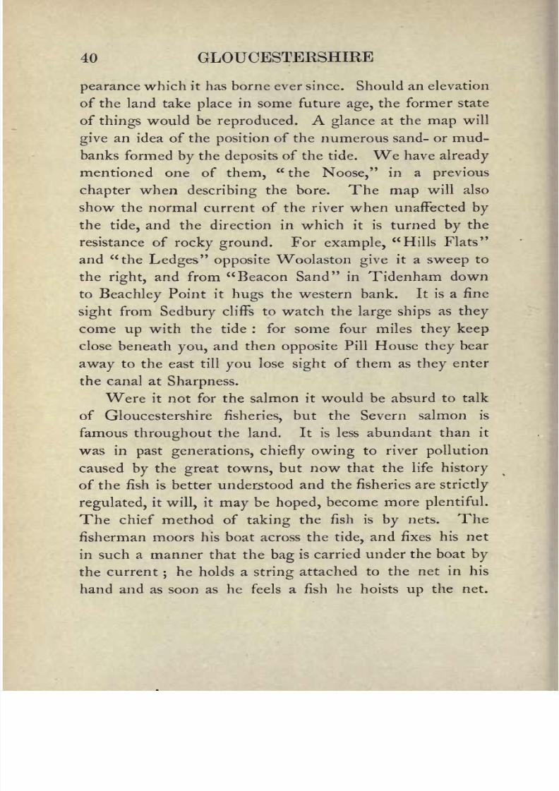
Another method, which has been practised from the
earliest times in the parishes of Tidenham and Woolaston,
is that of "potchers," or more
correctly"putchers."
A long stand of baskets is erected below high-water mark
tier over tier;the baskets are long and cone-shaped, and
open at the base of the cone. This open end faces the
incoming tide, and the fish swimming up the river enter
Salmon "Putchers" at Low Water, Beachley
these baskets, and being unable to turn round owing to the
narrow dimensions of the potcher are left high and dry
by the receding waters. It need hardly be added that the
privilege of erecting potchers has long been limited.
Other famous Gloucestershire fishes are the lamprey
and the lampern, which in Gloucester are potted or made
into pies. It was formerly the custom for the Corporation
to send gifts of these pies to the king, and to certain high

8/2/2019 Gloucestershire 1911
http://slidepdf.com/reader/full/gloucestershire-1911 56/174
42 GLOUCESTERSHIRE
officials of thecity
and county, but since the demise of the
old corporation in 1835, the custom has been dropped.
Another fish sold in Gloucester in large numbers in the
spring is the "elver": this is merely a very young eel of
thread-like appearance, andeasily
mistaken by the stranger
for worms. Millions of these elvers are exhibited in heaps
upon the slabs of thefishmongers. Nor must we forget
the Woolaston shrimps and Beachley sprats, which always
find a ready sale when hawked from door to door by the
captors and their families.
Gloucester, before the construction of the Manchester
Ship Canal, was the most inland port in the kingdom after
London. Its imports arechiefly
timber and grain, in
which articles its trade is very large: in 1903 the total
value of imported goods of all kinds was 2,925,601.
Its exports come from the western midlands and from the
manufactories in thecity
itself. In 1904, for example,
30,721 tons of salt from Droitwich and its neighbourhood
were exported to foreign ports, and in the same year iron
and steel manufactures to the value of 45,579. It will
thus be seen that its connexion with Birmingham and
other midland towns by railway and canal, together withits easy
communication with the Atlantic by means of the
ship canal, has made Gloucester the chief town and only
port upon the Severn.
Bristol, on the other hand, like Newport and Cardiff
on the further shore, is a port of the Channel. But for
this city,which has played so important a part in the
history of the west, and indeed of England itself, we shall
need a separate chapter.

8/2/2019 Gloucestershire 1911
http://slidepdf.com/reader/full/gloucestershire-1911 57/174
THE PORT OF BRISTOL 43
9. The Port of Bristol.
It is to its commerce even more than to its manufac-
tures that Bristol owes its greatness. When Liverpool
was unheard of and Cardiff little more than a Norman
fortress, Bristol was to the west what London was to the
east. Already in the eleventh century she was carrying
cargoes of slaves to the Scandinavian settlers Ostmen
as they were called on the east coast of Ireland, and in
the next century permission was received from the king
to form a settlement in Dublin. After this the trade with
Ireland was no longer confined to slaves. Rough cloth,
which was made in Bristol or its neighbourhood, began to
be exported not only to Ireland but to Scandinavia, whence
the ships brought home cargoes of salt fish a commodity
much more generally consumed in those days than now.
If the map be studied, it will be seen that the site of
Bristol is onepeculiarly
suitable for a trading settlement.
Placed on a tidal river capable ofcarrying ships of large
burden, and in easy communication with the ancient town
of Bath (and so with all parts of England, for on Bath
converged roads from every quarter), merchandise could
be collected from, and transported to every part of the
kingdom. In theearly days when docks were unknown
the soft mud of the estuary permitted the careening of
vessels without fear ofinjury.
If it is asked why the town
was not built nearer the sea, the answer iseasy.
The flat
ground at the mouth of the river was liable to inundation
and exposed to the attacks of an enemy by land or sea.
The steep cliffs that line the river on both sides made a

8/2/2019 Gloucestershire 1911
http://slidepdf.com/reader/full/gloucestershire-1911 58/174
44 GLOUCESTERSHIRE
landing-place impossible till the opening at the foot of
Clifton downs was reached.
This, then,
was the
spot,and here quays, alongside which ships could be brought,
were constructed. On the land side the neck of the
peninsula formed by the Frome and the Avon waseasily
guarded by a castle, and on this peninsula, fortified land-
The Avon from the Suspension Bridge, Clifton
ward and seaward, the town was built. By nature it was
a stronger place than London.
By the time of Henry II, the trade of Bristol had
become so important that a charter was granted to the
townsmen by the king, freeing Bristol men and their
merchandise from the tolls which were then levied upon
goods carried through a town or over a bridge. Aquitaine

8/2/2019 Gloucestershire 1911
http://slidepdf.com/reader/full/gloucestershire-1911 59/174
THE PORT OF BRISTOL 45
came to Henry as his wife's dowry, and in consequence
the trade in French wines received an immenseimpetus,
Bristol being its chief mart. In the thirteenth century the
townsmen had what we should call a corporation, and had
been granted the same privilegesas the citizens of London.
Besides this, the various trades had their guilds or societies
by which their interests were protected, and the exercise of
each particular trade confined to members of its guild.
The fifteenth century, in spite of French and civil
wars, was a flourishing time for Bristol merchants. The
Merchant Guild had now become the Fellowship of
Merchants, a title which itself was to be superseded
under Edward VI by that of theSociety
of Merchant
Venturers asociety which is still the wealthiest and
most honourable in thecity.
This was the age of the
Canynges, the Cabots, and the Yonges. Their ships
sailed north, west, south, and east to Iceland and the
Baltic, to France and Spain, to the Levant, and to the New
World. The Canynges William, John, and William,
three generations seem to have owed their greatness
to the cloth trade. The grandson, the greatest of the
three, had 2853 tons of shipping afloat and employed 800sailors : besides these he had at work a hundred carpenters,
masons, and other workmen. Thomas Yonge was his
half-brother and represented the town in seven Parlia-
ments; Canynges himself was member for Bristol in two
Parliaments and was five times mayor. After a long life
ofprosperity
and good works he retired in his old age to
the collegiate church of Westbury-on-Trym, where he
tookpriest's orders and died in 1474.
8/2/2019 Gloucestershire 1911
http://slidepdf.com/reader/full/gloucestershire-1911 60/174
46
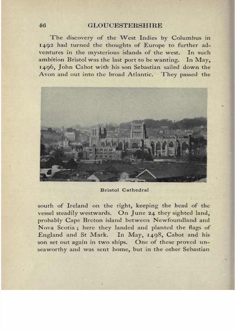
Thediscovery of the West Indies by Columbus in
1492 had turned the thoughts of Europe to further ad-
ventures in the mysterious islands of the west. In such
ambition Bristol was the last port to be wanting. In May,
1496, John Cabot with his son Sebastian sailed down the
Avon and out into the broad Atlantic. They passed the
Bristol Cathedral
south of Ireland on the right, keeping the head of the
vessel steadilywestwards. On June 24 they sighted land,
probably Cape Breton island between Newfoundland and
Nova Scotia;here they landed and planted the
flagsof
England and St Mark. In
May,1498, Cabot and his
son set out again in two ships. One of these proved un-
seaworthy and was sent home, but in the other Sebastian

8/2/2019 Gloucestershire 1911
http://slidepdf.com/reader/full/gloucestershire-1911 61/174
THE PORT OF BRISTOL 47
reached the coast of Labrador. Unable to proceed north-
wards on account of theice
he puthis vessel about and
sailed along the coast southward in search of a passage to
the west, for he could not tell whether the land he was
coasting was an island or not. He got as far as Virginia,
when he gave up and returned to England1. For the next
hundred years Bristol displayed but little enterprise as
regards the New World, though the Spaniards were very
active in Mexico and the south. In the seventeenth
century more than one attempt at colonisation was made.
At last,in 1630, John Winthrop planted a settlement at
Charlestown, which was reinforced ere long, and about
the same time Robert Aldworth and Giles Elbridge,
two Bristol merchants, founded a colony further north
in Maine. In 1620 the"
Mayflower
"had sailed from
Plymouth with the Pilgrim Fathers, and by the end of
the century Bristol was doing a brisk trade insugar and
tobacco with the southern colonies and the West Indies.
Sugar henceforward became the staple trade of Bristol :
the factories in which the sugar was refined and cast into
loaves were numerous. Macaulay, describing the wealth of
the sugar-refiners in the seventeenth century, says: " The
hospitality of thecity
was widely renowned, andespecially
the collations with which the sugar-refiners regaled their
visitors. The repast was dressed in the furnace, and was
accompanied by a rich beverage made of the best Spanish
wine, and celebrated over the whole kingdom as Bristol
milk." The death-blow to this long-established industry
was given by the introduction of Free Trade. The
1 A tower to the memory of the Cabots now crowns Brandon Hill.

8/2/2019 Gloucestershire 1911
http://slidepdf.com/reader/full/gloucestershire-1911 62/174
48 GLOUCESTERSHIRE
colonialsugar no longer had that advantage in the pay-
ment of duty over foreign sugar, and an inferior article
manufactured in France and elsewhere drove the fine
Bristol sugar out of the market. The West India planters
who had made their fortunes before this time were con-
sidered fortunate. Another circumstance, which in agreat
Old Dutch House and Wine Street, Bristol
degree damaged the West India trade, was the emancipation
of the slaves in 1833. In the eighteenth century the trade
in negro slaves was one of the chief sources of Bristol
wealth. Ships laden with home products iron, cloth,
glass, andso
onsailed to the West Coast of
Africa,where these things were exchanged for a human cargo.
Packed and crowded together in the hold like animals.

8/2/2019 Gloucestershire 1911
http://slidepdf.com/reader/full/gloucestershire-1911 63/174
THE PORT OF BRISTOL 49
and treated in much the same way, the negroes were
carried off to the West Indies and sold to the planters.
Thence the ships returned home, bringing sugar, rice,
tobacco, rum, and other tropical products soon to be
reladen for another voyage. Such was the business of the
famous West Indiamen that lined the quays of Bristol, the
pride of every citizen and the admiration of every stranger.
One would like to believe that among the goods exported
in those days were silken fabrics, for many Huguenots hadsettled in Bristol on the revocation of the Edict of Nantes
in 1685, but they seem to have been engaged in weaving
woollen materials rather than silk, which employed them
in London and elsewhere. They had other trades and
professions a list of 1709 included ten merchants, a
physician and three surgeons and their descendants maybe found in Bristol at the present day.
It was in the eighteenth century, too, that Bristol
sent out its many privateers. A privateer is a ship-of-war
fitted out at the owner's expense, and carrying"
letters of
marque," which authorise it to engage with any vessel of
the enemy, to make prizes, and carry home booty. The
most famous of the early privateering expeditions wasthat of the
" Duke"
and " Dutchess"
fitted out by
sixteen Bristol merchants, and commanded by Captain
Woodes Rogers. Leaving Kingroad, the great roadstead
at the mouth of the Avon, on August 8, 1708, they
sailed for Brazil, rounded Cape Horn, found Alexander
Selkirk on the island of Juan Fernandez off the coast of
Chile, and after taking several prizes set out home across
the Pacific on January I, 1710. They sailed round the
E. G. 4

8/2/2019 Gloucestershire 1911
http://slidepdf.com/reader/full/gloucestershire-1911 64/174
50 GLOUCESTERSHIRE
Cape of Good Hope and reached Bristol with gains to the
value of
;i 70,000. Scarcelyless successful was one of
the cruises of theuRanger," a Bristol privateer also owned
by a member of the Rogers family, which, in 1 780, brought
into Bristol four prizes, of which one the "Sta Inez"
carried treasure only inferior in value to the celebrated
Manila galleonu N.S. de Covadonga" captured by Com-
modore Anson. But the War of the Austrian Succession
(1743-48) and the Seven Years' War (1756-63) were the
great times for Bristol privateering. At one time no less
thanfifty-one Bristol privateers were afloat, though often
to the loss of their owners.
At the end of the eighteenth century, owing to a
combination of causes, the trade of Bristol began to de-
cline. The importation of wool from Ireland had ceased
at the end of the previous century when the Irish began
to manufacture woollen goods at home, and though this
industry was soon crushed by the tyranny of theruling
classes, Bristol gained nothing, for the Irish only took their
manufactures to foreign countries. After the wars with
Napoleon, the Spanish wool-trade went to London. The
difficulty with which the port of Bristol was entered
as compared with other ports was now beginning to tell.
The want of steam-coal and the heavy export and import
dues imposed sent the trade to the north of England.
Liverpool had now far outstripped Bristol in the race for
trade, and the American ships now preferred to run into
the northern port. These heavy port dues, which proved
so fatal to the trade of Bristol, were imposed by a Dock
Company which had been formed in 1803 to make a

8/2/2019 Gloucestershire 1911
http://slidepdf.com/reader/full/gloucestershire-1911 65/174
THE PORT OF BRISTOL 51
harbour 2^ miles long and covering a space of over
80 acres in the centre of the city. This was done by
damming up the bed of the Avon, so that its channel
formed a long floating harbour, and cutting a new course
for the river round the south of thecity.
The Company,
however, cared more about fillingtheir own pockets than
fostering the good of the city,and trade kept falling
offtill,
in 1 848, the Corporation bought the harbour and reduced
the dues.
From this time the trade of Bristol began to revive.
Already on April 8, 1838, the Great Western, the first
steamship worthy of the name to cross the Atlantic, had
sailed down the Avon and reached New York in less
than sixteen days,a wonderful achievement at that time,
and matters improved slowly till in 1871 a regular trade
with America was once more established. In 1877 a
new dock was opened at the mouth of the Avon by an
independent Company, and in 1880 another Company
opened a dock on the other side of the Avon at Portishead
two miles west of the former dock. A railway on either
side of the river connected these docks with thecity.
The competition which sprang up between these new
docks and the oldcity docks proved disastrous to the
latter, and in 1884 they both passed into the hands of the
Corporation.
The trade of Bristol now began to prosper, as it had
never done since the days of steam ships,and the increase
in the size of thegreat
ocean steamers made it clear that
if Bristol was to hold its own further dock accommoda-
tion would benecessary.
A new dock, called the Royal
42

8/2/2019 Gloucestershire 1911
http://slidepdf.com/reader/full/gloucestershire-1911 66/174
52 GLOUCESTERSHIRE
Edward Dock, was therefore begun in 1902 on the outer
side of the Avonmouth dock, which was connected withit by a canal 85 feet wide. The new dock which covers
30 acres, and can float vessels larger than any at present
in existence, was opened by the King in July
Avonmouth Docks
10. Climate.
The climate of a country or districtis, briefly,
the
average weather of that country ordistrict, and it depends
upon various factors, all mutually interacting ; upon the
The following table will show the size of the various docks
City Docks . . . . 83 acres
Avonmouth Dock . . . 19
Portishead Dock . . . 12
Royal Edward Dock . . . 30
All are under the control of the City.

8/2/2019 Gloucestershire 1911
http://slidepdf.com/reader/full/gloucestershire-1911 67/174
CLIMATE 53
latitude, the temperature, the direction and strength of
the winds, the rainfall, the character of the soil, and the
proximity of the district to the sea.
The differences in the climates of the world depend
mainly upon latitude, but a scarcelyless important
factor is this proximity to the sea. Along any great
climatic zone there will be found variations in proportion
to this proximity, the extremes being"continental
"
climates in the centres of continents far from the oceans,
and "insular
"climates in small tracts surrounded by sea.
Continental climates showgreat
differences in seasonal
temperatures, the winters tending to be unusually cold
and the summers unusually warm, while the climate of
insular tracts is characterised by equableness and also by
greater dampness. Great Britain possesses, by reason ofits position, a temperate insular climate, but its average
annual temperature is much higher than could be expected
from its latitude. The prevalent south-westerly winds
cause a drift of the surface-waters of the Atlantic towards
our shores, and this warm water current, which we know
as the Gulf Stream, is the chief cause of the mildness of
our winters.
Most of our weather comes to us from the Atlantic.
It would be impossible here within the limits of a short
chapter to discussfully
the causes which affect or control
weather changes. It must suffice to say that the conditions
are in the main either cyclonic oranticyclonic, which
terms may bebest
explained, perhaps, by comparing theair currents to a stream of water. In a stream a chain
of eddies may often be seen fringing the moresteadily

8/2/2019 Gloucestershire 1911
http://slidepdf.com/reader/full/gloucestershire-1911 68/174
54 GLOUCESTERSHIRE
moving central water. Regarding thegeneral
north-
easterly moving air from the Atlantic as such a stream, a
chain of eddies may be developed in a belt parallel with
its general direction. This belt of eddies or cyclones, as
they are termed, tends to shift its position, sometimes
passing over our islands, sometimes to the north or south
of them, and it is to this shifting that most of our weather
changes are due. Cyclonic conditions are associated with
a greater or less amount of atmospheric disturbance;
anticyclonic with calms.
The prevalent Atlantic windslargely
affect our island
in another way, namely in its rainfall. The air, heavily
laden with moisture from its passage over the ocean,
meets with elevated land-tractsdirectly
it reaches our
shores the moorland of Devon and Cornwall,the
Welshmountains, or the fells of Cumberland and Westmorland
and blowing up the rising land-surface, parts with this
moisture as rain. To how great an extent this occurs is
best seen by reference to the accompanying map of the
annual rainfall of England, where it will at once be
noticed that the heaviest fall is in the west, and that it
decreases with remarkable regularityuntil the least fall
is reached on our eastern shores. Thus in 1906, the
maximum rainfall for the year occurred at Glaslyn in the
Snowdon district, where 205 inches of rain fell;and the
lowest was at Boyton in Suffolk, with a record ofjust
under 20 inches. These western highlands, therefore,
maynot
inaptlybe
comparedto an
umbrella, shelteringthe country further eastward from the rain.
The above causes, then, are those mainly concerned

8/2/2019 Gloucestershire 1911
http://slidepdf.com/reader/full/gloucestershire-1911 69/174
ENGLAND & WALESANNUAL RAINFALL
tatute Miles
(The figures show the annual rainfall in inches.)
8/2/2019 Gloucestershire 1911
http://slidepdf.com/reader/full/gloucestershire-1911 70/174
56 GLOUCESTERSHIRE
in influencingthe weather, but there are other and more
local factors which often affect greatly the climate of a
place, such, for example, as configuration, position, and
soil. The shelter of a range ofhills, a southern aspect,
a sandy soil,will thus produce conditions which may
differ greatly from those of a place perhaps at no great
distance situated on a wind-swept northern slope with
a cold
clay
soil.
The character of the climate of a country or district
influences, as everyone knows, both the cultivation of the
soil and the products which ityields,
and thusindirectly
as well as directly exercises a profound effect upon Man.
The banana-nourished dweller in a tropical island who
has but to"tickle the earth with a hoe for it to laugh a
harvest
"is of different fibre morally and physically from
the inhabitant of northern climes who wins a scanty
subsistence from the land at the expense of unremitting
toil. These are extremes;but even within the limits of
a county, perhaps, similar if smaller differences may be
noted, and the man of the plain or thevalley
is often
distinct in typefrom his fellow of the hills.
Very minute records of the climate of our island are
kept at numerous stations throughout the country, relating
to the temperature, rainfall, force and direction of the
wind, hours of sunshine, cloud conditions, and so forth,
and are duly collected, tabulated, and averaged by the
Meteorological Society. From these we are able to
compare and contrast the climatic differences in various
parts.In Gloucestershire, as may be guessed, the chief
distinction is between the Cotswolds and the Vale, and

8/2/2019 Gloucestershire 1911
http://slidepdf.com/reader/full/gloucestershire-1911 71/174
CLIMATE 57
the protection, good soil, and other advantages which the
latter
enjoys
have a marked effect
uponits
productions."As long coming as Cotswold barley" is an old saying
referring to this fact, and the ripening of the crops on the
hills is often a month later than in the Vale.
In the rainfall map it will be seen that Gloucestershire
liesjust outside the limits of the 40 60 inches average
annual fall and is placed in the 30 40 inches division.
There are, however, exceptions to this, and a small
isolated region of the heavier fall existsjust
north of
Bristol. At Clifton the rainfall for thethirty years
from
1870 varied between 35 and 45 inches, and at Stroud for
the same period between 29 and 85 inches. These
figures are considerably higher than the average annual
rainfall for Great Britain, which is about 32 inches. On
the whole the south of the county is wetter than the
north.
On the whole Gloucestershire is a warm county,
partly due to the fact that the temperature of the water
in winter is warmer than that of the land, and to the
warm south-westerly winds that blow up the Bristol
Channel. The mean annual temperature for most of
the county is between 48 and 50 Fahr., but in thevalley
of the Bristol Avon and of the Severn as far up as
Gloucester it is over 50 Fahr. Partly owing to its mineral
springs andpartly to its sheltered position Cheltenham
has become a favourite health-resort, especiallysuitable
for the old and delicate.

8/2/2019 Gloucestershire 1911
http://slidepdf.com/reader/full/gloucestershire-1911 72/174
58 GLOUCESTERSHIRE
ii. People Dialect, Settlements, Popu=lation.
Although Gloucestershire belonged to Mercia for
a great part of itsearly history,
its people were West-
Saxon. They had subdued the Hwiccas, as the old
British settlers were called, who by that time at least
in the towns had become more or less Romanised.
There were at the time of the Conquest two dialects
spoken in England, the northern and the southern, and the
men of Gloucester of course spoke the latter. But with
the Normans a multitude of French words came in, and
helped to break up the old division. Of all these modified
forms it was the east-midland which became the language
of London and of literature, and the pure southern dialect
was pushed westwards till it deserved the name of western
rather than southern. This western form remained the
language of Gloucestershire, Wiltshire, Berkshire, Somer-
set, Dorset, and Devon. As language is not made but
grows, further modifications arose, till at the present day
the man of Gloucestershire complacently tolerates whathe considers the curious dialect of the man of Devon.
The old Gloucestershire dialect in its purity may be
found in the Chronicle of Robert of Gloucester.
Gloucestershire has been singularly free from foreign
settlements: the only noteworthy immigrants being the
French refugeesof the sixteenth and seventeenth centuries.
It was they who introduced the art of silk-weaving into
the Stroudvalley,
and at France Lynch near Chalford
8/2/2019 Gloucestershire 1911
http://slidepdf.com/reader/full/gloucestershire-1911 73/174
PEOPLE DIALECT, SETTLEMENTS 59
a French inscription may still be seen on one of the
cottage windows.
The population of the county in 1901 was 708,439
and the number of square miles is 1258, which gives an
average of 563 to the square mile. Gloucestershire is
the seventeenth English county in size, and the twelfth
in population.
12. Agriculture Cultivations, Stock.
Few counties have so many rural industries exclusive
of agriculture. In the whole county including the towns
60,000 persons are engaged in various industries, while the
number of those engaged in agricultureis but 25,000. The
total number of acres under crops and grass is 657,245; of
these the corn crops including rye, beans, and peas cover
108,646 acres, and 418,789 acres are laid down in
permanent pasture, the rest are taken up with green
crops, clover and saintfoin, etc.
The general features of the county have been described
in a previous chapter, we have now to consider them from
the point of view of their products. At the present day,
though here and there many acres have reverted to the
original sheep run, the general surface of the Cotswolds is
covered with cereals and artificial herbage. The soil is
a calcareous loam three to six inches deep, locallycalled
stonebrash : the ploughing must therefore be very shallow,
and rolling as well as treading by sheep is important. For
fodder the characteristic plant, as before noticed, is the
saintfoin. "This princely herb," as an eighteenth century

8/2/2019 Gloucestershire 1911
http://slidepdf.com/reader/full/gloucestershire-1911 74/174
60 GLOUCESTERSHIRE
writer on the agriculture of the county styles it,is a native,
but it has been cultivated on these hills for some250
years,and was a familiar plant long before the cultivation
of the turnip was introduced. The fact that its roots
penetrate the interstices of the oolite rock beneath the
stonebrash makes it a crop peculiarlysuited to this shallow
soil, and about 15 per cent, of the arable land is devoted
The Agricultural College, Cirencester
to it. The crop stands from three to five years before it
is broken up. To the south-east of the hills round
Fairford, South Cerney, and Tetbury the soil isclayey,
more or less overlaid with gravel, the same as that of the
adjacent county of Wilts. Since the disastrousyears, i.e.
since 1879, the upkeep of the untractable arable land in
this district has not been worth the expense, and much of

8/2/2019 Gloucestershire 1911
http://slidepdf.com/reader/full/gloucestershire-1911 75/174
AGRICULTURE 61
it has been laid down in pasture. Dairy farming and the
supply of milk to London and Swindon is now the chief
industry. The water meadows along the lower reaches of
the Churn and Coin are carefully irrigated,and produce
at least two rich cuttings ofgrass
in the season.
The Severnvalley consists chiefly
of Lias clayoverlaid
in some places by a sandy loam and in others by a red
marl, said to be brought down from the red country in
Worcestershire by the Teme, a tributary which joins the
Severn just below Worcester. In the lower parts nearer
the Bristol coalfield the Old and New Red Sandstone occur.
The whole vale is extremely fertile, and half a century ago
the arable and pasture land was about equal, but now the
greater part is pasture. Besides dairy farming and the
manufacture of butter and the celebrated Double and
Single Gloucester cheese, store cattle are reared for the
market inlarge numbers, and in many of the parishes the
famous Gloucestershire cider has been made for many
generations. The earliest mention of it which has been
discovered is across the river at Tidenham in about 1290,
but no doubt it had even then been made there for some
centuries.In
the valeof Evesham not only pears and
apples but other fruits areextensively cultivated, and near
thelarge towns Cheltenham, Gloucester, and Bristol
there are many acres of market-gardens.
Out of 73,000 acres west of the Severn, some 24,000
are forest. Of the rest the Newent district, as we have
calledit,
consists of alight
loam lying on the Old Red
Sandstone. It is by no means a rich or very fertile soil,
but will grow barley and turnips well, and feed cattle and

8/2/2019 Gloucestershire 1911
http://slidepdf.com/reader/full/gloucestershire-1911 76/174

8/2/2019 Gloucestershire 1911
http://slidepdf.com/reader/full/gloucestershire-1911 77/174
AGRICULTURE 63
sheep. These sandy soils have long been known as the
Ryelands, and gave their name to a breed of small sheep.
The "Ryelanders" however, having been continually
crossed with other breeds to improve their size, are very
seldom found in a pure state: they are a small, white-
faced hornless breed, remarkable for the fineness of their
wool and for the excellence of their mutton.
The Old Red Sandstone and Carboniferous Limestone
continue southwards from the Forest to the extremity of
the peninsula: near the Severn a considerable area is upon
New Red Sandstone, Red Marl and Lias. In the sandstone
parts,which are considerably in excess of the limestone,
the cultivation resembles that on the eastern side of the
estuary.The depth of soil on the limestone rock is
small and seldom worth more than rough grazing for sheep
and cattle.
The number of cattle have increased with the increase
of pasturage ;about Tewkesbury there are a few Here-
fords, but the Shorthorns are almost universally kept. Of
the old Gloucestershire breed only a very fewspecially
protected herds survive, as at Badminton and Prinknash.
Awriter at the
beginningof the last
century saysthat
even then few "packs" of the genuine old stock were
preserved. He describes them asdiffering "little in general
appearances from the Glamorganshire, except in colour,
which is a dark red, or brown : the bones are fine, horns
of a middling length, white in colour, with a black tipat
the ends. ..a slight streak of whitegenerally runs along
the back, and always on the rump end of the tail."
Oxen are still employed for the plough on the Cotswolds,

8/2/2019 Gloucestershire 1911
http://slidepdf.com/reader/full/gloucestershire-1911 78/174

8/2/2019 Gloucestershire 1911
http://slidepdf.com/reader/full/gloucestershire-1911 79/174
AGRICULTURE 65
though in some parts they are now almost entirely disused.
This is to be regretted, especially on large farms which can
keep a team of horses as well, as the expense of their keep
is only two-thirds that of the horses, and they can do
nearly as much work, both at the plough and as draught
animals. Harnessed to the ox-cart or wain they formerly
did all the farm traffic now done by horses.
The famous Cotswold sheep, which for many
generations made Chipping Campden and Northleach the
centre of the wool-trade of England, are now very scarce.
In the latter part of the eighteenth century they had
already been crossed with the Leicesters, and since then,
mutton having become a more important commodity than
wool, they have beenlargely crossed with the South
Down, which has reduced their size, and also the quantityof the wool. The demand for large joints of mutton is
not what it was, while for smalljoints
the butchers always
find a ready sale. A few flocks of the pure breed, however,
are still left. Those at Daglingworth and Hampnett
were, and may bestill, famous; and in 1905 the celebrated
Aldsworth flock produced noo fleeces at an average of
io| Ibs. per fleece. Of lateyears, too, the breed has been
revived at Hyde Farm, near Stroud.
Gloucestershire is not a great horse-breeding county,
though most farmers have a foal or two in the season.
The causes of agricultural depression have been the
same in Gloucestershire as in other counties, viz. the
longrun of bad seasons
culminating
in
1879,
and the
importation of foreign cereals. The results of the latter
in our county is shown at once by the fact that during
E. G. 5

8/2/2019 Gloucestershire 1911
http://slidepdf.com/reader/full/gloucestershire-1911 80/174
66 GLOUCESTERSHIRE
the lastthirty years permanent pasture has increased by
114,639 acres. The decrease in the number of agri-
cultural labourers is duepartly
to the same cause, and
partly to the introduction of machinery, which requires
much fewer hands to work it. Yet the flail may still be
seen at work in the more unsophisticated districts. There
Threshing with the Flail
is, however, a growing tendency of the young people of
both sexes to flock to the towns. In 1871 the number
of labourers in the county was 20,586, in 1901 13,319:
in the former
year 2007
of these were women, in
1901only 182.
Still, afterall,
Gloucestershire has not suffered so much

8/2/2019 Gloucestershire 1911
http://slidepdf.com/reader/full/gloucestershire-1911 81/174
AGRICULTURE 67
as many other counties, and though farmers are a race
privileged to grumble, it is seldom that a man of industry
and prudence fails to make a decent living.
13. Industries.
The staple industry of the county during the greater
part
of its history was wool. For six hundred years the
Cotswolds were a vast open down, over which roamed
thousands of sheep whose wool was famous throughout
England. When shorn the wool was stored in great
warehouses at the wool centres, of which Cirencester,
Northleach, and Chipping Campden were the chief. The
London wool-merchants then came down, and purchased
the wool from the middlemen by the sack and "tod." Theythen packed it in "sarplers" and "pokes" and conveyed it
to the Kentish ports, whence it was shipped to Calais or to
some Flemish wool-mart. This went on all through the
Middle Ages, but under Edward III the Gloucestershire
men not only grew the wool but also began to weave it
into cloth. For this purpose water was necessary, and
the Stroud valley having the best and swiftest streams, it
was here that the looms were set up. The wool could
now be washed and dyed, and in later days water-power
machinery could be set up. This was the origin of the
Gloucestershire clothing trade, which flourished down to
the middle of the nineteenth century. Itshistory cannot
begiven
here even inoutline ;
it
must suffice to say thatthe chief causes of its decline were, the introduction of
machinery, which employed fewer hands and so met with
52

8/2/2019 Gloucestershire 1911
http://slidepdf.com/reader/full/gloucestershire-1911 82/174
68 GLOUCESTERSHIRE
violent opposition ;the rise in the price of the fine
foreign
wools partly owing to the eight years' drought in Australia;
andlastly
the high protective tariffs of foreign countries
combined with their absence at home. These are some of
the difficulties with which thegreat manufacturing towns
of the north have been so far able to cope, but which have
Chipping Campden Market House and old Guild Chapel
now the Town Hall
given a severe blow to the clothing trade of the west. It
was in 1830 that the decline began, and since that time
the mills at Stroud are the only ones that have maintained
their
ground.
Here of late
years
there have been distinct
signsof improvement. A certain number of firms have
always kept their mills open, and a method has now been

8/2/2019 Gloucestershire 1911
http://slidepdf.com/reader/full/gloucestershire-1911 83/174
INDUSTRIES 69
discovered of refining the Cotswold wool and weaving
tweeds from it as
good
as
any
of those of the north of
England. Not long ago it was considered too coarse for
any but the rougher kind of material. Now, owing to
the improvements and the advance in the construction of
machinery, the annual output of Stroud cloth is larger
than it ever was.
If the number of persons engaged gives a county the
right to be called "industrial," Gloucestershire may be so
called, for, as we have seen, 60,000 persons are engaged
in industries of one sort or another, and only 25,000 in
agriculture. The former number of course includes
persons engaged in mining, which is thesubject
of the
next chapter. Many are employed in the Woods and
Forests, which cover about 61,184 acres an area only
surpassed by five other English counties, namely York-
shire, Hampshire, Sussex, Kent, and Devon. Timber-
dealing employs nearly 7000 persons, for, as noted in
a former chapter, there is a considerable trade with
Norway and other countries in this article. In 1905
25,000,000 worth was imported by the whole country,
of which Bristol was responsible for 1,000,000, andGloucester for 600,000. In the days when our navy
consisted of wooden ships, the Forest was one of the chief
sources from which the timber was drawn. There are
15,000 acres now under timber cultivation, and this con-
sists of young oaks. The ancient trees were mentioned
in a former chapter.
Other trades which employ a large number of hands
are engineering machinery and shipbuilding 10,470, and

8/2/2019 Gloucestershire 1911
http://slidepdf.com/reader/full/gloucestershire-1911 84/174
oPH
rt
Oboc
'S,
aIS
o

8/2/2019 Gloucestershire 1911
http://slidepdf.com/reader/full/gloucestershire-1911 85/174
INDUSTRIES 71
miscellaneous iron and steel, 2832. Bristol is now the
place where most of the Great Western locomotives are
built, with the exception of the heavy main-line engines,
which are built at Swindon. Other manufactures for
which Bristol is known all over the world are those of
cocoa and tobacco, the former having been in existence
for 1 80years.
To agriculturalmanufactures we referred
in the last chapter. There are many other smaller
industries of which we cannot speak here, but wemust not forget bell-founding, for which Rudhall of
Gloucester was famous two hundred years ago. The
industry was revived at Bristol in 1875 and is now
aflourishing trade.
14. Mines.
The principal mineral products of Gloucestershire are
coal and iron. There are two coalfields the Forest and
that part of the Bristol coalfield which lies between the
Avon and Tortworth. In 1903 1,406,021 tons of coal
wereraised from these
twofields.
Takingthe latter
first, its area is about 50 square miles, or ten miles long
by five wide, and there are now less than 30,000,000
tons of the best coal to be worked. The output is about
250,000 tons a year and at this rate it will be exhausted
in about another 100years.
This affords the principal
household coal of Bristol.
On the other hand the area of the Forest coalfields is
about 34 square miles and its annual output is more than

8/2/2019 Gloucestershire 1911
http://slidepdf.com/reader/full/gloucestershire-1911 86/174
72 GLOUCESTERSHIRE
460,000 tons, at which rate it is calculated that the supply
will last for another 600years. Firedamp in these
pits is
unknown, and the miners work with naked lights.A
well-known Gloucester man writing 20 years ago says :
"One can hardly imagine anything more severe in the
way of labour than that of the miner, lying on his side in
Speech House Colliery
a four-foot passage, cutting away with his pick the hard
rock encasing the seam. The strain upon the hands,
wrists, and arms is tremendous. The swing of the body
is not available, the legs are miserably cramped away, and
the whole task seems to fall upon the arms; but use is
everything. The men do not feel the cramped position,
and prefer this work, to which they have been born and

8/2/2019 Gloucestershire 1911
http://slidepdf.com/reader/full/gloucestershire-1911 87/174
MINES 73
bred, to any other. 'Nothing tires me like having to
stand
long
on
my legs.
The worst of all is
gardening.Bending down like that breaks my back,' said an old hand
who had been 52 years a pitman. This dislike of
gardening is common among colliers in the Forest of
Dean."
Geologically speaking the coal lies in a basin, of which
the inner coat is Millstone Grit, the middle coat Carboni-
ferous Limestone, and the outer coat Old Red Sandstone.
A writer of the middle of the last century says,"The
coal-measures in the central parts of Dean Forest are 1410
feet deep There are 27 beds of coal, making an
aggregate thickness of 40 ft. 8 in. These seams vary
from one or two inches to two or three feet, and in one
instance Coleford High Delf [one of the lowest seams]
to five feet. The Millstone Grit is from 265 to 455 feet
thick."
The head officer under the Crown who has the
control of the mines is called the gaveller, and by ancient
custom men born in the Hundred of St Briavels, who
have resided in the said Hundred, and worked in the
mines for a year and a day, have the privilege of being
registered as "free miners." Only free miners have
a right to grants of the Crown mines.
The iron ore is found in the Millstone Grit and in
the upper part of the Limestone, and has been worked
from the days of the Romans. They worked underground,
and also by what are called "day-workings," that is deep
winding passages open at the top, and now called
"Scowles." But the ore they got out they only partially

8/2/2019 Gloucestershire 1911
http://slidepdf.com/reader/full/gloucestershire-1911 88/174
74 GLOUCESTERSHIRE
smelted, and the unexhausted "cinders" which they left
were
profitably
reworked at least as
early
as the time of
Edward I. The fuel used for smelting up to the time of
Dud Dudley, an ironmaster of the days of Charles I,was
oak and beech charcoal;
for although "sea-coal" or "pit-
coal" was worked asearly
as the thirteenth century it was
not thought possible to utilise it for smelting purposes till
the appearance of Dudley's book Metallum Martis, in
which he suggested the experiment. This took a long
time to bring to perfection, and when at last this was
accomplished, the Sussex ironmasters whose supply of
timber was getting exhausted migrated to South Wales for
the sake of the coal.
The supply of iron oreis, however, on the decline
;for
in 1856 the totalyield
of all the iron mines in the Forest
was 109,268 tons, and in 1903 it was only 7456 tons.
Iron was also worked at a very early period in the
Bristol coalfield, where there is a village called Iron
Acton.
15. History of the County.
At the earliest period which need be noticed in this
chapter the district afterwards called Gloucestershire was
peopled by a Welsh tribe known to the Romans as the
Dobuni. On the invasion of the Romans, this tribe was
subdued in A.D. 43 by the generals Aulus Plautius and
Ostorius Scapula. The Romans founded at Gloucester
(Glevum) one of the four colonies which they planted in

8/2/2019 Gloucestershire 1911
http://slidepdf.com/reader/full/gloucestershire-1911 89/174
HISTORY OF THE COUNTY 75
the island, the other three being Colchester, Lincoln, and
York; and they established a settlement for residence and
commerce at Cirencester (Corinium). Apart from these
two towns, villas and smaller settlements, as we shall see
in the next chapter, were scattered over the Cotswolds.
On the withdrawal of the Roman troops about 410,
Gloucestershire, to use the later name, fell back under
Hypocaust of Roman Villa, Chedworth
native rulers. By this time the upper classes had become
Romanised, and many of them were Christians. In
towns like Cirencester they lived in ease and comfort, and
the civilisation equalled that of the continental towns,
while the wealthier citizens had their villas in convenient
situations in the country. In Gloucestershire probably

8/2/2019 Gloucestershire 1911
http://slidepdf.com/reader/full/gloucestershire-1911 90/174
76 GLOUCESTERSHIRE
the inroads of the Picts and Scots on the north-west, and
of the
marauding
Saxons in the
south-east,
were little
heeded, but the crash came when in 577 the West-Saxon
princes Ceawalin and Cutha crossed the lower Cotswolds
and defeated at Dyrham the three "kings" of Bath,
Gloucester and Cirencester. Thus the whole of the
county (touse the word in
anticipation) east of the Severn
The Abbey Gate, Cirencester
became Saxon, and the Welsh that survived were either
reduced toslavery
or driven beyond the river. The Saxon
tribe whichfinally
settled in the subsequent counties of
Gloucester and Worcester was the Hwiccas, and this
tribe formed the diocese of Worcester, when the great
Mercian diocese of Lichfield was divided in 673. It was
under the rule of the Mercian kings that the great dyke,

8/2/2019 Gloucestershire 1911
http://slidepdf.com/reader/full/gloucestershire-1911 91/174
HISTORY OF THE COUNTY 77
commonly attributed to Offa, was thrown up from the
Dee to the Severn to mark the boundary between the
English and the Welsh. The southern part of this dyke
may still be traced in the west of our county running
along the summit of the cliffs on the left bank of the Wye.Its termination on the Severn is conspicuous at Sedbury in
Tidenham. The province of the Hwiccas was not
divided into the shires of Worcester and Gloucester
until Mercia was recovered from the Danes in the tenth
century. The old kingdom of Mercia was then split up
into divisions called shires which took their name from
the chief town of each district, and thus differed from the
counties of the north, east, and south, the boundaries of
which corresponded with those of the old English
kingdoms. These latter counties, it will be noticed, are
not called after their capital towns.
In the autumn of 1066 came the Norman invasion,
and a year and a half later Gloucestershire and the
adjacent counties were subdued. Gloucester, which
under the Confessor had taken the place of Oxford as
a centralcity for assemblies and councils, retained its
dignity under the conqueror who "wore his crown" hereat the Christmas assembling of the Court, as he did in
Winchester at Easter, and in Westminster at Whitsuntide.
The only other event which need be mentioned before
the Wars of the Roses was the foul murder of Edward II
at Berkeley Castle (1327), nine months after his deposition.
The battle of Tewkesbury is one of the famous
battles of English history.In the spring of 1471
Edward IV landed in Yorkshire after his temporary

8/2/2019 Gloucestershire 1911
http://slidepdf.com/reader/full/gloucestershire-1911 92/174
78 GLOUCESTERSHIRE
deposition and exile. On April 14 he crushed the Earl
of Warwick and the Lancastrians at Barnet. On the
same day Queen Margaret, who had been in France ever
since her defeat at Hexham in 1464, landed at Weymouthwith the intention ofjoining Warwick. She now changed
Berkeley Church and Bell Tower
her plans and was marching northwards to join Jasper
Tudor in Wales, when Edward came up with her at
Tewkesbury. The Lancastrians were drawn up on the
south side of the town, andearly
on the morning of the
fourth of May, before they could be reinforced by Jasper
Tudor, who was marching from Chepstow to their

8/2/2019 Gloucestershire 1911
http://slidepdf.com/reader/full/gloucestershire-1911 93/174
HISTORY OF THE COUNTY 79
assistance, the battle began. The Lancastrians were
utterly routed, their leaders slain and Queen Margaret
taken prisoner. Edward was now firmly established on
the throne.
The dissolution of the monasteries, and the enormous
The Bear Inn, Tewkesbury
change which it produced in the whole face of thecountry,
is part of the general history of the nation, but in few
counties can -the shock have been more widely fel^ than
in Gloucestershire, with its wealthy abbeys and numer-
ous smaller religious foundations. It is certain that the
farmers did not benefit by the change, for they exchanged

8/2/2019 Gloucestershire 1911
http://slidepdf.com/reader/full/gloucestershire-1911 94/174
80 GLOUCESTERSHIRE
good landlords for a horde of greedy adventurers, who cared
nothing for farming beyond the rents.
There was no corner of Gloucestershire that did not
feel the stress of the civil wars of the seventeenth century.
The constant marching to and fro of troopers and
dragoons, musketeers and pikemen, and the frequent
skirmishes between the two parties, left the inhabitants
The Bell Inn, Tewkesbury
no rest. The billeting of soldiers and therequisitioning of
provisions spared neither friend nor foe. The townsmen
of every defensible town either had to stand the horrors
of a siege, or to put themselves at the mercy of the
challengers. The farmer had to see his land run to
waste, while his horses and oxen were hauling the great
guns up the hills,or pressed into the service of the baggage

8/2/2019 Gloucestershire 1911
http://slidepdf.com/reader/full/gloucestershire-1911 95/174
HISTORY OF THE COUNTY 81
train. But the most famous event, as well as that which
had most influence
uponthe future course of the
war,was
the resistance of the cityof Gloucester to the attack of
theRoyalists. By the middle of 1643 the whole county
with the exception of the capital citywas in the hands of
the king. If he was to be master of the country beyond
Market Cross, Stow-on-the-Wold
the Severn, and if he was to march upon London, he
must first capture this stronghold of Puritanism. On
August 10, he sat down before thecity
in person. The
citizens under Colonel Massey held out for four weeks,
and on September 5 the Earl of Essex with an army of
relief appeared upon the edge of the Cotswolds and the
siegewas at an end.
E. G. 6

8/2/2019 Gloucestershire 1911
http://slidepdf.com/reader/full/gloucestershire-1911 96/174
82 GLOUCESTERSHIRE
We have no space to mention any of the other affairs
in ourcounty except
the battle ofStow, March 21, 1646,
the last encounter of the war in the open field. Here
the veteran Lord Astley, the hero of many fights,laid
down his arms to the Roundheads. With clear foresight
of what was to come, he told his opponents that they
might now sit down andplay,
since their work was done,
if they did not fall out among themselves.
At the Revolution the Lord Lieutenant, the first
Duke of Beaufort, tried to hold the county for King
James, but the Prince of Orange was soon in a position
to make all resistance useless.
In the eighteenth century fighting was exchanged for
electioneering squabbles, and in the nineteenth for rioting
firstlyin opposition to the introduction of
machineryin the clothing trade, and secondly in favour of the Reform
Bill. It was in the latter connexion that the famous
Bristol riots of October 1831 occurred.
The domestic history of the county is on the same
lines as that of other English counties, thatis,
in the
country it tells of land tenure and the cultivation of the
soil, in the towns of trade and industries. In the middle
of the fourteenth century Gloucestershire, like the rest
of England, was swept by the terrible scourge known as
the Black Death, which carried off half the population.
The middle of the fifteenth century saw the beginning of
enclosures, and the practice of sheep-farming on a large
scale;the eighteenth century brought the destruction of
the old system of open-field cultivation and the extinction
of the yeoman farmer. We have already set down the

8/2/2019 Gloucestershire 1911
http://slidepdf.com/reader/full/gloucestershire-1911 97/174
83
population to the square mile of the county at the present
time ; after the Black Death it was only from 40 to 60,
a proportion which was also that of Kent and Essex.
But it would take a much bigger book than this to write
the domestic historyof the county. In this chapter we
must be content with the notice of the few occasions on
which Gloucestershire became the scene of events which
form a part of the historyof the whole kingdom.
16. Antiquities Prehistoric, Roman.
When we talk of the prehistoric period in thehistory
of a country we mean the period before the commence-
ment of written records. The date at which the historic
period begins naturally differs in different nations. In our
country it may be fixed at the invasion of Julius Caesar,
55-54 B.C. But the absence of written historydoes not
mean that the prehistoric period isutterly
unknown to
us. The men of those far remote days have left traces of
themselves and their work both in the remains of their
dwelling-places and in their tombs, and we find their
weapons, and their domestic implements. These it is the
business of the antiquarian, as distinct from the historian,
to study and interpret. The results of such investigations
have led to the dividing of the life of man on our island
into three periods, based upon the material used for
the manufacture of weapons and domestic implements :
(l) The Stone Age; (2) The Bronze Age ; (3) The Iron
Age ;but it must be remembered that these terms are
independent of dates, that the periods overlapped, and
62

8/2/2019 Gloucestershire 1911
http://slidepdf.com/reader/full/gloucestershire-1911 98/174
Palaeolithic Flint Implement
(From Kent's Cavern, Torquay)
Neolithic Celt of Greenstone
(From Bridlington, Torks.}
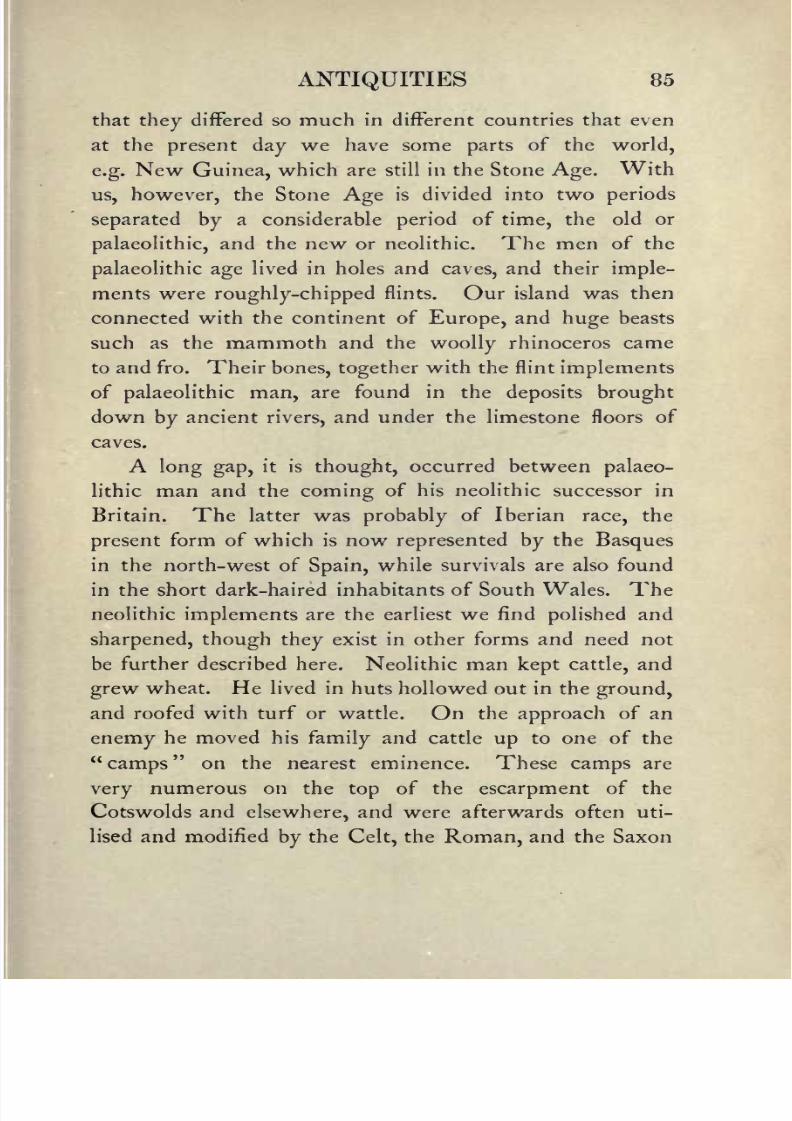
8/2/2019 Gloucestershire 1911
http://slidepdf.com/reader/full/gloucestershire-1911 99/174
ANTIQUITIES 85
that they differed so much in different countries that even
at the presentday
we have some parts of the world,
e.g.New Guinea, which are still in the Stone Age. With
us, however, the Stone Age is divided into two periods
separated by a considerable period of time, the old or
palaeolithic, and the new or neolithic. The men of the
palaeolithic age lived in holes and caves, and their imple-
ments were roughly-chipped flints. Our island was then
connected with the continent of Europe, and huge beasts
such as the mammoth and the woolly rhinoceros came
to and fro. Their bones, together with the flint implements
of palaeolithic man, are found in the deposits brought
down by ancient rivers, and under the limestone floors of
caves.
A long gap, it is thought, occurred between palaeo-
lithic man and the coming of his neolithic successor in
Britain. The latter was probably of Iberian race, the
present form of which is now represented by the Basques
in the north-west of Spain, while survivals are also found
in the short dark-haired inhabitants of South Wales. The
neolithic implements are the earliest we find polished and
sharpened, though they exist in other forms and need notbe further described here. Neolithic man kept cattle, and
grew wheat. He lived in huts hollowed out in the ground,
and roofed with turf or wattle. On the approach of an
enemy he moved his family and cattle up to one of the
"camps" on the nearest eminence. These camps are
very numerous on the top of the escarpment of the
Cotswolds and elsewhere, and were afterwards often uti-
lised and modified by the Celt, the Roman, and the Saxon

8/2/2019 Gloucestershire 1911
http://slidepdf.com/reader/full/gloucestershire-1911 100/174
86 GLOUCESTERSHIRE
in turn. The neolithic men buried their dead in the long
barrows which may still be seen here and there on the
hills. Even palaeolithicman made rude scratches of
animals on bone, and neolithic man fashioned for himself
rude vessels of baked clay with some kind of a pattern
upon them.
Wagborough Bush Barrow, Bourton-on-the-Water
Long after the Iberians came the Celts, an Aryan
people, dark and round-headed, who made their weapons
of bronze, and buried their dead in round barrows. Some-
times these barrows were mere tumps, at others they
were made of large stones forming a sort of hut inside
which the body was placed, and the whole then covered
with a mound;these are now distinguished as dolmens.

8/2/2019 Gloucestershire 1911
http://slidepdf.com/reader/full/gloucestershire-1911 101/174
ANTIQUITIES 87
We have many barrows, but no dolmens left in Gloucester-
shire. These Celts came over in two divisions. The
first,called the Goidels, drove the stone men westwards
before them and entered into their inheritance, only to
be themselves driven in the same direction by the second
horde of Celts, the Brythons or Britons. The Goidels
were pushed north-westwards to Scotland and Ireland,
justas the Britons were pushed into Wales and Cornwall
when the Saxons came.
As for the Romans, their policy was not one of
expulsion and extermination; they subdued the Britons
and mingled with the conquered tribes; they introduced
among them the civilisation of Rome with so much success
that all the wealthier classes and the population of the
towns became entirely Romanised. The traces of the
Roman occupation in our county are abundant. " Villas"
or the country houses of the upper classes are scattered
all over the Cotswolds, though most of them still have to
be unearthed. The most famous are those at Chedworth
and Woodchester. The Roman towns of Gloucester and
Cirencester are buried beneath the later towns. After
their destruction by the Saxons they long lay waste, and
though the four main streets whichlay north, south,
east and west from the Cross at Gloucester no doubt
follow the four ways of the Roman castra, at Cirencester
the town layin ruins for so long that when rebuilt it was
laid down on entirely different lines. The Roman town
has therefore only been excavated here and there, but
above ground the amphitheatre may still be seen, and on
the east side of the town a portion of the Roman wall.

8/2/2019 Gloucestershire 1911
http://slidepdf.com/reader/full/gloucestershire-1911 102/174
88 GLOUCESTERSHIRE
Of the ancient roads, some belong to the Celtic
period, others were constructed
by
the Romans. Where
a great Celtic track existed the Romans would utilise
it, repairing and remaking it wherenecessary. This was
the case with the most famous of all the Gloucestershire
roads, the great Fosseway, which as we shall see still forms
the main road from Cirencester to Moreton and beyond.
From what has been said it will be seen that the whole
of the county (not excepting the Forest, in which the
Romans had their ironworks) was more or less Romanised,
but the point to notice is that the Roman rule was one
of peace. The colony of Gloucester (Glevum) no doubt
contained a small garrison, but like Cirencester it was
mainly a seat of commerce and manufacture. In fact
both places served the purpose of market towns as we
know themto-day.
17. Architecture (a) Ecclesiastical.
Churches, Cathedrals, Abbeys.
The religious houses in Gloucestershire and the num-ber of churches which
they, as well as other foundations
elsewhere, were allowed to appropriate, may be gauged
by the number of vicarages, as distinct from rectories, at
the present day. Let us set down the Orders which had
propertyin the county, together with their houses. The
Benedictines had DeerhurstPriory, St Peter's Abbey, at
Gloucester, Winchcombe Abbey, Tewkesbury Abbey,
and Stanley St Leonard'sPriory.
The Cistercians had

8/2/2019 Gloucestershire 1911
http://slidepdf.com/reader/full/gloucestershire-1911 103/174
ARCHITECTURE ECCLESIASTICAL 89
Hayles Abbey and Flaxley Abbey. St Augustine's Abbey,
Bristol, and Cirencester Abbey, together with the Priories
of St Oswald and New Llanthony at Gloucester, were
filled by Augustine or Austin Canons. The Cistercian
Abbey of Kingswood was till the last century an island of
Wiltshire. Besides these there was a College of Secular
(not Regular as at the Augustine houses) Canons at
Westbury-on-Trym, and a Preceptory (asthe houses of
the military orders were called) at Quenington. TheTemplars had lands at Temple Guiting. After the
Dissolution all these monastic houses were pulled down
and carted away, but the churches of three of them were
spared those of St Peter's, Gloucester, and St Austin's,
Bristol, to serve as cathedrals for the new dioceses created
by Henry VIII, and that of Tewkesbury for use as the
parish church.
Before these new dioceses were formed the whole of
the country east of the Severn and north of the Forest
peninsula had belonged to the diocese of Worcester. The
Forest peninsula south of a line drawn north-westwards
from Minsterworth to Lea had been in the diocese of
Hereford, but,in
1541, this, togetherwith the rest of the
county, was taken to form the new diocese of Gloucester,
and next year a small portion in the extreme south was
cut off to form, with Dorset, the new diocese of Bristol.
We will consider the architecture of the buildings in
Gloucestershire under three divisions, viz. : () Ecclesias-
tical,or buildings relating to the Church
; (b) Military, or
Castles; (c) Domestic, or houses and cottages.
There is one fact worth noting with regard to all

8/2/2019 Gloucestershire 1911
http://slidepdf.com/reader/full/gloucestershire-1911 104/174
90 GLOUCESTERSHIRE
these classes of buildings, and that is that as indeed is
universally the rule the architecture of the county has
been affected by the materials accessible. Thus we find
that stone, wood, flints, and bricks are used either because
The Font, Deerhurst Church
they could beeasily obtained, or because of the wealth or
otherwise of the builders.
Now with regard to the ecclesiastical buildings, let us
consider first the churches and cathedrals, and then glance

8/2/2019 Gloucestershire 1911
http://slidepdf.com/reader/full/gloucestershire-1911 105/174
91
at the remains of theabbeys, monasteries, and other
religious houses. The churches of Gloucestershire are
Norman Doorway, Lower Guiting
of variousstyles
and of different ages, so that it will be
well toclassify them as Saxon, Norman, Early English,
Decorated, and Perpendicular.

8/2/2019 Gloucestershire 1911
http://slidepdf.com/reader/full/gloucestershire-1911 106/174
92 GLOUCESTERSHIRE
Towards the end of the twelfth century the round
arches and heavy columns of Norman work began gradually
to give place to the pointed arch and lighter styleof the
first period of Gothic architecture which we know as
Early English, conspicuous for its long narrow windows,
and leadingin its turn by a transitional period into the
highest development of Gothic the Decorated period.
This, in England, prevailed throughout the greater part of
the fourteenth century, and was particularly characterised
by its window tracery. The Perpendicular, which, as its
name implies, is remarkable for the perpendicular arrange-
ment of the tracery, and also for the flattened gateway
arches and the square arrangement of the mouldings over
them, was the last of the Gothicstyles.
It arose somewhat
suddenly after the Black Death and was in use till about
the middle of the sixteenth century. It is confined to
our country, and unknown on the Continent.
We will begin our brief survey of the variousstyles
of ecclesiastical architecture with the two cathedrals.
Gloucester was the church of the abbey of St Peter.
Very little remains of the conventual buildings except the
cloister;
this is on the north side of thechurch,
and is
famous as the earliest example of thepeculiarly English
styleof vaulting known as fan-tracery. On the south side
are the "Carrells," i.e. window recesses in which the monks
read and wrote. On the north side is a long trough in
which the monks washed before meals, with a recess
for towels opposite. The cloister served as a means of
communication between the church and other parts of
the buildings, and also for exercise in wet weather. The

8/2/2019 Gloucestershire 1911
http://slidepdf.com/reader/full/gloucestershire-1911 107/174
ARCHITECTURE ECCLESIASTICAL 93
nave is late eleventh century work, the aisles communi-
cating with the nave by semi-circular arches springing
from massive roundpillars. The choir was
originally
Norman also, but in the fourteenth century a Perpen-
dicular appearance was given to the whole of the interior.
This, however, does not prevent the original Norman
work from being detected at the back of the triforium.
Cloisters and "Carrells," Gloucester Cathedral
The Lady Chapel is late Perpendicular. The most
famous tombs are those of Edward II, whose murdered
body was brought here from Berkeley Castle (1327), and
of Robert Duke of Normandy, the eldest son of the Con-
queror, who died a prisoner at Cardiff.Castle in 1135.
Bristol Cathedral was the church of St Augustine's
Abbey. Founded by Robert Fitzharding in 1 142, it con-
sisted of the usual conventual buildings, of which little but

8/2/2019 Gloucestershire 1911
http://slidepdf.com/reader/full/gloucestershire-1911 108/174
Gloucester Cathedral, East End of Choir

8/2/2019 Gloucestershire 1911
http://slidepdf.com/reader/full/gloucestershire-1911 109/174
ARCHITECTURE ECCLESIASTICAL 95
the fine Norman gateway and a part of the cloister remains.
It
was surrenderedto
Henry's commissionersin Decem-
ber, 1539, and the first bishop appointed was Paul Bush,
a canon ofSalisbury.
At this time the church consisted
of a choir and north and south transepts : the nave was
added in 1877. The choir is not so beautiful as at
Gloucester, but is remarkable for the large Decorated
The Chapter House, Bristol Cathedral
aisle windows, and the fourteenth century glassof the
large east window. Bishop Butler, the author of the
Analogy, is buried in the cathedral (1752). Amongthe other monuments are some to early members of the
Berkeley family, including that of the founder.
The church of
Tewkesbury Abbey, though
nowonly
a parish church, may rank with any cathedral in the land
for size andbeauty. Founded in 1105 by Robert Fitz-

8/2/2019 Gloucestershire 1911
http://slidepdf.com/reader/full/gloucestershire-1911 110/174
Tewkesbury Abbey, the Nave looking East

8/2/2019 Gloucestershire 1911
http://slidepdf.com/reader/full/gloucestershire-1911 111/174
ARCHITECTURE ECCLESIASTICAL 97
Hamon, Earl of Gloucester, it was one of the chief
monasteries in the
kingdom,
and its abbot sat in Parlia-
ment. The most striking feature of the exterior is the
grand round-headed and recessed arch at the west entrance,
64 feet in height, now filled with a late Perpendicular
window. In the interior the great Norman nave with
its huge round pillars reminds one at once of Gloucester.
The transepts and the tower are also Norman, but the
choir, like that at Gloucester, has been altered, though in
the Decorated instead of the Perpendicular style.The
eastern extremity of the church is hexagonal, and here are
many splendid tombs and monuments, including that of
the last abbot, John Wakeman, who was consecrated first
Bishop of Gloucester in 1541. After the battle of Tewkes-
bury the Duke of Somerset and other Lancastrians took
sanctuary in the church, but after two days they were
dragged out and executed.
Deerhurst, the oldest church in the diocese, and one of
the oldest in England, was the church of the Priory of that
name, suppressed before the Dissolution. The church was
consecrated in 1056, and is of pre-Norman character, with
a few later additions. At the west end is a lofty tower,
with small round-headed windows on the exterior. Stand-
ing in the nave and looking back at the tower one may
notice high up in its eastern face a very curious window
of twolights,
with triangular heads, each side of the head
being formed of a single stone, very characteristic of this
early style.The chancel is entered from the nave by a
small round-headed arch, such as may be seen at Bradford-
on-Avon : the east end was a semi-circular apse, but the
E. G. 7

8/2/2019 Gloucestershire 1911
http://slidepdf.com/reader/full/gloucestershire-1911 112/174
98 GLOUCESTERSHIRE
arch which led into it is now built up to form the present
east end. Not far from the church is a Saxon chapel,
called Odda's, which, like the Saxon church at Bradford-
on-Avon, formed part of a dwelling-house, but was
detected and restored to its proper state in 1884.
Deerhurst Church, Saxon Windows in Belfry
In thinly populated parishes the small Norman church,
consisting only of nave, chancel, and bell-turret, often
remains, as at Upper Swell, Condicote, Postlip, and the
ruined Lancaut. In larger churches it is by no means

8/2/2019 Gloucestershire 1911
http://slidepdf.com/reader/full/gloucestershire-1911 113/174
Odda'sChapel, Deerhurst, looking East
73

8/2/2019 Gloucestershire 1911
http://slidepdf.com/reader/full/gloucestershire-1911 114/174
100 GLOUCESTERSHIRE
uncommon east of the Severn to find that the Norman
doorways
have been left, as at
Elkstone,
LowerGuiting,
Withington, and Quenington. The Early English style,
with its beautiful lancet windows, andstiff-foliaged capi-
tals, may be found, among other places, at Lydney,
Almondsbury, Berkeley, and in the beautiful chancel at
Lower Guiting. A specimen of Decorated work will be
St Mary Redcliffe, Bristol
found in the choir at Tewkesbury, but both Early English
and Decorated churches have generallybeen altered in the
Perpendicular period by lowering the roof of the nave to
build a clerestorey.
It is to the Perpendicular period that the finest
churches of the county, apart from the abbey churches,
belong Chipping Campden, Northleach, Fairford, Pains-

8/2/2019 Gloucestershire 1911
http://slidepdf.com/reader/full/gloucestershire-1911 115/174
ARCHITECTURE ECCLESIASTICAL 101
wick and Cirencester, to which (though in Somerset) we
mayadd the
greatchurch of St
MaryRedcliffe at Bristol.
All were built by thegreat merchants, who in the later
middle ages made such large fortunes out of wool, and
theireffigies may be seen cut in brass on the floor of the
church, with their woolpacks, their shears and their sheep.
All these churches have a family resemblance, though each
Cirencester Church, the South Porch
has its peculiar features. Campden and Northleach agree
in the arcades of the nave, which consist oflofty octagonal
fluted columns supporting very depressed arches;Fairford
is famous for its wonderfulglass,
which has survived the
devastations both of the Reformation and of the Civil War.
The wool-merchant who built this church was John
Tame, and he had theglass
made to fit his windows,

8/2/2019 Gloucestershire 1911
http://slidepdf.com/reader/full/gloucestershire-1911 116/174
102 GLOUCESTERSHIRE
whether in England or in Flanders is a matter of dispute.
Painswick and St
MaryRedcliffe have their
spires,
but the
latter the child of the trade with foreign parts, rather
than of homebred wool stands alone for magnificence
and splendour, and must not be classed with the humble
churches of the country town. Lastly Cirencester has its
noble three-storied porch, and(like
Burford in the neigh-
bouring county) its many aisles. This is not the place to
speak of the havoc wrought in so many of our churches
by the nineteenth century restorer. There are signs that
this false enthusiasm is now abating, and that a wiser
generation will now treat our sacred monuments with the
respect which they deserve.
18. Architecture (b) Military. Castles.
The English before the Conquest did not build castles,
nor did the Normans for some yearsafter their arrival, ex-
cept at one or two very important places, such as London.
They contented themselves with fortifyinga natural
mound or constructing one for the purpose themselves.
The summit of this mound they surrounded with a
stockade, inside which was a kind of wooden building
which served as a shelter and as a look-out. In front of
the mound was an enclosed court or "bailey," in which
were the stables and the quarters of the soldiers. But they
were not long satisfied with such an elementary style
of fortification;and soon began to build castles of stone.
The strongest part of these stone castles, into which the

8/2/2019 Gloucestershire 1911
http://slidepdf.com/reader/full/gloucestershire-1911 117/174
ARCHITECTURE MILITARY 103
garrison could retire when the rest of the defences were
taken,
was called the
keep.
This was most
commonlymade by surrounding the mound with stone, thus forming
a kind of shell. But where the site was a new one, or
sometimes where the mound was a natural one and there-
fore strong enough to bear the weight, the keep took the
form of a massive rectangular tower, of which we may
Berkeley Castle
see examples at London, Rochester, and Chepstow. If the
mound was an artificial one and the shell keep was not
adopted, the heavy rectangular keep would be built in the
bailey.
In Gloucestershire only one of these keeps remains, the
splendid shell keep of Berkeley. Gloucester and Bristol
had rectangular keeps, but these are now destroyed.

8/2/2019 Gloucestershire 1911
http://slidepdf.com/reader/full/gloucestershire-1911 118/174
104 GLOUCESTERSHIRE
There was once a Norman castle at Sudeley, but it has
long ago disappeared, and the most ancient part of the
present castle is no older than the reign of Henry VI,
so that the only Norman castle remaining in the county
is Berkeley. This castle has the distinction of having
been inhabited by the same family from its foundation to
the present day.
Some remains of the Edwardian or concentric type of
castle may be seen at St Briavels and at Beverstone. Theformer was once a Norman fortress, but the earlier portions
have long ago been destroyed, and the most conspicuous
feature of the existing building is a gate-house with
a semi-circular "drum" tower on either side of the gate-
way. It was always the residence of the Constable of
the Forest, and is still Crown property. Beverstone was
built by the Berkeleys in the fourteenth century on the
site of an earlier castle. In the concentric type of castle
the keep was no longer needed, and the fortifications con-
sisted of an outer and inner ward, each defended by curtain
walls and mural towers. A capital example of thistype
would be seen at Beaumaris, if the whole ruin were not
smothered in agreat
mass ofivy,
so that it is
impossibleto distinguish the distinctive features. Where the ground
was rocky and did not accommodate itself to thestrictly
concentric type, the wards or courts were, so to speak,
telescoped out, so that they came to be one behind the
other, as at Chepstow. Where the castle was very large
and powerful it was sometimes further strengthened by
the addition of a third ward outside the other two, as at
Caerphilly.

8/2/2019 Gloucestershire 1911
http://slidepdf.com/reader/full/gloucestershire-1911 119/174
ARCHITECTURE MILITARY 105
Here we must stop, but those who wish to know
somethingabout castles in connexion with the methods of
attack and defence in use before the days of gunpowder
will find it a most interesting study.
19. Architecture (^Domestic. Famous
Seats, Manor Houses.
While the militaryarchitecture of the county might
fill a volume the size of this, it would takefifty
such
volumes to describe its domestic architecture, so that in
this chapter we can only give the merest outline of the
subject.
The character of the houses in
every
district
dependsupon the kind of building material most
easily procurable ;
thus in one place it will be stone, in another brick, in
another a combination of brick and timber. In Glouces-
tershire, except in the northern parts of the Vale, it is
stone. East of the Severn it is the Oolite or yellowy
grey stone of the Cotswolds; west of the river it is the
Carboniferous Limestone of the Forest. In both districts
brick is an unwelcome intruder. The most beautiful
houses are of course in the former district, but those in the
latter have a beauty of their own. Up to a century ago,
the limestone was not left bare as is now the case,
but was covered with a thick coating of rough-cast and
coloured white or yellow,the roof being high and gabled,
and covered with burnt tiles or thatch, except in the
few cases in which stone tiles could be afforded. The

8/2/2019 Gloucestershire 1911
http://slidepdf.com/reader/full/gloucestershire-1911 120/174
106 GLOUCESTERSHIRE
rough-cast and wash kept the house dry and warm, for the
naked rubblestone, though
often seennowadays,
is not
calculated to keep out either the damp or the cold. The
whole harmonised perfectlywith the landscape, and
enhanced its beauty in the same degree that the modern
styleof house disfigures it.
The Market Hall, Minchinhampton
On the east side of the Severn the case is different.
The houses of all sizes are built of the durable Cotswold
stone a far finer material and most of them, except in
the larger towns, date from the seventeenth century. The
many fine manor houses of the Cotswolds, now generally
used as farm-houses, are known far and wide, and the
larger houses, such as those at Stanway and Bibury, are no
less famous. Even the humblest cottageswere built by

8/2/2019 Gloucestershire 1911
http://slidepdf.com/reader/full/gloucestershire-1911 121/174
ARCHITECTURE DOMESTIC 107
the local mason who took pride in his craft, and put his
own ideas intoit;
and therebeing
norailways
to
conveythe materials they were not "run up" by a builder with
the ready-made productions of a distantfactory.
This
Cotswold stone couldeasily
be faced with the chisel, and
soon became so hard and dry that it needed no plastering
The New Inn, Gloucester
or washing like the rough stone across the water. In
a few yearsit assumed the delightful grey-brown tone
which is the mark of every house from Campden to Bath,
and from Banbury to Cheltenham. The tiles are shaped
out of thin layersof sandstone which are quarried here
and there in the Cotswolds, and also at Stonesfield in
Oxfordshire. They are very heavy, and require a high

8/2/2019 Gloucestershire 1911
http://slidepdf.com/reader/full/gloucestershire-1911 122/174
108 GLOUCESTERSHIRE
pitched roof; a low roof could not bear their weight. In
each tile a hole is bored to receive a woodenpeg.
Of the Cotswold towns Chipping Campden, Stow-on-
the-Wold, Northleach, and Cirencester are the most charac-
teristic. The high street of Campden in particular consists
from end to end of houses built in the fifteenth and sixteenth
Ablington Village and Manor House
centuries, or even earlier "Grevel's House" for instance
is a splendid example of a fourteenth century merchant's
house. In the older parts of Bristol may still be seen the
tall half-timbered houses with theprojecting upper stories,
which were formerly the usual type of house in walled
cities such as London and Exeter, and many others. Oflate sixteenth or seventeenth century manor houses num-

8/2/2019 Gloucestershire 1911
http://slidepdf.com/reader/full/gloucestershire-1911 123/174
ARCHITECTURE DOMESTIC 109
bers are scattered throughout the district. Earlier houses
are rare. Southam de la Bere near Cheltenham was
built in the time of Henry VII; Thornbury and Down
Ampney in the time of Henry VIII;while Icomb Place
on the easterndeclivity
of the hills and Wanswell Court
near Berkeley belong to the fifteenth century.The
former has been altered and restored, but the latter, which
_ Owlpen Manor House
may be taken as a type of the smaller manor house of the
period, apart from a wing added in the reign of Elizabeth,
remains as it was built. The house faces south and a
south porch with a plain pointed arch and a room over
it opens directly into the large square hall, which served
as a dining-room for the household. In the north-east
corner a door opens into a parlour with a good perpen-

8/2/2019 Gloucestershire 1911
http://slidepdf.com/reader/full/gloucestershire-1911 124/174
110 GLOUCESTERSHIRE
dicular window of fourlights
to the south and a slanting
opening on either side ofit,
one of which commands the
front entrance, and the other the approaches in the other
direction. The kitchens and cellar or larder are behind
the hall to the north, with the bedrooms over them.
Another small parlour with a bay window is on the west
side of the hall, while the Elizabethan oblong building is
attached to the western side increasing the frontage only
by its width. The original house was probably built in
the middle of the fifteenth century about the time of the
close of the French war. The time for the building of
fortified houses came to an end with the invention of
gunpowder, and half a century later the castles of the
feudal nobility commonly fell into decay.
20. Communications Past and Present.
Roads, Railways, Canals.
The earliest roads would be the clearings made by the
earliest inhabitants through the woods which then covered
the hills. Of these of course we have noknowledge,
but
the British trackways of later times may have often
followed the same lines. Of these trackways many traces
are still left,for instance in the hollow ways so common
in the west of the county. Sometimes however these
hollow ways merely mark the track of the old road before
the days of Macadam, and may now be seen in some
places following the course of the new road at a lower
level : these may, or may not, date from pre-Saxon times.
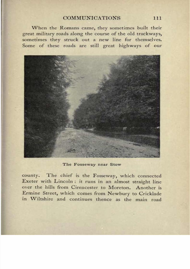
8/2/2019 Gloucestershire 1911
http://slidepdf.com/reader/full/gloucestershire-1911 125/174
COMMUNICATIONS 111
When the Romans came, they sometimes built their
great military roads along the course of the old trackways,
sometimes they struck out a new line for themselves.
Some of these roads are still great highways of our
The Fosseway near Stow
county. The chief is the Fosseway, which connected
Exeter with Lincoln : it runs in an almost straight line
over the hills from Cirencester to Moreton. Another is
Ermine Street, which comes from Newbury to Cricklade
in Wiltshire and continues thence as the main road

8/2/2019 Gloucestershire 1911
http://slidepdf.com/reader/full/gloucestershire-1911 126/174
112 GLOUCESTERSHIRE
through Cirencester to Gloucester. From Birdlip Hill
you may see it below you like a long white line, straight
from the foot of the hill to thecity.
Then there is
Akeman Street, which connects Colchester with Bath :
it passes through St Albans and Alcester near Bicester,
enters the county at the bridge over the Leach, andjoins
the Fosse at Cirencester. In this county, except for three
miles about Coin St Aldwyn, it coincides with a main
road. The Via Julia from Bath to Caerwent crossed the
Severn somewhere above the site of the present tunnel.
There are also many cross roads, but the only one we
can mention here is the road which joins Gloucester and
Caerwent, crossing the Wye at Chepstow about half a
mile above the present bridge, where the remains of
blackened stakes are to be seen at low water of spring
tides.
From the Conquest onwards, when the monasteries
took charge of the high roads, it is probable that they
were in tolerable order, at least for horsetraffic, but when
once the monks and feudal labour had departed their state
became deplorable. This is what a competent observer in
thelatter half of the
eighteenth century saysabout the
roads of the Vale : they "are shamefully kept. The
Parish roads [those kept up by the parish] mostly lie in
their natural flat state with the ditches on either side
of them full to the brim. The toll-roads are raised
(generallymuch too high) but even on the sides of these
I have seen full ditches The foundation is ever a quag-
mire ; and the superstructure, if not made unnecessarily
strong, is always liable to be pressed into it. Hence the.

8/2/2019 Gloucestershire 1911
http://slidepdf.com/reader/full/gloucestershire-1911 127/174
COMMUNICATIONS 1 13
deep ditch-like ruts which are commonly seen in roads of
this
description.The road between Glocester and Chel-
tenham (now become one of the most public roads in the
island) isscarcely
fit for the meanest of theirMajesties'
subjects to travel on and pay for; much less suitable for
their Majesties themselves, and their amiablefamily,
to
trust their own persons on." The "toll-roads" here spoken
of were the roads on which a toll was collected at gates
called turnpikes which barred the road : the gates have
long been gone, but the toll-houses occasionally remain.
The gates of a fixed district were let to the highest bidder
by a"Turnpike Trust," which also kept the roads in
repair. These roads as well as the parish roads are now
managed by the County Council.
The high roads of the hills have wide grass margins
which were formerly used as the summer road, thus
keeping the metalled road free from wear and tear till the
winter rains set in, but the writer just quoted complains
that the practice had been adopted of digging pits in these
grass margins, out of which the stones for the repair of the
road were procured. "The materials" however, hesays,
"are more plentiful than durable
:
presently grinding downunder heavy carriage." Another writer at the beginning
of the nineteenth century finds the roads much improved
(these were the days of Macadam) and reports that in the
neighbourhood of Gloucester the limestone from the rocks
at Clifton and Chepstow had already come into use for
metalling. At the present day the high roads throughout
the county are metalled with a hard stone from Clee Hill
in Shropshire and are some of the best in England.
E. G. 8

8/2/2019 Gloucestershire 1911
http://slidepdf.com/reader/full/gloucestershire-1911 128/174
114 GLOUCESTERSHIRE
At the beginning of the last century the great coach
roads were the
London, Oxford,and Cheltenham
road,which enters the county near Burford, and passes through
Northleach to Cheltenham, and thence on to Gloucester:
the Oxford, Chipping Norton, and Worcester road, which
cuts across the northern extremity of the county from
Old Bridge over the Avon at Tewkesbury
Moreton through Bourton-on-the-Hill to Broadway, above
which place it descends the steep hill by a zigzag, while the
course of the older and straighter road may be seen hard by :
the Faringdon, Lechlade, Cirencester, Tetbury, and Bath
road, which keeps to the flat country on the eastern slopes
of the Cotswolds, and enters Somerset about five miles
north of Bath : the Birmingham, Tewkesbury, Gloucester,

8/2/2019 Gloucestershire 1911
http://slidepdf.com/reader/full/gloucestershire-1911 129/174
COMMUNICATIONS 115
and Bristol road, which keeps to the foot of the western
escarpment of the Cotswolds: the Hereford, Ledbury,
and Gloucester road : the Brecon, Abergavenny, Mon-
mouth, Ross, and Gloucester road: andlastly
the Bath,
Bristol, Newport, and South Wales road, which crossed
the Severn by a ferry either at the New Passage at
Redwick, or three miles higher up by the Old Passage
at Aust. There were of course many other roads traversed
by coaches, but those mentioned were the chief mail
routes.
By 1840 the railway had found its way into
Gloucestershire. The first lines to be constructed were
the Great Western from Swindon to Gloucester, and the
Midland from Birmingham to Gloucester and Bristol. The
former enters the county near Thames Head, penetrates
the Cotswolds by the Saperton tunnel, and runs down
the Stroud valleyto Stonehouse, whence it continues
parallel with the Midland to Gloucester. The latter
crosses the Avon at DefFord, enters the county at
Ashchurch and runs past Cheltenham to Gloucester, and
thence by Wickwar and Yate to Bristol. Then came
the G.W.R. line from Oxford to Worcester by Adlestrop,
Moreton, and Campden ;the line from Gloucester to
Grange Court, Ross and Hereford;and the South Wales
line to Lydney and Chepstow. Later were made the
Great Western branch lines from Kemble to Cirencester
on the one side, and to Tetbury on the other;
the
Wye Valley railway from Chepstow to Monmouth which
is in Gloucestershire as far as Tintern, where it crosses
the Wye ;the line from Gloucester to Ledbury by
82

8/2/2019 Gloucestershire 1911
http://slidepdf.com/reader/full/gloucestershire-1911 130/174
116 GLOUCESTERSHIRE
Newent and Dymock; andlastly (though not in time)
a line
throughthe Cotswolds
(till
then untouchedby any
railway) from Cheltenham to Bourton-on-the-Water,
which was subsequently continued through Chipping
Norton to Banbury. Many yearsafter this railway was
opened, the Swindon and Andover railway was continued
northwards from Swindon, through Cirencester and
Withington to Andoversford, from which place the
trains run over the G. W. line into the Midland Station
at Cheltenham. The line was opened as the Midland
and South Western Junction Railway. It enters Glou-
cestershire justafter passing Cricklade.
The Severn and Wye railway from Berkeley through
the centre of the Forest to Lydbrook crosses the Severn at
Sharpness by alight high-level bridge. From Coleford
there is a branch of the Wye Valley railway to Monmouth
through Newland. A Great Western rail motor car now
runs from Cheltenham to Honeybourne by Winchcombe.
There is also a light railway from Moreton to Shipston-
on-Stour, part of which passes through the north-eastern
projection of our county. The G.W. branch from
Bristol to South Wales formerly crossed the water bya steam
ferry,but in July 1887 the famous Severn
Tunnel took its place. This great tunnel, 4 miles
624 yards long, of which 2^ miles are under water at
high tide, took nearly 14 years to make, the work having
been more than once brought to a standstill by the tapping
of fresh water springs ;but the story
of the tunnel would
require a whole book much larger than this one. Tomake the list of the Great Western railways of the

8/2/2019 Gloucestershire 1911
http://slidepdf.com/reader/full/gloucestershire-1911 131/174
COMMUNICATIONS 117
county complete it should be added that the four last miles
of the Oxford, Witney, and Fairford branch are in
Gloucestershire, that lines from Bristol and Clifton run
along the right bank of the Avon to the Docks at
Avonmouth, and that a new South Wales route has been
opened from Swindon via Badminton and the Severn
Tunnel.
The Midland branches are from Ashchurch on the
west to Tewkesbury and Malvern, and on the east to
Evesham. Detached portions of both these railways are
within our county. Other branches run from Coaley
Junction to Dursley ;from Berkeley Road to Berkeley ;
from Yate to Thornbury, and from Mangotsfield to
Bath.
It should be added that iron railways for the con-
veyance of trucks of coal or iron drawn by horses had
been in use in the Forest at least asearly
as the beginning
of the last century.
Canals began to be constructed in the last quarter of
the eighteenth century, but though they brought manure,
lime, and other necessaries, they were at first objected to
by farmers as diminishing the quantity of land available
for cultivation, and a writer in 1813 calculated that in
Gloucestershire they had occasioned the loss of 515 acres.
In spite of this they were a great advantage to the com-
munity in general for the conveyance of coal and all other
heavy goods, the freight being much less than that charged
for land transit. The eager promoters of the canals little
thought that in another half century they would be
superseded by a faster and easier means of conveyance.

8/2/2019 Gloucestershire 1911
http://slidepdf.com/reader/full/gloucestershire-1911 132/174
118 GLOUCESTERSHIRE
Nevertheless the canals remained serviceable for heavy
goods such as coal when speed was not desired, and in
the Midlands the barges still have a considerable traffic,
especiallyin coal and hay. There are even signs, as we
shall seedirectly,
of the revival of the canal system on the
ground that the carriage of heavy goods is cheaper by
water than by rail.
The principal canal of the county is the great
Gloucester and Berkeley ship canal. Until the formation
of the Manchester ship canal it was the biggest in
England. It was considered a colossal undertaking when
it was first started, and although begun in 1794, a writer
of 1813 reports that though 120,000 had been expended
scarcely 17^ miles were finished. Finished however it
was at last in 1827. It is 1 8 ft. deep, and can carry ships
of 1 200 tons up to Gloucester. The distance from
Sharpness to Gloucester is 16 miles by the canal, and 28^
by river. In 1875 the new docks were built at Sharpness,
in which ships of 5400 tons can be docked.
The idea, long entertained, of uniting the Thames
and Severn was realised at last by the Thames and
Severn Canal, completed in 1789, when the first boat
laden with goods passed into the Thames. The canal is
nearly 29 miles long. It begins at Framilode and passes
up the Stroud valleyto Saperton tunnel, the entrance of
which is a mile eastward from the entrance to the railway
tunnel : after emerging from the tunnel, which is nearly
1\miles
long,it
drops downinto the Thames
Valleyand
joins that river at Lechlade. Its traffic in 1841 when the
G.W.R. was opened from Swindon to Cirencester was

8/2/2019 Gloucestershire 1911
http://slidepdf.com/reader/full/gloucestershire-1911 133/174
COMMUNICATIONS 119
89,271 tons. It was then bought up by the railway
company, who closed it in 1893. By this time the tunnelwas much out of repair, but at last it was taken up
by a public trust, and handed over to the County
Council in 1901, and it is hoped that it will soon be
opened once more for traffic.
Mouth of the Canal Tunnel, Saperton
The Hereford and Gloucester canal (1792-1798) is
now derelict and islargely absorbed by the Gloucester
and Ledbury railway.It has been suggested that, if the
Worcester and Birmingham Canal were enlarged and
deepened, large
vessels
might bymeans of its connexion
with the ship canal be taken up to Birmingham, thus
opening the Atlantic to the centre of England. All such

8/2/2019 Gloucestershire 1911
http://slidepdf.com/reader/full/gloucestershire-1911 134/174
120 GLOUCESTERSHIRE
questions as this have recently been the subject of a Royal
Commission on Canals andWaterways
who issued their
Report in 1907.
The Thames and Severn Canal. At the Blue House
above Siddington
21. Administration and Divisions.
When a strange race settle in a new country, they
naturally bring with them their social and political insti-
tutions. This was the case with the English when they
settled in America in the sixteenth and seventeenth cen-
turies, and with the Saxons when they settled in Britain
in the fifth and sixth. Henceforth the land was called

8/2/2019 Gloucestershire 1911
http://slidepdf.com/reader/full/gloucestershire-1911 135/174
ADMINISTRATION AND DIVISIONS 121
England, and the people English. The earliest political
division of theEnglish
was the Hundred and the earliest
unit the Township. The Hundred, according to some
authorities, was the district, larger or smaller, occupied
by a hundred fighting men with their families. Where
the population was scanty the Hundred would belarger,
where dense, smaller. The township had a chief officer
called the Reeve, and settled small disputes for itself.
Larger matters were taken before the Hundred Court,
which met once a month and was attended by the
Reeve and four freemen from each township and also
by the Eorls or Thegns residing in the Hundred. Above
the Hundred Court was the court of the whole folk or
tribe, consisting of several Hundreds. This Folk Court
met twice a
year
and consisted of the members of the
Hundred Courts, presided over by the Ealdorman. When
the parishes were instituted by Archbishop Theodore
in the latter part of the seventh century they were made
to coincide with the townships. The name township is
seldom used nowadays, except inlegal phraseology, but
where its ecclesiastical organisation has been preserved, it
is simply the civil name for the parish.
Later, when the shires or counties caused the combining
of several Hundreds, the importance of the Hundred Court
declined, and that of the Folk Court which is now the
Shire or County Court increased. By the time the
Midland shires were formed the town from which each
took its name had become a place of importance, and
the Folk Courts were probably held there.
It must be noted that since the Domesday Book was

8/2/2019 Gloucestershire 1911
http://slidepdf.com/reader/full/gloucestershire-1911 136/174
122
compiled, some of the Hundreds have changed their names.
Originally the name was either that of some great chiefor was taken from the place a great tree for instance,
or a riverside where the Hundred Court was held, but
the name has often survived in some modernvillage.
It
would be an interesting task to take the Hundreds of
some particular county and attempt to trace their fortunes
from the earliest times. Here is a list of some of the
present Gloucestershire Hundreds, the name of which is
not at once apparent :
i The word loe is a
Bledisloe containing Lydney and Awre^
Botloe Newent
Barton Regis
Bradley
Brightwell's
Barrow
Crowthorne
Dud-Stone and \
King's Barton J
Grumbald's Ash
Kiftsgate
Langley and 1
Swineshed J
Longtree
Tibaldstone
Whitstone
Mangotsfield
Northleach
Fairford
Cirencester
[Gloucester]
Badminton
Campden
Almondesbury
variant of low,
here probably
meaning a burial
mound
The King's demesneBroad lea
Like loe, a burial
mound
The watch stone
A tree
A road or an opening
Minchinhampton and Tetbury
Ashton-under-Hill and Beckford
Fretherne and Stonehouse
The above list shows that trees, stones, and burial-
mounds were some of the commonest meeting-places for
the Hundred Court in the earliest times. The number of

8/2/2019 Gloucestershire 1911
http://slidepdf.com/reader/full/gloucestershire-1911 137/174
ADMINISTRATION AND DIVISIONS 123
Gloucestershire Hundreds is now 28, alarge number com-
pared with some of the adjacent counties. Thus, thoughWiltshire has 29, Worcestershire and Warwick have only
five each, Oxfordshire 14, and Herefordshire 1 1. The
jurisdiction of the Hundred has long been obsolete, but
it still has a constable or bailiff, and in case of damage
wilfullydone by rioters, the owner of the property can
sue the Hundred for damage.
Gloucester and Bristol are counties of themselves and
have their own assizes, but, generally speaking, the old
County Courts are now represented by the Quarter
Sessions and the County Council.
The Quarter Sessions are held by all the magistrates of
the county that choose to attend; they meet at Gloucester.
Their functions are now almost reduced to criminal busi-
ness andlicensing public-houses. Their other functions,
such as the management of roads and bridges and the
control of Lunatic Asylums, have since 1888 passed to the
County Council, which also meets at Gloucester. The
police are controlled by a joint standing committee of the
Quarter Sessions and the County Council. The County
Council consists of 75 members, of whom 1 9 are aldermen,
who during their term of office do not require re-election;
this gives an element of permanence to the Council. The
modern County Courts were instituted in 1846 for the
settlement of small debts : these County Court districts
are mapped out irrespective of county boundaries.
Below the
CountyCouncil are the Urban District
Councils and the Rural District Councils. As an example
of the latter we will take the Lydney Rural District

8/2/2019 Gloucestershire 1911
http://slidepdf.com/reader/full/gloucestershire-1911 138/174
124 GLOUCESTERSHIRE
Council, which comprises the parishes of Lydney, Alving-
ton,St
Briavels, Hewelsfield, Woolaston, Tidenham,Lancaut, and the "tithing" of Aylburton : the population
of this district is 8580.
Below the District Councils are the Parish Councils.
The ancient parish or township had always formed a unit
for administrative purposes, but now the civil parish1
,which
may or may not coincide with the ecclesiastical parish,
is the unit. There are 359 civil parishes in the county ;
the ecclesiastical parishes are more numerous.
There are 15 Unions for the administration of the
Poor Law, and some border parishes belong to the Union
of the adjacent county.
The municipal boroughs are Bristol, the population
of which in 1905 was 329,366: Cheltenham, 49,439:
Gloucester, 47,955 : Tewkesbury, 5419. The popula-
tion of the three last is given by the census of 1901. All,
except Cheltenham, have a separate jurisdiction.The
Hundred of the Duchy of Lancaster, containing Mitchel-
dean and Minsterworth, is for some purposes within the
jurisdictionof the Duchy.
We have left to the last the two chief officers of the
county and its Parliamentary representation. The two
chief officers are the Lord Lieutenant and the Sheriff, i.e.
the Shire-reeve. The one may be said to represent the
king and the other the county. Nevertheless both have for
many centuries been appointed by the Crown. The Lord
1
A civil parish is the area for which a separate poor-rate is, or can be
made, or for which a separate overseer can be appointed. Extra parochial
places were abolished by the Statutes of 1857 and 1868.

8/2/2019 Gloucestershire 1911
http://slidepdf.com/reader/full/gloucestershire-1911 139/174
ADMINISTRATION AND DIVISIONS 125
Lieutenant is appointed forlife,
and is also the Gustos
Rotulorum : he is the head of the
magistracy
and recom-
mends to the king persons fit for appointment asjustices.
Formerly he had the control of the militia, but after
1871 this was transferred to the Crown. The Sheriff is
the executive officer of the county; he is chosen from
the wealthy commoners every year on the morrow of
St Martin's, November I2th. It is his duty to attend the
judge at the assizes, and see that his sentences on the
prisoners are carried into execution. Neither he nor the
Lord Lieutenant is a paid officer. It is the Sheriff, too,
who presides over the election of members of Parliament,
and who applies to the Speaker of the House of Commons
for a writ in the case of a vacancy.
Gloucestershire returns II representatives to the House
of Commons six borough members and five county. The
boroughs are Bristol four, Gloucester one,and Cheltenham
one. There are five county divisions, each returning one
representative, viz. the Forest or Newnham, North or
Tewkesbury, East or Cirencester, Mid or Stroud, and
South or Thornbury.
The diocese of Gloucester comprises the whole county,
except Bristol and four parishes besides, which are in
the diocese of Bristol. There are two archdeaconries,
Gloucester and Cirencester, and each archdeaconry is
divided into rural deaneries. The archdeacon has a
general jurisdiction over his district under the bishop.
It is the business of the rural dean to call together at
stated periods the clergy of hisdeanery, and to see that
its churches and their furniture are in good order.

8/2/2019 Gloucestershire 1911
http://slidepdf.com/reader/full/gloucestershire-1911 140/174
126 GLOUCESTERSHIRE
22. Roll of Honour of the County.
Gloucestershire can claim an unusual number of famous
men, at the names of the more noteworthy of whom we
may glance in this chapter.
Let us begin with the divines. Except for 63 years
Joseph Butler
in the nineteenth century Gloucester and Bristol, two of
the sees created by Henry VIII in 1541, have always been
separate dioceses. Among the bishops of Gloucester maybe mentioned John Hooper (bishop 1550-54), who, a

8/2/2019 Gloucestershire 1911
http://slidepdf.com/reader/full/gloucestershire-1911 141/174
ROLL OF HONOUR 127
martyr to the Protestant faith, was burnt at Gloucester in
J 555 5ar>d William Warburton (1759-79)) the author of
the Divine Legation of Moses, and the friend and executor
of Pope. Of the bishops of Bristol we will only mention
Sir Jonathan Trelawny (1685-89). He was one of the
John Keble
seven bishops, who with Archbishop Sancroft at their
head, petitioned against James IFs Declaration of In-
dulgence, and is the hero of Hawker's ballad And shall
Trelawny die? Joseph Butler (1738-50), one of the
best known of English divines as the author of the Analogy,

8/2/2019 Gloucestershire 1911
http://slidepdf.com/reader/full/gloucestershire-1911 142/174
128 GLOUCESTERSHIRE
was bishop from 1738 to 1750 and was afterwards trans-
lated to Durham. The great churchman, John Keble,was born at Fairford in 1792. He was one of the leaders
of the" Oxford movement
"of the thirties, and was
professor of Poetry at Oxford from 1831-42. He is
now best known as the writer of The Christian Year, first
published in 1827. He died in 1866.
As Gloucestershire statesmen or lawyers may be men-
tioned Sir Matthew Hale (1609-76), Lord Chief Justice
of England, who was born at Alderley, educated at
Magdalen College, Oxford, studied the law at Lincoln's
Inn, represented his county in Parliament, and in 1671
was made Chief Justiceof the King's Bench : Henry,
second Earl Bathurst (1714-94), was Lord Chancellor
1771,and son of the famous first earl, the friend of
Pope.The historians have been few. Robert of Gloucester
wrote a rhyming Chronicle of Britain in the time of
Edward I, and Richard of Cirencester (died 1401), so
called from the place of his birth, was a monk of West-
minster, where he wrote the Historia ab Hengista. The
Itineraryascribed to him, however, is spurious. The
brothers Daniel (1762-1834) and Samuel (1763-1819)
Lysons planned a historyof the counties of England in
alphabetical order, but they only got as far as Devon-
shire. Daniel, who inherited Hempstead Court on the
death of his uncle, became F.R.S. and F.S.A. In 1811
he published a valuable work entitled The Environs of
London. Samuel was keeper of the archives in the Tower
of London and F.R.S. He published, 1801-17, Reliquiae
Britannico-Romanae, and in 1803, a folio volume of en-

8/2/2019 Gloucestershire 1911
http://slidepdf.com/reader/full/gloucestershire-1911 143/174
ROLL OF HONOUR 129
gravings entitled A Collection of Gloucestershire Antiquities.
Of county historians we have Sir Robert Atkyns of Saperton
(1647-1711). His now scarce folio was issued the year
after his death. Samuel Rudder (1726-1801), whose
folio was published in 1779, improved upon Atkyns, and
brought his history up to date. He also wrote a history
of Cirencester. Thomas Rudge, B.D. (1754-1825), was
the son of ThomasRudge
of Gloucester : he was educated
at Merton and Worcester Colleges, Oxford, and became
archdeacon of Gloucester in 1814 : he wrote a compressed
History ofthe County of Gloucester and a Survey of the
agricultureof the county. Thomas Dudley Fosbroke
(1770-1842) was another of the distinguished members
of Pembroke College, Oxford. He was curate (1810),
and vicar (1830), of Walford near Ross, and wrote a
History of theCity of Gloucester and other archaeological
works. Samuel Lysons the younger, the son of Daniel
already mentioned (1806-77), wrote a work on The Romans
in Gloucestershire which was published in 1860.
A famous merchant was William Grevel of Chipping
Campden (died 1401). He was a prince
amongwool
merchants and his house at Campden is still the finest in the
town. Great Bristol merchants were William Canynges
(1376-96) and his grandson William Canynges the
younger, five times mayor. The latter died in 1474,
apriest in the college of Westbury-on-Trym. Edward
Colston (1636-1721), founder of the Free School, is
perhaps one of the best known of past Bristol worthies;
hisanniversary day falls on the 1 3th of November, and
is celebrated by a banquet. Sebastian Cabot(b. 1474 ?)
E. G. 9

8/2/2019 Gloucestershire 1911
http://slidepdf.com/reader/full/gloucestershire-1911 144/174
130 GLOUCESTERSHIRE
was probably a native of Bristol : his father, John Cabot,
a Genoese, had settled there ; they were both great
navigators and explorers, and to them we owe the
discovery of Labrador. Sir William Penn (1621-70),
father of William Penn, the founder of Pennsylvania,
was born at Bristol : he rose to the rank of admiral,
distinguished himself in the Dutch wars, and captured the
island of Jamaica, which has ever since remained a British
possession. John Taylor, the " water poet"(1580-1653),
was born at Gloucester, and began life as apprentice
to a London waterman. His verses excel in number
rather than merit, and are valuable rather on antiquarian
than poetical grounds. Thomas Chatterton (1752-1770),
"the immortal boy," was the son of a sub-chanter of
St Mary's Redcliffe ; in the Treasury of this church he
pretended to have found the MSS. which he afterwards
printed as the composition of a monk of the fourteenth
century called Rowley. With brilliant abilities he might
have won success in a more legitimate field, but poverty
and misfortune drove him to suicide at the age of 18
in a London garret. Robert Southey (1774-1843) was
the son of a linen-draper in Bristol : he was educated at
Westminster and Balliol College, Oxford. In after life
he settled at Keswick and was the staunch friend of
Wordsworth and Coleridge. He is the best known
Gloucestershire poet, though he is a better master of prose
than verse.
Gloucestershire has
produced
more scientists than poets.
Edward Jenner (1749-1823), the discoverer of vaccination
and pioneer of modernsero-therapy,
was the son of the

8/2/2019 Gloucestershire 1911
http://slidepdf.com/reader/full/gloucestershire-1911 145/174
ROLL OF HONOUR 131
vicar of Berkeley. He was educated privately,and after-
wards took the degree of Doctor of Medicine and was
elected a Fellow of the Royal Society.In his latter years
he resided at Berkeley, where he died. James Bradley,
D.D., F.R.S. (1693-1762), was born at Sherborne in the
Edward Jenner
Cotswolds, and educated at Northleach Grammar School
and Balliol College, Oxford. He became Savilian Pro-
fessor of Astronomy in the University of Oxford, and in
1742 Astronomer Royal. John Lightfoot (1735-1788)
was born at Newent, educated at the Crypt School,
92

8/2/2019 Gloucestershire 1911
http://slidepdf.com/reader/full/gloucestershire-1911 146/174
132 GLOUCESTERSHIRE
Gloucester, and at Pembroke College, Oxford. He took
Holy Orders, and became a Fellow of the Royal Society.
His great work was the Flora Scotica, published in 1788,
and he was the first to distinguish and record as a British
bird the reed warbler, which he observed on the Coin
near Uxbridge. John Caxton, F.R.S., the electrician
(1718-72), the first to make powerful magnets, was born
at Stroud. Jonathan Hulls, the inventor of the steamboat,
was the son of a mechanic at Aston Magna, a hamlet
near Moreton. He settled at Broad Campden as a clock
repairer, but after many years of hard work, and partial
success, he retired, for want of money and encouragement,
to London, where he died.
William Tindale, the translator of the New Testa-
ment, was a member of a Gloucestershire family. Thebranch to which he belonged was settled at Stinchcombe.
He was born about 1495 and after a strenuous life was
executed as a heretic at Vilvord in Brabant in 1536. A
monument has been erected to him on Stinchcombe Hill.
George Whitefield (1714-70), the Calvinistic preacher,
was born at the Bell Inn in Gloucester : he was educated
at the Crypt School and Pembroke College, Oxford. His
addresses to the colliers at Kingswood had a great effect
upon this,at that time, wild and ignorant people. He
was a clergyman of the Church of England, and made
more than one visit to the American colonies, where he
died.
Robert Raikes(1735-1811),
the
promoterof
SundaySchools, was born at Gloucester. He was the son of
Robert Raikes, the founder, in 1722, of The Gloucester

8/2/2019 Gloucestershire 1911
http://slidepdf.com/reader/full/gloucestershire-1911 147/174
ROLL OF HONOUR 133
^Journal,one of the earliest local newspapers ;
on his
father's death in 1757, the son succeeded to the business,
and as a newspaper editor and an energetic doer of good
works he spent the rest of his days in his nativecity.
Sir Thomas Lawrence
Lastly we come to men of letters or art. William
Grocyn (1442-1519), the tutor of Sir Thomas More and
of Erasmus, and first teacher of Greek at Oxford, wasborn at Bristol, and educated at Winchester and New
College, Oxford. Greek was almost unknown in England

8/2/2019 Gloucestershire 1911
http://slidepdf.com/reader/full/gloucestershire-1911 148/174
134 GLOUCESTERSHIRE
when Grocyn went to Italy in his 46th year to perfect
himself in the language.
Richard Graves (1715-1804) was the son of Richard
Graves, the antiquary of Mickleton. He was educated
at Abingdon School and Pembroke College, Oxford : he
was afterwards elected to a fellowship at All Souls. In
1750 he became rector of Claverton near Bath, where
he resided till his death. He is the author of The Spiritual
Quixote and other amusing tales. He was the friend of
the poet Shenstone, of whom he wrote his Recollections.
Hannah More(i 745-1 833) was born at Stapleton. She
began life as a writer for the stage, and made the acquaint-
ance of all the principal literarymen of the day. At the
age of 41 she retired to Barley Wood, a house near
Wrington in Somerset, and devoted herself to writingmoral and
religious books.
Sir Thomas Lawrence(i 769-1 830), the famous portrait
painter, was born at Bristol. He was knighted in 1815
after painting the portraits of the allied sovereigns and
their ministers, and in 1820 he became President of the
Royal Academy. Hisportraits, though not perhaps to
be classified as of the first order of merit, often show
extraordinary brilliancy.

8/2/2019 Gloucestershire 1911
http://slidepdf.com/reader/full/gloucestershire-1911 149/174
23. THE CHIEF TOWNS AND VILLAGES
OFGLOUCESTERSHIRE.
(The figures in brackets after each name give the population
in 1901, and those at the end of each section are references
to the pages in the text.)
Almondsbury (2160), a popular and increasing village,
eight miles from Bristol. On the slope of the hill is Knole Park,
for 300 years the property of the Chester family, (pp. 100, 122.)
Amberley (1924), an ecclesiastical parish, formed in 1840
out of the parishes of Minchinhampton and Rodborough. It is
one mile west from Minchinhampton.
Awre with Blakeney (1096). Awre stands on a peninsula
of the Severn opposite Fretherne. Blakeney, separated as an
ecclesiastical parish in 1877, is famous for its orchards and is one
of the six woodwardships of the Forest, (p. 20.)
Barnwood (1184) is now a suburb of Gloucester, with a
large hospital for the insane.
Berkeley and its tithings (5217), famous for its Norman
castle, which has been inhabited by the same family from the
twelfth century to the present day. Edward II was murdered
within its walls. The thirteenth century church has a detached
bell-tower. Dr Jenner, the discoverer of vaccination, was born
here. Sharpness, a modern settlement, at the entrance of the

8/2/2019 Gloucestershire 1911
http://slidepdf.com/reader/full/gloucestershire-1911 150/174
136 GLOUCESTERSHIRE
Gloucester and Berkeley canal, is also the eastern extremity of
the high-level Severn railway bridge, (pp. n, 20, 28, 93, 100,
103, 117, 118, 133.)
Bishop's Cleeve (1317), three and a half miles from
Cheltenham. Cleeve Hill (1070 feet) in this parish is the highest
point of the Cotswolds. The Cotswold convalescent home on the
summit was erected by public subscription in 1903-4.
Bisley with Lypiatt (4769) is an ancient parish at a height
of 790 feet, four miles from Stroud, which was separated from it
in the reign of Edward II.
Bitton (3138), halfway between Bristol and Bath, is a large
parish on the Avon. The pretty village has a fine church with a
tower built in 1337. There are also coal-mines of great depth,
(pp. 6, 22.)
Bourton-on-the-Water (1097), a pretty village on the
Fossewaybetween Northleach and Stow-on-the-Wold. The
Windrush flows down the main street with houses on either side
of it. (p. 1 1 6.)
Bream (2429), a small village half mining half agricultural
on the borders of the Forest, four miles from St Briavels. See
Newland.
Brimscombe (1573), an ecclesiastical parish formed in
1840 out of the parishes of Minchinhampton and Rodborough.The Great Western Railway has a station here.
Bristol (329,366) was the second city in England until the
rise of the northern manufacturing towns, and is still the chief
city in the West. Its great merchants, such as William Canynges
and his grandson of the same name, and Edward Colston names
that are household words with every Bristol man lavished their
wealth for the good of their native city. Its trade with
Spainand
the West Indies was hardly surpassed by that of London; and a
great impetus has lately been given to the West Indian trade

8/2/2019 Gloucestershire 1911
http://slidepdf.com/reader/full/gloucestershire-1911 151/174
CHIEF TOWNS AND VILLAGES 137
owing to modern inventions, which make it possible to import
fresh fruit in
large quantities.Next to the merchants came the
vintners, and Bristol sherry is still some of the finest that can be
procured. Vessels of considerable size are able to come up into
the very centre of the city, and large docks have recently been
constructed at Avonmouth, which will hold still bigger ships. In
Bristol, about 1490, settled John Cabot with his three sons, of
whom Sebastian is best known. He made voyages from thence
and was the first to sight the mainland of America. The finest
church in Bristol is St Mary Redcliffe. The magnificent
thirteenth century tower had formerly an unfinished spire, but
this was completed in 1872 by the citizens. The main body of
the church is Perpendicular, but there are some beautiful
Decorated portions, notably the richly undercut exterior arch of
the north porch. It was in the "Treasury" over this porch that
Chatterton pretended to have found the MS. which he afterwards
printed as the "Rowley" poems. Except from 1836-1897 Bristol
has been the head of a diocese since 1542; the greater part of
this diocese is now in Wiltshire. The cathedral, before the
Reformation the church of a monastery of Austin Canons,
consisted until 1877 of a choir and transepts only: in that year the
modern nave was finished. The rest of the building is of various
dates, almost the oldest being the Transition Norman Chapter-
house. The Bishop's Palace was burnt by the Reform rioters of
1831. The magnificent "College gateway" with a splendid
Norman arch is a survival of the monastic buildings destroyed at
the Reformation. Bristol has a Lord Mayor, and returns four
members to parliament. Clifton, once a village, is now the
residential quarter of the city; it lies on the cliffs and downs to
the north. The chain suspension bridge across the gorge of the
Avon was begun in 1860, when the chains of the Hungerford
Suspension Bridge in London were purchased for the purpose.
By the river-side at the foot of the cliffs stood the Hot Wells,
a building which covered a medicinal spring, formerly much

8/2/2019 Gloucestershire 1911
http://slidepdf.com/reader/full/gloucestershire-1911 152/174
138 GLOUCESTERSHIRE
resorted to for chest complaints, and here too was the landing
place for the Chepstow steamers. Clifton College was founded in
1862. (pp. 4, 42, 43 52, 57, 66, 69, 71, 74, 89, 93, 101, 108,
113, 123, 124, 125, 127, 129, 130, 131, 132, 134, 135.)
Cainscross (2439), a modern parish constituted in 1894
out of the adjacent parishes. It is in the clothing district between
Stroud and Stonehouse.
Clifton and the Suspension Bridge
Cam (1717), one mile from Dursley. Lower Cam, with a
large cloth mill, was cut off as an ecclesiastical parish in 1888.
Chalford (2982), an ecclesiastical parish, with a manufactory
of walking and umbrella sticks, formed out of Bisley in 1842.
(p. 58.)
Charlton Kings (3806), a village about a mile from
Cheltenham and a favourite place of residence. It has two
churches; the modern one, opened in 1871, is remarkable for its
numerous carvings in stone.

8/2/2019 Gloucestershire 1911
http://slidepdf.com/reader/full/gloucestershire-1911 153/174
CHIEF TOWNS AND VILLAGES 139
Cheltenham (49,439), formerly a small country town, but
since the time of George III, whose first visit took place in 1788,
a fashionable watering-place. Its mineral springs were first
noticed in 1718. There are now two Pump Rooms, the Mont-
pelier built in 1826 close to the Promenade, and the Pittville built
at the same period by Joseph Pitt, M.P. Since 1894 the latter
has been surrounded by Pittville Park. Cheltenham College dates
from 1841, and the Ladies College from 1854. The town is a
borough and returns one member to Parliament, (pp. 10, 21, 57,
61, 109, 113, 114, 115, 116, 124, 125.)
IL.
The Market Place, Chipping Sodbury
Chipping Campden (1542), an ancient town in a hollow
of the northern extremity of the Cotswolds, and, like Northleach,
one of the chief centres of the wool-trade. Few of the houses of
the long wide street are later than the seventeenth century, andseveral are still older. The magnificent fifteenth century church
stands at the east end of the town hard by the ruins of Campden

8/2/2019 Gloucestershire 1911
http://slidepdf.com/reader/full/gloucestershire-1911 154/174
140 GLOUCESTERSHIRE
House, burnt in the civil wars. The seventeenth century alms-
houses built by the first Viscount Campden are remarkable for
their strong and simple facade, and their raised position above the
street, (pp. 9, 19, 65, 67, 100, 101, 107, 108, 122, 129.)
Chipping Sodbury (i 177), a small town eleven miles from
Bristol, with an increasing population.
Cirencester (Ciceter) (7536) with its fine wide market-
place and stately church may well be called the capital of the
Cotswolds. The Roman town is now buried under the modern
one, and so thorough was the destruction of the former that even
the streets do not correspond. Of the wealthy abbey, like Bristol
a house of Austin Canons, hardly a trace remains. The church
is mainly a fifteenth century edifice, the three-storied porch
facing the market-place is its most striking feature. The famous
Agricultural College was founded in 1845. Close upon the town
are the gates of Oakley Park, the seat of Earl Bathurst, a large
tract of woodland and rough pasture reaching to Saperton. (pp. 17,
6 7> 75> ?6, 87, 88, 89, 102, 108, in, 112, 114, 116, 118, 122,
125, 129.)
Clearwell. See Newland.
Clifton. See Bristol.
Coalpit Heath (2001), in the Bristol coalfield, is an ecclesi-
astical parish formed in i 845 out of the parishes of Westerleigh
and Frampton Cotterell.
Coleford. See Newland.
Downend (7470), in the Bristol coalfield, an ecclesiastical
parish cut out of Mangotsfield in 1874.
Dursley (2372), a small town, four miles east of Berkeley,at the foot of Stinchcombe Hill. It has a branch railway from
Coaley Junction, (p. 117.)

8/2/2019 Gloucestershire 1911
http://slidepdf.com/reader/full/gloucestershire-1911 155/174
CHIEF TOWNS AND VILLAGES 141
Dymock (1316), in the extremity of the Newent district,
celebrated for its orchards. The Man of Ross was born here,
(pp. 22, 1 1 6.)
Eastington (1213), one of the clothing villages one mile
from Stonehouse. The fifteenth century church was enlarged in
1860. It must not be confused with Ampney St Peter, which is
commonly called Eastington.
Fairford Church
Fairford (1404), on the Coin with a branch railway from
Oxford, twenty-seven miles. The fine church was rebuilt by
John Tame, wool-merchant, in the fifteenth century. It is
famous for its windows of coloured glass. This wonderful glass,
which fills twenty-eight windows, was made to fit them perhaps

8/2/2019 Gloucestershire 1911
http://slidepdf.com/reader/full/gloucestershire-1911 156/174
142 GLOUCESTERSHIRE
in Flanders. It only survived the devastation of the civil war by
being taken out and buried by a patriotic parishioner. Cirencester
is eight miles west by road. (pp. 17, 32, 60, 100, 101, 122.)
Forest of Dean. This large forest was formerly extra-
parochial, but in the last century it was divided into ecclesiastical
parishes, viz. Christchurch (1642), formed in 1844 out of the
township of West Dean, a suburb of Coleford: Coleford, see under
Newland: Cinderford (i 177), with two parishes one formed in 1844,
the other in 1880: East Dean (14,588), on the high road between
Mitcheldean and Newnham, containing three ecclesiastical parishes,
and West Dean (10,037) containing four: Viney Hill (1575),
formed out of the townships of East and West Dean in 1866; it
includes part of the hamlet of Yorkley: Parkend (3267), formed
out of the parish of St Paul in 1842. It is four miles from
Coleford and contains some of the best coalpits in the Forest,
(pp. 5, 6, 1315, 2 9, 30, 33, 36, 7174, 88, 104, 1 16, 117.)
Frampton Cotterell (2090), in the Bristol coalfield seven
miles from Bristol. There is a hat manufactory in the parish.
Frenchay (1194). A well-built village four miles from
Bristol: it was constituted an ecclesiastical parish out of Winter-
bourne in i 830.
Gloucester (47,955), an ancient city and the capital of the
county. The cathedral was formerly the church of St Peter's
Abbey, but was preserved as the cathedral church of the new
diocese, when the monasteries were destroyed. The central tower
with its perforated pinnacles and battlements is one of the most
beautiful in England. The whole church is Norman, with some
later additions. The imposing Norman arcade of the nave
resembles that of Tewkesbury, and is untouched, but over the
Norman work of the choir is thrown a delicate veil of Perpen-
dicular tracery which conceals its original state. The windowsare also of the later date. The east window is second only to
that of Carlisle cathedral in size. The vaulting of the choir is

8/2/2019 Gloucestershire 1911
http://slidepdf.com/reader/full/gloucestershire-1911 157/174
CHIEF TOWNS AND VILLAGES 143
one of the richest in England. Among the tombs may be
mentioned that of Edward II, whose murdered corpse was brought
here from Berkeley. Gloucester is a borough, returns one
member to Parliament, and is a county in itself. It is the chief
port on the Severn, and has a considerable trade both inland and
with foreign countries, (pp. 2, 3, 8, 1 1, 20, 39, 41, 42, 57, 61, 69,
74, 76, 77, 81, 87, 88, 89, 92 93, 97, 103, 112, 113, 114, 115,
118, 119, 123, 124, 125, 126, 127, 128, 129, 130, 133, 134-)
Hanham (2189),two miles from
Bitton,out of which it was
made into an ecclesiastical parish in 1842. There is a mansion
here called Hanham Court with a little ancient church adjoining.
Hawkesbury (1138), at the foot of the hill three miles
south-east from Wickwar. On the top of the hill is a column a
landmark for the over Severn country erected in 1846 in honour
of Lord Edward Somerset, for 28 years (1803-31) member of
Parliament for the county.
Henbury (2086), containing the tithings of Stowick,
Compton, Charlton, King's Weston, is four miles from Bristol.
Near the church is a ruined chapel perhaps built by William
Bleys, Bishop of Worcester (121 8-36) to whom the place belonged.
He gives his name to the modern "Blaize Castle," erected on
the summit of a conical hill, and famous for its collection of
pictures.
Horsley (1044), a large village five miles from Stroud on
the road to Wootton-under-Edge.
Iron Acton (1059), a village on the edge of the Bristol
coalfield four miles north-west of Chipping Sodbury. Acton
Court, now a farmhouse, was the residence of the family of
Poyntz, one of the most ancient in the county, and still surviving
elsewhere. The village gets its first name from the iron works
which once existed here. (p. 74.)
Kingstanley (1845) with the ecclesiastical district of Selsey
is two and a half miles from Stroud.

8/2/2019 Gloucestershire 1911
http://slidepdf.com/reader/full/gloucestershire-1911 158/174
144 GLOUCESTERSHIRE
Kingswood (11,961), an ecclesiastical district formed out of
Bitton. It is the centre of the Bristol coal trade, and must not
be confused with Kingswood near Wootton-under-Edge, formerly
an outlying island of Wiltshire, (p. 134.)
Lechlade (1167), a small town at the confluence of the
Coin and Leach with the Thames. The church is a fine example
of fifteenth century Perpendicular architecture. Half-a-mile
from the town is St John's Bridge, said to be the second stone
'
*
Lechlade from the River
bridge built over the Thames, London Bridge being the first.
At this point the counties of Gloucester, Berks, Wilts, and Oxford
unite. At Lechlade is the eastern extremity of the Thames and
Severn canal, (pp. 6, 17, 114, 118.)
Leckhampton (1009), two miles from Cheltenham on the
Chipping Norton Railway. There are large freestone quarries
on the slope of Leckhampton Hill. (p. 29.)

8/2/2019 Gloucestershire 1911
http://slidepdf.com/reader/full/gloucestershire-1911 159/174
CHIEF TOWNS AND VILLAGES 145
Lydbrook (2833). See Newland.
Lydney (7711), including the tithing of Aylburton, a
thriving town six miles below Newnham with an iron and tin
factory, and an export trade in Forest coal and iron. It has a
fine Early English church with a lofty spire, and at "The
Cross"
is the base of a magnificent fourteenth century cross with
a modern shaft. There is the base of a similar cross at
Aylburton. (pp. 38, 122, 123.)
MangOtsfield (1999), on the Midland Railway, five miles
from Bristol and in the Bristol coalfield. From the station there
is a branch to Bath. The population of the civil parish (which
includes certain modern ecclesiastical parishes) is 8806. (pp. 28,
117, 122.)
Marsfield (1223), a large village in the south-eastern corner
of the county, eight miles from Bath. (p. 6.)
Minchinhampton (1666). A small town facing south-
east, to the south of the Stroud valley. Here is a large common
now used for golf. The population of the ancient, now civil,
parish is 3864. (p. 122.)
Moreton-in-Marsh (1374). The last town in the county
on the Fosseway, which continues its course in a north-easterly
direction towards Lincoln. About two miles east on the London
Road is the junction of the four counties of Gloucester, Warwick,
Worcester, and Oxford, and the place is marked by a monument
called the "Four Shire Stone." (pp. 5, in, 114, 133.)
Nailsworth (3028), one of the manufacturing villages on
the Bath road near Minchinhampton. There is a branch railway
here from Stonehouse.
Newent (2485). The capital of the Ryeland district, nine
miles from Gloucester on the Hereford road. The church is a
curious seventeenth century edifice. There is a station here on
E. G. IO

8/2/2019 Gloucestershire 1911
http://slidepdf.com/reader/full/gloucestershire-1911 160/174
146 GLOUCESTERSHIRE
tlpe Gloucester and Ledbury railway, (pp. 15, 36, 38, 61, 116,
122, I33-)
Newland (1877), a large parish formed in the reign of
Edward I out of the borders of the Forest, but now many
parts have been cut off to form ecclesiastical parishes. The
village is beautifully situated in a hollow on the summit of the
steep bank of the Wye. The church is a most interesting
fourteenth century building. There are almshouses founded in
1615for
eight
men andeight
womenby
WilliamJones
of
Monmouth. Of the parts cut off Bream has been already
mentioned; Coleford (2541), cut off in 1872, is largely inhabited
by miners and is the terminus of the Monmouth and Coleford
branch railway on which Newland has a station;
Clearwell
(1044), with a fourteenth century village cross, was formed in
1856 ;and Lea Bailey was formed out of other parishes, as was
Lydbrook on the northern extremity of the Forest, (pp. 5,15,116.)
Newnham (1401), formerly a borough returning one
member to Parliament, is a pretty town on the right bank of the
Severn : the original church, which stood on the highest point of
the town, commanding a beautiful prospect, was burnt down in
1 88 1, and has been rebuilt on the same site. (pp. 20, 39, 125.)
Northleach (968), on the Cheltenham road just where it
crosses the Fosse, and once one of the great wool centres of the
Cotswolds, is now a forlorn and desolate town, the impetus
given by the coaching days having vanished. But the splendid
fifteenth century church makes amends for all. The interior
resembles that of Campden, and here on the floor of the nave are
the brasses of the wealthy woolstaplers, the builders of the church,
such as Thomas and John Forty, and William Scots, (pp. 17, 67,
100, 101, 108, 114, 122.)
Oldland (1956), a piece of Bitton formed into an ecclesi-
astical parish in 1861. A school was founded here by Wesley.

8/2/2019 Gloucestershire 1911
http://slidepdf.com/reader/full/gloucestershire-1911 161/174
CHIEF TOWNS AND VILLAGES 147
Old Sodbury (1332), on the high road from Gloucester to
Bath, three miles from Chipping Sodbury. The Cross Handsis
a famous old coaching inn.
Olveston (1374), three miles south-west from Thornbury.
Within a circuit of four miles are the parish churches of Alveston,
Olveston, Elberton, and Littleton-on-Severn.
Painswick (2587), a clean town with many fine houses on
the high ground between Stroud and Cheltenham. There is a
large fifteenth century church with a tall spire. The churchyardis remarkable for its beautifully carved tombstones, and its rows
of clipped yews. On the summit of Painswick hill, a mile and
a half to the north of the town, at an altitude of 900 feet, is
Kimsbury camp, from which there is a magnificent prospect from
Radnor Forest to the mouths of the Avon and the Wye, and from
the Clee Hills to the Berkshire White Horse, (pp. 100, 101.)
Prestbury (1393), a pleasant village two miles north-east of
Cheltenham.
Pucklechurch (1516), a village three miles east of Man-
gotsfield.
Rodborough (3378), a village on the opposite side of the
valley to Stroud. Rodborough Fort is a modern building on the
extremity of the spur, and conspicuous from the other side of the
Severn.
Ruardean (1292), a village at the top of a hill with a tall
church tower looking across the Wye into Herefordshire.
St Briavels (1015), loftily situated on the summit of the
steep bank of the Wye opposite Trelleck. The castle, which is
still inhabited, was the residence of the Constable of the Forest.
The interesting cruciform church has lost its central tower, and
the modern tower is very inferior, (pp. 38, 104, 124.)
Slad, The (1886), a piece of Painswick formed into an
ecclesiastical parish in 1 844.

8/2/2019 Gloucestershire 1911
http://slidepdf.com/reader/full/gloucestershire-1911 162/174
148 GLOUCESTERSHIRE
Stonehouse (2183), a clean well-built village three miles
from Stroud. The inhabitants are engaged in the various
branches of the clothing trade, (p. 122.)
StOW-On-the-Wold (1712). The highest town on the
Cotswolds (nearly 800 feet) : the church tower is visible for ten
miles round. Six roads converge here and all except the one
from Broadway have to climb a steep hill to reach the town. To
the outside world the town is best known for its fairs, which take
placein
Apriland October,
(pp. 82,108.)
Stroud (n,ooo). The chief seat of the clothing trade It
originally formed part of the parish of Bisley, but was separated
from it in the reign of Edward II. The town lies on the northern
slope of the Frome or Stroudwater valley, just where it opens out
into a wide basin, and is visible from Tidenham on the other side
of the Severn. The woollen manufactures have existed ever
since the
Englishfirst
beganto weave woollen cloth. The West
of England broadcloth is famous throughout the British Isles,
(pp. 32 n., 65, 67, 68, 69, 125.)
Tetbury (1989). In spite of a branch railway from Kemble,
this little town has declined rapidly in recent years. It has a
church rebuilt in 1781 and a market-place where corn is sold.
Two miles distant are the ruins of Beverston Castle, a fourteenth
century edifice. The Bristol Avon rises close to the town. (pp. 22,
60, 114.)
Tewkesbury (5419). A flourishing town at the junction
of the Avon with the Severn. Its chief manufactories are nails
and leather goods; there is also a small silk factory, and formerly
there was much stocking-frame knitting done. There are many
fine old half-timbered houses, of which the Bell Inn, with its
splendid bowling green, is the most remarkable. But the town is
best known as the site of the victory of Edward IV over Queen
Margaret and the Lancastrians in 1471, and for its magnificent
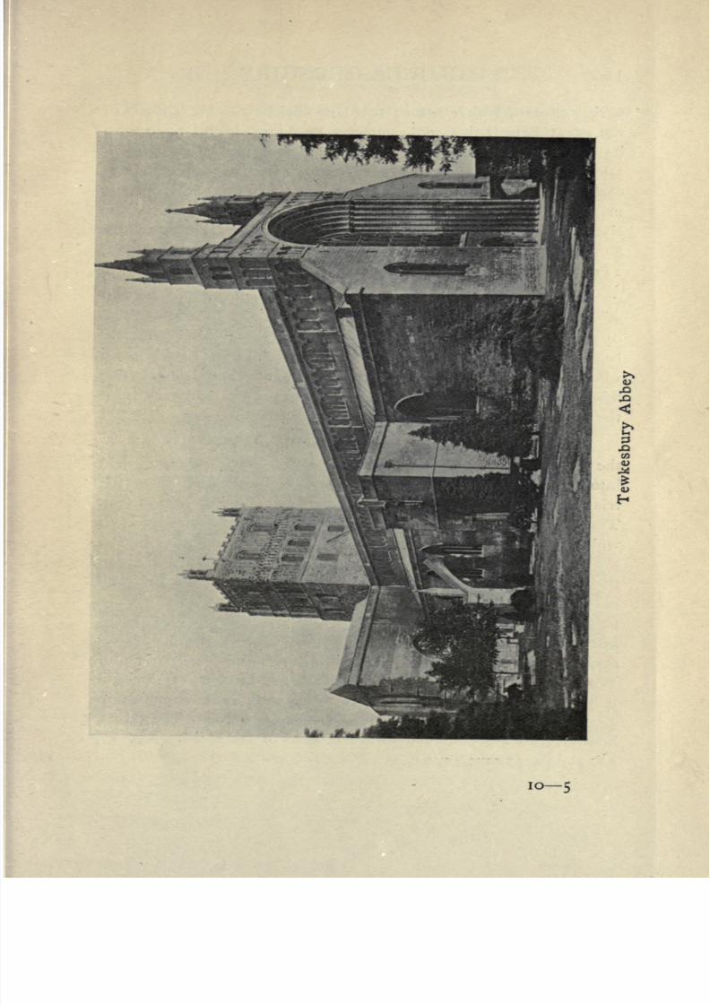
8/2/2019 Gloucestershire 1911
http://slidepdf.com/reader/full/gloucestershire-1911 163/174
io-5

8/2/2019 Gloucestershire 1911
http://slidepdf.com/reader/full/gloucestershire-1911 164/174
1 50 GLOUCESTERSHIRE
parish church, which before the Dissolution was the church of
the great Benedictine monastery of St Mary. The nave with
its imposing Norman arcade may be compared with that of
Gloucester. The central tower is also Norman; the choir is
early fourteenth century. The church is remarkable for its
many beautiful monuments dating from the fourteenth to the
sixteenth century. Tewkesbury is one of the five Gloucestershire
boroughs, (pp. 8, 18, 20, 30, 7779. 88> 95~97, 100, 122, 124,
1^5.)
Thornbury (2603). A declining town eleven miles north
of Bristol with a branch railway from Yate Junction. The
castle, an interesting example of early Tudor architecture, was
begun in 1511 by Edward Stafford third Duke of Buckingham
who was beheaded in 1521, but it was never finished. The
fifteenth century church has a fine lofty tower a landmark from
the other side of the water, (pp. 117, 125.)
Tidenham (1713), a large parish forming the extremity of
the Forest peninsula. The extreme point is Beachley, formed
into an ecclesiastical parish in 1850. At the north side of the
triangle is Tidenham Chace, which reaches the height of 778 feet.
The hamlet of Stroat is so called from the Roman road (street) on
which it lies. The church is a landmark from the other side of
the water. On the western side of the parish is Tutshill, with
the remains of an ancient watch-tower from which the approach
of strange vessels in the Wye could be signalled to Chepstow
Castle. In the Wye cliffs near the little peninsula of Lancaut
are large stone quarries a sad disfigurement of the quiet land-
scape. This parish, together with the adjoining parish of
Woolaston, were part of the Lordship Marcher of Striguil
(Chepstow) till the formation of the county of Monmouth in
1534, when theywere added to Gloucestershire.
They had,
however, always belonged to the diocese of Hereford, (pp. 13,
22, 30, 36, 37, 40, 41, 61, 124.)

8/2/2019 Gloucestershire 1911
http://slidepdf.com/reader/full/gloucestershire-1911 165/174
CHIEF TOWNS AND VILLAGES 151
Upton St Leonard's (1000), a parish three miles from
Gloucester, on the Painswick road.
Westbury-on-Severn (2005), a village on the right bank
of the Severn nine miles from Gloucester. The church is six-
teenth century, but the detached tower is earlier. Here is
Framilode passage across the river, (p. 30)
Yate Church
Westerleigh (1261),in the Bristol
coalfield; partsof it
have been taken to form other ecclesiastical parishes, the popula-
tion of the present ecclesiastical parish being only 429.

8/2/2019 Gloucestershire 1911
http://slidepdf.com/reader/full/gloucestershire-1911 166/174
1 52 GLOUCESTERSHIRE
Whiteshill (1600), formed into an ecclesiastical parish in
1844 out of Standish and Stroud. In 1894 it was constituted a
civil parish with a larger population.
Wickwar (905). A small town, formerly a borough, cele-
brated for its breweries, 15 miles NNE. from Bristol.
Winchcomb (2699). A small town at the foot of the
Cotswolds, seven miles north-east of Cheltenham. It was formerly
of great importance owing to its wealthy Benedictine abbey, not a
vestigeof
whichis left.
Sudeley Castle, oncethe
homeof the
Chandos family, is on the opposite side of the Isbourne. (pp. 19,
88.)
Winterbourne (3624) is a large parish in the Bristol coal-
field some four miles north of Bristol. In 1836 it was divided
into two ecclesiastical parishes, the population of the present
ecclesiastical parish of Winterbourne is 1484.
Wotton-under-Edge (2992), a small declining town witha station on the Midland Railway. It lies at the foot of the hills,
on the summit of which is Lord Edward Somerset's monument.
The grammar school, which still flourishes, is the oldest in
England, having been founded in 1382. (p. 32 n.)
Yate (1279). A village ten miles north-east of Bristol
with a station on the Midland Railway and a branch line to
Thornbury. (p. 117.)

8/2/2019 Gloucestershire 1911
http://slidepdf.com/reader/full/gloucestershire-1911 167/174
DIAGRAMS 153
ENGLAND & WALES

8/2/2019 Gloucestershire 1911
http://slidepdf.com/reader/full/gloucestershire-1911 168/174
154 GLOUCESTERSHIRE
Permanent Pasture
418,789 acres
Area not underPermanent Pasture
384.462 acres
Fig. 4. Diagram showing proportionate area of Permanent
Pasture in Gloucestershire to total area of the county
Permanent Pasture
including hay 418, 789 acres
Remaining area
of Gloucester
Fig. 5. Diagram showing the proportionate area under
Pasture, Cereals, Green Crops, etc., in Gloucestershire

8/2/2019 Gloucestershire 1911
http://slidepdf.com/reader/full/gloucestershire-1911 169/174
DIAGRAMS 155
Fig. 6. Proportionate acreage of Oats, Barley, and
Wheat grown in Gloucestershire in 1907
Fig. 7. Diagram showing the comparative number of
Sheep, Cattle, Pigs, and Horses in Gloucestershire

8/2/2019 Gloucestershire 1911
http://slidepdf.com/reader/full/gloucestershire-1911 170/174
PRINTED BY JOHN CLAY, M.A..
AT THE UNIVERSITY PRESS.

8/2/2019 Gloucestershire 1911
http://slidepdf.com/reader/full/gloucestershire-1911 171/174
DA Evans, Herbert Arthur
670 Gloucestershire
G5E8
PLEASE DO NOT REMOVE
CARDS OR SLIPS FROM THIS POCKET
UNIVERSITY OF TORONTO LIBRARY

8/2/2019 Gloucestershire 1911
http://slidepdf.com/reader/full/gloucestershire-1911 172/174
f'
>

8/2/2019 Gloucestershire 1911
http://slidepdf.com/reader/full/gloucestershire-1911 173/174

8/2/2019 Gloucestershire 1911
http://slidepdf.com/reader/full/gloucestershire-1911 174/174