gnss and egnos for farming: all you need to know from this
TRANSCRIPT
GNSS and EGNOS for farming: all you need to know from this
European free service
ESSP-MEMO-24322
Table of contents
2
• Overview of EGNOS system and services
• EGNOS performance
• Benefits of EGNOS in agriculture
• EGNOS configuration in agricultural equipment
• EGNOS user support
Table of contents
3
• Overview of EGNOS system and services
• EGNOS performance
• Benefits of EGNOS in agriculture
• EGNOS configuration in agricultural equipment
• EGNOS user support
4
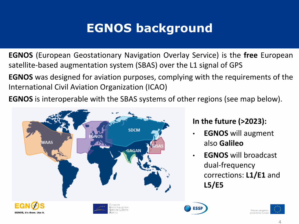
EGNOS (European Geostationary Navigation Overlay Service) is the free European satellite-based augmentation system (SBAS) over the L1 signal of GPS
EGNOS was designed for aviation purposes, complying with the requirements of the International Civil Aviation Organization (ICAO)
EGNOS is interoperable with the SBAS systems of other regions (see map below).
In the future (>2023):
• EGNOS will augment also Galileo
• EGNOS will broadcast dual-frequency corrections: L1/E1 and L5/E5
EGNOS background

EGNOS system
GPS signals
Ranging & Integrity Monitoring
Stations
40 x RIMS
Mission Control Centres
2 x MCC
Navigation Land Earth
Stations
4 x NLES 2 Geostationary Satellites
ESSP premises
EGNOS signal in space (SiS) coverage footprint
5
EGNOS application area

ESSP within the EGNOS ecosystem
service provider users
customer
design agent
industry
safety authority
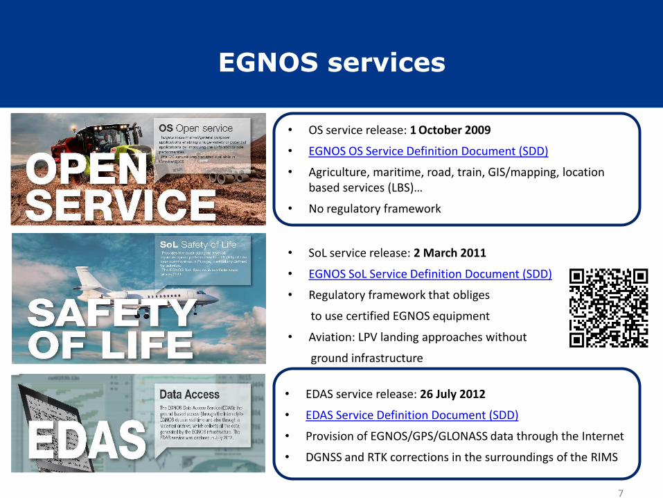
EGNOS services
7
• OS service release: 1 October 2009
• EGNOS OS Service Definition Document (SDD)
• Agriculture, maritime, road, train, GIS/mapping, location based services (LBS)…
• No regulatory framework
• SoL service release: 2 March 2011
• EGNOS SoL Service Definition Document (SDD)
• Regulatory framework that obliges
to use certified EGNOS equipment
• Aviation: LPV landing approaches without
ground infrastructure
• EDAS service release: 26 July 2012
• EDAS Service Definition Document (SDD)
• Provision of EGNOS/GPS/GLONASS data through the Internet
• DGNSS and RTK corrections in the surroundings of the RIMS

Table of contents
8
• Overview of EGNOS system and services
• EGNOS performance
• Benefits of EGNOS in agriculture
• EGNOS configuration in agricultural equipment
• EGNOS user support

EGNOS accuracy (1/2)
May 2019 (monthly reports)
RIMS HNSE 95% VNSE 95%
Aalborg 0.6 m 1.5 m
Berlin 0.7 m 1.2 m
Málaga 0.8 m 1.0 m
... ... ...
EGNOS Open Service application area
Source: OS SDD
Measured values
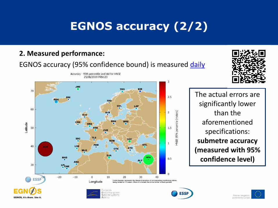
EGNOS accuracy (2/2)
The actual errors are significantly lower
than the aforementioned specifications:
submetre accuracy (measured with 95%
confidence level)
2. Measured performance:
EGNOS accuracy (95% confidence bound) is measured daily
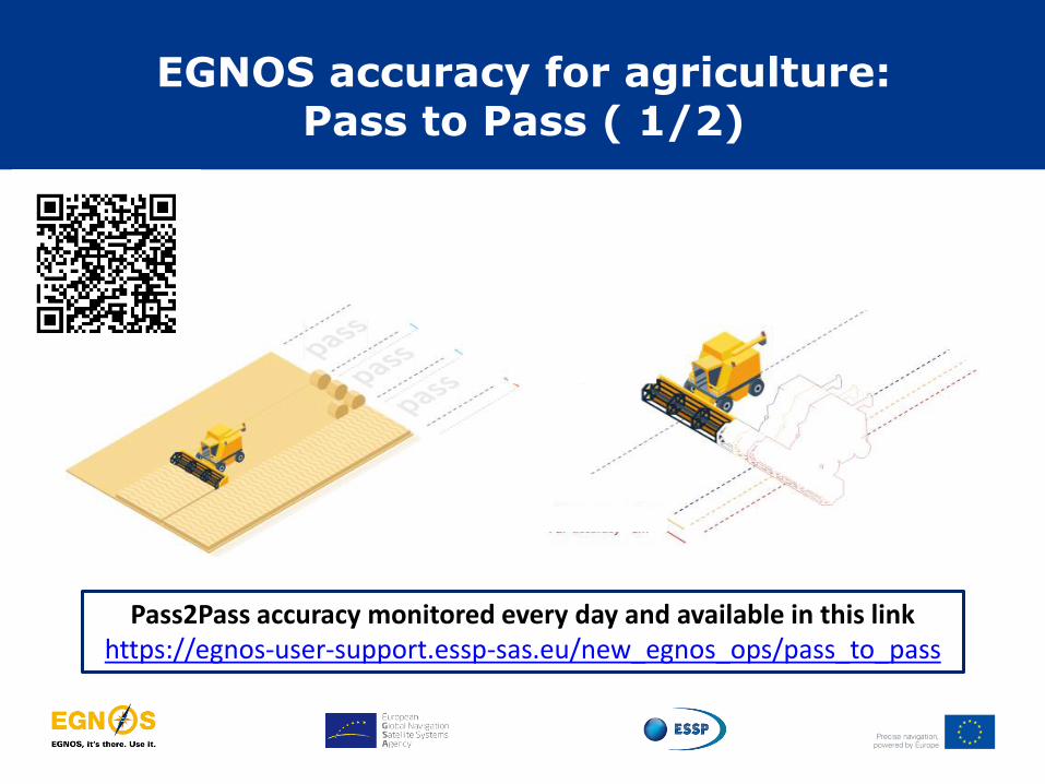
EGNOS accuracy for agriculture: Pass to Pass ( 1/2)
Pass2Pass accuracy monitored every day and available in this link https://egnos-user-support.essp-sas.eu/new_egnos_ops/pass_to_pass

EGNOS accuracy for agriculture: Pass to Pass (2/2)
EGNOS Pass2Pass accuracy is ~20-30 cm
Recent publication
testing EGNOS performance
(~13 cm)
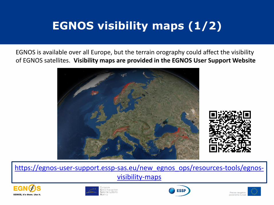
EGNOS visibility maps (1/2)
EGNOS is available over all Europe, but the terrain orography could affect the visibility of EGNOS satellites. Visibility maps are provided in the EGNOS User Support Website
https://egnos-user-support.essp-sas.eu/new_egnos_ops/resources-tools/egnos-visibility-maps

EGNOS visibility maps (2/2)
Users can find EGNOS “shadow areas” Maps can be zoomed in and out, allowing 3D view. Possible to select shadow areas for one GEO or for both
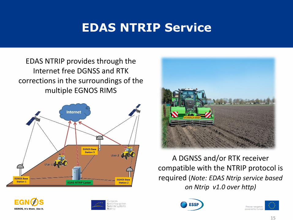
EDAS NTRIP Service
15
A DGNSS and/or RTK receiver compatible with the NTRIP protocol is required (Note: EDAS Ntrip service based
on Ntrip v1.0 over http)
EDAS NTRIP provides through the Internet free DGNSS and RTK
corrections in the surroundings of the multiple EGNOS RIMS

EDAS NTRIP application
DGNSS corrections
RTCM 2.1 y 2.3 < 260 km
Farming activities must be carried out close enough to any of the EGNOS
reference stations (see map) to achieve the suitable accuracy
RTK corrections
RTCM 3.1 < 50 km
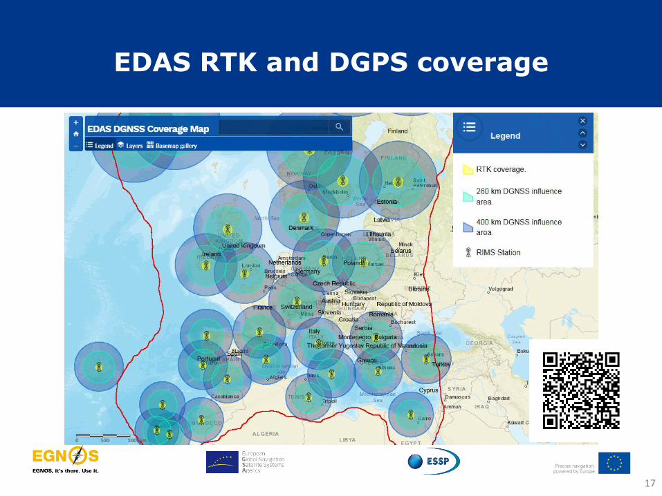
EDAS RTK and DGPS coverage
17

EDAS DGNSS: Pass to Pass results
18
Location Solution Pass to Pass
-15 min, 95th-
La Palma (Spain) LPAL0_LPIA 13,9 cm
La Palma (Spain) LPAL0_CNRA 10,1 cm
Cascais (Portugal) CASC0_LSBA 15,7 cm
Hoefn (Iceland) HOFN0_EGIA 12,4 cm
Onsala (Sweden) ONSA0_ALBA 10,1 cm
Melilla (Spain) MELI0_MLGA 11,2 cm
Oberpfaffenhofen (Germany) OBE40_ZURA 20,6 cm
Borowiec (Poland) BOR10_BRNA 13,7 cm
Ciboure (France) SCOA0_TLSA 18,6 cm
Toulouse (France) TLSE_TLSA 16,5 cm
Static data, percentile 95th, 15 minutes time window. ISO 12188-1, Tractors and machinery for agriculture and forestry-Test procedures for positioning and guidance systems in agriculture-Part1: Dynamic testing of satellite-based positioning devices
From 2nd July to August 6th 2016. Solutions with horizontal accuracy (percentile 95th) < 1 m
Pass to pass 20 cm
Table of contents
19
• Overview of EGNOS system and services
• EGNOS performances
• Benefits of EGNOS in agriculture
• EGNOS configuration in agricultural equipment
• EGNOS user support
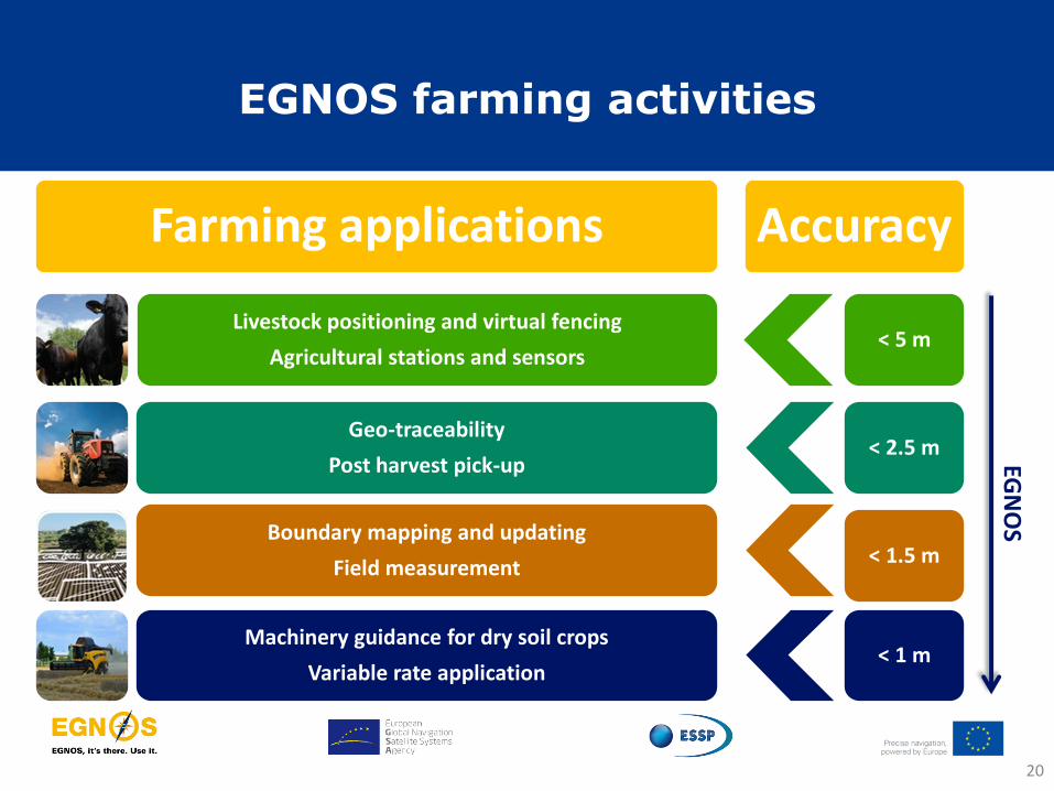
EGNOS farming activities
Accuracy
< 1.5 m
< 5 m
< 2.5 m
< 1 m
EGN
OS
Farming applications
Boundary mapping and updating
Field measurement
Livestock positioning and virtual fencing
Agricultural stations and sensors
Geo-traceability
Post harvest pick-up
Machinery guidance for dry soil crops
Variable rate application
20
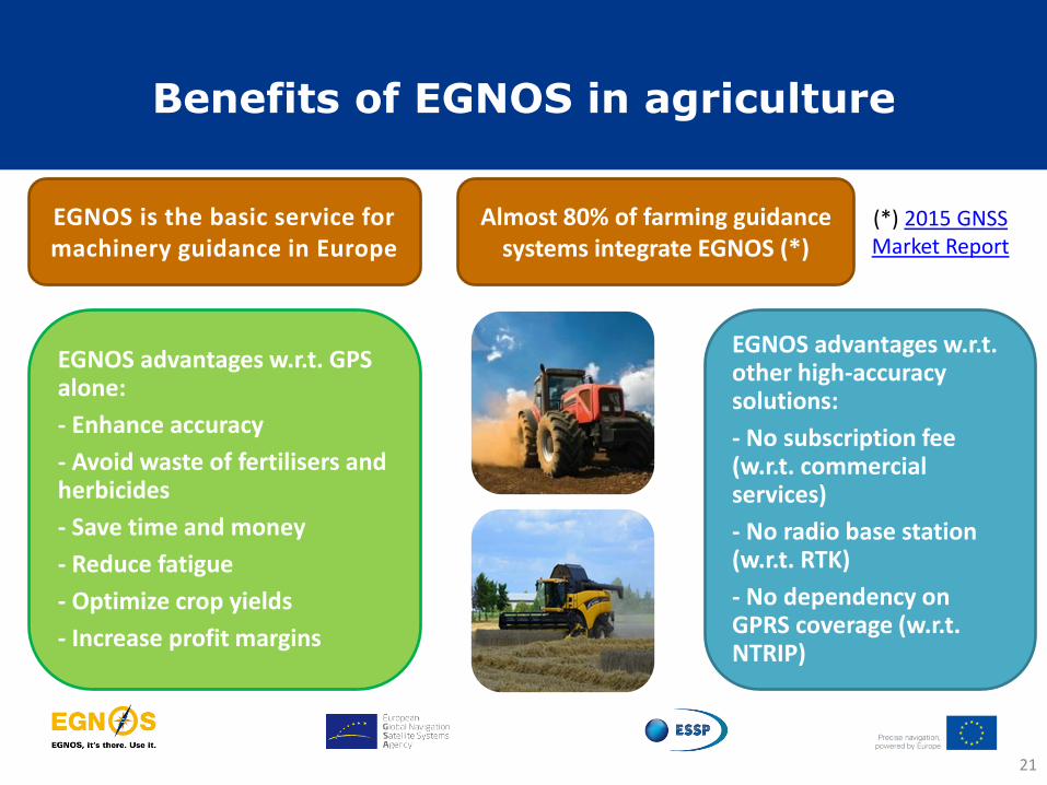
Benefits of EGNOS in agriculture
21
(*) 2015 GNSS Market Report
Almost 80% of farming guidance systems integrate EGNOS (*)
EGNOS is the basic service for machinery guidance in Europe
EGNOS advantages w.r.t. other high-accuracy solutions:
- No subscription fee (w.r.t. commercial services)
- No radio base station (w.r.t. RTK)
- No dependency on GPRS coverage (w.r.t. NTRIP)
EGNOS advantages w.r.t. GPS alone:
- Enhance accuracy
- Avoid waste of fertilisers and herbicides
- Save time and money
- Reduce fatigue
- Optimize crop yields
- Increase profit margins
Table of contents
22
• Overview of EGNOS system and services
• EGNOS performance
• Benefits of EGNOS in agriculture
• EGNOS configuration in agricultural equipment
• EGNOS user support

Almost all the GPS agricultural receivers are EGNOS enabled
GPS/SBAS receivers in agriculture
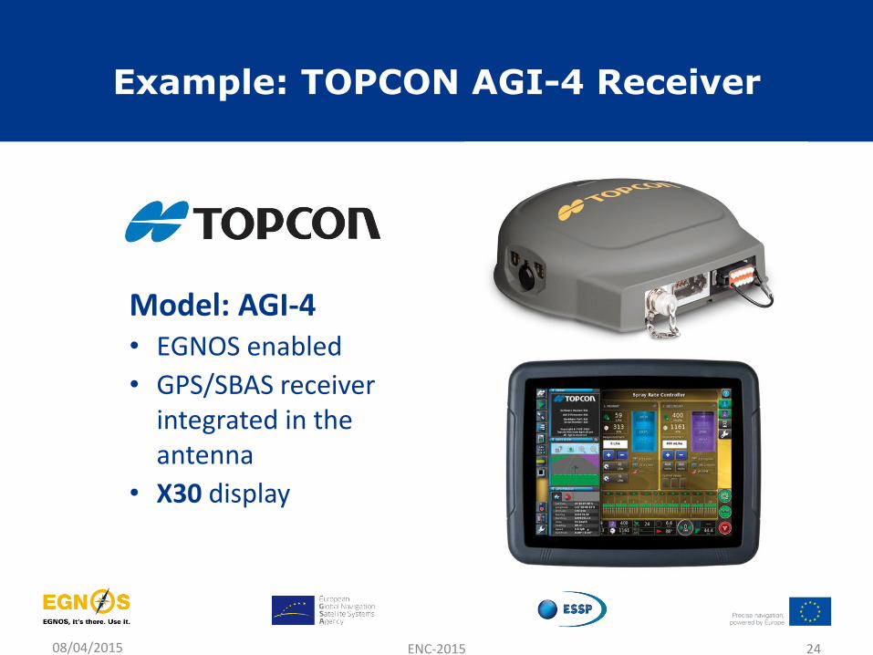
Example: TOPCON AGI-4 Receiver
08/04/2015 ENC-2015 24
Model: AGI-4 • EGNOS enabled
• GPS/SBAS receiver integrated in the antenna
• X30 display
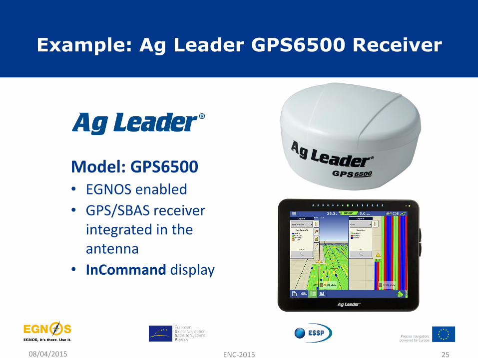
Example: Ag Leader GPS6500 Receiver
08/04/2015 ENC-2015 25
Model: GPS6500 • EGNOS enabled
• GPS/SBAS receiver integrated in the antenna
• InCommand display
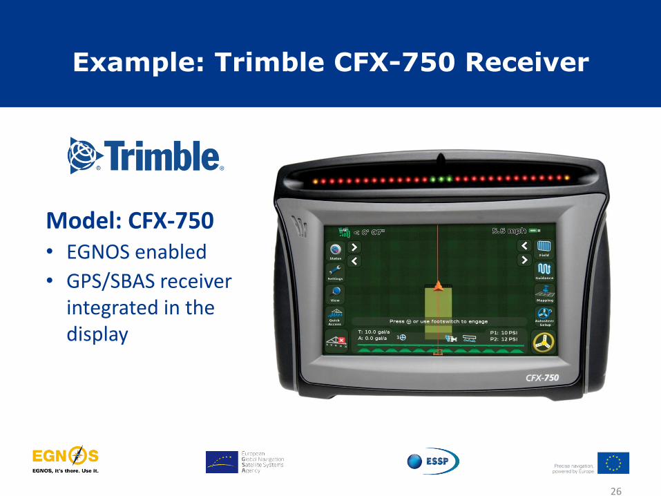
Example: Trimble CFX-750 Receiver
26
Model: CFX-750 • EGNOS enabled
• GPS/SBAS receiver integrated in the display
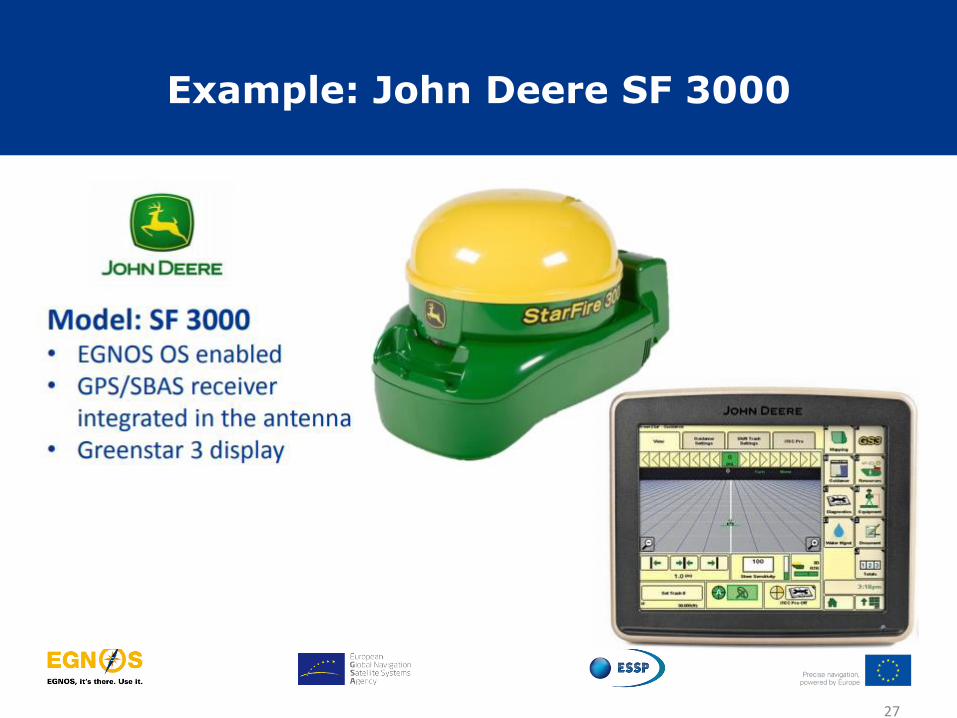
Example: John Deere SF 3000
27
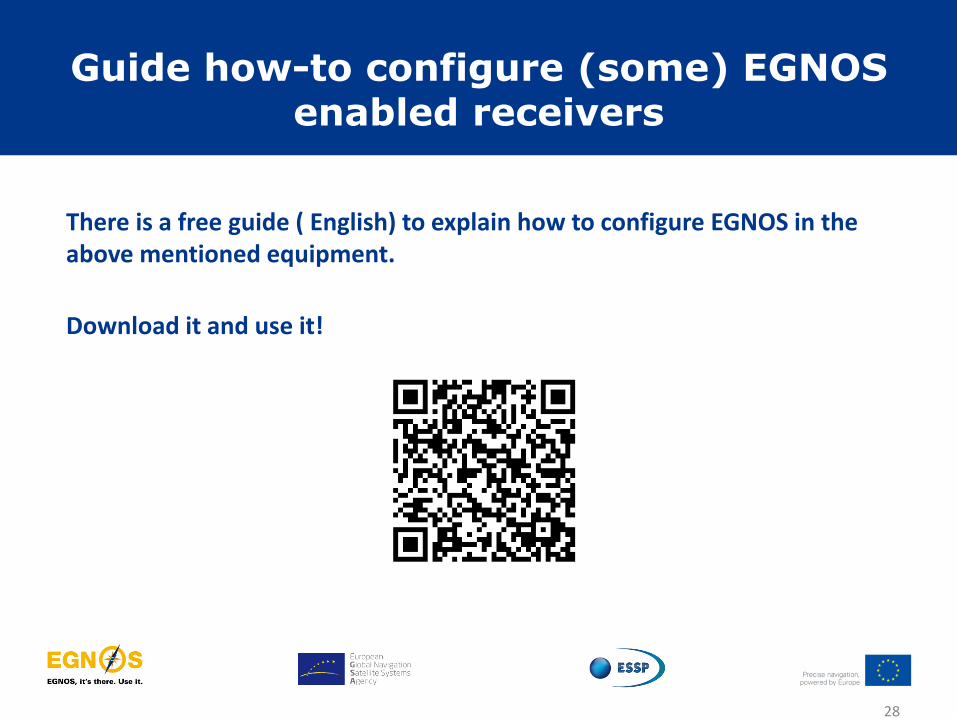
Guide how-to configure (some) EGNOS enabled receivers
28
There is a free guide ( English) to explain how to configure EGNOS in the above mentioned equipment.
Download it and use it!
Why should a farmer use EGNOS?
29
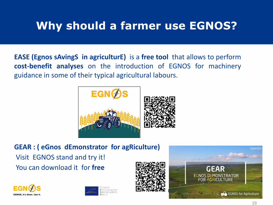
EASE (Egnos sAvingS in agriculturE) is a free tool that allows to perform cost-benefit analyses on the introduction of EGNOS for machinery guidance in some of their typical agricultural labours.
GEAR : ( eGnos dEmonstrator for agRiculture)
Visit EGNOS stand and try it!
You can download it for free

Table of contents
30
• Overview of EGNOS system and services
• EGNOS performance
• Benefits of EGNOS in agriculture
• EGNOS configuration in agricultural equipment
• EGNOS user support
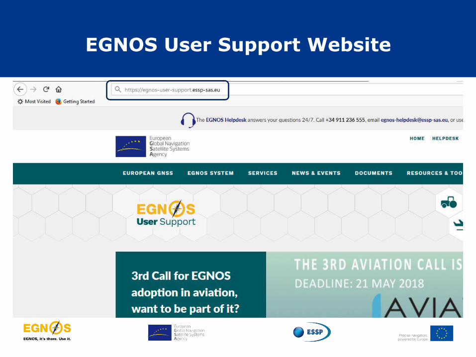
EGNOS User Support Website

EGNOS satellites availability
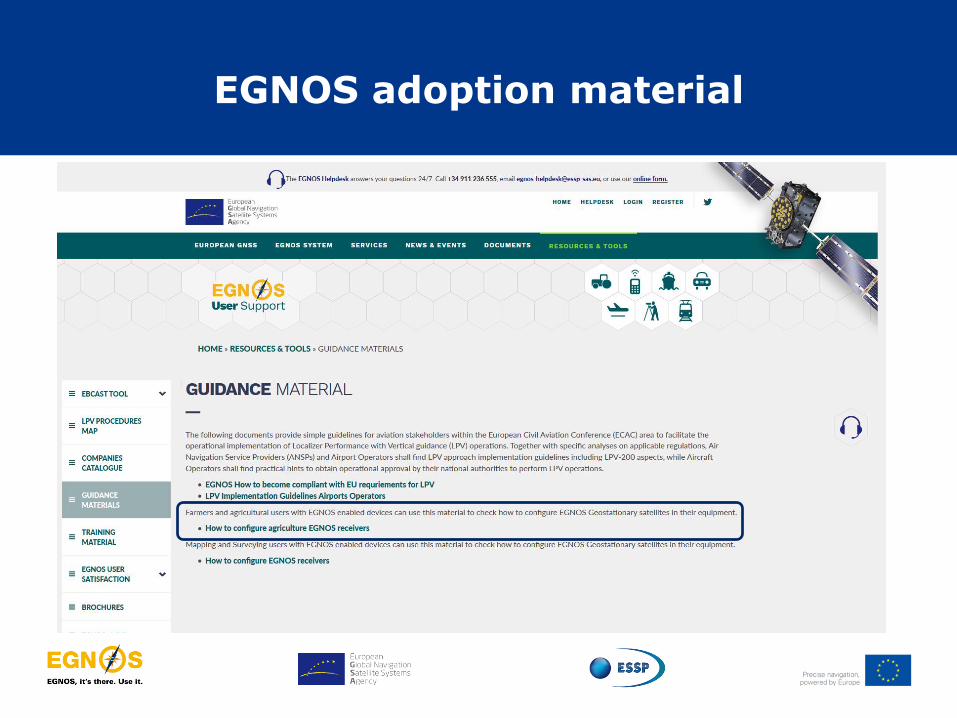
EGNOS adoption material

EGNOS Pass to Pass accuracy
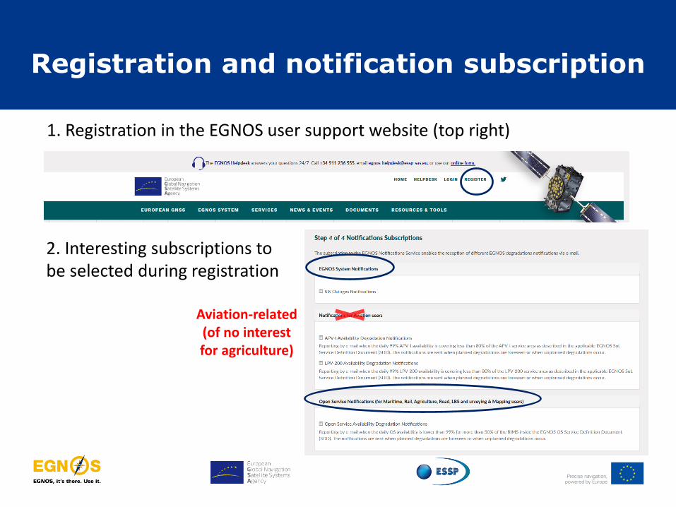
Registration and notification subscription
1. Registration in the EGNOS user support website (top right)
2. Interesting subscriptions to be selected during registration
Aviation-related (of no interest for agriculture)

EGNOS User Support Website: http://egnos-user-support.essp-sas.eu
• Service Notices (e.g. PRN modifications)
• Real-time performance:
• EGNOS vs GPS
• EDAS
• Pass to Pass accuracy
• Guidance material
• EASE tool
• EDAS coverage maps
• EGNOS bulletin
• EGNOS helpdesk
EGNOS links for farming
36

EGNOS mobile app
https://www.essp-sas.eu
Docs and tools Browse official
documents & tools
EGNOS performance
SoL, EDAS, OS services
EGNOS Helpdesk
Accessible from the app
Signal in Space
EGNOS system information
Freely available for Android and iOS

THANK YOU FOR YOUR ATTENTION
www.essp-sas.eu
+34 911 236 555 (H24/7)
http://egnos-user-support.essp-sas.eu
Corporate Video