gnss applications for safe navigation in egypt's nile mohsen fekry college of maritime...
TRANSCRIPT

GNSS Applications for Safe Navigation in Egypt's Nile
Mohsen FekryCollege of Maritime Transport and Technology (CMTT)Arab Academy for Science and Technology and Maritime Transport (AASTMT)Alexandria, [email protected]
AIN – 25 February 2015
Agenda
1. Introduction2. Current and Future GNSS and Their
Augmentation Systems GNSS Applications in Inland Waterways
3. Navigation in Egypt’s Nile River Egypt's Nile Ports, their Cargo Storage Capacity
and Working Unit's Fleet Navigation Problems in the Nile River Towards Improvement of the Nile River
Navigation
4. Conclusion
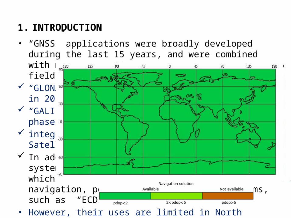
1. INTRODUCTION
• “GNSS” applications were broadly developed during the last 15 years, and were combined with many important events in that precise field.
“GLONASS” reconstruction and full operation in 2010, “GALILEO” expected entry in operational phase in 2015 integration and redundancy with American Satellite Navigation
System “GPS”. In addition to the regional augmentation systems that cover wide
areas of the world, which resulted in the development of modern navigation, positioning and tracking Systems, such as “ECDIS” and “AIS”.
• However, their uses are limited in North Africa in general and in Egypt in particular, despite the wide spreads of EGNOS services in North Africa.

2. CURRENT AND FUTURE GNSS AND THEIR AUGMENTATION SYSTEMS
GLONASS (Russia) GALILEO (Europe)
GPS plus ……...
Compass-Beidou (China) QZSS (Japan) IRNSS (India)
… and their augmentations:
by 2020 there will be around 120 navigation and positioning satellites
a user could receive signals from as many at ten satellites,
leading to meter-level accuracy, and will certainly develop creative new uses.
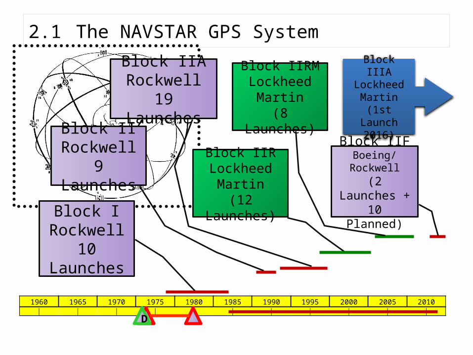
2.1 The NAVSTAR GPS System
1960 1965 1970 1975 1980 1985 1990 1995 2000 2005 2010│ │ │ │ │ │ │ │ │ │ │
D
Block IRockwell
10 Launches
Block IIRockwell
9 LaunchesBlock IIRLockheed
Martin(12 Launches)
Block IIARockwell
19 Launches
Block IIRMLockheed
Martin(8 Launches)
Block IIFBoeing/Rockwell(2 Launches +10 Planned)
Block IIIALockheed
Martin(1st Launch
2016)

2.1.1 Current and Planned GPS Signals Structure
Block II
Block IIA
Block IIR
Block IIRMBlock IIF
The L1 frequency, transmitted by all GPS satellites,
(C/A) code ranging signal with a N/M
Precision P(Y) code ranging signal with a N/M
new signals designed for civilian use
L2C L5 L1C
Block IIIA(1st Launch
2016)
L2 frequency
Most of the new signals will be of limited use until they are broadcast from 18 to 24 satellites
deliver faster signal acquisition, enhanced reliability and greater operating range for differential applications.
improve accuracy via ionospheric correction and robustness via signal redundancy
The use of three GPS frequencies may enable sub-meter accuracy without augmentations
enable interoperability between GPS and international satellite navigation systems
improve mobile reception in cities and environmental applications

2.2 The GLONASS System
Currently, the only other fully operational GNSS,
GLONASS, is developed and maintained by the Russian government.
It was created in 1976 and has undergone various transformations and restorations.
Since, in late 2011, the system was restored to its complete capacity of 24 satellites,
GLO
NAS
S
GLO
NAS
S-M
GLONASS-K1 …..
Source: (Oleynik, 2012)

2.2.1 Current and Planned GLONASS Signals Structure
New CDMA signals introduced on Glonass-KKeeping on transmitting the existing FDMA signals
GLONASS satellites transmit two types of signal: open standard-precision signal L1OF/L2OF, and obfuscated high-precision signal L1SF/L2SF.

2011 the accuracy of GLONASS reached less than 3 meters
User positioning error (RMS, SIS)

2.3 The GALILEO System
• Galileo is a global navigation satellite system (GNSS) currently being built by the European Union (EU) and European Space Agency (ESA)
• Galileo, developed and will always remain under civilian control.
• Galileo is nevertheless 100% interoperable with GPS and GLONASS, making it a fully integrated new element in the worldwide global navigation satellite system
• a powerful cornerstone that will allow more accurate and more reliable positioning, even in high-rise cities where buildings can obscure signals

2.4 Satellite-Based Augmentation Systems (SBAS)
• A satellite based augmentation system (SBAS) uses additional correction messages from satellite broadcasts to support signal augmentation.
• SBAS makes additional satellites and signal corrections available to end users therefore improving the integrity, accuracy, availability and continuity of existing global navigation systems.
• Several compatible systems have been deployed or are under deployment, which include WAAS in US, Mexico and Canada, MSAS in Japan, GAGAN in India, SDCM in Russia and EGNOS in Europe.

2.4.1 The European Geostationary Navigation Overlay Service (EGNOS)
• EGNOS is the first European SBAS, which enhances the performances of the existing satellite navigation systems (GPS and GLONASS).
• EGNOS is currently operational: the EGNOS Service Provider has been certified during July 2010 and the EGNOS entered into operation for Safety of Life in March 2011.
• The system is based on three geostationary satellites and a network of ground facilities in Europe and North Africa.
• Since the satellites already cover Europe and the entire African continent, EGNOS could easily extend the provision of its service to the African continent with some adaptations and the installation of ground stations on the African territory.
• These stations could be connected to the European network or, alternatively, to an independent EGNOS-like African system.
• EGNOS allows users to determine their position down to 1-2 meters compared with the 5-10 meters presently available with GPS alone.
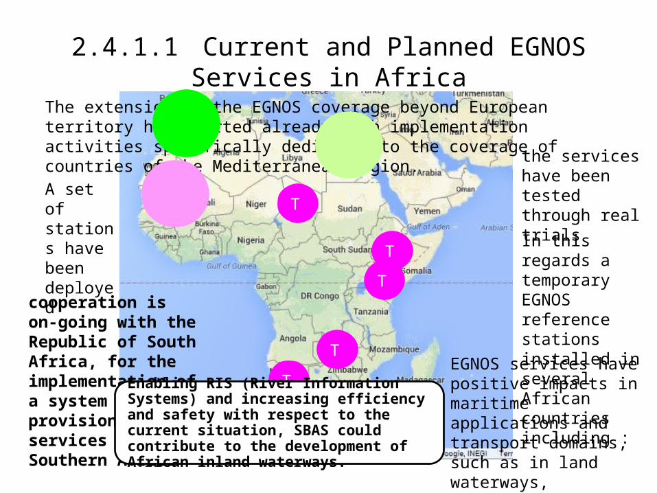
2.4.1.1 Current and Planned EGNOS Services in Africa
The extension of the EGNOS coverage beyond European territory has started already with implementation activities specifically dedicated to the coverage of countries of the Mediterranean region.
A set of stations have been deployed
the services have been tested through real trials
cooperation is on-going with the Republic of South Africa, for the implementation of a system for the provision of SBAS services over Southern Africa
In this regards a temporary EGNOS reference stations installed in several African countries including :
T
T
T
T
TEGNOS services have positive impacts in maritime applications and transport domains, such as in land waterways,
Enabling RIS (River Information Systems) and increasing efficiency and safety with respect to the current situation, SBAS could contribute to the development of African inland waterways.
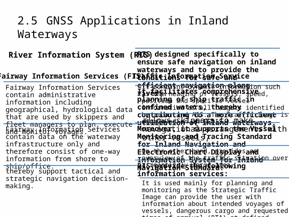
2.5 GNSS Applications in Inland Waterways
River Information System (RIS) RIS designed specifically to ensure safe navigation on inland waterways and to provide the conditions for safe and efficient navigation along rivers.
It facilitates comprehensive planning of ship traffic in confined waters, thereby contributing to a more efficient utilization of inland waterways.
Moreover, it supports the Vessel Monitoring and Tracing Standard for Inland Navigation and Electronic Chart Display and Information System for Inland Navigation Standard.
RIS provide the following information services:
Fairway Information Services (FIS)
Fairway Information Services contain administrative information including geographical, hydrological data that are used by skippers and fleet managers to plan, execute and monitor voyages.
Fairway Information Services contain data on the waterway infrastructure only and therefore consist of one-way information from shore to ship/office.
thereby support tactical and strategic navigation decision-making.
Traffic Information Service it contains dynamic information such as the heading of vessels, speed, position and specific vessel information of all targets identified by radar and AIS. The Traffic Image is displayed on an ECDIS.
allows skippers to make navigational arrangements with other vessels,
On the other hand, provides an overview of the traffic situation over a relatively large area.
It is used mainly for planning and monitoring as the Strategic Traffic Image can provide the user with information about intended voyages of vessels, dangerous cargo and requested times of arrival (RTA) at defined points such as locks and terminals

3 NAVIGATION IN EGYPT’S NILE RIVER
Nile River is one of the oldest rivers in the history
longest river in the world; It is approximately 6,853 km (3700.32 N. miles) long.
its water resources shared by eleven countries
Nile passes through the Egyptian land is 3126 km, it divided to three navigational courses or passage categories, the first of length 2116 km the second categories is 121 km, the third, is 813 km.
Most of the capitals of Egypt lie along the Nile valley north of Aswan, and The Nile ends in a large delta that empties into the Mediterranean Sea.

3.2 Egypt's Nile Ports, their Cargo Storage Capacity and Working Unit's Fleet
19 ports in Aswan and Qina9 ports in Sohag, Asuit, and Menya
13 ports in Giza and Cairo
Total no. of Nile Ports Cargo storage capacity / tone
47 994930
The Egyptian Nile River Ports from Aswan

1979 1982 1987 1992 2000 2005 2010 2014
Series 1 82.6 117.18 154.1 178.4 432.57 512.2 676.9 830.564
50150250350450550650750850
Quantities of Goods Traded annually in Egypt
Goo
ds T
rade
d in
M to
ns
Source: Saber, 2011

Working Nile’s river units fleet
No. of working units Type of Units
2 Floating winches 2899 passengers
48 Research units1247 Single cargo units111 Double cargo units40 Service units3 Sounding boats
296 Tourist Service boats
357 Towing units
5003 Total units
2001 2002 2003 2004 2005 2006
road
385.53 421.27 440.69 468.59 501.17 531.12
railways
9.88 9.96 9.36000000000001
10.38 9.7 9.36000000000001
river
2.09 1.37 1.28 1.43 1.33 1.42
50
250
450
Low river transport rates 0.3%
Carg
o in
M to
ns
Improving River Transport Productivity by Improving the River Ports Performance Quality

3.4 Navigation Problems in the Nile River
• The lack of enough water depth for navigation is a problem that threatens the navigation in the Nile River and the tourism industry
• water level in the Nile during December and January is the lowest throughout the year and navigation composes a real problem during this period unless additional water is released from Aswan High Dam.
• On the other hand, Lack of experience among boat navigators, • the absence of the suitable navigational aids and landmarks, • the navigational information of the channels is not well defined,
and continues change of the water level “the variation of water levels, along the River Nile from old Aswan Dam to Delta Barrages are the significance problems that faces the navigation in river Nile,
• those problems were evaluated during the period 1995 to 2009.

3.5 Improvement of the Nile River NavigationProduction of River Navigational Charts (IENCs)
Installation of aids to navigation, which includes; Watermarks and land mark
Establish (RIS) based on GNSS technology
جزيرة النباتات
جزيرة إلفنتين
أسوان محورالقاهرة
المجرى بداية المالحى
مدينة أسوان
Inland AIS (AtoN)Inland ECDIS

Anti-grounding by Look-ahead

Look Ahead Function

Prediction of
Own Ship`s Motion
Suez

Real Time and Real Space:
Scaled Own Ship

Own Ship‘sData

4 CONCLUSION
The capacity of goods transported by Nile River is not comparable with that transported by Egyptian both, land-born truck and rail transport modes. Since the storage, capacity of the existing ports on of the Nile River is not insignificant amount; so the Nile river ports and the infrastructure are essential to improve and develop for increasing the total cargo transporting by river mode. It will be interesting alternative to other transportation modes, and it will replicate great profits and outcomes on the Egyptian economy by increasing the investments, in addition to positive environmental impact.
This development requires establishment of RIS for the river safety of navigation. Moreover, take the advantages of the utilization of existing Global satellite navigation systems “GNSS” and the available services of “EGNOS” to enhance the Nile River navigation.
A traffic management system based on GNSS rather than on radar or, even worst on visual aids only can guarantee a more secure navigation also in rather narrow areas. It should be considered that, providing RIS and enhanced security measures along the waterways would greatly help the development of Nile River Navigation.