go fish! coral sea reserve cutbacks - npaq - home magazine/issue... · 2 3 contents from the...
TRANSCRIPT
1
Issue 16August - September 2017
Magazine of National Parks Association of Queensland
Glass House Mountains National ParkTrachyte Track and Tibrogargan Circuit Glasshouse Mountains Tea Tree
Go fish! Coral Sea reserve cutbacks
How mass land-clearing impacts on protected areas
PLUS
ALSO FEATURED
2 3
ContentsFrom the President ������������������������� 3
Coral Sea Marine Park draft plan ���� 4
The consequences of increased tree clearing in Queensland ������������������� 6
Glass House Mountains National Park ��������������������������������� 8
Want to get involved with NPAQ?NPAQ welcomes people from all walks of life and offers a variety of ways to be involved:
Mission statementThe National Parks Association of Queensland (NPAQ) promotes the preservation, expansion and good management of national parks in Queensland�
Contributor guidelinesNPAQ invites contributions to Protected articles� Please email admin@npaq�org�au for a schedule of future editions�
Contributors, please include contact details and brief personal summary� Articles can be submitted via email or hard copy� Digital photos should be minimum 300dpi�
Copyright and disclaimerNPAQ retains copyright of Protected� Articles may be quoted provided that appropriate acknowledgement occurs in the reproduction and use of material�
Articles in Protected do not necessarily reflect the NPAQ’s opinion or position�
Adver tising policy Advertisements are required to align with relevant NPAQ policies� NPAQ reserves the right to refuse any advertisement at any time� Advertisement in Protected does not imply NPAQ’s endorsement of products or services�
CouncilPresident Michelle Prior
Vice Presidents Tony O’Brien
Athol Lester
Hon Secretary Debra Marwedel
Asst Hon Secretary Yvonne Parsons
Hon Treasurer Graham Riddell
Councillors David Ball
Julie Hainsworth
Daniel Kelly
Denis McMullen
Richard Proudfoot
Alexsis Wilson
StaffBusiness Development Officer Marika Strand
Communications Officer Fred McKie
Conservation Officer Laura Hahn
Project & Office Administrator Jeannie Rice
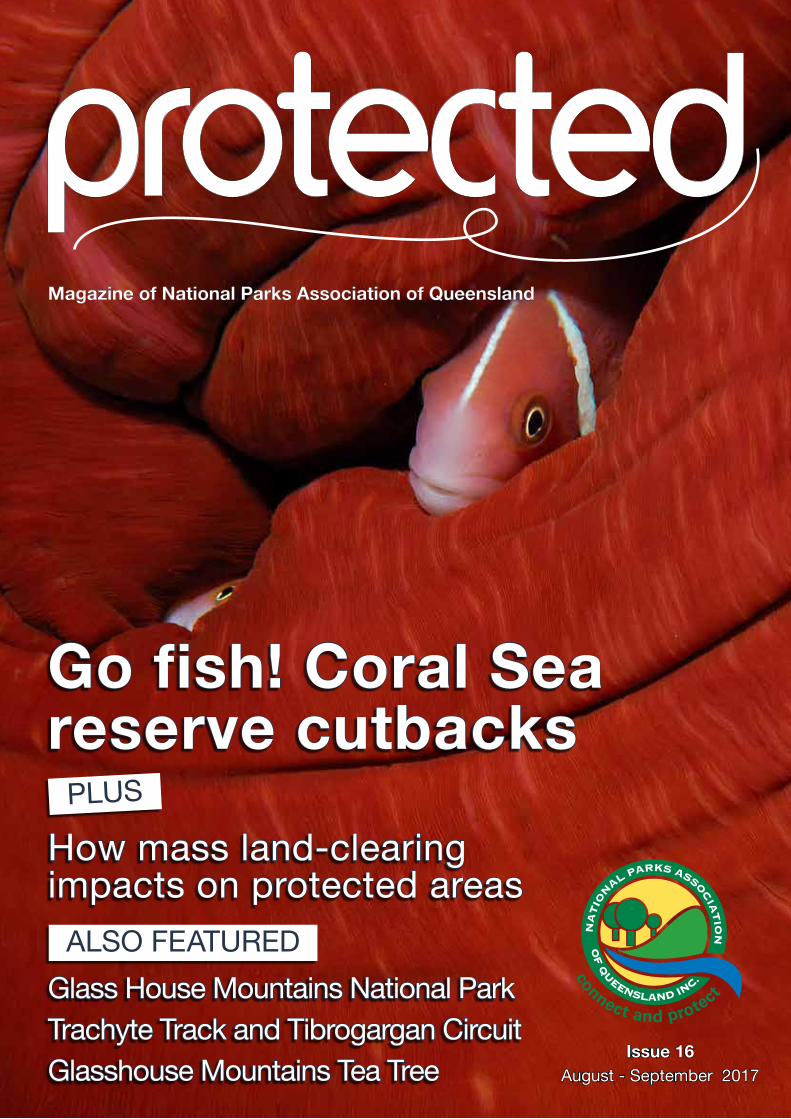
Cover imagePink skunk clownfish, a species of anemonefish, on a Coral Sea reef�
Photo: Lucy Trippett�
Contact detailsOffice Unit 10/36 Finchley St, MiltonPost PO Box 1040, Milton QLD 4064
Phone (07) 3367 0878Web www�npaq�org�auEmail admin@npaq�org�au
ABN 60 206 792 095
Adver tising enquiriesPlease email admin@npaq�org�au or phone (07) 3367 0878�
Editorial teamFred McKie (editor/designer), Laura Hahn and Jeannie Rice�
SUPPORT NPAQ AND HELP MAKE A DIFFERENCEBECOME A MEMBER, DONATE OR VOLUNTEER
www.npaq.org.au/get-involved
About NPAQ
• Have fun in the bush – come along on a bush walk or other activity
• Get your hands dirty – participate in on-ground conservation efforts
• Join us – become a member
• Step up – become a National Parks Conservation member or a National Parks Protector
• Donate – support our work
• Volunteer on exciting projects
• Subscribe to Protected and Neck of the Woods via email
• Connect with us – Facebook, Instagram and Twitter
• Stay in touch – read regular updates on our website
• Share a bush adventure with children – download NPAQ’s Kids in National Parks guide
AGM
National Parks Association of
Queensland invites all members to attend the Annual General
Meeting.
Date: Wednesday 20 September 2017
Time: 6:30pmVenue: Mt Coot-tha
Botanic Gardens Auditorium
ANNUAL AWARDS DINNER
Following the AGM the annual awards dinner
will commence at 7:30pm.
Cost: $35 per person.
To confirm your spot at the dinner, please RSVP to [email protected]
or 07 3367 0878 by 6 September
Trachyte Track and Tibrogargan Circuit via the Soldier Settlers’ Trail ���������� 10Leptospermum oreophilum ����������� 12The National Park Experience �������� 13Spotlight: Ranger of the Month ������ 14What’s On / Vale �������������������������� 15
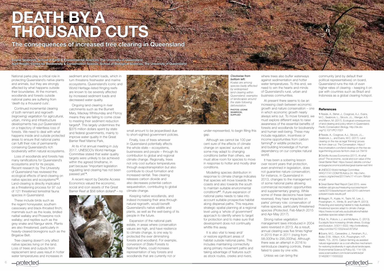
Our dollar-driven society appears yet again to have trumped over conservation� While it is undisputed, even heavily touted, just how much our beautiful protected areas in Queensland attract the tourist dollar, the conservation values underpinning this have been ignored in this year’s State Budget�
Of the $40 million allocated to national parks over two years, $35 million is earmarked for capital works and infrastructure projects, with the aim of improving visitor experience and recreation opportunities� In other words, tourism�
NPAQ readily acknowledges that everyone deserves the opportunity to obtain well paid and meaningful employment and that some areas are struggling with unemployment; and we fully understand the importance of people connecting with nature and our beautiful parks� But what we don’t agree with is conservation efforts clearly being given the back seat (when it is in fact the driver) in what is predominantly a tourism spend disguised as environmental dollars�
Of the $5 million that will potentially go towards operational funding and conservation, this equates to less than 30 cents a hectare each year�
NPAQ commends the State Government for recognising the economic value of our national parks and other protected areas� However, the funds for visitor services, infrastructure and recreation opportunities far outweigh the funding for conservation management and the resources required to maintain our national parks� It is akin to overloading
argument where all else fails� “How much did you just say that bit of nature was worth?”
Recently Deloitte Access Economics calculated the economic, social and iconic value of the Great Barrier Reef World Heritage area� The total asset value was so high – $56 billion – it was labelled “too big to fail”� While tourism made up $29 billion, the brand value – Australians that have not yet visited the Reef but value it knowing that it exists – was $24 billion� Quantified estimates of the value that Traditional Owners place on the Reef were not included�
To give full economic weight to their point, they added some visual stimuli� The value of the Reef is more than “12 Sydney Opera Houses”, “the cost of building new submarines” or, to get really graphic, “four times the length of the Great Wall of China in $100 notes”�
What hope do our terrestrial protected areas have when even the mighty Reef has been sold and consumed as Nature the Product, yet is still failing?
www.facebook.com/NPAQld @nationalparksassocqld
a boat with too much ballast – resulting in a lopsided journey, with the potential for sinking�
Queensland’s natural assets are a major drawcard for tourists� It is great that people want to experience our special places that have been protected� But while these unique and precious places may have the legal protection – through gazettal as a national park – they are not fully protected� Our protected areas are lacking sufficient people and funds to care for them�
Why? Because Nature the Product – Nature™, Nature © – or Consumptive Recreation trumps over simply Nature� Nature the Product and Consumptive Recreation can be sold, for cold hard cash� Whereas simply Nature is regarded as esoteric or a drain on the public purse, or even a hindrance to economic pursuits�
However, while we may eschew the selling of Nature’s soul for financial gain, economics can make a powerful
Michelle PriorPresident, National Parks Association of Queensland (NPAQ)
FROM THE PRESIDENT
@NPA_Qld
PHOTOS: QUEENSLAND MUSEUM

4 5
The Coral Sea is recalled by many Australians as a World War II battleground, where Australian and United States forces stopped the Japanese from landing troops in Port Moresby in 1942� Decades later, it has become a battleground between conservation and fishing�
A vast area of ocean, the Coral Sea extends from the Queensland coast 600km east to the edge of the Australian Continental shelf, north to Papua New Guinea and merges with the Tasman Sea in the south�
Incredible marine environment
Dotted with 51 cays, reefs and atolls – some of considerable size, with the Lithou Reef the second largest atoll in the world measuring 2,500 square kilometres – the Coral Sea also features a 2,000km long chain of submerged volcanoes�
The Tasmantid Seamounts rise as high as 4,000m above the seafloor – making them nearly twice the height of Mt Kosciuszko� Formed as the seafloor passed over a mantle hotspot, between six and 34 million years ago, some have become eroded flat-topped undersea mountains, called guyots, while others have reached the surface� Their limestone caps support reefs and cays�
Another remarkable and significant element of the Coral Sea is its four major plateaus, which have a total area of 42,000 sq km� Again, the troughs and canyons separating these undersea plains, which are home to deep cold water flora, are up to 4,000m deep�
Biodiversity hotspot
Referred to as the “Cradle of the Great Barrier Reef”, the Coral Sea provides currents that bring new coral to the Reef� i The sea waters are important in attracting aggregations of large pelagic fish species, while also providing migratory corridors for numerous highly mobile species which are associated
with major ocean currents�
For all its vast isolation, the Coral Sea is undoubtedly important as one of the last pristine ecosystems on the planet, despite sharing in the worldwide despoliation of the seas with plastics� It is a biodiversity hotspot, with a vast array of sea creatures including the dwarf minke whale, the majestic whale shark and large ocean predators including rare deepwater sharks, tuna and billfish� The Coral Sea contains 49 different habitats and supports over 300 threatened species� At least 28 species of whales and dolphins are found, some in pods up to 400 strong� There are 52 species of deepwater sharks and rays, 18 of which are unique to the Sea�ii
The Coral Sea is also the site of the world’s only known black marlin spawning event�iii The islets and cays also support 14 species of seabird, including regionally important populations of red-footed booby, lesser frigatebird and great frigatebird� The green turtle regularly nests on undisturbed islets, particularly the Coringa-Herald and Lithou Reef national nature reserves – the two existing protected areas within the million sq km of the Coral Sea within Australian waters� The hawksbill turtle also uses these islets for foraging and, occasionally, nesting� Five other species of sea turtle are also found in the Coral Sea as its atoll beaches make secure nest sites� The Sea hosts 341 species recognised by the IUCN for their conservation significance iv� The Sea’s sanctuary zones are “probably the only tropical pelagic environment not markedly impacted by fishing where an area of a very large scale can be established and effectively managed�” v
Protecting the Coral Sea – a fraught political process
The Federal Government undertook the marine reserves planning process over 15 years, resulting in a network of Commonwealth Marine Reservesv��
least $5 million annually�
3� Some minor changes are need to the original zones, around some of the key coral reefs targeted for protection�
4� Major concerns exist within the scientific community regarding the low level of protection for the unique habitats of the western and southern Coral Sea, particularly the deep water troughs, pelagic ecosystems and unique coral reefs�
Currently , the Coral Sea Marine Reserve contains Australia’s largest Marine National Park Zone – extending over 51% of the Marine Reserve� This is one of the few places globally where such a large marine sanctuary for relatively intact tropical marine life can be established; thereby making the conservation values of the area of global significance�xiii
The impacts of large scale commercial fishing are well known� Fisheries extraction is a major threat to world fish populations and needs to be managed closely�xiv
A proposed halving of the Marine
Whilst far from perfect, in 2012, Australia announced the world’s largest representative national network of marine parks and sanctuaries� The proposal underwent six rounds of public consultation, with over three quarters of a million people providing submissions – 95% of which were in favour of greater protection for marine zones�vii
However, before the new marine reserves could become operational, the newly elected Federal Government set aside the plans and announced an amended version of Marine National Park Zones in 2013� This action represented a perceived compromise between globally recognised conservation values and keeping reserves open to commercial and recreational fishers�viii In 2014, the Federal Government commenced a review of marine reserves, with the ‘need to consider the scientific evidence’ cited as the reason�ix
In July 2017, the Federal Government released draft management plans for Australia’s network of 44 marine sanctuaries�x It is proposed that sanctuary protections for a large area of Queensland’s Coral Sea, as well as
Reserve National Park area will leave the more accessible part of “the Cradle of the Great Barrier Reef unprotected�
Consultation Period
The Federal Government has called for submissions on the draft management plans, closing 20 September 2017�
https://parksaustralia�gov�au/marine/get-involved/have-your-say/
Referencesi Pedder, A� (2017)� ‘Protecting the Coral Sea – the Cradle to the Great Barrier Reef’, Vol LIV, 1 & 2, My 2017� UN Chronicle�ii Ibid�iii Domeier M�L�, and Speare P� (2012)� ‘Dispersal of Adult Black Marlin (Istiompax indica) from a Great Barrier Reef Spawning Aggregation�’ PLoS ONE 7(2): e31629� iv Ceccarelli, D� M� (2011)� Australia’s Coral Sea: A Biophysical Profile� Protect our Coral Sea Coalition�v Ibid, pg 3� vi Marine Division, Department of Sustainability, Environment, Water, Population and Communities (2012)� Completing the Commonwealth Marine Reserves Network: Regulatory impact statement� Commonwealth of Australia, Canberra� vii Pedder, A� (as above i)viii Beaver, D�, Turner, J�,Keily, T� and Douglass, L� (2015)� The coral sea marine reserve: centre for conservation geography report to the Australian Government’s marine reserves review, v�1�0, Save Our Marine Life Alliance�ix Ocean Science Council of Australia (2016)� Commonwealth Marine Reserve Network: what the scientific review should deliver� x Director of National Parks 2017, Draft Coral Sea Commonwealth Marine Reserve Management Plan 2017, Director of National Parks, Canberra� xi The Hon� Greg Hunt MP Minister for the Environment and Senator the Hon� Richard Colbeck Parliamentary Secretary to the Minister for Agriculture (2014)� JOINT MEDIA RELEASE, 11 September 2014, Review of Commonwealth marine reserves begins�xii Beaver et al (as above viii) xiii Halpern B�S�, Walbridge S�, Selkoe K�A�, Kappel C�V�, Micheli F�, D’Agrosa C�, Bruno J�F�, Casey K�S�, Ebert C�, Fox H�E�, Fujita R�, Heinemann D�, Lenihan H�S�, Madin E�M�P�, Perry M�T�, Selig E�R�, Spalding M�, Steneck R�, Watson R� (2008)� ‘A global map of human impact on marine ecosystems’� Science,319(5865), 948� xiv Booth, D� (2011)� ‘Does the Coral Sea marine park proposal provide enough protection?’ The Conversation, 26 November, 2011; citing Food and Agriculture Organisation of the United Nations (2015)� FAO Fisheries and Aquaculture Department [online]� Rome�
Denis McMullenCouncillor, National Parks Association of Queensland (NPAQ)
THE BATTLE OF THE CORAL SEA - FROM SANCTUARY TO FISHERY?Commonwealth marine park plan fails to provide adequate protection
Clockwise from left: A potato cod in the Coral Sea; a map showing the locations of the Tasmantid Seamounts; and marine biodiversity on Wreck Reef.
IMAGES: MARK SPENCER; GOOGLE IMAGERY, NASA & TERRAMETRICS; XANTHE RIVETT
other regions, are abandoned to allow for an expansion of fishing, including long-line fishing and seafloor trawling� The ‘sensible balance’ sought by the ‘science based review’,xi appears to have been more of a ‘fishery based’ review� Rather than increasing protection for oceans and marine life, a drastic decrease is proposed�
National Marine Park Zone Values
In 2015, the Centre for Conservation Geography undertook independent research on behalf of Save Our Marine Life Alliance� The research found that:
1� Marine National Park Zones are critical to the protection of the Coral Sea’s marine life� The weight of scientific evidence showed that partially protected zones did not deliver broad ranging and significant benefits�
2� The net social and economic benefits of the Coral Sea Marine Reserve contributes $1�2 billion to the Australian community� Further, the positive impacts on nature-based tourism and recreational fishing outweigh any potential negative impacts on commercial fishing by at
6 7
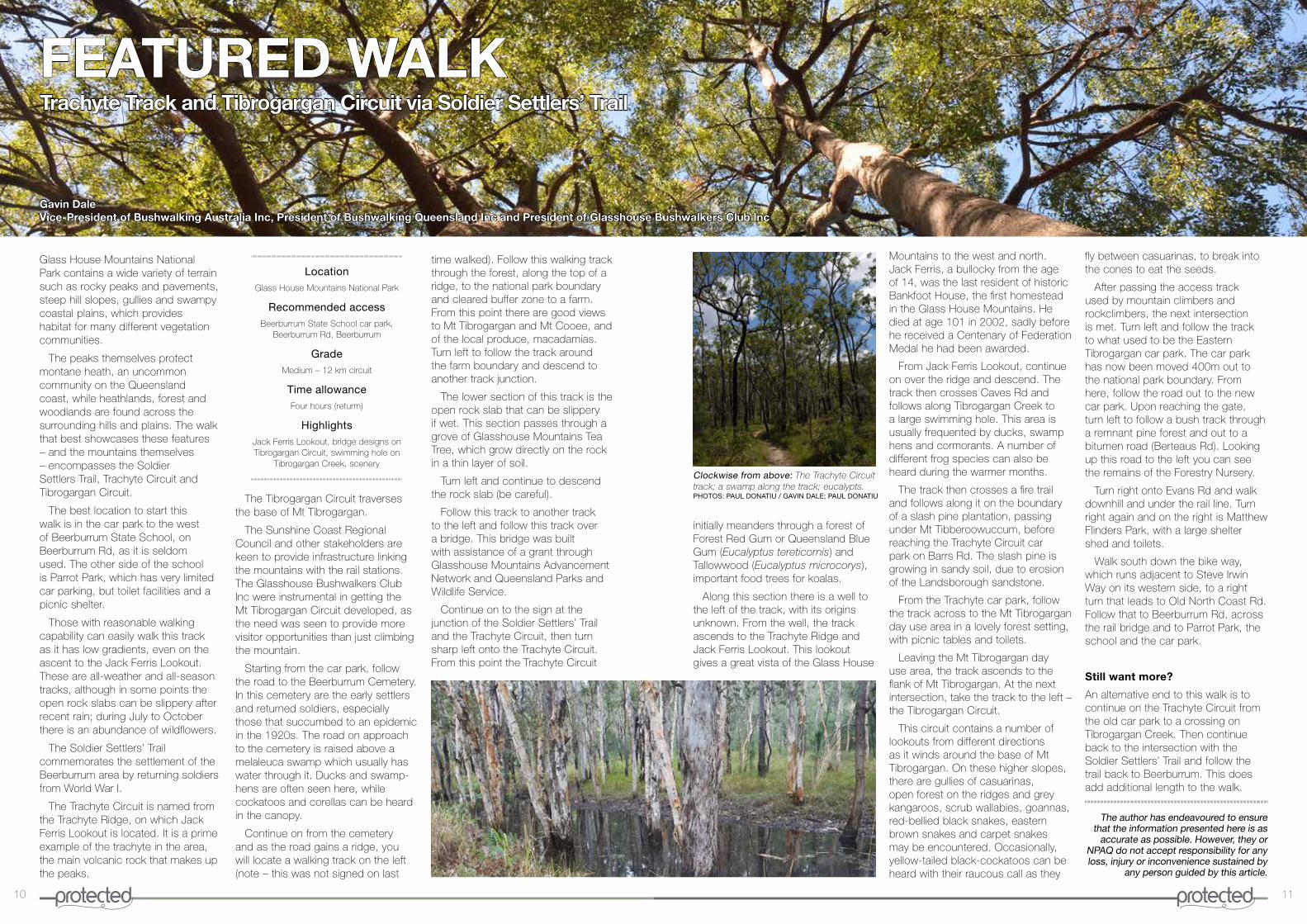
National parks play a critical role in protecting Queensland’s native plants and animals, but they are strongly affected by what happens outside their boundaries� At the moment, woodlands and forests outside national parks are suffering from ‘death by a thousand cuts’�
Continued incremental clearing of both remnant and regrowth (regrowing) vegetation for agricultural, urban, mining and infrastructure developments has put Queensland on a trajectory of relentless loss of forests� We need to deal with what happens inside and outside protected areas to ensure that national parks can fulfil their role of permanently conserving Queensland’s rich biodiversity within natural ecosystems�
Loss of woodlands and forests has many ramifications for Queensland’s ecosystems and for its people� Recent research by The University of Queensland has reviewed the ecological effects of land-clearing on native species and ecosystems1/2� Land-clearing is directly implicated as a threatening process for 97 out of 121 threatened terrestrial fauna species in Queensland�
These include birds such as the regent honeyeater, southern cassowary and black-throated finch; mammals such as the koala, bridled nailtail wallaby and Proserpine rock wallaby; and reptiles such as the grey snake and Nangur skink� Plants are also threatened, particularly in heavily-cleared bioregions such as the Brigalow Belt�
Tree-clearing doesn’t only affect native species living on the land� Loss of trees and outputs from replacement land uses result in hotter water temperatures and increases in
where trees also buffer waterways against sedimentation and hotter water temperatures� To this end, we need to win the hearts and minds of Queensland’s rural, urban and business communities�
At present there seems to be an increasing clash between economic growth and nature conservation – one in which economic growth nearly always wins out� To move forward, we must explore different ways to raise awareness of the essential benefits of forests and woodlands for biodiversity and human well-being� These may include regulation, incentives or income opportunities from carbon farming8 or wildlife protection, and building knowledge of human dependency on our complex natural world�
It has been a sobering lesson over recent years that protection, even enshrined in legislation, does not guarantee nature conservation; for instance, in Queensland in 2013, changes to the management of some national parks allowing commercial recreation opportunities and supplementary grazing� While some of these decisions have been reversed, they have impacted on parks’ primary role: conservation of native species, particularly threatened species (Protected, Feb-March 2015 and Apr-May 2017)�
Strong native vegetation management laws introduced in 2004 were reversed in 2013� As a result, annual clearing was five times higher in 2015 than in 2011 (rising from 58,000ha to 295,000ha)� Although there was an attempt in 2016 to reintroduce clearing controls, these failed to pass by one vote�
Unless we can bring the
sediment and nutrient loads, which in turn threatens freshwater and marine ecosystems� Queensland’s iconic and World Heritage-listed fringing reefs are known to be severely affected by increased sediment loads and decreased water quality�
Ongoing land clearing in river catchments such as the Burnett Mary, Mackay Whitsunday and Fitzroy means they are failing to come close to meeting their sediment reduction targets3� This largely undermines the $375 million dollars spent by state and federal governments, mainly to improve water quality in the Great Barrier Reef Marine Park�
At its 41st annual meeting in July 2017, UNESCO’s World Heritage Committee stated that water quality targets were unlikely to be achieved within the agreed timeframe, in part because “important legislation regulating land clearing has not been passed yet”4�
A recent report by Deloitte Access Economics valued the economic, social and icon assets of the Great Barrier Reef at $56 billion dollars5 – no
small amount to be jeopardised due to short-sighted government policies�
Finally, loss of trees wherever in Queensland potentially affects the whole state – ecosystems, businesses and people – through its contribution to global and regional climate change� Regionally, trees not only cool surface temperatures through evapotranspiration but also contribute to cloud formation and increased rainfall� Tree clearing releases carbon dioxide and also decreases potential carbon sequestration, contributing to global climate change�
Keeping native woodlands, and indeed increasing their area through natural regrowth, would benefit Queensland’s native wildlife and plants, as well as the well-being of its people in the future�
Expansion of the national park estate, in areas where conservation values are high, and have resilience to climate change, is one way to protected the ever diminishing forests and woodland� For example, conversion of State Forests to National Parks, could increase representation of key forests and woodlands that are currently not or
under-represented, to begin filling this gap�
Although we cannot be 100 per cent sure of the effects of climate change on species’ survival, and some may adapt to changing conditions better than others, we must allow room for species to move in response to hotter and mostly drier conditions�
Modelling species distribution in response to climate change indicates that species will move towards the coasts and also towards the south to maintain suitable environmental conditions6/7� Future expansion of national parks needs to take into account suitable prospective habitat along dispersal paths� This requires strategic spatial planning at a regional level using a ‘whole of government’ approach to identify where to target for protection and to make sure that development does not continually whittle this away�
It is also vital to keep and/or restore significant areas of habitat outside national parks� This includes maintaining connectivity along primary movement paths and taking advantage of features such as stock routes, creeks and rivers,
References1 Reside, A�, Beher, J�, Cosgrove, A�J�, Evans, M�C�, Seabrook, L�, Silcock, J�L�, Wenger, A�S� and Maron, M� (2017)� Ecological consequences of land clearing and policy reform in Queensland� Pacific Conservation Biology� http://dx�doi�org/10�1071/PC17001
2 Reside, A�, Cosgrove, A�J�, Silcock, J�L�, Seabrook, L�, and Evans, M�C� (2017)� Land clearing on the rise as legal ‘thinning’ proves far from clear-cut� The Conversation� https://theconversation�com/land-clearing-on-the-rise-as-legal-thinning-proves-far-from-clear-cut-79419
3 Deloitte Access Economics (2017)� At what price? The economic, social and icon value of the Great Barrier Reef� https://www2�deloitte�com/au/en/pages/economics/articles/great-barrier-reef�html
4 UNESCO World Heritage Committee WHC/17/41�COM/7B�Add p�24� http://whc�unesco�org/archive/2017/whc17-41com-7BAdd-en�pdf
5 Great Barrier Reef Report Card 2015� www�reefplan�qld�gov�au/measuring-success/report-cards/2015/assets/report-card-2015-catchment-pollutant-loads-results�pdf
6 Maggini, R�, Kujala, H�, Taylor, M�, Lee, J�, Possingham, H�, Wintle, B� and Fuller R� (2013)� Protecting and restoring habitat to help Australia’s threatened species adapt to climate change� https://www�nccarf�edu�au/publications/habitat-australias-species-adapt-climate
7 Butt, N�, Pollock, L�J� and McAlpine, C� (2013)� Eucalypts face increasing climate stress� Ecology and Evolution� 3:5011-5022� http://onlinelibrary�wiley�com/doi/10�1002/ece3�873/full
8 Evans, M�C�, Carwardine, J�, Fensham, R�J�, Butler, D�W�, Wilson, K�A�, Possingham, H�P�, Martin, T�G�, 2015� Carbon farming via assisted natural regeneration as a cost-effective mechanism for restoring biodiversity in agricultural landscapes� Environmental Science & Policy 50, 114-129� www�sciencedirect�com/science/article/pii/S1462901115000222
Clockwise from bottom left: Koalas are among species badly affected by widespread land-clearing within Queensland; examples of landscapes around the state following deforestation.
PHOTOS: LEONIE SEABROOK; SUPPLIED
Leonie Seabrook, School of Earth & Environmental Sciences, The University of QueenslandApril Reside, Centre for Biodiversity & Conservation Science, School of Biological Sciences, The University of Queensland
DEATH BY ATHOUSAND CUTSThe consequences of increased tree clearing in Queensland
community (and by default their political representatives) on board, Queensland runs the risk of even higher rates of clearing – keeping it on par with countries such as Brazil and Indonesia as a global clearing hotspot�

8 9
including all main peaks, was put forward by NPAQ’s founder, Romeo Lahey, to protect populations of wildflowers around Brisbane as members and the general public were noticing a substantial decline�
The consistent efforts put forward by NPAQ finally paid off in 1954 as the Glass House Mountains National park was gazetted in order to conserve the biodiversity and integrity of the unique flora and fauna within a fragmented landscape and attempt to maintain the pristine nature of the area�
Today the park protects 3037ha including the Glass House Mountains and surrounding landscape1/2�
Landscape features
The 13 mountainous intrusions that form the Glass House Mountains are an excellent example of an eroded central volcano complex and were created from a series of volcanic eruptions approximately 24-27 million years ago2/3�
These spectacular mountains were formed from masses of molten rock, solidifying into hard trachyte and rhyolite� Subsequent erosion of surrounding softer sandstone resulted in a lowering of the land surface and the removal of the exterior of the volcanic cones, further exposing the peaks we see today�
The park is a very popular destination� However, Queensland Parks and Wildlife Service staff work hard to limit visitor impacts and conserve the natural environment�
Visitors should be aware of the importance of maintaining this landscape, leaving no traces behind – coming away with only good memories and photographs�
The picturesque Glass House Mountains National Park is about 60km north of Brisbane and the mountains can be seen for miles around, including from Moreton Bay, where the first European sighting was documented in 1770 by James Cook aboard the Endeavour, who named them the ‘Glass Houses’1�
Being so close to Brisbane and coastal townships, the national park is a popular tourist destination and the surrounding area has endured high levels of land change for forestry, quarrying and soldier resettlement after World War I, along with ever-increasing threat of urban expansion�
From 1930, the National Parks Association of Queensland (NPAQ) campaigned tirelessly for the gazettal of all main peaks that make up the Glass House Mountains to be protected as national park�
A proposal of 15,000 acres,
Fauna and flora
Thanks to the diverse and fertile range of landforms and regional ecosystems within the national park, it provides prime habitat to a wide range of vegetation communities�
From the peaks that protect rare montane heath, to the swampy coastal plains, steep hills, forest and woodland, there is prime habitat for 23 plant species deemed significant to conservation� Sixteen of these plant species are listed as endangered, vulnerable or near threatened within the Nature Conservation (Wildlife) Regulation 2006 and a further seven, due to restricted distribution, are of conservation interest2�
The parks ecosystems provide essential habitat within a fragmented matrix for 21 native animals of conservation significance� These include the vulnerable glossy black cockatoo (Calyptorhynchus lathami) and the peregrine falcon (Falco peregrinus)� There are also the rare green-thighed frog (Litoria brevipalmata) and three vulnerable acid frogs: wallum froglet (Crinia tinnula), Freycinet’s frog (Litoria freycineti) and the wallum sedge-frog (Litoria olongburensis)�
Unfortunately, the park’s fragmentation also leaves it vulnerable to edge effects and pest species infestation� As such, a decrease in native animal populations has been observed within the park; in particular, the whiptail wallaby (Macropus parryi) has seen significant population decrease in recent years2�
Interesting walks and activities
The national park provides a range of outdoor recreation opportunities,
PARK IN F CUS
Lucy HollingsworthNational Parks Association of Queensland (NPAQ) work placement student, The University of Queensland
including walks of varying difficulty and roped sports such as abseiling and rockclimbing2�
The park houses many desirable walks, with grading ranges from 3 to 5 and wheelchair access at Mt Tibrogargan day-use area� The Mt Tibrogargan and Mt Ngungun summit routes provide suitable locations for roped sports, for well-equipped and experienced climbers, while excellent hikes can be had on the Trachyte Circuit, Mt Ngungun track, Mt Beerburrum, Mt Tibrogargan and Wild Horse Mountain� Easier walks within the park consist of the Tibrogargan Circuit and the Western Boundary Walk at the base of Mt Beerwah1/2�
Though the core purpose of national parks is to protect biodiversity, there is the growing realisation that these areas additionally should also be acknowledged for other essential ecological services such as climate change and natural disaster mitigation, water filtration, disease
control and health benefits� Within Glass House Mountains National Park, native vegetation assists in maintaining water quality in major creek systems that flow or drain into the Pumicestone Passage�
These waterways in turn provide essential ecosystems that support fisheries and some of the few local habitats untouched by development�
Indigenous heritage and the arrival of the Europeans
The Glass House Mountains are culturally and spiritually significant to the local Indigenous people� The fertile area once provided abundant resources, with the foothills of the mountains being paces for meetings, ceremonies and trading�
Many ceremonial sites are still present today and the Jinibara, Gubbi Gubbi and Kabi Kabi peoples maintain ongoing spiritual connections to the mighty mountains4�
In 1799, Matthew Flinders was sent to investigate the monoliths that Lieutenant Cook had recorded in 1770, explore the area and climb Mt Beerburrum�
The highest peak, Mt Beerwah, is believed to have been climbed by a non-Indigenous person for the first time in 1840 – when Andrew Petrie and his son scaled it� But the more challenging Mt Coonowrin (or Crookneck) was not ‘conquered’ until 1910 by Henry Mikalsen7�
Today visitors are urged to keep in mind that some mountains are closed to the public and the local Indigenous peoples prefer peaks are not climbed�
Glass House Mountains National Park
References1 Daly, J� and Daly, L�, 2010� Take a Walk in South-East Queensland, Take a Walk Publications, Brisbane January 2009 (reprinted with revisions 2013) pp� 67-77
2 Department of National Parks, Sport and Racing, 2013� Glass House Mountains National Park Management Statement 2013, Queensland Government, Brisbane, available at www�npsr�qld�gov�au/managing/plans-strategies/statements/pdf/glass-house�pdf [viewed 27/11/16]�
3 Wilmott, W�F and N�C� Stevens, N�C�, 1988� Rocks and Landscapes of the Sunshine Coast� Geological Society of Australia
4 Kabi Kabi Traditional Owners, 2016� Our Vision, Our Land, Our People, Our Focus, available online at www�kabikabi�com�au [viewed 30/11/16]�
5 Dudley, N�, Higgins-Zogib, L�, Hockings, M�, MacKinnon, K�, Sandwith, T�, Stolton, S�, 2011� National Parks with Benefits: How Protecting the Planet’s Biodiversity Also Provides Ecosystem Services, The Solutions Journal, Volume 2, Issue 6, Pages 87-95�
6 Meadows, M�, 2015� The Living Rock, the Invention of Climbing in Eastern Australia, Living Rock Press, Rochedale�
Clockwise from top: A panorama of the Glass House Mountains; a rockclimber on the Mt Tibrogargan Caves route; forest at Beerwah.
PHOTOS: RYAN POCKRAN; ANDREW SMITH; NPAQ ARCHIVES
10 11
FEATURED WALK
Gavin DaleVice-President of Bushwalking Australia Inc, President of Bushwalking Queensland Inc and President of Glasshouse Bushwalkers Club Inc
Trachyte Track and Tibrogargan Circuit via Soldier Settlers’ Trail
Glass House Mountains National Park contains a wide variety of terrain such as rocky peaks and pavements, steep hill slopes, gullies and swampy coastal plains, which provides habitat for many different vegetation communities�
The peaks themselves protect montane heath, an uncommon community on the Queensland coast, while heathlands, forest and woodlands are found across the surrounding hills and plains� The walk that best showcases these features – and the mountains themselves – encompasses the Soldier Settlers Trail, Trachyte Circuit and Tibrogargan Circuit�
The best location to start this walk is in the car park to the west of Beerburrum State School, on Beerburrum Rd, as it is seldom used� The other side of the school is Parrot Park, which has very limited car parking, but toilet facilities and a picnic shelter�
Those with reasonable walking capability can easily walk this track as it has low gradients, even on the ascent to the Jack Ferris Lookout� These are all-weather and all-season tracks, although in some points the open rock slabs can be slippery after recent rain; during July to October there is an abundance of wildflowers�
The Soldier Settlers’ Trail commemorates the settlement of the Beerburrum area by returning soldiers from World War I�
The Trachyte Circuit is named from the Trachyte Ridge, on which Jack Ferris Lookout is located� It is a prime example of the trachyte in the area, the main volcanic rock that makes up the peaks�
The Tibrogargan Circuit traverses the base of Mt Tibrogargan�
The Sunshine Coast Regional Council and other stakeholders are keen to provide infrastructure linking the mountains with the rail stations� The Glasshouse Bushwalkers Club Inc were instrumental in getting the Mt Tibrogargan Circuit developed, as the need was seen to provide more visitor opportunities than just climbing the mountain�
Starting from the car park, follow the road to the Beerburrum Cemetery� In this cemetery are the early settlers and returned soldiers, especially those that succumbed to an epidemic in the 1920s� The road on approach to the cemetery is raised above a melaleuca swamp which usually has water through it� Ducks and swamp-hens are often seen here, while cockatoos and corellas can be heard in the canopy�
Continue on from the cemetery and as the road gains a ridge, you will locate a walking track on the left (note – this was not signed on last
time walked)� Follow this walking track through the forest, along the top of a ridge, to the national park boundary and cleared buffer zone to a farm� From this point there are good views to Mt Tibrogargan and Mt Cooee, and of the local produce, macadamias� Turn left to follow the track around the farm boundary and descend to another track junction�
The lower section of this track is the open rock slab that can be slippery if wet� This section passes through a grove of Glasshouse Mountains Tea Tree, which grow directly on the rock in a thin layer of soil�
Turn left and continue to descend the rock slab (be careful)�
Follow this track to another track to the left and follow this track over a bridge� This bridge was built with assistance of a grant through Glasshouse Mountains Advancement Network and Queensland Parks and Wildlife Service�
Continue on to the sign at the junction of the Soldier Settlers’ Trail and the Trachyte Circuit, then turn sharp left onto the Trachyte Circuit� From this point the Trachyte Circuit
initially meanders through a forest of Forest Red Gum or Queensland Blue Gum (Eucalyptus tereticornis) and Tallowwood (Eucalyptus microcorys), important food trees for koalas�
Along this section there is a well to the left of the track, with its origins unknown� From the well, the track ascends to the Trachyte Ridge and Jack Ferris Lookout� This lookout gives a great vista of the Glass House
Mountains to the west and north� Jack Ferris, a bullocky from the age of 14, was the last resident of historic Bankfoot House, the first homestead in the Glass House Mountains� He died at age 101 in 2002, sadly before he received a Centenary of Federation Medal he had been awarded�
From Jack Ferris Lookout, continue on over the ridge and descend� The track then crosses Caves Rd and follows along Tibrogargan Creek to a large swimming hole� This area is usually frequented by ducks, swamp hens and cormorants� A number of different frog species can also be heard during the warmer months�
The track then crosses a fire trail and follows along it on the boundary of a slash pine plantation, passing under Mt Tibberoowuccum, before reaching the Trachyte Circuit car park on Barrs Rd� The slash pine is growing in sandy soil, due to erosion of the Landsborough sandstone�
From the Trachyte car park, follow the track across to the Mt Tibrogargan day use area in a lovely forest setting, with picnic tables and toilets�
Leaving the Mt Tibrogargan day use area, the track ascends to the flank of Mt Tibrogargan� At the next intersection, take the track to the left – the Tibrogargan Circuit�
This circuit contains a number of lookouts from different directions as it winds around the base of Mt Tibrogargan� On these higher slopes, there are gullies of casuarinas, open forest on the ridges and grey kangaroos, scrub wallabies, goannas, red-bellied black snakes, eastern brown snakes and carpet snakes may be encountered� Occasionally, yellow-tailed black-cockatoos can be heard with their raucous call as they
fly between casuarinas, to break into the cones to eat the seeds�
After passing the access track used by mountain climbers and rockclimbers, the next intersection is met� Turn left and follow the track to what used to be the Eastern Tibrogargan car park� The car park has now been moved 400m out to the national park boundary� From here, follow the road out to the new car park� Upon reaching the gate, turn left to follow a bush track through a remnant pine forest and out to a bitumen road (Berteaus Rd)� Looking up this road to the left you can see the remains of the Forestry Nursery�
Turn right onto Evans Rd and walk downhill and under the rail line� Turn right again and on the right is Matthew Flinders Park, with a large shelter shed and toilets�
Walk south down the bike way, which runs adjacent to Steve Irwin Way on its western side, to a right turn that leads to Old North Coast Rd� Follow that to Beerburrum Rd, across the rail bridge and to Parrot Park, the school and the car park�
Still want more?
An alternative end to this walk is to continue on the Trachyte Circuit from the old car park to a crossing on Tibrogargan Creek� Then continue back to the intersection with the Soldier Settlers’ Trail and follow the trail back to Beerburrum� This does add additional length to the walk�
The author has endeavoured to ensure that the information presented here is as
accurate as possible. However, they or NPAQ do not accept responsibility for any loss, injury or inconvenience sustained by
any person guided by this article.
LocationGlass House Mountains National Park
Recommended accessBeerburrum State School car park,
Beerburrum Rd, Beerburrum
GradeMedium – 12 km circuit
Time allowanceFour hours (returm)
HighlightsJack Ferris Lookout, bridge designs on Tibrogargan Circuit, swimming hole on
Tibrogargan Creek, sceneryClockwise from above: The Trachyte Circuit track; a swamp along the track; eucalypts. PHOTOS: PAUL DONATIU / GAVIN DALE; PAUL DONATIU
12 13
Dr Mike OlsenDirector, Landscape Assessment, Management and Rehabilitation Pty Ltd
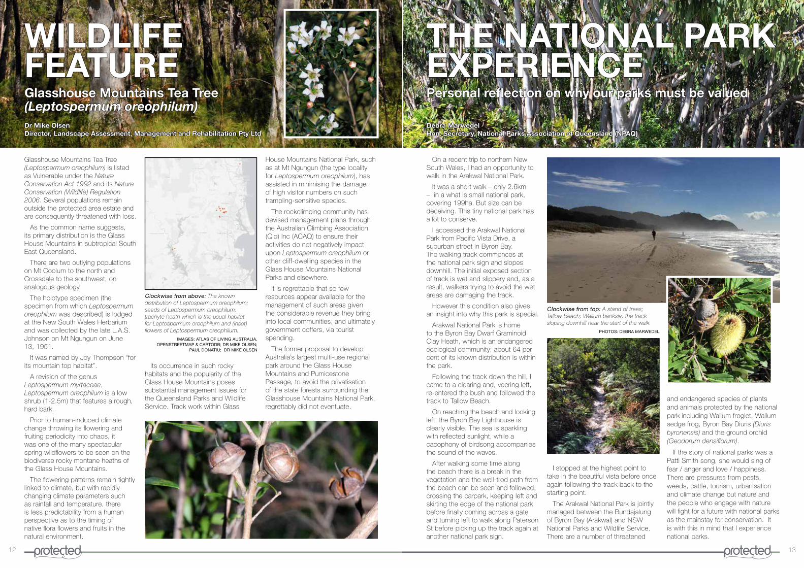
Glasshouse Mountains Tea Tree (Leptospermum oreophilum) is listed as Vulnerable under the Nature Conservation Act 1992 and its Nature Conservation (Wildlife) Regulation 2006� Several populations remain outside the protected area estate and are consequently threatened with loss�
As the common name suggests, its primary distribution is the Glass House Mountains in subtropical South East Queensland�
There are two outlying populations on Mt Coolum to the north and Crossdale to the southwest, on analogous geology�
The holotype specimen (the specimen from which Leptospermum oreophilum was described) is lodged at the New South Wales Herbarium and was collected by the late L�A�S� Johnson on Mt Ngungun on June 13, 1951�
It was named by Joy Thompson “for its mountain top habitat”�
A revision of the genus Leptospermum myrtaceae, Leptospermum oreophilum is a low shrub (1-2�5m) that features a rough, hard bark�
Prior to human-induced climate change throwing its flowering and fruiting periodicity into chaos, it was one of the many spectacular spring wildflowers to be seen on the biodiverse rocky montane heaths of the Glass House Mountains�
The flowering patterns remain tightly linked to climate, but with rapidly changing climate parameters such as rainfall and temperature, there is less predictability from a human perspective as to the timing of native flora flowers and fruits in the natural environment�
Its occurrence in such rocky habitats and the popularity of the Glass House Mountains poses substantial management issues for the Queensland Parks and Wildlife Service� Track work within Glass
House Mountains National Park, such as at Mt Ngungun (the type locality for Leptospermum oreophilum), has assisted in minimising the damage of high visitor numbers on such trampling-sensitive species�
The rockclimbing community has devised management plans through the Australian Climbing Association (Qld) Inc (ACAQ) to ensure their activities do not negatively impact upon Leptospermum oreophilum or other cliff-dwelling species in the Glass House Mountains National Parks and elsewhere�
It is regrettable that so few resources appear available for the management of such areas given the considerable revenue they bring into local communities, and ultimately government coffers, via tourist spending�
The former proposal to develop Australia’s largest multi-use regional park around the Glass House Mountains and Pumicestone Passage, to avoid the privatisation of the state forests surrounding the Glasshouse Mountains National Park, regrettably did not eventuate�
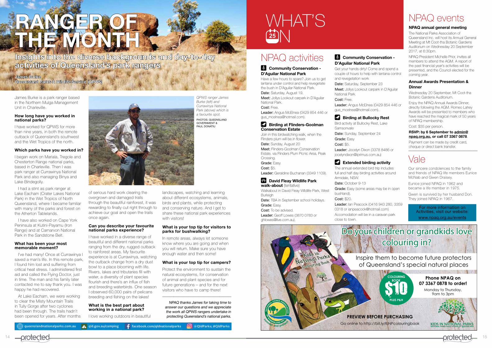
On a recent trip to northern New South Wales, I had an opportunity to walk in the Arakwal National Park�
It was a short walk – only 2�6km – in a what is small national park, covering 199ha� But size can be deceiving� This tiny national park has a lot to conserve�
I accessed the Arakwal National Park from Pacific Vista Drive, a suburban street in Byron Bay� The walking track commences at the national park sign and slopes downhill� The initial exposed section of track is wet and slippery and, as a result, walkers trying to avoid the wet areas are damaging the track�
However this condition also gives an insight into why this park is special�
Arakwal National Park is home to the Byron Bay Dwarf Graminoid Clay Heath, which is an endangered ecological community; about 64 per cent of its known distribution is within the park�
Following the track down the hill, I came to a clearing and, veering left, re-entered the bush and followed the track to Tallow Beach�
On reaching the beach and looking left, the Byron Bay Lighthouse is clearly visible� The sea is sparkling with reflected sunlight, while a cacophony of birdsong accompanies the sound of the waves�
After walking some time along the beach there is a break in the vegetation and the well-trod path from the beach can be seen and followed, crossing the carpark, keeping left and skirting the edge of the national park before finally coming across a gate and turning left to walk along Paterson St before picking up the track again at another national park sign�
WILDLIFEFEATURE
I stopped at the highest point to take in the beautiful vista before once again following the track back to the starting point�
The Arakwal National Park is jointly managed between the Bundajalung of Byron Bay (Arakwal) and NSW National Parks and Wildlife Service� There are a number of threatened
and endangered species of plants and animals protected by the national park including Wallum froglet, Wallum sedge frog, Byron Bay Diuris (Diuris byronensis) and the ground orchid (Geodorum densiflorum)�
If the story of national parks was a Patti Smith song, she would sing of fear / anger and love / happiness� There are pressures from pests, weeds, cattle, tourism, urbanisation and climate change but nature and the people who engage with nature will fight for a future with national parks as the mainstay for conservation� It is with this in mind that I experience national parks�
Clockwise from top: A stand of trees; Tallow Beach; Wallum banksia; the track sloping downhill near the start of the walk.
PHOTOS: DEBRA MARWEDEL
Clockwise from above: The known distribution of Leptospermum oreophilum; seeds of Leptospermum oreophilum; trachyte heath which is the usual habitat for Leptospermum oreophilum and (inset) flowers of Leptospermum oreophilum.
IMAGES: ATLAS OF LIVING AUSTRALIA, OPENSTREETMAP & CARTODB; DR MIKE OLSEN;
PAUL DONATIU; DR MIKE OLSEN
Glasshouse Mountains Tea Tree(Leptospermum oreophilum)
Personal reflection on why our parks must be valued
THE NATIONAL PARK EXPERIENCE
Debra MarwedelHon. Secretary, National Parks Association of Queensland (NPAQ)
14 15
Do your children or grandkids love colouring in?
Phone NPAQ on 07 3367 0878 to order!
Monday to Thursday,9am to 3pm
Inspire them to become future protectors of Queensland’s special natural places
$10PLUS P&H
COLOURING BOOK
PREVIEW BEFORE PURCHASINGGo online to http://bit.ly/KiNPcolouringbook
WHAT’S N
NPAQ activitiesÏ Community Conservation - D’Aguilar National ParkHave a few hours to spare? Join us to get lantana under control and help revegetate the bush in D’Aguilar National Park�Date: Saturday, August 19,Meet: Jollys Lookout carpark in D’Aguilar National Park� Cost: Free� Leader: Angus McElnea (0429 854 446 or gus_mcelnea@hotmail�com)�
Æ Birding at Flinders-Goolman Conservation EstateJoin in this birdwatching walk, when the Flinders plum will be in flower�Date: Sunday, August 20Meet: Flinders-Goolman Conservation Estate, via Flinders Plum Picnic Area, Peak Crossing� Grade: Easy� Cost: $5� Leader: Geraldine Buchanan (3349 1109)�
5 David Fleay Wildlife Park walk-about (tentative)Walkabout in David Fleay WIldlife Park, West BurleighDate: TBA in September school holidays�Grade: Easy� Cost: To be advised� Leader: Geoff Lowes (3870 0783 or ghlowes@live�com�au)�
ValeOur sincere condolences to the family and friends of NPAQ life members Eunice McNab and Gwen Draisey�
Eunice joined NPAQ in 1962 and became a life member in 1975�
Gwen is survived by her husband Don� They joined NPAQ in 1967�
Insights into the diverse backgrounds and day-to-day activities of Queensland’s park rangers
of serious hard work clearing the overgrown and damaged trails through the beautiful rainforest, it was rewarding to finally cut right through to achieve our goal and open the trails once again�
Can you describe your favourite national parks experience?
I have worked in a diverse range of beautiful and different national parks ranging from the dry, rugged outback to rainforest areas� My favourite experience is at Currawinya, watching the outback change from a dry dust bowl to a place blooming with life� Rivers, lakes and tributaries fill with water, a diversity of plant species flourish and there’s an influx of fish and breeding waterbirds� One season I observed 60,000 pairs of pelicans breeding and fishing on the lakes!
What is the best part about working in a national park?
I love working outdoors in beautiful
landscapes, watching and learning about different ecosystems, animals, birds and plants, while protecting and conserving nature� And I get to share these national park experiences with visitors!
What is your top tip for visitors to parks for bushwalking?
In remote areas, always let someone know where you are going and when you will return� Make sure you have enough water and then some!
What is your top tip for campers?
Protect the environment to sustain the natural ecosystems, for conservation of animal and plant species and for future generations – and for the next visitors who have to camp there!
RANGER OFTHE MONTH
James Burke is a park ranger based in the Northern Mulga Management Unit in Charleville�
How long have you worked in national parks?
I have worked for QPWS for more than nine years, in both the remote outback of Queensland’s southwest and the Wet Tropics of the north�
Which parks have you worked in?
I began work on Mariala, Tregole and Chesterton Range national parks, based in Charleville� Then I was park ranger at Currawinya National Park and also managing Binya and Lake Bindegolly�
I had a stint as park ranger at Lake Eacham (Crater Lakes National Park) in the Wet Tropics of North Queensland, where I became familiar with many of the parks and forest on the Atherton Tablelands�
I have also worked on Cape York Peninsula at Kutini-Payamu (Iron Range) and at Carnarvon National Park in the Sandstone Belt�
What has been your most memorable moment?
I’ve had many! Once at Currawinya I saved a man’s life� In this remote park, I found him lost and suffering from critical heat stress� I administered first aid and called the Flying Doctor, just in time� The man and his family later contacted me to say thank you� I was happy he had recovered�
At Lake Eacham, we were working to clear the Misty Mountain Trails in Tully Gorge after two cyclones had been through� The trails hadn’t been opened for years� After months
NPAQ thanks James for taking time to answer our questions and we appreciate the work all QPWS rangers undertake in protecting Queensland’s national parks.
James BurkeQueensland Parks & Wildlife Service (QPWS)
QPWS ranger James Burke (left) and Currawinya National Park (above) which is a favourite spot.
PHOTOS: QUEENSLAND GOVERNMENT & PAUL DONATIU
Ï Community Conservation - D’Aguilar National ParkGet your hands dirty! Come and spend a couple of hours to help with lantana control and revegetation work
Date: Saturday, September 23
Meet: Jollys Lookout carpark in D’Aguilar National Park�
Cost: Free�
Leader: Angus McElnea (0429 854 446 or gus_mcelnea@hotmail�com)�
Æ Birding at Bullocky RestBird activity at Bullocky Rest, Lake Samsonvale
Date: Sunday, September 24
Grade: Easy
Cost: $5�
Leader: Jocelyn Dixon (3378 8486 or jocelyndixon@iprimus�com�au)
Æ Extended birding activityThe annual extended bird trip includes full and half day birding activities around Armidale, NSW�
Date: October 9-13
Grade: Easy (some areas may be in open bushland)�
Cost: $20�
Leader: Ian Peacock (0416 943 280, 3359 0318 or ianpeacock@hotmail�com)
Accomodation will be in a caravan park close to town�
NPAQ eventsNPAQ annual general meetingThe National Parks Association of Queensland Inc� will host its Annual General Meeting at Mt Coot-tha Botanic Gardens Auditorium on Wednesday 20 September 2017, at 6:30pm�
NPAQ President Michelle Prior, invites all members to attend the AGM� A report of the past financial year’s activities will be presented, and the Council elected for the coming year�
Annual Awards Presentation & DinnerWednesday 20 September, Mt Coot-tha Botanic Gardens Auditorium�
Enjoy the NPAQ Annual Awards Dinner, directly following the AGM� Romeo Lahey Awards will be presented to members who have reached the magical mark of 50 years of NPAQ membership�
Cost: $35 per person�
RSVP: by 6 September to [email protected], or call 07 3367 0878�
Payment can be made by credit card, cheque or direct bank transfer�
For more information on Activities, visit our website:www.npaq.org.au/events

16
Selling chunks of national parks to investors for development, undermines the very essence of our national parks - the conservation of nature.
NPAQ has been the voice of Queensland national parks since 1930.
Donate to NPAQ today to protect Queensland’s national parks for tomorrow.
Learn more about the Lindeman Islands National Park proposal at
www.npaq.org.au/campaigns-app/lindeman
Help protect Lindeman Islands National Park
Our national parks are increasingly coming under threat from commercial development.
The State Government is moving away from protectionof nature to revenue generation.
A current proposal would see hectares of land revokedfrom Lindeman Islands National Park to allow multiple luxury resorts
owned by overseas investors.
Stop over-development in the Great Barrier Reef World Heritage Area
DONATE TODAY! Call 07 3367 0878 or visit www.npaq.org.au/donate
LINDEMAN, NATURALLYNATIONAL PARKS ARE TOO PRECIOUS TO LOSE
Image: Nancy Jenks