government should know about - esri€¦ · should know about 7apps esri insert 13 ... donation...
TRANSCRIPT

Esri | Advertising Supplement | 1
TO LEARN MORE ABOUT THE SEVEN APPS THAT ARE LISTED HERE, VISIT WWW.ESRI.COM/7APPS
Digital technology offers local government vast opportunities to extend to their constituents new and better services. Government lead-ers understand the importance of finding
applications with features that stimulate innovation, without taxing the resources of the organization.
With its mapping and location analytics technology already integrated into the operations of large and small communities across the nation, Esri is the leader in Geographic Information Systems (GIS). Based in Redlands, Calif., Esri seeks out start-up companies with innovative approaches to supporting the public sector, just one of its many client services.
“We are actively engaging and supporting academic innovation centers, civic hackers, and the developer community,” says Christopher Thomas, Esri’s direc-tor of government markets. “Once a start-up has a solid offering and business plan, we invite them into our user and partner ecosystem.”
As a partner with local government, Esri often asks leaders how their GIS systems can better support
their operations. One of the most common requests, Thomas says, is assistance in sorting through the vast array of options to find the most suitable apps that will add valuable services to the community without overwhelming their limited resources.
“We’ve identified companies that fill a focused need,” says Thomas. “These are apps that have catapulted right to the forefront of the market. They have risen to the top and are all built on the Esri® ArcGIS® platform.
“We are facilitating the marriage between innovative companies and the government community,” Thomas continues. “The companies we have identified are the shining stars, and we help government to discover them. They are really taking off.”
Esri has looked at the hundreds of applications available to the public sector today and is present-ing the seven that meet the needs of governments and their constituents. The apps Esri has chosen to showcase meet critical issues facing government leaders without adding to their technology staff’s workload.
Government Should Know About
AppsAppsAppsApps7
ESRI insert 13.indd 1 11/25/13 5:42 PM

2 | Advertising Supplement | Esri
TO LEARN MORE ABOUT THE SEVEN APPS THAT ARE LISTED HERE, VISIT WWW.ESRI.COM/7APPS
Esri | Advertising Supplement | 3
With CitySourced, everyday citizens become the eyes and ears of the community, identifying civic issues, such as potholes and graffiti, and reporting them real-time to their government. For officials, CitySourced is an efficient tool to manage services and improve accountability, keeping citizens up-to-date on how their issue is being handled. Using mobile technology, citizens can take photos of public safety, quality of life and environmental issues so government understands the nature of the problem. With GIS, government can identify the exact location of the problem. The ability of CitySourced to integrate into existing systems means government staff doesn’t have to learn a new process or spend extra time updating another system. This also means that IT Depart-ments do not need to get involved or deal with integration headaches.
Recovers provides easy-to-use software for communities that have the foresight to prepare before a disaster strikes and for those that need to bounce back from the destruction. The software connects local leaders with local resources, helping them meet survivor needs. Volunteers and people who would like to donate physical items can find local organizations that need their specific assistance, sign up remotely, receive updates from local lead-ers and change their availability. Disaster survivors can request assistance through their phone messaging or the Recovers web platform, or view updates on aid and locations of distribution centers. Local leaders can manage volunteers, donation items and requests for help throughout response and long-term recovery, especially helpful in the critical first few days after a disaster. Recovers is a 2012 Code for America Accelerator Startup.
Recovers
CitySourced, Inc.
MindMixer gives the vast majority of constituents who do not attend civic meetings the opportunity to raise their voice and be heard through state-of-the-art communication tools. Civic organizations gain the abil-ity to effectively engage with their constituents. Through social media and the web, school systems, cities, hospitals, universities, non-pro� ts and other organizations can keep their audiences actively interested in their issues over time. Studies show that half the U.S. adult population has never attended a public meeting, and participation is often limited to the few who have the time. Now, organizations can use online tools like surveys, idea submission, idea re� nement, voting and interactive budgeting to invite participation and dialogue around important commu-nity topics. MindMixer is a 2012 Code for America Accelerator Startup.
MindMixer1
2
3
ESRI insert 13.indd 2 11/25/13 5:42 PM

2 | Advertising Supplement | Esri
TO LEARN MORE ABOUT THE SEVEN APPS THAT ARE LISTED HERE, VISIT WWW.ESRI.COM/7APPS
Esri | Advertising Supplement | 3
RideAmigos changes the transportation experience for today’s commuters. Users of this app can easily iden-tify the most efficient, quickest and affordable transportation options, i.e. walking, biking, driving, public transit, and carpooling/vanpooling. These modes of commuting are displayed on a virtual dashboard and then are paired with the user based on place of business, final destination, city and region. Each choice displays the cost - time- CO2 - health benefit analysis of each mode. RideAmigos understands that individuals decide on their means of transportation by generally thinking about what their peers are doing, about flexibility in their schedules and about saving money. RideAmigos offers a modern and natural system, where users can actually enjoy their experience and interactions, transforming the gener-ally dreaded commute into something more exciting – being part of change.
OpenCounter eases the permitting process at City Hall so entrepreneurs can get their businesses up and running more quickly and smoothly. Through an on l ine in te r face , OpenCounter asks the right questions, in the right order, so business owners see the requirements, fees and estimated turnaround time for their planned use and location. Unlocking the economic potential of a community’s small busi-
ness community, OpenCounter helps government foster economic development and job creation. For entrepreneurs, OpenCounter reduces delay and complexity in opening their new business and removes duplication in data entry. For governments, OpenCounter improves business community relations, expands economic development activities, deploys planning resources more intelligently, maintains permitting regulations and increases compliance. Open Counter is a 2013 Code for America Accelerator Startup.
OpenCounter
RideAmigos Corp. 4
5
ESRI insert 13.indd 3 11/25/13 5:42 PM
4 | Advertising Supplement | Esri
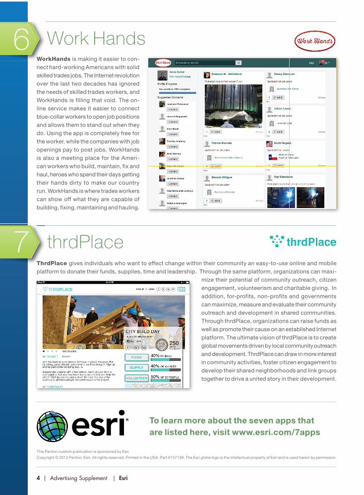
WorkHands is making it easier to con-nect hard-working Americans with solid skilled trades jobs. The Internet revolution over the last two decades has ignored the needs of skilled trades workers, and WorkHands is filling that void. The on-line service makes it easier to connect blue-collar workers to open job positions and allows them to stand out when they do. Using the app is completely free for the worker, while the companies with job openings pay to post jobs. WorkHands is also a meeting place for the Ameri-can workers who build, maintain, fix and haul, heroes who spend their days getting their hands dirty to make our country run. WorkHands is where trades workers can show off what they are capable of building, fixing, maintaining and hauling.
ThrdPlace gives individuals who want to effect change within their community an easy-to-use online and mobile platform to donate their funds, supplies, time and leadership. Through the same platform, organizations can maxi-
mize their potential of community outreach, citizen engagement, volunteerism and charitable giving. In addition, for-profits, non-profits and governments can maximize, measure and evaluate their community outreach and development in shared communities. Through thrdPlace, organizations can raise funds as well as promote their cause on an established Internet platform. The ultimate vision of thrdPlace is to create global movements driven by local community outreach and development. ThrdPlace can draw in more interest in community activities, foster citizen engagement to develop their shared neighborhoods and link groups together to drive a united story in their development.
thrdPlace
Work Hands
This Penton custom publication is sponsored by Esri.
Copyright © 2013 Penton, Esri. All rights reserved. Printed in the USA. Part #137138. The Esri globe logo is the intellectual property of Esri and is used herein by permission.
To learn more about the seven apps that are listed here, visit www.esri.com/7apps
6
7
ESRI insert 13.indd 4 11/25/13 5:42 PM