gps 4 gis joel cusick national park service alaska support office garmin trimble plgr tips, tricks...
Post on 21-Dec-2015
219 views
TRANSCRIPT
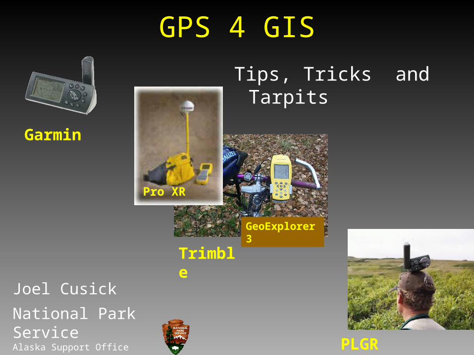
GPS 4 GIS
Joel Cusick
National Park ServiceAlaska Support Office
Garmin
Trimble
PLGR
Tips, Tricks and Tarpits
Pro XR
GeoExplorer 3
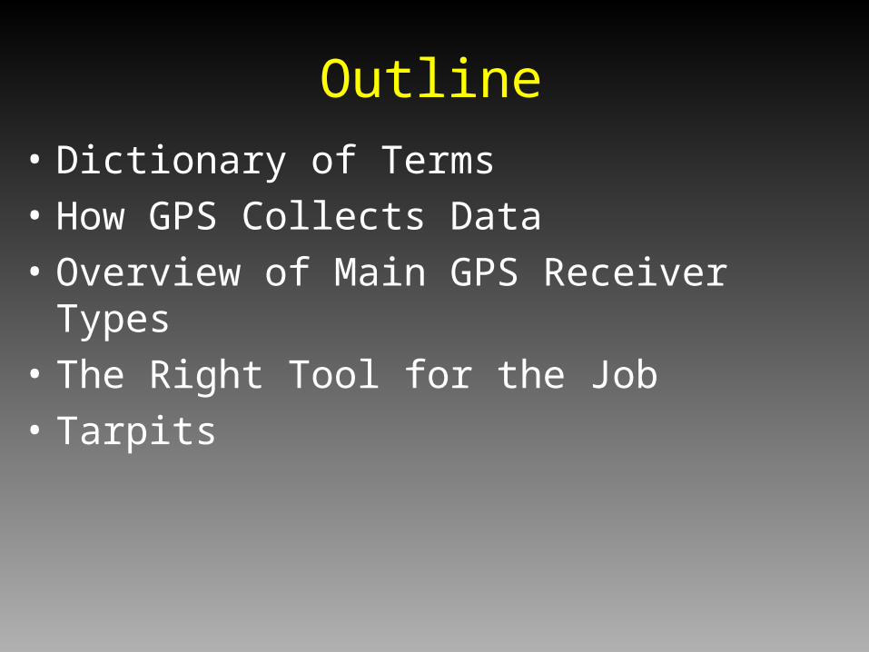
• Dictionary of Terms
• How GPS Collects Data
• Overview of Main GPS Receiver Types
• The Right Tool for the Job
• Tarpits
Outline
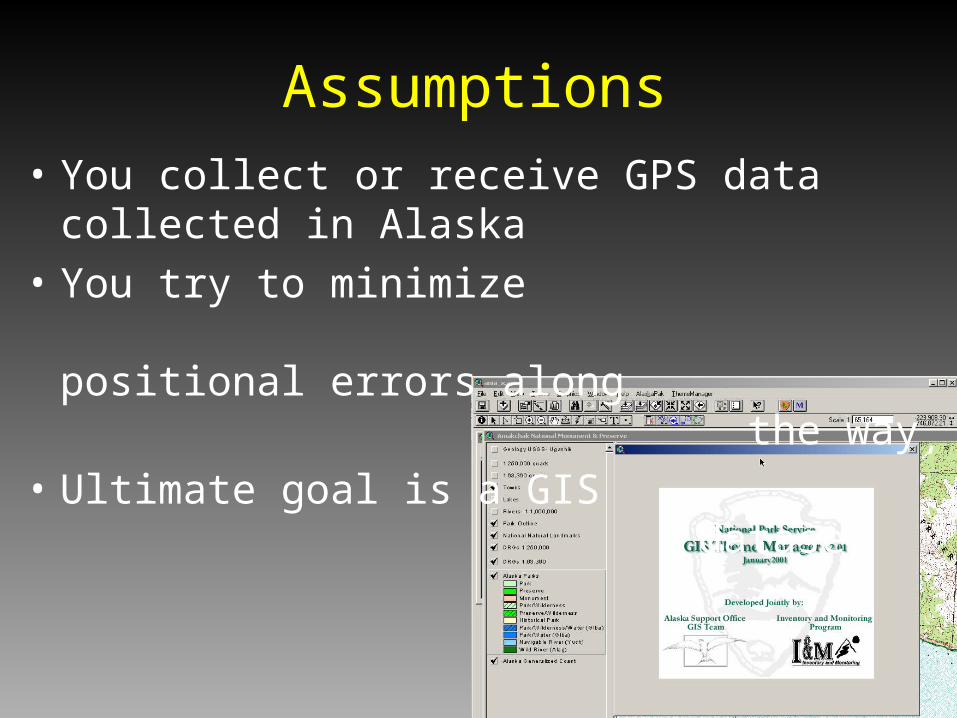
• You collect or receive GPS data collected in Alaska
• You try to minimize positional errors along the way
• Ultimate goal is a GIS dataset
Assumptions
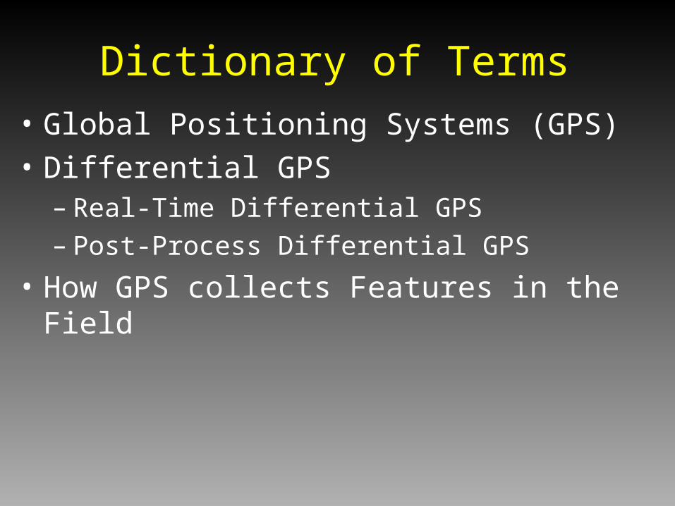
• Global Positioning Systems (GPS)
• Differential GPS– Real-Time Differential GPS– Post-Process Differential GPS
• How GPS collects Features in the Field
Dictionary of Terms

• Tracking a GPS Satellite Vehicle (SV)
• 28 Satellites
• Distance = 12,0000 miles
• Speed = 6000 mph
GPS Space Segment
http://liftoff.msfc.nasa.gov/realtime/jtrack/3d/JTrack3d.html

• Mapping Grade Receivers
• Recreational Grade Receivers
GPS Ground Segment
Garmin
Trimble
Pro XR
GeoExplorer 3

• GPS– Not for navigation anymore
– Since Selective Availability SA was turned off…..
– $300 unit can map at 1:24,000 scale (+/- 12m)• in the open• but not under canopy
Dictionary of Terms
http://www.fs.fed.us/database/gps/ Garmin
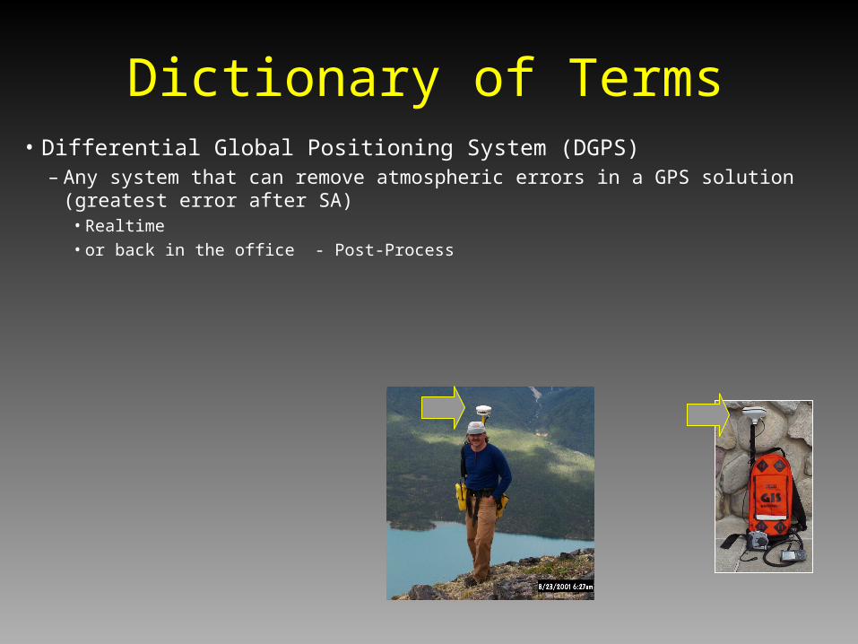
• Differential Global Positioning System (DGPS)– Any system that can remove atmospheric errors in a GPS solution (greatest error after SA)
• Realtime• or back in the office - Post-Process
Dictionary of Terms

• Real Time Differential GPS– CORS BASE Stations– In Alaska - depends on where you are at and how
lucky you are– Dependent on the CORS Network - Gulf of Alaska:
• Hit / Miss
• Not dependable
Dictionary of Terms

• Real Time Differential GPS– WAAS
• Wide Area Augmentation System
• Designed for high flying aircraft
• 2 Geostationary satellites (parked over equator)
• 3 meter solution (if the GPS is enabled)
• Hit / Miss in AK
• Poor under any canopy
Dictionary of Terms
Tip: Other Satellite DGPS systems like StarLink do not cover AK
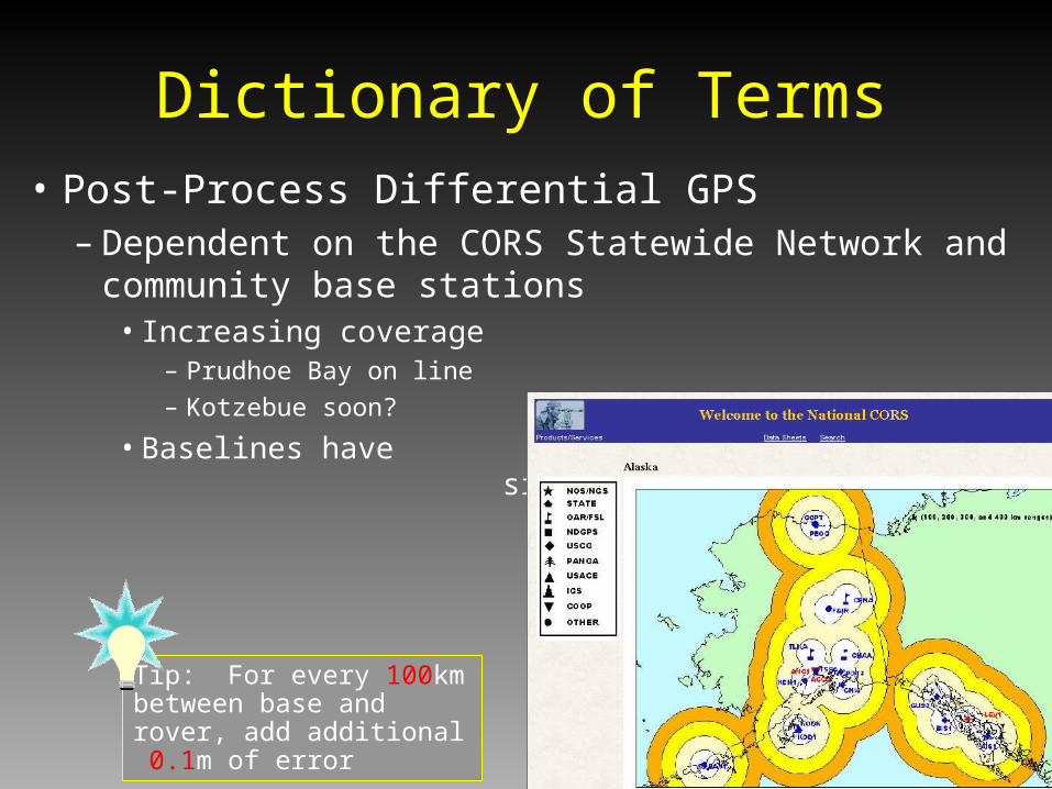
• Post-Process Differential GPS– Dependent on the CORS Statewide Network and community
base stations• Increasing coverage
– Prudhoe Bay on line
– Kotzebue soon?
• Baselines have significantly decreased
Dictionary of Terms
Tip: For every 100km between base and rover, add additional 0.1m of error
• GPS View of the World
Dictionary of Terms
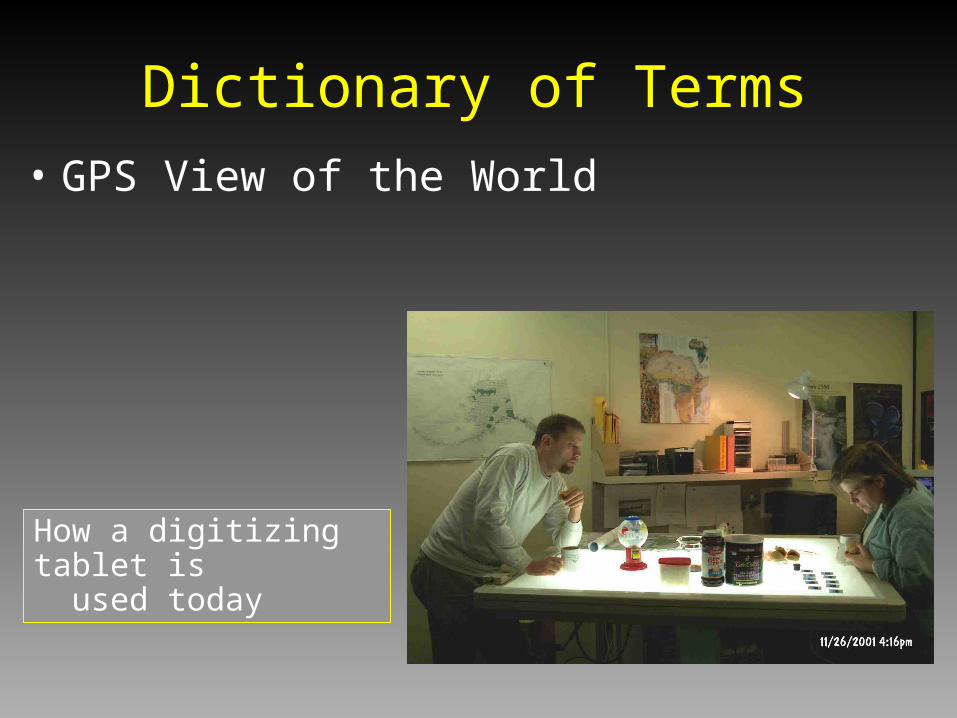
How a digitizing tablet is used today
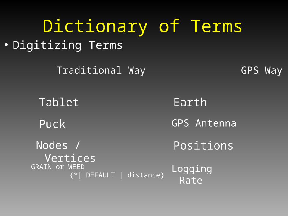
• Digitizing Terms
Dictionary of Terms
Tablet Earth
Traditional Way GPS Way
Puck
Nodes / Vertices
GRAIN or WEED {*| DEFAULT | distance}
GPS Antenna
Positions
Logging Rate
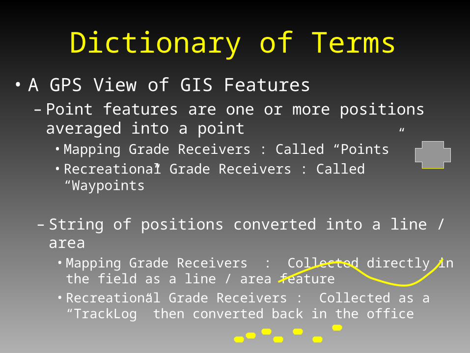
– String of positions converted into a line / area• Mapping Grade Receivers : Collected directly in the field
as a line / area feature
• Recreational Grade Receivers : Collected as a “TrackLog” then converted back in the office
• A GPS View of GIS Features– Point features are one or more positions averaged into
a point• Mapping Grade Receivers : Called “Points”
• Recreational Grade Receivers : Called “Waypoints”
Dictionary of Terms
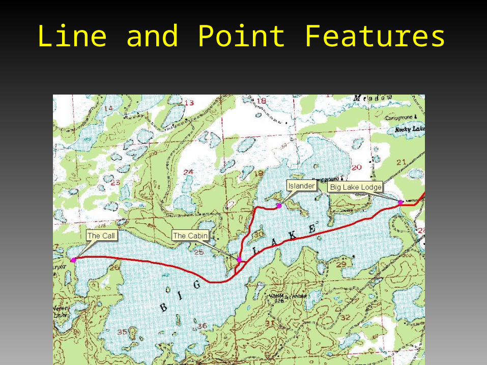
Line and Point Features
Waypoint1N 61 13 9.0W 149 53 28.4
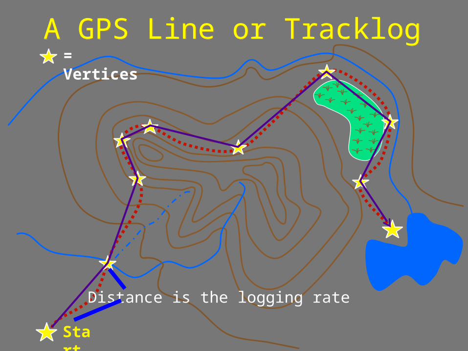
A GPS Line or TracklogA GPS Line or Tracklog
Start
Distance is the logging rate
= Vertices

Collecting Points or Waypoints along the Way
Collecting Points or Waypoints along the Way
Multiple positions averaged into a point

• Hardware
• Software
What a GPS Mapping Receiver Should Do
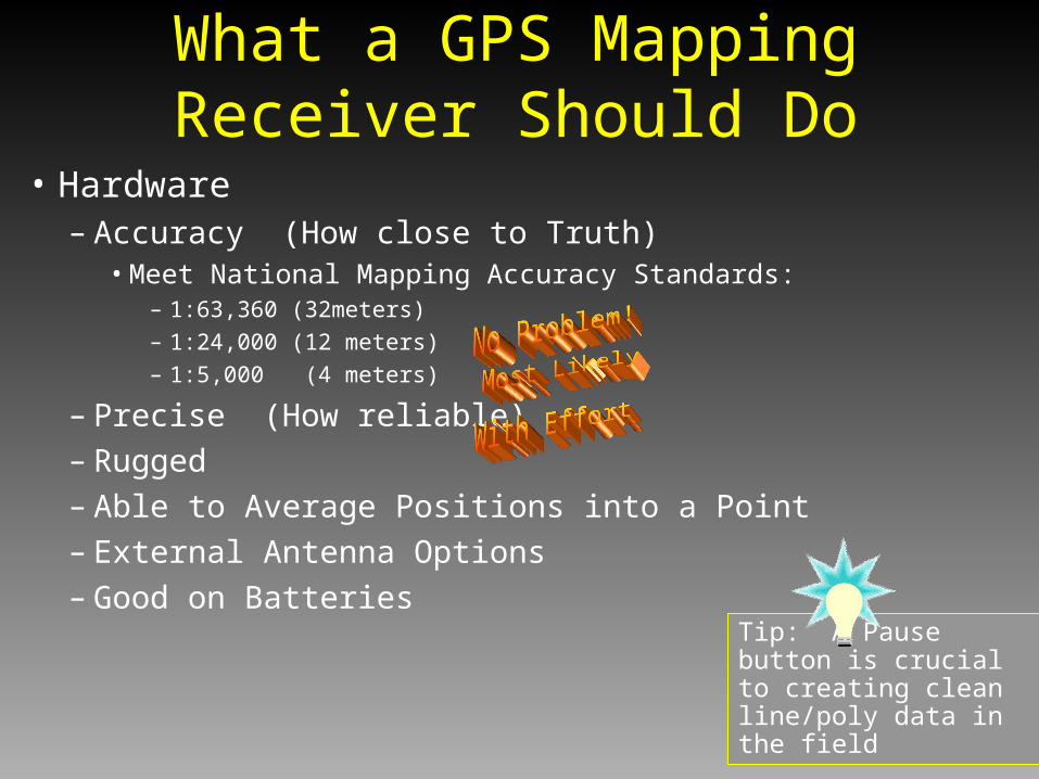
• Hardware– Accuracy (How close to Truth)
• Meet National Mapping Accuracy Standards:– 1:63,360 (32meters) – 1:24,000 (12 meters)– 1:5,000 (4 meters)
– Precise (How reliable)
– Rugged
– Able to Average Positions into a Point
– External Antenna Options
– Good on Batteries
What a GPS Mapping Receiver Should Do
Tip: A Pause button is crucial to creating clean line/poly data in the field

• Software– Export in GIS Friendly Formats (shapes, coverages, DXF)
– Capable of Controlling Attributes in the Field• Data Dictionary (Name, Trail Width, Comments)
– Capable of Datum Transform - To NADCON 27– Mission Planning
• Sky Plots
• Planning the day
– Able to Differentially Correct (Realtime or Post-process)
What a GPS Mapping Receiver Should Do

• Recreational Grade GPS - Garmin
• Mapping Grade GPS - Trimble
• Y-Code Receivers - Rockwell PLGR+96
• GPS/GIS Field Mapping Tools
Overview of Main Types
Nerd Factor
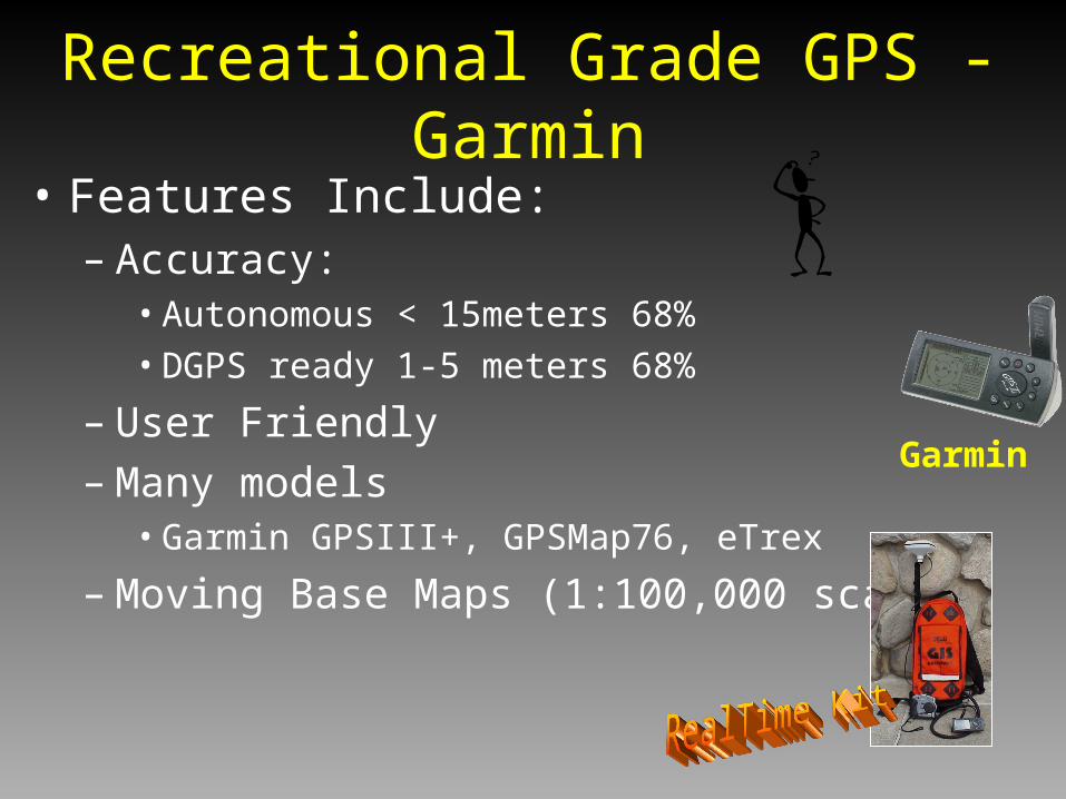
• Features Include:– Accuracy:
• Autonomous < 15meters 68%
• DGPS ready 1-5 meters 68%
– User Friendly– Many models
• Garmin GPSIII+, GPSMap76, eTrex
– Moving Base Maps (1:100,000 scale)
Recreational Grade GPS - Garmin
Garmin

• Features Include:– Accuracy:
• Autonomous < 15meters 68%
• Post-Process DGPS– 3-5 meters 95% (Geo3)
– 1 meter 95% (ProXR)
– Pathfinder Office Software• Data Dictionary, Mission
Planning
Mapping Grade GPS - Trimble
Trimble
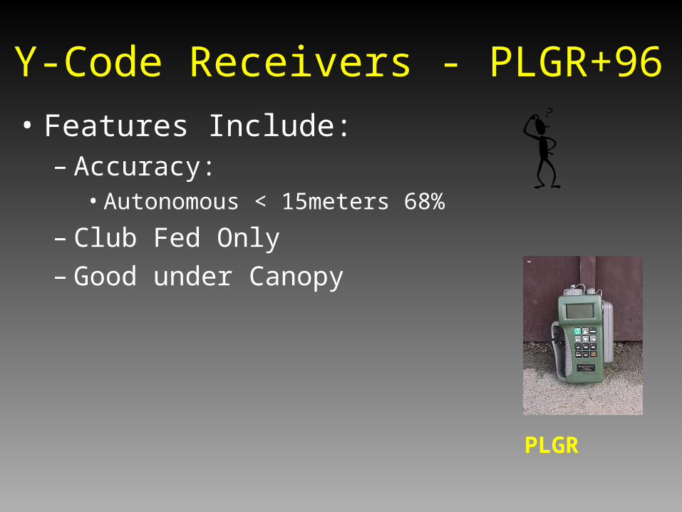
• Features Include:– Accuracy:
• Autonomous < 15meters 68%
– Club Fed Only– Good under Canopy
Y-Code Receivers - PLGR+96
PLGR
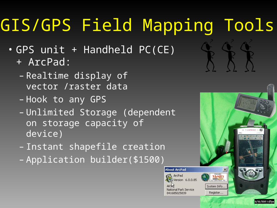
• GPS unit + Handheld PC(CE) + ArcPad:– Realtime display of vector /raster
data– Hook to any GPS– Unlimited Storage (dependent on
storage capacity of device)– Instant shapefile creation – Application builder($1500)
GIS/GPS Field Mapping Tools
Garmin and IPAQ running ArcPad

• Garmin III+– Pros
• Cheap and consistent 15 meters positions - okay under canopy• Good “Point tool”• Fun / easy to use and easy to navigate with• Integration into ArcView - relatively straightforward• Battery usage is great
– Cons• Cheap• No GPS Filters (2D Fixes Given, SNR, PDOP, MASK Angle set to 5)• Position accuracy not recorded• Not designed for GIS Mapping - relies on 3rd party software• No Data Dictionary capability
GPS for GIS - Pros and Cons

• Trimble GeoExplorer 3– Pros
• 2-5 meter mapping tool• Point/Line/Poly Tool• Rugged• Collect data for 16 hours• Exports in coverage or shapefile• Excellent software (Pathfinder Office)
– Cons• Requires additional training• $4000• Under Canopy issues - Velocity filtering / Use Antenna• Need to post-process after the field (internet connection)
GPS for GIS - Pros and Cons

• Trimble Pro XR– Pros
• Top-of-the-line GIS Mapping Tool
• Submeter to 2 meter Tool
• Real-time DGPS
• Point/Line/Poly
• Excellent under Canopy
• Rugged
• Exports in coverage or shapefile
• Excellent software (Pathfinder Office)
– Cons• Requires additional training• $8,000 - $10,000• Big/Bulky
• Need to post-process after the field (internet connection)
GPS for GIS - Pros and Cons
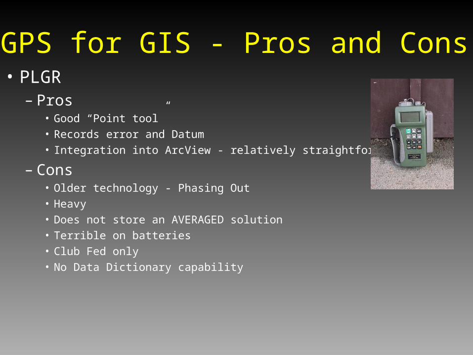
• PLGR– Pros
• Good “Point tool”
• Records error and Datum
• Integration into ArcView - relatively straightforward
– Cons• Older technology - Phasing Out
• Heavy
• Does not store an AVERAGED solution
• Terrible on batteries
• Club Fed only
• No Data Dictionary capability
GPS for GIS - Pros and Cons
GIS/GPS Field Mapping ToolsPros and Cons
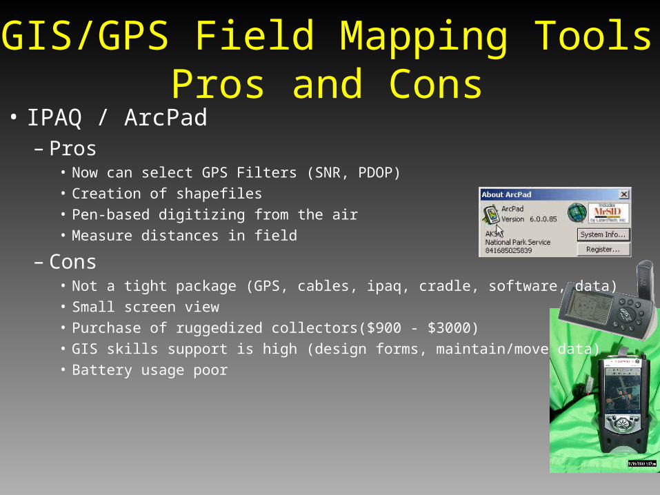
• IPAQ / ArcPad– Pros
• Now can select GPS Filters (SNR, PDOP)
• Creation of shapefiles
• Pen-based digitizing from the air
• Measure distances in field
– Cons• Not a tight package (GPS, cables, ipaq, cradle, software, data)
• Small screen view
• Purchase of ruggedized collectors($900 - $3000)
• GIS skills support is high (design forms, maintain/move data)
• Battery usage poor
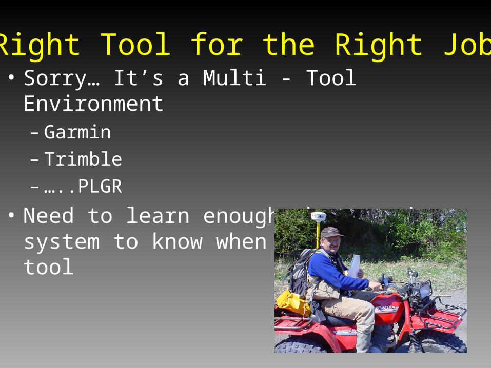
• Sorry… It’s a Multi - Tool Environment– Garmin– Trimble– …..PLGR
• Need to learn enough about each system to know when to use the tool
Right Tool for the Right Job
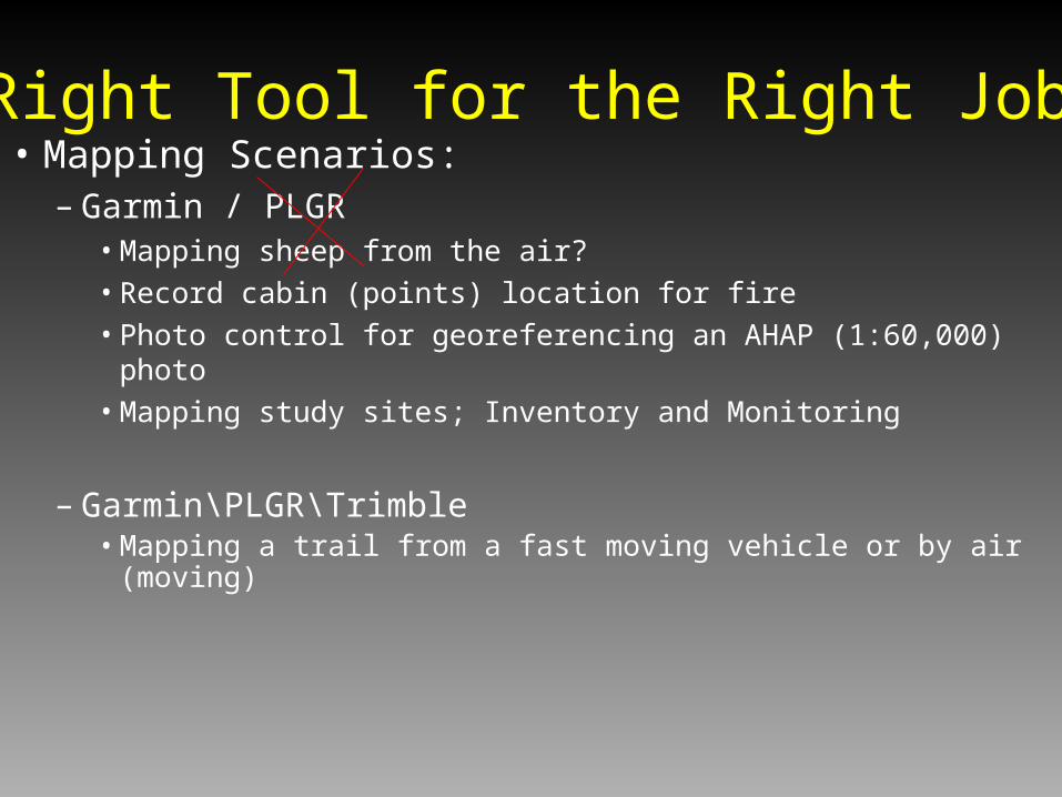
• Mapping Scenarios:– Garmin / PLGR
• Mapping sheep from the air?
• Record cabin (points) location for fire
• Photo control for georeferencing an AHAP (1:60,000) photo
• Mapping study sites; Inventory and Monitoring
– Garmin\PLGR\Trimble• Mapping a trail from a fast moving vehicle or by air (moving)
Right Tool for the Right Job
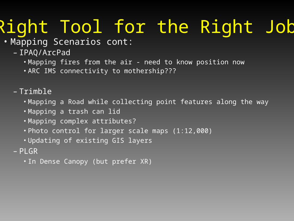
• Mapping Scenarios cont:– IPAQ/ArcPad
• Mapping fires from the air - need to know position now• ARC IMS connectivity to mothership???
– Trimble• Mapping a Road while collecting point features along the way• Mapping a trash can lid• Mapping complex attributes? • Photo control for larger scale maps (1:12,000)• Updating of existing GIS layers
– PLGR• In Dense Canopy (but prefer XR)
Right Tool for the Right Job

• Putting it another Way:– If accuracy is the key...
• Map a SUV - Garmin or PLGR
• Map a small Subaru - Garmin (Average) or Trimble
• Map a bunch of scooters - Trimble and post process
• Map the four corners of an archeology dig (10 meters across)– Pull out the Survey equipment
– If mapping features is the key...• Map a trail network - limited funds, inexperienced personnel - Garmins
• Map a campground - tentpads, sign posts- Trimble
Right Tool for the Right Job

• Ask Yourself
• 1) What are your accuracy needs?– A) resolution of the other data types
– B) anticipated data for the future
• 2) Project Needs– A) What are the crews GIS skills
– B) Is it just you dealing with the data
• 3) What part of Alaska are you working in?
• 4) How much money do you have?
What is Best?
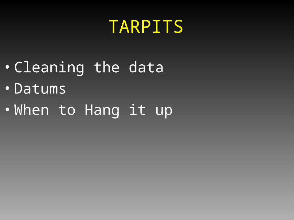
• Cleaning the data
• Datums
• When to Hang it up
TARPITS

QC / Clean Tarpit
• Coverages– Set Precision to Double Double– Check out the data tolerances first -measure distances
between vertices– Watch for places where a GPS was left on and dropped
a bunch of vertices

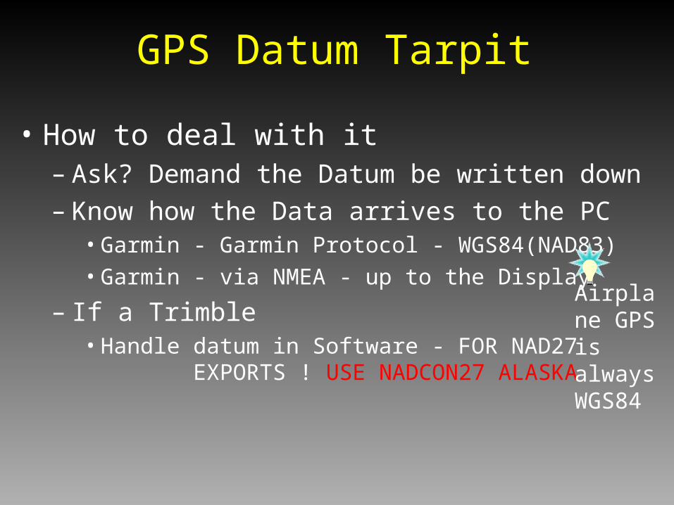
GPS Datum Tarpit
• What’s the big deal– Differences:
• WGS84(NAD83) to NADCON Alaska 27 = 100-150meters• 3parameter NAD27 to NADCON Alaska 27 = 1.5 - 8 meters
– #1 - KNOW the Datum– Accept that 1.5 - 7 meters might not be a big deal
• Depending on the GPS, method of acquisition, scale of base data etc.
– In your mind, switch WGS84 with NAD83
GPS Datum Tarpit
• How to deal with it– Ask? Demand the Datum be written down– Know how the Data arrives to the PC
• Garmin - Garmin Protocol - WGS84(NAD83)
• Garmin - via NMEA - up to the Display
– If a Trimble• Handle datum in Software - FOR NAD27 EXPORTS
! USE NADCON27 ALASKA
Airplane GPS is always WGS84
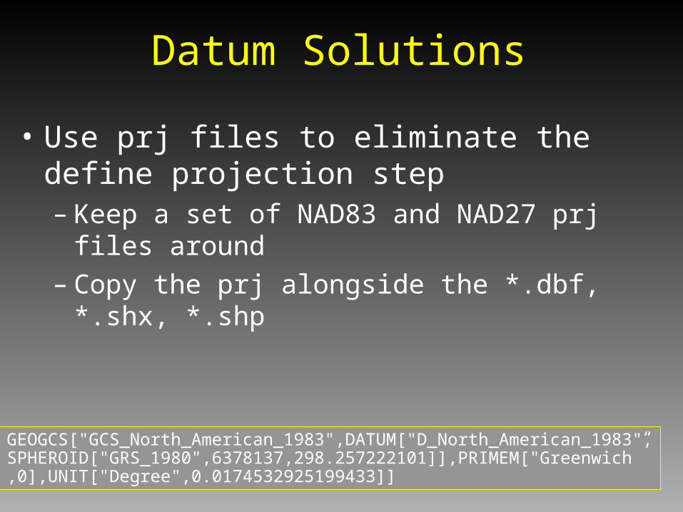
Datum Solutions
• Use prj files to eliminate the define projection step– Keep a set of NAD83 and NAD27 prj files around– Copy the prj alongside the *.dbf, *.shx, *.shp
GEOGCS["GCS_North_American_1983",DATUM["D_North_American_1983",SPHEROID["GRS_1980",6378137,298.257222101]],PRIMEM["Greenwich” ,0],UNIT["Degree",0.0174532925199433]]

GPS Data Tarpits
• When to “Hang it Up”– Effective GPS for GIS purposes requires
• In Super thick canopy or canyons?????
• Attentive field personnel (“A Field Nerd”)
– Mapping may be more efficient by..• remote sensing
• heads-up digitizing
Summary
• GPS not for navigation alone
• Rapidly evolving technology - Migration to Windows CE and mult-tasking environments
• GPS Toolbox may require several tools to get the job done
• Instead of waiting for an updated Map product do it yourself and enjoy the outdoors