gps use in u.s. critical infrastructure and emergency - gps.gov
TRANSCRIPT
GPS Use in U.S. Critical Infrastructure
and Emergency Communications
Presented to the
United States Technical Training Institute (USTTI)
Presenter
Monty Graham
Program Manager GPS Jamming & Interference
NPPD/CS&C/NCC
DOT, DoD, and DHS
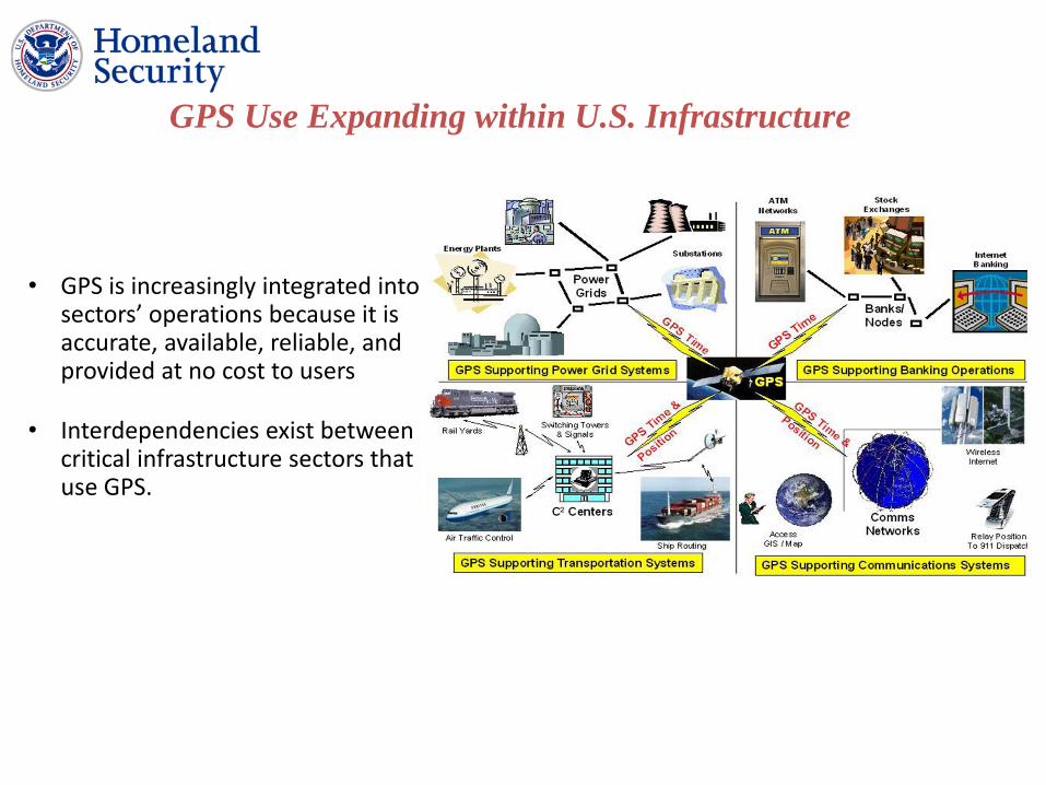
• GPS is increasingly integrated into sectors’ operations because it is accurate, available, reliable, and provided at no cost to users
• Interdependencies exist between critical infrastructure sectors that use GPS.
GPS Use Expanding within U.S. Infrastructure

Civilian GPS Applications Civilian GPS penetration growing / dependencies not well understood

GPS Support to Aviation
• Enables three-dimensional position determination for all phases of flight from departure, en route, and arrival, to airport surface navigation
• NextGen would replace radar tracking with GPS; allow more direct routing that would save time and fuel, and provide more precise data about the distance of one plane from another (Washington Post, 12 Sep 2012)
• Allows more aircraft to fly more favorable and efficient routes, saving time, fuel, and increasing cargo revenue
• Enhanced Ground Proximity Warning System (EGPWS) that has proven successful in reducing the risk of Controlled Flight into Terrain
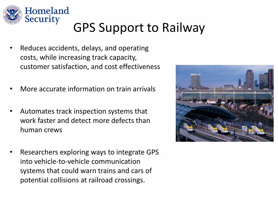
GPS Support to Railway
• Reduces accidents, delays, and operating costs, while increasing track capacity, customer satisfaction, and cost effectiveness
• More accurate information on train arrivals
• Automates track inspection systems that work faster and detect more defects than human crews
• Researchers exploring ways to integrate GPS into vehicle-to-vehicle communication systems that could warn trains and cars of potential collisions at railroad crossings.

GPS Support to Maritime Operations • Search and rescue
• Underwater surveying, buoy placement, and navigational hazard location and mapping.
• Navigate to optimum fishing locations, track fish migrations, and ensure compliance with regulations
• Management of maritime port facilities.
• GPS technology, coupled with geographic information system (GIS) software, is key to the efficient management and operation of automated container
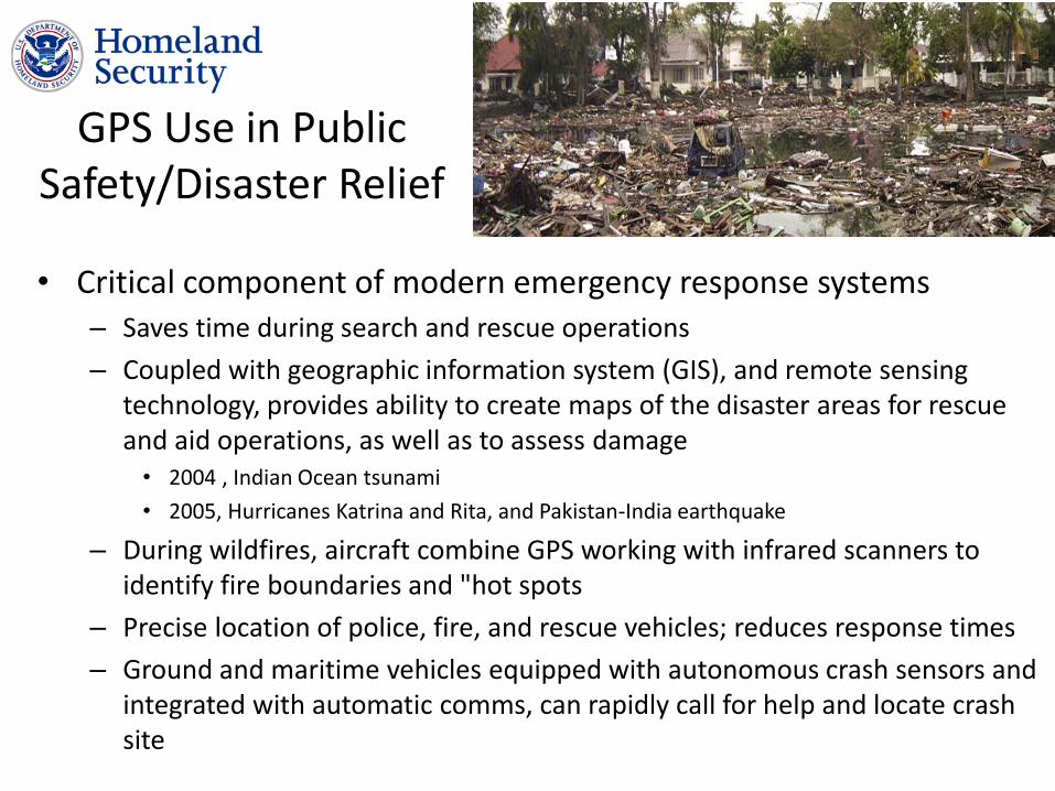
GPS Use in Public Safety/Disaster Relief
• Critical component of modern emergency response systems – Saves time during search and rescue operations
– Coupled with geographic information system (GIS), and remote sensing technology, provides ability to create maps of the disaster areas for rescue and aid operations, as well as to assess damage • 2004 , Indian Ocean tsunami
• 2005, Hurricanes Katrina and Rita, and Pakistan-India earthquake
– During wildfires, aircraft combine GPS working with infrared scanners to identify fire boundaries and "hot spots
– Precise location of police, fire, and rescue vehicles; reduces response times
– Ground and maritime vehicles equipped with autonomous crash sensors and integrated with automatic comms, can rapidly call for help and locate crash site
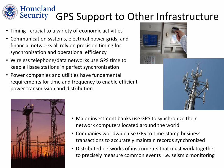
GPS Support to Other Infrastructure • Timing - crucial to a variety of economic activities
• Communication systems, electrical power grids, and financial networks all rely on precision timing for synchronization and operational efficiency
• Wireless telephone/data networks use GPS time to keep all base stations in perfect synchronization
• Power companies and utilities have fundamental requirements for time and frequency to enable efficient power transmission and distribution
• Major investment banks use GPS to synchronize their network computers located around the world
• Companies worldwide use GPS to time-stamp business transactions to accurately maintain records synchronized
• Distributed networks of instruments that must work together to precisely measure common events i.e. seismic monitoring
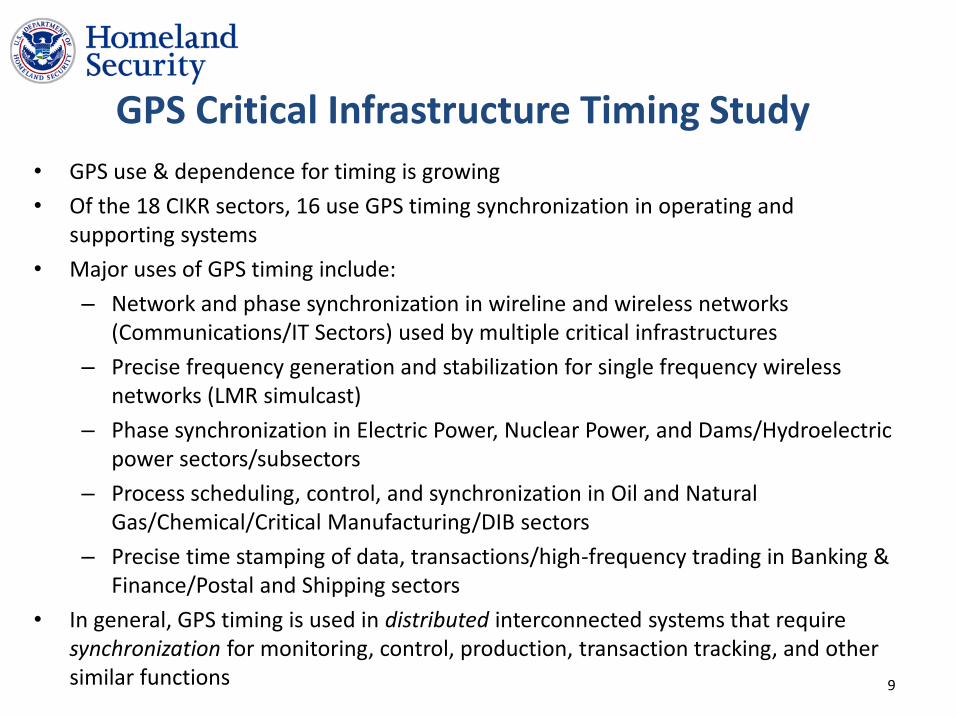
GPS Critical Infrastructure Timing Study
• GPS use & dependence for timing is growing
• Of the 18 CIKR sectors, 16 use GPS timing synchronization in operating and supporting systems
• Major uses of GPS timing include:
– Network and phase synchronization in wireline and wireless networks (Communications/IT Sectors) used by multiple critical infrastructures
– Precise frequency generation and stabilization for single frequency wireless networks (LMR simulcast)
– Phase synchronization in Electric Power, Nuclear Power, and Dams/Hydroelectric power sectors/subsectors
– Process scheduling, control, and synchronization in Oil and Natural Gas/Chemical/Critical Manufacturing/DIB sectors
– Precise time stamping of data, transactions/high-frequency trading in Banking & Finance/Postal and Shipping sectors
• In general, GPS timing is used in distributed interconnected systems that require synchronization for monitoring, control, production, transaction tracking, and other similar functions 9
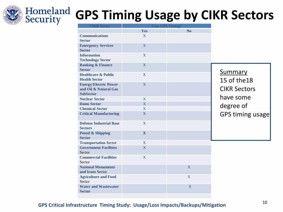
GPS Timing Usage by CIKR Sectors CIKR Sector Uses GPS Timing?
Yes No
Communications
Sector
X
Emergency Services
Sector
X
Information
Technology Sector
X
Banking & Finance
Sector
X
Healthcare & Public
Health Sector
X
Energy/Electric Power
and Oil & Natural Gas
SubSector
X
Nuclear Sector X
Dams Sector X
Chemical Sector X
Critical Manufacturing X
Defense Industrial Base
Sectors
X
Postal & Shipping
Sector
X
Transportation Sector X
Government Facilities
Sector
X
Commercial Facilities
Sector
X
National Monuments
and Icons Sector
X
Agriculture and Food
Sector
X
Water and Wastewater
Sector
X
Summary 15 of the18 CIKR Sectors have some degree of GPS timing usage
GPS Critical Infrastructure Timing Study: Usage/Loss Impacts/Backups/Mitigation 10
Risks/Threats to the GPS Signal
• Unintentional Interference: Includes out-of-band emissions from other radio sources or in-band
emissions from other systems, such as, for example, other satellite navigation systems
• Intentional Jamming: The deliberate drowning out of legitimate Positioning, Navigation, and
Timing, and Frequency (PNTF) signals using higher power signals to cause loss of satellite lock and to prevent reacquisition
Spoofing: The deliberate emitting of legitimate-appearing false signals to shift the computed position or time of a victim’s receiver
• Naturally Occurring Space Weather: Variable conditions on the Sun and the space environment that
can influence the performance and reliability of space and ground based systems.
• o
11
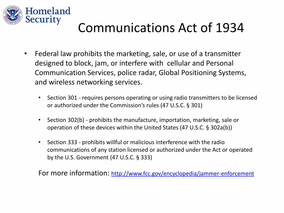
Communications Act of 1934
• Federal law prohibits the marketing, sale, or use of a transmitter designed to block, jam, or interfere with cellular and Personal Communication Services, police radar, Global Positioning Systems, and wireless networking services.
• Section 301 - requires persons operating or using radio transmitters to be licensed or authorized under the Commission’s rules (47 U.S.C. § 301)
• Section 302(b) - prohibits the manufacture, importation, marketing, sale or operation of these devices within the United States (47 U.S.C. § 302a(b))
• Section 333 - prohibits willful or malicious interference with the radio communications of any station licensed or authorized under the Act or operated by the U.S. Government (47 U.S.C. § 333)
For more information: http://www.fcc.gov/encyclopedia/jammer-enforcement

Manned Spaceflight
Impacts from geomagnetic storms are wide-ranging with
potentially significant consequences.
GPS
Satellite Operations
Aircraft Operations (Credit: K. Turnbull / J. Wild / ESA) Power Grid Operations
Geomagnetic Storm Impacts are Wide Ranging
13

Questions?