grand canyon studies: - usgs · pdf fileusgs home. contact usgs. search usgs. pacific coastal...
TRANSCRIPT
USGS Home Contact USGS Search USGS
Pacific Coastal & Marine Science Center
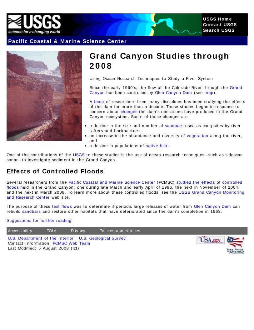
Grand Canyon Studies through2008Using Ocean-Research Techniques to Study a River System
Since the early 1960's, the flow of the Colorado River through the GrandCanyon has been controlled by Glen Canyon Dam (see map).
A team of researchers from many disciplines has been studying the effectsof the dam for more than a decade. These studies began in response toconcern about changes the dam's operations have produced in the GrandCanyon ecosystem. Some of those changes are
a decline in the size and number of sandbars used as campsites by riverrafters and backpackers,an increase in the abundance and diversity of vegetation along the river,anda decline in populations of native fish.
One of the contributions of the USGS to these studies is the use of ocean-research techniques--such as sidescansonar--to investigate sediment in the Grand Canyon.
Effects of Controlled Floods
Several researchers from the Pacific Coastal and Marine Science Center (PCMSC) studied the effects of controlledfloods held in the Grand Canyon; one during late March and early April of 1996, the next in November of 2004,and the next in March 2008. To learn more about these controlled floods, see the USGS Grand Canyon Monitoringand Research Center web site.
The purpose of these test flows was to determine if periodic large releases of water from Glen Canyon Dam canrebuild sandbars and restore other habitats that have deteriorated since the dam's completion in 1963.
Suggestions for further reading
Accessibility FOIA Privacy Policies and Notices
U.S. Department of the Interior | U.S. Geological SurveyContact Information: PCMSC Web TeamLast Modified: 5 August 2008 (lzt)
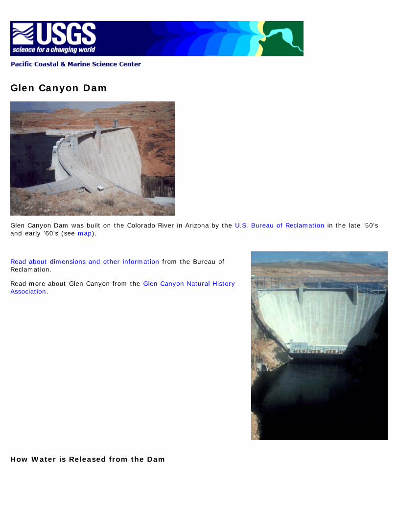
Glen Canyon Dam
Glen Canyon Dam was built on the Colorado River in Arizona by the U.S. Bureau of Reclamation in the late '50'sand early '60's (see map).
Read about dimensions and other information from the Bureau ofReclamation.
Read more about Glen Canyon from the Glen Canyon Natural HistoryAssociation.
How Water is Released from the Dam

Glen Canyon Dam stores and releases water from Lake Powell, which holds about 24.3 million acre-feet. Water canbe released from the dam through the
power plant (up to 33,200 cubic feet per second, or cfs),river outlet works (up to 15,000 cfs), andspillways (208,000 cfs).
In order to maximize energy and revenues, releases have generally not exceeded the 33,200-cfs maximum thatcan flow through the power plant.
Since 1991 (when Interim Operating Criteria were adopted to protect downstream resources pending completion ofenvironmental studies), releases through the power plant have been held at or below 20,000 cfs.
These numbers are exceeded when heavy runoff necessitates releases of extra water, sometimes called floodflows.
Some Spectacular Photographs
Photographs of water being released from Glen Canyon Dam's river outlet works and spillways can be seen atthese sites:
USGS's fact sheet about the controlled flood held during late March and early April of 1996USGS Water Resources of Arizona
For more detail...
Read the following passages, taken from "Operation of Glen Canyon Dam--Colorado River Storage Project,Arizona," a Final Environmental Impact Statement published March 1995 by the U.S. Department of the InteriorBureau of Reclamation:
Powerplant Releases"Glen Canyon Powerplant has eight generators with a maximum combined capacity of 1,356,000 kilowatts.The maximum combined discharge capacity of the eight turbines is approximately 33,200 cfs when LakePowell is full; however, releases during fluctuations are limited to 31,500 cfs. When the reservoir is less thanfull, maximum possible discharge is reduced. Discharge through the turbines is the preferred method ofrelease because electricity and its associated revenue are produced."River Outlet Works Releases"The capacity of the river outlet works is 15,000 cfs. The river outlet works are used when there is a need torelease more water than can be passed through the powerplant. The outlet works are almost always used inconjunction with powerplant releases, producing combined releases up to 48,200 cfs."Spillway Releases"Releases through the spillways bypass both the powerplant and the river outlet works. The combinedcapacity of the right and left spillways is approximately 208,000 cfs. Spillway releases are made only whennecessary to avoid overtopping the dam or to lower the level of Lake Powell. Spillway releases are avoided

whenever possible, not only to prevent powerplant bypasses, but also because the service life of thespillways is shorter than that of the other release structures."
See suggestions for further reading for the sources of information on this page.
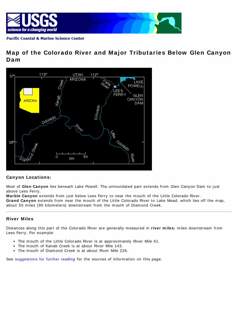
Map of the Colorado River and Major Tributaries Below Glen CanyonDam
Canyon Locations:
Most of Glen Canyon lies beneath Lake Powell. The uninundated part extends from Glen Canyon Dam to justabove Lees Ferry.Marble Canyon extends from just below Lees Ferry to near the mouth of the Little Colorado River.Grand Canyon extends from near the mouth of the Little Colorado River to Lake Mead, which lies off the map,about 55 miles (90 kilometers) downstream from the mouth of Diamond Creek.
River Miles
Distances along this part of the Colorado River are generally measured in river miles: miles downstream fromLees Ferry. For example:
The mouth of the Little Colorado River is at approximately River Mile 61.The mouth of Kanab Creek is at about River Mile 143.The mouth of Diamond Creek is at about River Mile 226.
See suggestions for further reading for the sources of information on this page.


Glen Canyon Environmental Studies: Multidisciplinary Studies of theEffects of Glen Canyon Dam
Upon its completion in 1963, Glen Canyon Dam began altering the physical environment and the wildlife in GlenCanyon, Marble Canyon, and Grand Canyon downstream from the dam (see map).
In 1982, concern about these changes led the U.S. Bureau of Reclamation, which operates the dam, to establishGlen Canyon Environmental Studies, an interagency effort to address two major questions:
1. Are current operations of Glen Canyon Dam, through control of the flows in the Colorado River, adverselyaffecting the environmental and recreational resources of Glen and Grand Canyons?
2. Are there ways to operate the dam, consistent with Colorado River Storage Project water deliveryrequirements, that would protect or enhance those resources?
Agencies cooperating in the studies are the Bureau of Reclamation, National Park Service, Department of Energy'sWestern Area Power Administration, U.S. Geological Survey, U.S. Fish and Wildlife Service, Hopi Tribe, HualapaiTribe, Navajo Nation, and Southern Paiute Consortium, with contributions from Arizona Game and FishDepartment, private consultants, universities, and river guides.
Funding for these studies has been provided mainly from the sale of hydropower.
Experimental controlled floodEnvironmental Impact Statement prepared by U.S. Bureau of Reclamation
See suggestions for further reading for the sources of information on this page.
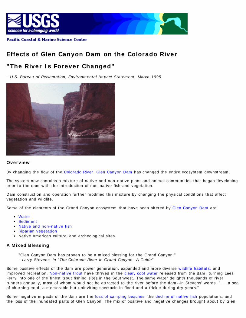
Effects of Glen Canyon Dam on the Colorado River
"The River Is Forever Changed"
--U.S. Bureau of Reclamation, Environmental Impact Statement, March 1995
Overview
By changing the flow of the Colorado River, Glen Canyon Dam has changed the entire ecosystem downstream.
The system now contains a mixture of native and non-native plant and animal communities that began developingprior to the dam with the introduction of non-native fish and vegetation.
Dam construction and operation further modified this mixture by changing the physical conditions that affectvegetation and wildlife.
Some of the elements of the Grand Canyon ecosystem that have been altered by Glen Canyon Dam are
WaterSedimentNative and non-native fishRiparian vegetationNative American cultural and archeological sites
A Mixed Blessing
"Glen Canyon Dam has proven to be a mixed blessing for the Grand Canyon."--Larry Stevens, in "The Colorado River in Grand Canyon--A Guide"
Some positive effects of the dam are power generation, expanded and more diverse wildlife habitats, andimproved recreation. Non-native trout have thrived in the clear, cool water released from the dam, turning LeesFerry into one of the finest trout fishing sites in the Southwest. The same water delights thousands of riverrunners annually, most of whom would not be attracted to the river before the dam--in Stevens' words, ". . .a seaof churning mud, a memorable but uninviting spectacle in flood and a trickle during dry years."
Some negative impacts of the dam are the loss of camping beaches, the decline of native fish populations, andthe loss of the inundated parts of Glen Canyon. The mix of positive and negative changes brought about by Glen
Canyon Dam make it more complicated than one might expect to answer the question posed by Glen CanyonEnvironmental Studies: "Are there ways to operate the dam . . . that would protect or enhance the environmentaland recreational resources?"
Can Controlled Floods Help Restore Natural Resources?
A controlled flood was held in late March and early April of 1996, and again in November 2004, to helpresearchers determine if periodic large releases from Glen Canyon Dam can help restore some of the resourcesand dynamics of a natural river system.
See Suggestions for further reading for the sources of information on this page.

Effects of Glen Canyon Dam on Sediment in the Grand Canyon
Sediment can be considered a basic resource, linked in some way to most of the resources within Glenand Grand Canyons.--"Glen Canyon Dam Beach/Habitat-Building Test Flow," published in January 1996 by the U.S. Bureau ofReclamation.
Aerial view of sandbar used as camping beach along the Colorado River.
Glen Canyon Dam, which controls the flow of the Colorado River through the Grand Canyon, has affected sedimentin the Grand Canyon in a number of ways. Here are three examples:
Loss of Sand from Camping Beaches
Most of the sand that used to be delivered yearly to the Grand Canyon by the Colorado River now gets trappedbehind Glen Canyon Dam.
This drop in sand input, combined with erosive daily flow variations used to meet power demands--variations thathave produced as much as 10-foot differences in daily river levels--has caused a net loss of sand from sandbarsused as campsites along the river.
Buildup of Rapids at Tributary Mouths
The rapids that make the Grand Canyon so popular with white-water rafters are created by debris fans: piles ofrock fragments, from clay size to boulders, that tumble down the tributaries during intense rainfall. Rapids formwhere the debris fans extend into the river and constrict its channel.
Fresh debris fans used to be cleaned out yearly--small fragments flushed away and some boulders moved--bylarge floods of water, commonly reaching 100,000 cubic feet per second (cfs), that flowed through the canyonduring spring snowmelt in pre-dam years.
Glen Canyon Dam dramatically reduced flows through the canyon, which have rarely exceeded about 30,000 cfssince the dam was built. This drop in water flow has reduced the ability of the river to move rock debris attributary mouths. In the absence of floods, there will be a continuing buildup of boulders and smaller rockfragments on many rapids, which could become more dangerous to navigate.
Silting Up of Fish Habitats

Elimination of yearly flooding in the Grand Canyon has also allowed silt to build up in backwater channels used ashabitats by native fish.
Controlled Flood Expected to Redistribute Sediment
A controlled flood was held in the Grand Canyon during late March and early April of 1996, and again in November2004. Researchers hope to find that the flood moved sand from deep pools in the river channel to sandbars alongits banks and flushed silt from backwater channels. The 1996 test flow--45,000 cfs for seven days--may also havemoved boulders from some rapids and made them more navigable.
Scientists from the Western Coastal and Marine Geology team of the U.S. Geological Survey are contributing toresearch on the test flow by studying how it redistributed sand in the river system.
See suggestions for further reading for the sources of information on this page.

Effects of Glen Canyon Dam on Riparian Vegetation in the GrandCanyon
Sandbar at River Mile 55 (55 miles downstream from Lees Ferry) on the Colorado River. The floodflows of 1983eroded the vegetation from this bar, which was still nearly free of vegetation when this photograph was taken inOctober 1987.
Same sandbar in November 1990. In the absence of flooding, vegetation has recolonized the bar.
Before Glen Canyon Dam was built, riparian (near-water) vegetation was scoured from the river banks duringseasonal high flows.
Following dam construction, protection from annual high flows permitted riparian vegetation to develop at lowerelevations in a new zone that provides more than 1,000 acres of additional habitat for native wildlife.
Marshes probably did not occur in Glen and Grand Canyons before dam construction, but now are present andgreatly enhance the plant diversity in the river corridor.
Various plants in the riparian zone and many of the animals supported by it have cultural significance to NativeAmericans.
See suggestions for further reading for the sources of information on this page.


Effects of Glen Canyon Dam on Fish in the Colorado River
Humpback chub
Razorback sucker
Native Fish
Before Glen Canyon Dam was built in the late '50's and early '60's, eight native and several non-native fishspecies inhabited the Colorado River system.
Today,
three native species--the Colorado squawfish, bonytail chub, and roundtail chub--have disappeared from theGrand Canyon,two native species--the humpback chub and razorback sucker--are listed as endangered,one native species--the flannelmouth sucker--is a candidate for listing under the Endangered Species Act,andtwo native species--the bluehead sucker and speckled dace--remain relatively common in tributaries andcertain sections of the river.
The reasons for declines are undoubtedly complex, but principal known factors are competition and predation bynon-native fish, habitat changes, and a fragmented ecosystem brought about by construction and operation ofGlen Canyon Dam.
A controlled flood was held in late March and early April of 1996, and another in November 2004. Researchershope to find that the flood cleaned silt out of backwater channels used as habitats by native fish.
Non-Native Fish
Although coldwater trout species make up the majority of non-native fish in the Colorado River through Glen andGrand Canyons, other species have been introduced through the years.
Anecdotal evidence suggests that channel catfish and carp have been present in the Colorado River system sincethe late 1800's, and sparse pre-dam data (from Glen Canyon only) suggest that warmwater non-nativesdominated natives by the late 1950's.
Since completion of Glen Canyon Dam in 1963, non-native carp and channel catfish have declined, while trouthave increased. In fact, post-dam conditions now support a highly successful rainbow trout fishery in the GlenCanyon reach below the dam.
It is likely that some trout eggs, fry, and young were lost downstream during the controlled flood, a temporaryloss that can be mitigated by restocking.
Related Wildlife
Bald eagles--which only passed through Grand Canyon before the dam--now stop during winter at sites along theriver to feed on spawning trout and fish stranded by fluctuating flows.
See suggestions for further reading for the sources of information on this page.

Sand in the Grand Canyon:Two U.S. Geological Survey Studies
Table of Contents:
BackgroundStudy of sandbar formationStudy of sand distribution on the channel bedAdditional studies
Background
Effects of Glen Canyon Dam
Observers in the Grand Canyon of the Colorado River (see map) have noticed a gradual decline in the size andnumber of sandbars used as camping beaches by river runners and backpackers.
Because most of the sand that was carried yearly to the Grand Canyon by the Colorado River now gets trappedbehind Glen Canyon Dam, many people feared that the sandbars would gradually erode away and never bereplaced.
But the dam also dramatically reduced the magnitude of floods through the canyon, and today's reduced flowmeans that sand is not washed out of the Grand Canyon nearly as fast as before the dam was built.
Sand is still being supplied by undammed tributaries--such as the Paria River, which enters the Colorado River atLees Ferry about 15 miles downstream from Glen Canyon Dam, and the Little Colorado River, whose mouth isabout 60 miles farther downstream from Lees Ferry. This sand may be sufficient to replenish sand lost yearly toerosion.
Can Controlled Floods Rearrange Available Sand?
A controlled flood was held during late March and early April of 1996 to help researchers determine if periodiclarge releases of water from Glen Canyon Dam can rebuild sandbars and restore other habitats that havedeteriorated since the dam's completion in 1963.
Researchers now studying the effects of the controlled flood hope to find that it lifted sand out of deep pools in
the river channel and deposited it on bars along the banks, possibly adding as much as a few feet to sandbars inthe Grand Canyon.
Such redistribution is possible because sand suspended by swiftly flowing water is deposited where thewater slows down.
Water of the main current moving swiftly enough to lift sand from the channel bed slows down where it isdeflected into eddies downstream from natural obstructions, such as debris fans extending from the mouths oftributaries.
The sand deposited in these eddies forms sandbars.
(Return to Table of Contents)
Study of Sandbar Formation
During the Controlled Flood--Watching Sandbars Form
David Rubin, George Tate, and their colleagues used the following equipment to study the formation of sandbarswhile the controlled flood was in progress:
current meters to measure how fast water was flowing in sandbar-building eddies,optical devices to measure how much sediment was suspended in the water, andsidescan sonar to record the migration of sand waves and ripples on the surfaces of sandbars.
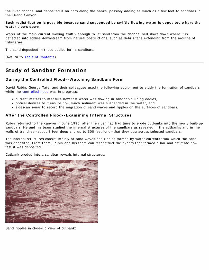
After the Controlled Flood--Examining Internal Structures
Rubin returned to the canyon in June 1996, after the river had had time to erode cutbanks into the newly built-upsandbars. He and his team studied the internal structures of the sandbars as revealed in the cutbanks and in thewalls of trenches--about 3 feet deep and up to 300 feet long--that they dug across selected sandbars.
The internal structures consist mainly of sand waves and ripples formed by water currents from which the sandwas deposited. From them, Rubin and his team can reconstruct the events that formed a bar and estimate howfast it was deposited.
Cutbank eroded into a sandbar reveals internal structures:
Sand ripples in close-up view of cutbank:
How the Sandbar Data Will Be Used
The team's estimates of sedimentation rates will be used to verify models U.S. Geological Survey hydrologists havedeveloped to predict what the river will do to sediment at different flow rates. Such models may eventually beused by the U.S. Bureau of Reclamation to regulate discharges from Glen Canyon Dam.
Detailed descriptions of the sandbars' internal structures will help geologists recognize the remnants of such barsin rocks that formed millions of years ago, enabling them to more accurately reconstruct the geologic histories ofancient rivers.
More Information
Rubin has been studying sandbars in the Grand Canyon for about 20 years. Some publications about his findingsare listed in Suggestions for Further Reading.
(Return to Table of Contents)
Study of Sand Distribution on the Channel Bed
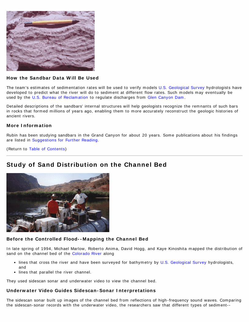
Before the Controlled Flood--Mapping the Channel Bed
In late spring of 1994, Michael Marlow, Roberto Anima, David Hogg, and Kaye Kinoshita mapped the distribution ofsand on the channel bed of the Colorado River along
lines that cross the river and have been surveyed for bathymetry by U.S. Geological Survey hydrologists,andlines that parallel the river channel.
They used sidescan sonar and underwater video to view the channel bed.
Underwater Video Guides Sidescan-Sonar Interpretations
The sidescan sonar built up images of the channel bed from reflections of high-frequency sound waves. Comparingthe sidescan-sonar records with the underwater video, the researchers saw that different types of sediment--

boulders, cobbles, gravel, sand--produced distinctive patterns on the sidescan-sonar records.
The underwater video provided clear footage upstream from the mouth of the Little Colorado River anddownstream to about 7 miles below the Little Colorado (see map). Farther downstream, suspended sedimentbrought in by the Little Colorado and other tributaries made the Colorado River too turbid for useful video footage.
The consistency with which patterns on the sidescan-sonar records could be matched with sediments seen onvideo footage from the clear reaches gave the researchers confidence that sidescan sonar could be used to mapsediment on the channel bed in all the reaches they studied.
Working in Calm Water
Most of the sand on the channel bed rests in deep pools where currents are not swift enough to wash the sandaway. To map this sand, the researchers conducted their surveys in calm pools that form upstream anddownstream from rapids.
The reaches they studied stretch from above North Canyon Rapid at about River Mile 20 (20 miles downstreamfrom Lees Ferry) to above Lava Falls Rapid at about River Mile 179.
After the Controlled Flood--Looking for Changes
Marlow, Anima, and Hogg returned to the river in June 1996. They used sidescan sonar and underwater video tomap the distribution of sediment on the channel bed along the same lines they mapped in 1994.
Comparison of the 1996 map with the 1994 map will show how the test flow redistributed sand on the channelbed and will provide sediment-distribution data for the USGS hydrologists' models. These models may eventuallybe used by the U.S. Bureau of Reclamation to regulate discharges from Glen Canyon Dam.
(Return to Table of Contents)
Additional Studies
The studies described above are just two of many studies of the controlled flood planned by various researchgroups and coordinated by the U.S. Bureau of Reclamation.
For a summary of U.S. Geological Survey studies planned for the controlled flood, see this illustrated fact sheet.
(Return to Table of Contents)
See suggestions for further reading for the sources of information on this page.

Controlled Flood
Can Large Releases of Water Restore Habitats in Grand Canyon?
River runners and other observers in the Grand Canyon of the Colorado River have noticed a decline in the numberand size of sandbars used as campsites--a decline attributed to Glen Canyon Dam, which controls the flow of theColorado through the canyon (see map).
Experimental Flow
The U.S. Bureau of Reclamation, which operates Glen Canyon Dam, released an unusually high flow of waterduring late March and early April of 1996 to see if it could rebuild camping beaches and restore other habitatsthat have deteriorated since the dam's completion in 1963. Two more experimental flows were released inNovember, 2004 and March, 2008.
The water in 1996 was released at a rate of 45,000 cubic feet per second (cfs) from March 26 to April 2, 1996.This discharge, considerably higher than the 33,200-cfs maximum that can flow through the power plant, wasintended as a small analog of larger flooding that was common during spring snowmelts before the dam was built.In 2004, "the dam's bypass tubes were opened for 90 hours, beginning Nov. 21. The peak high flows weresustained for two and one-half days (60 hours) at about 41,000 cubic-feet-per-second." -USGS Water Resourcesof Arizona
Scientists from the Bureau of Reclamation, the USGS, and other Federal and State agencies and academicinstitutions are studying the effects of the test flow, which was expected to rebuild sandbars that providecampsites and clean silt out of backwater channels used by native fish.
Two USGS Studies of Sand Redistribution
Several scientists from the Pacific Coastal and Marine Science Center studied the redistribution of sand by thecontrolled flood. Their results are used to test the validity of theoretical models that USGS hydrologists havedeveloped to predict what will happen to sediment in the river at different flow rates. These models mayeventually be used by the Bureau of Reclamation to regulate the flow of water from Glen Canyon Dam.
A Multidisciplinary Effort
The controlled flood is one result of more than a decade's study of the effects of Glen Canyon Dam on the GrandCanyon ecosystem by a multidisciplinary team coordinated by the Bureau of Reclamation's Glen CanyonEnvironmental Studies.

If the controlled flood is judged successful, such short-duration, high-release flows will probably be incorporatedinto long-term plans for the operation of Glen Canyon Dam, as recommended in an environmental impactstatement, "Operation of Glen Canyon Dam," released in March 1995 by the Bureau of Reclamation.
For more information, see
US Bureau of Reclamation details about Glen Canyon Dam: http://www.usbr.gov/projects/Facility.jsp?fac_Name=Glen+Canyon+DamHow U.S. Geological Survey Pacific Coastal and Marine Science Center scientists studied effects of thecontrolled floodSee suggestions for further reading for the sources of information on this page.

USGS Home Contact USGS Search USGS
Pacific Coastal & Marine Science Center
Grand Canyon Studies
Suggestions for Further ReadingPlease see the USGS Grand Canyon Monitoring and Research Center web site at http://www.gcmrc.gov/
Here are some publications from which you can learn more about the Grand Canyon ecosystem, the effects of GlenCanyon Dam, and the controlled flood held in late March and early April of 1996:
U.S. Department of the Interior, Bureau of Reclamation, March 1995, Operation of Glen Canyon Dam,Colorado River Storage Project, Arizona--Final Environmental Impact Statement, ~425 pages.--On July 27, 1989, the Secretary of the Interior directed the Bureau of Reclamation to prepare anEnvironmental Impact Statement on the effects of Glen Canyon Dam on environmental and culturalresources of the Colorado River in Glen and Grand Canyons. This report is the result. It provides a wealth ofinformation about the Grand Canyon ecosystem and the changes it has undergone since Glen Canyon Damwas built. The report describes a number of alternative ways to operate the dam and the likely effects ofthose alternatives. Much of the information in this set of Web pages comes from this report. U.S. Department of the Interior, Bureau of Reclamation, March 1995, Operation of Glen Canyon Dam--Final Environmental Impact Statement--Summary, 73 pages.--Summary of the report described above. U.S. Department of the Interior, Bureau of Reclamation, March 1995, Operation of Glen Canyon Dam--Final Environmental Impact Statement-- Comments and Responses, 156 pages.--Summary of comments received on the "Operation of Glen Canyon Dam Draft Environmental ImpactStatement" (EIS) and how the final EIS was changed to respond to these comments. Stevens, Larry, 1983, The Colorado River in Grand Canyon--A Guide: Flagstaff, Arizona, Red Lake Books,114 pages.--Comes in a water-resistant version for carrying on river trips. About half of this book consists of maps ofthe Colorado River corridor in the Grand Canyon, showing the location of rapids, commonly used camps,trails near the river, and geologic faults and formations. Captioned photographs in the map margins addinformation about natural and human history in the canyon. The book includes sections on weather andclimate, geology, human history, biology and ecology, and the effects of Glen Canyon Dam. Webb, Robert H., 1996, Grand Canyon, A Century of Change--Rephotography of the 1889-90 StantonExpedition: Tucson, University of Arizona Press, 320 pages.--The author took photographs in the Grand Canyon of the same views and from the same vantage points asphotographs taken a century before. The then-and-now pairs provide striking examples of both change andlack of change in the canyon. David M. Rubin, John C. Schmidt, and Johnnie N. Moore, 1990, Origin, Structure, and Evolution of a

Reattachment Bar, Colorado River, Grand Canyon, Arizona: Journal of Sedimentary Petrology, vol. 60,no. 6, p. 982-991.--Written for a technical audience, this paper describes in some detail the flow processes that producesandbars in eddies, the internal structure of the bars, and the history of a particular bar in the GrandCanyon. Non-geologists will be greatly assisted in their understanding of this paper by the section onSandbars (p. 97-103) in the Final Environmental Impact Statement listed at the top of this page, and byaccess to geologic dictionaries. David M. Rubin, John C. Schmidt, Roberto A. Anima, and others, 1994, Internal Structure of Bars inGrand Canyon, Arizona, and Evaluation of Proposed Flow Alternatives for Glen Canyon Dam: U.S.Geological Survey Open-File Report OF94-594, 56 pages.--Also written for a technical audience, this report describes sedimentary structures of three types ofsandbars along the Colorado River in Grand Canyon. The authors explain the processes that deposit thesandbars, present estimated rates of deposition, and predict how various alternatives proposed for therelease of water from Glen Canyon Dam will affect sandbar deposition in the canyon. An appendix containsnearly 50 explanatory drawings of internal structures revealed in the walls of trenches and pits dug intoselected bars. Northern Arizona University, Dec. 18, 1995, Studies of Colorado River Sandbars (Beaches) in GrandCanyon at Northern Arizona University: http://www4.nau.edu/geology/namdor/ (Web site). Funded bythe Glen Canyon Environmental Studies Program of the Bureau of Reclamation in cooperation with theNational Park Service and Grand Canyon National Park.--Describes the university's ongoing monitoring and study of the effects of Glen Canyon Dam on ColoradoRiver sandbars. Includes photographs and QuickTime movies. U.S. Department of the Interior, Bureau of Reclamation, January 1996, Glen Canyon Dam, Beach/Habitat-Building Test Flow--Draft Environmental Assessment and Draft Finding of No Significant Impact,~75 pages.--The Preferred Alternative for the operation of Glen Canyon Dam proposed in the Final EnvironmentalImpact Statement listed at the top of this page calls for periodic large releases of water, called"Beach/Habitat-Building Flows." The purpose of such flows is to rebuild sandbars and restore other habitatsthat have deteriorated since the dam's completion in 1963. This report helped clear the way for a test flowconducted in late March and early April of 1996 to help researchers determine if Beach/Habitat-BuildingFlows will perform as intended. The report describes expected results of the test flow.
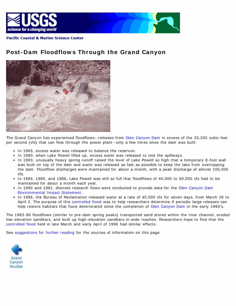
Post-Dam Floodflows Through the Grand Canyon
The Grand Canyon has experienced floodflows--releases from Glen Canyon Dam in excess of the 33,200 cubic feetper second (cfs) that can flow through the power plant--only a few times since the dam was built:
In 1965, excess water was released to balance the reservoir.In 1980, when Lake Powell filled up, excess water was released to test the spillways.In 1983, unusually heavy spring runoff raised the level of Lake Powell so high that a temporary 8-foot wallwas built on top of the dam and water was released as fast as possible to keep the lake from overtoppingthe dam. Floodflow discharges were maintained for about a month, with a peak discharge of almost 100,000cfs.In 1984, 1985, and 1986, Lake Powell was still so full that floodflows of 40,000 to 50,000 cfs had to bemaintained for about a month each year.In 1990 and 1991, discrete research flows were conducted to provide data for the Glen Canyon DamEnvironmental Impact Statement.In 1996, the Bureau of Reclamation released water at a rate of 45,000 cfs for seven days, from March 26 toApril 2. The purpose of this controlled flood was to help researchers determine if periodic large releases canhelp restore habitats that have deteriorated since the completion of Glen Canyon Dam in the early 1960's.
The 1983-86 floodflows (similar to pre-dam spring peaks) transported sand stored within the river channel, erodedlow-elevation sandbars, and built up high-elevation sandbars in wide reaches. Researchers hope to find that thecontrolled flood held in late March and early April of 1996 had similar effects.
See suggestions for further reading for the sources of information on this page.
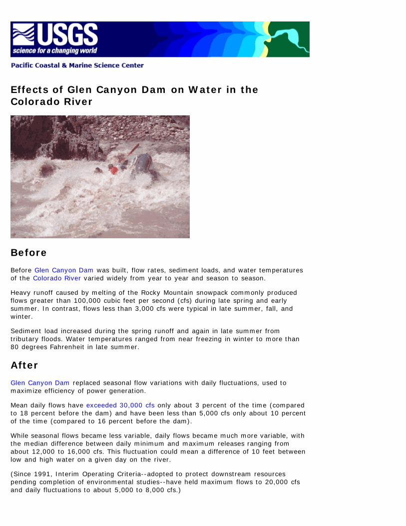
Effects of Glen Canyon Dam on Water in theColorado River
Before
Before Glen Canyon Dam was built, flow rates, sediment loads, and water temperaturesof the Colorado River varied widely from year to year and season to season.
Heavy runoff caused by melting of the Rocky Mountain snowpack commonly producedflows greater than 100,000 cubic feet per second (cfs) during late spring and earlysummer. In contrast, flows less than 3,000 cfs were typical in late summer, fall, andwinter.
Sediment load increased during the spring runoff and again in late summer fromtributary floods. Water temperatures ranged from near freezing in winter to more than80 degrees Fahrenheit in late summer.
After
Glen Canyon Dam replaced seasonal flow variations with daily fluctuations, used tomaximize efficiency of power generation.
Mean daily flows have exceeded 30,000 cfs only about 3 percent of the time (comparedto 18 percent before the dam) and have been less than 5,000 cfs only about 10 percentof the time (compared to 16 percent before the dam).
While seasonal flows became less variable, daily flows became much more variable, withthe median difference between daily minimum and maximum releases ranging fromabout 12,000 to 16,000 cfs. This fluctuation could mean a difference of 10 feet betweenlow and high water on a given day on the river.
(Since 1991, Interim Operating Criteria--adopted to protect downstream resourcespending completion of environmental studies--have held maximum flows to 20,000 cfsand daily fluctuations to about 5,000 to 8,000 cfs.)

The dam greatly reduced the river's sediment load, now supplied only by downstreamtributaries, and resulted in a nearly constant water temperature, averaging a cool 46degrees Fahrenheit year-round.
See suggestions for further reading for the sources of information on this page.