green plot ratio
TRANSCRIPT

8/11/2019 Green Plot Ratio
http://slidepdf.com/reader/full/green-plot-ratio 1/15
Landscape and Urban Planning 63 (2003) 197–211
Green plot ratio: an ecological measure forarchitecture and urban planning
Boon Lay Ong∗
Department of Architecture, School of Design and Environment, National University of Singapore,
4 Architecture Drive, Singapore 117566, Singapore
Received 8 January 2002; received in revised form 23 August 2002; accepted 25 August 2002
Abstract
Current research on sustainability of cities has favoured the implementation and conservation of greenery in the urban
context. The benefits of plants are not just environmental but recreational, aesthetic and emotional. The full benefits of plants
and the role they play in the ecology of cities remain to be mapped out but the general significance of plants appears to
be uncontested. This paper proposes a new architectural and planning metric for greenery in cities and buildings. This new
metric, the green plot ratio (GPR), is based on a common biological parameter called the leaf area index (LAI), which is
defined as the single-side leaf area per unit ground area. The green plot ratio is simply the average LAI of the greenery
on site and is presented as a ratio that is similar to the building plot ratio (BPR) currently in use in many cities to control
maximum allowable built-up floor area in a building development. GPR allows more precise regulation of greenery on site
without excluding a corresponding portion of the site from building development. It provides flexibility to the designer whilesimultaneously protecting the green quota in the design. This concept has been applied in a number of design competitions in
which the author has collaborated with colleagues and various architectural practices. It has also been adopted as a planning
requirement by the client authority for one of the competitions for which the author has entered. While seen as a fundamental
and important metric, GPR is not in itself an indicator for all the ecological relationships between plants and cities. A larger
set of related metrics need to be developed.
© 2002 Elsevier Science B.V. All rights reserved.
Keywords: Green plot ratio; Leaf area index; Ecological masterplanning; Plants; Urban landscape
1. Introduction
One of the key components in the planning of sus-
tainable cities, according to current research, is plants
and planted spaces. Whitford et al., 2001 (abstract), in
developing indicators for the ecological performance
of urban areas in the UK noted that “the greatest in-
fluence on ecological performance was the percentage
of green space, particularly of trees.” The fields of
∗ Tel.: +65-874-3536; fax: +65-779-3078.
E-mail address: [email protected] (B.L. Ong).
landscape ecology and urban ecology have emerged
from research to become the primary advocates of ecological design in cities. While a considerable body
of research has been gathered, problems of integration
and common standards remain to be resolved. Leitao
and Ahern (2002), for example, noted that there are
“literally hundreds of metrics developed” and that
these metrics are “frequently strongly correlated,
and may be confounded” (p. 74). They suggested a
reduced list of 7–9 metrics categorised under two
aspects of landscape planning—composition and con-
figuration. According to Pauliet and Duhme (2000),
0169-2046/02/$20.00 © 2002 Elsevier Science B.V. All rights reserved.
P I I : S 0 1 6 9 - 2 0 4 6 ( 0 2 ) 0 0 1 9 1 - 3

8/11/2019 Green Plot Ratio
http://slidepdf.com/reader/full/green-plot-ratio 2/15
198 B.L. Ong / Landscape and Urban Planning 63 (2003) 197–211
urban ecology in Europe is focused mainly on bio-
logical surveys of habitat and autecological studies.
They proposed the phrase urban metabolism to iden-
tify studies developed around notions of exchangeand transfer of energy and matter. Much current work
is centred on natural habitats in the city: the conser-
vation of existing greenery, and the establishment of
new parklands and other forms of planted landscapes.
The emphasis on vegetation is not unfounded.
Attwell (2000) identified three broad areas in which
plants are useful: environmentally, aesthetically and
recreationally. The last two benefits may be consid-
ered to be incidental, although important—we can
obtain our aesthetic and recreational satisfaction in
many ways, not necessarily with plants. It is the en-
vironmental contribution of plants that is important
to the development of sustainability in our cities and
to our future. This aspect, predictably, is the primary
concern of current researchers. Akbari et al. (2001)
identified, among other benefits, climate modification,
carbon sequestration, ozone reduction (and conse-
quently smog reduction), dry deposition of NOx , O3,
and PM10 particulates, improvement in quality of
life, increased value of landed properties, decreased
rainwater runoff, and protection against floods. In a
paper concerned with the implementation of environ-
mental goals, Jensen et al. (2000) also focused on theenvironmental benefits of plants. In this case, their
environmental goal was identified as the potential of
urban green spaces to contribute to organic waste
recycling, surface runoff infiltration, and biodiversity
improvement. Whitford et al. (2001) identified four
performance indicators also linked with green spaces:
climate, hydrology, carbon storage and sequestration,
and biodiversity.
1.1. Environmental benefits of plants
Specific environmental parameters monitored in
research vary. The indicators identified by Whitford
et al. (2001)—climate, hydrology, carbon storage and
sequestration, and biodiversity—provide a convenient
shortlist. To this list may be added one other—
pollution control (ozone reduction, smog control,
dry deposition of NOx and other gases and small
particulates, and organic waste recycling).
Of these, climate amelioration in terms of overall
temperature reduction and subduing the heat-island ef-
fect has been most widely studied. The primary cause
of heat build-up in cities is insulation, the absorption
of solar radiation by roads and buildings in the city
and the storage of this heat in the building materialand its subsequent re-radiation. Akbari et al. (2001)
advocate the use of ‘cool’ surfaces (surfaces with a
high albedo or reflective index) as a remedy but it
can be demonstrated that planted surfaces are more
effective than even high albedo surfaces in reducing
heat build-up. Building materials, however high their
albedo, absorb heat and store it. Even white surfaces
can become as much as 10 ◦C higher than the ambient
temperature (Akbari et al., 2001, p. 298). Plant sur-
faces however, as a result of transpiration, do not rise
more than 4–5 ◦C above the ambient and are some-
times cooler (Jones, 1992).
The effectiveness of vegetation cover in terms of
controlling rainwater runoff is clearly reflected in
studies by Pauliet and Duhme (2000). The data pre-
sented later (Fig. 1) were extracted from Table 2 of
Pauleit and Duhme’s report and show a clear corre-
lation between percentage vegetation coverage and
surface runoff.
Carbon storage and sequestration are directly corre-
lated to plant metabolism, and photosynthesis in par-
ticular. For the purpose of most of the studies sampled
here, the metrics were based on land area coverage.This is calculated either in terms of actual coverage
(m2) or percentage cover, with a distinction sometimes
made between lawn (grass) and ‘trees and bushes.’
Whitford et al. (2001), for example, use percentage
tree cover as the main determinant of both carbon stor-
age and sequestration in their work.
Pollution control (ozone reduction, smog control,
dry deposition of NOx and other gases and small
particulates, and organic waste recycling) involves
both air-borne and water-borne wastes. In the natural
state, as Lovelock (1989) pointed out, the recyclingof animal waste is the primary resource for plants. He
phrases it neatly (p. 26):
I say that only by pollution do we survive. We an-
imals pollute the air with carbon dioxide, and the
vegetation pollutes it with oxygen. The pollution of
one is the meat of another. Gaia (the planet earth)
is more subtle, and, at least until humans appeared,
polluted this region of the solar system with no more
than the gentle warmth of infrared radiation.

8/11/2019 Green Plot Ratio
http://slidepdf.com/reader/full/green-plot-ratio 3/15
B.L. Ong / Landscape and Urban Planning 63 (2003) 197–211 199
Fig. 1. Relationship between surface runoff and percentage vegetation cover (data extracted from Pauliet and Duhme, 2000, Table 2—data
excluded related to railroads and construction sites, which had porous ground but were devoid of vegetation cover, and waterbodies like
lakes, ponds and streams).
It should be noted that the recycling of resourcesbetween animals and plants has kept the planet in rel-
ative ecological balance for millions, if not billions,
of years. The use of plants to recycle our wastes is
thus, interestingly, a re-engagement with the forces of
natural ecology. The problem here is not the act of re-
cycling itself, but the quantity—we need to adjust our
pollution to levels within the processing limits of the
plants we use.
Conversely, Karlik and Winer (2001) studied bio-
genic emissions of plants that contribute to the pro-
duction of ozone and other photochemical compoundsand hence promote pollution rather than reduce it.
These emissions are characteristic of certain plant
species and the amount emitted is linked to leaf
mass.
Biodiversity is a difficult parameter. While desir-
able, neither a minimum benchmark nor how an ac-
ceptable balance can be achieved manually have yet
been identified. Nature, of course, establishes its own
equilibrium and both enables and requires a high level
of biodiversity to maintain this equilibrium. In the
man-made landscape, it is not clear quantitatively howbiodiversity benefits the human environment. On the
whole, the recommendation is towards greater biodi-
versity and enabling a natural balance as much as pos-
sible. Connections between green patches are useful
in helping animal migration but also increase the risk
of infection and contamination.
It should be noted that the earlier benefits (and dis-
advantages) of plants are dependent primarily on the
extent of leaves or leaf area. In current literature, the
exact species of the plant (with the notable exception
of biogenic emitting plants studied by Karlik andWiner, 2001) and the nature of the landscape (whether
it is a nature reserve or an artificially maintained land-
scape, even agricultural) are generally less critical
than the extent of greenery available. For the purposes
of urban ecological planning, it would appear that
“farmland has much in common with natural ecosys-
tems (Whitford et al., 2001, p. 91).” Such generali-
sations, while patently untrue, are however necessary
and valid when a larger context like cities are being
studied.

8/11/2019 Green Plot Ratio
http://slidepdf.com/reader/full/green-plot-ratio 4/15
200 B.L. Ong / Landscape and Urban Planning 63 (2003) 197–211
Fig. 2. Proposed tropical megacity cooled by plants (source: Tay, 1989).
2. Integration of architecture and greenery
Current literature separates built-up urban areas
from planted landscapes. Underlying the proposals
Fig. 3. An ecological vision of Manhattan greened (source: SITE, Green Architecture and Urbanism, 1990).
set forth by various authors, there is a simple assumed
scenario. The built environment is assumed to be gen-
erally hard and impervious. Against this are planted
landscapes, or greenery, which may be man-made or

8/11/2019 Green Plot Ratio
http://slidepdf.com/reader/full/green-plot-ratio 5/15
B.L. Ong / Landscape and Urban Planning 63 (2003) 197–211 201
wild. The two components—built environment ver-
sus planted landscape—compete for site coverage.
Little distinction is made between the two landscape
typologies—man-made versus wild—except in termsof tree cover. The general recommendation is to en-
courage increased greenery and higher levels of tree
cover and biodiversity.
However, enlightened architects and designers are
looking at ways to incorporate greenery into their de-
signs (Figs. 2 and 3, for example). A new term—
skygardens—has been introduced to refer to planted
landscapes built above the ground: in intermediate
floors of high-rise buildings or at the rooftop (Fig. 4).
How do these new design concepts figure in the met-
rics set-up by current research? Is a roof garden equiv-
Fig. 4. A high-rise residential block designed for the Liuxiancun Ecocity competition which features extensive planting—the entire ground
floor, two skygardens on every three floors which take up two out of a nine-square mandala, and roof garden (GPR = 2:1).
alent to a similar sized garden on the ground? Is a
high-rise building enwrapped by greenery on its roof
as well as facades (Fig. 2) as effective as a mature
tree of similar size? How can we tell? If the incorpo-ration of plants into architecture is somewhat, if not
equally, as effective as greenery on ground, then the
antagonistic face-off between urban ecologists and ar-
chitects/planners/designers may be turned into one of
collaboration.
2.1. Architectural benefits of incorporating
greenery
There are several benefits to incorporating plants
into the building itself. The shade provided by the

8/11/2019 Green Plot Ratio
http://slidepdf.com/reader/full/green-plot-ratio 6/15
202 B.L. Ong / Landscape and Urban Planning 63 (2003) 197–211
plants reduces the cooling load of the building and to
that extent, also helps to reduce the building’s con-
tribution to the urban heat-island effect. Hydrologi-
cal benefits are also derived. Not only do the plantsthemselves capture rain, and the soil on which they
grow help reduce runoff, the remaining rainwater can
be collected for human use within the building. The
plants and growing medium help to sieve and filter
the water so that less of the rain needs to be rejected.
Planted waterbodies can also be designed to help recy-
cle wastewater for reuse within the building. Carbon
storage and sequestration also occur and if harvested
and dried, the plants may be used as fuel. Pollution
control by plants in buildings is not diminished when
compared to greenery planted at ground level. On the
other hand, the capacity of planted spaces in buildings
to support a range of dependent biota is not well estab-
lished. Common wisdom suggests that small animals
are less common the higher the floor is above ground
and that species richness may be reduced because of
isolation of skygardens from the ground.
Beyond this, plants in high-rise buildings also help
to humanise the building and give tenants a stronger
emotional relationship to the ground. If well tended
and healthy, plants and greenery are generally aesthet-
ically pleasing to most people. For some, the space
and opportunity to garden in high-rise buildings mayalso be welcome.
2.2. The need for a greenery metric
The strategic position of greenery in sustainability
argues for a common metric. A common metric is im-
portant if research findings and empirical data are to be
shared and compared. Experience gained from various
projects can then be more easily consolidated and ap-
plied to new projects. Data developed by different re-
searchers can contribute to a common knowledge base.The selected metric must meet rigorous standards and
broad applicability. Current correlation between envi-
ronmental benefits and land coverage is coarse and at
best, indicative. Current parameters also assume exist-
ing typological configurations which may not be ap-
plicable with new ecological building alternatives.
The present paper proposes a green metric that
does not presuppose typical configurations of land
and building. The proposed metric is based on a bi-
ological parameter—leaf area index (LAI)—that is
currently used to monitor the ecological health of
natural ecosystems and to mathematically model and
predict plant metabolic processes. As such, it can be
used to quantify planning metrics in biological terms.Being in common use in the biological sciences, it
provides a useful link between planners, ecologists
and scientists.
3. Green plot ratio (GPR) and leaf area index
(LAI)
In the literature reviewed, the primary metric for
greenery is land cover. This metric is sometimes fur-
ther delineated into lawns and shrubs-and-trees. The
present paper proposes that a more scientific and ac-curate metric be adopted. Most, if not all, of the ben-
efits gained from plants result from plant metabolic
processes. These processes include photosynthesis,
evapotranspiration, respiration and uptake of minerals
from the air and ground. The extent to which plants
engage in these processes is directly related to the
amount of green matter, usually found in the leaves of
the plant (see Jones, 1992, for example, for a detailed
account of plant metabolism). Even dry deposition
of pollutants and particulates depend on the total leaf
area of the plant and its leaf characteristics.
The total leaf area of a plant is indicated, in biolog-ical science, by the LAI. The present paper provides
a summarised account of LAI in current application
and proposes an equivalent planning metric called the
green plot ratio (GPR), for urban planning. GPR is
defined as the average LAI of the greenery on site.
3.1. LAI—a metric for greenery
LAI is related to a range of ecological processes
like photosynthesis, transpiration and metabolism.
These plant processes in turn enable the predictionof net primary production, rates of energy exchange
between plants and the atmosphere, rates of future
growth and yield, and the monitoring of changes in
canopy structure due to pollution and climate change.
The ability to estimate LAI is therefore a valuable
tool in modelling the ecological processes occurring
within a forest and in predicting ecosystem responses.
Actual plant productivity is dependent on chlorophyll
concentration, stomatal density and other physiolog-
ical and environmental factors.

8/11/2019 Green Plot Ratio
http://slidepdf.com/reader/full/green-plot-ratio 7/15
B.L. Ong / Landscape and Urban Planning 63 (2003) 197–211 203
In biological science, LAI is defined as the single-
side leaf area per unit ground area. It is a dimensionless
number. At a simplistic level, LAI can be considered
simply as the ratio of leaves to ground covered. How-ever, in so far as chlorophyll and stomata concentra-
tion differs from plant to plant and influences the light
absorption ability of the individual plant, LAI is more
accurately understood in terms of its ‘green’ content
rather than leaf area alone. This is reflected in the in-
direct methods of measuring LAI, e.g. measurements
of canopy transmittance or remote sensing techniques.
These indirect methods measure the intensity of light
transmittance or absorption rather than leaf area. As
might be expected, LAI values from different methods
vary.
Indicative LAI for various biomes are available.
Scurlock et al. (2001) provides a summary of selected
biomes which is helpful in determining the corre-
sponding LAI of urban greenery (Table 1). It may be
noted that the LAI of various biomes range from about
1 to 2 for grasslands and 6 to 8 for plantations and
wetlands. Shrubs have a mean LAI of 2 but depend-
ing on the density of cover, can be expected to rise to
about 4. The data in Table 1 may be used as indicative
values, in lieu of actual measurements, of urban green-
ery. It is reasonable, for example, to assume that turf
Table 1
Statistical distribution of leaf area index by biome, for the data set “Global Leaf Area Index Data from Field Measurements, 1932–2000”
Biome Original data Data after IQR analysis
Number of
observations
Mean Standard
deviation
Minimum Maximum Number of
outliers
removed
Mean Standard
deviation
Minimum Maximum
All 931 5.23 4.08 0.002 47.0 53 4.51 2.52 0.002 12.1
Forest/BoDBL 58 2.64 1.03 0.28 6.0 5 2.58 0.73 0.6 4.0
Forest/BoENL 94 3.50 3.34 0.48 21.6 8 2.65 1.31 0.48 6.21
Crops 88 4.22 3.29 0.2 20.3 5 3.62 2.06 0.2 8.7
Desert 6 1.31 0.85 0.59 2.84 0 1.31 0.85 0.59 2.84
Grassland 28 2.50 2.98 0.29 15.4 3 1.71 1.19 0.29 5.0Plantation 77 8.72 4.32 1.55 18.0 0 8.72 4.32 1.55 18.0
Shrub 5 2.08 1.58 0.4 4.5 0 2.08 1.58 0.4 4.5
Forest/BoTeDNL 17 4.63 2.37 0.5 8.5 0 4.63 2.37 0.5 8.5
Forest/TeDBL 187 5.12 1.84 0.4 16.0 3 5.06 1.60 1.1 8.8
Forest/TeEBL 58 5.82 2.57 0.8 12.5 1 5.70 2.43 0.8 11.6
Forest/TeENL 215 6.70 5.95 0.002 47.0 16 5.47 3.37 0.002 15.0
Forest/TrDBL 18 3.92 2.53 0.6 8.9 0 3.92 2.53 0.6 8.9
Forest/TrEBL 61 4.90 1.95 1.48 12.3 1 4.78 1.70 1.48 8.0
Tundra 13 2.69 2.39 0.18 7.2 2 1.88 1.47 0.18 5.3
Wetlands 6 6.34 2.29 2.50 8.4 0 6.34 2.29 2.5 8.4
Preliminary analysis by Asner and co-workers, May 2000 (source: Scurlock et al., 2001).
or grass will have an LAI of 1, herbal gardens or small
bushes may have an LAI of 3 and highly wooded and
densely populated landscapes with trees may reach an
LAI of 6.
3.2. Methods for measuring LAI
Several methods for measuring LAI exist. On the
whole, current research in determining LAI (Martens
et al., 1993; Wilkinson, 1991; Peper and McPherson,
1998; Gower et al., 1999; Green and Clark, 2000) us-
ing destructive and/or non-destructive methods have
been conducted on forest canopies, orchards and agri-
cultural row crops rather than single trees or in the
urban context. Peper and McPherson’s (1998) work
is distinctive in that their research was orientated to-
wards the determination of LAI values of single trees
in urban conditions and pertain more directly to this
current paper.
The methods of measuring LAI can be divided into
two main categories: destructive and direct methods;
and non-destructive and indirect methods. The direct
methods essentially involve physically calculating the
average area of individual leaves taken from a plant
or parts of a tree and then extrapolating to the stand
or the entire tree. Indirect methods in general involve

8/11/2019 Green Plot Ratio
http://slidepdf.com/reader/full/green-plot-ratio 8/15
204 B.L. Ong / Landscape and Urban Planning 63 (2003) 197–211
determining light transmittance values through the
plant canopy and remote sensing measurements of
Earth’s albedo; that is in effect a measure of the
canopy’s absorption instead of its transmittance.
3.2.1. Direct measurement
Direct estimates of LAI are obtained either by total
harvesting or by partial harvesting. With partial har-
vesting, the application of suitable allometric equa-
tions can extrapolate the harvested data to the whole
tree or stand. These allometric equations are not only
species specific but also site specific as plant growth
and leaf composition are strongly influenced by nu-
merous environmental and ecological factors.
3.2.2. Canopy transmittanceThe estimation of LAI using linear canopy mea-
surements is based on the Beer-Lambert law. The
Beer-Lambert law assumes that light is attenuated
exponentially as it passes through the canopy in ac-
cordance to the extinction coefficient, k . The light
below the canopy, Qi , is related to the light above the
canopy, Q0, and LAI, by the relationship.
Qi = Q0 e−kLAI (1)
The canopy is assumed to be randomly dispersed
both in this instance and also in the use of hemi-spherical photography described later. This assump-
tion is not true in fact as canopies can be observed
Fig. 5. Hemispheric photograph used in the determination of LAI of a mulberry tree (source: Peper and McPherson, 1998).
to be distributed into clumps rather than smoothly
homogeneous, randomly distributed volumes. How-
ever, the assumption is a necessary simplification
that enables mathematical manipulation of collecteddata.
3.2.3. Hemispheric and other photographic methods
The use of hemispherical photography in estimating
LAI relies on the fact that tree canopies are unevenly
distributed (Fig. 5) and therefore gaps exist through
which unattenuated solar penetration may be assumed.
The light intensity of other user-defined partitions of
the canopy is then compared against this and averaged
to obtain an average solar beam penetration (Peper
and McPherson, 1998). The values obtained produce
estimates of LAI, leaf distribution, mean foliage incli-
nation, transmission coefficients for diffuse and radi-
ation penetration, and extinction coefficient.
Peper and McPherson (1998) also reported using a
photographic method of determining LAI using tree
profiles. These are pictures of trees taken on elevation
(Fig. 6). For greater accuracy, additional photographs
are taken from different angles—Peper and McPher-
son used two photographs at positions perpendicular
to one another.
3.2.4. Remote sensingRemote sensing using satellite images is based on a
discovered linear relationship between the normalised
8/11/2019 Green Plot Ratio
http://slidepdf.com/reader/full/green-plot-ratio 9/15
B.L. Ong / Landscape and Urban Planning 63 (2003) 197–211 205
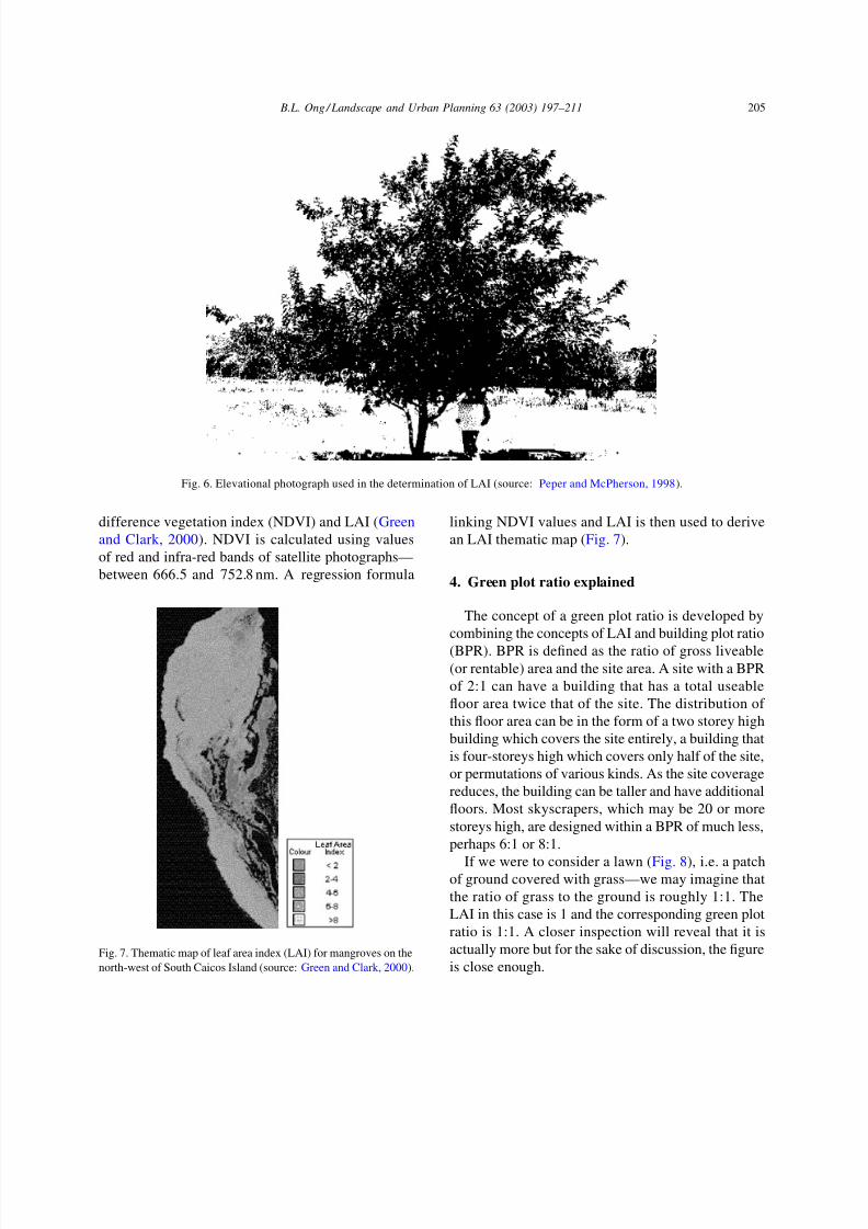
Fig. 6. Elevational photograph used in the determination of LAI (source: Peper and McPherson, 1998).
difference vegetation index (NDVI) and LAI (Green
and Clark, 2000). NDVI is calculated using values
of red and infra-red bands of satellite photographs—
between 666.5 and 752.8 nm. A regression formula
Fig. 7. Thematic map of leaf area index (LAI) for mangroves on the
north-west of South Caicos Island (source: Green and Clark, 2000).
linking NDVI values and LAI is then used to derive
an LAI thematic map (Fig. 7).
4. Green plot ratio explained
The concept of a green plot ratio is developed by
combining the concepts of LAI and building plot ratio
(BPR). BPR is defined as the ratio of gross liveable
(or rentable) area and the site area. A site with a BPR
of 2:1 can have a building that has a total useable
floor area twice that of the site. The distribution of
this floor area can be in the form of a two storey high
building which covers the site entirely, a building that
is four-storeys high which covers only half of the site,
or permutations of various kinds. As the site coverage
reduces, the building can be taller and have additionalfloors. Most skyscrapers, which may be 20 or more
storeys high, are designed within a BPR of much less,
perhaps 6:1 or 8:1.
If we were to consider a lawn (Fig. 8), i.e. a patch
of ground covered with grass—we may imagine that
the ratio of grass to the ground is roughly 1:1. The
LAI in this case is 1 and the corresponding green plot
ratio is 1:1. A closer inspection will reveal that it is
actually more but for the sake of discussion, the figure
is close enough.

8/11/2019 Green Plot Ratio
http://slidepdf.com/reader/full/green-plot-ratio 10/15
206 B.L. Ong / Landscape and Urban Planning 63 (2003) 197–211
Fig. 8. Allocated green plot ratio (GPR) values based on ground cover (the values are rounded from data summarised by Scurlock et al.,
2001; Table 1 above).
If this patch of ground were to be covered instead by
a clump of bushes, the total surface area of leaves ex-
posed to the sun may be expected to be more. Leaves
are translucent and leaves within a canopy are able
to tap the transmitted light through the upper layer of
leaves. Current research (e.g. Deshmukh, 1986; Jones,
1992; Scurlock et al., 2001—see Table 1 above) sug-gests that a reasonable figure for this is about 3:1. That
is, the total area of leaves exposed to the sun is about
three times that of the area of the ground itself.
If the ground is covered instead with full grown
trees, with a dense canopy and closely planted individ-
ual trees, the ratio would be yet higher—6:1 or even
10:1. From Table 1, a more reasonable ratio for the
most heavily planted landscape would be 6:1.
The green plot ratio has been defined earlier as
the average LAI of the greenery on the site. It can
also be equivalently defined as the ratio of the totalsingle-side leaf area of the planted landscape to the
plot or site area. Its value is effectively the same as
the average LAI but expressed as a ratio rather than a
single figure to reflect the normal practice for calcu-
lating maximum allowable floor area in architectural
and planning practice. GPR is a more reasonable
indication of the effectiveness of the greenery on a
site than current metrics based on the extent of site
coverage because it is directly related to the amount
of photosynthetically active leaves on site.
4.1. The ecological value of GPR
Since GPR replicates the conventional planning in-
strument of BPR, it is easily understood by the design
and planning professions while maintaining a direct
correlation to scientific measures. In practice, GPR is
specified as a ratio applied to the whole site.Because of this, GPR enables the designer to off-
set areas of low LAI values with areas of high LAI
values. The specification of GPR is useful in various
ways. Firstly, it enables urban planners to specify a
minimum acceptable degree of ecological responsive-
ness without restricting or predetermining the design
proposal. Secondly, it provides designers greater flex-
ibility in terms of design options since it is a targeted
degree of green composition that is specified rather
than land cover. Thirdly, it is consistent with current
practices of measuring the ecological health of natu-ral ecosystems using remote sensing technology, and
can therefore be a similar indicator of the ecological
health of urban areas. Finally, it is possible to include
urban environments in a global audit of the planet’s
ecological health using satellites and remote sensing
technology.
The use of GPR carries some caveats. GPR alone
cannot indicate species richness on site. Leitao and
Ahern (2002), for example, have provided a more de-
tailed discussion of applicable metrics in a broader

8/11/2019 Green Plot Ratio
http://slidepdf.com/reader/full/green-plot-ratio 11/15
B.L. Ong / Landscape and Urban Planning 63 (2003) 197–211 207
ecological context. The determination of which set of
metrics should finally be used lies outside the scope
of the present paper. Issues to be answered include the
definition of urban ecology, not as a broad field encom-passing various research directions, but as a planning
and design target with quantifiable criteria to be met
and regulated. While additional ecological criteria are
needed, they do not, however, replace the usefulness
of GPR but complement it. It is argued here that GPR,
and its correlate LAI, are metrics fundamental to the
development of this larger set of ecological metrics.
4.2. Application in architecture and urban
planning
GPR has been applied by the author to a number
of design proposals. GPR can be applied as an urban
tool, for masterplanning, as well as an architectural
design tool, for individual buildings. The determina-
tion of suitable GPR may take one of three possible
Fig. 9. Masterplan of Liuxiancun Ecocity showing the central nature reserve and ecologically designed high-rise housing in the corresponding
terrain.
options. It can reflect the desired degree of greenery
from the viewpoint of the planners and/or users. In this
case, the GPR will be an arbitrary number to be settled
by negotiation—on social, aesthetic and environmen-tal grounds. The GPR value can also be determined
on the grounds of anticipated use of the site. For ex-
ample, it is more difficult to achieve a high GPR in
an industrial or commercial site than in a residential
or recreational site. Until suitable designs and tech-
nologies are developed, this is likely to be the most
common method of determination. Finally, the GPR
value can also be determined in terms of ecology—
either in terms of the current LAI of the site before
development, in terms of restoration of the green-
ery on site to reflect a specific period historically, or
as part of an ecological masterplan requiring specific
LAI values for greenery at various sites. The author
prefers the last option and has applied it in two design
competitions in which he has participated in recent
years.

8/11/2019 Green Plot Ratio
http://slidepdf.com/reader/full/green-plot-ratio 12/15
208 B.L. Ong / Landscape and Urban Planning 63 (2003) 197–211
4.2.1. Liuxiancun ecocity, Shenzhen, China
The design entry for Liuxiancun new town (Foo and
Ong, 1999) was a collaboration between the author,
Dr. Foo Ah Fong, Archurban Architects and Planners,and CESMA (a subsidiary of the Housing and De-
velopment Board, Singapore). Although not required
within the brief, the approach taken was to implement
ecological measures as fundamentally and as exten-
sively as possible. The strategies adopted included
bioclimatic design, conservation of natural landscapes,
energy conservation, intelligent building design, and
extensive greenery. A key strategy was to incorpo-
rate skygardens—gardens incorporated into high-rise
buildings above ground level. In the prototypical
high-rise housing design (Fig. 4) that was proposed,
the first level of accommodation was raised 3 storeys
above the ground to enable light penetration into the
entire ground floor. This allowed the ground floor or
void deck under the building to be extensively land-
scaped. There were two skygardens every three floors
which took up two of the nine square mandala upon
which the plan was based. The roof was also greened.
The individual buildings achieved a GPR of about 2:1.
Fig. 10. Planted and naturally ventilated basement carpark. The plants provide visual relief, aesthetics, and environmental benefits as well
as reduce the need for mechanical ventilation and artificial lighting.
Sixty percent of the site was conserved and returned
to nature (Fig. 9). This portion of the site was origi-
nally a quarry and was, at the time of the competition,
open for commercial exploitation. It was mountainousand was, for high-rise buildings, expensive to build
upon. On the other hand, it had a scenic topography
and good potential for development as a nature reserve.
Our proposal, by conserving this part of the site, not
only reduced the cost of construction (we built only on
flat terrain and 60% of the site did not require any civil
work), the value of the project was also increased by
introducing a nature reserve within easy access. A sell-
ing point of the project was that there would be a view
from any apartment of this landscape, and there will be
a garden just outside the front door. The GPR for the
conserved part of the site was set at maximum—6:1.
A key innovation was to design an underground car
park which would be ventilated by large landscaped
openings which opened to the sky (Fig. 10). This
proposal would save costs and energy consumption
required for artificial ventilation as well as provide
natural lighting, ventilation and other environmental
advantages arising from the plants.

8/11/2019 Green Plot Ratio
http://slidepdf.com/reader/full/green-plot-ratio 13/15

8/11/2019 Green Plot Ratio
http://slidepdf.com/reader/full/green-plot-ratio 14/15
210 B.L. Ong / Landscape and Urban Planning 63 (2003) 197–211
Fig. 12. Planted design for proposed residential apartments for Bouna Vista competition entry. Note the planting on the roof, facades,
central spaces and at ground level. It is anticipated that the final green coverage will meet a GPR of 1:1.
adopted by the organisers, Jurong Town Corporation,
and will be applied in the final development of the
project—now renamed 1 North.
5. Conclusion
One of the primary strategies in the greening of
the built environment is the incorporation of trees and
plants. There are several benefits to increasing theamount of greenery in cities—environmentally, aes-
thetically, and recreationally. Current research not only
supports the argument that plants are an important in-
gredient in balancing the polluting effects of cities, but
also found plants to be aesthetically and emotionally
beneficial. In fact, it is not the beneficial significance
of plants that is surprising but the ability of modern
society to camouflage our dependence on plants. Paper
alone accounts for nearly half of the global appetite
for wood and together with the use of hardwoods for
furniture and building construction, is responsible for
much of the destruction of natural forests and habitat
in the world today. Most of our medicine, clothing,
furniture, flooring and building material come directly
from plants. Of course, we still rely on plants for food,
as do the animals we eat. Similarly, the oxygen in the
air we breathe still comes entirely from plants. Plants
are also responsible for the cleanliness of the water in
our rivers, streams and other natural waterbodies—to
the degree that these waterbodies are clean and havenot been polluted by our industries.
A proper, and future, strategy for a sustainable city
must not only include plants but be more precise in
channelling plants towards balancing what Pauliet and
Duhme (2000) have called urban metabolism. Better
technology will be needed to increase the efficiency of
cities and reduce their pollution levels, but it is likely
that all the best efforts will not be enough if the role of
plants in the sustainability of cities is not recognised.
To do this, cities will need to be described in ecological

8/11/2019 Green Plot Ratio
http://slidepdf.com/reader/full/green-plot-ratio 15/15
B.L. Ong / Landscape and Urban Planning 63 (2003) 197–211 211
terms such that the ecological impact of cities on the
global environment can be identified and monitored.
Within cities themselves, ecological processes of cities
cannot be separated into industrial and natural systemsbut the two will need to be resolved and integrated.
Both human needs and the need to maintain nature’s
equilibrium will have to be met concurrently—not just
globally but within the urban context.
The green plot ratio, or GPR, proposed here is a
small, but hopefully, useful step towards enabling this
development of a future strategy for sustainability in
our cities. Based on a biological parameter, LAI, cur-
rently used to monitor the metabolic rate of agricul-
tural fields and the overall ecological impact of natural
ecosystems, GPR bridges the fields of ecology, bio-
logical science and urban planning. The concept has
been used in two projects involving the author and is
currently being considered for regulatory adoption in
Singapore.
Acknowledgements
The work presented is a culmination of collabora-
tion with colleagues, architects and planners over the
last few years. In particular, the contribution and sup-
port of the Department of Architecture, Dr. Foo Ah
Fong, Archurban Architects and Planners, CESMA,
Design Vista and Jurong Town Corporation are gladly
acknowledged.
References
Akbari, H., Pomerantz, M., Taha, H., 2001. Cool surfaces and
shade trees to reduce energy use and improve air quality in
urban areas. Sol. Energy 70 (3), 295–310.
Attwell, K., 2000. Urban land resources and urban planting—case
studies from Denmark. Landsc. Urban Plann. 52, 145–163.
Deshmukh, I., 1986. Ecology And Tropical Biology. Blackwell
Scientific Publications, Palo Alto, CA.Foo, A.F., Ong, B.L., 1999. Eco-city in Shenzhen: ecological
design and planning in Liu Xian Cun. Singapore Architect 203,
40–45.
Gower, S.T., Kucharik, C.J., Norman, J.M., 1999. Direct and indi-
rect estimate of leaf area index fapar and net primary produc-
tion of terrestrial ecosystems. Special Issue of EOS Remote
Sensing of the Environment 70 (1), 29–51. Available online
from the Center for Sustainability and the Global Environ-
ment, Institute for Environmental Studies, University of Wiscon-
sin–Madison http://sage.aos.wisc.edu/download/pubs/Abstracts/
gower1999EOSabstract.htm.
Green, E.P., Clark, C.D., 2000. Assessing mangrove leaf area indexand canopy closure. In: Alasdair, J. Edwards (Ed.), Remote Sen-
sing Handbook for Tropical Coastal Management, Coastal Man-
agement Sourcebooks 3. Part 5. Quantitative Measurement of
Ecological Parameters and Marine Resource Assessment, CSI,
UNESCO—http://www.unesco.org/csi/pub/source/rs13.htm.
Jensen, M.B., Persson, B., Guldager, S., Reeh, U., Nilsson, K.,
2000. Green structure and sustainability—developing a tool for
local planning. Landsc. Urban Plann. 52, 117–133.
Jones, H.G., 1992. Plants and Microclimate, Second ed. Cambridge
University Press, Cambridge, UK.
Karlik, J.F., Winer, A.M., 2001. Plant species composition, calcu-
lated leaf masses and estimated biogenic emissions of urban
landscape types from a field survey in Phoenix, Arizona.
Landsc. Urban Plann. 53, 123–134.
Leitao, A.B., Ahern, J., 2002. Applying landscape ecological
concepts and metrics in sustainable landscape planning. Landsc.
Urban Plann. 59, 65–93.
Lovelock, J., 1989. The Ages of Gaia. Oxford University Press,
Oxford, UK.
Peper, P.J., McPherson, E.G., 1998. Comparison of five methods
for estimating leaf area index of open-grown deciduous trees.
J. Arboriculture 24 (2), 98–111.
Pauliet, S., Duhme, F., 2000. Assessing the environmental perfor-
mance of land cover types for urban planning. Landsc. Urban
Plann. 52, 1–20.
Martens, S.N., Ustin, S.L., Rousseau, R.A., 1993. Estimation of
Tree Canopy Leaf Area Index by Gap Fraction Analysis.Available online from the Center for Spatial Technologies and
Remote Sensing (CSTARS), University of California, Davis—
http://www.cstars.ucdavis.edu/papers / html / martensetal1993a /
index.html.
Scurlock, J.M.O., Asner, G.P., Gower, S.T., 2001. Global Leaf Area
Index Data from Field Measurements, 1932–2000. Available
On-Line From the Oak Ridge National Laboratory Distributed
Active Archive Center, Oak Ridge, University of Colorado, TN,
U.S.A.—http://www.daac.ornl.gov .
SITE, Green Architecture, 1990. Special Feature, A + U Archi-
tecture and Urbanism, 12, 243.
Tay, K.S., 1989. Mega-Cities in the Tropics: Towards an Archi-
tectural Agenda for the Future. Institute of Southeast Asian
Studies (ISEAS), Singapore.Whitford, V., Ennos, A.R., Handley, J.F., 2001. ‘City form and
natural process—indicators for the ecological performance of
urban areas and their application to Merseyside, UK. Landsc.
Urban Plann. 57, 91–103.
Wilkinson, D.M., 1991. Can photographic methods be used for
measuring the light attenuation characteristics of trees in leaf?
Landsc. Urban Plann. 20, 347–350.