ground control for aerial photogrammetry - yolasure 340 ‐photogrammetry 12/12/2008 ground control...
TRANSCRIPT
SURE 340 ‐ Photogrammetry 12/12/2008
Ground Control for Aerial Photogrammetry 1
Center for Photogrammetric TrainingFerris State University
IntroductionPhotogrammetry Control (Ground Control)
Any point whose positions known in object space and whose images can be positively identified on the imageUsed to orient/relate imagery to the ground
Classified asHorizontal control – position wrt to horizontal datumVertical control – elevation wrt to vertical datum
Historically – 2 step process, but with GPS, this is not as clear
Basic controlPhoto control
SURE 340 ‐ Photogrammetry 12/12/2008
Ground Control for Aerial Photogrammetry 2
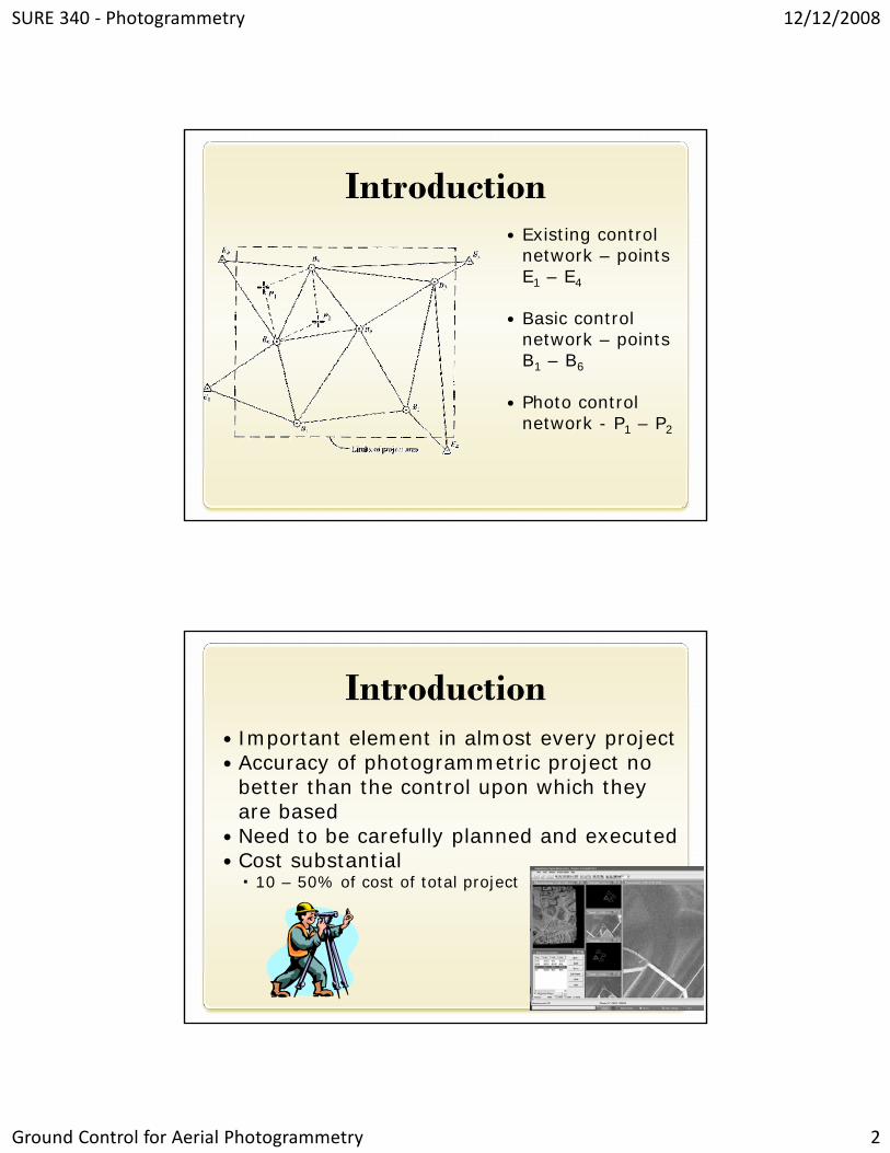
IntroductionExisting control network – points E1 – E4
Basic control network – points B1 – B6
Photo control network - P1 – P2
IntroductionImportant element in almost every projectAccuracy of photogrammetric project no better than the control upon which they are basedNeed to be carefully planned and executedCost substantial
10 – 50% of cost of total project
SURE 340 ‐ Photogrammetry 12/12/2008
Ground Control for Aerial Photogrammetry 3
Number and Location of Photo ControlDepends on use
For calculating flying height: only horizontal length and elevations of endpointsFor mosaics: sparse network needed
Uniformly distributedSpace resection: determine position & orientation of photo –minimum 3 XYZ control points
Ideally form large, nearly equilateral triangle
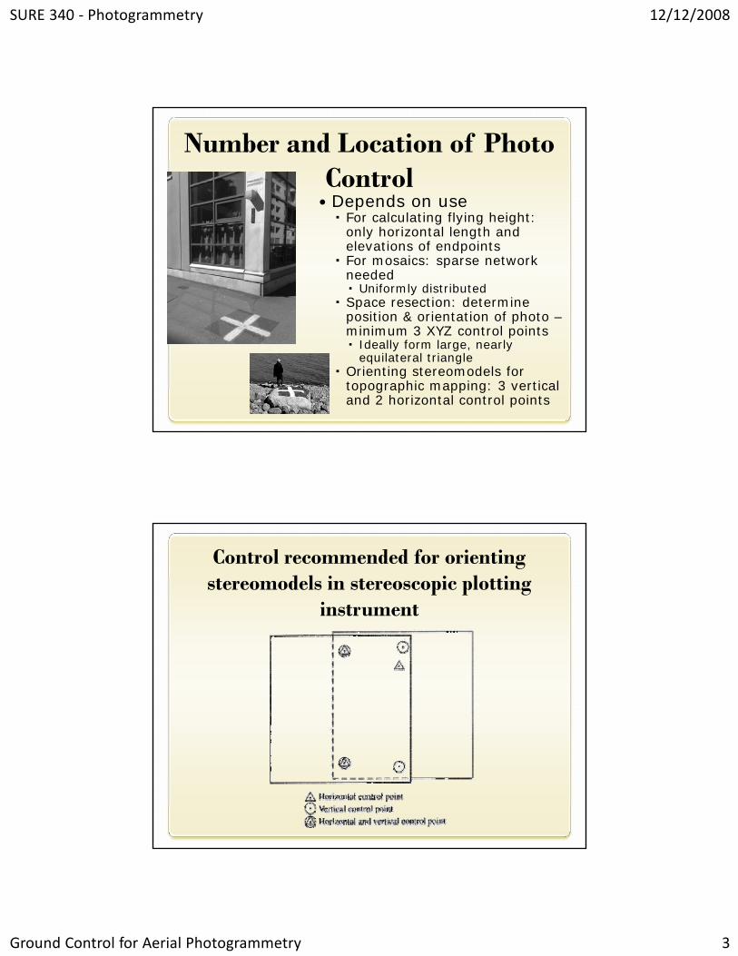
Orienting stereomodels for topographic mapping: 3 vertical and 2 horizontal control points
Control recommended for orienting stereomodels in stereoscopic plotting
instrument
SURE 340 ‐ Photogrammetry 12/12/2008
Ground Control for Aerial Photogrammetry 4
Number and Location of Photo Control
Aerotriangulation: fewer ground control required
Varies depending on size, shape, nature of area, required accuracy, and procedures, instrument and personnel
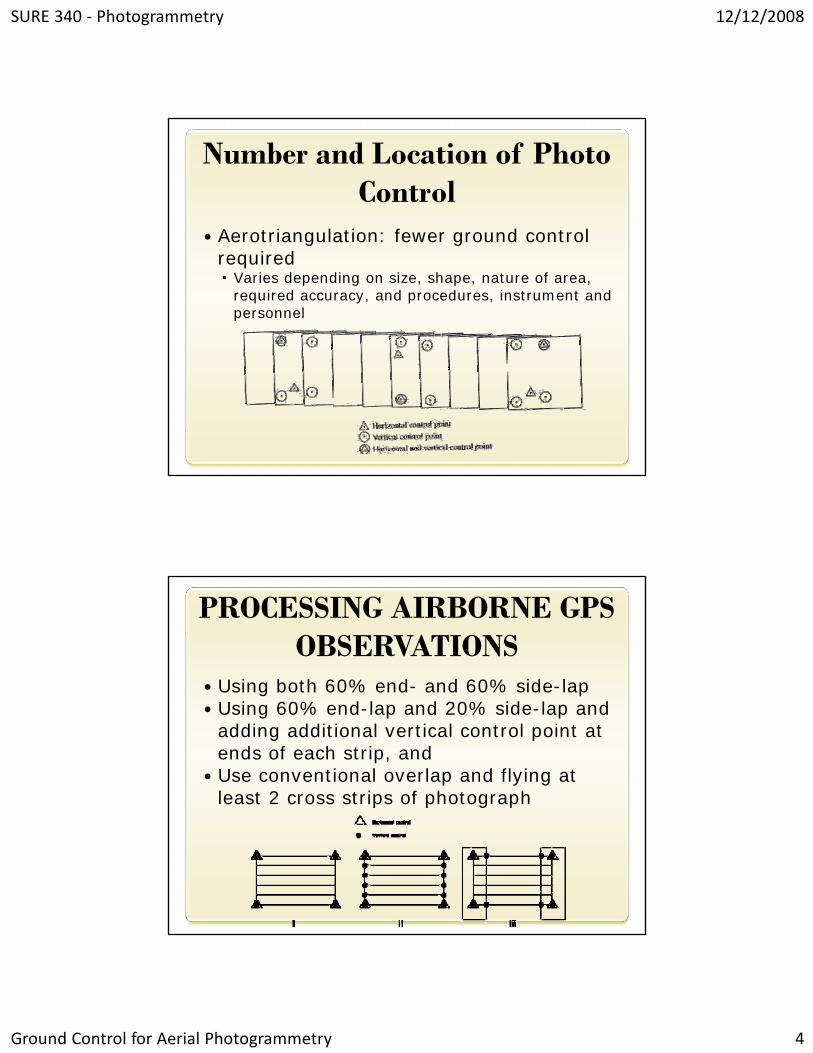
PROCESSING AIRBORNE GPS OBSERVATIONS
Using both 60% end- and 60% side-lap Using 60% end-lap and 20% side-lap and adding additional vertical control point at ends of each strip, and Use conventional overlap and flying at least 2 cross strips of photograph

SURE 340 ‐ Photogrammetry 12/12/2008
Ground Control for Aerial Photogrammetry 5
The image part with relationship ID rId2 was not found in the file.
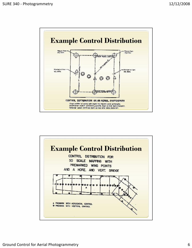
Example Control Distribution
SURE 340 ‐ Photogrammetry 12/12/2008
Ground Control for Aerial Photogrammetry 6
Example Control Distribution
Example Control Distribution
SURE 340 ‐ Photogrammetry 12/12/2008
Ground Control for Aerial Photogrammetry 7
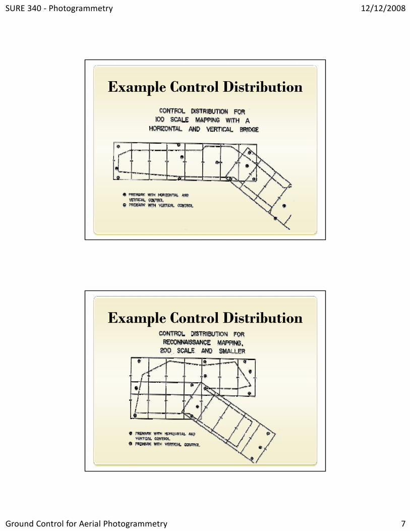
Example Control Distribution
Example Control Distribution

SURE 340 ‐ Photogrammetry 12/12/2008
Ground Control for Aerial Photogrammetry 8
Planning Control SurveyWhat is required accuracy?
Controls equipment and survey techniques
Standards to consider in processNational Map Accuracy StandardsGeospatial Positioning Accuracy StandardsAmerican Society for Photogrammetry and Remote SensingFederal Highway Administration StandardsAmerican Society of Civil Engineers
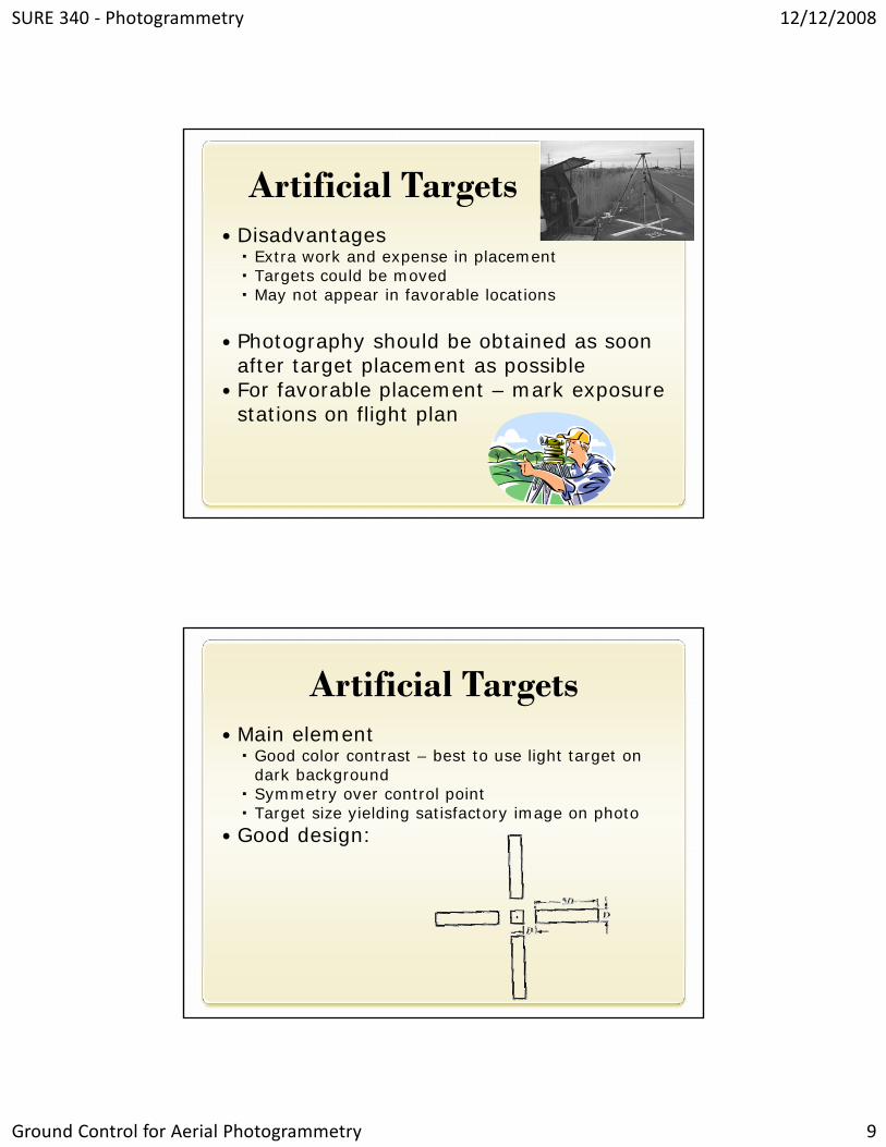
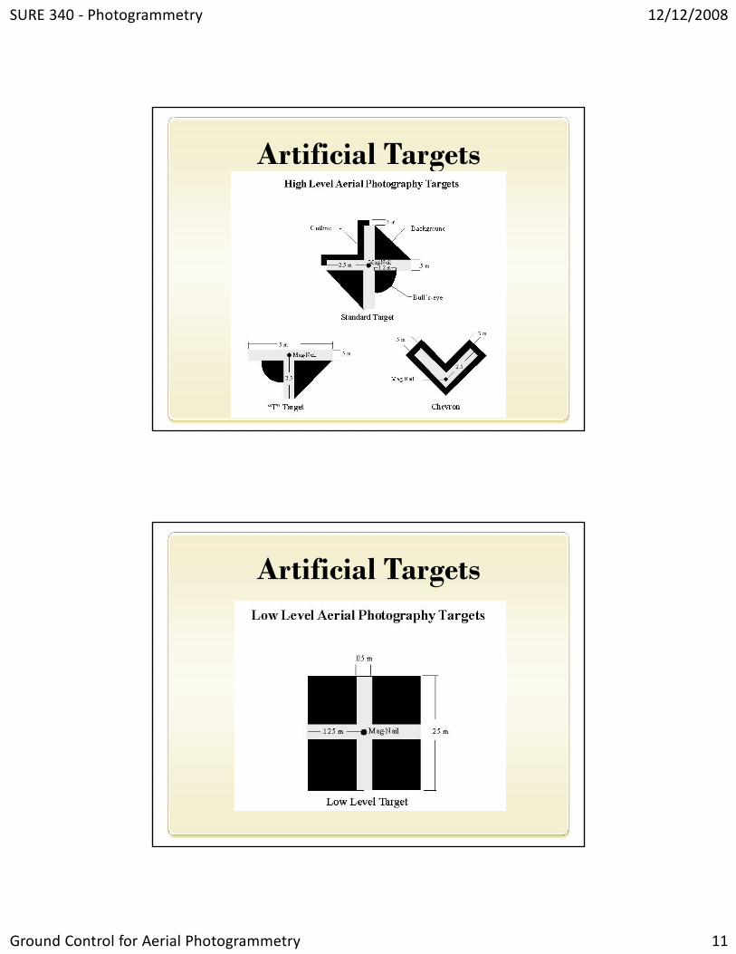
Artificial TargetsSome cases – need to set artificial targets
Called panel pointsPlaced in field prior to aerial photography
Called premarking or panelingUsed for controlling most precise photogrammetric work
Also used to mark section corners/boundary lines for photogrammetric cadastral work
Unique appearance makes misidentification unlikely
SURE 340 ‐ Photogrammetry 12/12/2008
Ground Control for Aerial Photogrammetry 9
Artificial TargetsDisadvantages
Extra work and expense in placementTargets could be movedMay not appear in favorable locations
Photography should be obtained as soon after target placement as possibleFor favorable placement – mark exposure stations on flight plan
Artificial TargetsMain element
Good color contrast – best to use light target on dark backgroundSymmetry over control pointTarget size yielding satisfactory image on photo
Good design:
SURE 340 ‐ Photogrammetry 12/12/2008
Ground Control for Aerial Photogrammetry 10
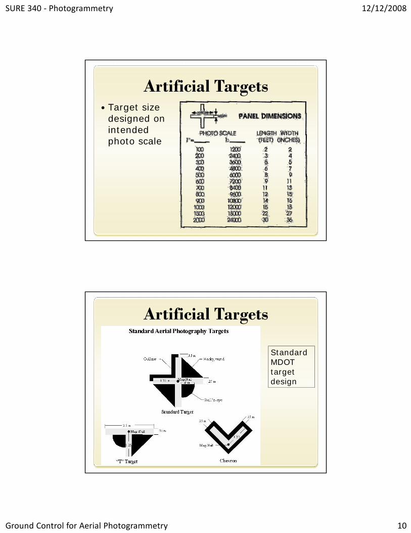
Artificial TargetsTarget size designed on intended photo scale
Artificial Targets
Standard MDOT target design
SURE 340 ‐ Photogrammetry 12/12/2008
Ground Control for Aerial Photogrammetry 11
Artificial Targets
Artificial Targets