group 4 wellington/horowhenua/rangitikei region 4 – wellington/horowhenua/rangitikei region within...
TRANSCRIPT
55
Group 4 – Wellington/Horowhenua/Rangitikei Region
Within Group 4, all electorates together have a total average population almost exactly on quota.
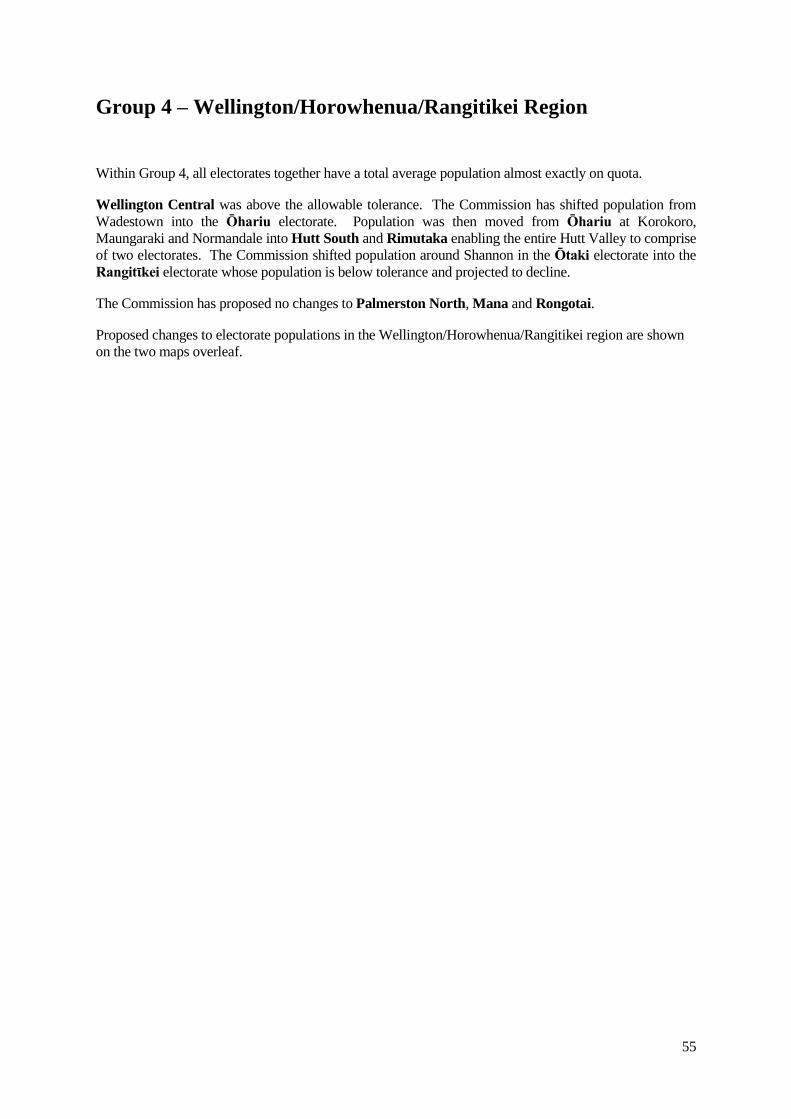
Wellington Central was above the allowable tolerance. The Commission has shifted population from
Wadestown into the Ōhariu electorate. Population was then moved from Ōhariu at Korokoro,
Maungaraki and Normandale into Hutt South and Rimutaka enabling the entire Hutt Valley to comprise
of two electorates. The Commission shifted population around Shannon in the Ōtaki electorate into the
Rangitῑkei electorate whose population is below tolerance and projected to decline.
The Commission has proposed no changes to Palmerston North, Mana and Rongotai.
Proposed changes to electorate populations in the Wellington/Horowhenua/Rangitikei region are shown
on the two maps overleaf.
56
Maps of Proposed Population Changes –
Wellington/Horowhenua/Rangitikei Region
57
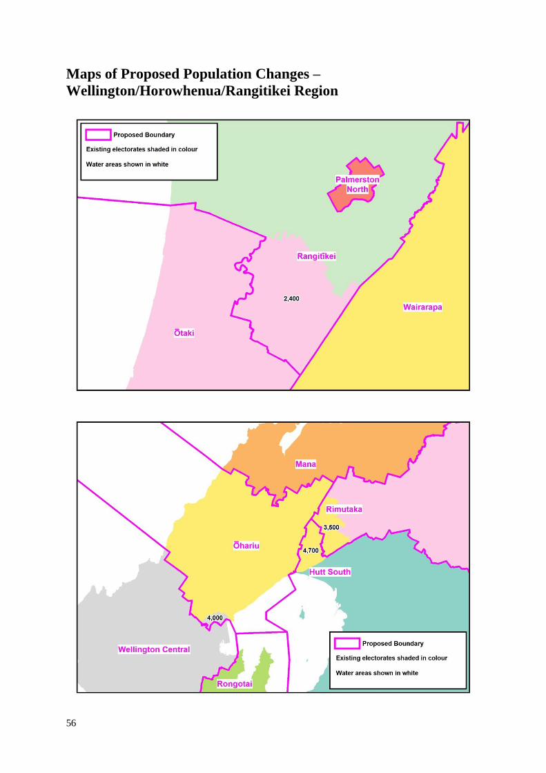
RANGITĪKEI
North Island General
Electoral Districts
Electoral
population
Variation from quota
(NI Quota = 59,731)
Projections
Code Name Number % 2014 2017
N38 Rangitῑkei 58,720 -1,011 -1.7% -3% -5%
General Description
The Rangitῑkei electorate comprises the communities of Taumarunui, Owhango and National Park in the
north, Ohakune, Waiouru and Taihape in the centre and Marton, Bulls, Shannon and Feilding in the
south.
Summary of Reasons
Rangitῑkei is under tolerance and requires significant additional population. To meet quota and projected
decline relative to quota for the life of the electorate, population of 2,400 at Shannon has been moved into
the electorate from Ōtaki.
58
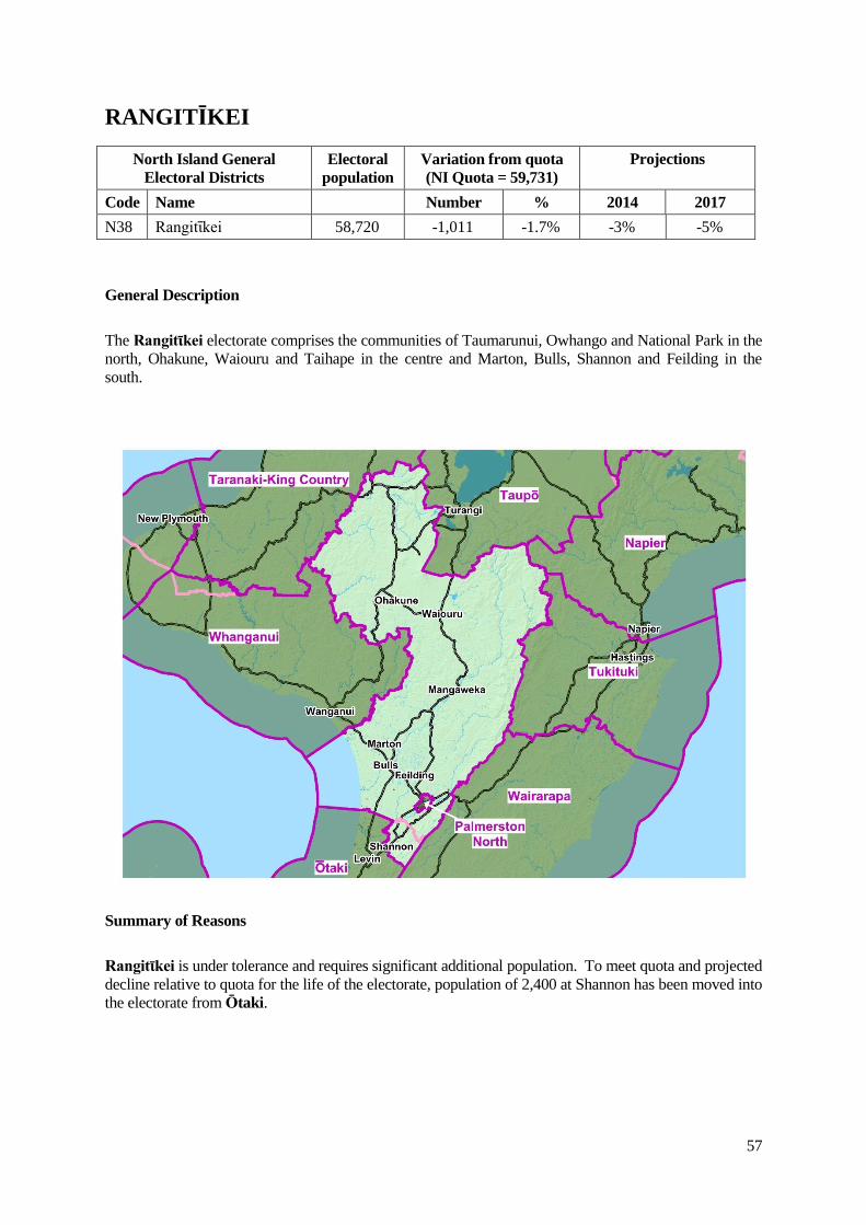
PALMERSTON NORTH
North Island General
Electoral Districts
Electoral
population
Variation from quota
(NI Quota = 59,731)
Projections
Code Name Number % 2014 2017
N40 Palmerston North 59,567 -164 -0.3% -1% -2%
General Description
The Palmerston North electorate comprises Palmerston North City, including the suburbs of Cloverlea,
Milson and Kelvin Grove.
Summary of Reasons
The Commission proposes retaining the existing boundaries. The electorate is within the permitted quota
and is projected to remain so.
59
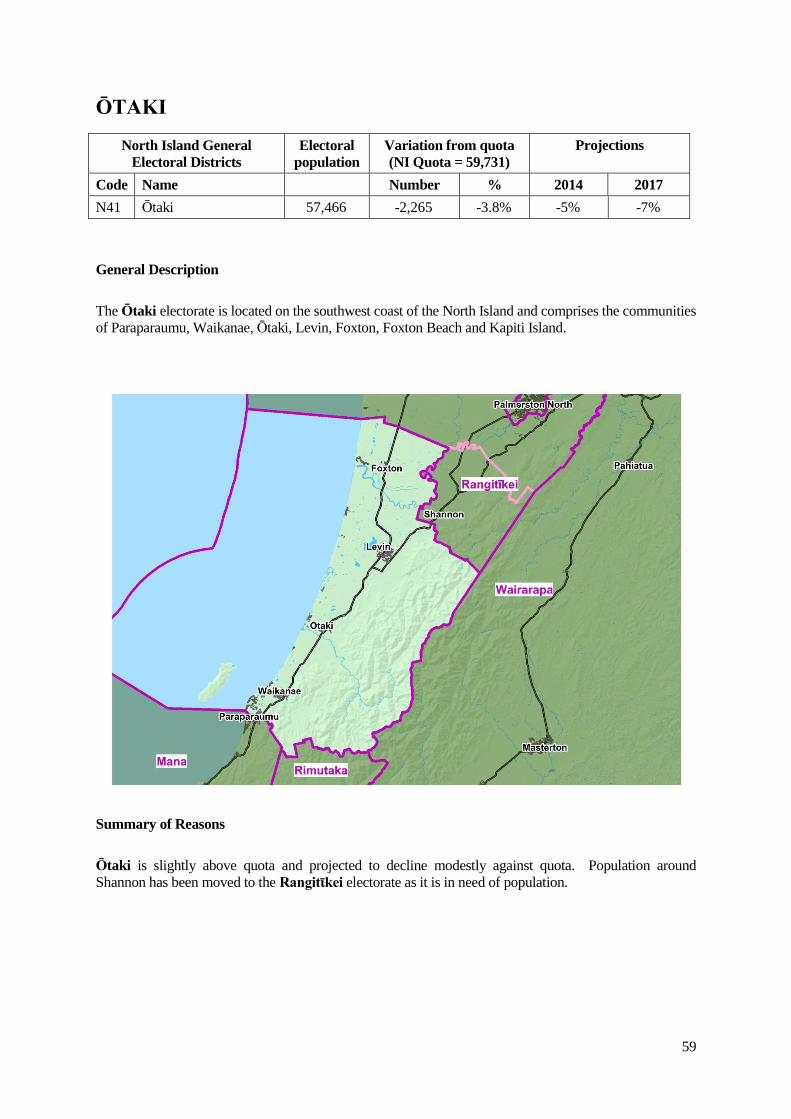
ŌTAKI
North Island General
Electoral Districts
Electoral
population
Variation from quota
(NI Quota = 59,731)
Projections
Code Name Number % 2014 2017
N41 Ōtaki 57,466 -2,265 -3.8% -5% -7%
General Description
The Ōtaki electorate is located on the southwest coast of the North Island and comprises the communities
of Paraparaumu, Waikanae, Ōtaki, Levin, Foxton, Foxton Beach and Kapiti Island.
Summary of Reasons
Ōtaki is slightly above quota and projected to decline modestly against quota. Population around
Shannon has been moved to the Rangitῑkei electorate as it is in need of population.
60
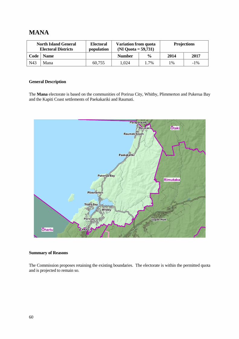
MANA
North Island General
Electoral Districts
Electoral
population
Variation from quota
(NI Quota = 59,731)
Projections
Code Name Number % 2014 2017
N43 Mana 60,755 1,024 1.7% 1% -1%
General Description
The Mana electorate is based on the communities of Porirua City, Whitby, Plimmerton and Pukerua Bay
and the Kapiti Coast settlements of Paekakariki and Raumati.
Summary of Reasons
The Commission proposes retaining the existing boundaries. The electorate is within the permitted quota
and is projected to remain so.
61
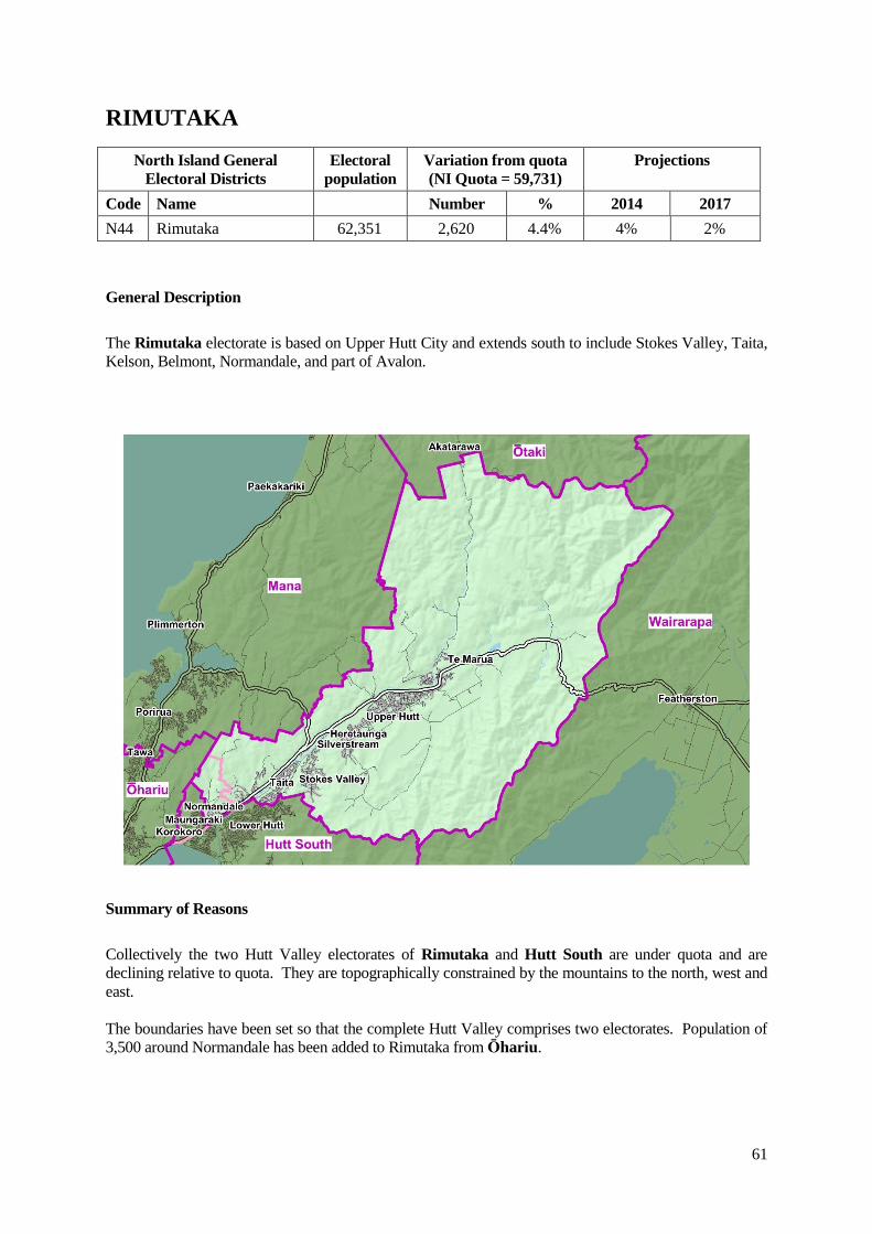
RIMUTAKA
North Island General
Electoral Districts
Electoral
population
Variation from quota
(NI Quota = 59,731)
Projections
Code Name Number % 2014 2017
N44 Rimutaka 62,351 2,620 4.4% 4% 2%
General Description
The Rimutaka electorate is based on Upper Hutt City and extends south to include Stokes Valley, Taita,
Kelson, Belmont, Normandale, and part of Avalon.
Summary of Reasons
Collectively the two Hutt Valley electorates of Rimutaka and Hutt South are under quota and are
declining relative to quota. They are topographically constrained by the mountains to the north, west and
east.
The boundaries have been set so that the complete Hutt Valley comprises two electorates. Population of
3,500 around Normandale has been added to Rimutaka from Ōhariu.
62
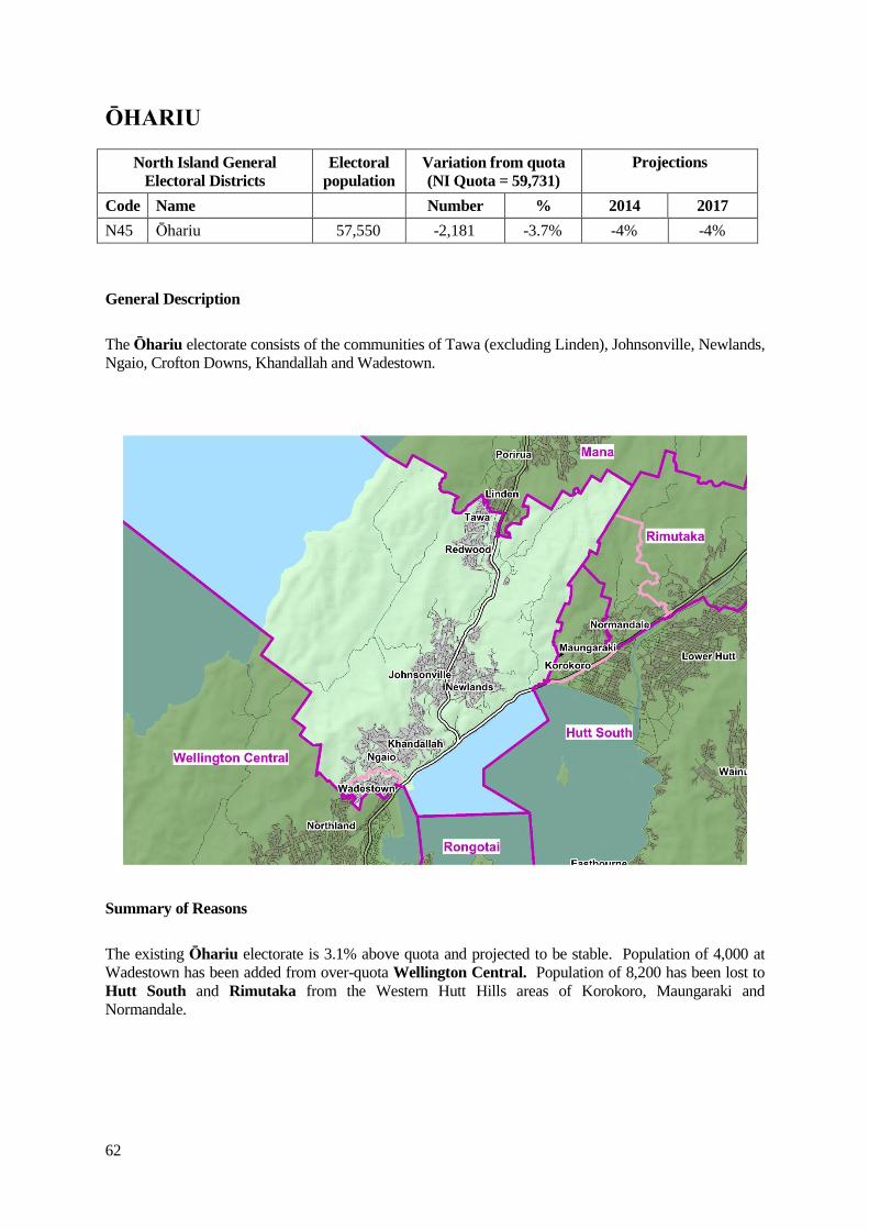
ŌHARIU
North Island General
Electoral Districts
Electoral
population
Variation from quota
(NI Quota = 59,731)
Projections
Code Name Number % 2014 2017
N45 Ōhariu 57,550 -2,181 -3.7% -4% -4%
General Description
The Ōhariu electorate consists of the communities of Tawa (excluding Linden), Johnsonville, Newlands,
Ngaio, Crofton Downs, Khandallah and Wadestown.
Summary of Reasons
The existing Ōhariu electorate is 3.1% above quota and projected to be stable. Population of 4,000 at
Wadestown has been added from over-quota Wellington Central. Population of 8,200 has been lost to
Hutt South and Rimutaka from the Western Hutt Hills areas of Korokoro, Maungaraki and
Normandale.
63
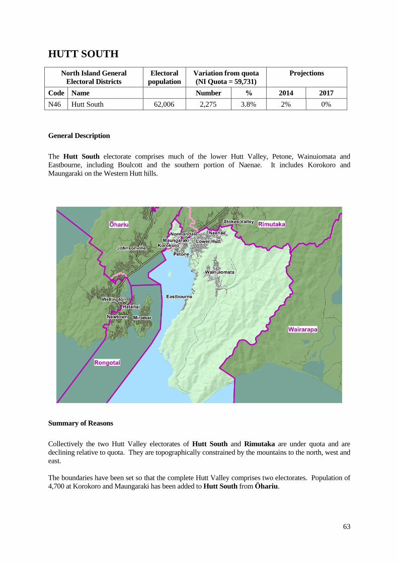
HUTT SOUTH
North Island General
Electoral Districts
Electoral
population
Variation from quota
(NI Quota = 59,731)
Projections
Code Name Number % 2014 2017
N46 Hutt South 62,006 2,275 3.8% 2% 0%
General Description
The Hutt South electorate comprises much of the lower Hutt Valley, Petone, Wainuiomata and
Eastbourne, including Boulcott and the southern portion of Naenae. It includes Korokoro and
Maungaraki on the Western Hutt hills.
Summary of Reasons
Collectively the two Hutt Valley electorates of Hutt South and Rimutaka are under quota and are
declining relative to quota. They are topographically constrained by the mountains to the north, west and
east.
The boundaries have been set so that the complete Hutt Valley comprises two electorates. Population of
4,700 at Korokoro and Maungaraki has been added to Hutt South from Ōhariu.
64
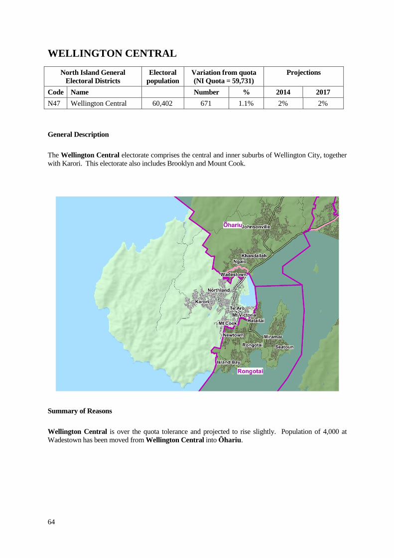
WELLINGTON CENTRAL
North Island General
Electoral Districts
Electoral
population
Variation from quota
(NI Quota = 59,731)
Projections
Code Name Number % 2014 2017
N47 Wellington Central 60,402 671 1.1% 2% 2%
General Description
The Wellington Central electorate comprises the central and inner suburbs of Wellington City, together
with Karori. This electorate also includes Brooklyn and Mount Cook.
Summary of Reasons
Wellington Central is over the quota tolerance and projected to rise slightly. Population of 4,000 at
Wadestown has been moved from Wellington Central into Ōhariu.
65
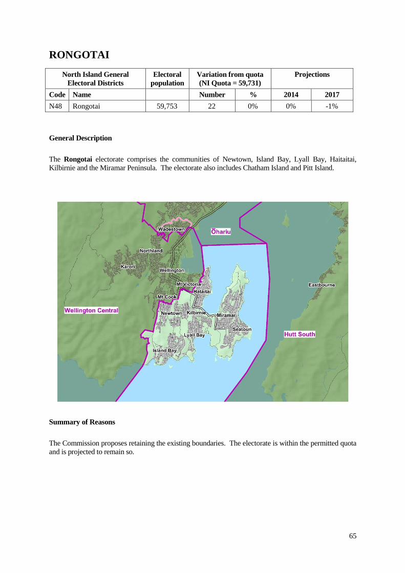
RONGOTAI
North Island General
Electoral Districts
Electoral
population
Variation from quota
(NI Quota = 59,731)
Projections
Code Name Number % 2014 2017
N48 Rongotai 59,753 22 0% 0% -1%
General Description
The Rongotai electorate comprises the communities of Newtown, Island Bay, Lyall Bay, Haitaitai,
Kilbirnie and the Miramar Peninsula. The electorate also includes Chatham Island and Pitt Island.
Summary of Reasons
The Commission proposes retaining the existing boundaries. The electorate is within the permitted quota
and is projected to remain so.