growing opendap support: current arcgis workflows and future directions
DESCRIPTION
Growing OPeNDAP Support: Current ArcGIS Workflows and Future Directions. Christine White, Esri [email protected]. Overview. ArcGIS. Natural Science Domains. Geology/Geophysics. Climate Science. Agricultural Science. Conservation Biology. Sustainability Science. Forestry. Ecology. - PowerPoint PPT PresentationTRANSCRIPT
Growing OPeNDAP Support: Current ArcGISWorkflows and Future Directions
Christine White, Esri
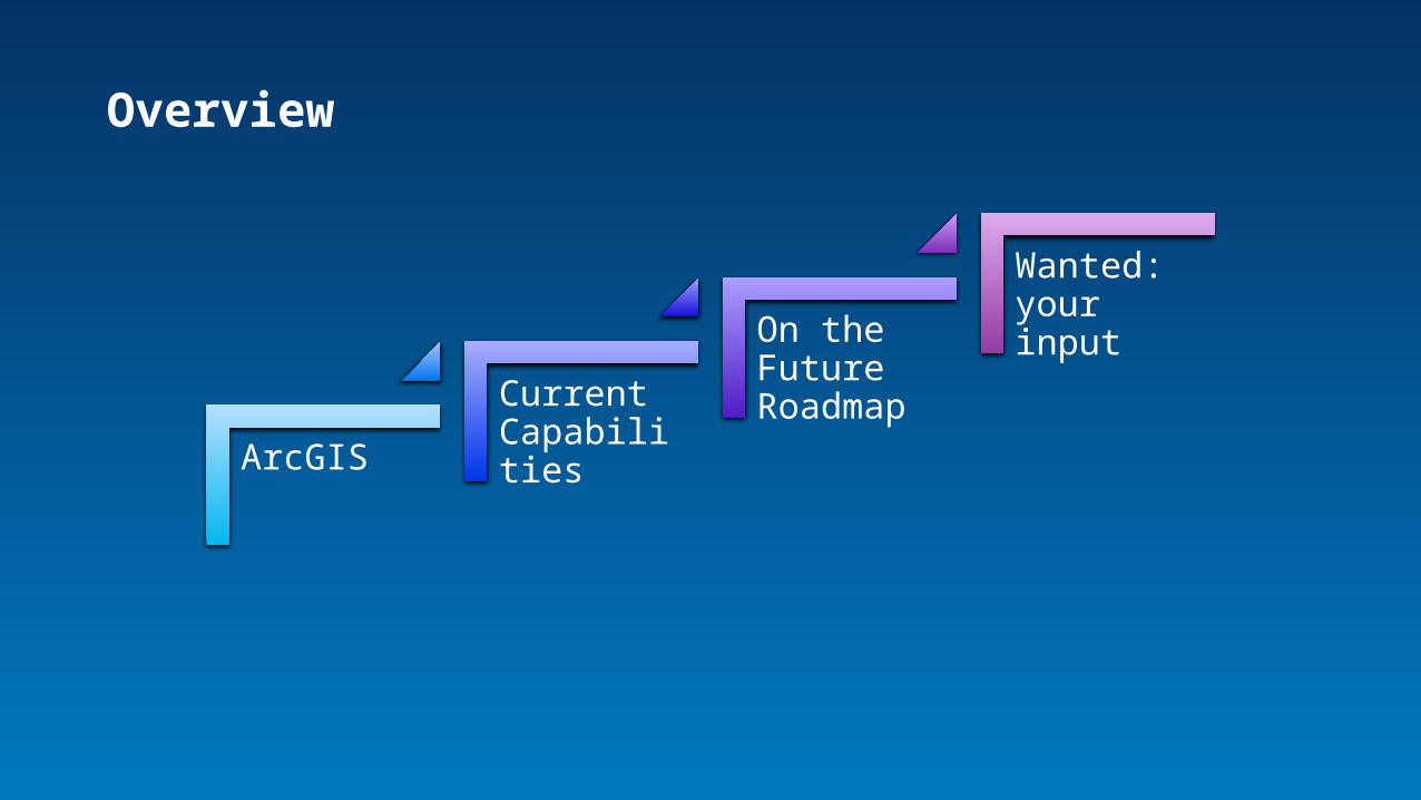
ArcGIS
Current Capabilities
On the Future Roadmap
Wanted: your input
Overview
ArcGIS
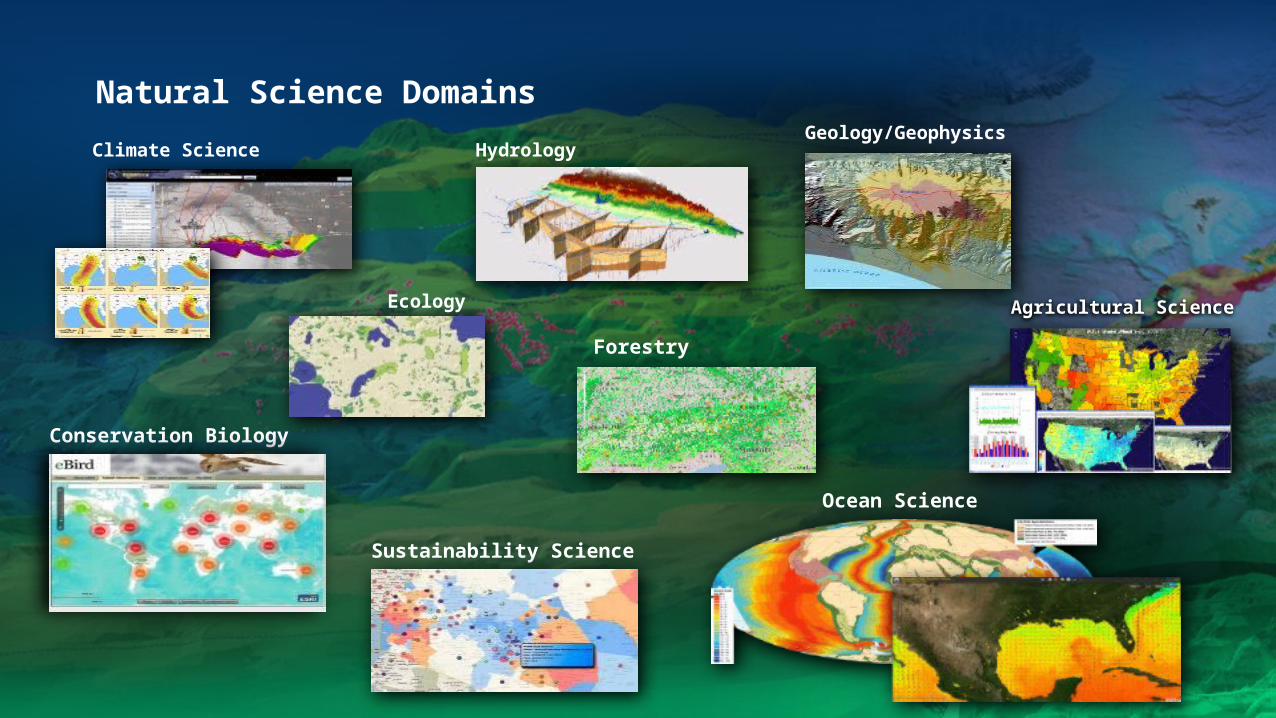
Natural Science Domains
Agricultural Science
Hydrology
Ecology
Climate ScienceGeology/Geophysics
Conservation Biology
Sustainability Science
Forestry
Ocean Science

Ocean GIS InitiativeChief Scientist
Project Managers
Software Engineers
Product Engineers
Account Managers
Industry Solutions Managers
Distributors
Federal Science Team
YOU
esriurl.com/oceanebook
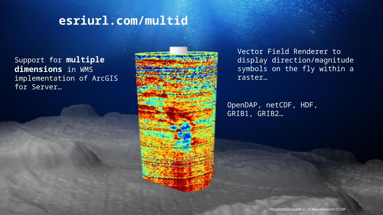
Visualization source: U. of New Hampsire CCOM
Support for multiple dimensions in WMS implementation of ArcGIS for Server…
Vector Field Renderer to display direction/magnitude symbols on the fly within a raster…
OpenDAP, netCDF, HDF, GRIB1, GRIB2…
esriurl.com/multid
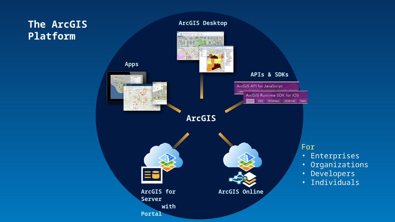
The ArcGISPlatform
Apps
ArcGIS
ArcGIS Online
APIs & SDKs
ArcGIS Desktop
ArcGIS for Server with Portal
For • Enterprises• Organizations• Developers• Individuals
Current ArcGIS Capabilitiesfor DAP
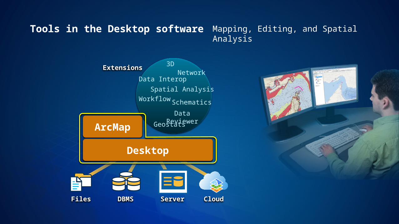
Data Interop
Data Reviewer
3DNetwork
Workflow
Geostats
Spatial Analysis
Extensions
Files DBMS Server Cloud
Desktop
Mapping, Editing, and Spatial Analysis
Schematics
ArcMap
Desktop
Tools in the Desktop software
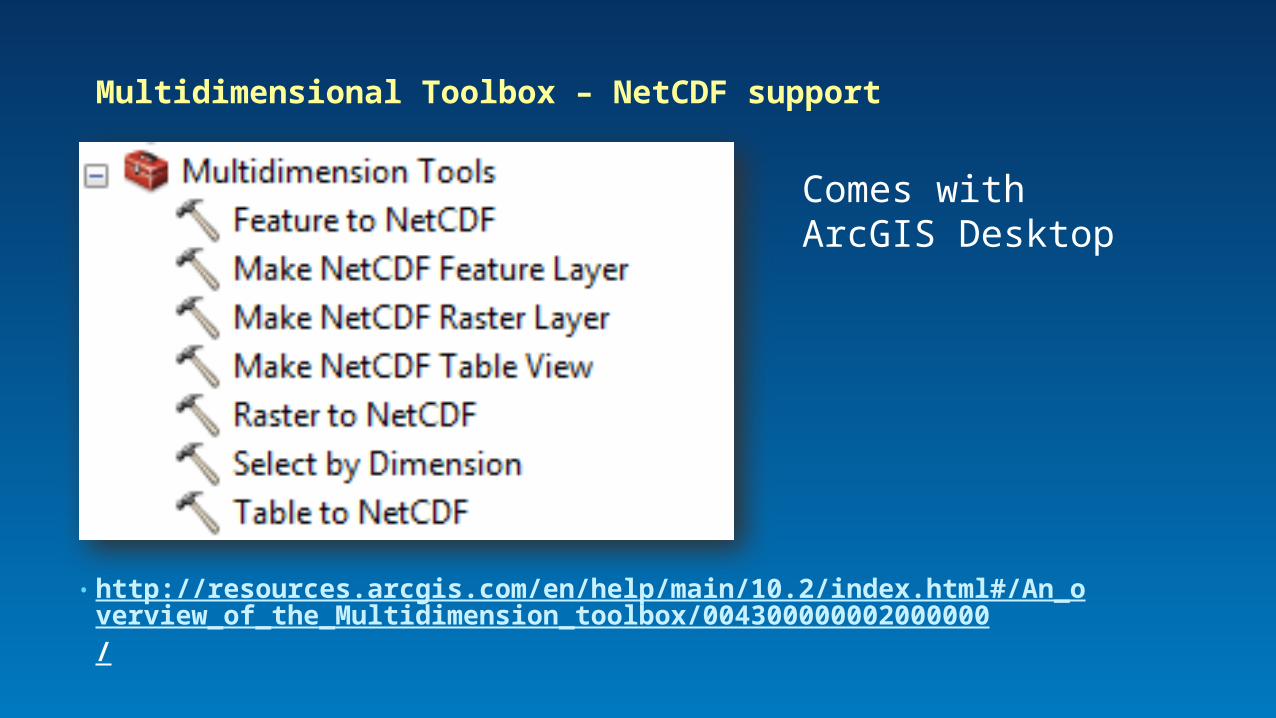
• http://resources.arcgis.com/en/help/main/10.2/index.html#/An_overview_of_the_Multidimension_toolbox/004300000002000000/
Multidimensional Toolbox – NetCDF support
Comes with ArcGIS Desktop
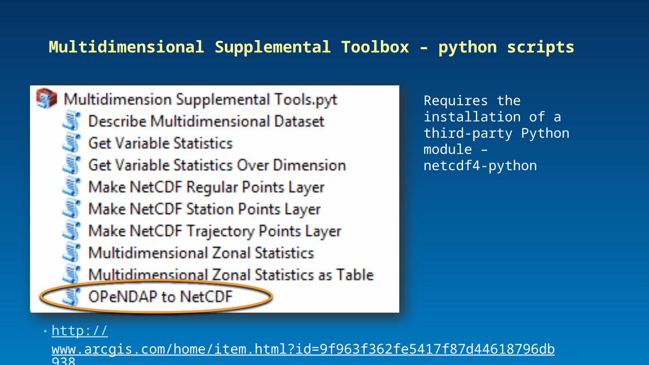
• http://www.arcgis.com/home/item.html?id=9f963f362fe5417f87d44618796db938
Multidimensional Supplemental Toolbox – python scripts
Requires the installation of a third-party Python module – netcdf4-python
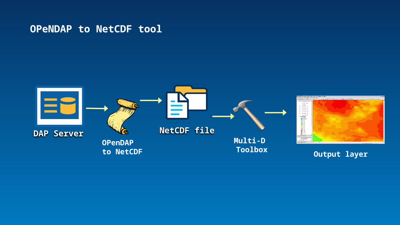
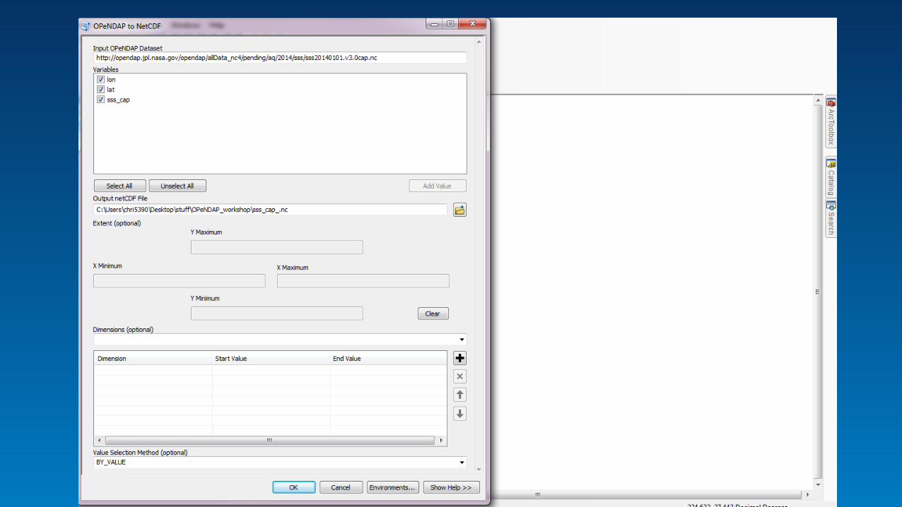
OPeNDAP to NetCDF tool
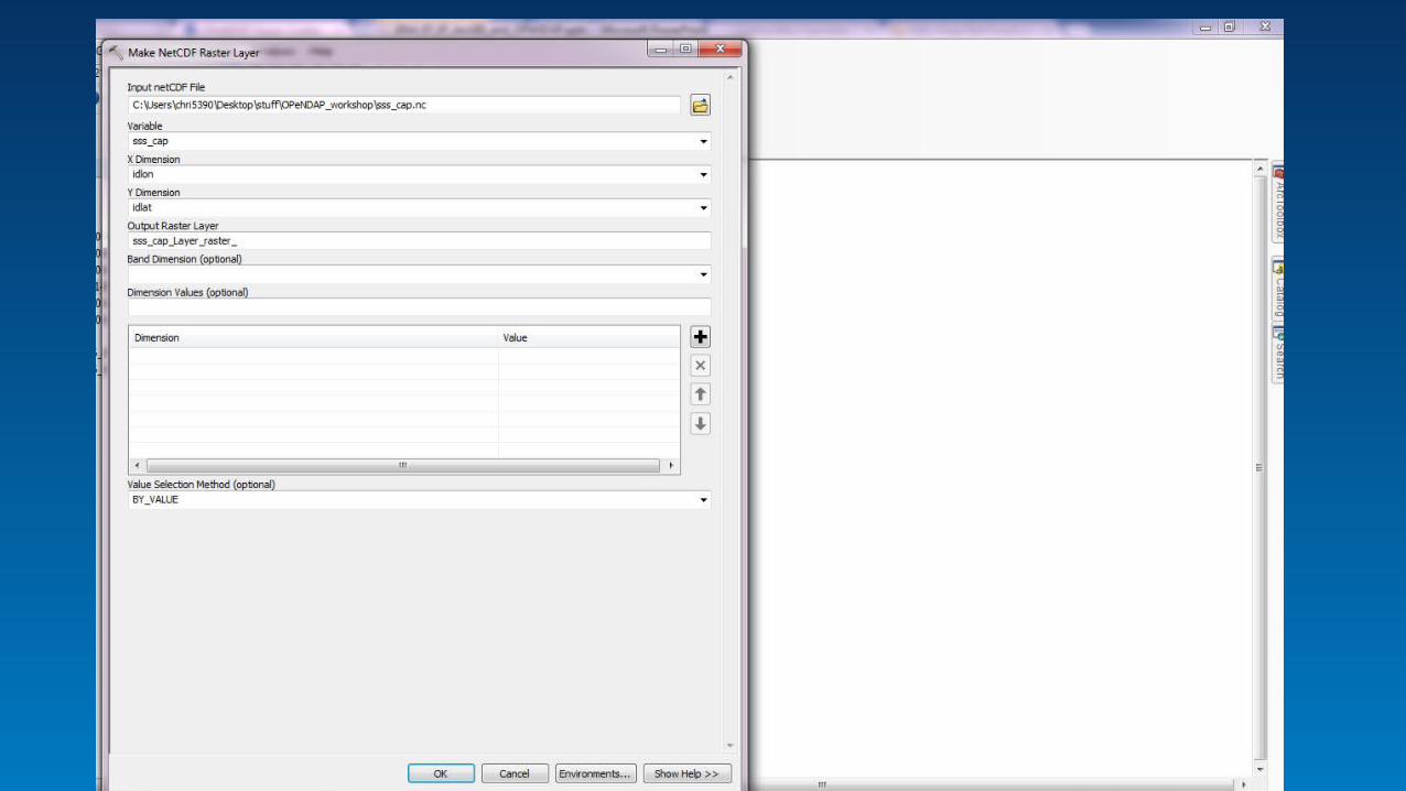
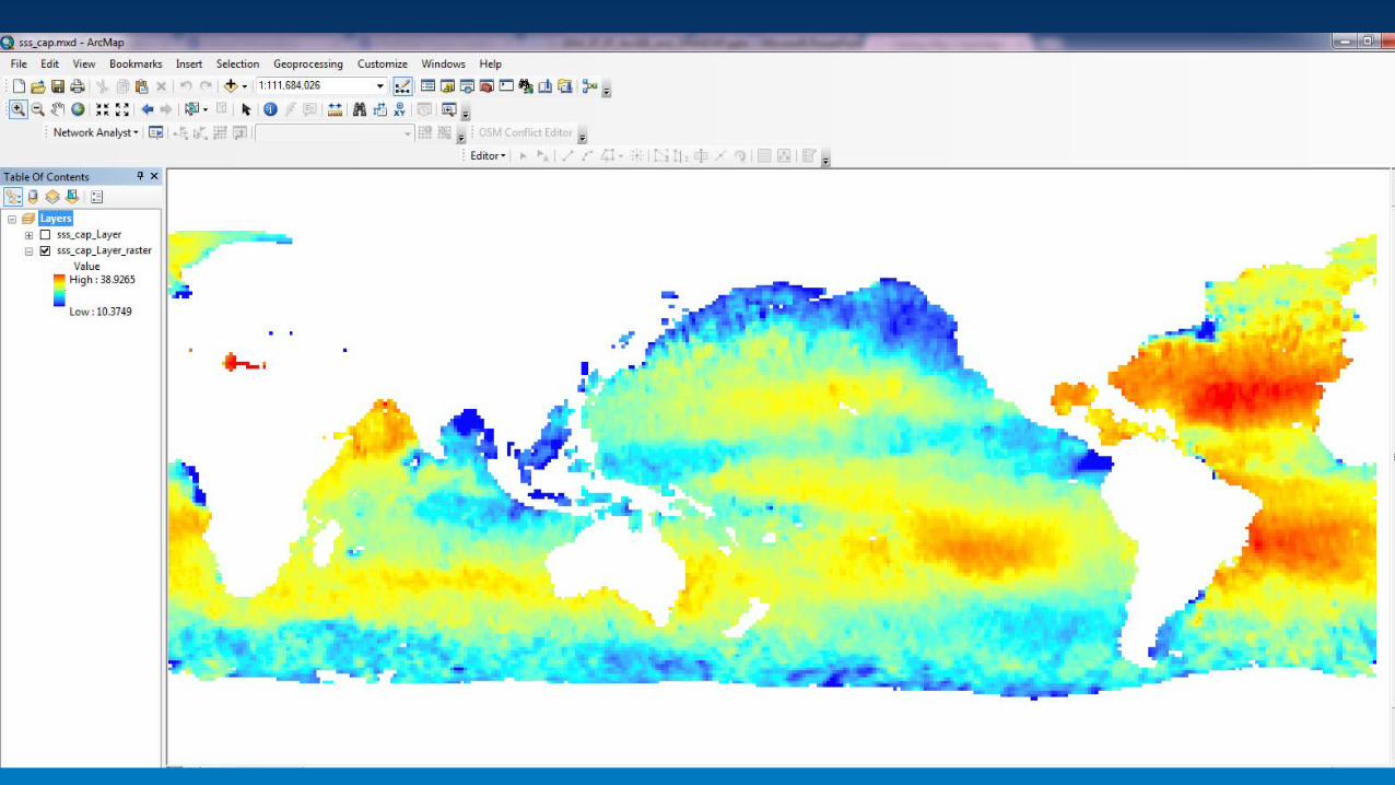
NetCDF fileDAP ServerOPenDAP to NetCDF
Multi-D Toolbox
Output layer
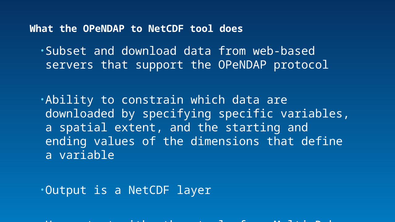
• Subset and download data from web-based servers that support the OPeNDAP protocol
• Ability to constrain which data are downloaded by specifying specific variables, a spatial extent, and the starting and ending values of the dimensions that define a variable
• Output is a NetCDF layer
• Use output with other tools from Multi-D box
What the OPeNDAP to NetCDF tool does
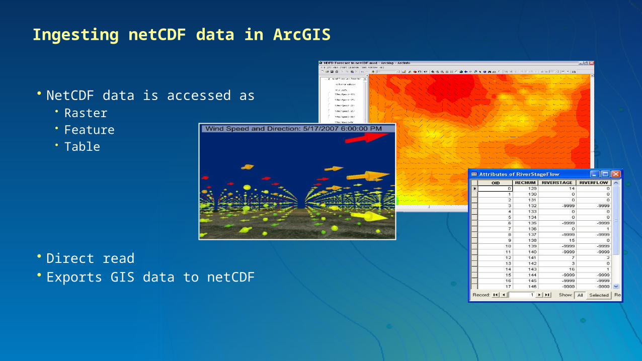
Ingesting netCDF data in ArcGIS
• NetCDF data is accessed as• Raster• Feature• Table
• Direct read• Exports GIS data to netCDF
OPeNDAP to NetCDF WorkflowArcGIS 10.1 and higher
Demo
Post version 10.3OPeNDAP to Raster
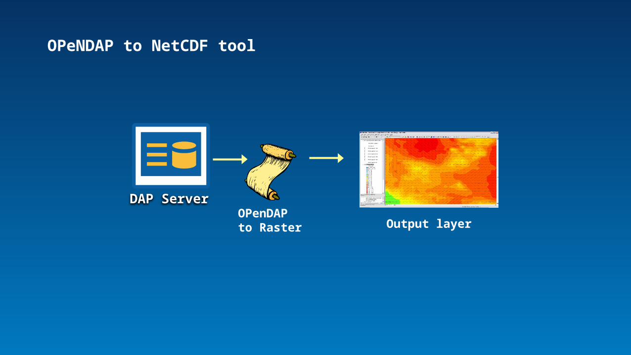
OPeNDAP to NetCDF tool
DAP ServerOPenDAP to Raster Output layer
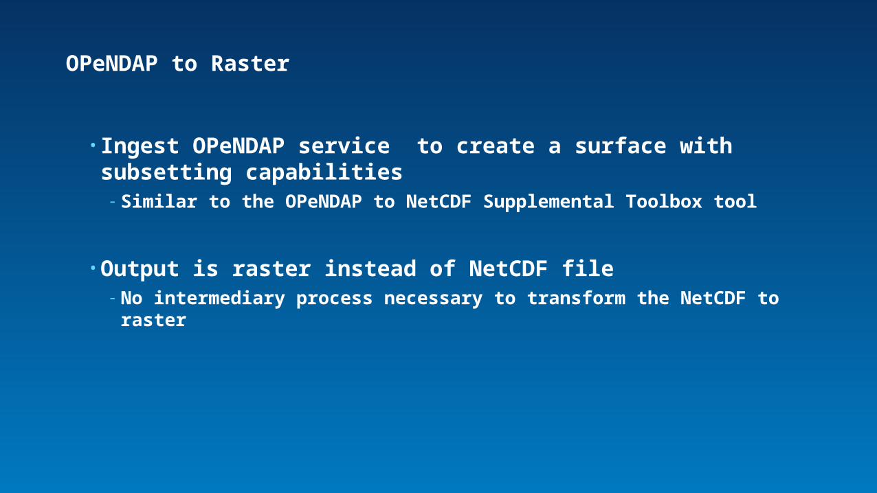
• Ingest OPeNDAP service to create a surface with subsetting capabilities- Similar to the OPeNDAP to NetCDF Supplemental Toolbox tool
• Output is raster instead of NetCDF file- No intermediary process necessary to transform the NetCDF to raster
OPeNDAP to Raster

OPeNDAP to Raster
Make NetCDF Raster Layer
Make WCS Layer
Ingest a ServiceOutput supports
multiple dimensions
• What does it mean that the output is a dynamic raster?- Output is not a file you store, but instead is in memory
- Means you can pan around, and get data as you move through map, not load it all at once; just loads what you need for that view
• Can send another request and view a different variable (dynamic raster layer) without losing the first one
Further Details

Input from You
• OPeNDAP to Raster is Ingest oriented and geared toward gridded data
- Are there other data types in which you are interested? E.g., station data (wx balloons)
• Who are the potential main service providers/users of this tool?
Ingest
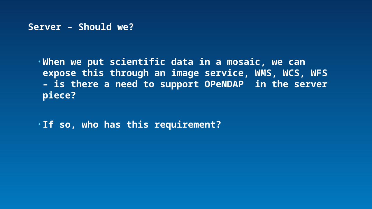
• When we put scientific data in a mosaic, we can expose this through an image service, WMS, WCS, WFS – is there a need to support OPeNDAP in the server piece?
• If so, who has this requirement?
Server – Should we?