guidance for 50 or more realty … for 50 or more realty improvement certifications the new jersey...
TRANSCRIPT

GUIDANCE FOR50 OR MORE REALTY IMPROVEMENT
CERTIFICATIONS
THE NEW JERSEY DEPARTMENT OF ENVIRONMENTAL PROTECTION
Division of Water QualityBureau of Nonpoint Pollution Control
Original version of April 9, 1999Revised October, 2002

TABLE OF CONTENTS
INTRODUCTION ..........................................................................................................................................1
PART I. OBTAINING CERTIFICATION FOR 50 OR MORE REALTY IMPROVEMENTS...........2SIMPLIFIED NITRATE DILUTION MODEL APPROACH ......................................................................................2
PART II. INSTRUCTIONS FOR USING THE SIMPLIFIED NITRATE DILUTION MODEL.........3RATIONALE FOR DETERMINING NUMBER OF BUILDING LOTS...................................................3CALCULATING LOT DENSITY USING THE MODEL ..........................................................................................3
Summary of the Process.............................................................................................................................4Details of the Process ................................................................................................................................4
EXAMPLE CALCULATIONS USING THE SIMPLIFIED APPROACH.................................................5Calculating Ground Water Recharge ........................................................................................................6Calculating Number of Lots per Site .........................................................................................................7
PART III. APPLICATION REQUIREMENTS..........................................................................................9
Application Information.............................................................................................................................9
APPENDICES...............................................................................................................................................11APPENDIX 1. A SELF-CHECK SUBMISSION PREPARATION LIST ....................................................12APPENDIX 2. SUPPLEMENTAL INFORMATION FOR APPLICATION PREPARATION ...................13APPENDIX 3. GLOSSARY...........................................................................................................................15APPENDIX 4. SAMPLE FACT SHEET .......................................................................................................16APPENDIX 5. SPREADSHEET EXAMPLE OF A NITROGEN DILUTION AND LOT SIZE
CALCULATION....................................................................................................................17APPENDIX 6. HELPFUL TELEPHONE NUMBERS FOR 50 OR MORE REALTY IMPROVEMENT
APPLICATIONS....................................................................................................................18APPENDIX 7.SOIL CONSERVATION DISTRICTS IN NEW JERSEY....................................................19APPENDIX 8. BASIN FACTOR EXPLANATION......................................................................................20APPENDIX 9. NEW JERSEY PROVINCES ................................................................................................21APPENDIX 10. DIRECTIONS FOR VISITING DEP ..................................................................................22
\\DEP-05\MAIN\DATA\BNPC\PROJECTS\Program Development\50ORMORE\Guidance\50more.doc

1
INTRODUCTION
Development of rural land is occurring at a rapid pace throughout the State of New Jersey. Inareas that are not served by municipal sewers, residential homes rely on septic systems todispose of their sanitary wastewater. Septic systems provide a safe and reliable method fordisposing of residential wastewater when they are constructed and operated in accordance withthe accepted standards.
The New Jersey Department of Environmental Protection (Department) has modern regulationsfor septic system design and construction at N.J.A.C. 7:9A, called the “Standards for IndividualSubsurface Sewage Disposal Systems.” These rules authorize construction of onsite sewagesystems that are protective of human health and the environment, particularly as they affectsurface and ground water. Surface water quality is protected by distance setbacks from streamsand wetlands. Ground water is protected by requiring sufficient distance between the disposalsystem and the water table, and by relying on modern well construction requirements. Theseregulatory measures effectively protect water bodies and wells against contamination from humandisease organisms.
However, each septic system, whether working properly or not, generates water solublepollutants that can eventually enter streams, aquifers, and lakes. For example, each homegenerates about 30 to 40 pounds per year of nitrate nitrogen and some other pollutants such assodium and chloride. If building lots are too densely packed together, the nitrates and otherpollutants can accumulate in streams and wells at levels that are not considered safe under NewJersey Water Quality Standards. When adequate distance is maintained between homes withonsite sewage disposal systems, experience proves that contamination problems are rare.Therefore, the Department review of 50 or more Realty Improvement Applications is intended toestablish a building lot density that is likely to protect the ground water and surface water and tocomply with the Ground and Surface Water Quality Standards.
This Guidance Document explains the procedure and rationale used by the Department to reviewand ultimately approve applications for 50 or more Realty Improvement Certifications. Thisprocess is one more way that the New Jersey Department of Environmental Protection is workingto protect the waters of the State for present and future generations.
For more information visit our web site at:
www.state.nj.us/dep/dwq/sep50mor.htm
or contact us at:
Bureau of Nonpoint Pollution ControlDivision of Water Quality
NJ Department of Environmental ProtectionPO Box 029
Trenton, NJ 08625609-633-7021609-292-0407
Fax: 609-984-2147

2
Part I. OBTAINING CERTIFICATION FOR 50 OR MORE REALTYIMPROVEMENTS
The New Jersey Department of Environmental Protection is authorized by N.J.S.A. 58:11-25 to certifysubdivisions involving 50 or more realty improvements. The purpose of the Department's review is toestablish the maximum number of building lots that can be built at a subdivision while protecting theground water and surface water quality from the nitrate produced by the individual septic systems.
Simplified Nitrate Dilution Model Approach
The “Simplified Approach” identified in Part II considers that the nitrate generated by the collective groupof septic systems at a subdivision will be diluted by the infiltrating precipitation entering the area inquestion. The “Simplified Nitrate Dilution Model Approach” can be developed and submitted to theDepartment quickly and without great cost, since no geological fieldwork is necessary. The “SimplifiedApproach” relies on information found in easily obtained documents and tables, and requires only simplecalculations. A scientist, planner or engineer can develop the model, or anyone with an ability to do simplecalculations based on maps and areas. Although the “Simplified Nitrate Dilution Model Approach” issomewhat of an oversimplification of what actually happens in the environment, it closely approximates theresults of more detailed analyses and is consistent with our empirical (observed) knowledge of lot sizes thatare protective of the ground water quality. The Department can thusly review and render a decisionquickly, usually within several weeks. The “Simplified Approach” is perfect for someone who wants toobtain a fast review and approval based on a simple and standardized approach, with a minimum of cost.
As of November 1, 2002, there is no acceptable alternative method for establishing appropriate lot sizesunless an administratively complete application is currently being processed by the Department or if a pre-application meeting with the Department has been completed, which identifies the use of a previouslyaccepted method. Only the “Simplified Nitrate Dilution Model Approach” (A above) is acceptable.
The Department highly recommends you to follow the instructions and information providedin this document and its appendices. Failure to follow these instructions will cause anAdministrative Denial of the entire submission. Failure to use the "Simplified NitrateDilution Approach" will result in an automatic Administrative Denial of the entiresubmission. With any denial, your complete submission will be returned for correctionsnoted or recalculation using the "Simplified Nitrate Dilution Approach".

3
Part II. INSTRUCTIONS FOR USING THE SIMPLIFIED NITRATEDILUTION MODEL
RATIONALE FOR DETERMINING NUMBER OF BUILDING LOTSThe approach to determine number of building lots is based on the concept that the nitrate that emanatesfrom septic systems can be diluted to a safe level by the annual volume of water that enters the ground asrecharge. Groundwater recharge is a function of precipitation, runoff, infiltration, andevaporation/transpiration. The Simplified Model assumes that the annual nitrate mass load is completelymixed with the annual volume of water entering the ground as recharge. This simplified method isreasonably accurate because New Jersey has a scientifically based method for estimating recharge based onactual soil mapping units, called soil series.
Calculating Lot Density Using the ModelLot size is established using a simple mass balance equation or model. The essential form of the equationunderlying the "Nitrate Dilution" model is shown in Equation 1.
watereWastVolumeeargchReVolumeyearehom/Nomg
NitrateL/mg 3
+⋅⋅
=⋅ Equation 1
Using the derived equation shown below (Equation 2), one can calculate housing densities based uponeffluent quality, recharge volume, and the ground water quality criteria for NO3-N which must be achieved.To determine lot size using this model, the following assumptions or facts must be accepted:
Volume of Recharge for the nitrate dilution model is established using the Recharge valuescalculated using GSR-32.
Each home is occupied by 3.5 persons1; and each person generates 75 gallons per day ofwastewater2 expressed on an annual basis.
There is no NO3-N in the infiltration which recharges ground water There are no ground water withdrawals. The background ground water quality for NO3-N is 0.4 mg/L and the nitrate target is 5.2 mg/L,
to be consistent with N.J.A.C. 7:9-6 (unless background ground water quality is determined on asite-specific basis through a ground water sampling plan as approved by the Department inwriting or when projects are located in Class I aquifers as defined in N.J.A.C. 7:9-6);
Sewage NO3-N concentration is 40 mg/l;The more complete and complex form of the nitrate dilution model3 is as follows:
)(39.74
)(
iR
oC
oC
sC
pPQ
hA
−=
Equation 2
1 The existing guidance uses 3.5 persons per home. Based upon the most recent census datafor single family homes on single systems, this number is still appropriate. At some later date, theState Planning Commission may employ a different typical home occupancy constant inaccordance with more current demographic information.2 The 75 gallons per day value is consistent with current DEP rules in N.J.A.C. 7:9A. It is subjectto change in the future in accordance with ongoing policy analyses being developed by NJGSand the Division of Watershed Planning3 This model has been often been referred to as the "Wehrman" model or the "Trela/Douglas"Model.

4
Where:
Co = allowable NO3-N concentration in ground water (mg/l) as specified in N.J.A.C. 7:9-6Cs = NO3-N concentration in septage (mg/l)Ri = recharge to ground water (in/yr)P = residents per home (persons/home)Qp = wastewater discharge (gal/person/day)Ah = Average minimum lot size (acres/home)74.39 = Conversion factor to account for converting the infiltration from inches per year to
gallons/acre/day4
Qp = wastewater discharge (gal/person/day)
The result of the calculation is the average lot size per home, and by dividing average by total area by lotsize, one can establish the total number of homes that can be built on a given area of land. For example,when recharge is 12.22 inches per year, the average lot size is 2.42 acres using this equation.
Summary of the ProcessThe steps to carry out the simplified approach are as follows:
1. Determine the distinct watershed areas2. Determine the total area and the area that will be used for residential development3. Determine the recharge for the entire area.
Details of the Process
Step 1: Determining the Watershed areas or Drainage Basins If more than one watershed or drainage basin exists at the major subdivision, the land area should besegmented and recharge should be calculated for each drainage basin area. This is particularly importantwhen streams or other hydraulic boundaries occur that control the potential mixing of ground water. Anexample is shown below in Figures 1 and 2. In the maps, the streams that are central to the watershed areasare shown as lines with arrows, and the delineation between watershed polygons is the bold line in Figure2.
Figure 1. Theoretical subdivision with two watershedsseparated by a drainage divide
Figure 2. Two watersheds delineated for separaterecharge calculations
Step 2: Determining the total area of the residential developmentThe proposed development must always be evaluated to see that the total area generates enough recharge todilute the nitrate to 5.2 mg/L. Ultimately, homes can be distributed evenly throughout the property orclustered. In no case however, can more than the maximum number of homes be built on the property,When using clustering, please be aware that in order to protect each individual home form possiblecontamination from their well or their neighbor's well, the target is 8 mg/L, which is below the drinking
4 The conversion factor 74.39 is obtained as follows: gallons25.27154inch*acre*
yearday365*
day*acregallons
yearInches
= = 74.39

5
water standard of 10 mg/L. However, the soils on which the homes are located should be the morepermeable ones, so that recharge in the densely occupied areas is at least on a average the same as theoverall average recharge.
Step 3: Determining RechargeRecharge must be determined for each application, because it varies based on soils and climatic factors.The method used to determine ground water recharge is specified in "New Jersey Geologic Survey,Geologic Survey Report GSR-32, A Method for Evaluating Ground Water Recharge Areas in New Jersey,1993.Typically, the applicant will obtain soil boundary information from USDA soil maps for the entiredevelopment. Then, the applicant will determine the area of each soil group or unit and will assign arecharge value in a table.The maps generated using the techniques in section II of GSR-32 will be comprised of many groups ofpolygons sharing common recharge characteristics based upon soil type and land use/land coverdesignations. GSR-32 outlines two approaches for classifying and ranking ground water recharge areas. Inmost cases though, an adequate degree of accuracy and precision can be achieved using a simple Thiessenweighted average calculation for annual ground water recharge using the equation belowFrom the table, a single recharge value is typically established that is used to calculate lot size inaccordance with the Equation 2. This average-weighted approach for classifying ground water recharge for an entire project area isrecommended for all projects which do not have highly diverse drainage characteristics as mapped andclassified according to section II of GSR-32, and/or do not have dissected drainage (i.e. any area or portionthereof within the project area that gathers water originating as precipitation and contributes it to separateand distinct areas). In these cases, it will be necessary to either use the "Volumetric-RechargeClassification" method outlined in GSR-32, or the property will have to be dissected into separate drainagebasins. In either case, development density within the project site would have to be segregated relative toground water recharge classification or drainage areas.
∑
×+×+×= A
ARc...AARcA
ARcRc nn
211 2
Equation 35
Where:
Rc = average weighted annual ground water recharge (in/yr)Rci = annual ground water recharge per individual unit or polygon (in/yr)A = total land area available for infiltration (acres)Ai = land area of individual units or polygons (acres)
(i = any number 1 through n)If one uses the spreadsheet supplied by the Department, the site recharge value is calculated automatically.
EXAMPLE CALCULATIONS USING THE SIMPLIFIED APPROACH
The Department recommends that you use the Excel spreadsheet available on the Division of Water QualityWebsite www.state.nj.us/dep/dwq/sep50mor.htm.
5 When developing this recharge number, be sure to include all polygons, even if they are equalto zero inches per year. The total acreage must add up to 100% of the area.

6
Calculating Ground Water RechargeThe equation for calculating an estimate of annual ground water recharge is as follows:
Annual ground Water recharge = (R-Factor x C-Factor x B-Factor) - R-ConstantWhere:
• R-Factor is selected from a table (Appendix 4 or 5) in GSR-32 considering Land Use Land CoverCode (LULC) and soil series or soil group
• R-Constant is selected from a table (Appendix 4 or 5) in GSR-32 considering Land Use LandCover Code and soil series or soil group
• C-Factor is the Climate factor, and it is selected from a table (Appendix 6) in GSR-32, and it isspecific to the location of the proposed development.
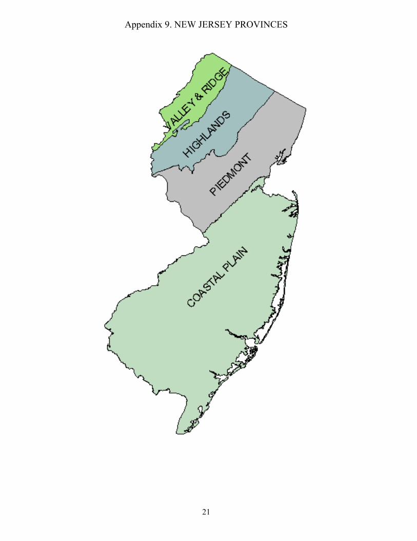
• B-Factor is a constant of 1.06. A constant of 1.3 may be substituted for those projects locatedwithin areas of the New Jersey Coastal Plain as shown in Appendix 9.
Thus, when the soil series is Sassafras, and the LULC code is 4, the R-Factor = 16.61 and the R-Constant =12.78, and the C-Factor = 1.43 (typical for Middlesex County), the following recharge can be calculated:
Annual ground Water recharge = (16.61 x 1.43 x 1.0) - 12.78Simplified:
Annual ground Water recharge = 10.97 inches/year
The recharge of 10.97 inches/year is now entered into the Nitrate dilution equation (Equation 2) todetermine the number of building lots that can be safely sited without risking contamination of the groundwater above the ground water quality standards.
Average Weighted RechargeIn those circumstances when many soils and many polygons are involved, there is a need to establish anarea weighted average infiltration or recharge rate. The approach for calculating this is the Thiessenpolygon approach, as described in most hydrology textbooks. This simple example should provide adequateguidance for anyone pursuing this approach. Suppose there are four different polygons, and that both the recharge and the area are known for them all.The following type of table can be constructed. Equation 3 above is followed, whereby the fractional areafor each polygon is calculated, and multiplied by the recharge for each polygon. The weighted rechargevalues are summed and this sum is the Weighted Area Recharge to put into the Equation 2 above.
6 This is a new modified basin factor constant proposed by NJGS. It is an amended value forGSR-32 For additional information, contact the New Jersey Geologic Survey, 29 Arctic Parkway,P.O. BOX 427, Trenton, NJ 08625 , Phone: (609) 292-1185 , FAX: (609) 633-1004

7
Table 1. A simple generic example of the approach used to calculate the Thiessen weighted Arearecharge
Soil orPolygonNumber
Recharge(inches)
Soil or PolygonArea
(Acres)
Area Fraction(Polygon
Area/Total Area)
Recharge weighted byFractional Area
(Inches)Col 2 * Col 4
1 10 50 0.25 2.52 20 50 0.25 53 30 50 0.25 7.54 40 50 0.25 10
Total 200 1.0 25
Alternatively, it can be laid out as in this example in Table 2, where there are 100 total acres.
Table 2. An example recharge calculation using actual soils recharge data and recharge/landarea by the Thiessen weighted area (Table 2) approach.Soil Name or Recharge Group AbA AbB BuB BuC AmwellLULC 4 4 4 4 4Recharge factor (Rf) 12.94 12.94 17.86 17.86 0.00Recharge Constant (Rc) 8.25 8.25 14.12 14.12 0.00Climate Factor (Cf) 1.52 1.52 1.52 1.52 1.52Polygon Area (acres) 25.00 25.00 25.00 25.00 25.00Recharge (in/yr) 11.42 11.42 13.03 13.03 0.00Recharge per Polygon 2.28 2.28 2.61 2.61 0.00In this example, the total recharge is the sum of Recharge per polygon Land Area, which is 9.78 inches.This is the same layout used in the recommended spreadsheet as illustrated in Appendix 5 where thecalculation for each soil is Recharge X Polygon_Area/Total_Area.
Calculating Number of Lots per SiteThe example calculations that follow are for a case where only one soil occurs on site. Situations that aremore complex are easily calculated, but if the person preparing the calculation needs assistance, please donot hesitate to call the Department "50 or More" contact.Using the nitrate dilution (Equation 2) Part II, calculations yield an average lot size of 2.42 acres using theexample data in Table 2.
Table 3. Example of the results of the average lot size calculation.Co Allowable NO3-N concentration in ground water discharge
(mg/l)5.2 mg/l
Cs NO3-N concentration in septage (mg/l) 40 mg/lRI Recharge to ground water (in/yr) 9.78 in/yrP Residents per home (persons/home) 3.5 persons/homeQp Wastewater discharge (gal/person/day) 75Ah Average lot size (acres/home) 2.42
In order to enable clustering, one can conduct two sets of calculations. First, the nitrate target of 5.2 shall beused to establish the maximum number of houses that can occupy the entire site. Like in Table 4, a secondcalculation can be conducted using the target of 8.0 mg/L expressed over the actual area where houses willbe built. Using this approach, calculations yield a minimum lot size of 2.14 acres when the soil is Sassafras,and when the LULC is 4, and when the climate factor is 1.43. This means that for this site, average lot size

8
may be larger than the minimum lot size, but the minimum lot size is adequate to protect against any onehome exerting a profound effect on an adjacent home.
Table 4. Example of the results of the minimum lot size calculation.Co Maximum allowable NO3-N concentration in ground water
discharge (mg/l) when clustering is utilized8.0 mg/l
Cs NO3-N concentration in septage (mg/l) 40 mg/lRI Recharge to ground water (in/yr) 9.78 in/yrP Residents per home (persons/home) 3.5 persons/homeQp Wastewater discharge (gal/person/day) 75Ah Minimum lot size (acres/home) 1.44
ConclusionIt might take a little effort to become completely familiar with this approach, but it is really quite simple,especially when you use the Department developed spreadsheet. Please do not hesitate to call the BNPC at609-633-7021 and ask for assistance if you pursue this approach.

9
Part III. APPLICATION REQUIREMENTSApplication Information
An application to obtain Certification of sewerage facilities for subdivisions involving 50 or more realtyimprovements using the “Simplified Approach” discussed herein shall ONLY include the below listedinformation and that requested on the Supplemental Information for Application Preparation Sheet. Noadditional information will be accepted. Any information submitted that is illegible, too small a scale ortyping font will be automatically marked "Administratively Deficient" and returned for correction.
Please submit:
1. A completed Treatment Works Approval Permit Application, Form (TWA-1). This form isavailable on the internet at http://www.state.nj.us/dep/dwq/forms.htm
2. Engineering plans signed and sealed by a professional engineer licensed to practice in New Jersey,including:
A. A Plot Plan (on one sheet) of the entire site showing: name of project, municipality, lot andblock designations, location of proposed lots, and location of boundaries of land not intendedfor development (e.g. easements, wetlands, floodplains and dedicated open space, etc.); thelocation of streams, ponds, and springs on and within 100 feet of the boundaries of the site.These boundaries must be approved by the DEP Land Use Regulation Program or have astatement of no jurisdiction in lieu of an approval;
B. A Final Grading and Drainage Plan (on one sheet) showing final site grading elevations andcontours (minimum 2 foot contours);
C. A Topographic Plan (on one sheet) showing all elevations (minimum 2 foot contours) of thepre-developed site along with any distinct watershed areas delineated within the site to showdissected drainage;
D. A Test Pit/Septic System Location Plan (on one sheet) showing the location of all soil test pits,borings and percolation/permeability tests, and any other tests/evaluations conducted onsite;
3. A Fact Sheet (on one, separate sheet of paper) can be enclosed separately or with the cover letter.It must list the below project data:
A. total project acreage,
B. total wetland & surface water bodies acreage,
C. total open space acreage ( i.e. land not to be built upon & not wetlands or open water),
D. total project land area available for infiltration – downgradient from houses - (by each projectwatershed basin – if more than one watershed {i.e. dissected drainage} in project area),
E. local zoning schedule for type of project requesting Certification,
F. total number of houses requested in Certification,
G. minimum lot size requested in Certification,
H. a statement specifying the mechanism for providing potable water at the proposed subdivision;
All soil logs, boring logs and percolation/permeability test results, and any other results ofsoil/geohydrologic tests/evaluations conducted onsite;

10
5. Government Agency Mapping:A. United States Geologic Survey (USGS) Topographic Quadrangle with site boundaries
outlined.B. United States Department of Agriculture (USDA) Soil Conservation Service County Soil
Survey Sheet(s) with site boundaries outlined.C. United States Department of the Interior, Fish and Wildlife Services National Wetland
Inventory Quadrangles with site boundaries outlined.
6. Ground Water Recharge Mapping Series as described in GSR-32, section II:(e.g. source datamaps, composite OVERLAYS and recharge base map). Use 81/2” x 11” mylar (acetate) sheets, 1EACH for each of the below categories:
A. Project site soilsB. LULC codesC. Recharge areas
7. Ground Water Recharge Spreadsheet (completed according to the directions in GSR-32).including: See Part VII for an example, plus visit our Website on the internet athttp://www.state.nj.us/dep/dwq for our example (M/S Excel software). The spreadsheetshould show:
A. Polygon Codes (no polygons should be less than 2 acres in area)B. Land Use/Land Cover Codes (for the intended development – NOT pre-development) C. Soil Group/TypeD. Basin factor is now 1.0E. R-FactorF. R-ConstantG. C-FactorH. Estimated Recharge (in/yr)
8. Nitrate dilution calculations demonstrating maximum number of lots that can be accommodatedwhile remaining in compliance with the New Jersey Ground Water Quality Standards (GWQS) andfollowing guidelines in this document.
9. All final data and calculations of annual ground water recharge, nitrate dilution, and minimum lotsize.
10 Written documentation from the relevant township or municipality indicating that the projectcomplies with local zoning, planning and environmental ordinances and if applicable, all localmaster plan requirements. If the project is in Burlington, Ocean, Atlantic, or Cape May Counties,you will need to provide an affirmative statement that the project does not occur in the Pinelandsarea. If it does occur in the Pinelands area, please submit documentation from the PinelandsCommission that indicates that the development is consistent with their requirements.

11
APPENDICES

12
Appendix 1. A SELF-CHECK SUBMISSION PREPARATION LIST50+ Realty Improvements Application Submission
SELF-CHECKSubmission Preparation List
General
GENERAL
I have a complete 50+ Application Package to use for my submission.
I understand the 50+ Guidance Document including all appendices.
I understand the Simplified Nitrate Dilution Model Approach.
I understand that no alternative methods to the Simplified Approach will be permitted forNitrate Dilution calculation.I have a copy of GSR-32.
I understand that NO Fee is required for a 50+ Certification submission. I understand time frames for application submission and appointments. I understand that I do NOT need to send copies of state or federal rules and regulations with
my submission.
APPLICATION "PACKAGE" INCLUSIONS
Cover Letter or Transmittal Sheet Fact Sheet (one sheet) TWA-1 Application (signed & dated) Plot Plan (one sheet)Dilution Model calculations Final G & D Plan (one sheet) Topographic Plan (one sheet) Test Pit/Septic System Location Plan (one page) Government Agency Mapping of:__ USGS Topo Quadrangle, __ USDA - SCS Soil Survey Sheet(s) __ USDI National Wetland Inventory Quadrangle Mylar Overlays of: __ LULC (post-development) codes, __ Project Site Soils __ Recharge Areas Spreadsheet
Nitrogen Dilution calculationsFinal ground water recharge data, calculations and minimum lot size
Pinelands Commission documentation (Burlington, Ocean, Atlantic & Cape May counties) Written documentation from township (project compliance with all local ordinances & master
plan requirements) Attachments
6/02
This sheet is provided for your personal use in preparing your 50+ submission

13
Appendix 2. SUPPLEMENTAL INFORMATION FOR APPLICATION
PREPARATION 50 or More Realty Improvement Certifications
All applicants are asked to use this supplemental information in conjunction with the instructions given inthe main body of this document. Use of the other appendices will also assist in application preparation.
IMPORTANT REMINDER:
Automatic Administrative Denial will result when:1. Review staff can not read/understand any part of the submission (i.e. any part is illegible, too small
a scale or typing font, poor photocopying quality, etc.)2. Applicant failed to use the “Simplified Nitrate Dilution Model Approach".
Some other common reasons for Administrative Denial are:1. Incomplete information on the application2. Missing portions of submittal package (special note to municipal documents and/or Pinelands
information must be included as applicable)3. Missing signatures4. Submitting an overly complicated application (i.e. sending in too much material - more than was
asked for in the instructions)5. Failure to follow any of the instructions in C. Application Preparation, Numbers 1 through 10.
Document.
GENERAL SUGGESTIONS:
PLAN AHEAD - do not procrastinate - do not submit applications at the last minute and expectinstantaneous service. The 50+ Certification Program is not a "walk-in" or "over-the-counter" type ofprocess. Allow at least 30 working days (from date of receipt of submission by the Bureau) for review. Ifthe guidance document instructions have been followed and the submission is Administratively Complete,our usual review time is less than 30 days.
Read the entire 50+ Guidance Document completely - BEFORE working on your submission package.Call this office with any questions. Calling may avoid the need for a pre-meeting or save the submissionfrom being Administratively Denied and returned.
SPECIFIC SUGGESTIONS:
The application typing, map wording or any labels are to be no smaller than 10pt. Type.
Color maps and/or drawings are not required.
CAD drawings are not required.
Minimal engineering plans are to be submitted in accordance with guidance document instructions. DoNOT submit unnecessary plans (e.g. road profiles, utility drawings, landscape plans, lighting schemes, etc.)
Grading and drainage plans are to be FINAL - preliminary plans will not be acceptable.

14
Use single sheets (whenever possible) for all engineering plans. See Part C. 2 - Application Requirementsin the main body of the guidance document.
Double check the Recharge Spreadsheet numbers taken from GSR-32, Appendix IV. Look fortransposition errors.
Raw data will only be accepted on a computer diskette.
Calculate recharge using a Basin Factor of 1.0.
Determine LULC Codes on POST DEVELOPMENT grading and landscaping not on the pre-construction, undeveloped site. This is what the site will look like after all construction has been completedand occupancy/use has started.
Do not submit polygons smaller than 2 acres.
Refer to the calculation and model examples in the guidance document when determining your nitrogendilution figures.
Use good quality photocopying (especially with the soils maps).
DO NOT SUBMIT COPIES OF NJDEP RULES,REGULATIONS, GSR-32 OR ANY OTHER GOVERNMENTDOCUMENTS!
The separate Fact Sheet is an official part of the application submission and must be complete. Follow thesample shown in the Appendix III-D.
The Cover Letter (or Transmittal Sheet) must include a listing of ALL enclosures being submitted.
NO COPIES ARE REQUIRED for the Department. This office only requires the original package withoriginal forms and signatures.

15
Appendix 3. GLOSSARY50+ Realty Improvements Application Submission
(The select definitions listed in this Glossary are intended for use only with 50+Application Submissions. They are NOT official Department definitions. Theyare only intended to clarify certain 50+ application processes and not refer to orimpact any other Department rules or regulations.)
1. Basin Factor means a constant number of 1.0 used in calculating recharge. It is a new modifiednumber by NJGS and is an amended value for GSR-32. For projects located in areas of the NewJersey Coastal Plain, a basin factor of 1.3 may be used in lieu of 1.0. This variation is based uponvarious studies that have been conducted as identified in Appendix 8 that show that while a basinfactor of 1.0 was most appropriate in the studies conducted in the northern areas of the State, coastalplain areas yielded less variability when using the Sliding interval methodology vs. using the Postenmethod. This, coupled with the idea that there is variability between different areas of New Jersey, itis shown that a basin factor of 1.3 may be more appropriate in the coastal plain provinces.
2. Dissected Watershed means any area or portion thereof within a project area that gathers wateroriginating as precipitation and contributes it to separate and distinct areas.
3. Infiltration Area means that land within the project area where water will percolate into thesubsoil.
4. Non-infiltration Area means any area within the project area where water will not percolate intothe subsoil.
5. Open space means that portion of the project area where no development will occur and isguaranteed by municipal ordinance or project covenant to remain as such in perpetuity.
6. Polygon means areas (no smaller than 2 acres for 50+ submissions) within the project that sharecommon recharge characteristics based upon soil types and land use/land cover designations.
7. Project Area means the total site acreage submitted for Certification.
8. Surface Water Body (i.e. open water) means any spring, stream, river, lake, pond, wetlandor artificial water body at or above the lands surface. Flow rate or frequency (constant or intermittent)has no affect.
9. Wetlands means those areas saturated by surface or ground water at a frequency and duration tosupport hydrophilic vegetation.

16
Appendix 4. SAMPLE FACT SHEET 50+ Realty Improvements Application Submission
1. This sheet is a mandatory submission.2. Failure to include it with a submission will cause an automatic "Administrative Denial".3. Attachments are to be kept to a minimum number of pages.4. Keep this form as an individual document and separate form all other information.
======================================================================================
Company Letterhead
Inside Address:
Date
RE: 50+ Fact Sheet for: (name the project, block & lot numbers and city/township, state & zip)
Dear Mr. Chalofsky:
This Fact Sheet is submitted for the above referenced project as part of the requirements for 50+Certification Application Program.
(Name of project) has:
A. ________ total project acres;
B. _______ total acres of wetland & surface water bodies;
C. _______ total open space acres ( i.e. land not to be built upon & not wetlands or open water);
D. _______ acres of total project land area available for infiltration (by each project watershed basin ifmore than one watershed in project area, i.e. dissected drainage);
E. _______ attached the local zoning schedule for type of project under this Certification submission;
F. _______ total number of houses to be constructed under this Certification submission;
G. _______ acres as the minimum lot size being requested under this Certification;
H. _______ as the minimum number of lots being requested under this Certification;
I. _______ attached written documentation of:___ compliance with local ordinances___ local master plan requirements___ Pinelands Commission (Burlington, Ocean, Atlantic & Cape May counties only)
J. Project's houses will get potable water from: individual house wells public supply
Signatory:
Attachments:

17
Appendix 5. SPREADSHEET EXAMPLE OF A NITROGEN DILUTION AND LOT SIZECALCULATION
Project Name Fill in the Name HereProject Location Fill in the location hereLot and Block Fill in the lot and block information hereFill in as many Soil Types as needed up to column "AA" (Click the "Add New Soil" button to createadditional ones)Soil Name or Recharge Group AbA AbB BuB BuC AmwellLULC 4 4 4 4 4Recharge factor (Rf) 12.94 12.94 17.86 17.86 0.00Recharge Constant (Rc) 8.25 8.25 14.12 14.12 0.00Climate Factor (Cf) 1.52 1.52 1.52 1.52 1.52Polygon Area (acres) 25.00 25.00 25.00 25.00 25.00Recharge (in/yr) 11.42 11.42 13.03 13.03 0.00Recharge per Polygon 2.2838 2.2838 2.6054 2.6054 0.0000Calculated Sum of Project Acres 125.00Average Weighted Infiltration (In/yr) 9.78Target Nitrate Concentration 5.20Maximum Nitrate Concentration 8.00Basin Factor (Constant) 1.00Average Lot Size (acres/home) 2.42Minimum Lot Size (acres/home) 1.44Maximum number of homes 51.76
A complete version of this spreadsheet can be downloaded fromhttp://www.state.nj.us/dep/dwq/sep50mor.htm

18
Appendix 6. HELPFUL TELEPHONE NUMBERS FOR 50 OR MORE REALTYIMPROVEMENT APPLICATIONS
AGENCIES Telephone Fax
Bureau of Nonpoint Pollution Control (BNPC (609) 633-7021 (609) 984-2147New Jersey Geological Survey (NJGS (609) 292-1185New Jersey Maps & Publications Office (sales (609) 777-1038Land Use Regulation Program (609) 292-0060 (609) 292-8115US Soil Conservation Service (SCS (732) 246-1171NJ State Soil Conservation Committee (SSCC) (609) 292-5540
PUBLICATIONS
NJGS GSR – 32, “A Method for Evaluating Ground Water Recharge Areas in New Jersey,1993”, $10.00/copy, NJ DEP Maps & Publications OfficeNJ Ground Water Protection (NJPDES) Regulations, N.J.A.C. 7:14A-1, et seq.
Internet, http://www.state.nj.us/dep/dwq/rules.htm NJ Ground Water Quality Standards, N.J.A.C. 7:9-6
West Group Customer Support, Tele: 1-800-808-9378Internet, http://www.state.nj.us/dep/dwq/pdf/njac79-6.pdf.
NJ Standards for Individual Subsurface Disposal (“Chapter 199”), N.J.A.C. 7:9ANJ DEP Maps & Publications Office Internet, http://www.state.nj.us/dep/dwq/rules.htm
NJ Realty Improvement Sewerage and Facilities Act (1954), N.J.S.A. 58:11-25.1State and County libraries
NJDEP Field Sampling Procedures Manual, NJ DEP Maps & Publications OfficeUnited States Geological Survey (USGS) Topographic Quadrangle Sheets (1:24,000 scale)
NJ DEP Maps & Publications Office, many large sporting goods stores, Internet at www.ugs.gov
United States Department of Agriculture (USDA) Soil Conservation Service (SCS), County Soil Survey Sheets , Local Soil Conservation District (see Part V)
United States Department of the Interior (USDOI), Fish and Wildlife Services (F&WS) National Wetland Inventory Quadrangles (1:24,000 scale), NJDEP Maps & Publications Office
NJ Freshwater Wetlands Maps, NJDEP Maps & Publications OfficeGround Water Recharge Mapping Series, NJGS GSR – 32, Section IIOrthophotographic Quadrangles (register to 1:24,000)
MARKHURD at 1 - 800 - 627 - 4873 or NJ DEP Maps & Publications (for diazoprints)
***Ask at Maps & Publications about CDRom prices for any mapping needs***

19
Appendix 7.SOIL CONSERVATION DISTRICTS IN NEW JERSEY
DISTRICT ADDRESS TELEPHONE FAX
Bergen County 327 Ridgewod AvenueParamus, NJ 07652
(201) 261- 4407or (973) 538-1552
(201) 261-7573
Burlington County Tiffany Square, Suite 1002615Route 38 – RD 2Mount Holly, NJ 08060
(609) 267–7410or (609) 267-0811*
(609) 267-3347
Camden County 403 Commerce Lane, Suite 1West Berlin, NJ 08091
(856) 767- 6299 or (609)205-1225*
(856) 767-1676
Cape-Atlantic Atlantic County OfficeBuilding6260 Old HardingHighway Mays Landing, NJ 08330
(609) 625-3144 or (609)205-1225*
609) 625-7360
Cumberland County PO Box 144, Route 77Deerfield, NJ 08313
(856) 451-2422 or (856)205-1225*
(856) 451-1358
Freehold(Middlesex & MonmouthCounties)
211 Freehold RoadManalapan, NJ 07726
732) 446-2300 or (732)462-1079*
(732) 446-9140
Gloucester County Kandle Center, 72 East Holly AvePitman, NJ 08071
(856) 589-5250 or (856)769-2790*
(856) 256-0488
Hudson, Essex & Passaic 15 Bloomfield AvenueNorth Caldwell, NJ 07006
(973) 364-0786 or (973)538-1552
(973) 364-0784
Hunterdon County Community Services Annex 8Gauntt PlaceFlemington, NJ 08822
(908) 788-1397 or (908)735-0737*
(908) 788-0795
Mercer County 508 Hughes Drive HamiltonSquare, NJ 08690
(609) 586-9603 or (732)462-1079*
609) 586-1117
Morris County Courthouse, POB 900 Morristown,NJ 07960( physical location – 560W. Hanover Ave., MorrisTownship)
(973) 285-2953 or (908)735-0737*
(973) 285-8345
Ocean County 714 Lacey Road Forked River, NJ08731
(609) 971-7002 or (609)267-0811*
(609) 971-3391
Salem County PO Box 168Deerfield, NJ 08313
(856) 769-1124 or (609)205-1225*
(856) 451-1358
Somerset-Union Somerset County 4-H Center308 Milltown RoadBridgewater, NJ 08807
(908) 526-2701 or (908)782-4614*
(908) 526-7017
Sussex County 186 Halsey Road, Suite 2Newton, NJ 07860
(973) 579-5074 or (908)735-0737*
(973) 579-7846
Warren County 224 STIGER STREETHACKETTSTOWN, NJ 07840
(908) 852-2579 or (908)735-0737*
(908) 852-2284
* Natural Resource Conservation Service Field Office
STATE SOIL CONSERVATION COMMITTEENEW JERSEY DEPARTMENT OF AGRICULTURE
PO BOX 330, TRENTON, NJ 08625
Tele:(609) 292-5540 Fax:(609) 633-7229

20
Appendix 8. BASIN FACTOR EXPLANATION
21
Appendix 9. NEW JERSEY PROVINCES

22
Appendix 10. DIRECTIONS FOR VISITING DEP