guidelines for coastal catchment management · pdf fileguidelines for coastal catchment...
TRANSCRIPT

Guidelines for Coastal Catchment Management Authorities:
Assessing development in relation to sea level rise. June 2012

These Guidelines have been developed in consultation with representatives of the Catchment Management Authorities,
Melbourne Water, the Department of Sustainability and Environment and the Department of Planning and Community
Development.
These Guidelines were approved by the Hon Peter Walsh MP, Minister for Water on 8June 2012.
Published by the Victorian Government Department of Sustainability and Environment Melbourne,
June 2012
© The State of Victoria Department of Sustainability and Environment 2012
This publication is copyright. No part may be reproduced by any process except in accordance with the
provisions of the Copyright Act 1968.
Authorised by the Victorian Government, 8 Nicholson Street, East Melbourne.
Printed on recycled paper.
For more information contact the DSE Customer Service Centre 136 186
Disclaimer
This publication may be of assistance to you but the State of Victoria and its employees do not guarantee that the
publication is without flaw of any kind or is wholly appropriate for your particular purposes and therefore disclaims all
liability for any error, loss or other consequence which may arise from you relying on any information in this publication.
Accessibility
If you would like to receive this publication in an accessible format, such as large print or audio, please telephone
136 186, or email [email protected]
Deaf, hearing impaired or speech impaired? Call us via the National Relay Service on 133 677 or visit
www.relayservice.com.au
This document is also available in PDF format on the internet at www.dse.vic.gov.au

Report Title Report Subtitle 1
Contents
Contents 1
Purpose of the guidelines 2
Application of guidelines 2
Policy basis for guidelines 2
Objectives of the guidelines 3
Considering and advising on development proposals 5
Establishing flood levels and associated risk 5
Assessing proposals 6
Conditions on planning permits 8
Application of Freeboard 9
APPENDIX A 11
APPENDIX B – Acronyms and Glossary 17

Report Title Report Subtitle 2
Purpose of the guidelines
These guidelines set out relevant criteria and considerations to be taken into account by coastal Catchment Management
Authorities (CMAs) in assessing development proposals that may potentially be affected by sea level rise. They do not
apply to Melbourne Water. Melbourne Water has developed similar guidelines, tailored to meet local circumstances.
The guidelines will be reviewed in 2017, or prior to, if there are advances in adaptation planning prior to this date.
The role of CMAs is to provide advice on flooding and development controls pursuant to Section 202 of the Water Act
1989. This does not include advising on coastal physical vulnerability such as erosion.
Application of guidelines
CMAs need to consider these guidelines when advising the responsible authority on development proposals under the
Planning and Environment Act 1987, and the application of Clause 13.01 of the State Planning Policy Framework relating
to predicted rises in sea level.
In addition, these guidelines should inform any pre-application advice provided to relevant applicants by the CMA and or
the responsible authority.
It is important to note that these guidelines focus on coastal inundation and are not relevant to the CMA’s role in
providing advice on development proposals located on floodplains that are not affected by coastal inundation.
Specifically, these guidelines apply to land including:
• areas adjoining the coastline;
• estuaries, such as the Gippsland Lakes; and
• the tidal reaches of rivers, drains and other waterways.
Where a responsible authority forms the view that land may be subject to potential coastal inundation, it may seek a
CMA’s view pursuant to the referrals process outlined in Sections 52 and 55 of the Planning and Environment Act 1987.
Policy basis for guidelines
These guidelines apply the policies set out in Clause 13.01-1 of the State Planning Policy Framework relating to coastal
inundation.
In addition to these guidelines, flood information specific to a particular locality set out in the planning scheme or known
by a Floodplain Management Authority, must also be considered in assessing development in areas susceptible to
coastal inundation or in riverine and estuarine areas that are impacted by sea level rise.
Any relevant information in addition to these guidelines must be construed consistently with and reflect the intent of the
objective and strategies set out in Clause 13.01-1 of the State Planning Policy Framework.

Guidelines for Coastal Catchment Management Authorities: Assessing development in relation to sea level rise June 2012 3
Objectives of the guidelines
The primary objective of these guidelines is set out in Clause 13.01 of the State Planning Policy Framework in the
planning scheme.
That is, to plan for and to manage the potential coastal impacts of climate change in advising on development and use of
land.
In order to realise this objective, the following strategies apply:
Plan for sea level rise of not less than 0.8 metres by 2100, and allow for the
combined effects of tides, storm surges, coastal processes and local conditions
such as topography and geology when assessing risks and coastal impacts
associated with climate change.
Although coastal inundation from sea level rise and storms may take years to be experienced, in some areas the impacts
will be felt sooner. If development intensifies in coastal areas at risk of current or future inundation, property and
infrastructure damage may increase, and increased numbers of people may be exposed to health and safety issues
associated with flooding. However, tight restrictions on development at this point in time may impact on the viability and
vitality of coastal communities, which may not be affected by sea level rise for some time. Effective adaptation planning
is ultimately the medium to long term solution to managing the impacts of sea level rise.
Apply the precautionary principle to planning and management decision-making
when considering the risks associated with climate change.
The precautionary principle states that where there are threats of serious or irreversible environmental damage, a lack of
full scientific certainty should not be used as a reason for delaying actions to prevent environmental degradation. In
practice, this means decision makers should consider the best available science and information on potential impacts
and risks and take action to prevent degradation of the environment where there are threats of serious or irreversible
environmental damage.
Ensure that new development is located and designed to take account of the impacts of climate change on coastal
hazards such as the combined effects of storm tides and river flooding.
Climate change will progressively impact on flood risk at the property level. This can come from increased sea and flood
levels. The progressive change in flood risk will necessitate appropriate planning and building controls.
Buildings typically have a lifespan of 30 to 80 years, but it is not unusual for some form of re-development to occur before
then, either through a new building or extensive renovations/additions to a building, requiring a new planning and/or
building control where new conditions can be applied.

Guidelines for Coastal Catchment Management Authorities: Assessing development in relation to sea level rise June 2012 4
Ensure that land subject to coastal inundation is identified and appropriately
managed to ensure that future development is not at risk.
These guidelines support the need for flood mapping at a suitable scale and quality, to enable referrals to be made to
CMAs. The Victorian Government will provide the following information and guidance to assist decision makers as it is
completed:
• Digital elevation models of the Victorian coast provide three-dimensional representations of the land
(topographic) to indicate areas that may be more vulnerable to coastal inundation.
• Bathymetric (sea-floor) digital elevation models along the entire Victorian coast.
• Regional climate change projections developed by CSIRO for ten regions of Victoria that include projections
on temperature and rainfall.
• The Victorian state-wide inundation dataset, which maps the projected extent of coastal inundation due to sea
level rise and storm tide events (the rise of water associated with a storm event combined with a high tide) for
four different time periods: 2010, 2040, 2070 and 2100.
• The Victorian Coastal Hazard Guide provides further information for land managers and decision makers on
coastal hazards such as erosion and inundation. It describes the impact that climate change may have on
these hazards, and provides guidance on the ways to manage the effects of these hazards.
• A coastal asset data library containing information about built and natural assets on Victoria’s coast.
CMAs are encouraged to make use of new information and scientific data on coastal hazards as it becomes available.
New large-scale development outside existing urban areas, such as greenfield subdivisions, has the potential to
significantly increase the number of people and amount of infrastructure at risk. Aside from flooding considerations at
the site there will be a need to consider how roads, drains, water, gas, power and other services can be provided to the
site in a sustainable manner. Other considerations relate to preserving significant flowpaths or flood storage areas and
their associated ecological values.
Development proposals outside established urban areas which require rezoning may also be subject to Ministerial
Direction 13 under the Planning and Environment Act 1987. The Direction applies to any planning scheme amendment
involving coastal land which would have the effect of allowing non-urban land to be used for an urban use and
development.
Avoid development in identified coastal hazard areas susceptible to inundation.
It is usually too late to avoid development in existing urbanised areas because the streetscape and infrastructure have
already been established, and in many situations, it is better to allow development inside existing urban areas rather than
expand into rural areas. This is not the case for new development outside existing urban communities that would
substantially increase numbers of people at risk of future flooding. For such areas a long term planning approach is
warranted, to ensure that new development will be located, designed and protected from potential coastal hazards well
into the future.

Guidelines for Coastal Catchment Management Authorities: Assessing development in relation to sea level rise June 2012 5
Considering and advising on development proposals
Responsible authorities are encouraged to give CMAs notice under the Planning and Environment Act 1987 where
advice is required from the CMA on the impacts of sea level rise on a proposed development and or use of land.
An applicant may also seek advice from the CMA as part of their pre-application discussions.
The CMA’s role is to provide the responsible authority with expert advice on the potential flood risk arising from coastal
inundation. It is not the CMA’s role to provide advice or a response on other aspects of the planning scheme that are not
relevant to its functions under Section 202 of the Water Act 1989.
In providing advice or a response, the CMA must consider all reliable information relevant to coastal inundation available
at the time it considers the application.
Where there is a level of uncertainty about how climate change will affect sea level rise in relation to particular land, the
precautionary principle should be applied. The precautionary principle is reflected in the benchmark flood levels set out in
these guidelines.
Where direct enquiries are received as part of a pre-application process or from the public generally, the CMA should
state that any advice provided is on an information only basis and should not be construed as giving approval or
otherwise for development on the property. The CMA may also recommend that the person contact the relevant council
for further information.
Establishing flood levels and associated risk
Flood behaviour, and therefore flood hazard, is influenced by a range of factors, including the catchment and floodplain
topography, and for coastal flooding, the coastline and shape of the estuary. These vary significantly with location. The
process is complex and accuracy of the flood hazard will improve with better data.
Factors that influence the flood risk include: frequency, duration, extent, depth and velocity of flooding of the site and
access pathway; the flood warning time available; and the danger to occupants of the development, other floodplain
residents, and emergency personnel if the site or access path is flooded.
It is envisaged that flood level estimates will improve over time, and will be influenced by the capture of historic data and
the implementation of local and regional adaptation plans.
Considerations that influence flood level estimates along the coast and estuaries may include:
• mean sea level rise associated with global warming;
• storm surges, which are a rises above the normal water level along a shore resulting from strong onshore
winds and / or reduced atmospheric pressure;
• tidal variations;
• flows from drains and rivers, including the effects of outfalls being drowned out by high water levels;
• flood storage in lakes and estuaries;
• the effect of openings such as sand bars across estuaries; and
• the impact of waves on the shoreline - wave set up and run-up.
CMAs need to consider these factors where relevant, and are advised to use the best available data and evidence to
estimate 1% Annual Exceedence Probability (AEP) flood levels and the flood hazard.
Guidelines for Coastal Catchment Management Authorities: Assessing development in relation to sea level rise June 2012 6
Assessing proposals
Assessment of development proposals will involve the following steps 1 to 4.
Step 1: Establish if there is a need to request additional information
As a minimum, the information provided by an applicant should include the following:
Plans that adequately describe the nature of the proposed development and its relationship to adjoining area, (including
but not limited to scaled site plans, locality maps, architectural drawings detailing the proposals, and an existing
conditions plan showing how the land is currently used and developed).
A feature survey of the property and its access routes to enable the depth of flooding to be estimated (unless the CMA
already has sufficient information).
The CMA or the responsible authority may require additional relevant information from the applicant to enable the
proposals to be satisfactorily assessed against the relevant considerations set out in Appendix A to these Guidelines.
Under Section 54 of the Planning and Environment Act 1987 the statutory referral response time in which a CMA has to
consider a referral would be suspended until such information is provided.
Assessing the Proposed Development
A two-fold approach should be applied when assessing development proposals:
1. assess the compliance of the proposal with applicable benchmark flood levels applying to the proposals; and
2. evaluate the proposal with regard to other relevant considerations.
Guidelines for Coastal Catchment Management Authorities: Assessing development in relation to sea level rise June 2012 7
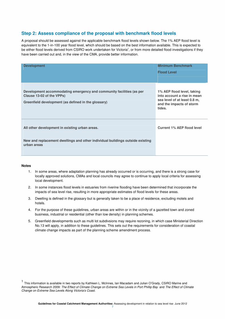
Step 2: Assess compliance of the proposal with benchmark flood levels
A proposal should be assessed against the applicable benchmark flood levels shown below. The 1% AEP flood level is
equivalent to the 1-in-100 year flood level, which should be based on the best information available. This is expected to
be either flood levels derived from CSIRO work undertaken for Victoria1, or from more detailed flood investigations if they
have been carried out and, in the view of the CMA, provide better information.
Development Minimum Benchmark
Flood Level
Development accommodating emergency and community facilities (as per
Clause 13-02 of the VPPs)
Greenfield development (as defined in the glossary)
1% AEP flood level, taking
into account a rise in mean
sea level of at least 0.8 m,
and the impacts of storm
tides.
All other development in existing urban areas.
New and replacement dwellings and other individual buildings outside existing
urban areas
Current 1% AEP flood level
Notes
1. In some areas, where adaptation planning has already occurred or is occurring, and there is a strong case for
locally approved solutions, CMAs and local councils may agree to continue to apply local criteria for assessing
local development.
2. In some instances flood levels in estuaries from riverine flooding have been determined that incorporate the
impacts of sea level rise, resulting in more appropriate estimates of flood levels for these areas.
3. Dwelling is defined in the glossary but is generally taken to be a place of residence, excluding motels and
hotels.
4. For the purpose of these guidelines, urban areas are within or in the vicinity of a gazetted town and zoned
business, industrial or residential (other than low density) in planning schemes.
5. Greenfield developments such as multi lot subdivsions may require rezoning, in which case Ministerial Direction
No.13 will apply, in addition to these guidelines. This sets out the requirements for consideration of coastal
climate change impacts as part of the planning scheme amendment process.
1 This information is available in two reports by Kathleen L. McInnes, Ian Macadam and Julian O’Grady, CSIRO Marine and
Atmospheric Research 2009: The Effect of Climate Change on Extreme Sea Levels in Port Phillip Bay and The Effect of Climate Change on Extreme Sea Levels Along Victoria’s Coast.
Guidelines for Coastal Catchment Management Authorities: Assessing development in relation to sea level rise June 2012 8
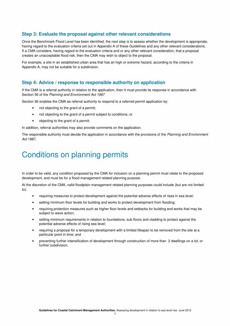
Step 3: Evaluate the proposal against other relevant considerations
Once the Benchmark Flood Level has been identified, the next step is to assess whether the development is appropriate,
having regard to the evaluation criteria set out in Appendix A of these Guidelines and any other relevant considerations.
If a CMA considers, having regard to the evaluation criteria and or any other relevant consideration, that a proposal
creates an unacceptable flood risk, then the CMA may wish to object to the proposal.
For example, a site in an established urban area that has an high or extreme hazard, according to the criteria in
Appendix A, may not be suitable for a subdivision.
Step 4: Advice / response to responsible authority on application
If the CMA is a referral authority in relation to the application, then it must provide its response in accordance with
Section 56 of the Planning and Environment Act 1987
Section 56 enables the CMA as referral authority to respond to a referred permit application by:
• not objecting to the grant of a permit;
• not objecting to the grant of a permit subject to conditions; or
• objecting to the grant of a permit.
In addition, referral authorities may also provide comments on the application.
The responsible authority must decide the application in accordance with the provisions of the Planning and Environment
Act 1987.
Conditions on planning permits
In order to be valid, any condition proposed by the CMA for inclusion on a planning permit must relate to the proposed
development, and must be for a flood management related planning purpose.
At the discretion of the CMA, valid floodplain management related planning purposes could include (but are not limited
to):
• requiring measures to protect development against the potential adverse effects of rises in sea level;
• setting minimum floor levels for building and works to protect development from flooding;
• requiring protection measures such as higher floor levels and setbacks for building and works that may be
subject to wave action;
• setting minimum requirements in relation to foundations, sub floors and cladding to protect against the
potential adverse effects of rising sea level;
• requiring a proposal for a temporary development with a limited lifespan to be removed from the site at a
particular point in time; and
• preventing further intensification of development through construction of more than 2 dwellings on a lot, or
further subdivision.

Guidelines for Coastal Catchment Management Authorities: Assessing development in relation to sea level rise June 2012 9
Application of Freeboard
Freeboard is the height above the adopted design (1% AEP) flood level, and is typically used to provide a safety margin,
to take into account uncertainties in the flood level estimate. This is illustrated in Figure 1.
Uncertainties include:
• inaccuracies in the way flood levels have been estimated;
• differences in water levels across the flooded area because of local factors such as turbulence around objects
or an undulating water surface; and
• increases in water level as a result of local wave action or coastal effects.
CMAs generally apply a minimum of 0.3 m freeboard, but this can vary. Melbourne Water for example sets a freeboard of
0.6 m for development subject to riverine flooding. Freeboard requirements should be determined in consultation with the
local council.
Figure 1 – applying freeboard
Sea level rise introduces additional uncertainties, such as the impacts of waves that reach the shore, the rate at which sea level will rise and the complex behaviour of tide and storm affects.
Where development proposals are assessed against current 1% AEP flood levels, CMAs should therefore include an additional freeboard allowance of at least 0.2 m on top of the normal freeboard they apply, to offset these additional uncertainties about the rate of future sea level rise.
However, the CMA has discretion to apply a different freeboard if, in its opinion:
New dwelling with floor level set above the current 1% AEP flood level
Freeboard includes an allowance for future sea level rise on top of the “normal” freeboard allowance.
Still water line = the average of peaks and troughs. This will vary according to tidal variations and storm conditions.
The 1% AEP flood level includes provision for atmospheric and wind effects and high tides.

Guidelines for Coastal Catchment Management Authorities: Assessing development in relation to sea level rise June 2012 10
• the likelihood and consequences flooding are small relative to the existing risk (e.g. car port, small building
extension, bungalow).
• there is a reasonable expectation that the flood risk can be mitigated through flood insurance arrangements or
as part of business planning, where it can be demonstrated that the potential costs of flood damage is an
acceptable business risk. This could apply to buildings associated with some forms of industrial, retail or
warehouse land use; and/or
• the CMA adopts flood levels that take sea level rise into account.

Guidelines for Coastal Catchment Management Authorities: Assessing development in relation to sea level rise June 2012 11
APPENDIX A
Evaluating proposals
In addition to identifying the benchmark flood level applicable to a proposal, the CMA must also evaluate the proposed
development and or use, as relevant, against the following evaluation criteria, in addition to any matters that the CMA
considers relevant:
• Whether the land is also subject to tidal influenced riverine or stormwater flooding and the associated
hazards.
• Development in active flow paths and or flood storage areas will be inappropriate if it increases the hazard,
impedes flood flows, causes local rises in flood levels and velocities, or has adverse environmental effects.
• Development should be avoided in wetlands and areas which in the opinion of the CMA pose an
unacceptable flood hazard. These areas should be preserved for recreational or other low-intensity passive
uses that promote environmental values.
• Flood levels in adjacent areas must not be significantly increased as a result of a loss of flood storage or an
obstruction to flood flows resulting from the proposed development. Any adverse impacts must be prevented
or mitigated.
What can be done to mitigate the risk
Development should not occur if the proposed mitigation measures to combat coastal inundation solely rely on flood
defence mechanisms, such as levees and sea-walls.
Building entrances and other key outdoor access areas should not be affected by unsafe levels of flooding.
Access to the development must not be through an area which in the opinion of the CMA poses an unacceptable
hazard.
Development subject to wave action may be acceptable provided there are appropriate protection measures in place
such as, adherence to adequate design standards, higher floor levels or provision for setback. In addition, infrastructure
and services designed to adequately accommodate the wave action must be in place.
Any development affected by flooding must be designed to withstand flood impacts with minimal damage. This includes
foundations, sub floors, services (e.g. plumbing and electrical) and cladding.
Where possible, development should be sited to minimise flood risk. This does not necessarily mean the highest point of
ground on the site, as safe access is also an important consideration.
The nature of the development and its effect on others
Minor developments will usually be appropriate provided they comply with the Benchmark Flood Level and do not
obstruct flood flows.
When evaluating evacuation routes, the distance to flood-free relief services, the depth and velocity of the floodwater
likely to be encountered, and the vulnerability of the people being evacuated are important considerations.
Development that accommodates vulnerable sectors of the community and or will provide emergency services or refuge
during a flood should preferably be located at levels above the height of the probable maximum flood. As a minimum,
assessment should be conservatively assessed, as indicated in Step 2.

Guidelines for Coastal Catchment Management Authorities: Assessing development in relation to sea level rise June 2012 12
Risk management
Risk management is essential to responsible floodplain management (SCARM 2000)2. Risk assessment is strategically
based on the likelihood and consequences of flooding.
In relation to likelihood it is customary for development proposals to be assessed against the 1% AEP (equivalent to the
1-in-100 year flood), which has a probability of 1% to be equalled or exceeded in any one year. A consequence of sea
level rise is that coastal properties currently inundated rarely or not at all will be inundated more frequently in the coming
decades. Strategic adaptation planning will focus on quantifying these risks, but is outside the scope of these guidelines.
Evaluation of development proposals (as determined in Step 2) will be in accordance with four categories of hazard. It is
assumed that flow velocities will be less than 0.4 m/s for areas where coastal flooding is influenced by sea levels.
If flow velocities are low, buildings can be designed to be safe in a flood. Therefore the potential requirements people to
self evacuate during a flood is the main consideration.
If higher flood velocities are likely, further reference should be made to other sources of information such as Hazard
graphs in SCARM3, or material from Engineers Australia.
4
The four hazard categories are tied to the safety of people:
• Low - depth of floodwaters is less than 0.3 m
• Medium - depth of floodwaters is between 0.3 and 0.6 m
• High - depth of floodwaters is between 0.6 and 1.2 m
• Extreme - depth of floodwaters is more than 1.2 m.
Generally with regard to evacuations:
• A low hazard means that there are no significant evacuation problems.
• A medium hazard means that most adults and some children are likely to be able to wade to safety (at least
for relatively short distances). Small children may experience difficulties when depths exceed 0.5 m and most
cars will float.
• A high hazard means that children and the elderly will have trouble wading to safety and evacuation by most
vehicles will be impossible.
• An extreme hazard means that evacuation other than by boat or helicopter is not an option.
Table 1 provides a guide for some of the more common development proposals encountered and how they should be
assessed.
Referring to the viability prompt in this table:
• If the answer is “yes”, the development is likely to be viable, subject to appropriate conditions of permit.
• If the answer is “no” the flood risk is likely to be too great for the intended purpose and the planning permit
application should be opposed.
2 Agriculture and Resource Management Council of Australia and New Zealand Standing Committee on Agricultural and Resource
Management, (SCARM - 2000). Floodplain Management in Australia: Best Practice Principles and Guidelines, CSIRO Publishing, Melbourne.
3 Agriculture and Resource Management Council of Australia and Resource Management Council of Australia and New Zealand
Standing Committee on Agricultural and Resource Management, (SCARM - 2000). Floodplain Management in Australia: Best Practice Principles and Guidelines, CSIRO Publishing, Melbourne. 4 Engineers Australia, Australian Rainfall and Runoff Revision Projects, Project 10 Appropriate Safety Criteria for People and Vehicles.

Guidelines for Coastal Catchment Management Authorities: Assessing development in relation to sea level rise June 2012 13
Table 1: Development viability in coastal areas
Flood Hazard category: Extreme High Medium Low Comments
Subdivision in urban area No No Yes Yes
House extension Yes Yes Yes Yes If hazard is high or extreme, may need to restrict the size of the extension if floor levels are to be set to the existing floor level, and the foot print size of the building.
Replacement dwelling other than dual occupancies
Yes1 Yes Yes Yes Main concern is development
intensification and safety implications. There may be a need to restrict the foot print size of the building and to keep rooms with a high flood damage potential flood free.
New single dwelling on vacant residential lot (including dual occupancy)
No2 No
2 Yes Yes The main concern will be the long term
flood risk to future occupants and how this can be mitigated.
New commercial development (e.g. warehouse, factory)
New hotel, motel
No2 No
2 Yes Yes
Commercial expansion (e.g. warehouse, factory)
Replacement hotel, motel
No2 No
2 Yes Yes
Preference is for no increase in the number affected by the flood risk. Main concern is development intensification and safety of future occupants.
Residential apartment complex
No No2 Yes Yes Main concerns are the safety of occupants
and the level of intensification.
Basement (non habitable floors below ground level)
No No Yes Yes Main concerns are flood proofing and exposure to wave setup.
Temporary dwelling Yes3 Yes
3 Yes
3 Yes
3 Would need to be satisfied that the
temporary status of the building will not change over time.
Car parking Yes Yes Yes Yes Should be located away from active flow areas and have a means of evacuating safely or not at all.
Emergency Management Facilities (new and extensions)
No No No No These should be preferably located outside the Probable Maximum Flood extent if possible.
New education, hospital, retirement village or child care facility
No No No No4 Preference is for these to be located well
outside the 1% AEP extent.
Extension/expansion to education, hospital, retirement village or child care facility
No No No5 No
5 Main concerns are the safety of
occupants.
New caravan park No Yes Yes Yes
Expansion of caravan park No6 Yes Yes Yes
Main concerns are the safety of residents, and whether moving caravans (which may contain annexes) to high ground is feasible.
Minor sheds, outbuildings Yes Yes Yes Yes May need to look at flow obstructions if there are drainage issues.
Guidelines for Coastal Catchment Management Authorities: Assessing development in relation to sea level rise June 2012 14
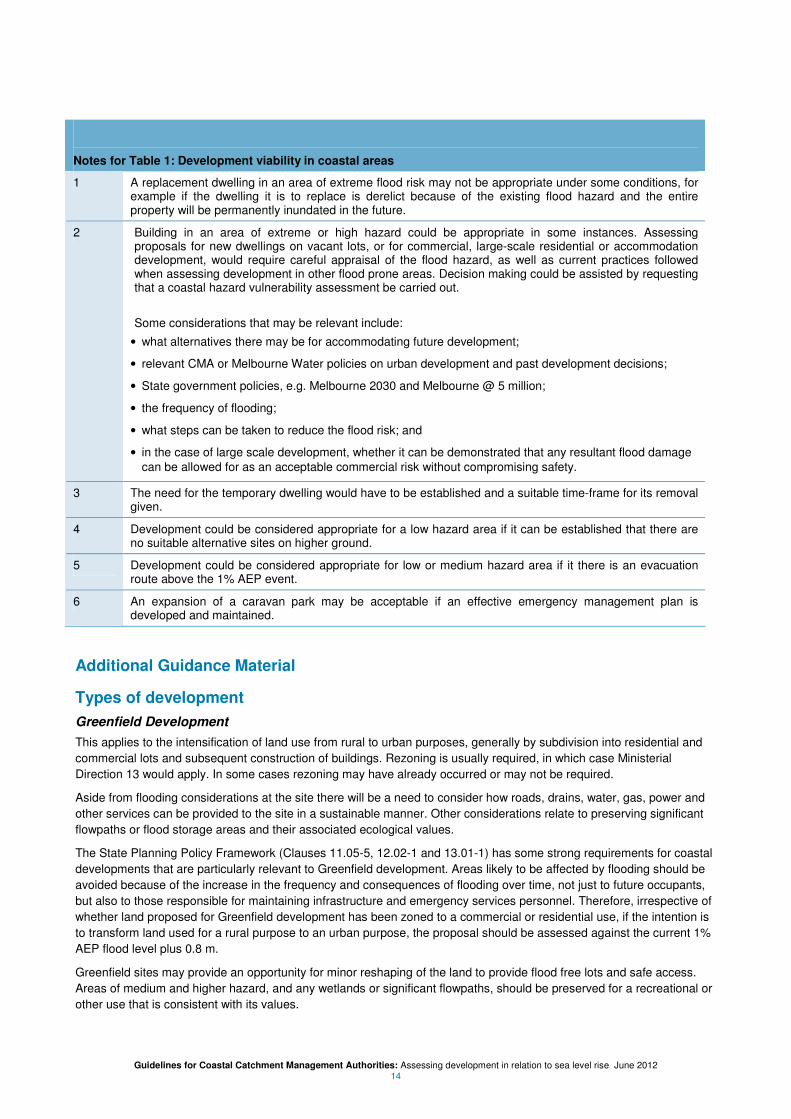
Notes for Table 1: Development viability in coastal areas
1 A replacement dwelling in an area of extreme flood risk may not be appropriate under some conditions, for example if the dwelling it is to replace is derelict because of the existing flood hazard and the entire property will be permanently inundated in the future.
2 Building in an area of extreme or high hazard could be appropriate in some instances. Assessing proposals for new dwellings on vacant lots, or for commercial, large-scale residential or accommodation development, would require careful appraisal of the flood hazard, as well as current practices followed when assessing development in other flood prone areas. Decision making could be assisted by requesting that a coastal hazard vulnerability assessment be carried out.
Some considerations that may be relevant include:
• what alternatives there may be for accommodating future development;
• relevant CMA or Melbourne Water policies on urban development and past development decisions;
• State government policies, e.g. Melbourne 2030 and Melbourne @ 5 million;
• the frequency of flooding;
• what steps can be taken to reduce the flood risk; and
• in the case of large scale development, whether it can be demonstrated that any resultant flood damage
can be allowed for as an acceptable commercial risk without compromising safety.
3 The need for the temporary dwelling would have to be established and a suitable time-frame for its removal given.
4 Development could be considered appropriate for a low hazard area if it can be established that there are no suitable alternative sites on higher ground.
5 Development could be considered appropriate for low or medium hazard area if it there is an evacuation route above the 1% AEP event.
6 An expansion of a caravan park may be acceptable if an effective emergency management plan is developed and maintained.
Additional Guidance Material
Types of development
Greenfield Development
This applies to the intensification of land use from rural to urban purposes, generally by subdivision into residential and
commercial lots and subsequent construction of buildings. Rezoning is usually required, in which case Ministerial
Direction 13 would apply. In some cases rezoning may have already occurred or may not be required.
Aside from flooding considerations at the site there will be a need to consider how roads, drains, water, gas, power and
other services can be provided to the site in a sustainable manner. Other considerations relate to preserving significant
flowpaths or flood storage areas and their associated ecological values.
The State Planning Policy Framework (Clauses 11.05-5, 12.02-1 and 13.01-1) has some strong requirements for coastal
developments that are particularly relevant to Greenfield development. Areas likely to be affected by flooding should be
avoided because of the increase in the frequency and consequences of flooding over time, not just to future occupants,
but also to those responsible for maintaining infrastructure and emergency services personnel. Therefore, irrespective of
whether land proposed for Greenfield development has been zoned to a commercial or residential use, if the intention is
to transform land used for a rural purpose to an urban purpose, the proposal should be assessed against the current 1%
AEP flood level plus 0.8 m.
Greenfield sites may provide an opportunity for minor reshaping of the land to provide flood free lots and safe access.
Areas of medium and higher hazard, and any wetlands or significant flowpaths, should be preserved for a recreational or
other use that is consistent with its values.

Guidelines for Coastal Catchment Management Authorities: Assessing development in relation to sea level rise June 2012 15
Land development that is flood free may not be appropriate if access to the land is cut off by floodwaters. In these
instances, considerations will be guided by the potential impact on community health caused by the isolation, potential
safety issues if people choose to evacuate, and the loss of water, sewerage, gas and other services, which may continue
for some time after floods have abated.
Proposals that rely on flood defence mechanisms, such as levees and sea-walls, are not considered appropriate
because of their long term maintenance implications and because sea level rise will continue beyond 2100.
Development within an existing urban area
The flood hazard, as it applies to the current use of the land and also after the proposed development has occurred, will
influence whether development should proceed. Some of the considerations relating to the coastal flood hazard are:
• Site safety. While floors can be built above the nominal flood protection level, consideration should be also
be given to ensuring that building entrances and their surrounds, and other key outdoor access areas are not
affected by unsafe levels of flooding.
• Access safety. Site constraints will limit hazard treatment options such as providing flood free sites or
access. This may mean that future occupants may be marooned unless they evacuate. Guidance on what
needs to be considered has been provided in the main body of the guidelines. Access safety will be a major
constraint if the access route is through an area of extreme hazard.
• Flood damage potential. Even if floor levels are raised, damage will still occur to property and possibly parts
of the building below the floor level. Consideration will need to be given to ensuring that new structures have
a low damage potential and that the amount of damage associated with the proposed development does not
increase significantly compared to the current use.
• The capacity to increase flood impact to adjoining areas. It is imperative to ensure that flood levels in
adjacent areas do not significantly increase as a result of a loss of flood storage or an obstruction to flood
flows. Any potentially adverse impacts on adjacent, upstream or downstream areas must be identified and
prevented or mitigated Consideration will need to be given to the cumulative impact of similar proposals. This
is not generally a problem for areas impacted by flooding from the sea unless it is compounded by riverine or
stormwater flooding. For example, the construction of sea walls can result in localised drainage problems.
• The flood warning time available and evacuation requirements. There are no formal arrangements for
providing coastal flood inundation warnings. This may affect the capacity of people to become aware that
coastal flooding is imminent, particularly if coastal flooding occurs infrequently. If flash flooding also occurs
there may be no effective flood warning time. Proposals that create an additional imposition to emergency
services personnel should not be supported.
• Vulnerability of people affected. Some sectors of the community are more vulnerable than other sectors,
e.g. the sick, elderly or disabled. Proposals for new buildings that house vulnerable sectors of the community
(such as hospitals, retirement and aged care homes, and special accommodation centres) should preferably
be located in areas above the relevant 1% AEP level.
• The potential for those exposed to a flood risk to increase. A comparison should be made between the
number of people occupying or visiting the site now compared to the number at risk if the site is occupied.
Minor Developments
Minor developments include minor buildings such as outhouses, garages and sheds; and works to improve amenity, e.g.
swimming pools, tennis courts, landscaping, fill pads and fences.
Generally no objections should be raised to these proposals, provided they are:
• consistent with the intended land use (e.g. associated with a permitted dwelling or building);
• designed so as not to obstruct flood flows;
• located in a suitable area (e.g. in reasonable proximity to the house and away from any unstable cliff face);
• in the case of fill pads, designed to have stable slopes, be well compacted and to take into account any
settlement of the ground; and
• in the case of buildings, have floor level requirements appropriate for the proposed use.
Flood warning and evacuation requirements

Guidelines for Coastal Catchment Management Authorities: Assessing development in relation to sea level rise June 2012 16
Even if floor levels are set with a freeboard margin above the 1% AEP flood level, buildings can still be affected by higher
flood levels from more severe events or from unquantified storm related effects (such as wave run-up). Proposed
development needs to take into account the potential need to relocate.
The safety of future occupants and emergency services personnel is an important consideration. Ideally, occupants
should be able to safely travel from their premises to high ground with relief services, preferably by road. This may not be
achievable for established urban areas.
As flooding will generally be intermittent, a low level of flood awareness should be assumed. Also, because there are
currently no formal flood warnings for coastal flooding, it should be assumed that evacuation may need to take place in
an uncontrolled manner in the dark and in poor weather.
Even if emergency services personnel were available to assist, evacuation may be difficult because of the number of
people requiring assistance in similar circumstances and the danger of crossing floodwaters which are highly turbid and
likely to contain debris. Coastal wave action can also create a significant risk where it crosses evacuation routes.
Development intensification in areas of high or extreme flood risk will invariably add to the workload of emergency
services personnel.
When evaluating evacuation routes, the distance to flood-free relief services, the depth and velocity of the floodwater
encountered and the vulnerability of the people being evacuated are important considerations.
Certain types of development have a higher potential for damage in flood events than others, and may present a danger
to personal safety that requires addressing. These types of development include:
• caravan parks need to have processes in place to evacuate people and property safely and secure vans and
mobile homes that aren’t removed;
• hospitals, aged care facilities and retirement villages have specific issues relating to evacuation of vulnerable
residents; and
• cul-de-sac residential developments on rising land, where the access road runs downhill from the properties,
have issues associated with safe access, given that access will be cut off before properties are impacted.
Flood emergency response plans
Flood emergency response plans can be used to mitigate a remaining flood risk in areas where the development is
considered acceptable for the level of flood hazard, but for which some level of risk remains. For example, where a
residential development is approved with a floor level raised above the appropriate 1% flood level, a flood emergency
response plan could be used to ensure future occupants have a strategy for safe evacuation in place.
While a flood emergency response plan can reduce the flood consequences, its effectiveness depends on the flood
awareness, ability and capacity of the person implementing the plan, Flood emergency plans are not fail safe.
It is not appropriate to require a flood emergency response plan to offset an inappropriate flood risk. Referring to Table 1
for example, it would not be appropriate to approve a subdivision in a high or extreme hazard area provided the future
occupants have a flood emergency response plan.
Guidelines for Coastal Catchment Management Authorities: Assessing development in relation to sea level rise June 2012 17
APPENDIX B – Acronyms and Glossary
Acronyms
AEP Annual Exceedance probability
AHD Australian Height Datum
CMA Catchment Management Authority
Glossary
Active flow paths: Those parts of a waterway and its floodplain that are important for flow conveyance. They are often
associated with fast moving floodwaters, and the depth of flooding is often significant.
Adaptation planning. This may take many different forms depending on the context and should involve all relevant
decision makers and stakeholders. Common approaches use scientific projections and information about present and
future climate change impacts to assess potential risks and vulnerabilities, and to consider if there is any capacity to
adapt to these impacts. Actions to reduce any residual negative impacts can be developed and assessed with preferred
actions agreed to by all relevant parties with time frames for implementation and review.
Annual Exceedence Probability (AEP). The likelihood of occurrence of a flood of a given size or larger in any one year.
For example if a flood level of 1.8 m AHD at a particular part of the coastline has an AEP of 1% it means there is a 1%
chance of this level being equalled or exceeded in any one year.
Coastal erosion. The wearing away of land or the removal of beach or dune sediments by wave action, tidal currents,
wave currents, or drainage. It is a natural process that is likely to change as a result of climate change. Potential impacts
include loss of beaches, migration of sand dunes, damage to coastal structures and infrastructure, loss of habitat and
biodiversity, loss of private and public land, adverse impact on lifestyle or amenity values and declining tourism values.
Coastal flooding. Flooding along the coastline. This is mainly associated with flooding from the sea associated with
storm surge. It may also include additional flooding caused by heavy rainfall. Surface runoff following heavy rainfalls
causes a temporary increase in normal water levels in a river, creek, watercourse, lake or drain. When the capacity of
these water systems is exceeded, adjoining land which is normally dry land is temporarily inundated. In coastal areas,
river or creek estuaries may become swollen, and water levels will rise until the inflows match the outflows into the sea.
Coastal Hazard Vulnerability Assessment. An investigation into the long term viability of a development proposal. This
will generally require hydrodynamic modelling to evaluate the effects of coastal flooding, including the impacts of wave
action, and coastal erosion. Solutions to mitigate the risk may include coastal engineering, design or setback responses
necessary to demonstrate assessed risks can be effectively managed and in a sustainable manner.
Development is defined in the Planning and Environment Act 1987 to include:
(a) the construction or exterior alteration or exterior decoration of a building; and
(b) the demolition or removal of a building or works; and
(c) the construction or carrying out of works; and
(d) the subdivision or consolidation of land, including buildings or airspace; and
(e) the placing or relocation of a building or works on land; and
(f) the construction or putting up for display of signs or hoardings;
Dwelling is defined in the Planning and Environment Act 1987 to mean a building that is used, or is intended, adapted
or designed for use, as a separate residence, (including kitchen, bathroom and sanitary facilities) for an occupier who
has a right to the exclusive use of it but does not include:
• a building that is attached to a shop, office, warehouse or factory and is used, or is intended, adapted or
designed for use, as a residence for an occupier or caretaker of the shop, office, warehouse or factory; or

Guidelines for Coastal Catchment Management Authorities: Assessing development in relation to sea level rise June 2012 18
• any part of a motel, residential club or residential hotel or residential part of licensed premises under the
Liquor Control Reform Act 1998.
Floodplain Management Authority. An authority having the floodplain management functions described in s202 of the
Water Act 1989. Melbourne Water and Catchment Management Authorities have these functions.
Flood Risk. An assessment of the likelihood and consequences of flooding. The likelihood of flooding can be usually
linked to the annual exceedance probability (AEP) of the event. The consequences of flooding relate to qualitative or
quantitative measures of the impacts of a flood in terms of loss, injury, disadvantage or gain.
Flood storage areas are those parts of the floodplain or overland flow path utilised for the temporary storage of
floodwaters during the passage of a flood. Flood depths may be significant but flow velocities are generally low.
Areas with a large amount of flood storage will generally be associated with a significant reduction in the peak flow rate
downstream. This could be affected if incremental development cumulatively reduces the amount of flood storage,
causing peak flow rates and flood levels to rise.
Freeboard. The height above the design (1% AEP) flood level, typically used to provide a safety margin, to take into
account uncertainties in the flood level estimate. These may include: uncertainties in the way flood levels have been
estimated, differences in water levels across the flooded area because of local factors such as turbulence around objects
or an undulating water surface; and increases in water level as a result of local wave action or coastal effects.
Greenfield development. The conversion of rural land to urban use, generally by subdivision into residential and
commercial lots and subsequent construction of infrastructure and development.
Nominal flood protection level. The level for setting floor levels, and also fill levels and levee heights where
appropriate. It is the design flood level (generally the 1% AEP level) plus freeboard.
Precautionary Principle is defined in the Intergovernmental Agreement on the Environment to mean that where there
are threats of serious or irreversible environmental damage, lack of scientific certainty should not be used as a reason for
postponing measures to prevent environmental degradation. In practice, this means decision makers should consider
the best available science and information on potential impacts and risks.
Sea level rise. The increase in sea level as a result of the interaction of three mechanisms: mean sea level rise;
astronomic tides; and storm surge. While the mean sea level can be regarded as a benchmark against which the impacts
of tide and storm surge can be measured, climate change projections indicate that the mean sea level will rise.
Storm surge. A rise above the normal water level along a shore resulting from strong onshore winds and / or reduced
atmospheric pressure. In Victoria storm surges generally accompany intense low-pressure systems.
Storm tide. The combination of storm surge and normal (astronomical) tide.

Guidelines for Coastal Catchment Management Authorities: Assessing development in relation to sea level rise June 2012 19
