hiking guide for the divjake-karavasta national park
DESCRIPTION
The national park is located at the Adriatic Sea, near the town Lunshje (driving from Durres to Vlore), and comprises a series of lagoons, among them the largest of the country. Many water bodies were drained in the agricultural revolution of the 60s and wildlife population decimated by hunting. In order to protect this unique habitat, it was declared a RAMSAR protected biotope and a total hunting ban is in place. Recently also nesting platforms are being installed to attract the rare Dalmatian Pelican, being one of the largest birds in the world it is the main attraction of the park. This guide will help you get most out of your trip.TRANSCRIPT
2
3
Author of the text:
Endrit Shima, Program Coordinator, EDEN center
Proof reading:
Allan Zaretsky
Pictures: the EDEN group of Nature Guides
GPS mapping: Endrit Shima, Program Coordinator, EDEN center
This publication is financially supported by The Democracy Commission
Small Grants Program of the Embassy of United States of America in Tirana.
Note: The findings, conclusions and interpretation expressed in this
document are those of the contracted alone and should in no way be taken
to reflect the policies or opinions of the donor.
4
FOREWORD
Through this hiking guide EDEN center has the pleasure to bring into your
view and your interest the attractions of one of the Albanian most famous
national parks, the Divjaka-Karavasta National park.
Since our beginnings, in March 2004, we have been very active in promoting
ecotourism and offering possibilities and opportunities to people to explore
and feel the nature with all the senses. In this frame, a lot of work is being
done from our Nature Guide group. They explore new itineraries around
Albania and get experienced in field trips and GPS mapping in order to offer
such services for all hiking lovers.
This acquired experience is very valuable in aiming at publications of hiking
guides, and this enthusiasm became true in the frame of the project
“Bringing Karavasta Lagoon back to life” financially supported by the
Democracy Commission Small Grants Program of the Embassy of United
States of America in Tirana and successfully implemented by EDEN center. In
this project we aimed at enforcing the development of a sustainable
development in protected areas by promoting ecotourism as well as civilized
and democratic behavior of local community and daily visitors. This hiking
guide is one of the tools we are using in promoting ecotourism in the area
and one of the most important outputs.
The guide provides information for seven suggested hiking and bird watching
routs in the national park accompanied with pictures and GPS tracks and
maps. Through the pages apart from history and culture of the area you can
find interesting useful information on how to get there, accommodation and
other services in and around the national park.

5
EDEN Nature Guides group helped in defining and GPS mapping the hiking
routs. With their help we went beyond the expectations of mapping trails –
from five trails planed in the beginning to seven trails.
We have been cooperating and had the support of different institutions and
individuals during this process who we take the opportunity to thank:
Ministry of Environment Forest and Water Administration, Mr. Nihat Dragoti,
Specialist; Divjaka Municipality, the entire administration; “Miti Zoi Zaka”
high school in Divjaka; the students of Divjaka: Mrs. Anxhela Shurdhaqi, Mrs.
Kristi Zeqo, Mr. Vlash Bërboti, Mr. Andi Biti and Mr. Endri Gjoni for helping
us with selecting interesting hiking routs; EDEN Nature Guides: Bajram
Alldervishi, Daniela Memushaj, Eduart Alldervishi, Eni Xhemali, Fation Zane,
Ina Lile, Kledjan Isufaj, Kristina Huda, Lazjon Petri, Marsida Taraj, Megi Shima
and Suada Mansaku; Mrs. Jonida Mamaj, Program Coordinator in EDEN
center; Mr. Endrit Shima, Program Coordinator in EDEN center and author of
the text for the patience and energy dedicated to the success of the project
and this hiking guide and all the locals for their hospitality.
A special thank goes to Democracy Commission Small Grants Program of
United States of America Embassy in Tirana. This book would not have been
possible without their support.
In particular, we would like to thank Mrs. Ermelinda Mahmutaj, Executive
Director of EDEN center and Mrs. Merita Mansaku, Founder of EDEN center,
whose contribution and enthusiasm to the success of the project went far
beyond from their responsibilities.
EDEN team
September 2011

6
CONTENT
I. BACKGROUND……………………………………………………………………
Geographical position……………………………………………………………………
Natural importance of the park……………………………………………………..
Climate………………………………………………………………………………………….. History and tourism…………………………………………………………….………..
7
7 8 9 10
II. SUGGESTED HIKING TRAILS…………………………………………….... Getting there………………………………..…………………….……………………….. Accommodation and other services……………………..…………………….. Points of interest…………………………………………………………………………..
1. Southern forest– Vahu Canal – Dunes and Divjaka beach – Park center……………………………………..
2. Park center – Godulla e Pishës lagoon – Spiaxho lagoon – Park center ………………………………………….
3. Park center – Divjaka beach – Godulla lagoon – Karavasta lagoon – Park center………………………………………..
4. Southern forest – Ishulli i Pelikanit (pelicans island)……….. 5. Northen forest – Pisha e Egër në Oazin e Karavastasë
(Old Pine) – Godulla e Pishës lagoon – Park center………… 6. Divjaka shore – Vahu canal – Second canal…………………….. 7. Northen forest – Kular – Mouth of Shkumbini River –
Ishulli i Kularit (Kulari Island) – Godulla e Pishës lagoon…
11 11 11 13 16 19 22 27 30 34 37
III. PRACTICAL INFORMATION……………………………………………….
Equipments…………………………………………………………………………………
GPS tracks and maps……………………………………………………………………
41
41
41
IV. BIBLIOGRAPHY…………………………………………………………………
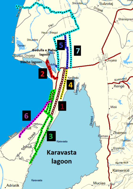
The map of the suggested hikes……………………………………….
43
44
7
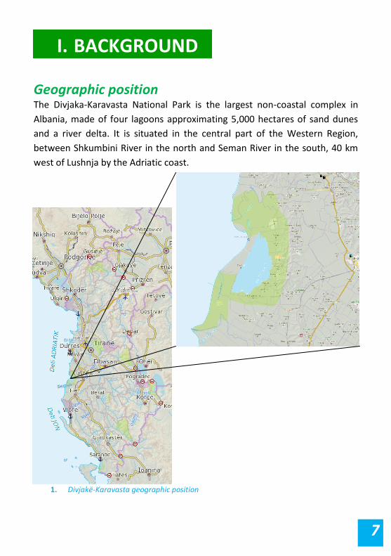
Geographic position The Divjaka-Karavasta National Park is the largest non-coastal complex in
Albania, made of four lagoons approximating 5,000 hectares of sand dunes
and a river delta. It is situated in the central part of the Western Region,
between Shkumbini River in the north and Seman River in the south, 40 km
west of Lushnja by the Adriatic coast.
I. BACKGROUND
http://en.wi
kipedia.org/
wiki/Collare
d_Pratincole
1. Divjakë-Karavasta geographic position

8
Natural importance Divjakë-Karavasta National Park has been listed as a Ramsar site since 1994.
It is a Mediterranean pine forest near the Karavasta lagoon, and it contains
one of the most interesting varieties of fauna in the country. Divjakë-
Karavasta area provides conditions for the livelihood of a number of plant
communities and animal species, among which many are at risk of extinction
in the world. We can mention here: Pelican (Pelicanus crispus Bruch). The
lagoons provide living and breeding sites for over 5% of the world population
of this bird.
The islands in the lagoons are one of the most important features of the area
for conservation of this bird species. While in the past Dalmatian pelicans
have nested in other parts of the lagoon, they now nest only on these islands
due to disturbances elsewhere. In addition, many other important breeding
birds of the lagoon nest on the islands as they are safe from predators and
human disturbance. These include collared pratincole (Glareola pratincola L.)
and little tern (Sterna albifrons).
Climate Divjakë-Karavasta is part of the Mediterranean climate zone’s plains’ central
sub-districts. The features of this climate are mild, wet winters and hot, dry
summers.
During winter there is an average of 4.1 hours of sunshine per day, while in
summer it increases to 10 hours of sun.
Precipitation ranges from 550-1200 mm, distributed over 85-100 days per
year. Two-thirds of the annual rainfall comes in November-March.
Precipitation is mainly in the form of rain, while snow and hail are rare
occurrences for this area.

9
The average annual temperature is 18.8 ° C.
History and tourism Divjaka has been an inhabited center since ancient times, evidenced by
numerous excavated archaeological objects and burial sites. These materials
were found during the opening of new lands in Divjakë during Communist
times. Various ceramic containers, bronze swords, spears, coins and many
other objects, dating from III-II century BC, were found at that time.
After 1945, as a result of poor policy decisions and slow economic progress,
there were a series of setbacks regarding tourism development. Investments
in this very important branch of economy were scarce and rarely made by the
state. Public investment consisted of the construction of a worker’s camp
with a capacity of 80 rooms and about 200 beds, along with a number of
cabins with a capacity of around 400 beds.
Democratic changes happening after 1990 opened the country to the outside
world. The transition from planned economy to free market allowed for
tourism to be converted into a more economically-competitive industry,
bringing in a variety of local and international investment.
Currently, the national park is suffering from the lack of management and
absence of sustainable tourism acitivities. Only beach tourism during the
summer time is being promoted. Likewise, illegal hunting is a big problem in
the area.
The location of the park at the center of the Western region of Albania
provides good opportunities for visiting some of the more developed touristic
sites within the country. These include:

10
Durresi (79 km), the country's main port, rich with the ruins of an
ancient Roman amphitheater, museum, etc.
Berati (78 km), a UNESCO city. The town is renowned for its historic
architecture and scenic beauty and is known as the “Town of a
Thousand Windows” due to the houses' many beautifully decorated
windows overlooking the town.
Apollonia (75 km) is an ancient Illyrian city located on the right bank
of the Vjosa River. Its ruins are situated in the Fier region, near the
village of Pojani in modern-day Albania.
Also interesting to visit are the 18th century Byzantine church in Karavasta e
Re village (24 km) and Ardenica Monastery, 18th-19th century, near Kolonje
village (28 km). The latter is declared a cultural monument of special
importance.
11
Getting there The starting point is considered the capital, Tirana. From here, Divjaka can be
reached by public transport, private car or bike. The route goes via Durrës,
Rrogozhinë, Divjakë and finally Divjakë-Karavasta National Park. The route is
in good condition and is approximately 100 km.
To get to the park by public transport one may either take a minibus (furgon)
or a bus. The minibus station is at “21 dhjetori” crossing (1.3 km from
Skendërbeg Square). Walk south-west from Skendërbeg Square towards
Kavaja Road (with the Albania Bank on your left and Opera buildng behind).
Furgons running to Vlora or Fier will also bring you to Çermë village where
one can find regular minbuses and buses continuing on to Divjaka. To reach
the park from Divjaka one can hire a taxi which costs around 400 Lekë, or
walk on foot (around 6 km west fom Divjaka center). The bus station is at
Nishëraku (500 meters south-west from “21 dhjetori”). The bus ticket from
Tirana to Çerma village costs 200 Lek and the minibus ticket costs 300 Lek.
Minibus and bus tickets from Çermë to Divjaka cost 50 Lek.
The entrance fee to the park is 100 Lek for cars, 200 Lek for minibuses and
300 Lek for buses. For passengers and hikers coming on foot there is no
entrance fee at the moment.
Accommodation and other services
There are several hotels in the park. The hotels and restaurants are often run
by families from Divjaka, giving you the experience of staying in a guest
house rather than a typical hotel.
III. SUGGESTED HIKING TRAILS
http://en.wikipedia.org/wik
i/Collared_Pratincole

12
No. Names and addresses Telephone Open dates 1 Ben Rrudha
Center park +355 68 4091160 1.1-31.12
2 Bar Restaurant Taku, Center park +355 68 47 71791 1.1-31.12 3 Bar Restaurant Ben Muça
Center park 1.1-31.12
4 Bar Restaurant Zabit Sina Center park
+355 69 2180232 1.1-31.12
5 Camping and Hotel Center park
+355 68 27 91 974 1.6-15.9
6 Agena Center park 1.6-15.9 7 Bar Restorant Hotel Pelikani
Center park +355 68 2146069 1.1-31.12
8 Bar Restaurant Vëllezërit Kiço Center park
+355 68 4818680 1.1-31.12
9 Fast food Center park
1.6-15.9
10 Market Center park
1.6-15.9
11 Restaurant Alkuna Center park
1.6-15.9
12 Dhoma me qera (rooms for rent) Center park
+355 68 23 000 61 +355 68 36 12 939
1.6-15.9
13 Fast food Center park
1.6-15.9
14 Dhoma me qera (Rooms for rent) Center park
+355 68 200 6785 1.6-15.9
15 Bar Restaurant Center park
1.6-15.9
16 Bar Restaurant Devis Center park
1.6-15.9
17 Hotel Xeladin Sallaku Center park
+355 68 4625141 1.6-15.9
18 Bar Restaurant Olsi Center park
1.6-15.9
19 Dhoma me qera (Rooms for rent) Center park
+355 69 40 11 950 1.6-15.9
20 Bar Restaurant Marko Center park
+355 27 75 229 1.1-31.12
21 Hotel Divjaka Center park
+355 68 40 65 407 1.1-31.12
Tab. 1 Accommodation and other services
13
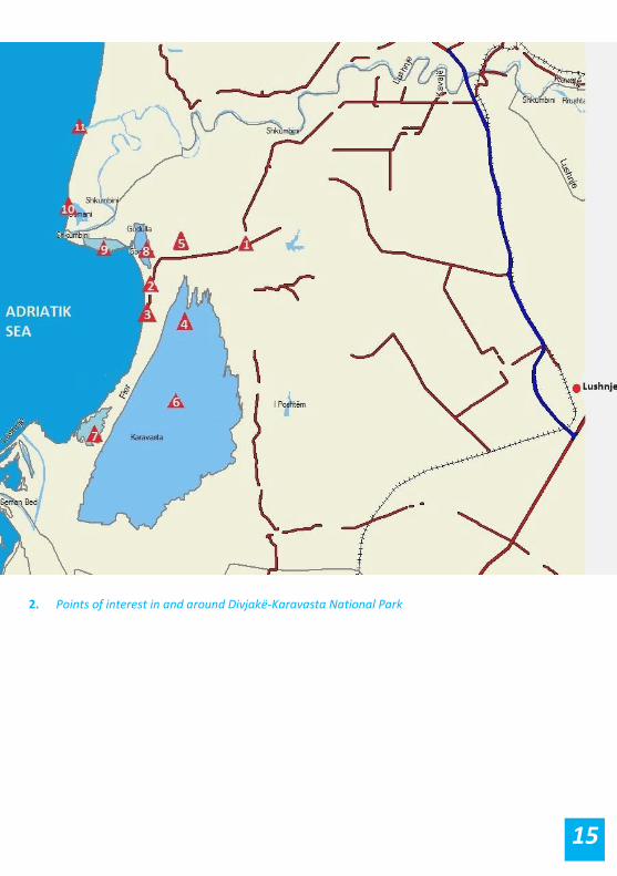
Points of interest in and around Divjakë-Karavasta National Park
1. Divjaka is the nearest city to the park (approx. 6 km). It has a
population of about 13,600 inhabitants, where 7300 people belong
to the municipality and the rest live in surrounding villages. Locals
mainly work in the cultivation of vegetables, fruits, fishing, and to a
lesser extent in raising livestock.
2. Entrance to the park is off the main road which connects Divjaka and
the National Park. The road divides the forest in two parts (North
and South parts). The entrance of the park is situated 1.2 km north of
the park center and the beach. The entrance fee is 100 Lek for cars,
200 Lek for vans and 300 for buses.
3. The center of the park is located near Divjaka beach, approx. 1.2 km
SW from the park entrance. The majority of services are located in
the park center. Divjaka beach is a stretch of roughly 15 kilometers of
white sand lined by pine forest, and it is a popular seaside destination
for thousands of tourists and day-trippers from south-central
Albania. The sandy beach is huge (250 m wide from forest edge to
water in some areas), and even in peak season it is possible to walk
further up or down and find some privacy.
4. Pelican Island (Natural Monument) is located northwest of Karavasta
Lagoon. This is an important place for Dalmatian Pelicans nesting.
The hiking guides suggested below also offer a viewing point for the
island.
5. The Big and Old Pine (in Albanian: Pisha e Egër në Oazin e
Karavastasë) is listed as a Natural Monument in Albania. It represents

14
a 410 year-old pine tree located southwest of the northern part of
the forest.
6. The Karavasta lagoon is the biggest and most important lagoon on
the coastal area of the Adriatic Sea. It has a surface of 43.3 km2, with
a maximum length of 10.6 km, a maximum width of 4.3 km, and a
maximum depth of 1.5 m. Karavasta Lagoon is best known for its
colony of globally-threatened Dalmatian pelicans. The presence of
these birds is one of the main reasons that Karavasta lagoon has
been designated a Ramsar Site of International Importance. Well
over 200 other bird species have been observed in the area, including
some other globally threatened species such as the pygmy
cormorant, white-headed duck, spotted eagle and pallid harrier.
7. Godulla Lagoon represents a small lagoon situated very close to
Karavasta lagoon. This lagoon has a surface of 8.5 km2 with a length
of 5 km, a width of 3.8 km and a maximum depth of 3.8 m.
8. Godulla e Pishës (Natural Monument) is situated northwest of
Divjaka forest. It represents a lagoon with a maximal length of 1.8 km
and a maximal width of 400 m and is surrounded by pine forest and
dunes with plenty of pine scrub. The Dalmatian pelicans nest here.
9. Spiaxho is a small lagoon in N part of Divjakë-Karavasta system.
10. Osmani lagoon is a small lagoon N of Spiaxho lagoon.
11. Kulari Island (Natural Monument) is located near Shkumbini Delta,
0.5 m above sea level and formed by the river's accumulation. The
island is covered with bushes, wild poplar hardwood, cedar, winter
pasture, and various grass types. You can find aquatic birds here,
especially the Dalmatian pelican.
15
2. Points of interest in and around Divjakë-Karavasta National Park
16
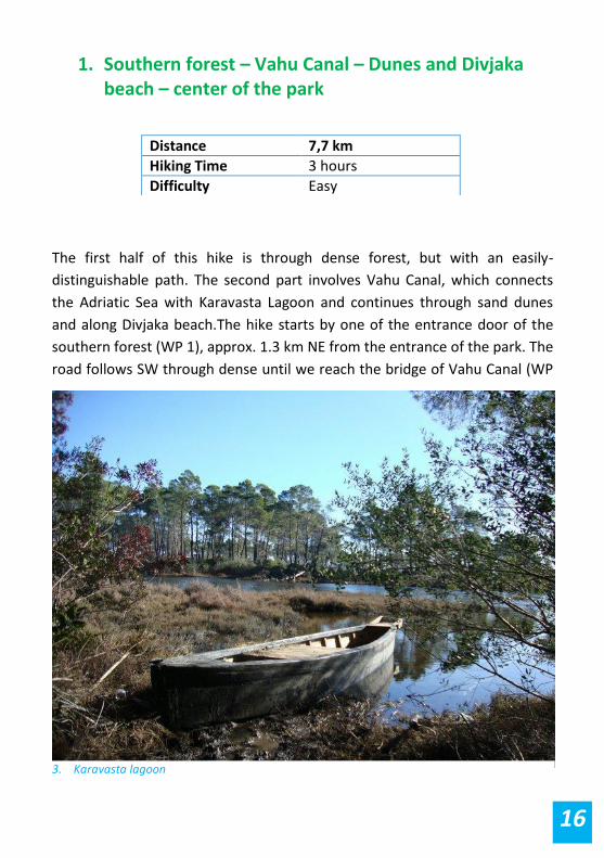
1. Southern forest – Vahu Canal – Dunes and Divjaka beach – center of the park
The first half of this hike is through dense forest, but with an easily-
distinguishable path. The second part involves Vahu Canal, which connects
the Adriatic Sea with Karavasta Lagoon and continues through sand dunes
and along Divjaka beach.The hike starts by one of the entrance door of the
southern forest (WP 1), approx. 1.3 km NE from the entrance of the park. The
road follows SW through dense until we reach the bridge of Vahu Canal (WP
Distance 7,7 km
Hiking Time 3 hours
Difficulty Easy
3. Karavasta lagoon

17
3). After that we turn NW with the forest on our right and the sea on our left.
The route continues N through the beach sand. We pass a big bunker near
Divjaka Hotol (WP 4) and continue either along the sa or ghrough the forest
until we reach the automobile road wich is also the par center (WP 5). To get
back to WP 1 you should follow the automobile road for approx. 2.5 km.
4. Hike 1
18
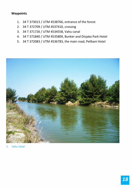
Waypoints
1. 34 T 373013 / UTM 4538766, entrance of the forest
2. 34 T 372709 / UTM 4537410, crossing
3. 34 T 371726 / UTM 4534558, Vahu canal
4. 34 T 371840 / UTM 4535809, Bunker and Divjaka Park Hotel
5. 34 T 372083 / UTM 4536783, the main road, Pelikani Hotel
5. Vahu Canal
19
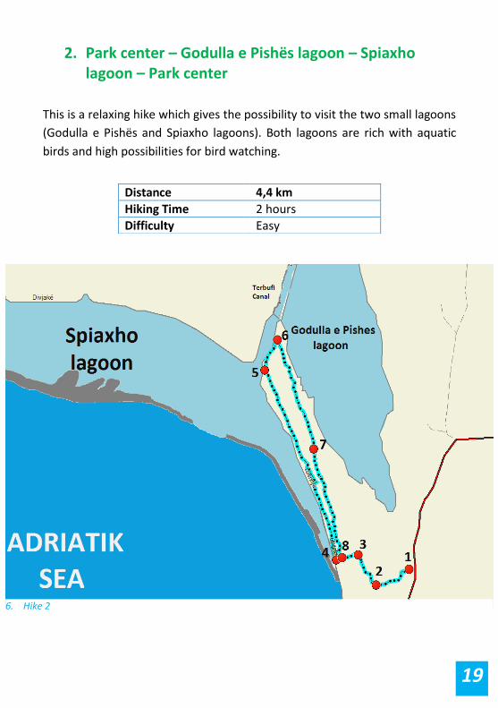
2. Park center – Godulla e Pishës lagoon – Spiaxho lagoon – Park center
This is a relaxing hike which gives the possibility to visit the two small lagoons
(Godulla e Pishës and Spiaxho lagoons). Both lagoons are rich with aquatic
birds and high possibilities for bird watching.
Distance 4,4 km
Hiking Time 2 hours
Difficulty Easy
6. Hike 2
20
The hike starts at the entrance of the park (WP 1) and follows directly SW
through a rare pine forest along a visible hiking path. After approx. 250 m,
we turn left right (WP 2). The route follows NW for approx. 220 m before we
turn left at the hotel (WP 3). We follow left and turn right (NW) once we
reach the sand beach hiking path (WP 4), which is very visible and runs
through rare pine forest on the left and beach bushes on the right.
If you follow for approx. 100 m W on WP 4, you can see the south part of
Spiaxho lagoon.
From WP 4, our path follows NW along a visible sand beach path which runs
in the middle of two lagoons (Spiaxho and Godulla e Pishës lagoons) but you
cannot often see them because of the forest on the left side and the bushes
on the right.
After approx.
1.4 km we
will have very
clear views of
Spiaxho
lagoon,
Godulla e
Pishës lagoon
and Tërbfui
canal, which
run in the
middle of Spiaxho lagoon (WP 5). The path follows right with the canal
on our left for approx. 200 meters and then it turns back through the forest
(WP 6).
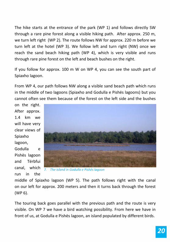
The touring back goes parallel with the previous path and the route is very
visible. On WP 7 we have a bird watching possibility. From here we have in
front of us, at Godulla e Pishës lagoon, an island populated by different birds.
7. The island in Godulla e Pishës lagoon
21
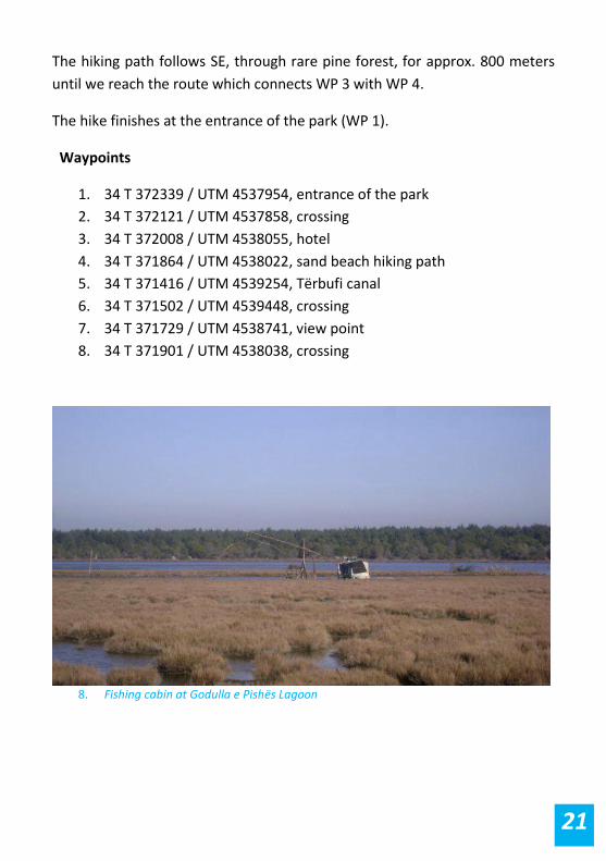
The hiking path follows SE, through rare pine forest, for approx. 800 meters
until we reach the route which connects WP 3 with WP 4.
The hike finishes at the entrance of the park (WP 1).
Waypoints
1. 34 T 372339 / UTM 4537954, entrance of the park
2. 34 T 372121 / UTM 4537858, crossing
3. 34 T 372008 / UTM 4538055, hotel
4. 34 T 371864 / UTM 4538022, sand beach hiking path
5. 34 T 371416 / UTM 4539254, Tërbufi canal
6. 34 T 371502 / UTM 4539448, crossing
7. 34 T 371729 / UTM 4538741, view point
8. 34 T 371901 / UTM 4538038, crossing
8. Fishing cabin at Godulla e Pishës Lagoon
22
3. Park center – Divjaka beach – Godulla lagoon – Karavasta lagoon – Park center
This is a relatively long hike along the fishermen paths. It offers sensational
views of two of the largest lagoons in the area (Karavasta lagoon and Godulla
lagoon), Divjaka beach and restaurants of the park.
As long as the path remains unmarked, a local guide is suggested.
The hike starts at the center of the park, near the Argena Hotel (WP 1), from
where we follow SW along the unpaved road with hotels and restaurants
along both sides. After approx. 1 km,
near the Divjaka Park Hotel, the
unpaved road ends and we keep
following SW along the sand beach
path, with the sea on our right and
the pine forest very close on our left.
After a while we reach the Vahu canal,
which is the only direct connection
between the sea and Karavasta
lagoon (WP 3). Our route turns left
towards the canal and sea connection where there is also a small bar
available for purchasing beverages (WP 4). After that we turn back to WP 3,
continuing SW for a few hundred meters and pass over the bridge across the
canal (WP 5).
Distance 16,5 km
Hiking Time 5-6 hours
Difficulty Easy
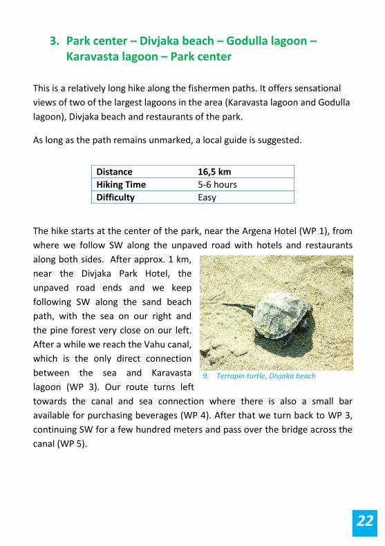
9. Terrapin turtle, Divjaka beach
23
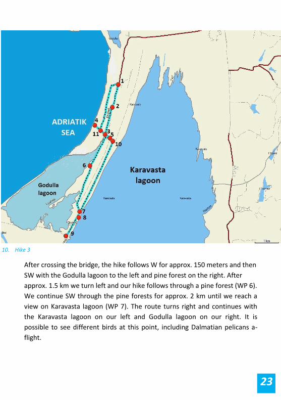
After crossing the bridge, the hike follows W for approx. 150 meters and then
SW with the Godulla lagoon to the left and pine forest on the right. After
approx. 1.5 km we turn left and our hike follows through a pine forest (WP 6).
We continue SW through the pine forests for approx. 2 km until we reach a
view on Karavasta lagoon (WP 7). The route turns right and continues with
the Karavasta lagoon on our left and Godulla lagoon on our right. It is
possible to see different birds at this point, including Dalmatian pelicans a-
flight.
10. Hike 3

24
After approx. 200 meters
we pass the first canal
which connects Karavasta
lagoon with Godulla lagoon.
Nearby to the canal there is
a fish manufactory (WP 8).
Our route follows SW on a
path located between the
lagoons and after approx. 1
km we reach the second canal that connects Karavasta with Godulla lagoon
(WP 9). After that we get back to WP 7 and then we follow NE near to the
Karavasta lagoon along an unpaved road for approx. 3.3 km until we reach
the Vahu canal (WP 10). The route follows left and after a while we reach the
bridge of Vahu canal (WP 5). To get back to WP 1 you can either follow the
same track by the forest, or choose to walk along the coast.
Waypoints
1. 34 T 372126 / UTM 4536800, Argena Hotel
2. 34 T 371856 / UTM 4535849, end of unpaved road, Divjaka Hotel
3. 34 T 371532 / UTM 4534711, Vahu canal
4. 34 T 371109 / UTM 4535108, connection of sea with the lagoon
5. 34 T 371731 / UTM 4534557, bridge
6. 34 T 370867 / UTM 4533409, pine forest
7. 34 T 370401 / UTM 4531486, view to Karavasta lagoon
8. 34 T 370354 / UTM 4531245, first connection of Godulla-Karavasta
9. 34 T 369805 / UTM 4530475, second connection
10. 34 T 371849 / UTM 4534423, Vahu canal
11. 34 T 371341 / UTM 4534887, crossing
11. A bar restaurant in Divjaka, near the Vahu canal
25
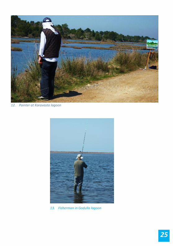
13. Fisherman in Godulla lagoon
12. Painter at Karavasta lagoon

26
14. Horses at Divjaka beach
15. Fish farm at the channel connecting Karavasta Lagoon with Godulla Lagoon
27
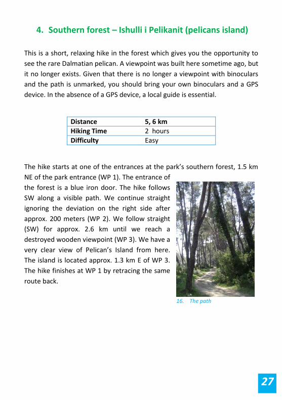
4. Southern forest – Ishulli i Pelikanit (pelicans island)
This is a short, relaxing hike in the forest which gives you the opportunity to
see the rare Dalmatian pelican. A viewpoint was built here sometime ago, but
it no longer exists. Given that there is no longer a viewpoint with binoculars
and the path is unmarked, you should bring your own binoculars and a GPS
device. In the absence of a GPS device, a local guide is essential.
The hike starts at one of the entrances at the park’s southern forest, 1.5 km
NE of the park entrance (WP 1). The entrance of
the forest is a blue iron door. The hike follows
SW along a visible path. We continue straight
ignoring the deviation on the right side after
approx. 200 meters (WP 2). We follow straight
(SW) for approx. 2.6 km until we reach a
destroyed wooden viewpoint (WP 3). We have a
very clear view of Pelican’s Island from here.
The island is located approx. 1.3 km E of WP 3.
The hike finishes at WP 1 by retracing the same
route back.
Distance 5, 6 km
Hiking Time 2 hours
Difficulty Easy
16. The path
28
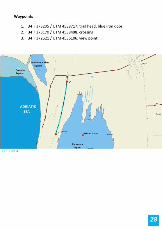
Waypoints
1. 34 T 373205 / UTM 4538717, trail head, blue iron door
2. 34 T 373170 / UTM 4538498, crossing
3. 34 T 372621 / UTM 4536106, view point
17. Hike 4
29
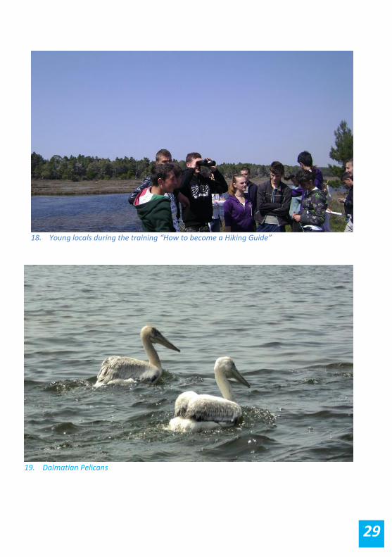
18. Young locals during the training “How to become a Hiking Guide”
19. Dalmatian Pelicans

30
5. Northern forest – Pisha e Egër në Oazin e Karavastasë
(the old pine) – Godulla e Pishës lagoon – Park center
Distance 8,2 km
Hiking Time 3 hours
Difficulty Easy
20. Hike 5

31
This is a beautiful hike passing through the park’s dense pine forest. By
following this trail you will have the opportunity to visit two natural
monuments within the park – the Old Pine and Godulla e Pishes Lagoon. The
path is very visible but it has some crossing points that may mislead you. A
hiking guide or a GPS device is suggested since the track is unmarked.
The trail head is WP 1, a blue gate next to the main road which serves as the entry to the forest, approx. 1.5 km before the park entrance. The trail follows N for approx. 2 km on a very visible path through dense pine forest until we reach a crossing point (WP 2) and we turn off west (left). We follow W for about 150 m and then turn again N at the crossing (WP 3). The route follows N and after approx. 600 m we reach the Old Pine, which is located a few meters left of the trail (WP 4). After visiting the Old Pine, we turn back again onto the trail and follow N until we arrive at WP 5, Emisari i Terbufit canal. There are many fishing cabins along the canal. At WP 5 the track follows W with the pine forest to our left and the canal on our right for approx. 1 km. At WP 6 the route turns off S. The forest is no denser than the parallel route we had taken earlier. At WP 7 we find a very good viewpoint over Godulla e Pishes lagoon. The viewpoint is approx. 200 m left of the main track. We get back onto the main track and we follow S for a few hundred meters until we see an exit gate from the forest. The hike ends at the main road, around 900 m before the park entrance (WP 8).
Waypoints
1. 34 T 373215 / UTM 4538733, trail head, blue gate
2. 34 T 373278 / UTM 4540556, crossing
3. 34 T 373140 / UTM 4540552, crossing
4. 34 T 373104 / UTM 4541112, Old Pine
5. 34 T 373088 / UTM 4541768, Emisari i Tërbufit canal
6. 34 T 372104 / UTM 4541413, crossing
7. 34 T 372250 / UTM 4538982, view point
8. 34 T 372552 / UTM 4538620, main road

32
21. Marsi, Fation, Vlashi and Endri at Pisha e Egër në Oazin e Karavastasë (The Old Pine) during the defining routes process
22. Tërbufi canal

33
23. Fishing cabin at Tërbufi canal

34
6. Divjaka shore – Vahu canal – Second canal
This is a nice hike along the sea shore ending at the Godulla lagoon's
connection with the sea. Near the connection (second canal) is a very good
view point for bird watching.
The hike starts at Hotel Divjaka Park (WP 1), the last hotel going S from the
park center along the car road. We continue the hike S along the seashore for
approx. 1.8 km until we reach the Vahu canal (WP 2). Vahu canal is normally
dry so you can just cross it and hike further S along the sea shore to approach
the second canal (WP 3). In case the Vahu canal is working, you may either
cross the water (max. 1/2 m deep) or rent a boat to reach the second canal.
Between the two canals, one of the most sensational stories of the
Communist era took place. Xhevdet Mustafa, a young Albanian fugitive who
fled to the United States, returned to Albania with two other people in
September of 1982. Their mission was to topple the regime. He was a young
man committed to overthrowing the totalitarian government in Albania.
Their mission was betrayed by someone, and they found themselves
surrounded by Albanian security forces. On the way between the two canals,
near the lagoon, you can see memorials for two of security force members
killed during the gun fight by Xhevdet Mustafa and his companions.
Distance 4. 4 km – one way
Hiking Time 3 hours
Difficulty Easy
35
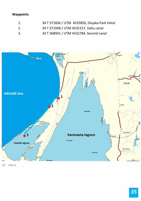
Waypoints
1. 34 T 371836 / UTM 4535850, Divjaka Park Hotel
2. 34 T 371048 / UTM 4535157, Vahu canal
3. 34 T 368941 / UTM 4532784, Second canal
24. Hike 6

36
25. The channel connecting the sea with Godulla lagoon
26. Poultry footprints near of the channel
37
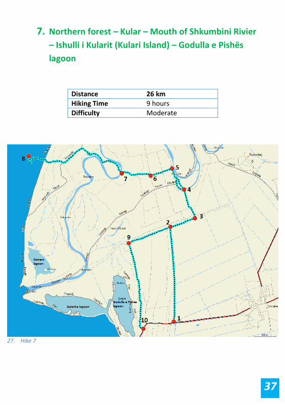
7. Northern forest – Kular – Mouth of Shkumbini Rivier
– Ishulli i Kularit (Kulari Island) – Godulla e Pishës
lagoon
Distance 26 km
Hiking Time 9 hours
Difficulty Moderate
27. Hike 7
38
This is a long hike with beautiful views and a mix of forested roads, river
views, and lagoon trails. The path is visible, but with many crossings. We
suggest either hiring a guide or making sure you have a GPS device with you.
The hike starts at the beginning of the Divjaka forest. Coming from Divjaka to
the National Park along the normal car road, the trail head will be the first
entrance gate (WP1) to the forest. It follows N along a visible trail until it
reaches the WP2 (Tërbufi canal). We turn E (right) and cross the canal at the
bridge (WP 3). After crossing the bridge the trail follows N and enters a small
wooded area (WP4). After crossing the wooded area, the trail follows for
approx. 400 meters along the Shkumbini River to our right. There will be
agricultural lands to our left. This area is called Kulari and used to be a village
many years ago. Now it is disbanded as a result of regular flooding by the
Shkumbin River.
At WP 5 (crossing) we turn left and hike along a broad trail through
agriculture lands and enter the forest at WP 6. After walking through the
forest for approx. 1 km on a broad visible trail, we exit it at WP 7 and follow
W until we reach WP 8 (Mouth of Shkumbini River) with a beautiful view of
the Kulari Islands and their diverse bird life.
To return, we follow the same trail until we reach WP 2 and then continue W
with the canal on our right and the forest on our left. At WP 9 thethe trail
follows S. During this part of the hike you will have the possibility to see the
Godulla e Pishes lagoon. The trail ends at the main car road, approx.900
meters before the park entrance.
39
Waypoints
1. 34 T 373549 / UTM 4538830, trail head, blue gate
2. 34 T 373486 / UTM 4541930, Tërbufi canal
3. 34 T 374300 / UTM 4542195, bridge
4. 34 T 373961 / UTM 4543143, entrance of a wooden area
5. 34 T 373575 / UTM 4543832, crossing
6. 34 T 372876 / UTM 4543609, forest entrance
7. 34 T 371919 / UTM 4543704, forest exit
8. 34 T 368881 / UTM 4544316, mouth of Shkumbini River
9. 34 T 372112 / UTM 4541416, crossing
10. 34 T 372551 / UTM 4538618, main road
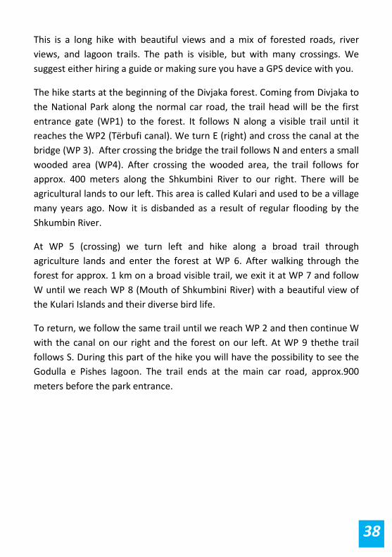
28. Kristina, Ilir and Endri during the routes defining at mouth of Shkumbini River
40
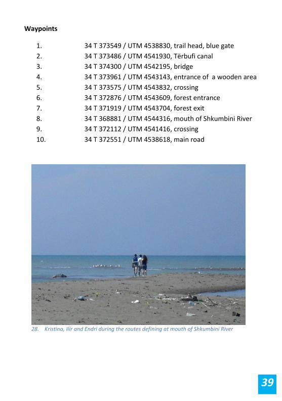
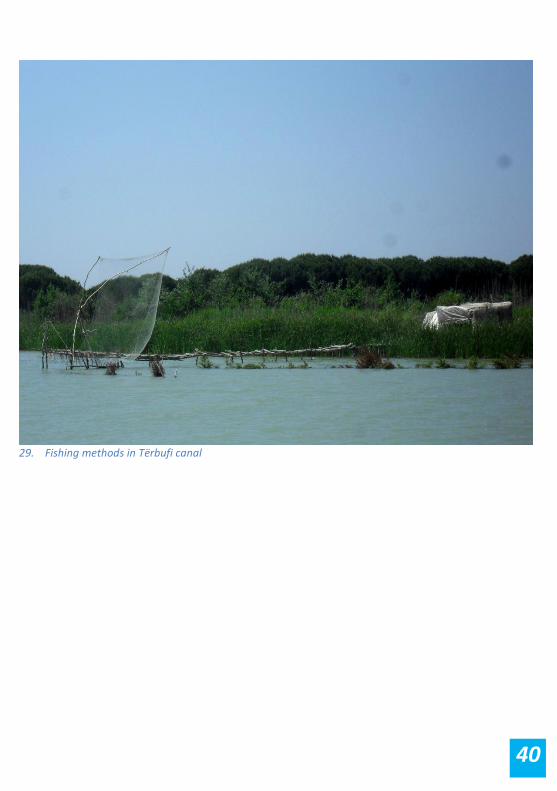
29. Fishing methods in Tërbufi canal

41
Equipment Appropriate hiking equipment is essential (hiking boots, waterproofs, sun
protection, insect protection, backpack, food, first aid kit, GPS device,
functioning mobile phone, etc). During the spring and winter time it is
essential to have with you long waterproof boots because there are some
water ponds on the trails. Regarding the first aid kits, it is crucial to have the
right medical supplies with you because Divjaka doesn’t have a rescue system
for the hikers in the forest. If traveling in a group, your tour guide should
highlight the danger of poisonous snake bites and should carry a suction
pump just in case. The kit should also contain treatments and bandages for
less serious injuries such as bruises, cuts and so on. The insect protection is
very essential from April to October because Divjaka wetland has a lot of
mosquitoes during this time of the year.
GPS tracks and maps
The maps used for this guide are old Soviet military maps. Divjaka's coast has
changed some since the map was produced due to erosions factors.
However, the trails in the area are not difficult and the maps are good for
orientation.
At www.bunkertrails.com you can download topographic maps of scales
1:50000 and 1:100 000. The GPS (UTM) data provided here is two-fold:
Waypoint number and UTM coordinate. Within the text the waypoint
numbers (e.g., WP1’) refer to the items listed at the end of each description.
III. PRACTICAL INFORMATION

42
Apart from the waypoint that you can find within the text, GPS tracks with
waypoints can be found at EDEN center website (www.eden-al.org), Wikiloc
GPS data sharing website (www.wikiloc.com )and EveryTrail website
(www.everytrail.com). At Wikiloc and EveryTrail the trails can be found
through searching for Endrit Shima's account. Given that trails are not
marked, weadvise using a local guide in this region, Anxhela Shurdhaqi, group
leader ofdivjaka hiking guides, tel. +355 695619269, email:
[email protected]. If you do choose to hike alone, it would
be good to have a GPS device with you to avoid getting off the trail.
43
Anni (Koci) Kallfa and Taulant Bino, Reproduction Biology of Dalmatian
Pelican (Pelecanus Crispus) in the Divjaka-Karavasta National Park, 2010
Ecotourism Ltd, Technital S.pA. and Tour du Valat, Karavasta lagoon eco
guide, 1997
Pano, Niko and Frashëri Alfred, The coastal geomorphology of the Semani
river mouth-Karavasta lagoon in the southern Adriatic Sea
Qiriazi, Perikli and Sala, Skënder, Monumentet e Natyrës së Shqipërisë.
Botim eLektronik, 2005.
Ramsar site management plans – Albania, Karavasta Lagoon, 1996
The maps of Bunkertrails: www.bunkertrails.com
The Geo Consulting map of Albania: www.albinfo.al
Zindel, Christan and Husammann, Barbara, Thethi and Kelmendi: Hiking
Guide of Northern Albania, 2009
IV. BIBLIOGRAPHY
44

45

46