history of wildland fires on - ntrs.nasa.gov
TRANSCRIPT

. (I
NASA Technical Memorandum 100983
History Of Wildland Fires On Vandenberg Air Force Base, California
Unclar GJ/57 G748775
March 1988
National Aeronautics and Space Administration

I NASA Technical Memorandum 100983
History Of Wildland Fires On Vandenberg Air Force Base, California Diana E. Hickson The Bionetics Corporation, Kennedy Space Center, Florida
March 1988
National Aeronautics and Space Administration
John F. Kennedy Space Center NASA

TABLE OF CONTENTS
SECTION PAGE
TABLE OF CONTENTS ................................................................................................... i
ABSTRACT ...................................................................................................................... . . i i
LIST OF TABLES ............................................................................................................. 1 1 1
LIST OF FIGURES ........................................................................................................... HI
ACKNOWLEGMENTS .................................................................................................... iv
PRODUCT DISCLAIMER ................................................................................................ v
INTRODUCTION ................................................................ i ............................................. .l
METHODS ........................................................................................................................ .4
RESULTS.. ....................................................................................................................... .9
DISCUSSION ................................................................................................................. 18
RECOMMENDATIONS FOR MANAGEMENT AND FURTHER STUDY .............. 22
CONCLUSIONS ............................................................................................................. 25
LITERATURE CITED ..................................................................................................... .27
Appendix 1 . Geographic Information System Files ................................................. 30
...
...
1
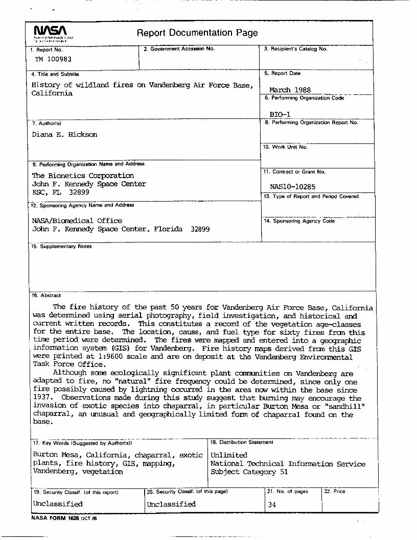
ABSTRACT
The fire history of the past 50 years for Vandenberg Air Force Base,
California was determined using aerial photography, field investigation, and
historical and current written records. This constitutes a record of the vegetation
age-classes for the entire base. The location, cause, and fuel type for sixty fires
from this time period were determined. The fires were mapped and entered into
a geographic information system (GIS) for Vandenberg. Fire history maps
derived from this GIS were printed at 1 :9600 scale and are on deposit at the
Vandenberg Environmental Task Force Office.
l
Although some ecologically significant plant communities on
Vandenberg are adapted to fire, no "natural" fire frequency could be
determined, since only one fire possibly caused by lightning occurred in the
area now within the base since 1937. Observations made during this study
suggest that burning may encourage the invasion of exotic species into
chaparral, in particular Burton Mesa or "sandhill" chaparral, an unusual and
geographically limited form of chaparral found on the base.

LIST OF TABLES
PAGE
Table 1. Aerial photography used for fire history ....................................................... 5
Table 2. Description of sites in the exotic species study and frequencies of exotics on transects ......................................................................................... 8
Table 3. Fires documented on fire history maps ..................................................... 12
Table 4. Area burned by mapped fires ...................................................................... 14
Table 5. Fires not documented on fire history maps ............................................... 16
LIST OF FIGURES PAGE
Figure 1 . Map of historic fires, Vandenberg Air Force Base .................................. 10
iii

ACKNOWLEDGMENTS
This project was conducted under the direction of Dr. Albert Koller, Jr.,
Chief, Programs and Planning Office and Dr. William M. Knott, 111, Biological
Sciences Officer, Life Sciences Research Office, The Biomedical Operations
and Research Office, John F. Kennedy Space Center under NASA Contract
NAS10-10285. This study was conducted for the Environmental Task Force
Office at Vandenberg Air Force Base.
The staffs of the University of California, Santa Barbara, Map and
Imagery Laboratory and of the Fairchild Collection at Whittier College,
California assisted with the historical imagery. Michael McElligott and Richard
Nichols of the Environmental Task Force Office provided logistical support, and
Lawrence Spanne provided historical information. TSgt. Tony Rabonza and the
Vandenberg Air Force Base Hot Shot Crew provided valuable assistance in
locating burn sites on photography and in the field. Chief Donald Perry of the
Santa Barbara County Fire Department, Ernest Bondietti, and Walter Spanne
also provided information on past fires. Carla D'Antonio of the University of
California, Santa Barbara, Department of Biological Sciences provided insights
into fire/disturbance-exotic species interactions. From The Bionetics
Corporation, Mark Provancha assisted in the GIS work, and Paul Schmalzer
and Joel Butteworth assisted in the field, reviewed an earlier version of this
report, and helped in the GIS manipulation and map production. Dennis Odion,
Department of Geography, University of California, Santa Barbara, also
reviewed an earlier draft of this report.
i v

PRODUCT DISCLAIMER
This report, in whole or in part, may not be used to state or imply the
endorsement by NASA or by NASA employees of a commercial product,
process or service, or used in any other manner that might mislead.

INTRODUCTION
There are two purposes for reconstructing the fire history of Vandenberg
Air Force Base. The first is to determine age classes of vegetation. The
combination of highly flammable vegetation types, rugged topography, and
variety of ignition sources found on Vandenberg creates a high potential for
hazardous wildfires. Recognizing this, a controlled burning program based on
the Wildland Fuel Management plan developed for Vandenberg (Wakimoto et
al. 1980b) was implemented in 1981 by the base Fire Department. However,
no recommendations for the frequency of prescribed burning were given nor
were areas prioritized for burning beyond a five year proposed schedule in the
report. A fire history would complement the fuel management plan, since age-
class information is needed for prioritizing areas to be burned. A knowledge of
the location of past fires is also useful in planning wildfire fighting strategy.
The second purpose for the fire history is to provide the background
information necessary to develop an understanding of how fires have affected
the vegetation patterns on the base. This can be used to determine the
optimum fire frequency that may balance reduction of fuel hazard with
management practices that maintain the vigor and integrity of native vegetation
and wildlife habitat.
Vandenberg contains regionally important vegetation that is fire-
dependent. The Bishop pine (Pinus muricata) forests in this area are discussed
by Zedler (1 977) and Vogl et al. (1 977). The fire ecology of chaparral, which is
abundant on base, has received considerable attention in the literature (e.g.,
Sampson 1944, Sweeney 1956, Hanes 1971, Vogl 1982); aspects of this fire
ecology are reviewed by Schmalzer et al. (1988). Burton Mesa chaparral, a
form of maritime chaparral that occurs on Vandenberg, is discussed in Ferren et
al. (1 984), Griggs (1 980), Holland (1 986), and Hickson (1 987a); its significance
1

is evidenced by numerous environmental documents concerning developments
in the area (e.g., Howald et al. 1985, Howald and Davis 1986, Interface 1987).
The importance of fire in coastal sage scrub, another common vegetation type
on the base, is reviewed by Mooney (1977), and was later studied by Westman
(1981, 1982). Each of these vegetation types is also discussed in the
Ecological Assessment of Vandenberg by Coulombe and Cooper (1976) and in
the recent study by Schmalzer et al. (1988).
The vegetation in the Vandenberg area has been subjected to varying
fire regimes throughout history. The prehistoric fire regime is a matter of
conjecture. Based on records dating from 1929, lightning is extremely rare, only
occasionally striking the area around Tranquillon Peak. Therefore, lightning
was probably infrequent before settlement. Lightning is not infrequent
elsewhere in the region (e.g., the San Rafael Mountains to the east). The
frequency of prehistoric lightning fires initiated elsewhere and spreading into
the Vandenberg area is not known. Most prehistoric fires were probably set by
aboriginal people. Early explorers and Spanish missionaries left records
describing frequent burning by the Chumash Indians of large areas along the
coast of what is now Santa Barbara County, presumably to encourage the
growth of fire-following species, the seeds of which were eaten (Timbrook et al.
1982). This practice of burning was outlawed in the late 1700's with the
establishment of the Spanish Missions. Cattle and sheep grazing, along with
the practice of controlled burning for range improvement, had a great impact on
the vegetation for the next century.
The recent fire history of Vandenberg has been examined in several
studies. In the Wildland Fuel Management Plan, an analysis of the limited fire
history that had been documented at the time revealed that: 1) there had been
few recent large wildfires; 2) prescribed burning for range improvement was
2
~

common on South Base in the past; and 3) most wildfires were man-caused
(Wakimoto et al. 1980b). Based on ring counts, Coulombe and Cooper (1976)
determined the "greater part of chaparral vegetation" on the base to be from 15
to 30 years old. In a study of the Bishop pine forests, Zedler (1977) found even-
aged stands (which result from fire) ranging from 15 to 35 years old on South
Base. Hickson (1 987a) compiled a fire history of Burton Mesa. More specific
information on some historic fires is contained in assorted reports, records, and
maps held by the Base Historian and Fire Department. However, this
information is not comprehensive, nor is it in a format that is easily used.
In this study, the location, fuel type, and causes of past fires on
Vandenberg are determined, using the aforementioned information and other
sources. The fires are mapped and entered into a geographic information
system (GIS) for the base, which can be updated and used by both wildland fuel
and land managers. In addition, 19600 scale maps of the fires corresponding
to Master Planning map sheets and derived from the GIS are presented
(Hickson 1987b) and are on deposit with the Vandenberg Environmental Task
Force Office.
The presence of Carpobrotus edulis in recently burned sites in Burton
Mesa chaparral on Vandenberg is a serious concern. This invasive exotic is
also a problem in other coastal vegetation types (see review in Schmalzer and
Hinkle 1987). The connection between its establishment and fire was noted by
Jacks et al. (1984) while studying the response of the rare plant Eriodictyon
capitaturn to a prescribed fire. In a follow-up study, Zedler and Scheid (1 987)
quantified an increase in C. edulis in the three years following the prescribed
burn.
3

This report contains the results of a preliminary study of the invasion of
three exotics, including Carpobrotus edulis, into Burton Mesa chaparral, and
offers recommendations for management and further study.
METHODS
Fire History
The fire history for the past 50 plus years of the area now included within
Vandenberg was reconstructed from written records and from black-and-white,
color, and color infrared aerial photography (Table 1). The first complete
photographic coverage of the base is from 1938. Complete coverage also
exists for the years 1954, 1971, 1974, 1978, 1980, 1981, and 1986. Partial
coverage exists for sixteen other dates. The most recent imagery was flown by
the NASNAmes High Altitude Aircraft Program for the Air Force in December,
1986.
Information on the fires, such as exact date, fuel type, and cause, was
obtained from the following sources: Vandenberg Fire Department Fuel
Management Plan yearly records from 1981 to 1986, maps of wildfires and
controlled burns from 1977 to present provided by the Fire Department, an
historical report of major brush fires from 1957 to 1982 provided by the Base
Historian, editions of the local newspaper (The Lompoc Record) from the years
1931 to 1956, and interviews with Vandenberg and Santa Barbara County Fire
Department personnel and long-time residents of Lompoc. A large prescribed
burn in 1977 is described in a report by Perry and Simmons (1977). Some burn
sites were first discovered in the field while ground-truthing for vegetation age-
classes. The most recent fire mapped occurred on August 19, 1987. Some
controlled burns on Burton Mesa and a wildfire near LF-09 occurred in the fall of
1987, after mapping was completed.
4

~
1928 - 1938 Jan 1943 21 Sep 1954 20 Feb 1956 22Apr 1958 13Dec 1960 17Oct 1966 22 Jun 1967 14May 1968 5Jan 1969 26Jan 1969 25 Feb 1971 2Apr 1972 13Dec 1972 20Nov 1973 23May 1974 20May 1975 Dec 1978 20 Sep 1980 19Oct 1981 17 Jun 1981 19Oct 1983 29Mar 1986 29Apr 1986 6Dec
Table 1. Aerial photography used for fire history.
Year Date Coverage1 Scale Flight Number2
P 1 :12.000 C-307 A.B.C. C-311 D C P C P P P P P P P P C P C P C P C C C C P P C
. . . 1 :40;000 C-5140 1:20,000 BTM 1944 1 :20,000 BTM 1954 111 1,400 HA-AN 114,300 HA-DS 1 :19,000 HA-JT 1122,600 HB-HU
111 2,000 HB-LH 1:6,000 HB-NN 111 2,000 HB-OL
1:20,000 BTM 1967
1 :120,000 NASNMSC 164 site 254, flt. 5, roll 29 (CIR) 1 :11,000 NASNMSC 224 site 254, flt. 2, roll 12 (CIR)
1 :36,000 NASNMSC 235 site 254, flt. 4, roll 17 (CIR)
1 :36,000 AMI SB 75
1 :40,000 1 :40,000 1 :58,000 NHAP 81 (CIR) 1 :24,000 PW-15188 (color) Variable 1:30,000
1 :80,000 HB-UR
1 11 4,000 AF74-9
1 :40,000 USDA-40-06083 USDA-FIRESCOPE roll 11 (CIR) USDA-FIRESCOPE roll 14 (CIR)
USAF imagery (color and CIR) of SLC-4 and SLC-6 Access 03613,87-040 (BMI, color, and CIR)
1 C=Complete, P=Partial coverage 2All imagery is BMI print or negative, except where noted, and is in the University of California, Santa Barbara Map and Imagery Laboratory collection. Exceptions: the 1928 photos, which are at Whittier College, Whittier, California; the 1983 photos, which are available from Pacific Western Aerial Surveys, Santa Barbara, California; and the 1986 imagery, held by the U.S. Air Force.

Burned areas in dense chaparral in the Vandenberg area can be
detected on aerial photography taken up to ten years after the fire (Hickson
1987a). There is a continuous fire record for this vegetation for the periods
1928 to 1938,1944 to 1954, and 1961 to the present, and partial coverage of
much of the base at intermediate dates.
Other vegetation types may display only subtle texture or color
differences between the burned and adjacent unburned vegetation on aerial
photography taken even a short time after the fire. The location of burn
boundaries in these cases was facilitated by a priori knowledge of the fire
obtained from the sources listed above, including the size, location, fuel type,
direction of burn, and location of fuel breaks.
Evidence of burning in annual grassland is not visible on aerial
photography or in the field beyond the first growing season after fire; thus, fires
in grassland could not be located except when there was fortuitous aerial
photography coverage or when an informant could identify the exact fire
boundaries. Beyond the first year after fire, the fuel class for grassland does not
change. Thus, mapping historical fires that occurred in this vegetation type
would not be useful for fuel management purposes.
In interviews with Fire Department personnel, the minimum fuel
management size was given as 8.1 ha (20 ac). Fires smaller than this were not
included in the fire history unless they were controlled burns or were located in
heavy fuel near facilities.
Mapping and Digitization of Fires
Burned areas on the aerial photography were located and mapped onto
Vandenberg Master Planning (MP) maps (nominally 1 :9600 scale) using a
Bausch and Lomb Zoom Transfer Scope. Dates were then assigned to the
6
~~

mapped fires based on the written records mentioned above and/or interviews.
Where no written or oral record existed of a fire located on photographs, the
date was bracketed by the aerial photography coverage dates and the year of
the fire was estimated.
The burn sites were field checked for exact boundary locations and
unburned islands of vegetation using the MP maps and the 1986 aerial
photography. At chaparral-covered sites that burned less than 15 years
previous, the presence of charred stems made the burn boundaries evident.
Fire boundaries were digitized using the ERDAS (Earth Resource Data
Analysis System) software programs DIGPOL and DIGBND. Since the scale
varied among MP maps, the scale of each map was calculated based on at
least three measurements. ERDAS allows a test of the accuracy of the map set-
up prior to digitization; the scale that yielded the most accurate test was used.
The digitized information was then converted to raster (grid) format using the
program GRDPOL at a spatial resolution of 30 m (98.425 ft), thereby creating a
fire history data "layer" for the GIs.
The ERDAS program GISMAP was used to produce fire history maps
corresponding to individual MP map sheets at 1 :9600 scale (Hickson 1987b).
These maps were derived from the rasterized, composite database. Fires on
the maps were color-coded by year and type (wildfire or controlled burn).
Sampling for Exotics
To obtain a quantitative indication of the invasion of burned areas by
three exotic weeds, 60 m transects were randomly located in 12 burned and 4
unburned areas on Burton Mesa (Table 2) using a compass and a random
number table to determine random starting positions and compass bearings for
the transects. The presence of Carpobrotus edulis, Conicosia pugioniformis,

Table 2. Description of sites in the exotic species study and frequencies (percent of quadrats in which species were found) of exotics in transects.
Site Year burned MP map Number of Frequency Frequency Frequency number quadrats Carpobrotus Conicosia Cortaderia
edulis pugioniformis jubata
1 1984 33 52 54 0 0 2 crushed 33 26 38 19 0 3 4 5 6 7 8 9 10 11 12 13 14 15 16 17 18
- crushed I-
- I
ca. 1980 1981 1981 1985 1982 ca. 1952 ca. 1940 1986 1986 1986 ca. 1960
33 33 33 28 28 37 30,35 38 38 37 38 29 28,33 29 42 29
39 39 39 39 39 52 42 56 41 39
0 0 0 0 0 5
41 0 10 0 0 3 0 0 0
11 25 0 28 0 0 39 0 0 37 0 0 49 0 0 None of these exotics observed None of these exotics observed Carpobrotus, Conicosia seedlings Carpobrotus seedlings Carpobrotus, Conicosia seedlings None of these exotics observed
8

and Cortaderia jubata in a 1 m2 quadrat placed along the tape at 5 m intervals
was recorded. One to four transects were laid out in each burned area,
depending upon the size of the burn and the variation in vegetation present.
Transects were located in unburned areas adjacent to the first burn sites
sampled, but the frequency of exotics was soon found to be nil in the unburned
chaparral, and the sampling was time consuming and difficult. Thereafter the
boundary of the burned area was walked and a search was made for exotic
species in the adjacent unburned chaparral. Two areas that had been crushed
but not burned by the Fire Department were also sampled. Sites burned before
1986 were sampled during the first two weeks of February 1987, and sites
burned in 1986 in June 1987.
RESULTS
Fire History
Sixty fires were located and mapped (Figure 1); 30 were documented
controlled burns (1 188.6 ha total), and 13 were documented wildfires (8026.6
ha total). The remaining 17 undocumented fires that occurred prior to 1970
were classified as wildfires in the GIs, since none had the distinct boundaries
indicative of controlled burns. The date, MP map sheet number(s), information
source, cause, and fuel type for each mapped fire is given in Table 3. A
summary of the area burned in each year or year-group is given in Table 4.
The 60 fires comprise the fire history data layer of the GIs. Two types of
GIS files are presented: single year (or year-groups) with fires classified either
as wildfires or controlled burns (1 8 files), and a composite file with all mapped
fires. The yearly files are useful in displaying fires or determining acreage
burned in a given year. The composite file is a record of vegetation age-
classes, since areas burned more than once are assigned the date of the most
9

Figure 1. Map of historic fires, Vandenberg Air Force Base.
10

\ -
\I(

I
* v ) ( D b c o r r r r r
a 8 -
3 7
- 3 7
0 a, ci r cu
B z (0 r
b c o e o e o e o r r r r r
12
l-
Q s
v 8
C 0 'E 0
.-
-3383
ui p!
3 2 z
E .- U
al
v) c 8 p! m c 8 0 r Q c 0 5 5 5 0

Table 4. Area burned by mapped fires.
Year Fire Area burned in year in given year but not burned by
subsequent fire(s) (ha) tY Pel
(ha)
ca. 1940 w 61 2.3 361.6 ca. 1952 ca. 1957
1968 ca. 1970 ca. 1971
1974 1977 1977 1978 1979
ca. 1980 1981 1981 1982 1983 1983 1984 1984 1985 1986 1986 1987
w W w W C C C w w w w w C C w C w C C w C C
183.3 563.0 261.7 5.5
156.9 3.6 88.8
3334.0 110.6 57.7 2.2
1889.7 103.0 174.9 21.8 268.6 905.6 15.6 39.7 39.5 174.7 202.5
160.2 422.3 249.0 5.5
119.2 3.6 88.8
3295.7 1 1 0.6 57.7 2.2
1786.4 102.0 172.8 21.8 267.2 905.6 15.6 39.7 39.5 174.7 202.5
1 W=wildfire C=co n t rolled burn
14

recent fire. The codes used in the composite file are given in Table 3. GIS
filenames and descriptions are in Appendix 1
Maps of the 38 MP sheets in which fires occurred (Hickson 1987b), and
the blueprint maps from which the fires were digitized are on deposit with the
Vandenberg Environmental Task Force Office.
Forty-two 8.1 plus ha (20 plus ac) wildland fires that were not mapped
are listed in Table 5. These fires could not be mapped for one or more of the
following reasons: 1) the vegetation type was primarily grassland and therefore
the burned area was not discernable on aerial photography taken more than
one season after the fire; 2) there was no recent aerial photography coverage of
the burned area; or 3) there was insufficient information about the location of the
fire.
Exotic Species Study
All of the sites sampled that burned between 1980 and 1985 contained
Carpobrotus edulis, at frequencies varying from 11 to 54 percent (Table 2). The
older stands of chaparral (burned in approximately 1940, 1952, and 1960)
contained no Carpobrotus, although one control (unburned) site contained this
species in 41 percent of the quadrats. At all burned sites sampled, no
Carpobrotus was observed in the adjacent unburned chaparral. One of the
sites that had been crushed with a "sheep's'foot roller" contained Carpobrotus
in 38 percent of the quadrats.
The presence of Conicosia pugioniformis and Corfaderia jubata was not
strongly related to the occurrence of fire. Observations suggest that Conicosia
occurs primarily in mechanically disturbed or eroded soils such as along fuel
breaks and jeep trails. This species was observed in 19 percent of the quadrats
at one of the crushed, but unburned, sites. Prevalence of Conicosia in

I E ;5
3
0 0 0 0 0
000000b.Q D o o o o o ~ ~ m - 1 C U e O N C 9 C U A A -
3 : 0 0
U I
P E 8
0 a, m 0 r- * o 0 0 0 o o m 9 0 o Q ) 0 0 0 0 0 0 0 d c o m 0 0 m r m 0 0 0 0 O N Y O
I I I m C U m m C U ( D c o C U m C U 0 1 r r m O * r m ~ l m C U < U m
rruuulruulruu auaaaaa
(u e v) 3
16

v)oooo t m m m m
17

disturbed soils has also been observed and quantified along the route of a
subterranean oil pipeline recently installed on the Burton Mesa (Carla
D'Antonio, pers. comm.). Corfadefia is also found in disturbed areas, and was
found in gaps in the chaparral that showed no evidence of disturbance.
i 1 8
DISCUSSION
Fire History
The first purpose for compiling this fire history was to provide information
on location of past wildland fires for use in fuel management. The exact
locations of many historic fires are presented on maps and in GIS files
produced in this project (maps and GIS files on deposit with Vandenberg
Environmental Task Force Office). Since no exact met hods of age-classing
(e.g., coring) were used in this study, determination of age-classes in areas that
did not have documented fires could not be made. However, all burned areas
that were evident in the field were dated, and most large brush fires since 1957
are well-documented; therefore, it is reasonable to assign these "non-burned"
areas a minimum age since fire of 30 years. Some other generalizations can
be drawn about the age-classes of vegetation and the pattern of fires on the
base. Based on aerial photography, most of Burton Mesa west of Highway 1
and most of the Lompoc Terrace were cultivated at least until 1938. Therefore,
the chaparral in these areas is no more than 50 years old. Much of the brush on
the northern slopes of the Santa Ynez mountains was probably burned in the
four large fires that occurred there in the early 1940's and in 1953 (Table 5).
These dates correspond to Bishop pine stand ages in this area (Zedler 1977).
Much of the chaparral in the roughest terrain, the slopes of Honda
Canyon and nearby canyons, was last burned in the 1977 wildfire on South
Base. Some of the remaining chaparral in this area has been controlled-

burned since then. However, large areas of coastal sage scrub in the Santa
Ynez Mountains, between the areas burned by the 1981 wildfire on Oak
Mountain and the 1977 wildfire, have probably not burned in at least 40 years.
Controlled burning since 1981 has been concentrated in three areas: in
grassland (for range improvement), in areas around base housing and the
picnic area (for safety purposes), and in areas of Burton Mesa chaparral and its
related form on the Lompoc Terrace of South Base (for fuel reduction and
wildlife habitat improvement).
The fire history GIS data layer, when combined with the vegetation data
layer (Provancha 1988), can be used to determine the areas on base with the
highest fuel loadings that potentially should receive priority under the Fuel
Management Plan. If kept up to date, the data base can be used in the event of
a wildfire to determine the amount of fuel likely to be encountered by the
spreading fire and the location of possible fuel discontinuities created by young
vegetation. The GIs format is also an efficient way of recording fires so that the
information can be combined with other environmental data.
The second purpose for compiling a fire history is to provide insight into
how past fires have affected vegetation patterns as a basis for further study to
provide ecologically sound methods of burning. In addition, the results of this
study can be used to locate vegetation stands of various ages, or to determine
the fire history of a particular site.
In order to manage for optimum regeneration and maintenance of plant
communities, knowledge of the natural fire return interval and responses of the
plant communities to fire is required. Existing information does not provide
enough evidence to establish a "natural" fire frequency.
Aspects of the fire regime in addition to return interval may also affect the
regeneration of vegetation following fire. Parker (1 987) suggests that controlled
1 9
burning, which usually occurs under cooler and moister conditions than would
normally occur during the "natural" fire season, may affect regrowth in at least
two ways: burning when soil moisture is high increases the mortality of seeds in
the soil, and burning in the spring, when the resources of burl-sprouting shrubs
are allocated to above-ground growth, may kill species such as Adenostoma
fasciculatum, if they do not have adequate below-ground energy reserves to
resprout. Short intervals between fires may change species composition
drastically (Zedler et al. 1983). Size of the area burned may also influence fire
response, since small burns may be subject to abnormal amounts of herbivory.
Ideally, natural fire regimes should be adapted to the vegetation of
Vandenberg. Unfortunately, natural fire frequencies are not well known for the
vegetation types that occur on Vandenberg. Some studies have suggested that
the fire return interval in coastal regions is fairly long, possibly over 100 years
(Wells 1962, Keeley and Keeley 1986). Westman (1982) suggested a 20 year
interval for coastal sage scrub although he observed healthy stands that had
not burned in at least 60 years. Zedler (1977) found that young stands of
Bishop pine had sufficient cone crops to allow burning on a rotation of 25 years;
however, he considered that conclusion tentative, since the sample size was
not large. Further research would be needed to determine the optimum fire
frequency for these vegetation types.
It is likely that the natural fire interval for Burton Mesa chaparral, an
especially important vegetation type because of the number of endemic species
it contains, is quite long, since the mesa is at low elevation (average 90 m), and
the few lightning strikes recorded in the region have been in the distant
mountains. Species composition of Burton Mesa chaparral is related to time
since fire, along with depth to a subsoil pan and distance from the coast, with
greater cover of the dominants Arctostaphylos rudis and Arctostaphylos
2 0

purissima found in older sites (Hickson 1987a, Davis et al. 1987). Burton Mesa
chaparral may have once covered approximately 9000 ha, based on an
analysis of topography and substrate. Aerial photography shows that in 1938,
5900 ha were left, and at present, 3500 ha. Sixty-six percent of the remaining
Burton Mesa chaparral is within Vandenberg, much of it in a fragmented and
degraded state. The dense population and development on the mesa has
necessitated intensive controlled burning of the chaparral and has contributed
to the occurrence of many wildfires.
Longer fire intervals appear to favor the increased cover of coast live oak
(Quercus agrifolia) that occurs scattered within Burton Mesa chaparral (Wells
1962, Hickson 1987a).
Exotics
The observations made in this study, along with those made by Zedler
and Scheid (1987), suggest that burning of Burton Mesa chaparral may
encourage the invasion of Carpobrotus edulis. This plant is found in every area
on the mesa west of Santa Lucia Canyon that has burned since 1981.
Carpobrotus does not occur in the 20- to 40-year-old sites possibly because: 1)
it had not spread to those areas of the base by the time the fires occurred, and
therefore there was no local seed source; or 2) Carpobrotus invaded the burn
sites but has since been replaced by chaparral species.
Carpobrotus edulis is animal-dispersed; germination is greatly enhanced
by passing through the guts of rabbits (Carla D'Antonio, pers. comm.) and
possibly other small mammals. This exotic plant is now distributed on
Vandenberg along roadsides, trails, and utility/communication lines, providing a
seed source near all remaining areas of pure (uninvaded) chaparral.
2 1

The other two exotics that were included in the sampling, Cortaderia
jubata and Conicosia pugionifomis, are associated with mechanical soil
disturbance.
RECOMMENDATIONS FOR MANAGEMENT AND FURTHER STUDY
There is no doubt that wildland fuel management is required on
Vandenberg. Aside from the benefits of reduced fuel, burning also creates a
more favorable habitat for wildlife and favors the continued existence of fire-
adapted plant species. However, certain management and research
recommendations must be made based on the current research.
In the environmental assessment of their Fuel Management Plan,
Wakimoto et al. (1980a) stressed the use of existing roads, fuel breaks, and
natural barriers as fire breaks for controlled burning rather than the creation of
new breaks, thus reducing the potential for soil erosion and disturbance of
ecosystems. Observations made in the field during this study indicate that
mechanical soil disturbance results in the invasion of weedy exotic plants. To
keep the plant communities on Vandenberg as natural as possible, it is
recommended that new fuel breaks not be established for controlled burning. In
addition, the use of existing breaks should be stressed in fighting wildfires.
Crushing the chaparral prior to controlled burning, which disturbs the soil,
should be avoided.
Although the "natural" fire return intervals for areas within Vandenberg
are not known, they are almost certainly much longer than the 20 to 30 year
interval now predominant over much of the base as a result of controlled
burning and human-caused wildfires. For this reason, some areas of pristine
vegetation should be protected from fire. These areas should be chosen based
on the following: 1) the absence of weedy exotics; 2) location away from
2 2

facilities or residences; and 3) low probability of future development. These
areas should not be protected from burning at all costs, but should not be
scheduled for controlled burning. This would ensure that some areas are
maintained in mature condition, providing areas that can be compared to
burned sites, and would maintain populations of species that may require or be
favored by long fire intervals. Substantial areas of Burton Mesa chaparral, in
particular, should be protected from fire, or burned very infrequently. In
addition, the areas of chaparral included in the controlled burn program should
not be burned at the same interval, allowing variation in ages.
Further research is needed on the fire ecology of Burton Mesa chaparral,
with the goal of determining, if possible, the optimal fire regime needed to
maintain the health of this unique vegetation while reducing the fuel hazard it
poses to an acceptable level. The prescribed burning measures (i.e., timing,
intensity, and burn size) that minimize the invasion of unwanted exotic plants
into chaparral need to be determined. More information is needed to determine
if controlled burning does indeed favor the invasion of exotics, and if
regeneration of native species is slowed or precluded to any extent by these
exotics. In the meantime, controlled burning should be limited to areas where
there is no significant seed source of Carpobrotus edulis nearby, or eradication
of this exotic (see Schmalzer and Hinkle 1987) should precede prescribed
burning. The eradication method used should not damage critical native seed
assemblages, nor cause excessive soil disturbance.
Because of the significance of Burton Mesa chaparral, an inventory of the
seed assemblages in areas of different age-classes should be made. Currently,
knowledge of seed bank dynamics in chaparral is lacking. An understanding of
inputs, longevity, and losses of seeds during the fire cycle will allow
management favoring certain species (e.g. Ceanothus impressus var.
2 3

impressus, which is found almost exclusively in "young" chaparral) or for
vegetation composition or diversity criteria.
Little is known about wildlife responses to the controlled burning program
including those of special interest species such as the California legless lizard.
Research is needed in this area.
Zedler (1977) stated that active management of Bishop pine forest was
unnecessary; however, the pine stands should be examined periodically to
detect any decline in overall health. Since it has been 10 years since Zedler's
study, these stands should soon be examined again and subsequently at
regular intervals not exceeding 10 years. No controlled burns are scheduled in
areas containing Bishop pine forest in the near future (Tony Rabonza, pers.
comm.), allowing time to monitor the condition of these stands. As
recommended by Zedler (1977), any controlled burn in Bishop pine forest
should be a high intensity fire. This ensures the opening of a maximum number
of cones and the death of the old trees, conditions necessary for vigorous
regeneration.
I Controlled burning for fuel management is necessary on Vandenberg,
given the favorable conditions for large wildfires. Currently, however, there is
no formal schedule for burning or recommendations for fire intervals for
individual shrub communities on Vandenberg. Further study is needed so that
ecologically sound, community-specific fuel management plans can be
developed.
One strategy that should be considered would be to manage by
controlled burning the vegetation and fuel loads in the vicinity of structures and
facilities where they represent a fire hazard and to do little or no burning in
areas remote from facilities. The vegetation and fire history layers of the GIS
can be used to determine vegetation types and age classes within a given
2 4

distance of facilities. With additional research, it might be possible to link
models of fire spread and behavior to the GIS data base providing a predictive
tool for both controlled burns and wildfires.
To maintain the utility of the fire history "layer" of the GIs, all new fires
should be mapped accurately, digitized, and added to the existing data base on
a periodic basis. Although historic small fires and grassland fires are not
included in the data base thus far; all future fires can be easily added. This will
improve the utility of the data base.
CONCLUSIONS
1) Most of the hazardous wildland fuel on Vandenberg is in the 10- to 50-
year age-class. Age-classes can be determined from the fire history maps
(Hickson 1987b) and GIS files produced in this project (maps and GIS files on
deposit with Vandenberg Environmental Task Force Office).
2) The Wildland Fuel Management program has burned 939.3 ha since it
was implemented in 1981. In the same period, wildfires have burned
2896.3 ha.
3) The modern fire regime is completely anthropogenic. Only one of the
102 mapped and unmapped fires of more than 8.1 ha in size was even possibly
lightning-caused. This study, limited to the past 50 plus years, uncovered no
evidence from which to determine a "natural" fire frequency. However, since
much of the vegetation on Vandenberg is fire-dependent, further study is
needed to determine type-specific fire frequencies that both reduce wildland
fuel and ensure optimum regeneration and maintenance of the unique
vegetation and habitats on Vandenberg.
4) There is evidence that burning some plant communities encourages
the invasion of weedy exotic species that may not be replaced by the regrowth
2 5

of native vegetation after fire. This is especially significant for the management
of Burton Mesa chaparral; 65 percent of the remaining 3489 ha of this
community is on Vandenberg, and only a fraction of the Burton Mesa chaparral
off the base is in natural preserves.
2 6

LITERATURE CITED
Coulombe, H.N. and C.F. Cooper. 1976. Ecological assessment of Vandenberg Air Force Base, California. Vol. 1. Evaluation and recommendations. AFCEC TR-76-15. Air Force Civil Engineering Center. Tyndall Air Force Base, Florida. 187 pp.
Davis, F.W., D.E. Hickson, and D.C. Odion. 1987. Composition of maritime chaparral related to fire history and soil Burton Mesa, California. Madrono (in press).
Ferren, W.R., Jr., H.C. Forbes, D.A. Roberts, and D.M. Smith. 1984. The botanical resources of La Purisima Mission State Historic Park, Santa Barbara County, California. Publication No. 3. The Herbarium, Department of Biological Sciences, University of California, Santa Barbara, 300pp.
Griggs, T. 1980. Maritime chaparral: element preservation plan. Prepared for The Nature Conservancy. Unpub. 7pp.
Hanes, T.L. 1971. Succession after fire in the chaparral of southern California. Ecological Monographs 41 : 27-52.
Hickson, D.E. 1987a. The role of fire and soil in the dynamics of Burton Mesa chaparral, Santa Barbara County, California. M.A. Thesis. University of California, Santa Barbara. 83pp.
Hickson, D.E. 1987b. Historic fires, Vandenberg Air Force Base, California. (Maps in Master Planning format). The Bionetics Corporation, NASA Biomedical Operations and Research Office, John F. Kennedy Space Center, Florida.
Holland, R. 1986. Preliminary descriptions of the terrestrial natural communities of California. State of California Department of Fish and Game, Non-game Heritage Program. Sacramento, California. 156pp.
Howald, A., P. Collins, S. Cooper, W. Ferren, Jr., P. Lehman, K. Saterson, and K. Steele. 1985. Technical Appendix F: Terrestrial and Freshwater Biology. Union Oil Project/Exxon Project Shamrock and Central Santa Maria Basin Area Study EIS/EIR. Prepared for County of Santa Barbara, US. Minerals Management Service, California State Lands Commission, California Coastal Commission, California Office of Off shore Development. A.D. Little, Inc., Santa Barbara, California. 365 pp.
Howald, A.M. and F.W. Davis. 1986. Burton Mesa chaparral preserve site selection process. Union Oil Company Point Pedernales Project. Permit Condition H-22. Prepared for: Santa Barbara County Energy Division and Union Oil Company of California.
2 7

Interface. 1987. EIR, Onstott Estates Subdivision, TM 13,705. Prepared for the County of Santa Barbara, Department of Resource Management.
Jacks, P., C. Scheidlinger, and P.H. Zedler. 1984. Response of Eriodictyon capitatum to prescribed fire on Vandenberg AFB, California. Report to U.S. Dept. of the interior, Fish and Wildlife Service. Controact No. 1 1 31 0-0263-81. 3 9 ~ ~ .
Keeley, J.E. and S.C. Keeley. 1986. Chaparral and wildfires. Fremontia 14(3): 18-21.
Mooney, H.A. 1977. Southern coastal scrub. Pp. 471 -489. In: M.G. Barbour and J. Major (eds.). Terrestrial vegetation of California. John Wiley & Sons, New York.
Parker, V.T. 1987. Can native flora survive prescribed burns? Fremontia 15(2): 3-6.
Perry, D. and L. Simmons. 1977. Mountain View prescribed burn environmental analysis report. Santa Barbara County Fire Department Fuel Management Program. Santa Barbara, California. 33pp.
Provancha, M.J. 1988. Vegetation and land use type maps, Vandenberg Air Force Base, California. (Maps in Master Planning format). The Bionetics Corporation, NASA Biomedical Operations and Research Office, John F. Kennedy Space Center, Florida.
Sampson, A.W. 1944. Plant succession on burned chaparral lands in northern California. University of California Agricultural Experiment Station Bulletin 685, Berkeley, California. 144pp.
Schmalzer, P.A. and C.R. Hinkle. 1987. Species biology and potential for controlling four exotic plants (Ammophila arenaria, Carpobrotus edulis, Cortaderia jubata, and Gasoul crystallinurn) on Vandenberg Air Force Base, California. NASA Technical Memorandum 100980. John F. Kennedy Space Center, Florida. 101 pp.
Schmalzer, P.A., D.E. Hickson, and C.R. Hinkle. 1988. Vegetation studies on Vandenberg Air Force Base, California. NASA Technical Memorandum (In press). John F. Kennedy Space Center, Florida.
Sweeney, J.R. 1956. Responses of vegetation to fire: a study of the herbaceous vegetation following chaparral fires. University of California Publications in Botany 28: 143-250.
Timbrook, J., J.R. Johnson, and D.D. Earle. 1982. Vegetation burning by the Chumash. Journal of California and Great Basin Anthropology 4:163- 186.
2 8

Vogl, R.J. 1982. Chaparral succession. Pp. 81-85. In: C.E. Conrad and W.C. Oechel (eds.). Dynamics and Management of Mediterranean-type Ecosystems. U.S.D.A Forest Service General Technical Report PSW-58. Pacific Southwest Forest and Range Experiment Station. Berkeley, California.
Vogl, R.J., W.P. Armstrong, K.L. White, and K.L. Cole. 1977. The closed-cone pines and cypress. Pp. 295-358. In: M.G. Barbour and J. Major (eds.). Terrestrial vegetation of California. John Wiley & Sons, New York.
Wakimoto, R.H., P. Veisze, D. Kaplow, R. Elefant, and D. Pitcher. 1980a. Environmental Analysis Report. Wildland fuel management plan for Vandenberg Air Force Base. University of California, Department of Forestry and Resource Management, and U.S. Forest Service Cooperative Forestry and Fire Staff, Berkeley. 55pp.
Wakimoto, R.H., P. Veisze, D. Kaplow, R. Elefant, D. Pitcher, R.B. Forbes, and C.C. Wilson. 1980b. Wildland fuel management plan, Vandenberg Air Force Base. University of California Department of Forestry and Resource Management and US. Forest Service Cooperative Forestry and Fire Staff. Berkeley. 120pp. and appendicies.
Wells, P.V. 1962. Vegetation in relation to geological substratum and fire in the San Luis Obispo Quadrangle, California. Ecological Monographs 32: 79-1 03.
Westman, W.E. 1981. Factors influencing the distribution of species of Californian coastal sage scrub. Ecology 62: 170-1 84.
Westman, W.E. 1982. Coastal sage scrub succession. Pp. 91 -99. In: C.E. Conrad and W.C. Oechel (eds.). Dynamics and management of Mediterranean-type ecosystems. U.S.D.A. Forest Service General Technical Report PSW-58. Pacific Southwest Forest and Range Experiment Station. Berkeley, California.
Zedler, P.H. 1977. The status of Bishop pine (Pinus rnuricata) on Vandenberg Air Force Base and recommendations for its management. Report for 1977 Summer Faculty Research Program, Air Force Office of Scientific Research. 42pp.
Zedler, P.H., C.R. Gautier, and G.S. McMaster. 1983. Vegetation change in response to extreme events: the effect of a short interval between fires in California chaparral and coastal scrub. Ecology 64: 809-81 8.
Zedler, P.H. and G.A. Scheid. 1987. lnvasibility of chaparral after fire: seedling establishment of Carpobrotus edulis and Salix lasiolepis in a coastal site in Santa Barbara County, California. Manuscript.
2 9

Filename
Fires.gis
Appendix 1. Fire History GIS Filenames and Descriptions
Description
All fire-years overlain, see Table 3 for fire codes.
Following are the yearly fire files. Codes: 1 = Within VAFB boundary
2 = Controlled burn 3 = Wild fire
1940ca.gis 1983.gis
1952ca.gis 1984.gis
1957ca.gis 1985.gis
1968.gis 1986.gis
1970ca.gis 1987.gis
1971 ca.gis
1974.gis
1977.gis
1978.gis
1979.gis
1980ca.gis
1981 .gis
1982.gis
3 0
Report Documentation Page 3. Recipient's Catalog No. I
f6 Abstract
The fire history of the past 50 years for Vandenberg Air Force Base, California was determined using aerial photography, field investigation, and historical and current written records. This constitutes a record of the vegetation age-classes for the entire base. time period were detennined. The fires were mapped and entered into a geographic information system (GIS) for Vandenberg. Fire history maps derived fmn this GIS were printed at 1:9600 scale and are on deposit at the Vandenberg Enviroxnnental Task Force Office.
Although sane ecologically significant plant camunities on Vand- are adapted to fire, no "natural" fire frequency could be determined, since only one fire possibly caused by lightning occurred in the area now within the base since 1937. invasion of exotic species into chaparral, in particular Burton Mesa or "sandhill" chaparral, an unusual and geographically limited form of chaparral found on the base.
The location, cause, and fuel type for sixty fires f m this
Observations made during this study suggest that burning m y encourage the
7. Authods)
Diana E. Hickson
. Report No.
TM 100983
9. Performing Organization Name and Address
2. Government Accession No.
The Bionetics Corporation John F. Kennedy Space Center KSC, FL 32899 '2. Sponsoring Agency Name and Address
17. Key Words (Suggested by Authorkl)
Burton Wsa, California, chaparral, exotic plants, fire history, GIs, mapping, Vandenberg, vegetation
__
NASA/Bianedical Office John F. Kennedy Space Center, Florida 32899
18. Distribution Statement
Unlimited National Technical Information Service Subject Category 51
15. Supplementary Notes
19. Security Classif. (of this report) 20. Security Classif. (of this page) 21. No. of pages 22. Price
5. Report Date
Unclassified
March 1988 6. Performing Organization Code
Unclassified 34
BIO-1 8. Performing Organization Report No.
10. Work Unit No.
11. Contract or Grant No.
NAS10-10285 13. Type of Report and Period Covered
14. Sponsoring Agency Code