höhendarstellung in ol-karten mithilfe von airborne laser-scanning
DESCRIPTION
Representing the r elief of Orienteering m aps wit h the a id of a irborne laser s canning. Höhendarstellung in OL-Karten mithilfe von Airborne Laser-Scanning. Thomas Hohl Gymnasium Kirschgarten Basel. Airborne Laser-Scanning. Basic principle. Accuracy in height ± 15cm - PowerPoint PPT PresentationTRANSCRIPT
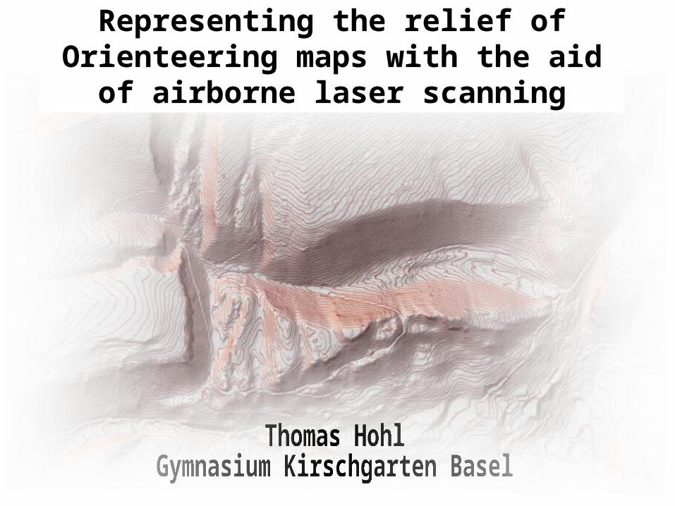
Representing the relief of Orienteering maps with the aid of airborne laser
scanning
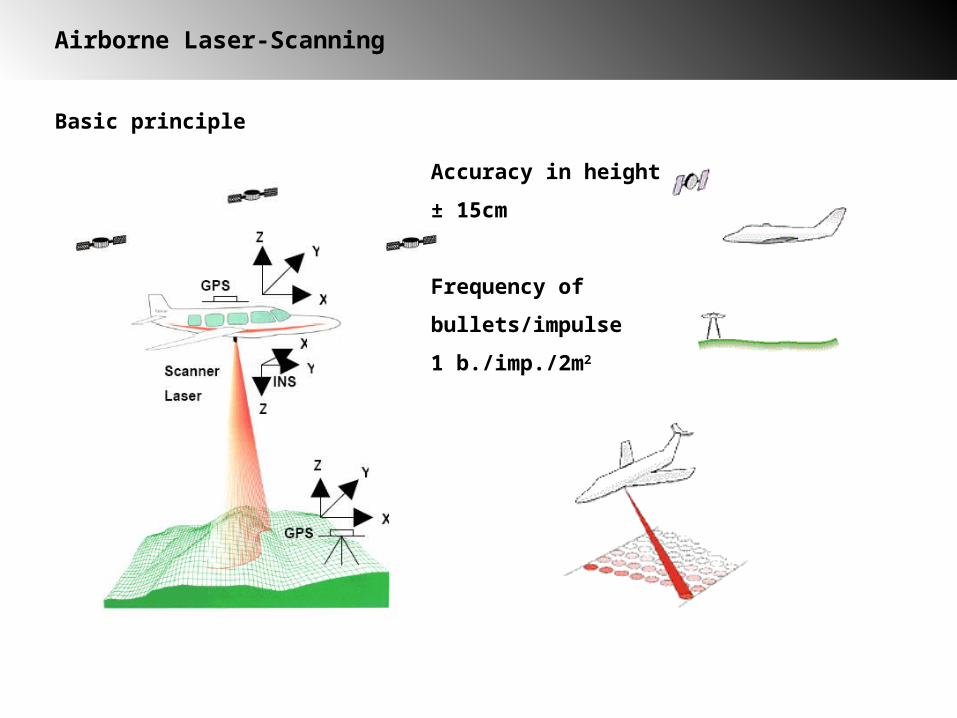
Airborne Laser-Scanning
Basic principle
Accuracy in height
± 15cm
Frequency of
bullets/impulse
1 b./imp./2m2

Airborne Laser-Scanning
first received impulse
last received impulse
Laser impulse in forested areas

Airborne Laser-Scanning
Method of analyzing
Laser raw data
GRID
TIN
Contour lines
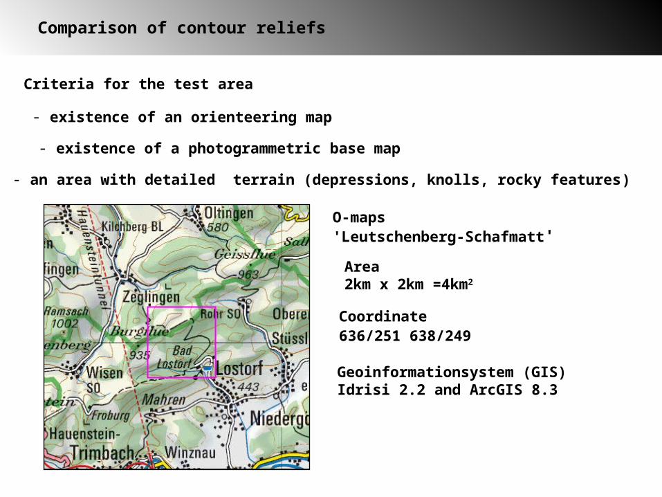
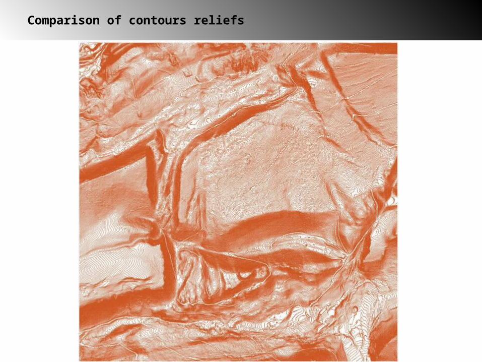
Comparison of contour reliefs
- existence of an orienteering map
- existence of a photogrammetric base map
- an area with detailed terrain (depressions, knolls, rocky features)
Criteria for the test area
O-maps'Leutschenberg-Schafmatt'
Area2km x 2km =4km2
Coordinate636/251 638/249
Geoinformationsystem (GIS)Idrisi 2.2 and ArcGIS 8.3
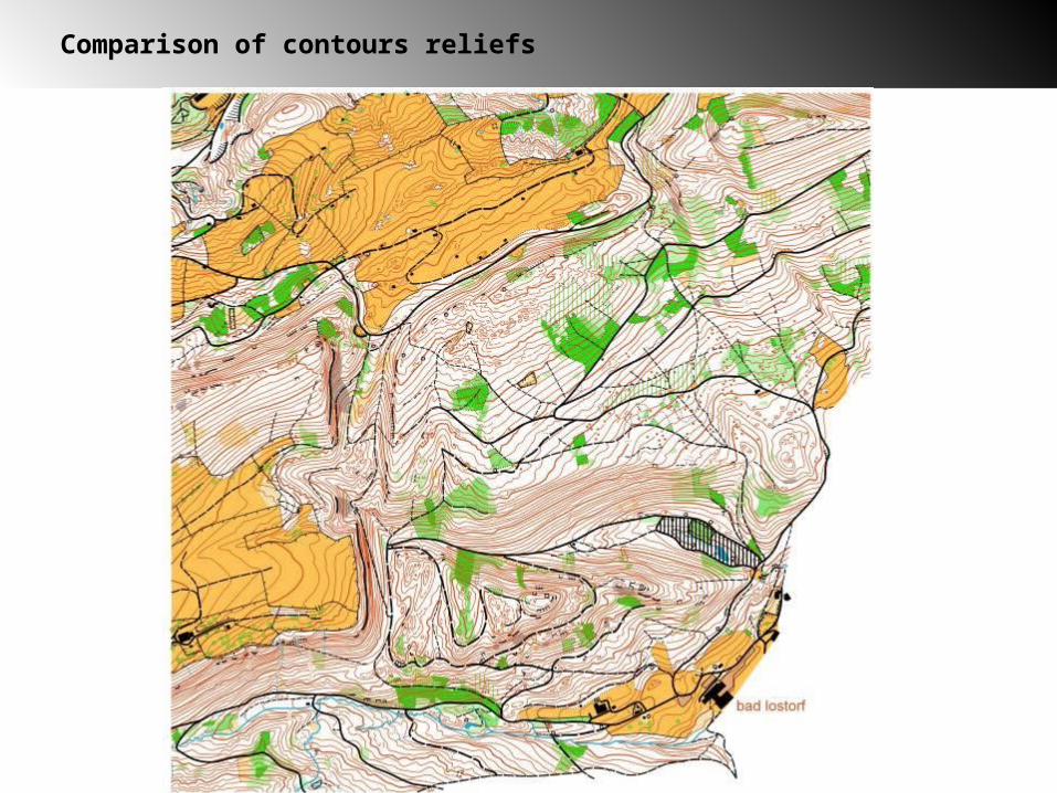
Comparison of contours reliefs
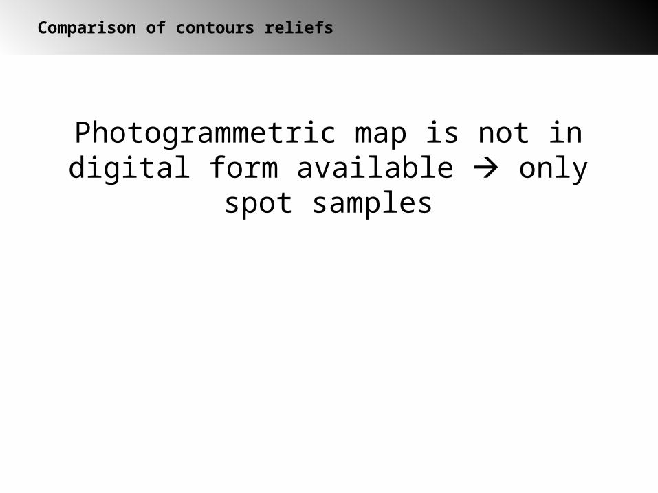
Comparison of contours reliefs
Comparison of contours reliefs
Photogrammetric map is not in digital form available only spot samples

Legend
open terrain
forest
dense vegetation
north sides of slopes
Map with samples
Comparison of contours reliefs

Comparison of contour relief
Distribution of spot samples
Size of 1 spot sample 150m x 150m

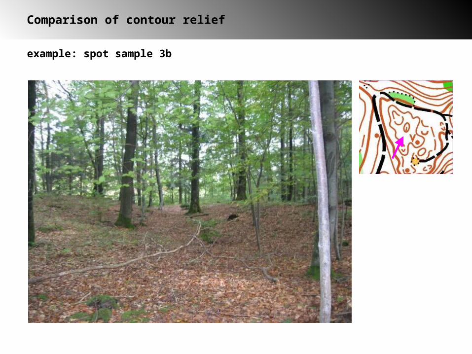
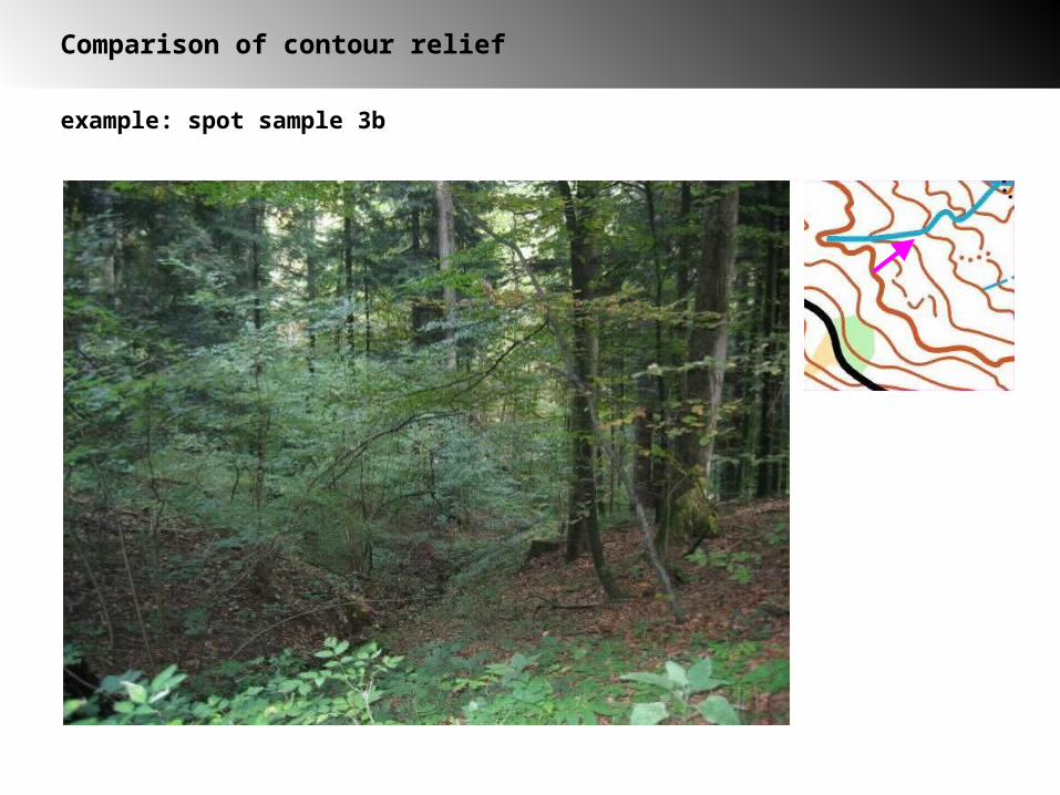
example: spot sample 3b
Comparison of contours reliefs
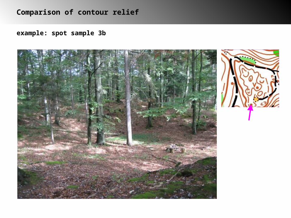
example: spot sample 3b
Comparison of contour relief
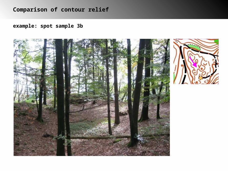
example: spot sample 3b
Comparison of contour relief
example: spot sample 3b
Comparison of contour relief
example: spot sample 3b
Comparison of contour relief

example: spot sample 3b
Comparison of contour relief
Comparison of contour relief
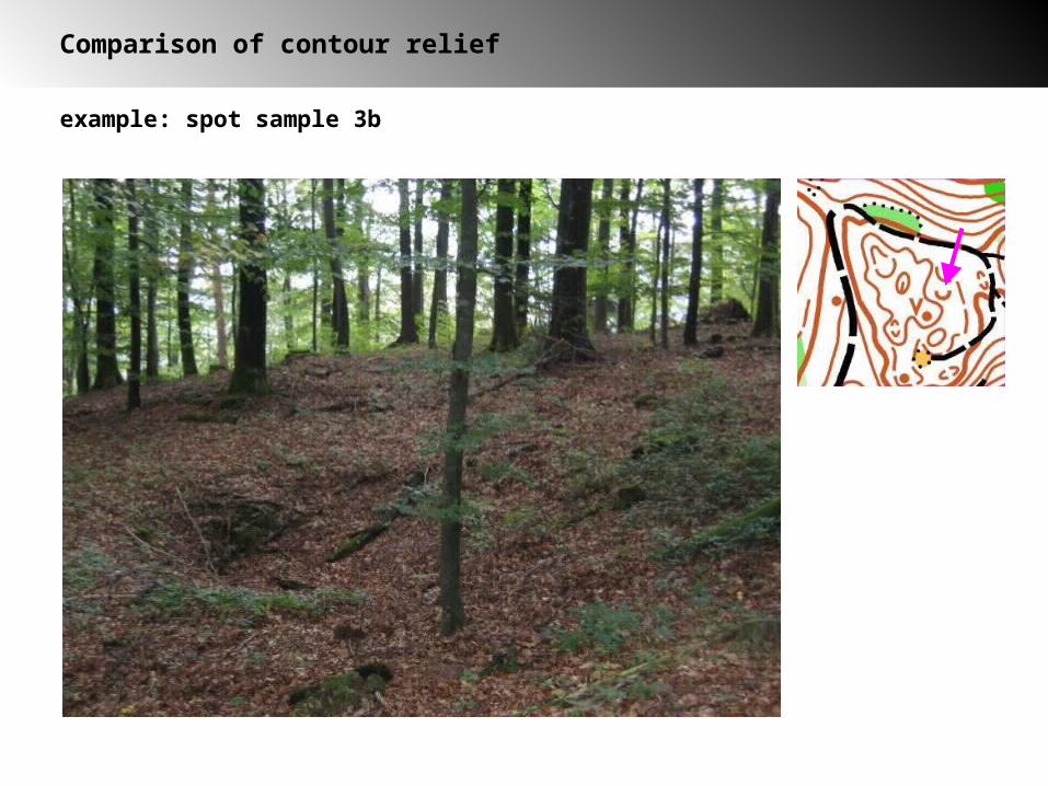
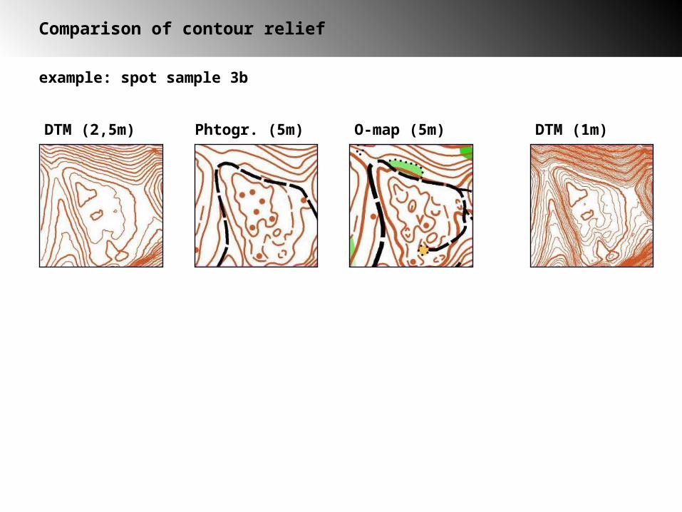
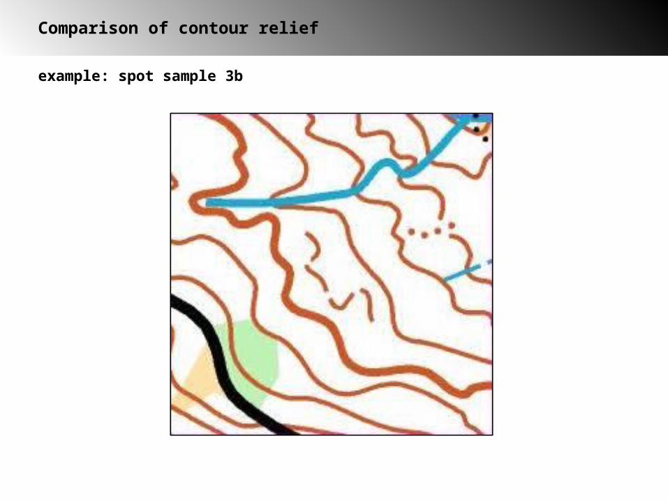
example: spot sample 3b
DTM (2,5m) Phtogr. (5m) O-map (5m) DTM (1m)
example: spot sample 3b
Comparison of contour relief

example: spot sample 3b
Comparison of contour relief

example: spot sample 3b
Comparison of contour relief
example: spot sample 3b
Comparison of contour relief

example: spot sample 3d
Comparison of contour relief
DTM (2,5m) Photogr. (5m) map (5m) DTM (1m)

Comparison of contour relief
Conclusion
2,5m-DTM- In detailed terrain not sufficient
- precise contour lines in dense vegetation
Photogrammetric base map
- very good representation of the terrain in open terrain
- not suitable in dense vegetation and north sides of hills
- often features are represented with objects instead of contour lines bad legibility
O-map
→ 1m-DTM

Conclusion
positive negative
DTM
Photogrammetricbase map
-very precise position-accuracy
- completeness
- good for relief representation
- pseudo features
- dithering contour lines
- only eliminate features, no new measuring
- representation without O-symbols
- representation with O-symbol
- inprecise
- uncompleted
- new measurements necessary
Comparison of contour reliefs
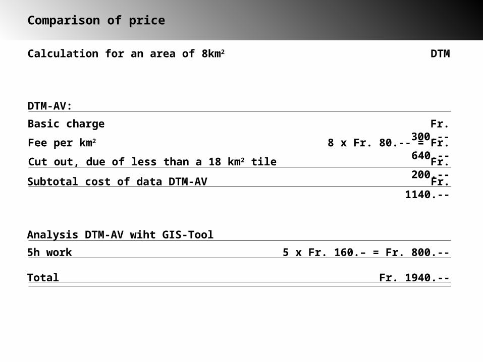
Comparison of price
Calculation for an area of 8km2 DTM
Basic charge Fr. 300.--
Fee per km2 8 x Fr. 80.-- = Fr. 640.--
Cut out, due of less than a 18 km2 tile Fr. 200.--
Subtotal cost of data DTM-AV Fr. 1140.--
DTM-AV:
5h work 5 x Fr. 160.– = Fr. 800.--
Analysis DTM-AV wiht GIS-Tool
Total Fr. 1940.--
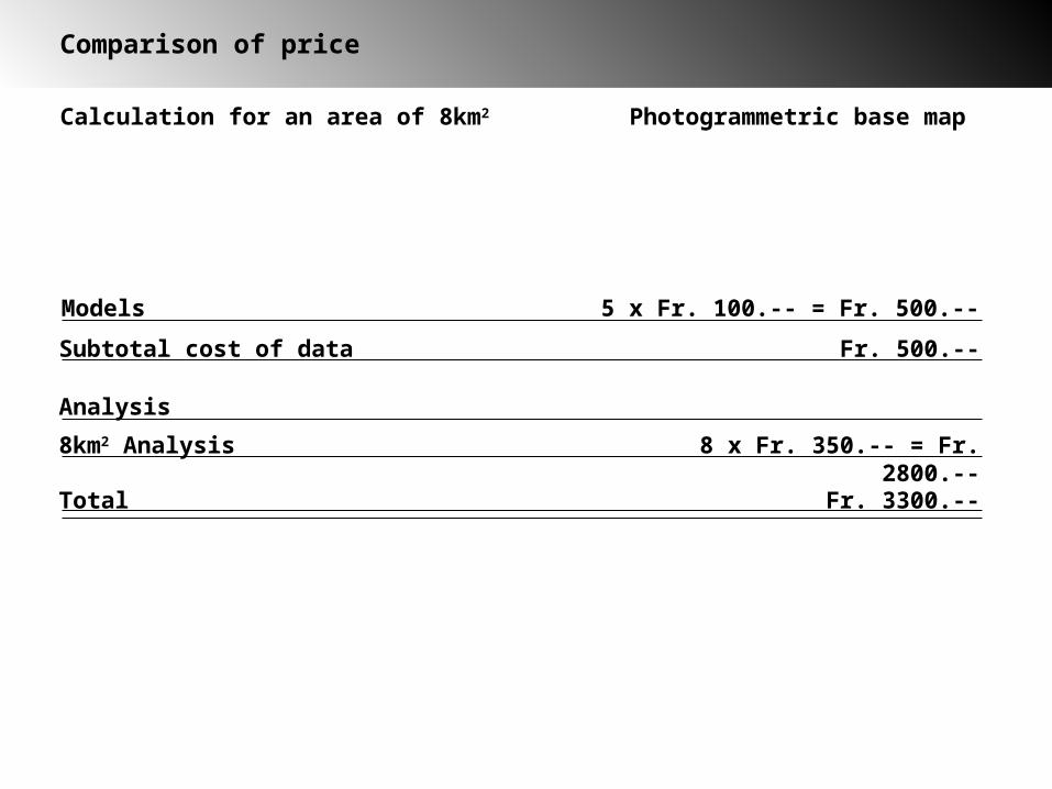
Comparison of price
Calculation for an area of 8km2 Photogrammetric base map
Models 5 x Fr. 100.-- = Fr. 500.--
Subtotal cost of data Fr. 500.--
8km2 Analysis 8 x Fr. 350.-- = Fr. 2800.--
Analysis
Total Fr. 3300.--
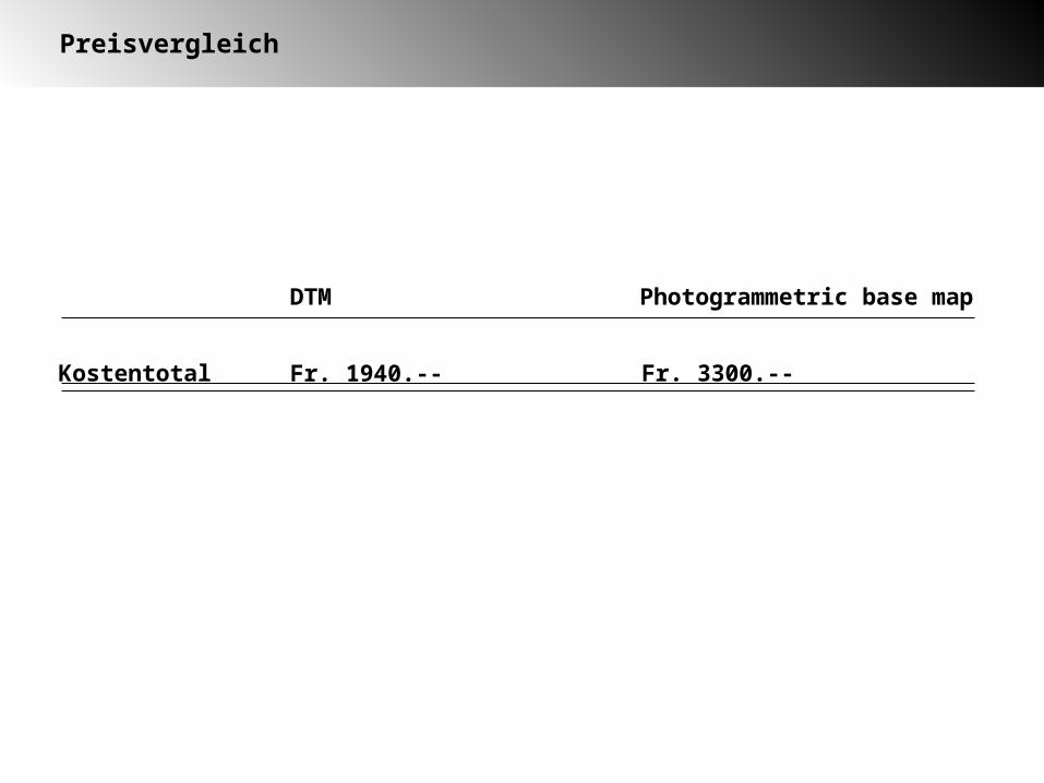
Preisvergleich
Kostentotal Fr. 3300.--
DTM Photogrammetric base map
Fr. 1940.--
Conclusion
1. Saving of time in the terrain because of its availability without interruption and precisness (elimination instead of measuring).
2. Raw-data all over Switzerland available. Time consuming work to find photogrammetric pictures are not any more necessary
3. Significant reduced costs compared to photogrammetric base maps.
4. Data are available rapidly.
5. Combination with orthophotos possible (georeferenced)
Advantages of laser air borne scanning
Disadvantages of laser air borne scanning
1. Base map without O-set of symbol
2. A detailed contour relief could easily lead to an over crowded and badly generalized map image.
Outlook
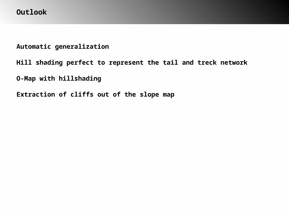
Automatic generalization
Hill shading perfect to represent the trail and track network
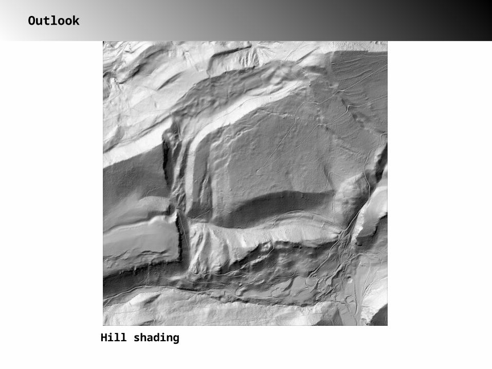
Outlook
Hill shading
Outlook
Automatic generalization
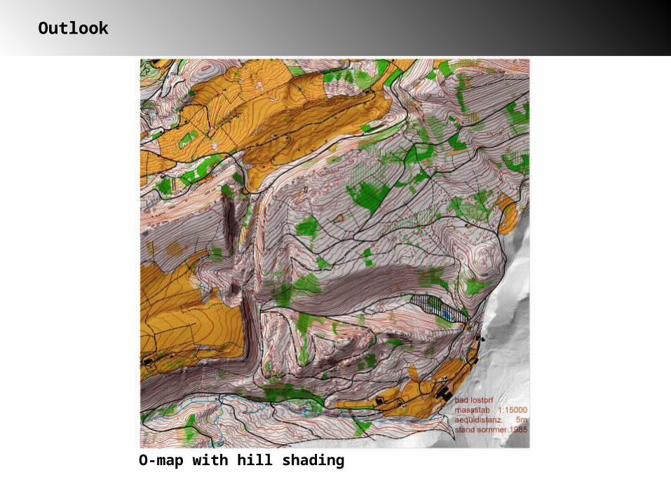
O-Map with hill shading
Hill shading perfect to represent the trail and track network
Outlook
O-map with hill shading
Outlook
Automatic generalization
Extraction of cliffs out of the slope map
O-Map with hillshading
Hill shading perfect to represent the tail and treck network
Outlook
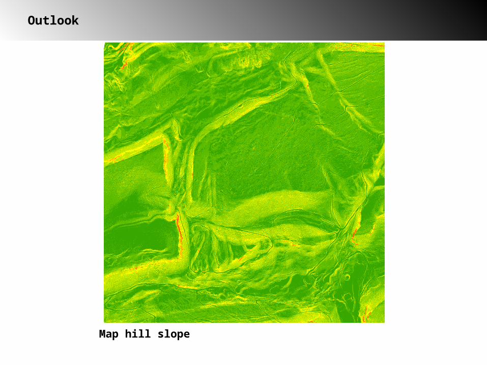
Map hill slope

Questions