how to evaluate and communicate issues
TRANSCRIPT

How to evaluate and communicate issues of spatial planning, ecology and flood management: Identifying a multi-disciplinary approach
Report on the International Workshop 15-17 May 2006, Koblenz, Germany
Report compiled by Peter Horchler (BfG)

ead partner
Hessian Ministry of Environment, Rural
Development and Consumer Protection
Darmstadt University of Technology
TECHNISCHE
UNIVERSITÄT
DARMSTADT
Provincie Noord-Brabant
German Federal Institute of Hydrology
Water board Aa en Maas
Water board Brabantse Delta
Water board de Dommel
Water board Mümling
The nofdp project is embedded in the INTERREG III B programme, an initiative of the European Commission aiming at the promotion of interregional co-operation within Europe. It is a four- year trans-national project with partners from The Netherlands and Germany launched in spring 2004. This project has received European Regional Development Funding (ERDF) through the INTERREG III B Community Initiative

Table of contents Page
Schedule of the Workshop .............................................................................................1
Introduction ...................................................................................................................4
The nofdp project .........................................................................................................................4
Aims of the workshop...................................................................................................................5
Structure of the workshop.............................................................................................................6
Presentations ..................................................................................................................6
Lessons learned from the workshop ...............................................................................7
General approaches and methods of evaluation...........................................................................7
Approaches and methods of evaluation in spatial planning........................................................13
Approaches and methods of evaluation in water and flood management...................................14
Approaches and methods of evaluation in ecology ....................................................................15
Results of the "silent discussion" ...................................................................................19
Methods .....................................................................................................................................20
Indicators....................................................................................................................................20
Communication..........................................................................................................................21
General conclusions.....................................................................................................22
Outlook........................................................................................................................23
Annexes .................................................................................................................. 24 ff.
Abstracts of selected talks........................................................................................................................25
List of participants ...................................................................................................................................50


International Workshop: How to evaluate and communicate issues of spatial planning, ecology and flood management: Identifying a multi-disciplinary approach
1
Schedule of the Workshop 15 May 2006 The EU INTERREG IIIB project nature-oriented flood damage prevention (nofdp): A short introduction 14:00 Welcome Fritz Kohmann (Federal Institute of Hydrology, Koblenz) 14:15 Introduction to the EU INTERREG IIIB programme Elmar Fuchs (Federal Institute of Hydrology, Koblenz) 14:30 Introduction to the nofdp project Axel Winterscheid (TU Darmstadt) 15:00 Results of an NWE-wide questionnaire on planning of flood prevention
measures Peter Horchler (Federal Institute of Hydrology, Koblenz) 15:15 Ecological modelling approaches in the Dutch investment projects Gerard van den Heuvel (Waterschap Brabantse Delta, Breda) 15:30 Coffee / tea break 16:15 The three nofdp investment project Steenbergse Vliet, Aa and Dommel (NL) Piet van Iersel (Waterschap Brabantse Delta, Breda) 17:00 The nofdp investment project Mümling (D) Axel Winterscheid (TU Darmstadt) 17:15 Closure 16 May 2006 Session 1 General approaches and methods of evaluation 9:00 Welcome and short introduction Christoph Hübner (TU Darmstadt) 9:15 The nofdp products IDSS and Knowledge Base Christoph Hübner (TU Darmstadt) 9:30 Keynote: Role of evaluation for integrated planning and decision
support Luc Boerboom (ITC, Enschede) 10:30 Coffee / Tea break 11:00 How to balance conflicting stakeholder interests in flood management? Markus Hostmann (EAWAG, Zürich)

2
11:30 Knowledge Integration for the nofdp IDSS - Elements of a multi-disciplinary approach
Bernhard Hahn (RIKS, Maastricht) 12:00 Effects of different groyne types on vegetation - A GIS-based multi-criteria
evaluation Uwe Schröder (Federal Institute of Hydrology, Koblenz) 12:30 Open discussion 13:00 Lunch break Session 2 Approaches and methods of evaluation in spatial planning 14:00 Welcome and short introduction Elmar Fuchs (Federal Institute of Hydrology, Koblenz) 14:15 Study on the NWE spatial planning procedures Piet van Iersel (Waterschap Brabantse Delta, Breda) 14:30 Keynote: Comparing methods for evaluation and weighing up
in spatial planning Frank Scholles (Hannover University) 15:30 Coffee / Tea break 16:00 The EcoDSS Arnejan van Loenen (Hydrologic, Amersfoort) 16:30 Decision Support System (DSS) for the EU WFD´s Programmes of measures
identification and assessment of suitable measures for morphological aspects? Heribert Nacken (RWTH, Aachen) 17:00 Open discussion 17:30 Closure 19:00 Conference dinner 17 May 2006 Session 3 Approaches and methods of evaluation in water and flood management 9:00 Welcome and short introduction Piet van Iersel (Waterschap Brabantse Delta, Breda) 9:15 An integrated approach in flood management in Flanders (Belgium) – The
valley of the river Dyle as a test case (project executed in 2000) Piet De Becker (INBO, Brussels) 10:00 Coffee / Tea break

International Workshop: How to evaluate and communicate issues of spatial planning, ecology and flood management: Identifying a multi-disciplinary approach
3
10:30 A short overview of the “water retention by land use change” concept of the
WaReLa INTERREG IIIB NWE project Hugo Hellebrand (Public Research Center-Gabriel Lippmann, Luxembourg) 11:00 Open discussion 11:30 Lunch break Session 4 Approaches and methods of evaluation in ecology 12:30 Welcome and short introduction Peter Horchler (Federal Institute of Hydrology, Koblenz) 12:45 The Eco-Efficiency approach in the WaReLa INTERREG IIIB NWE project
Gebhard Schüler (Research Institute for Forest Ecology and Forestry Rheinland-Pfalz, Trippstadt)
13:15 Keynote: The values of nature and the nature of values Valentina Tassone (Wageningen University) 14:15 Ecological evaluation approaches of the Federal Institute of Hydrology Volker Hüsing (Federal Institute of Hydrology, Koblenz) 14:45 Open discussion 15:15 Coffee / Tea break Session 5 Creating the product 15:45 Open discussion on:
Topics and methods to be implemented in the multi-disciplinary approach Common language and communication approach
16:30 Closure

4
Introduction
The nofdp project
Water, ecological and human issues in combination determine the complex func-
tionality of river basins. Hence, all administrative measures have to take into ac-
count all three issues. European and national policies as well as legislation reflect an
increasing awareness of this necessity. Thus, it is the aim of the nofdp project to pro-
vide a balanced view on the issue of nature-oriented flood damage prevention. Still
technical measures are often considered to be the only way to achieve flood damage
prevention, while impacts on ecology often are largely neglected in riverine man-
agement and spatial planning.
Here we provide a more detailed description of what we understand by nature-
oriented flood damage prevention measures. These are:
• all measures to reduce flood damage, which use or restore natural elements (e.g.
forests, scrubs, sand bars) of the entire catchment area to achieve a (more) natu-
ral floodplain (with retention, storage, and discharge function) of brooks and riv-
ers,
• all technical measures which include or generate elements and/or functionalities
that mitigate negative anthropogenic effects on nature (e.g. fish passages in
dams),
• all measures that develop or restore a (more) natural environment (e.g. river
banks with natural vegetation succession, re-meandering of rivers, allowing flow
dynamics to work, secondary channels, fish or amphibian spawning zones,
land-use changes) aiming to get a natural and sustainable floodplain function,
• all measures (also political and planning measures), which provide and ensure a
sustainable and nature-friendly land-use of floodplains, and which are taking
into account the demands of natural river and flood dynamics.
One major project goal is to develop an Information & Decision Support System

International Workshop: How to evaluate and communicate issues of spatial planning, ecology and flood management: Identifying a multi-disciplinary approach
5
(IDSS). Planned task of this computer-based IDSS is to support project managers,
decision makers and policy makers in their
• pre-planning of measures related to flood damage prevention and nature devel-
opment along rivers,
• internal communication within their own water boards or governmental organi-
sations,
• external communication with stakeholders and politicians, and
• testing of strategic planning options
Further deliverable is a knowledge base, which provides the user nofdp relevant in-
formation and best-practise examples on flood protection, nature development and
spatial planning. The knowledge base will be realised as web-based information sys-
tem under www.nofdp.net. Finally, printed guidelines will provide additional sup-
port.
The emphasis of the IDSS is not the exact prognosis of sectoral impacts (i.e. change
in water levels measured in centimetre but no information regarding impact on
vegetation). The IDSS concept is designed to be able to
• process a large amount of data and information, which cover the issues of flood
protection, nature development and spatial planning,
• arrive at better decisions through interaction with data and information,
• address possible conflicts caused by a certain measure or strategy,
• compare and evaluate measure or strategy alternatives
• provide a general information base regarding the impact of measures, which on
the other hand covers the most relevant aspects regarding flood protection, na-
ture development and spatial planning and
• provide an information base (e.g. best-practise examples, relevant EU-Directives
as well as national laws) that can be used in discussions with high level decision
makers, policy makers, local politicians and affected stakeholders.

6
Aims of the workshop
To take a final decision in every planning procedure it is necessary to foresee the
advantages and disadvantages of strategy options or measures taking into account
every stakeholder's interest. Therefore, we aim to identify a suitable multi-
disciplinary and integrative evaluation approach for the implementation into the
IDSS.
During the workshop four essential topics concerning nofdp were discussed. These
topics and the corresponding session titles were:
General approaches and
methods of evaluation
In this context we asked the
slightly provocative question:
"How to compare apples with
pears?", meaning that this session
was dedicated largely to the ques-
tion of multi-criteria analysis
(MCA). Hence, the aims were to
identify suitable approaches and
methods of MCA, which can be
implemented into the nofdp IDSS.
Approaches and methods of evaluation in spatial planning
We subtitled this session "How to balance conflicting spatial demands?"
The primary aim of this session was to clarify the basic ideas and evaluation meth-
ods spatial planners are applying when working in the field of nature oriented flood
damage prevention. Trans-national spatial planning is the basis for every INTERREG
IIIB project, but this perspective is often largely neglected in the projects. Hence,
more emphasis must be put on this issue.

International Workshop: How to evaluate and communicate issues of spatial planning, ecology and flood management: Identifying a multi-disciplinary approach
7
Approaches and methods of evaluation in water and flood management
Since water and especially flood management is directly linked to human and socie-
tal interests, we asked the question "How to assess and evaluate the cost-benefit rela-
tion of flood damage prevention measures?"
In this session we aimed to identify commonly used and broadly accepted methods
to address and evaluate the cost-benefit ratio and how they can be implemented in
the nofdp IDSS.
Approaches and methods of evaluation in ecology
We subtitled this session "How to weigh the impact on, or the benefit for nature,
taking the value of ecosystem services into account?"
In this session we wanted to discuss a "hot" topic, which, although known for quite a
while, is almost always neglected in planning procedures, i.e. the intrinsic value of
nature and especially the service it provides "free of charge" for the safety and wel-
fare of human society. As an outcome we hoped to identify suitable methods for the
implementation into the IDSS.
Structure of the workshop
The whole workshop was divided into three days.
On the first day (afternoon) a brief introduction to the nofdp project was given by
some presentations.
The topic-related workshop sessions started the second day.
Most sessions were introduced by a short presentation of a nofdp topic, followed by
a keynote lecture introducing the main theme of the corresponding session. Thereaf-
ter, additional short presentations served as impulse lectures to stimulate the discus-
sion.

8
In a final step, the session called creating the product, we aimed to extract the most
relevant and suitable information regarding the multi-disciplinary and integrative
evaluation approaches and methods. Furthermore, we hoped to identify good ways
how to communicate the evaluation results.
In the end of the workshop, the ideas of all participants regarding the major topics of
the workshop were written down collectively by means of a communication method
called "silent discussion" and briefly presented afterwards.
Presentations
Abstracts of some selected presentations are provided in the annex.
Furthermore, most of the original presentations can be downloaded from our website
at http://nofdp.bafg.de/servlet/is/12521/?lang=en.

International Workshop: How to evaluate and communicate issues of spatial planning, ecology and flood management: Identifying a multi-disciplinary approach
9
Lessons learned from the workshop
The knowledge we have gained will be summarised and presented according to the
main workshop topics:
general approaches and methods of evaluation
approaches and methods of evaluation in spatial planning
approaches and methods of evaluation in water and flood management
approaches and methods of evaluation in ecology
Direct interpretations and some conclusions are given within the chapters. The key
messages of those presentations, which are considered to provide direct input to the
theme of the workshop, are presented briefly. Most other presentations are repre-
sented by abstracts in the annex. A general conclusion and outlook will finish the
report.
General approaches and methods of evaluation
nofdp as a tool for spatial planning always has to deal with the problem of how to
evaluate a multitude of issues, criteria and parameters. Hence, it is evident that a
tool for multi-criteria analysis (MCA) or multi-criteria evaluation (MCE) has to be im-
plemented into the IDSS. Because most problems the IDSS will address are spatial
problems, it must be a tool for spatial
MCA and MCE.
Apparently, many methods and soft-
ware tools are already available.
According to Luc Boerboom (ITC), it
is essential for the success of evaluation
to structure the whole planning
process, especially criteria, alternatives

10
and expected impacts in a very clear, sim-
ple and transparent way. Carefully selected
units of persons (stakeholders) and methods
will result in a sound decision process. This
has to be done right from the start along with
the involvement of all stakeholders. He
stressed the importance to look not only at
problems but also at opportunities especially during discussions with stakeholders.
Structuring of problems should be value-driven and not data-driven. Value func-
tions could be setup for this purpose. A so-called criteria tree can be used to list
existing problems and put them in a hierarchical order. Pruning of this tree during a
joint discussion with all stakeholders
shall yield key objectives for the
evaluation process. The number of cri-
teria should be limited to a few (e.g. up
to seven) to facilitate communication.
Regarding the comparison of alterna-
tives/variants, he strongly recom-
mended only using a ranking proce-
dure instead of assigning numbers or
scores to the variants (= rating) because
such evaluation schemes mostly face
the problem of non-linearity and un-
equal distances between the numbers
or scores. Besides, most stakeholders
easily accept a simple ranking, just stat-
ing that one or the other variant is bet-
ter or worse. He also recommended using descriptive criteria for water management
projects. This would require a shift to normative criteria.
© Boerboom
© Boerboom
International Workshop: How to evaluate and communicate issues of spatial planning, ecology and flood management: Identifying a multi-disciplinary approach
11
As software for a spatial multi-criteria evaluation he proposed to use the ITC soft-
ware ILWIS-SMCE. This application aims to improve group decision processes and
focuses on spatial sensitivity analysis to evaluate consequences of errors in data for
certainty about choices.
Markus Hostmann (EAWAG) presented an analysis of the contribution of MCDA
(Multiple Criteria Decision Analysis) methods for conflict solution in environ-
mental management projects. This analysis is based on a case study carried out
within a flood protection project at the Thur River in Switzerland. The principal
steps, which were taken to finally achieve a decision, were:
Definition of the decision problem
Identification of objectives
Importance of objectives (for stakeholders)
Identification of alternatives
Prediction of outcomes of alternatives
Ranking of alternatives: find consensus solution
The overall question of the project was: "how can flood protection level and eco-
logical conditions both be improved?"
In a representative circle of stakeholders (26 people) a hierarchy of objectives was
identified and weights were assigned by each stakeholder group to these objec-
tives.
After a joint discussion and elaboration of four planning alternatives, the stake-
holders first stated their preferences in a holistic way. Next, they were asked to per-
form a five-score ranking of the alternatives based on the Multi-attribute value
theory (MAVT). Finally the ranking result was discussed among all stakeholders
leading to a final holistic ranking. Most stakeholders acknowledged this stepwise
approach because it stimulated a learning process leading to a better overall under-
standing.

12
The recommendations of M. Hostmann regarding methods to be used in a decision
process were to:
use a Multiple Criteria Decision Analysis (MCDA) method, in specific: Multi-
attribute value theory (MAVT) and to
apply them in a multiple stakeholder setting in order to support learning proc-
esses and enhance communication & transparency.
Regarding communication he recommended to:
discuss objectives within small stakeholder groups,
discuss results combining all stakeholders in a stakeholder forum,
provide information for the public (newsletter, homepage, workshops etc.)
Uwe Schröder (Federal Institute of Hydrology) presented the results of a case
study at the river Elbe on the effects of different groyne types on vegetation using a
GIS-based multi-criteria evaluation. Landscape metrics and diversity indices were
used to quantify landscape heterogeneity. Furthermore, the quality of vegetation was
International Workshop: How to evaluate and communicate issues of spatial planning, ecology and flood management: Identifying a multi-disciplinary approach
13
assessed to identify the ecological value of different degrees of landscape heteroge-
neity. The approach was judged to be very useful especially because of:
the systematic and objective integration of various evaluation criteria,
the additional opportunity of personal and/or subjective weighing and
the good performance in comparing various evaluation approaches.
Approaches and methods of evaluation in spatial planning
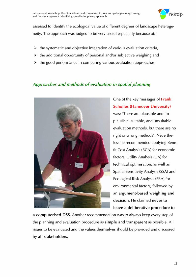
One of the key messages of Frank
Scholles (Hannover University)
was: "There are plausible and im-
plausible, suitable, and unsuitable
evaluation methods, but there are no
right or wrong methods". Neverthe-
less he recommended applying Bene-
fit Cost Analysis (BCA) for economic
factors, Utility Analysis (UA) for
technical optimisation, as well as
Spatial Sensitivity Analysis (SSA) and
Ecological Risk Analysis (ERA) for
environmental factors, followed by
an argument-based weighing and
decision. He claimed never to
leave a deliberative procedure to
a computerised DSS. Another recommendation was to always keep every step of
the planning and evaluation procedure as simple and transparent as possible. All
issues to be evaluated and the values themselves should be provided and discussed
by all stakeholders.

14
Arnejan van Loenen (Hydrologic) presented a GIS tool called EcoDSS that en-
ables to analyse the ecological effects of the measures retaining water or water stor-
age on agriculture and nature. The tool is based on knowledge rules developed by
STOWA and valid for The Netherlands. It proved to be applicable in a trans-national
study (Belgium/The Netherlands). The GIS allows to quickly and interactively display
the results of different management alternatives. Therefore, the EcoDSS can be ide-
ally used as communication tool. The methodology will be implemented into the
nofdp IDSS.
Heribert Nacken (RWTH) presented a Decision support system (DSS) that en-
ables selecting suitable measures to improve the morphological conditions in water
bodies taking into consideration the eco-hydrological objectives of the European
Water Framework Directive. The DSS is based on expert knowledge implemented as
‘if-then’ rules necessary for selecting feasible measures to reach the good ecological
status. Furthermore it comprises rules that predict the impacts after implementing the
measure. The tool appears to be very useful as application for nofdp, however, user
rights have to be clarified.
Approaches and methods of evaluation in water and flood management
Two interesting presentations (de Becker and Hellebrandt) addressed the issue in a
rather integrative way.
Piet de Becker (INBIO) presented a case study at the Dijle river in Flanders (Bel-
gium). The urgent need to improve flood protection in this valley including a large
protected area led to a nature-oriented approach combining technical elements
(sluice) with the free and natural development of nature. In this way all safety stan-
dards (storage of a 1/100 y peak discharge) could be realised and at the same time
the situation for nature could be improved considerably. The project can serve as
best-practice case.

International Workshop: How to evaluate and communicate issues of spatial planning, ecology and flood management: Identifying a multi-disciplinary approach
15
Hugo Hellebrand (Public Research Center-Gabriel Lippmann, Luxembourg)
presented the basic ideas of the project WaReLa (water retention by land-use
change). The project (www.warela.eu) focuses on the headwaters of rivers aiming at
optimising retention potentials by various measures such as deep-loosening of soils,
creation of small retention areas etc. To identify suitable areas for such measures he
presented results of a meso-scale GIS analysis combining mainly geological and
geomorphological data into a value (C-value), indicating the retention potential of a
given area. The WaReLa approach provides an important element for the aims of
nofdp.
Approaches and methods of evaluation in ecology
Gebhard Schüler (Research Institute for Forest Ecology and Forestry
Rheinland-Pfalz) presented an approach called Eco-Efficiency Analysis realised
by the Institute of Forestry Economics (University of Freiburg) within the EU INTER-
REG III B project WaReLa. The aim is to develop an information-instrument to
analyse the eco-efficiency of flood prevention measures by precautionary land-use.
It will provide information about possible short and long-term ecological and eco-
nomic effects caused by such measures. It will be applicable for single and a combi-
nation of measures. Finally it shall facilitate the process of decision making.
The approach appears to be very suitable as addition to the nofdp project. A meeting
with the developers is planned to clarify if and how the tool could improve the
nofdp IDSS or be implemented into it.
Valentina Tassone (Wageningen University) presented various new approaches
to evaluate ecosystem goods and services in terms of money (= valuation),
partly based on the synthesis report "Ecosystems and Human Well-Being" by the
world-wide consortium of scientists called the Millennium Ecosystem Assessment.
These approaches include:

16
1. to identify all possible services nature
provides for mankind, including for in-
stance provisional services such as
food, fresh water, regulating services
such as climate and flood regulation, but
also cultural services such as aesthetic,
spiritual and recreational values
2. to identify or assign monetary values to it
Today this second step of monetization
seems necessary and very important in order:
to give an estimate of the economic
value of the environmental goods and
services
to provide a sense of how important
are environmental resources to the
economy
to provide information easy to under-
stand by the general public and pol-
icy makers
to allow comparison with other sectors
of the economy
to justify implementation of conservation
measures
to justify investments in environmental resources

International Workshop: How to evaluate and communicate issues of spatial planning, ecology and flood management: Identifying a multi-disciplinary approach
17
Different kinds of values must be considered.
In financial terminology, many environmental goods and services do not have a
market; hence, no market prize approach is possible. Other methodologies must be
used. Well known valuation methods are hedonic prize technique, avoided damage
cost method, replacement cost technique, production function method, travel cost
method, contingent valuation method, and benefit transfer method.
To calculate a value of damage avoidance seems especially suitable in the
context of flood damage prevention. It should clearly be included in the cost-
benefit evaluation tool.
The contingency method, although well known and often applied, was criticised
and appears to be less suitable for nofdp.
Valentina Tassone provided the following framework for an integrated assessment of
all factors and values:
© Tassone

18
It was stated during the discussion that average values for common ecosystem
services should be at hand for daily practice. Such values may partly be taken from
the recent literature e.g. Balmford et al. (2002) or Millennium Ecosystem Assessment
(2005). As a meaningful example within the nofdp context Balmford et al. (2002)
provided a value of almost 6000 US$ per hectare and year for the ecosystem
services of an intact wetland area.
The studies within the Millennium Ecosystem Assessment (2005) revealed that the
net benefits from a more sustainably managed ecosystem are greater than those
from a converted ecosystem when measurements include both marketed and non
marketed services.
© Tassone

International Workshop: How to evaluate and communicate issues of spatial planning, ecology and flood management: Identifying a multi-disciplinary approach
19
Results of the "silent discussion"
After the main section of the workshop with presentations and short discussions, a
final so-called "silent discussion" was initiated. Among the participants small groups
of maximum 5 persons were built. In these groups, each person - based on his/her
ideas and on what he/she has learned during the workshop - started to write down
his/her main conclusion on a given topic. Then he/she passed the text to his/her
neighbour, who commented on it and went on to pass it to the next person. The
process was stopped, after the initial text came back to the person who wrote it. Fi-
nally a speaker of each group presented the conclusions of this silent discussion.
Each group focused on one of the three topics: methods, indicators and communica-
tion.
The key findings were:

20
Methods
Because of the complexity and multi-diciplinarity addressed by the nofdp project
there was consensus that the evaluation tool must be based on a multi-criteria ap-
proach. Nevertheless the evaluation method should be as transparent and under-
standable as possible. Among the methods mentioned the value-benefit analysis
was considered to be a good and flexible tool although there were some doubts
about the time scale to be taken into account (project time or longer) and if a mone-
tarisation of all values might be the right way. As basic requirement the benefit must
be clearly defined. The cost-benefit analysis was considered by some participants
as too demanding by others as good choice if monetary values of all goods are used.
Avoided damage costs or replacement costs were mentioned in this context. Another
method mentioned was the ecological risk analysis.
For all methods critical requirements are the availability of suitable baseline data
and the acceptance of the used methods by all stakeholders (e.g. simple ranking of
alternatives).
A GIS was considered to be the most suitable platform. Based on this tool it was
proposed to perform a ranking or pair-wise comparison of planned measures or vari-
ants. Uncertainty, e.g. by fuzzy logic or sensitivity analysis, should be taken into ac-
count.
Indicators
It was stated that suitable indicators for the evaluation process are case and context-
dependent and that they must be related to the given objectives. Furthermore they
must be transparent and reproducible and they must be accepted and trusted by the
stakeholders. Therefore they should be identified and agreed on by all persons in-
volved right at the beginning of a planning process. The types of indicators men-
tioned were
• costs and effectiveness of the measures for the reduction or prevention of
flood damage,
• storage volume,
• changes in ecological value such as physical river quality,

International Workshop: How to evaluate and communicate issues of spatial planning, ecology and flood management: Identifying a multi-disciplinary approach
21
• habitat fragmentation or the impact on protected areas.
Land-use demand (ha) for the planned measure and the costs for ownership and
maintenance for e.g. 50 years were also listed as suitable indicators. To find the right
ones can be realised in a learning process during an open discussion with all stake-
holders.
Communication
It became clear in all discussion groups that communication is considered to be a
very important issue for nofdp. The nofdp IDSS should provide decision-relevant
information in clear and transparent way, the system itself should not decide. It
should ideally support a very open discussion process in an interactive way that
works very quickly. However, the participants were convinced that the IDSS cannot
satisfy all target groups. It was therefore proposed to have different options how to
present the results. A short debate arose about the neutrality of the authority per-
forming the planning and evaluation process. Some participants stated that it is never
possible to be completely neutral however it should be targeted. There was almost a
general agreement that a GIS is the tool of choice for visualisation. Nevertheless,
many participants thought that an integrative and positively thinking mediator is
needed to guarantee a successful planning process.

22
General conclusion
Among the most important statements or recommendations we identified the follow-
ing:
• A very clear, transparent and simple project structure is necessary for a suc-
cessful planning
• Since almost all the planning projects considered in the nofdp framework have a
spatial coverage or impact a spatial multi-criteria evaluation is necessary
• Because the method of rating requires the assignment of numbers to the value of
objects that sometimes can hardly or not be numbered (e.g. ecology or natural
beauty), the method of ranking is preferable. Also different values are often rep-
resented at different scales (e.g. metric or ordinal) and therefore, a direct com-
parison is at least statistically critical.
• To include a cost-benefit analysis is considered to be essential because most
deciders (e.g. politicians) most of the time think in monetary terms. Hence, even
ecological values such as ecosystem services should be represented in monetary
terms.
• To apply sensitivity analysis was mentioned various times. However, there
were different meanings. In the spatial context it aims to identify sensitive areas
such as protected areas, where impacts should be avoided. In the statistical con-
text it aims to identify variables in a (statistical) model, whose variation has a
strong influence on the model output. Both types have to be considered for the
evaluation module within the IDSS.
Because of the large number of possible evaluation criteria for measures of nature
development and flood damage prevention we decided not to set up a fixed cata-
logue of criteria. The basic functionality of the so-called "Assessment Manager" is to

International Workshop: How to evaluate and communicate issues of spatial planning, ecology and flood management: Identifying a multi-disciplinary approach
23
implement criteria for evaluation and assign qualitative or quantitative values to
these criteria (using calculated data or estimates by personal judgement). This will be
done interactively by the user in order to ensure the desired transparency.
We decided that the nofdp IDSS will contain three methods for evaluation (rank-
ing/rating, cost-benefit analysis and value-benefit analysis). The implementation will
be realised by the end of April 2007.
Outlook
A prototype of the nofdp IDSS with as much functionality as possible will be ready
in spring 2007. Testing the product will be done including external persons in order
to optimise its functioning. The final product will be available in October 2007.
For interested persons, there is a possibility to subscribe to “nofdp IDSS community”
on the nofdp internet platform at: http://nofdp.bafg.de/servlet/is/13308/.

24
Annex

International Workshop: How to evaluate and communicate issues of spatial planning, ecology and flood management: Identifying a multi-disciplinary approach
25
Abstracts of some presentations Keynotes Role of evaluation for integrated planning and decision support Luc Boerboom....................................................................................................................................22 Comparing methods for evaluation and weighing up in Spatial Planning Frank Scholles ....................................................................................................................................23 The values of nature and the nature of values Valentina Tassone ..............................................................................................................................25 Other presentations Aims and functions of the nofdp IDSS Christoph Hübner & Axel Winterscheid .............................................................................................27 Results of an NWE-wide questionnaire on planning of flood prevention measures Peter Horchler....................................................................................................................................32 How to balance conflicting stakeholder interests in flood management? Markus Hostmann..............................................................................................................................37 Spatial Planning and its relation to INTERREG IIIB projects focusing water management Elmar Fuchs........................................................................................................................................38 Results of a research on Spatial Planning in NW Europe Piet van Iersel.....................................................................................................................................40 Ecohydrologic modelling of trans-national river basins with the EcoDSS Arnejan van Loenen ...........................................................................................................................44 Decision Support System (DSS) for the EU WFD´s programmes of measures: Identification and assessment of suitable measures for morphological aspects? Heribert Nacken, Sabine Bartusseck & Hani Sewilam........................................................................45 An integrated approach in flood management in Flanders (Belgium): The valley of the river Dyle as a test case (project executed in 2000) Piet De Becker ...................................................................................................................................46 A short overview of the “water retention by land use change” concept of the WaReLa INTERREG IIIB NWE project Hugo Hellebrand, J. Juilleret & L. Pfister ............................................................................................48

26
Role of evaluation for integrated planning and decision support Luc Boerboom (ITC, Enschede, NL) Two pillars for this presentation will be two models, one of the planning and deci-sion making process the other of how integrated planning and decision support. This allows me to define planning and decision support systems. I will briefly look at success and failure of spatial planning and decision support sys-tems and relate this to the success of methods of cost benefit analysis and multi-criteria evaluation. Spatial multi-criteria evaluation will then be demonstrated and discussed and it will be shown how it relates to the two pillars. I will discuss the difference between spa-tial and non-spatial multi-criteria evaluation and the importance for a combined ap-proach. These normative models will be contrasted with descriptive models, which will also be related to the two pillars. I will discuss the phases of multi-criteria evaluation and the importance of problem structuring, which can be done in many ways. I will therefore build a case for a thorough understanding of decision processes as well as decision makers in order to design useful indicators for value-driven design. Also I will argue in favour of shell environment in which planners can shape planning and decision problems as they see fit.

International Workshop: How to evaluate and communicate issues of spatial planning, ecology and flood management: Identifying a multi-disciplinary approach
27
Comparing methods for evaluation and weighing up in Spatial Planning Frank Scholles (Hannover University, DE) The aim of spatial planning is to promote social and economic development with special regard to effects on the environment for a sustainable development. Thus, its objectives include:
• to efficiently use available (limited) space • to economically balance the regions • to create living conditions of the same value • to keep and develop environmental resources.
This means that spatial planning is based on a multi-dimensional system of aims. Objectives often compete and must be weighed up amongst and against each other when dealing with planning proposals. Weighing up means looking at the single case and balancing its advantages and disadvantages to make a decision. It is a characteristic feature of spatial planning. Weighing up is prepared by identifying, describing and evaluating effects that are likely to be caused by a proposal. In this process, the spatial planner has no own interest but must mediate the different inter-ests that are introduced into the process by actors and stakeholders. Spatial planning must be seen as a co-operative process of communication, arguing and, sometimes, bargaining. Strategic environmental assessment has recently been implemented to make this process more transparent to the public by a formal proce-dure and especially documentation. The presentation will give a short introduction of evaluation approaches that are (or have been) frequently used to assess proposals and thus prepare decision-making. These include:
• cost benefit analysis • utility analysis • spatial sensitivity analysis • ecological risk analysis • threshold approach • different argument based approaches including ranking, pair comparison, re-
traction, site tables. It is important that the approach answers to legal requirements for planning permis-sions. Some legal requirements, e.g. the EU Habitats Directive, provide taboo criteria that cannot be overridden or can only be overridden under special circumstances. The suitability of the above listed approaches for spatial planning will be assessed and compared based on criteria like inter-subjectivity, reliability, validity, structural consistence, transparency, separation of facts and values. It must be stressed that there are no right or wrong methods. Instead, methods may be more or less suitable for the evaluation task. Today, best spatial planning practice

28
is characterised by a pluralism or mix of methods. Often, the first step is a spatial sensitivity analysis based on map overlay technique to identify those areas that are unlikely to be suitable as site or route for a planning proposal. In a second step, the remaining areas are studied in more detail using an argument based approach with thresholds or, in complicated cases with impacts on many factors, a risk analysis to compare alternative solutions. A cost benefit analysis is mandatory for all public pro-jects but will be carried out by sectoral planners rather than spatial planners. The main aim of applying evaluation methods in spatial planning is to identify cru-cial factors for the single case, thus getting rid of all less relevant factors and criteria. Final decision-making should be left to those who are legitimated to do so – politi-cians. The spatial planners' (experts') task in the process is to moderate and prepare deci-sion-making by identifying relevant elements, amongst other tasks.

International Workshop: How to evaluate and communicate issues of spatial planning, ecology and flood management: Identifying a multi-disciplinary approach
29
The values of nature and the nature of values Valentina Tassone (Wageningen University, NL) Human society depends, for its survival and well being, on the earth’s ecosystems and the goods and services they provide (e.g. freshwater, food, timber, climate regu-lation, recreation). Unfortunately, unsustainable economic development has altered the structure and the functioning of many ecosystems. As pointed out by the Mille-nium Ecosystem Assessment (2005), over the past 50 years humans have changed nature more rapidly and extensively than in any other comparable period of time in human history. This has resulted in a unequal distribution of benefits and tremen-dous costs in terms of degradation of ecosystems and loss of diversity of life on earth. In order to reverse this degradation process is necessary a significant change in poli-cies and practices. Decision makers, spatial planners, managers are urged to make a sustainable use of natural resources, develop integrated approaches to assess the environmental impact of their management plans before actually implementing them, and provide an overview of the costs and the benefits involved in their plans. All these require an understanding of environmental values and how to incorporate them in a decision making process. Decision support tools that take into account the ecological values are currently be-ing developed (e.g. De Groot, 2006). Some studies have already showed that the total economic value associated with managing ecosystems more sustainably is of-ten higher than the value associated with unsustainable conversion (e.g. Balmford et a., 2002). Others have showed the damages that occur when not taking into account the environmental impact of policy choices and projects (e.g. Tassone et al., 2004). Fortunately, in some countries such as the Netherlands, ecosystem valuation is a compulsory component of a cost-benefit analysis (Ruijkrog, 2005). When including environmental values in a decision making process it is important to distinguish three types of values. The financial value of the ecosystems is given by the actual income derived from the use of the goods and services (e.g. income de-rived from agricultural production). The socio-economic value of an ecosystem is given by the welfare that it generates for society and can be often expressed in monetary terms. This last value includes all forms of welfare that human derive from the goods and services provided by the ecosystems (e.g. option value). To be able to assess the socio-economic value of ecosystems (or the impact of certain activities on the ecosystem) it is necessary to have clarity about the ecosystem functions which can be seen as the actual (‘functional’) processes and components in ecosystems and landscapes that can provide several goods and services to human beings (de Groot et al, 2002). In order to estimate the values of goods and services not captured in the market (e.g. landscape beauty) several techniques are available such as contingent valuation method, replacement cost approach, avoided costs method, hedonic pric-ing method. To be able to capture the full value of an ecosystem it is important not to omit any goods and services that it provides, as this can lead to underestimation of values; on the other hand is necessary to avoid double counting as this can lead to overestimates (e.g. we are counting double if for example we are valuing at the

30
same time the nutrient recycling function of the ecosystem and the clean water pro-vided). Finally the intrinsic value of nature is the value that nature has in and for it-self, not relating to its utility for human beings. The Millenium Ecosystem assessment (2005) suggests to include all the values of (and the impacts on) the ecosystems into the decision making process. Current and future planning should consider ways to manage ecosystems that reduce negative trade-offs and favour the achievement of the Millennium Development Goals. Literature Balmford, A., Bruner, A., Cooper, P., Costanza, R., et al., 2002. Economic reasons
for conserving wild nature. Science, Vol. 297, pp. 950-953.
De Groot, 2006. Function analysis and valuation as a tool to assess land use con-flicts in planning for sustainable, multi-functional landscapes. Landscape and urban planning. In press.
De Groot, R., Wilson, M.A., Boumans, R.M.J., 2002. A typology for the classifica-tion, description and valuation of ecosystem functions, goods and services. Ecological Economics, Vol. 41, issue 3, pp. 393-403.
Millenium Ecosystem Assessment, 2005. Ecosystems and human well-being. Island Press, Washington DC.
Ruijkrog, E.C.M., 2005. Valuation of nature, water and soil in socio-economic cost benefit. Witteven en Bos.
Tassone, V.C., Wesseler, J., Nesci, F.S., 2004. Diverging incentives of afforestation from carbon sequestration: an economic analysis of the EU afforestation pro-gram in the south of Italy. Forest Policy and Economics, Vol. 6, pp.567-578.

International Workshop: How to evaluate and communicate issues of spatial planning, ecology and flood management: Identifying a multi-disciplinary approach
31
Aims and functions of the nofdp IDSS Christoph Hübner & Axel Winterscheid (TUD, Darmstadt, DE) The August 2005 flood in the Alpine Region was just one of a series of severe flood events in recent times. However, it caused damage amounting to several hundreds of million Euros and casualties. Again the public demanded for better future flood protection supported by technical solutions. At the same time, politicians realised again the difficulties and existing conflicts in finding appropriate and effective solu-tions. The nofdp (nature-oriented flood damage prevention, www.nofdp.net) project is embedded in the INTERREG III B programme, an initiative of the European Com-mission aiming at the promotion of interregional cooperation within Europe. The project has the ambitious target to harmonise and balance the various conflicts of interests in flood management. One of the projects objectives is to develop a modu-lar and integrative Information and Decision-Support System (IDSS). The IDSS aims to support water managers in developing regional flood damage prevention strate-gies by means of a progressive decision making process. This ensures to achieve a balanced view in the planning procedure. Scope of the IDSS The acronym IDSS stands for Information and Decision Support System. The IDSS is designed to assist water managers in developing flood risk management strategies, which keep track with a balanced view on the often conflicting issues of spatial planning, water management and ecological development. The IDSS is specially designed for the use in small and medium scale river basins. The overall objective is to develop a system that is modularly structured, open source and free of charge for the user [1]. In that way, this decision support software intends to be a strong foun-dation for further development and enhancement by the later user community. The process of scanning and evaluating the advantages as well as disadvantages of a multitude of possible flood damage prevention measures and locations is a prerequi-site for the development of strategies or conceptual plannings. We define this phase as the pre-planning procedure. The IDSS is designed for this particular purpose and not to support an expert’s opinion aiming at the dimensioning of measures and exe-cution planning. To support water manager and decision makers the IDSS provides the following functionalities:
• a comprehensive catalogue including different types of measures to be tested, • an impact/effect assessment for each measure, • an evaluation of each variant to be tested, where a variant refers to a number
of coordinated measures, • communication of the results by means of reports and maps.
New technology like the Open Modelling Interface & Environment (OpenMI) [2] allows to connect the IDSS to modelling systems, which are also equipped with the OpenMi interface. The IDSS does not introduce new modelling systems to replace existing and well-validated models. By implementing the OpenMI standard it is pos-sible to use the synergies of already modelled results and information gained.

32
Workflow of the IDSS
In a first step the user must setup a project and add basic information like project location, project duration and partners involved. The setup process includes opera-tions like uploading and establishing links to data and information. The IDSS will mainly be GIS-based due to the spatial characteristics of most data and information. Subsequent to the project setup the user primarily selects a certain type of measure from the catalogue and then implements the measure at any desired location within the project area. An assistant will guide the user through the steps needed for a rough dimensioning of the measure. An optional number of measures can be real-ised in a project.
Figure 1. Workflow and software components of the nofdp IDSS. After this the user groups optional selections of measures to variants. The IDSS will provide catalogue of standard criteria to continue with the evaluation procedure. Additional criteria can be added by the user taking into account the particularities of the project area. Before starting the evaluation procedure values must be assigned to the criteria. For this purpose the IDSS provides functionality that facilitates an auto-mated value assessment. If the database is limited not all evaluation criteria can be allocated with values. In such a case values have to be estimated and can be added manually. This guarantees that knowledge can be gathered from all different kind of sources. The criteria are input to four possible evaluation procedures, where complexity and data requirements increase from 1) to 4):

International Workshop: How to evaluate and communicate issues of spatial planning, ecology and flood management: Identifying a multi-disciplinary approach
33
1. Ranking Analysis 2. Value-Benefit-Analysis 3. Cost-Effectiveness-Analysis 4. Cost-Benefit-Analysis
It will be possible to add other methods like dynamic-cost-comparison-analysis. Result of the analysis is an evaluated set of solutions, which serves as information input for subsequent debate. Presuming that one of the solutions constitutes a com-promise accepted by all parties involved the decision process is considered to be finished. In the case that none of the solutions are satisfying the decision making path will be restarted. But now knowledge and experience from the previous cycle is available. Automated value assessment
The IDSS will provide respective tools that will supporting an easy handling of the GIS functionality, in particular to improve the handling of the IDSS for users with little GIS and modelling experience. Interfaces like OpenMI and others are also clas-sified as assessment “tools” because they deliver information and data from existing models and systems.
Figure 2: The primary delivered assessment tools, expandable modules / interfaces in dotted. GIS Analysis A number of sequential GIS operations will be summarised for an easier assessment of evaluation criteria including spatial information. It is assumed that these function-alities are not generally provided by a GIS like simple layer overlay function. Internal Toolbox The IDSS will include a simple and fast but robust toolbox to provide a prognosis of effects / impacts on hydraulic, ecological values and changes spatial patterns.
Table 1: Overview of modules included in the internal toolbox
Name of the module
Functionality
Conflict detection
This module is designed to consider the needs related to spatial planning on a regional scale by means of an overlay of flood risk maps or inunda-tion maps with zoning plans. Using the information included in deficit maps of physical river quality, this module provides functionality for conflict detection on a local level along the river.

34
Flow network A simple GIS-based model will provide functionality to test measures with respect to hydraulic effects (discharge and water levels). Flood rout-ing will be described by the empirical Kalinin-Miljukov equation in a node-channel flow network. The module will be equipped with an OpenMI interface.
Floodplain Roughness
Based on a known vegetation pattern (= map) this module uses knowl-edge tables to determine roughness values as input factors for the flow network module or an external hydraulic model.
Vegetation Suitability
This module is based on the MOVER model [3]. Based on a knowledge table (if-then relation) with flooding frequency and type of land use as main input parameters a new layer with predicted potential vegetation distribution will be created. Application of the existing knowledge table is so far limited to low-land rivers located in the Netherlands and Bel-gium as well as the north-western part of Germany.
Flooding Suitability
This module analyses the suitability of an area for water retention. Attrib-utes (land cover layer, inundation map, inundation duration, recurrence interval and season of flooding) are linked to a knowledge table (based on the STOWA method [4]). Application of the STOWA knowledge table is limited to lowland rivers located in the Netherlands and Belgium as well as the north-western part of Germany.
Interfaces The above mentioned tools provide information in an easy way of handling. The target group consists of water manager and not of modelling specialists. The choice of system for these users is likely to be a GIS or a Decision Support System (DSS) [5]. The IDSS combines GIS and DSS technology and enhances the potential of those systems by using the OpenMI Interface. This interface enables an easy coupling with externally operated models (e.g. water quality model or advanced hydraulic models) presuming those are also equipped with OpenMI. The ability to automatically gen-erate integrated modelling runs increases the power and usefulness of DSS. Modularity
Due to the multitude of particularities of a case there is no holistic catalogue of crite-ria as well as no automated value assessment of criteria. Assessing knowledge like ecological effects and demand for future spatial planning are in most cases subjected to qualitative or so-called soft data and information. Therefore, the IDSS will be designed as an open and modular system. The modular-ity will be realised by means of an implemented “extension interface”, which allows adding other assessment tools, evaluation methods, interfaces, evaluation criteria, types of measures to the primarily delivered system. In Figure 1 and Figure 2 posi-tions for additional modules and interfaces are depicted as dotted boxes. Conclusions
At present many Decision Support Systems for catchment management are devel-oped, but in most cases they are not transferable to other catchments. The used data und functionality are mostly determined by the particularities of one catchment. This contribution presents an Information and Decision Support System that is transfer-able to other catchments. The modular structure provides the flexibility to enhance the system according to the needs pre-determined by the characteristics of the

International Workshop: How to evaluate and communicate issues of spatial planning, ecology and flood management: Identifying a multi-disciplinary approach
35
catchment characteristics. Existing and therefore validated models can be incorpo-rated into the iterative decision process making use of the OpenMI interface and the possibility to add alternative interfaces. The IDSS architecture is a step forward to holistic Decision Support Systems. References [1] "nature oriented flood damage prevention", www.nofdp.net, 03.03.2006 [2] Moore R. Tindall I. and Fortune, D, "Update in the HarmonIT Project. The
OpenMI Standard for Model linking", 6th International Conference on Hydro-informatics, Singapore: World Scientific Pub-lishing Company, 2004, p. 1811-8.
[3] Fuchs E., Giebel H., Hettrich A., Hüsing V., Rosenzweig S. and Theis H.J., "Einsatz von ökologischen Modellen in der Wasser- und Schifffahrtsverwal-tung: Das integrierte Flussauenmodell INFORM (Version 2.0)", Koblenz, Bun-desanstalt für Gewässerkunde, 2003.
[4] "Waterberging en natuur", http://www.stowa.nl/index2.asp?mID=4909&rID=41, 06.03.2006
[5] Fortune D., "Catchment Decision Support Systems Using OpenMI ", 6th Inter-national Confer ence on Hydroinformatics, Singapore: World Scientific Publishing Company, 2004, p. 1835-42.

36
Results of an NWE-wide questionnaire on planning of flood prevention measures Peter Horchler (Federal Institute of Hydrology, Koblenz, DE) One of the first actions within the nofdp project was to identify the role of ecological issues and associated problems within the process of planning and realising flood damage prevention / protection measures. This information should serve as guidance for the further development of the project. To get a representative overview a questionnaire was developed and sent out to 1297 persons working in water boards or related organisations in the northwest-European area (France, Belgium, The Netherlands, Ireland, United Kingdom, Ger-many and Switzerland). The questionnaire consisted of three parts: • Part A contained general questions e.g. about the water board, its tasks, number
of staff, catchment area size and characteristics, position and profession of the addressee.
• Part B, the main part, focussing on ecology and flood protection, dealt with ques-tions concerning e.g. the last realised measure, the impact on protected areas, the occurrence of ‘ecological’ problems and which parts of the ecosystem were affected. Furthermore we asked which stakeholders participated in the planning and which were affected, we asked for the moment of occurrence of ‘ecological’ problems, cooperation in the decision process and for important factors within the process of decision making.
• Part C contained questions on commonly used models in the fields: hydrology, hydraulics, ground water, sedimentation, water quality, ecology, DSS, GIS.
As feedback we got 152 (12 %) answers. Figure 1 shows the distribution of the an-swers assigned to the respective countries. The strong differences in reply are partly due to the size of the countries and the number of existing water boards. The structure of water boards can also differ con-siderably. In the Netherlands for instance, it is quite common to have large water boards with several hundred employees, while in Germany water boards sometimes consist of very few persons. This fact explains the high number of answers from Germany as compared to the comparatively low one of Belgium and the Nether-lands. However, in the case of France, Ireland and the United Kingdom the reply was rather unsatisfactory. In these cases we apparently missed to identify the right contact persons.

International Workshop: How to evaluate and communicate issues of spatial planning, ecology and flood management: Identifying a multi-disciplinary approach
37
1
22
16
81
9
10
4
0 100 200 300 400 500 600 700
Ireland
France
United Kingdom
Belgium
Netherlands
Switzerland
Germany
sentreply
3%
6%
6%
9%
14%
15%
15%
75% 80% 85% 90% 95% 100%
Ireland
France
United Kingdom
Belgium
Netherlands
Switzerland
Germany
%sent% reply
Figure 1 Left: Map of the NWE area (including the associated part of Switzerland) with the numbers / percentages of replies to our questionnaire. Right: total (upper part) and relative (lower part) contributions. The yellow arrow points to Luxembourg, from where one answer was received
The answers including some combined "if/then" cases were analysed statistically. The key findings were:
• today small-scale and rather inefficient flood management measures are often realised,
• re-naturalisation and non-operated flood control basins are commonly real-ised measures,
• ‘ecological’ problems most often occur during the planning process, • money and human safety aspects govern the decision making process, • the step to combine ecology and flood management is not yet finalised, • some countries show pronounced differences in how they perceive and han-
dle ecological issues. Among these finding we considered most important that (1) often rather inefficient flood management measures were realised and that (2) most problems occur during the planning process. As consequence we will put much emphasis on describing clearly the suitability and effectiveness of measures proposed by nofdp. Furthermore, the IDSS software will be optimised for supporting and facilitating communication in order to prevent prob-lems during the planning process. A detailed report on the results of the questionnaire, including the original question-naire can be downloaded at http://nofdp.bafg.de/servlet/is/13787/?lang=en.

38
How to balance conflicting stakeholder interests in flood man-agement? Markus Hostmann (EAWAG, Zürich, CH) Multiple objectives and conflicting stakeholder interests are often an important im-pediment to the realization and success of flood management projects. Multiple cri-teria decision analysis (MCDA) methods are potentially useful for balancing multiple objectives and facilitating conflict resolution among stakeholder groups. This study examines whether and how MCDA methods facilitate conflict resolution in flood management projects. Therefore, MCDA methods are applied to a specific flood protection and river rehabilitation project in Switzerland (Thur River). We find that the principle advantage of the methods was to enhance conflict resolution among stakeholder groups as a result of individual and social learning of stakeholders.

International Workshop: How to evaluate and communicate issues of spatial planning, ecology and flood management: Identifying a multi-disciplinary approach
39
Spatial Planning and its relation to INTERREG IIIB projects focusing water management Elmar Fuchs (Federal Institute of Hydrology, Koblenz, DE) As well known Spatial Planning forms in fact the basis for all INTERREG-Projects. This is due to the passing of the European Spatial Development Perspective by the European Ministers of Spatial Development (Potsdam 1999). This guideline intends to strengthen territorial cohesion by fostering a balanced development through cross-border, trans-national and interregional co-operation. That means that a syn-thesis of spatial relationships is the key for putting these objectives into practice of the European Territory. Setting up the INTERREG Programme including its thematic priorities was one means of transforming theory and political intention into practice. Experiencing the past and ongoing INTERREG-IIIB-Projects obviously reveal an up-coming conflict: Spatial Planning often is neglected in water related INTERREG pro-jects. Reason for that may be that representatives of the Spatial Planning sector often are insufficiently involved in respective projects. Additionally there is a huge lack of knowledge and misunderstanding of the fact what spatial planning really does and how spatial planners operate. Spatial Planning means the process of integrating and realising policies for the de-velopment and use of land and water with other policies and programmes which influence the nature of places and their functionalities. General concern is the for-mulation and implementation of plans and policies or other arrangements for the development and conservation of land and environment. In this process the inheri-tance of the past and the needs of future generations in terms of sustainability have to be considered. While doing so short-term gains have to be balanced with long-term consequences, which is the precautionary aspect of spatial planning. Spatial Planning needs a continuous process of anticipating and preparing for fore-seeable future change. A broad range of instruments and solutions is at Spatial Plan-ning's disposal for operating and transforming plans into reality. Considering future development perspectives Spatial Planning focuses essentially the long term scale that means usually a period of 20 up to 50 years. Forecasting instruments are needed to have a potential insight in future conditions of the targeted situation. Normally various disciplines, professions and political sectors are involved in creat-ing spatial plans for future development. For this reason a craft of synthesis to spatial relationships is absolutely needed. Putting things into practice additionally requires strongly a common “understandable” language for communicating among various sectors and disciplines. Above all an integrated evaluation is needed for getting a common agreed action plan realised. Thinking of trans-national dimensions in North-West-Europe in terms of fostering a stronger European cohesion it becomes obvious that in the Member States planning systems as well as planning instruments strongly vary. This obviously causes prob-
40
lems in developing and applying a trans-national strategy for European wide spatial planning. This fact asks for respecting and harmonising national facts with respect to European applicability. The approach of creating a sectoral agreed spatial plan normally follows the proce-dure of drafting a spatial plan followed by a political decision on this, creating the concept plan also agreed by political decision and finally passing politically the agreed plan being legally effective for implementing actions and measures into prac-tice. In this process the political decisions to be taken need a sound basis for selecting a specific option of potential action alternatives. Therefore an evaluation method is required having criteria being able to deduce advantages and/or disadvantages of optional planning solutions. These criteria should include specific indicators, appro-priate methods as well as multi-sectoral communication skills with the aim of pro-viding the desired comprehensive a mutually accepted final spatial planning. Acknowledgement: Royal Haskoning BV, division Spatial Planning, Amsterdam (NL)

International Workshop: How to evaluate and communicate issues of spatial planning, ecology and flood management: Identifying a multi-disciplinary approach
41
Results of a research on Spatial Planning in NW Europe Piet van Iersel (Waterschap Brabantse Delta, Breda, NL) Introduction River basins have their own unique hydro- and ecological design. This fundamental structure is influenced by mankind’s activity, for instance by spatial planning issuing from many different administrative sectors. A particular example of suchlike influ-ence are measures for flood damage prevention. These activities often interfere with ecological issues on both a local and on a river basin scale. Against this background the nofdp INTERREG project wishes to attempt to harmonise these issues by devel-oping multi-levelled and multi-spatial management strategies for the North-West European territories. As an interface for communication between experts’ knowledge and decision mak-ers an Information and Decision Support System (IDSS) will be set-up within the nodfp project. Objectives The aim of the study is to make a compilation of relevant EU-directives and national legislations (NW Europe) that would need to be taken into consideration in the joint implementation of both flood damage prevention and ecological development. All relevant information will be stored later in a knowledge base as a part of the IDSS. The second objective is to identify the contribution that spatial planning (planning methods & implementations) has on the actual realisation of flood damage preven-tion measures while, at the same time, focusing on ecological conservation and im-provement. Methods The research was divided into four phases: Phase 1: The first phase consisted of a desk study in order to develop the best possible knowl-edge needed for optimal planning methods and instruments of implementation of spatial planning and water management in the Netherlands and Germany. In accordance with the second objective a compilation of relevant EU-directives and national legislation, especially related to ecology, would be created with all informa-tion finally being structured in tables. Phase 2: The second phase consisted in the preparation of interviews. A questionnaire was made to give structure to the interviews. The interviews were held at different levels within the governmental organizations in both countries.

42
Phase 3: The third phase involves the analyses and elaboration of the research results. A con-cise summary will be made of the planning methods and implementations already in use in NW Europe. This summary will be briefly discussed in order to identify and list those methods and means which have the potential to be commonly used in cross-border orientated projects. A briefly discussed synopsis of EU-directives, linked to water management and na-tional legislation, with particular emphasis to ecology, will also be carried out. Phase 4 The fourth phase will involve a brief analyse of spatial planning and flood damage prevention NW European countries. Upon completion a draft and final report will be compiled. Results of the desk study The desk study of the Netherlands, Germany and United Kingdom has been com-pleted. As a result of this an overview is made of the laws, policy and plans at the different governmental levels. The governmental levels are in each country different. Europe is the upper level and the lowest and lowest one is the project level. It was found that even within countries there are big differences. This has partly to do with the internal organisation. The Netherlands is one land with provinces, but German and the UK consists of different lands or countries with there own freedoms in legislation and planning systems. Therefore in this study six levels were reviewed on three items: water management, spatial planning and nature. In doing so a matrix was made with 48 cells. In the Netherlands only one law on spatial planning was made in 1965. Based on this law national guidelines and principles are made and written down in a national document. Going from national, provincial and city level the description of the use of land is done in more detail. The most detailed one, which is legally binding and therefore the most important for citizens, is made by the communities. This plan has to be approved by the government of the province and lasts for 10 years. In German spatial planning is based on cooperation between the Federal govern-ment and the different lands. A land has its own sub-national plan. The most detail of the description of land use we also find this in German at local or city level. This plan has to be approved by the superior government. In the UK the newest law on spatial planning is made in 1990 but in Scotland in 1997. This shows that the countries within the UK can make their own laws. The central government is responsible for the planning policy. In the UK the local or county plans contain the most detail in land use and have a time horizon of 10 year. European directives In this study a inventory was made on European directives that are dealing with wa-ter management, spatial planning and nature.

International Workshop: How to evaluate and communicate issues of spatial planning, ecology and flood management: Identifying a multi-disciplinary approach
43
Next list was made: Water framework directive (2000/60/EC) European Spatial development perspective (1999) Drinking water directive (98/83/EC) Integrated pollution directive (96/61/EC) Habitat directive (92/43/EC) Municipal wastewater directive (91/271/EC) Nitrate directive (91/676/EC) Pesticide directive (91/414/EC) Environment reporting directive (85/337/EC) Groundwater directive (80/86/EC) Bird directive (79/409/EC) Fish water directive (78/659/EC) Water protection directive (76/464/EC) Bathing water directive (76/160/EC) All this directives are or should be implemented in national laws. That will give a longer list of national laws and instruments in the NW European countries. An short overview, which gives only the aim of this directives should already take a lot of text and work and therefore is not presented here. The same can be said of the national laws. This is the reason why the results of this study are put in the knowledge base of the nofdp IDSS. It is clear that the desk study gave a lot of questions to ask people who work in field of spatial planning, water management and nature. In the Netherlands and Germany seven individuals were interviewed. The following items were discussed: integral approach, cooperation of spatial planning and water management, legislation tools, cooperation beyond borders, the Water Framework Directive and sustainable devel-opment, the necessity of new tools and the possibilities for the future. The answers were collected and analysed to give an overview of this topics. Here some conclusions are presented. Results of the interviews Some provisional conclusions: There is a great discrepancy about the notion of an integrated approach between the water managers and the spatial planners. The water managers are mainly concerned about the varying water aspects while the spatial planners approach possible inte-gration projects from the viewpoint of land infrastructure in all its aspects, i.e. agri-culture, residential areas, economic zones, recreation, nature, water bodies, road and rail. However the successful co-operation in the water assessment project (the so-called “watertoets” in Dutch) as a process instrument, the integrated approach of the pro-ject and the resulting legal status of the proposed plans has been broadly experi-enced as being of great importance by both the water managers and the spatial planners.

44
On the other hand the water managers and the spatial planners both regret that the WFD hasn’t addressed flooding. The differences in culture and the regional / techni-cal / financial approach to water management have also been experienced by both groups as a hindering factor in the co-operation. Land infrastructure planning is not always open for discussion. The WFD is too inflexible. A positive aspect of the WFD is its total perception with regards the river basin area as a whole. But the focus on water quality is too narrow, its character too rigid. Cross-border co-operation is not easy for any of the parties involved, yet despite this the co-operation should be increased. Although the WFD is generally perceived to be helpful in improving water management, it is not perceived by all the persons interviewed of having the capability of maintaining sustainable development. There are doubts about whether a new tool or instrument is needed, but also there is an obvious need for cost benefit analyses of various spatial development scenarios. An integrated river zone development plan should be a policy instrument that con-sists of a regional plan, that combines all land infrastructure, the WFD, as well as the high water directive. A planning process in steps would create more flexibility at a project level. References Steinhauer, K. (2005) Spatial planning in nofdp, presentation May 2005 in Koblenz. Steinhauer, K. (2005) Spatial planning in nofdp, draft report phase 2. Winterscheid, A (2004), Terms of reference on the work package “spatial planning
in the nature-oriented flood damage prevention INTERREG IIIB project (nofdp)”, nofdp project.
Winterscheid, A (2004), Terms of reference on the work package “EU-directives,
national laws and policies in the nature-oriented flood damage prevention IN-TERREG IIIB project (nofdp)”.
Steinhauer, K. (2004), Tender of the division spatial development of Royal Haskon-
ing, Utrecht INTERREG IIIB NWE Project Nature Oriented Flood Damage Pre-vention (nofdp), Royal Haskoning bv.
International Workshop: How to evaluate and communicate issues of spatial planning, ecology and flood management: Identifying a multi-disciplinary approach
45
Ecohydrologic modelling of trans-national river basins with the EcoDSS Arnejan van Loenen (Hydrologic, Amersfoort, NL) Project context For the INTERREG IIIB project “Nature Oriented Flood Damage Prevention” (NOFDP) HydroLogic has developed a transnational ecohydrologic GIS-model (EcoDSS). In this project HydroLogic cooperated with the Province of Noord-Brabant, the Waterboard Brabantse Delta, the Waterboard De Dommel and various others. The aim of the project was to enable a sustainable and systematic approach to flood damage prevention. The EcoDSS contributes to the search for measures for the prevention of flood damage from an ecological point of view. Aim The aim of the EcoDSS is to provide insight into the suitability of natural and agricul-tural areas for taking measures against flooding. The model has been designed in such a way that it is applicable on a regional level in the whole North West Euro-pean territory and uses commonly available spatial information. Approach The EcoDSS can analyse the measures conservation and storage of water on both agricultural and natural areas. The models used for the analysis of these measures are based on commonly accepted STOWA methods like “Waternood”, “Knowledge survey Water storage and Nature” and “Knowledge survey Water storage and Agri-culture”. These methods were applied in a GIS-system, which enables the use of commonly available spatial information, such as nature maps, soil maps and land use maps, complemented with global water quality indicators. Results The development of the transnational ecohydrological GISmodel has led to a deci-sion support system which, on a regional level, gives an indication of the suitability of natural and agricultural areas for the storage and conservation of water. The user of the EcoDSS can analyse which areas are suitable for the storage and conservation of water, from an ecological point of view. In the analysis the user can vary characteristics of measures, such as inundation depth, period and frequency. The EcoDSS is implemented in both an ArcGIS extension and a webbased version to meet the users’ needs. The ArcGIS extenstion enables further analysis of the results using basic and additional maps. The webbased version enables access of results for larger groups. Both versions of the EcoDSS contribute to the (transnational) search for areas where measures for flood prevention can be taken, from an ecological point of view.

46
Decision Support System (DSS) for the EU WFD´s programmes of measures: Identification and assessment of suitable measures for morphological aspects? Heribert Nacken, Sabine Bartusseck & Hani Sewilam (RWTH, Aachen, DE) During the previous years a significant water quality improvement of the water bod-ies in North Rhine-Westphalia (NRW) has been achieved. But there still exist con-siderable deficits in the morphological structure. The results of a morphological quality assessment study indicate that 48.6% of the small and medium sized water bodies in NRW are classified as 6 or 7 out of 7 classes, where class 1 stands for a natural state and class 7 for a completely artificial state. Measures to improve the morphological structures are normally expensive and time-consuming. They have to be interdisciplinary planned by hydrologists, ecologists, geographers and hydraulic engineers. To avoid large and expensive renaturation projects, measures that support the dynamic development are preferred. Mathemati-cal modelling of such measures and predicting their impacts is time consuming and highly complicated. However, experts have a satisfactory experience about selecting the suitable measure and predicting the effects of its implementation in water streams. The preliminary objective of this study was to acquire these expertises to formulate a rule-based system. The aim of the DSS is to support decision makers in selecting the suitable measure to improve the morphological conditions in water bodies taking into consideration the eco-hydrological objectives of the European Water Framework Directive (EU WFD). The DSS contains the expert knowledge as ‘if-then’ rules necessary for selecting fea-sible measures to reach the good ecological status. Furthermore it comprises rules that predict the impacts after implementing the measure. The DSS answers questions such as what combination of measures will be the best to reach the goal of the EU WFD for a certain water body in NRW. It considers exist-ing restrictions while searching for the best combination of measures. The DSS de-livers and evaluates statements about the effects of feasible measures and combina-tions of measures. Discrete time steps are included in the rules to add the time-dimension to the qualitative simulation of water bodies’ behaviour after implement-ing a certain measure. The DSS is not developed to deliver detailed planning of measures. It rather supports in finding the right measure and to identify implementation priorities based on the current situation. It helps to get an overview about the required measures in a whole catchment area. The DSS ensures a uniform accomplishment of the programmes of measure in NRW since it is based on fixed rules. The presentation will present the objective of the DSS as a tool for implementing the EU WFD. A description of the DSS concept will be illustrated. The methodology of construction the rule-based system will be demonstrated using several examples. A brief example of the results will be presented and discussed.

International Workshop: How to evaluate and communicate issues of spatial planning, ecology and flood management: Identifying a multi-disciplinary approach
47
An integrated approach in flood management in Flanders (Belgium): The valley of the river Dyle as a test case (project executed in 2000) Piet De Becker (INBO, Brussels, BE) The problem Frequent inundations in the city of Leuven, in the centre of the city as well as the university campus site, causing economic damage amounting millions of euros, trig-gered the demand for solutions upstream the city. The river Dijle has eroded a valley in the silt-plateau, cutting out a valley of approx. 40-60 meters deep and 1 – 1.5 km wide). The river has a pronounced alluvial character, with very high sediment loads. In the past, due to regular inundations, the river has formed a marked and typical micro topography in its floodplain with natural levees and floodplain mires (also called back swamps). In the lowland of Western Europe, most wetland ecosystems have been partially or completely reclaimed, even as early as medieval times. The main driving forces were the need for an increased area of hay meadows and to exploit the peat reserves for fuel. Alluvial valleys were of particular interest for agriculture because of the regular flooding and thus natural and recurring fertilisation. Due to increasing mechanisation and the appearance of inorganic fertilisers, flooding was no longer beneficial. Quite on the contrary, it became a liability. Rivers were canalised, recti-fied and embanked, and drainage systems were enlarged causing severe degradation of alluvial river ecosystems and the disappearance of related vegetation types. Yet, even these degraded rivers and floodplain habitats can include refugia from pre-industrial disturbances. Not seldom, restoration projects are undertaken in an at-tempt to create nature reserves in these valleys. This story is also valid for the floodplains of the river Dijle. The conflict of interest Until recently, the most popular solution for flood control was the construction of storm basins. The major advantage of storm basins is their surveaybility, technically as well as spatially. Although storm basis usually are sound solution in reducing flood damage, they tend to have a number of major ecological disadvantages. The excess floodwater volume is stored on a limited surface. As a result, the water depth is usually large, the flooding frequency and retention time are high, causing thick sediment deposits. These are all factors that reduce the survival chances of most wetland (plant)species. Moreover, these storm basins are usually constructed on land that has no economical value, i.e. nature conservation areas. A different approach for the river Dijle After long discussions (more than 20 years) it was decided to adopt an integrated approach in tackling the inundation problems of Leuven. Since 25 years there was a lot of effort invested in a large nature restoration project upstream of the afflicted city.

48
It was decided to restore the alluvial character of the river. In one combined action, the flooding problems of the urban areas would be solved while rehabilitating a spe-cies rich alluvial ecosystem in the river valley. This implies a different way of looking at flood risk reduction.
• In any case, the safety-requirements for the threatened urban areas down-stream must be fulfilled.
• Instead of containing the flood water on a small surface between huge artifi-cial levees, the entire natural floodplain was used here. That means a sharp reduction in flood water depth and frequency as well as a sharp reduction of sediment deposition (per area surface). Instead of containing the excess vol-ume of water in a relatively small storm basin, here the water is completely free to inundate the entire floodplain (with the exception of a limited number of urban constructions at the fringes of the floodplain requiring a limited number of very small levees.).
• The management of the river channel, previously executed to avoid flood-plain inundations, was completely abandoned. This resulted in a free mean-dering river with active meander evolution an with an increasing channel roughness resulting in a more frequent bank full discharge and more frequent natural inundations. This evolution reduces the down stream risk of floods in the city even further.
Major advantages of this approach: no big construction works, no wetland destruc-tion, on the contrary, a “natural” ecosystem is being restored, cheaper than creation storm basins. Major disadvantage: surveyability is less, flood water quality has to be good (then again, what is good?)

International Workshop: How to evaluate and communicate issues of spatial planning, ecology and flood management: Identifying a multi-disciplinary approach
49
A short overview of the “water retention by land use change” con-cept of the WaReLa INTERREG IIIB NWE project Hugo Hellebrand, J. Juilleret & L. Pfister (Public Research Center-Gabriel Lippmann, LU) In addition to flood disasters on major rivers, damage caused by the flooding of smaller and medium-sized tributaries is also of considerable significance. By reduc-ing floods at the meso-scale, a reduction of flood damage in major rivers can be ex-pected. To ensure that flood protection measures are effective at the meso-scale, integrated catchment management must support (engineering) flood prevention measures on river systems. This includes preventive water retention measures im-plemented in the sectors of forestry, agriculture and residential areas. The framework of the WaReLa project is a multi-disciplinary and multi-scale approach in order to assess water retention by land use change. The instruments and specific regional planning procedures of the project can form the basis for co-operative international river basin management to ensure the permanent precaution of flood damage and, like the EU Water Framework Directive, promote high-quality and ecological inter-national river basin management. Within the scope of the project, water retention potentials in catchments will be identified and quantified. Over and above trans-national spatial planning steering elements will be developed to evaluate the impact and the eco-efficiency of land use change measures on a meso-scale level. The overall approach in the WaReLa project is firstly to identify runoff-producing areas at the meso-scale and secondly, once the runoff-producing areas are identified, to as-sess their hydrological behaviour in more detail. The identification of the runoff-producing areas at the meso-scale will be done with a tool developed within the project and combines physiographic basin characteristics with measured discharge data. An auxiliary aspect of this tool comprises a hydro-climatological analysis of the project area to assess its robustness with respect to climate variability. The tools, which are used in the second step, are derived to supply a more detailed assessment of runoff producing areas. They consist of a hydrological information system (also developed within the project) incorporating soil aspects for modelling meso-scale river discharges, a tool to identify soil hydrological processes of micro-scale basins and a project-catalogue for water retention measures on the plot scale. The water retention measures vary from changes in, or applying different forms of land use to the actual construction of small retention basins. Contributions from an eco-efficiency analysis of the measures to be implemented and legislative aspects of these measures on the variety of scales will make it possible to assess socio-economical aspects within the project as well.

50
List of participants Name Institution Cou
ntry E-Mail Phone / Fax
Bartusseck, Sabine RWTH Aachen Lehr- und Forschungsgebiet Ingenieurhydrologie Mies-van-der-Rohe-Str. 1 52074 Aachen
DE bartusseck@ lfi.rwth-aachen.de
+49-241/80-25643 +49-241/80-22701
Becker, Piet de Research Institute for Nature and Forest Kliniekstraat 25 1070 Brussel
BE [email protected] +32-2-558-1843 +32-2-558-1805
Boerboom Dr. Ir., Luc
ITC, International Institute for Geo-information Science and Earth Observation, Department of Urban and Regional Planning and Geo-information Management P.O. Box 6 7500 AA Enschede
NL [email protected] +31-53-4874 247 +31-53-4874 575
Buryn, Romuald Landesumweltamt Brandenburg 15236 Frankfurt (Oder)
DE romuald.buryn@ lua.brandenburg.de
+49-335-5603289 +49-335-5603402
Cruijsen van der, Joost
Waterschap de Dommel Bosscheweg 56 Postbus 10.001 5280 DA Boxtel
NL [email protected] +31-411-618424 +31-411-618400
Fuchs, Dr. Elmar Bundesanstalt für Gewässerkunde Referat U2/M3 Am Mainzer Tor 1 56068 Koblenz
DE [email protected] +49-261-1306-5338 +49-261-1306-5333
Hahn, Bernhard RIKS – Research Institute for Knowledge Systems Abtstraat 2A P.O. Box 463 6200 AL Maastricht
NL [email protected] +31-(43)-3883239 +31-(43)-3253155
Halbig, Angelika Björnsen Beratende Ingenieure GmbH Maria Trost 3 56070 Koblenz
DE [email protected] +49-261-8851-0 +49-261-80 57 25
Hellebrand, Hugo Environment and Biotechnologies Research Unit Public Research Center-Gabriel Lippmann 41, rue du Brill 4422 BELVAUX
LU [email protected] +352-470-261478 +352-470-264
Hens, Thorsten Björnsen Beratende Ingenieure GmbH Maria Trost 3 56070 Koblenz
DE [email protected] +49-261-8851-148 +49-261-80 57 25
Heppeler, Jörn Regierungspräsidium Stuttgart Ruppmannstr. 21 70565 Stuttgart
DE Joern.Heppeler@ rps.bwl.de
+49-711-904-15316 +49-711-904-15091
Heuvel, Gerard van den
Waterschap Brabantse Delta, Postbus 5520 4801 DZ Breda
+31-76-5641511 +31-76-5601450
Horchler, Peter Bundesanstalt für Gewässerkunde Referat U2 Am Mainzer Tor 1 56068 Koblenz
DE [email protected] +49-261-1306-5936 +49-261-1306-5333
Hove, Ditske van University of Antwerp, Ecosystem managment research group Campus Drie Eiken Universiteitsplein 1 c1.19 2610 Wilrijk
+32-3-820-2280 +32 3 820-2271
Hostmann, Dr. Markus
EAWAG - Swiss Federal Institute of Aquatic Science and Technology Überlandstrasse 133 Postfach 611 8600 Dübendorf
CH Markus.Hostmann @eawag.ch
+41-44 823 53 64 +41-44 823 53 75
Hübner, Christoph Darmstadt University of Technology Department of Hydraulic and Water Resources Engineering, Section of Engineering Hydrology and Water Resources Management Petersenstr. 13 64287 Darmstadt
+496151-16-2043 +496151-16-3243

International Workshop: How to evaluate and communicate issues of spatial planning, ecology and flood management: Identifying a multi-disciplinary approach
51
Name Institution Country
E-Mail Phone / Fax
Hüsing, Volker Bundesanstalt für Gewässerkunde Referat U2 Am Mainzer Tor 1 56068 Koblenz
DE [email protected] +49-261-1306-5365 +49-261-1306-5333
Iersel, Piet van Waterschap Brabantse Delta, Postbus 5520 4801 DZ Breda
NL p.van.iersel@ brabantsedelta.nl
+31 76-5641511 +31 76-5601450
Kohmann Dr., Fritz Bundesanstalt für Gewässerkunde Am Mainzer Tor 1 56068 Koblenz
DE [email protected] +49-261-1306-5320 +49-261-1306-5148
Leichtfuß, Armin SYDRO Consult Ingenieurgesellschaft für System-hydrologie, Wasserwirtschaft und Informations-systeme GbR Mathildenplatz 8 64283 Darmstadt
DE [email protected] +49-6151-367367 +49-6151-367348
Loenen van, Arnejan Hydrologie BV Postbus 2177 3800 CD Amersfoort
NL arnejan.vanloenen @hydrologie.nl
+31-334753535 +31-334753879
Nacken, Prof. Dr. Heribert
RWTH Aachen Lehr- und Forschungsgebiet Ingenieurhydrologie Mies-van-der-Rohe-Str. 1 52074 Aachen
+49-241-80-25273 +49-241-80-22701
Ostrowski, Prof. Dr. Manfred
Darmstadt University of Technology Department of Hydraulic and Water Resources Engineering, Section of Engineering Hydrology and Water Resources Management Petersenstr. 13 64287 Darmstadt
+49-6151-16-2143 +49-6151-16-3243
Peter, Winfried Schnittstelle Ökologie Büro für ökologische Planung und Beratung Johanniterstr. 16 44787 Bochum
+49-234-96476-0 +49-234-96476-55
Rosenzweig, Stephan
Federal Institute of Hydrology Section U2 - Ecological Interactions Am Mainzer Tor 1 56068 Koblenz
DE [email protected] +49-261-1306-5895 +49-261-1306-5333
Schleuter, Dr. Mi-chael
Bundesanstalt für Gewässerkunde Am Mainzer Tor 1 56068 Koblenz
DE [email protected] +49-261-1306-5469 +49-261-1306-5302
Schmitt, Melanie Bundesanstalt für Gewässerkunde Am Mainzer Tor 1 56068 Koblenz
DE [email protected] +49-261-1306-5348 +49-261-1306-5374
Scholles, Dr. Frank University of Hannover Institute for Environmental Planning Herrenhäuser Str. 2 30419 Hannover
+49-511-762-2617 +49-511-762-5219
Scholz, Mathias Institut für Landschaftsplanung und Ökologie Universität Stuttgart Keplerstr. 11 Postfach 10 60 37 70049 Stuttgart
+49-341/ 235-2820/ -2519 +49 -341/ 235 -3191
Schröder, Uwe Bundesanstalt für Gewässerkunde Am Mainzer Tor 1 56068 Koblenz
DE [email protected] +49-261-1306-5320 +49-261-1306-5148
Schüler Prof. Dr., Gebhard
Research Institute for Forest Ecology and Forestry Rheinland-Pfalz Hauptsr. 16 67705 Trippstadt
DE [email protected] +49-6306-911 113 +49-6306-911 201
Schüler, Anke Emschergenossenschaft Kronprinzenstraße 24 45128 Essen
DE [email protected] +49-201-104-2361 +49-201-104-2882
Tassone, Dr. Valen-tina
Foundation for Sustainable Development Environmental Systems Analysis group Wageningen University and Research Center Dreijenborch, Ritzema Bosweg 32 A 6703 AZ Wageningen
NL Valentina.Tassone @wur.nl
+31-317-483340 +31-317-484839

52
Name Institution Country
E-Mail Phone / Fax
Valk, Michael van der
The Netherlands National Committee for IHP & HWRP c/o KNMI - Royal Netherlands Meteorological Institute P.O. Box 201 NL-3730 AE De Bilt
NL [email protected] [email protected]
+3130-220 68 32 +3130-221 08 43
Wilke Dr., Klaus Bundesanstalt für Gewässerkunde Am Mainzer Tor 1 56068 Koblenz
DE [email protected] +49-261-1306-5242 +49-261-1306-5363
Winterscheid, Axel Darmstadt University of Technology Department of Hydraulic and Water Resources Engineering, Section of Engineering Hydrology and Water Resources Management Petersenstr. 13 64287 Darmstadt
+496151-16-2043 +496151-16-3243
Wolf-Schumann, Uli Hydrotec Ingenieurges. für Wasser und Umwelt mbH Bachstr. 62-64 52066 Aachen
DE [email protected] +49-241-94689-0 +49-241-506889