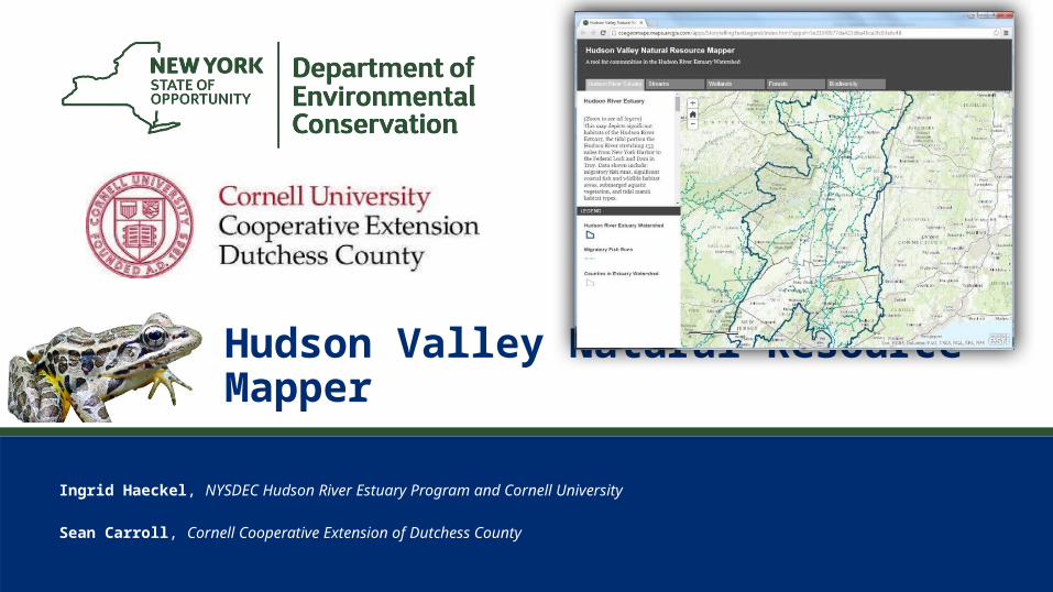
hudson valley natural resource mapper
TRANSCRIPT
1
Ingrid Haeckel, NYSDEC Hudson River Estuary Program and Cornell University
Sean Carroll, Cornell Cooperative Extension of Dutchess County
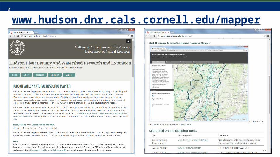
Hudson Valley Natural Resource Mapper
3
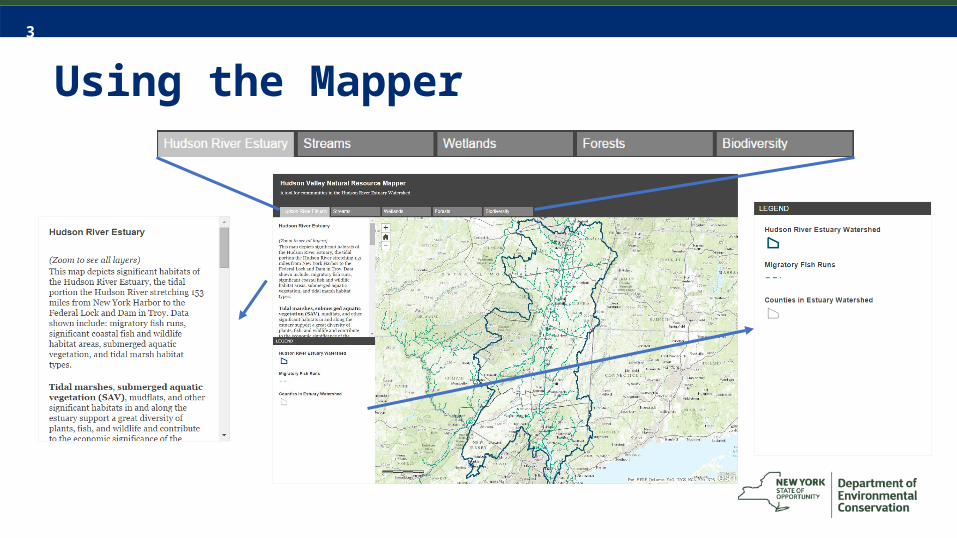
Using the Mapper
4
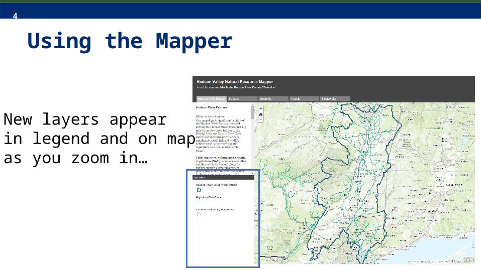
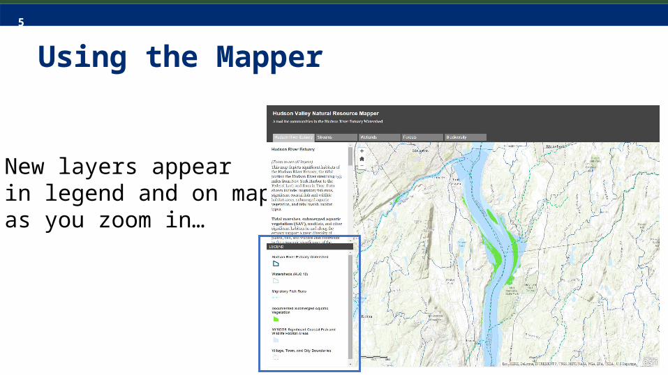
Using the Mapper
• New layers appearin legend and on map as you zoom in…
5
Using the Mapper
• New layers appearin legend and on map as you zoom in…
6
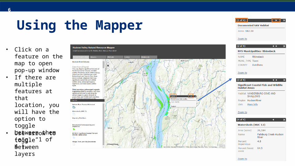
Using the Mapper• Click on a feature
on the map to open pop-up window
• If there are multiple features at that location, you will have the option to toggle between them (e.g. “1 of 4”)
• Use arrow to toggle between layers
7
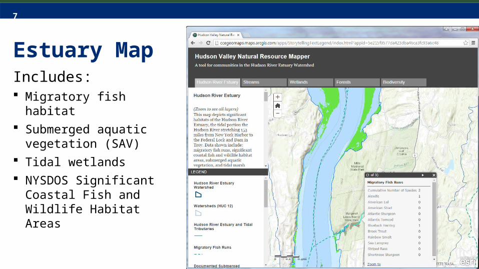
Estuary MapIncludes: Migratory fish habitat Submerged aquatic
vegetation (SAV) Tidal wetlands NYSDOS Significant Coastal
Fish and Wildlife Habitat Areas
8
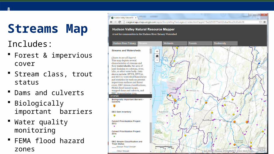
Streams MapIncludes: Forest & impervious cover Stream class, trout status Dams and culverts Biologically important
barriers Water quality monitoring FEMA flood hazard zones Stream Condition Index
(coming soon)
9
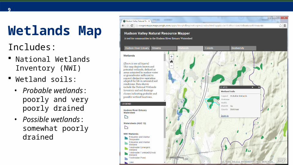
Wetlands MapIncludes: National Wetlands Inventory
(NWI) Wetland soils:
• Probable wetlands: poorly and very poorly drained
• Possible wetlands: somewhat poorly drained
10
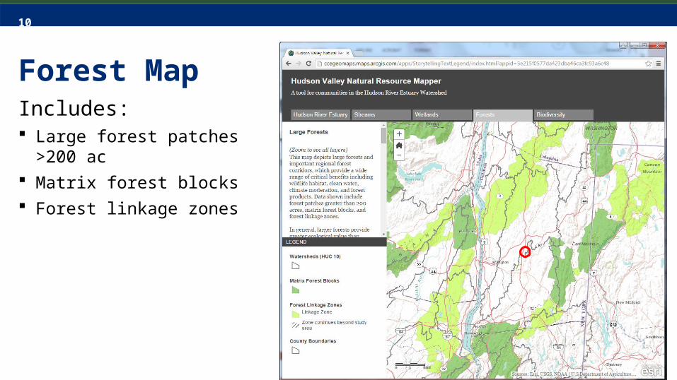
Forest MapIncludes: Large forest patches >200 ac Matrix forest blocks Forest linkage zones
11
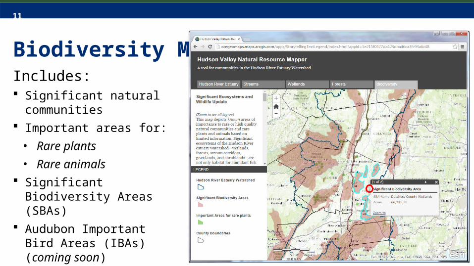
Biodiversity MapIncludes: Significant natural
communities Important areas for:
• Rare plants• Rare animals
Significant Biodiversity Areas (SBAs)
Audubon Important Bird Areas (IBAs) (coming soon)
12
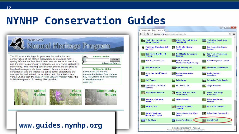
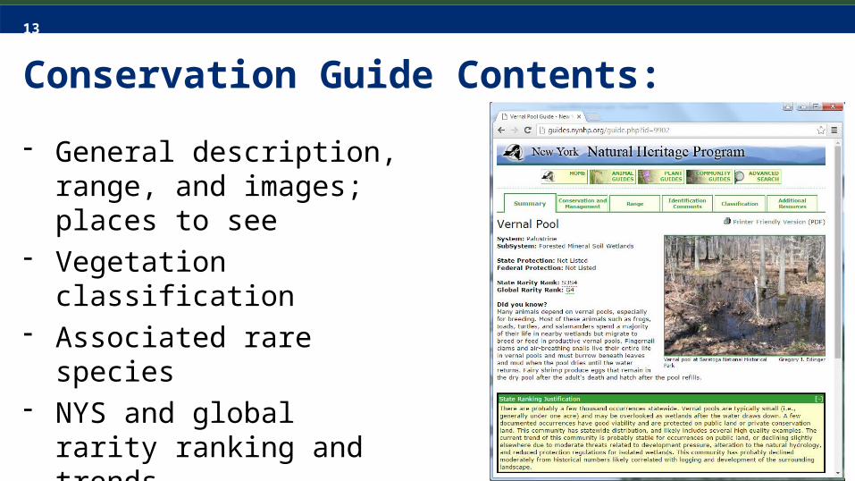
NYNHP Conservation Guides
www.guides.nynhp.org
13
Conservation Guide Contents:
- General description, range, and images; places to see
- Vegetation classification- Associated rare species- NYS and global rarity
ranking and trends- Threats, conservation and
management strategies

14
Example: Vernal pool
- Intermittently ponded, shallow depression in upland forest; sparsely vegetated, fishless
- Threats: development, habitat or hydrology alteration…
- Strategies: wetland buffers- Rare species: mole
salamanders, false hop sedge
Photo by Greg Edinger

15
More woodland pool conservation guidance

16
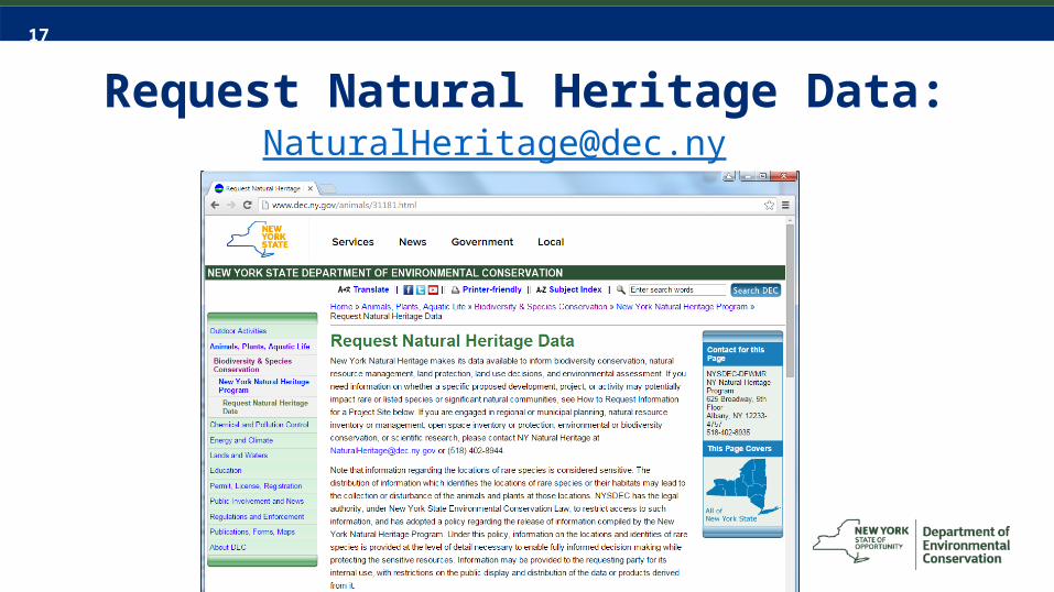
FAQ: What if a project is located in a designated “Important Area”?
• Important Areas are non-regulatory. No action is legally required.• The town or applicant can contact NYNHP to find out what rare
plant, rare animal, and/or significant ecosystems may be affected.• NYNHP recommends that the nature and severity of any potential
impacts be considered in the planning, design, and review of the proposed project/activity.
• The NYNHP conservation guides provide basic guidelines on minimizing impacts that can be very useful in project reviews.
18
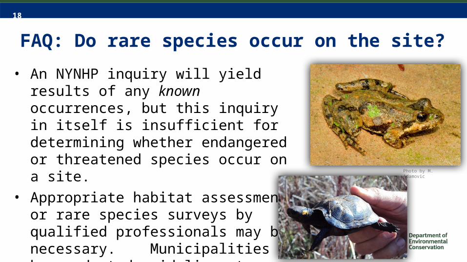
FAQ: Do rare species occur on the site?• An NYNHP inquiry will yield results of any
known occurrences, but this inquiry in itself is insufficient for determining whether endangered or threatened species occur on a site.
• Appropriate habitat assessment or rare species surveys by qualified professionals may be necessary. Municipalities have adopted guidelines to standardize this process.
Photo by M. Adamovic
19
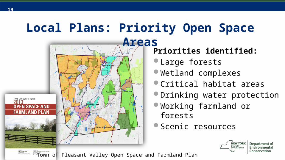
Local Plans: Priority Open Space Areas
Priorities identified:Large forestsWetland complexesCritical habitat areasDrinking water protectionWorking farmland or forestsScenic resources
Town of Pleasant Valley Open Space and Farmland Plan
20
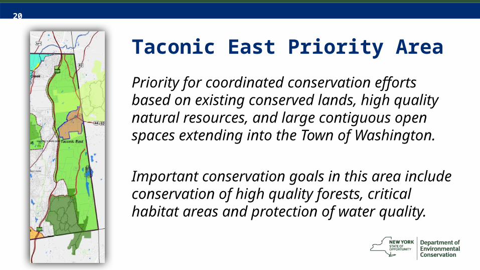
Taconic East Priority AreaPriority for coordinated conservation efforts based on existing conserved lands, high quality natural resources, and large contiguous open spaces extending into the Town of Washington.
Important conservation goals in this area include conservation of high quality forests, critical habitat areas and protection of water quality.

21
Summary of Findings• What habitats are on or near the site?• Are there important connections to
other offsite habitats?• Are there any documented rare
plants or animals in the area? • Any other features of conservation
consideration?Photo by Laura Heady

22
Questions?
Connect with us:Facebook: www.facebook.com/NYSDECTwitter: twitter.com/NYSDECFlickr: www.flickr.com/photos/nysdec
Ingrid HaeckelConservation & Land Use [email protected] Hudson River Estuary Program and Cornell University Photo by Laura Heady
Sean CarrollCommunity Environmental [email protected] Cornell Cooperative Extension of Dutchess County
23
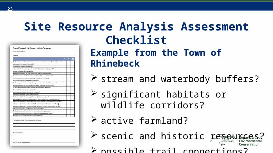
Site Resource Analysis Assessment Checklist
Example from the Town of Rhinebeck stream and waterbody buffers? significant habitats or wildlife corridors? active farmland? scenic and historic resources? possible trail connections?
24
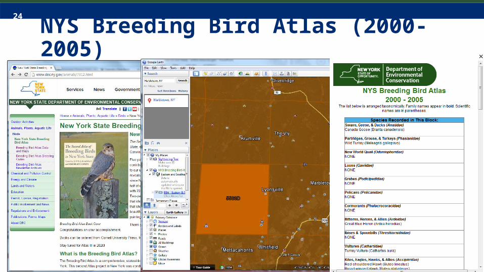
NYS Breeding Bird Atlas (2000-2005)
Click icon to add chart
25
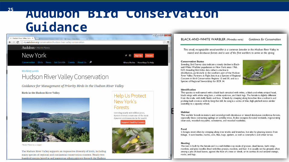
Black-and-White Warbler
Audubon Bird Conservation Guidance

26
New York Nature ExplorerClick icon to add chart