hydrothermal exploration data gap analysis update · temperature gradient drilling. ... • will...
TRANSCRIPT
NREL is a national laboratory of the U.S. Department of Energy, Office of Energy Efficiency and Renewable Energy, operated by the Alliance for Sustainable Energy, LLC.
Hydrothermal Exploration Data Gap Analysis Update
GTP Peer Review Lunch Presentation Westminster, CO
Kate Young Dan Getman Ariel Esposito
May 10, 2012
2
Data Gap Analysis
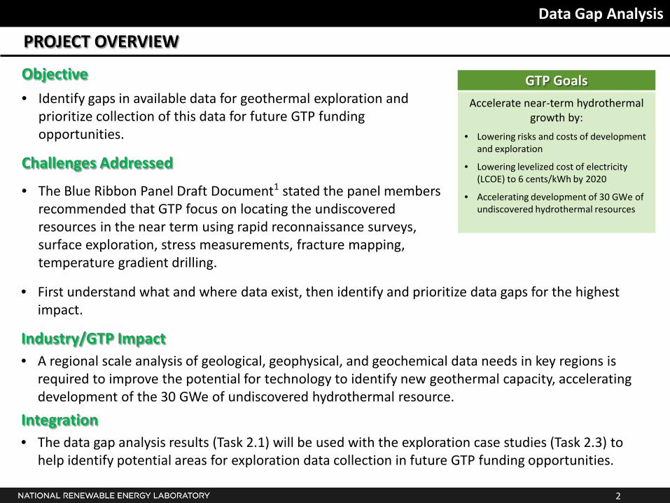
PROJECT OVERVIEW
Objective
• Identify gaps in available data for geothermal exploration and prioritize collection of this data for future GTP funding opportunities.
Challenges Addressed
• The Blue Ribbon Panel Draft Document1 stated the panel members recommended that GTP focus on locating the undiscovered resources in the near term using rapid reconnaissance surveys, surface exploration, stress measurements, fracture mapping, temperature gradient drilling.
Accelerate near-term hydrothermal growth by:
• Lowering risks and costs of development and exploration
• Lowering levelized cost of electricity (LCOE) to 6 cents/kWh by 2020
• Accelerating development of 30 GWe of undiscovered hydrothermal resources
GTP Goals
• First understand what and where data exist, then identify and prioritize data gaps for the highest impact.
Industry/GTP Impact • A regional scale analysis of geological, geophysical, and geochemical data needs in key regions is
required to improve the potential for technology to identify new geothermal capacity, accelerating development of the 30 GWe of undiscovered hydrothermal resource.
Integration • The data gap analysis results (Task 2.1) will be used with the exploration case studies (Task 2.3) to
help identify potential areas for exploration data collection in future GTP funding opportunities.
3
Data Gap Analysis
DATA GAP ANALYSIS – INFORMATION SHARING
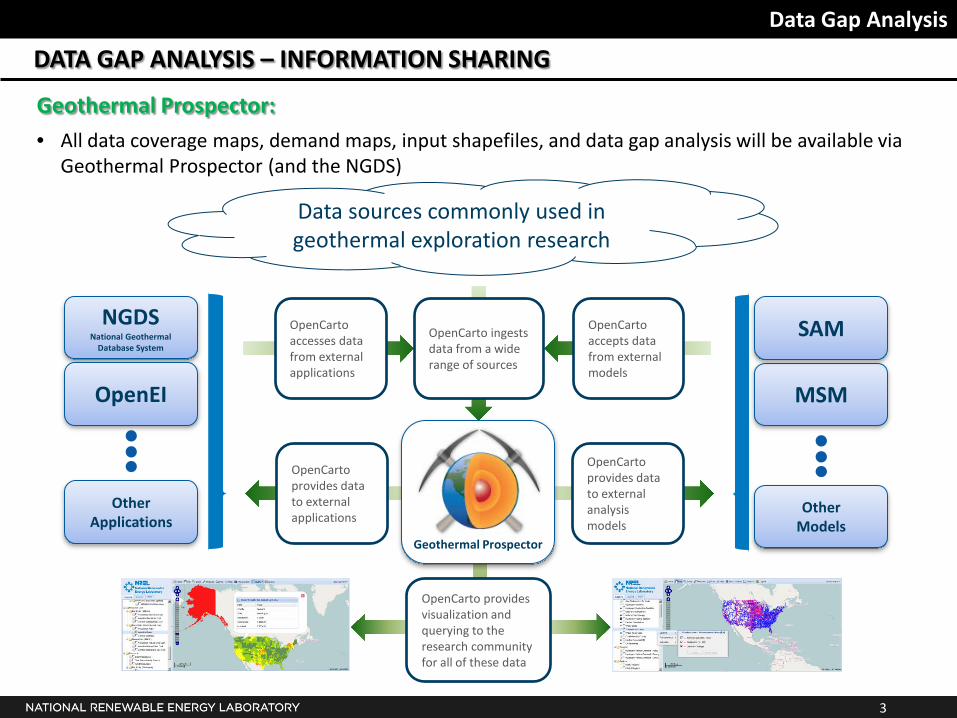
Geothermal Prospector:
• All data coverage maps, demand maps, input shapefiles, and data gap analysis will be available via Geothermal Prospector (and the NGDS)
MSM
SAM
Other Models
NGDS National Geothermal
Database System
Other Applications
OpenCarto ingests data from a wide range of sources
Data sources commonly used in geothermal exploration research
OpenCarto accesses data from external applications
OpenCarto accepts data from external models
OpenCarto provides data to external applications
OpenCarto provides data to external analysis models
Geothermal Prospector
OpenCarto provides visualization and querying to the research community for all of these data
OpenEI
4
Data Gap Analysis
DATA GAP ANALYSIS – INFORMATION SHARING
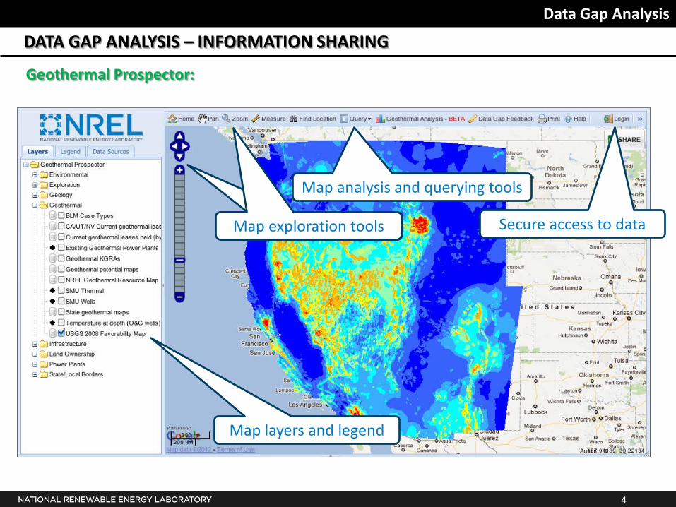
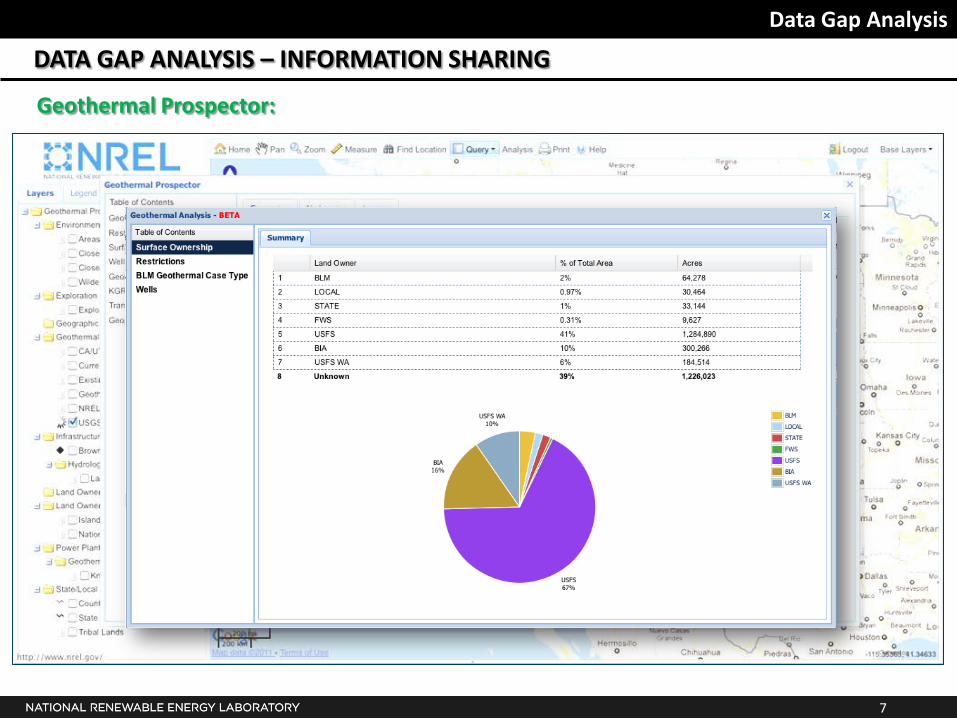
Geothermal Prospector:
Map layers and legend
Map analysis and querying tools
Map exploration tools Map exploration tools Secure access to data
5
Data Gap Analysis
DATA GAP ANALYSIS – INFORMATION SHARING
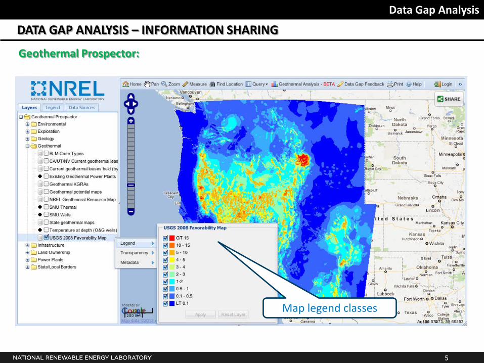
Geothermal Prospector:
Map legend classes
6
Data Gap Analysis
DATA GAP ANALYSIS – INFORMATION SHARING
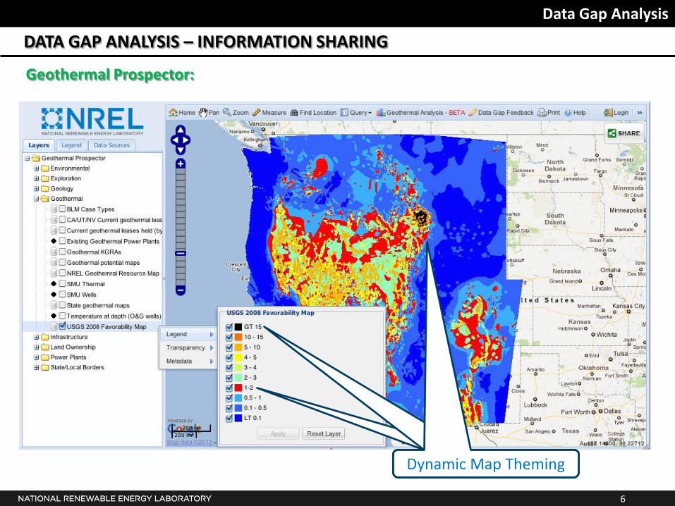
Geothermal Prospector:
Dynamic Map Theming Dynamic Map Theming Dynamic Map Theming
7
Data Gap Analysis
DATA GAP ANALYSIS – INFORMATION SHARING
Geothermal Prospector:
8
Data Gap Analysis
DATA GAP ANALYSIS – INFORMATION SHARING
Geothermal Prospector:
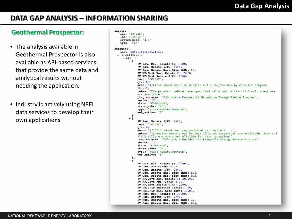
• The analysis available in Geothermal Prospector is also available as API-based services that provide the same data and analytical results without needing the application.
• Industry is actively using NREL data services to develop their own applications
9
Data Gap Analysis
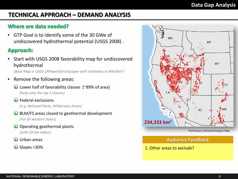
TECHNICAL APPROACH – DEMAND ANALYSIS
Where are data needed?
• GTP Goal is to identify some of the 30 GWe of undiscovered hydrothermal potential (USGS 2008) .
Approach:
• Start with USGS 2008 favorability map for undiscovered hydrothermal
(Base Map is USGS LRPowerDensityLayer with estimates in MW/km2)
• Remove the following areas:
Lower half of favorability classes (~89% of area) (keep only the top 5 classes)
Federal exclusions (e.g. National Parks, Wilderness Areas)
BLM/FS areas closed to geothermal development (For all western states)
Operating geothermal plants (with 10-km radius)
Urban areas
Slopes >30%
Preliminary Demand Analysis Map
1. Other areas to exclude?
Audience Feedback
234,333 km2
10
Data Gap Analysis
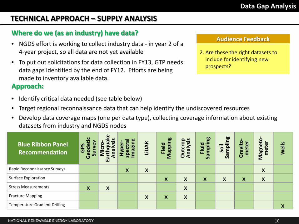
TECHNICAL APPROACH – SUPPLY ANALYSIS
Where do we (as an industry) have data?
• NGDS effort is working to collect industry data - in year 2 of a 4-year project, so all data are not yet available
• To put out solicitations for data collection in FY13, GTP needs data gaps identified by the end of FY12. Efforts are being made to inventory available data.
Blue Ribbon Panel Recommendation G
PS
Geo
deti
c Su
rvey
M
icro
-Ea
rthq
uake
A
naly
sis
Hyp
er-
spec
tral
Im
agin
g
LiD
AR
Fiel
d M
appi
ng
Out
crop
A
naly
sis
Flui
d Sa
mpl
ing
Soil
Sam
plin
g
Gra
vito
- m
eter
Mag
neto
- m
eter
Wel
ls
Rapid Reconnaissance Surveys X X X Surface Exploration X X X X X X Stress Measurements X X X Fracture Mapping X X X Temperature Gradient Drilling X
2. Are these the right datasets to include for identifying new prospects?
Audience Feedback
Approach:
• Identify critical data needed (see table below)
• Target regional reconnaissance data that can help identify the undiscovered resources
• Develop data coverage maps (one per data type), collecting coverage information about existing datasets from industry and NGDS nodes
11
Data Gap Analysis
TECHNICAL APPROACH – SUPPLY ANALYSIS
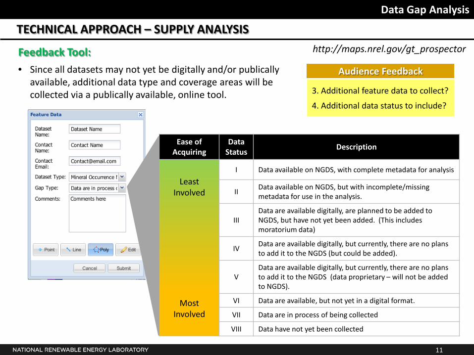
Feedback Tool:
• Since all datasets may not yet be digitally and/or publically available, additional data type and coverage areas will be collected via a publically available, online tool.
3. Additional feature data to collect?
4. Additional data status to include?
Audience Feedback
Ease of Acquiring
Data Status
Description
Least Involved
Most Involved
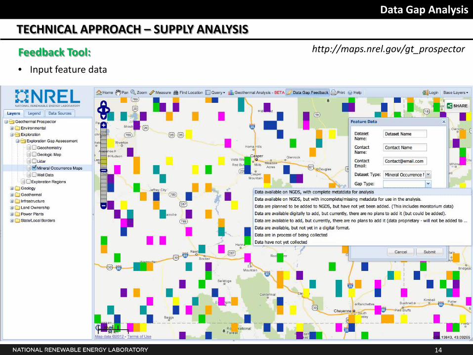
I Data available on NGDS, with complete metadata for analysis
II Data available on NGDS, but with incomplete/missing metadata for use in the analysis.
III Data are available digitally, are planned to be added to NGDS, but have not yet been added. (This includes moratorium data)
IV Data are available digitally, but currently, there are no plans to add it to the NGDS (but could be added).
V Data are available digitally, but currently, there are no plans to add it to the NGDS (data proprietary – will not be added to NGDS).
VI Data are available, but not yet in a digital format.
VII Data are in process of being collected
VIII Data have not yet been collected
http://maps.nrel.gov/gt_prospector
12
Data Gap Analysis
TECHNICAL APPROACH – SUPPLY ANALYSIS
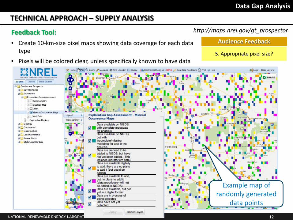
5. Appropriate pixel size?
Audience Feedback
Example map of randomly generated
data points
Feedback Tool:
• Create 10-km-size pixel maps showing data coverage for each data type
• Pixels will be colored clear, unless specifically known to have data
http://maps.nrel.gov/gt_prospector
13
Data Gap Analysis
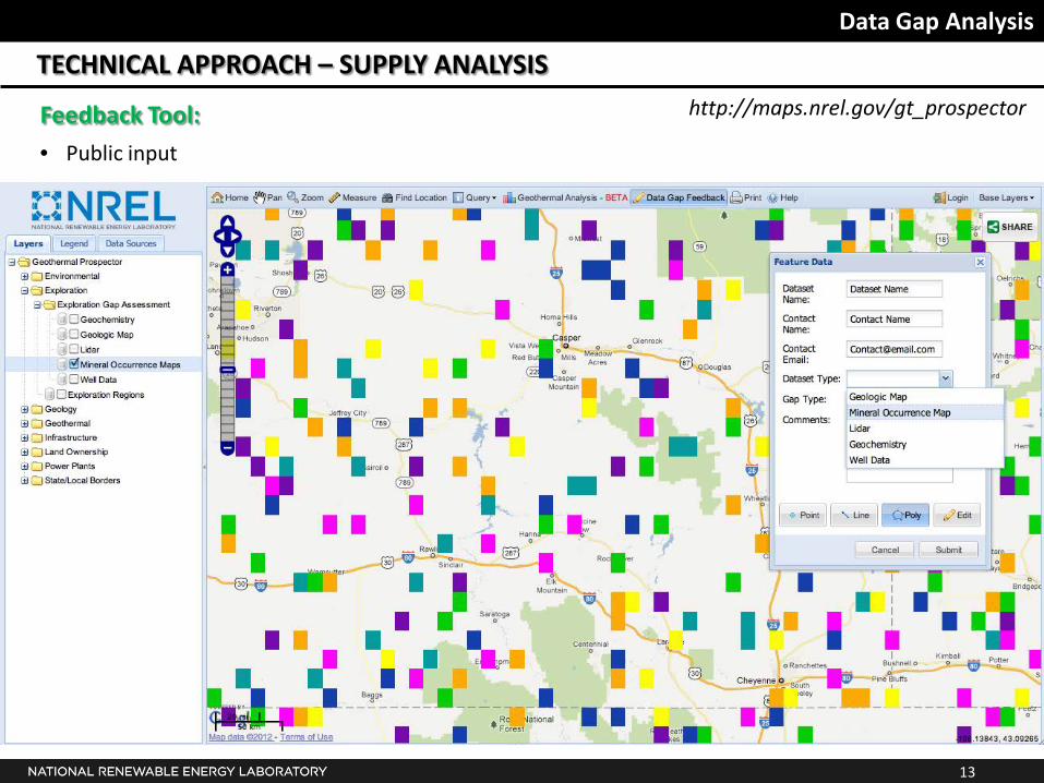
TECHNICAL APPROACH – SUPPLY ANALYSIS
Feedback Tool:
• Public input
http://maps.nrel.gov/gt_prospector
14
Data Gap Analysis
TECHNICAL APPROACH – SUPPLY ANALYSIS
Feedback Tool:
• Input feature data
http://maps.nrel.gov/gt_prospector
15
Data Gap Analysis
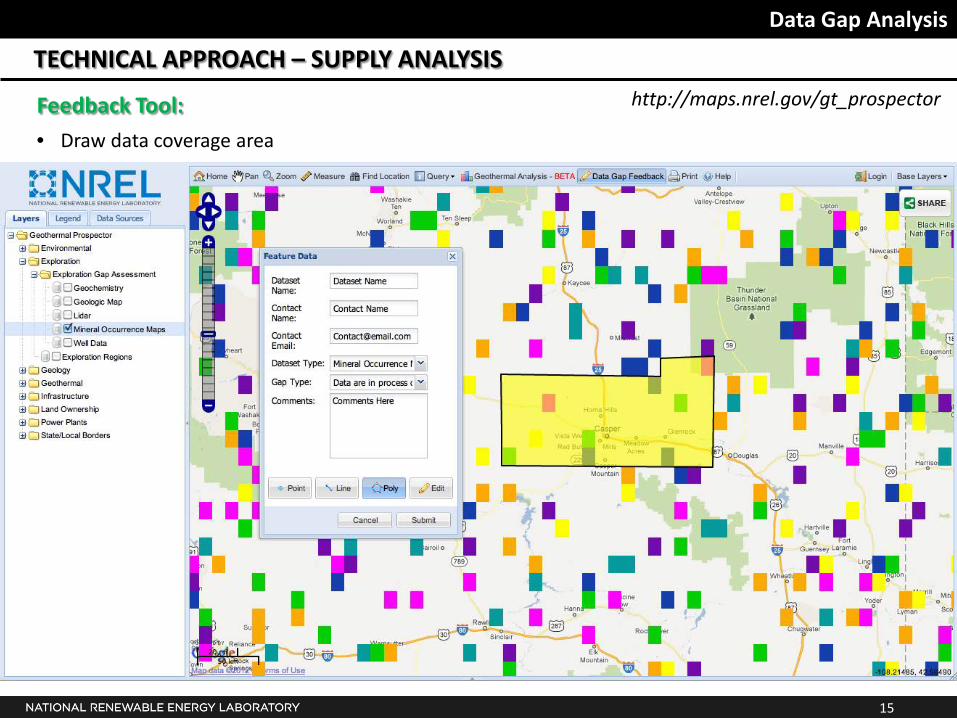
TECHNICAL APPROACH – SUPPLY ANALYSIS
Feedback Tool:
• Draw data coverage area
http://maps.nrel.gov/gt_prospector
16
Data Gap Analysis
TECHNICAL APPROACH – SUPPLY ANALYSIS
Feedback Tool:
• All data will be collected in a database and be publicly available as data layers within the geothermal prospector and as services listed in the NGDS.
• Hope to get industry input
• Will also solicit input via e-mails and phone calls to potential data holders
6. Suggestions for data holders to contact?
Audience Feedback
Partial List of Data Holders to contact:
• NGDS nodes
• USGS (including volcano observatories, seismic hazard monitoring)
• State geological surveys/agencies
• Remote sensing vendors
• Mining companies
• Oil/Gas companies
http://maps.nrel.gov/gt_prospector
17
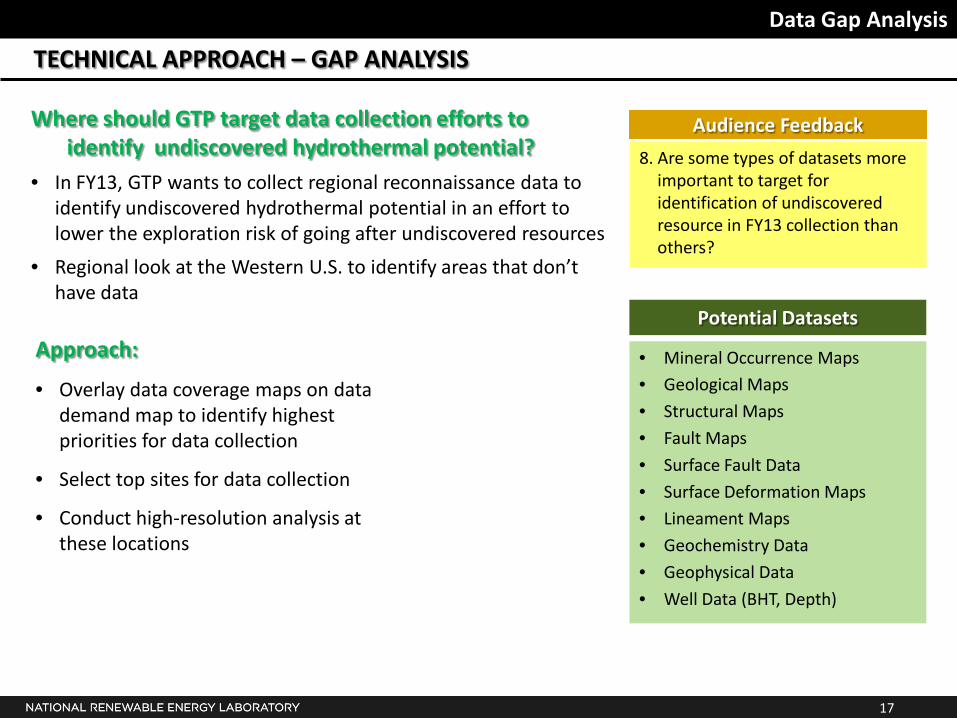
Data Gap Analysis
TECHNICAL APPROACH – GAP ANALYSIS
Where should GTP target data collection efforts to identify undiscovered hydrothermal potential?
• In FY13, GTP wants to collect regional reconnaissance data to identify undiscovered hydrothermal potential in an effort to lower the exploration risk of going after undiscovered resources
• Regional look at the Western U.S. to identify areas that don’t have data
8. Are some types of datasets more important to target for identification of undiscovered resource in FY13 collection than others?
Audience Feedback
Approach:
• Overlay data coverage maps on data demand map to identify highest priorities for data collection
• Select top sites for data collection
• Conduct high-resolution analysis at these locations
Potential Datasets
• Mineral Occurrence Maps • Geological Maps
• Structural Maps
• Fault Maps
• Surface Fault Data
• Surface Deformation Maps • Lineament Maps
• Geochemistry Data
• Geophysical Data
• Well Data (BHT, Depth)

THANK YOU!
This project is being funded by the Geothermal Technologies Program through Annual Operating Plan funds.
Questions? Comments? Suggestions? We’d love to hear from you! Kate Young [email protected] (720) 272-8800
Dan Getman [email protected] (303) 275-4677
Ariel Esposito [email protected] (303) 275-4694
Special thanks to those providing input to this project: Hidda Thorsteinsson, Arlene Anderson, Joe Iovenitti, David Cuyler, Billy Roberts, Kermit Witherbee, Walt Snyder, Steve Richard