identifying karst and manure management
TRANSCRIPT
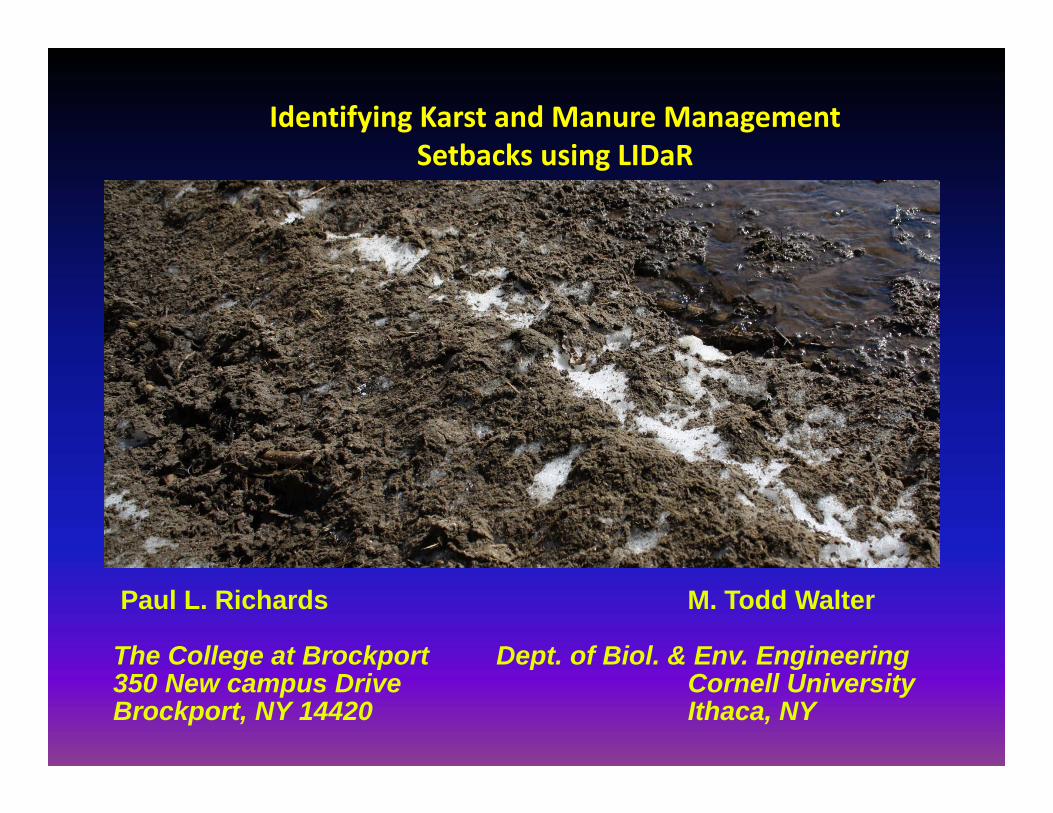
Paul L. Richards M. Todd Walter
The College at Brockport Dept. of Biol. & Env. Engineering350 New campus Drive Cornell UniversityBrockport, NY 14420 Ithaca, NY
Identifying Karst and Manure Management Setbacks using LIDaR

THE PROBLEM: Well Contamination Events

B. Any liquid manure with less than 12% solids applied from January 1 through April 15 of each year must be incorporated the same calendar day as it is applied in fields with:
1) Surface depressions (either mapped or observedby a AEM planner) that contain shallow soils (Aurora, Benson, Newstead, Rubblel and, or Wassaic), rock outcrops, and/or shallow bedrock; and/or
2) Any other area mapped with Aurora, Benson, Newstead,Rubbleland or Wassaic soil types; and/or
3) Contributing drainage areas to karst features (i.e., sinkholes, swallets, depressions, the shallow soils listedabove, rock outcrops, and/or shallow bedrock).
Czymmek and others (2011)
NEW MANURE MANAGEMENT GUIDELINES(applicable to Genesee County )

2) Sinkholes and swallets must be protected with a vegetated buffer 30 feet wide and a manure application setback of 100 feet at all times.
NEW MANURE MANAGEMENT GUIDELINES(applicable to Genessee County )

WHAT ABOUT OTHER COUNTIES ?
New York Soil Series, Variants, and Miscellaneous units that are less than 40 inches deep to carbonate bedrock (e.g. limestone, dolomite):
Benson Galway Kings Falls OgdensbergChaumont Gouveneur Madalin Variant RuseChippeny Groton Variant Matoon SummervilleHippeny Guff Neckrock Sun VariantFarmington Guffin Nehasne WassaicGaloo Joliet Newstead Wilpoint
Likely to be the same rules but different soils
See Appendix A of Czimmek et al (2004 )
http://nmsp.cals.cornell.edu/publications/files/Groundwater.pdf
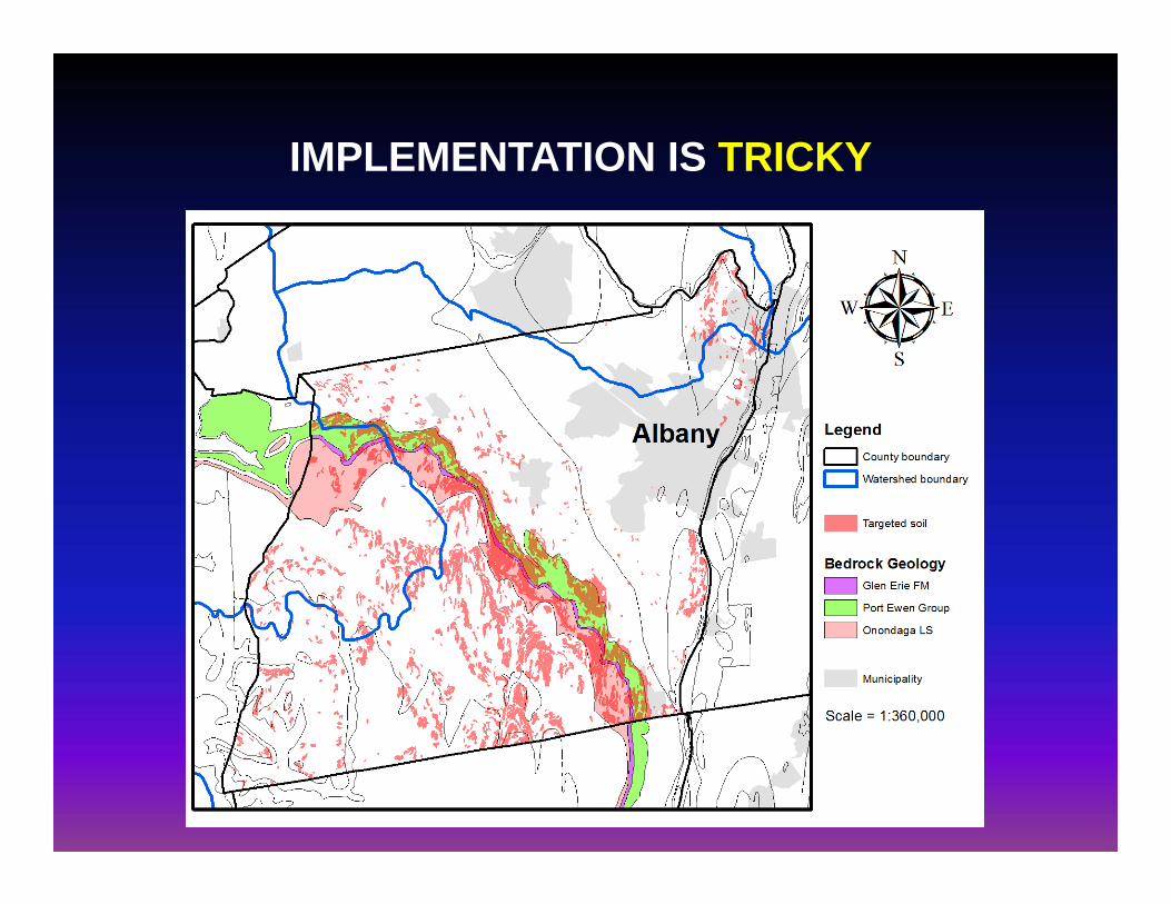
IMPLEMENTATION IS TRICKY

BACKGROUNDFairchild et al (1909)
Palmer (multiple papers)
Rhinehart Thesis (2005)
Voortman and Simons Thesis (2009)
KARST

Palmer (1981) GSA Bulletin V. 103 p.1-21
Karst Formation

+ Post Glacial Modification by burial or scour
+ Presence of some “Pop-up” Ridges

Identify sinkholes -> Buffer them in accordance to the guidelines-> Evaluate watershed divides
Map “targeted soils” that need spring manure restrictions
Identify targeted soils that may be “False Positives” ; soils that are shallow, but where there is compelling geological evidence that they are in fact thickly-soiled.
OBJECTIVES
Prepare shapefiles and maps that CCAs can use to farm in accordanceto the guidelines.

STUDY AREA

METHODOLOGYIdentify sinkholes from hill-shaded LIDAR
Intersect crop fields with targeted soil, rubble land and elevated bedrock zones to identify sensitive areas
From this collection, intersect sensitive cropland with glacial facesAnd borehole data indicative of thick glacial sediments.

Wells were used to independently determine depth to bedrock.

METHODOLOGYUtilize digital terrain modeling techniques to evaluate dividesassociated with sinkholes
Field check the maps by walking some of these fields and searching for evidence of shallow bedrock

RESULTS 57 sinkholes found

Many sinkholes occur along fracture zones or near escarpments visible from the LiDAR data

Drumlin / Flute covered highlands and melt water channels
IDENTIFYING GLACIAL FACES / FEATURESRESULTS Meltwater channels where sedimentwas stripped away to bedrock

RESULTS Glacial Mega-flutes and Drumlins

Glacial Megaflutes

RESULTS Banded Moraine Deposits

RESULTS Scoured bedrock ridges / highlands

RESULTS End moraine deposits
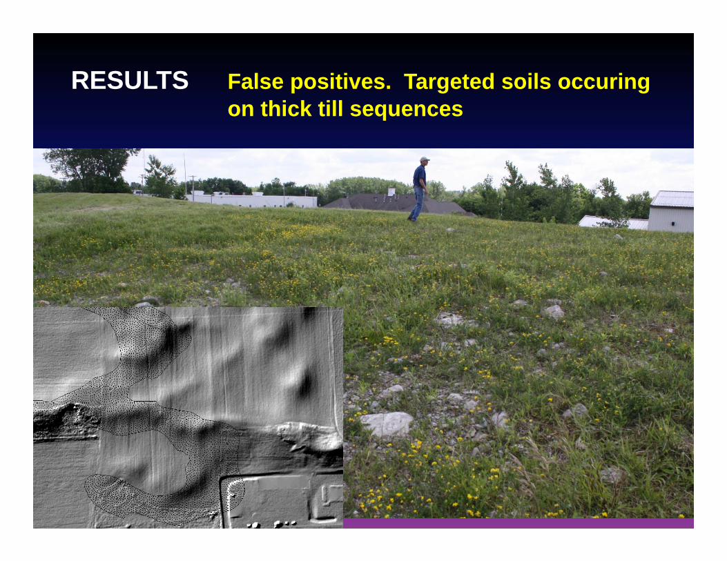
RESULTS False positives. Targeted soils occuringon thick till sequences

Map Products


CONCLUSIONS
- There are 57 sinkholes sites that need buffering.
- 19,335 acres of crop fields need spring restrictions.
- 4,822 acres of cropfields were deemed in this study tohave evidence for thick till, but fail the manure guidelines by either presence of targeted soil or elevated bedrock zone.

This work was funded by a USDA Conservation Innovation Grant Provided by NRCS-NY