ifr gps procedures seminar - tom gorski · ifr gps procedures seminar participant study guide notes...
TRANSCRIPT

IFR GPS Procedures Seminar
Participant Study Guide Notes
©2014 Thomas W. Gorski Aviation Safety Research


Record of Revisions Date Version Notes 03-14-2014
0 Original


IFR GPS SEMINAR
Goals The goals of IFR GPS Seminar are for you to:
o Demonstrate, practice, and evaluate proper use of GPS in specific IFR operations
o Increase your knowledge of operational procedures o Increase your knowledge of operational techniques o Focus on development of your ability to operate safely in the IFR environment o Address your questions and concerns
Objective: The objectives of GPS Instrument Training are for you to:
• Become aware of the extent of your knowledge • Increase your knowledge of operational procedures • Expand your awareness of nav equipment & operational techniques • Develop new management skills in the cockpit • Explore attributes of safe and efficient operations • Address your questions and concerns
Elements: • GPS Instrument Procedures Terminology • The basics of RNAV Approaches (a new way of looking) • Features of Data-centric Avionics • GPS Operation with Memory Items • Wide Area Augmentation System (WAAS) • Local Area Augmentation System (LAAS) • Aeronautical Decision Making (ADM)
Schedule: Each lesson is designed to take approximately 45 minutes
Student Actions: Complete all lessons and actively participate in discussions and exercises
Completion Standards: Satisfactory completion of all worksheets/lessons upon conclusion as determined by the instructor.


1
GPS Instrument TrainingWelcome & Introduction
March 29, 2014
FLIGHT RULESPlease turn off cell phones, pagers, alarms.
Participate in an Open, Honest, Active and Constructive Manner.
Discussion comments remain in this room.
One person talks at a time – share your comments with all.
“Holding Pattern” for unanswered questions.
Introductions
Facility
Observers
Participants
Questions?

2
My Background
• 1976 – US Army Avionics Technician
• 1984 – CFI & Charter New Jersey
• 1986 – 04 CFI & Charter WA, CT, OR
• 2002 – CFI Specializing in GPS Training
• 2004 – Lear FO TX, & FL.
• 2006 – Lear CA Charter Africa, Middle East
• 2007 – Lear / CE500 CA Charter North America
• 2008 – FO Part 121 B747-200 & 400
• 2010 – Director of Flight Standards CA B-747-400
• 2013 – IFR Ground, GPS Seminars, Training Products
About This Seminar• Interactive Questions & Answers
• To form inquiry and discussion.• To stimulate critical thinking.• To illuminate ideas about Flt. Mgmt.
Objectives• Become aware of the extent of your knowledge
• Increase your knowledge of operational procedures
• Expand your awareness of nav equipment & operational techniques
• Develop new management skills in the cockpit
• Explore attributes of safe and efficient operations
• Address your questions and concerns

3
Menu (elements)• GPS Instrument Procedures Terminology
• The basics of RNAV Approaches (a new way of looking)
• Features of Data-centric Avionics
• GPS Operation with Memory Items
• Augmentation Systems (WAAS & LAAS)
• Aeronautical Decision Making (ADM)
Why This Course• Absence of procedural discipline observed with
GA GPS
• “Direct To” mentality. Avoidance of menus
• Lack of equipment trust. (“How can that be correct?” “I’ve never used that feature before.”)
• “Does not apply to Part 91.”
4
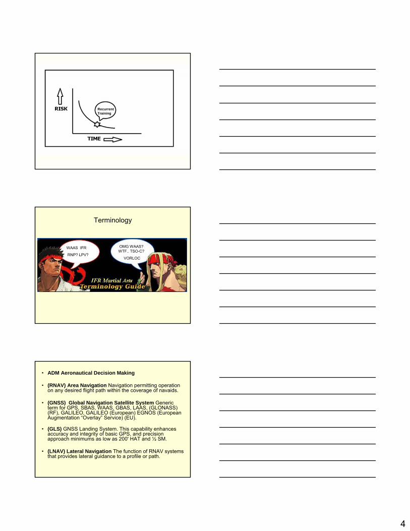
RecurrentTraining
Terminology
WAAS IFR
RNP? LPV?
OMG WAAS? WTF.. TSO-C?
VORLOC
• ADM Aeronautical Decision Making
• (RNAV) Area Navigation Navigation permitting operation on any desired flight path within the coverage of navaids.
• (GNSS) Global Navigation Satellite System Generic term for GPS, SBAS, WAAS, GBAS, LAAS, (GLONASS) (RF), GALILEO, GALILEO (European) EGNOS (European Augmentation “Overlay” Service) (EU).
• (GLS) GNSS Landing System. This capability enhances accuracy and integrity of basic GPS, and precision approach minimums as low as 200' HAT and ½ SM.
• (LNAV) Lateral Navigation The function of RNAV systems that provides lateral guidance to a profile or path.

5
• (VNAV) Vertical Navigation The function of RNAV systems that provides vertical guidance to a profile or path. VNAV is distinct from LPV.
• (RAIM) Receiver Autonomous Integrity Monitoring Integrity monitoring and alerting using GPS measurements and /or barometric aiding.
• Check NOTAMS with WAAS vertical integrity provided and no need for RAIM prediction, or file non-GPS alternate.
• (RNP) Required Navigation Performance Navigation systems have been sensor specific, such as VOR, NDB, and ILS. When RNP is specified, it does not matter what the underlying combination of systems are, provided the required navigation performance is achieved. (5 1 .3)
RNAV v RNP• RNAV Is Area Navigation
• RNP Concept word for Performance Based Navigation
• RNAV = Navigation allowing any desired course within the coverage of the navigation system
RNAV v RNP• PBN = Navigation is dependent on the
performance of the equipment
• RNP = The value (.3 – 1 - 5 - 10) to be complied with to fly in the airspace / route / procedure with which it is associated
• Only when equipment has an ANP (actual navigation performance) at least 95% of the time equal to or better than RNP can you be allowed to fly any track/path/route

6
Non-Precision Approaches: TSO-C129a• (VOR)• (NDB)• (GPS) without vertical guidance (LNAV)• (GPS) with vertical guidance (LPV)*• (LOC) • (LDA)• (SDF)• (RNAV)• (TACAN) – Tactical Air Navigation (military.)• (SRA–ASR) Surveillance Radar Approach
• * LPV technically a nonprecision approach. LPV can be used to demonstrate a precision approach. (LPV and LVAV/VNAV approaches cannot be used to demonstrate nonprecision approach due to the presence of a glidepath.
Precision Approaches: TSO-C145c, 146c• GCA – Ground-Controlled Approach (mostly
military)
• GNSS – Global Navigation Satellite System
• GLS – Landing System. GNSS augmentation
• ILS – Instrument Landing System
• LAAS – Local Area Augmentation System (GBAS) for (GNSS)
Precision Approaches: TSO-C145c, 146c
• JPALS – Joint Precision Approach and Landing System (Military LAAS)
• LPV – Localizer Performance with Vertical guidance
• MLS – Microwave Landing System
• PAR – Precision Approach Radar (military)
• TLS – Transponder Landing System

7
History
• 1970’s RNAV Approaches were based on VOR DMEs and VORTACs. (KNS-80 is an RNAV Receiver) About 500 RNAV approaches in the US
• 1994 First GPS Approach Chart Issued (rate of 500 per year). Termed Overlay Approaches “XXX or GPS” in the Title
• 1997 FAA Renamed RNAV Approached based on VOR/DME VOR DME RNAV Rwy XX approach.
History
• 2000 all new GPS approach procedures were issued with the name “RNAV”
• 2001 RNAV approaches issued with (GPS). Controllers referred to the approach as RNAV and it appeared in the database as a GPS approach
Alerting Features
• Ground NAVAlD failure results in cockpit warning flags, Morse code identification removal
• GPS avionics alert via an internally calculated integrity alarm.
• IFR-certified GPS avionics provide alerting by using Receiver Autonomous Integrity Monitoring (RAIM) algorithms to detect any system faults.

8
Alerting Features
• Non- IFR certified GPS does not have RAIM alerting capability.
• In addition to checking RAlM availability and GPS NOTAMs, if an alternate airport is required, this airfield must have a non-GPS approach and the ground-based and associated navigation equipment operational.
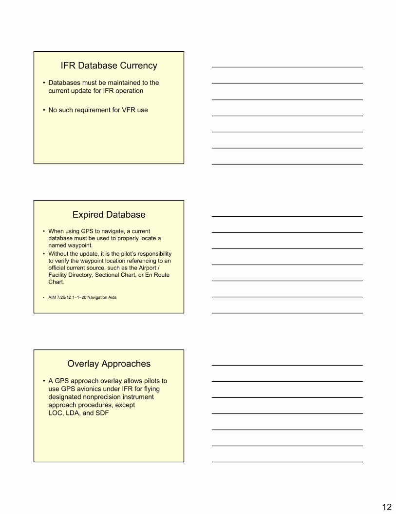
GPS Approach Terminology
GPS Approach Terminology

9
GPS Approach Terminology
GPS Approach Terminology
GPS Approach Terminology
10
GPS Approach Terminology
GPS Approach Terminology
GPS Approach Terminology

11
In Lieu of ADF & /or DME
• Except Hand Held and VFR Panel Mount
• Requires current database or verification that the procedure has not been amended since the expiration of the database
IFR Enroute and Terminal
• Requires verification of datafor correctness if database is expired
GPS Missed Approach• A GPS missed approach requires pilot action to
sequence the receiver past the MAWP
• Activating the missed approach prior to the MAWP will cause CDI sensitivity to immediately change to terminal (±1NM) sensitivity and the receiver will continue to navigate to the MAWP The receiver will not sequence past the MAWP
12
IFR Database Currency
• Databases must be maintained to the current update for IFR operation
• No such requirement for VFR use
Expired Database
• When using GPS to navigate, a current database must be used to properly locate a named waypoint.
• Without the update, it is the pilot’s responsibility to verify the waypoint location referencing to an official current source, such as the Airport / Facility Directory, Sectional Chart, or En Route Chart.
• AIM 7/26/12 1−1−20 Navigation Aids
Overlay Approaches
• A GPS approach overlay allows pilots to use GPS avionics under IFR for flying designated nonprecision instrument approach procedures, except LOC, LDA, and SDF

13
GPS Approaches• All approach procedures to be flown must
be retrievable from the current airborne navigation database supplied by the equipment manufacturer or other FAA approved source
• Manual entry of waypoints using latitude/longitude or place/bearing is not permitted for approach procedures
GPS Instrument TrainingGPS Features
March 29, 2014
GPS Basics• 24 GPS satellites• Each satellite transmits data• Airborne receiver processes data to
determine position/velocity/time• Calculates your position vs. satellites to
determine if sufficient for navigation• Considers known satellite failures• RAIM check for approaches (not en route)
14
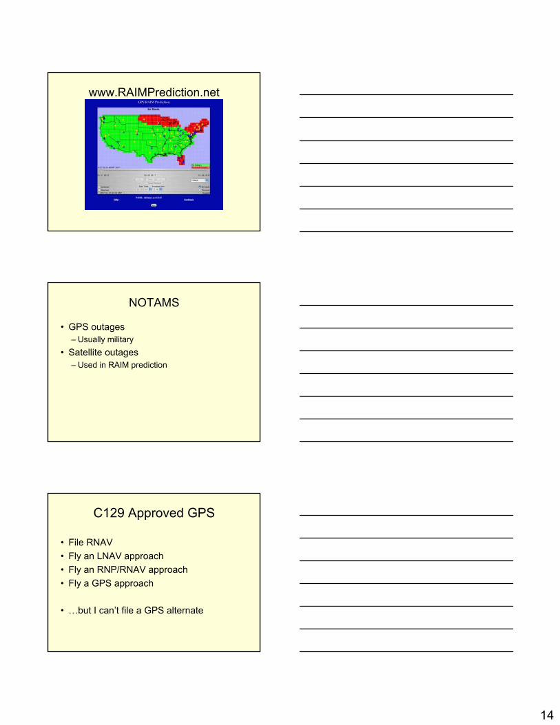
www.RAIMPrediction.net
NOTAMS
• GPS outages– Usually military
• Satellite outages– Used in RAIM prediction
C129 Approved GPS
• File RNAV• Fly an LNAV approach• Fly an RNP/RNAV approach• Fly a GPS approach
• …but I can’t file a GPS alternate

15
Features• To describe the basic principles and internal logic of
GPS avionics systems.
• Obtain the manufacturer’s guide for each system to be operated, as only those materials contain details and nuances of those particular systems.
• Many systems allow multiple methods of accomplishing a task, such as programming or route selection.
• Try all the methods, and choose that works best.
Features Software VersionsDatabases Fixes (Waypoints)LegsMenus
Features Software v Database
Software is the application that gives the ability to access and use the database.
Databases include only information —they do not include the software to manipulate the databases. Check Exp. Date!

16
DatabaseJune 1973 - The first use of databases in
commercial airline service in the United States. National Airlines installed the Collins ANS-70 RNAV in their DC-10s.
September 1973 - Aeronautical Radio, Inc. meetings every other month,
First ARINC standard was published in July 1975. (Five Character Fixes.)
Fixes in a Database
As of 2001 the Mile High VORTAC (D V V) near Denver.
Is used on seven airways, three SIDs, four STARs, five ILS approaches, one VOR DME RNAV approach, and is the formation facility for 25 intersections.
Database RulesEvery geographical aeronautical location in
the world in has a unique, five-character identifier.
When a country does not specify a five-character name, one is made up according to the ARINC rules.
The first rule is to use the identifier of the navaid followed by the nautical mile distance. An unnamed intersection 45 NM from Denver would have the identifier of DEN45.
That worked well until you add fixes on a DME arc with an approach.On a DME arc you couldn’t have several fixes with the same ID.

17
Loading the ILS 26 with the 166 Radial IAF
Note how fixes are coded in database.
D=DME 166=Radial S=19nm
Waypoint Distance Coding Table
Enroute Fixes• Technically, all fixes in the enroute environment
are fly-by fixes.
• This means when making any turns over a fixyou start your turn before arriving at the fix.
• Another way of saying the same thing is that you should “lead the turn,” or “anticipate the turn,”and not wait until crossing the fix before initiating the turn.
18
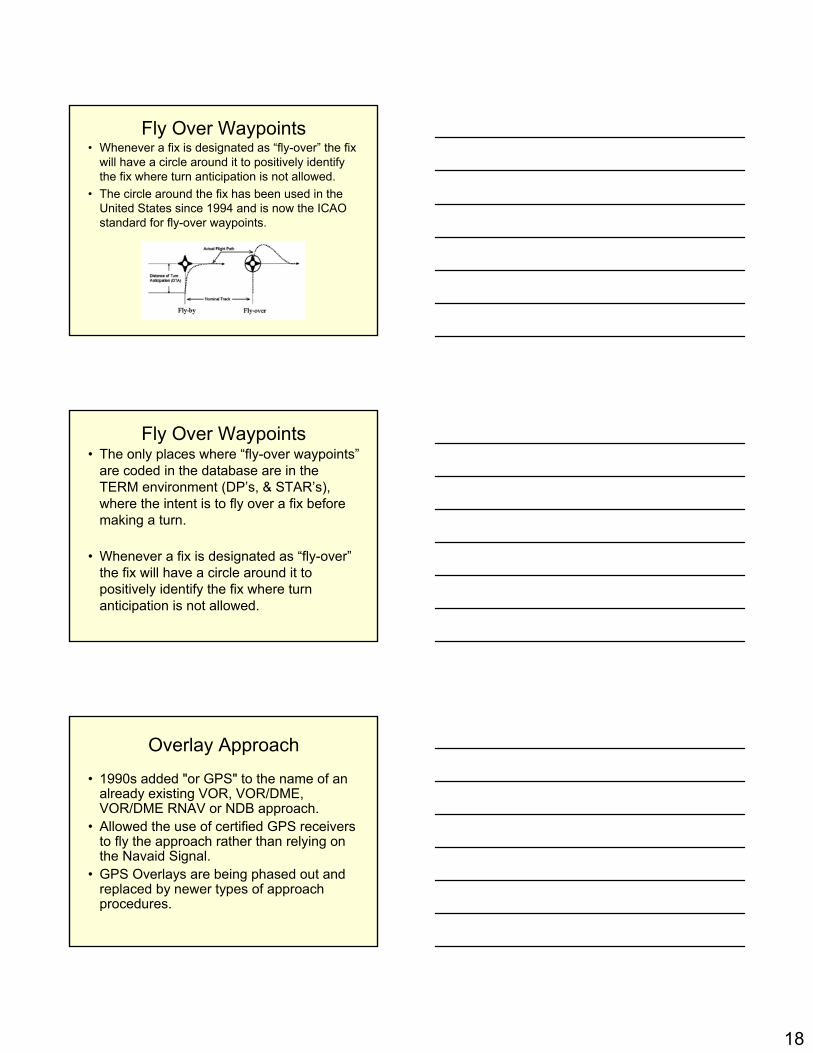
Fly Over Waypoints• Whenever a fix is designated as “fly-over” the fix
will have a circle around it to positively identify the fix where turn anticipation is not allowed.
• The circle around the fix has been used in the United States since 1994 and is now the ICAO standard for fly-over waypoints.
Fly Over Waypoints• The only places where “fly-over waypoints”
are coded in the database are in the TERM environment (DP’s, & STAR’s), where the intent is to fly over a fix before making a turn.
• Whenever a fix is designated as “fly-over”the fix will have a circle around it to positively identify the fix where turn anticipation is not allowed.
Overlay Approach
• 1990s added "or GPS" to the name of an already existing VOR, VOR/DME, VOR/DME RNAV or NDB approach.
• Allowed the use of certified GPS receivers to fly the approach rather than relying on the Navaid Signal.
• GPS Overlays are being phased out and replaced by newer types of approach procedures.

19
Overlay Approaches
• Not necessary to have the conventional navigational equipment
• Conventional navigational avionics required for any required alternate. (TSO-129 GPS receiver.)
GOTCHAS• Multiple RNAV Approaches to the Same Rwy• Databases cannot handle duplicate file names• Two approach procedures with identical names
to the same runway are coded as “Y” and “Z” for example.
• Letters start at the end of the alphabet going back
• Not to be confused with approaches that don’t have straight in landing minimums.
GOTCHAS• The GNS 500W-series units use a
different database than legacy units.The databases are incompatible.
• The GNS 500W-series units must use a WAAS enabled database.
• Updates every 28 days.

20
Altitude calculated by the GPS is geometric height above mean sea level and could vary significantly from altitude displayed by pressure altimeters in aircraft.
The GNS unit may not provide correct guidance until established on a defined leg.
GOTCHAS
A chart note will indicate if the VDP or VGSI are not coincident with the VDA.
If this is the case you may notice you may be above the VGSI with needles centered.
GOTCHAS
Air navigation is increasingly dependent upon RNAV systems…

21
Setting Up Your GPS Trainer• Fly all exercises using the HDG or NAV
feature of the simulated autopilot.
• Pause by setting airspeed to zero.
• Reset upper left data field on the Default Nav page to BRG.
Mayday Mayday MaydayTo quickly tune and activate 121.500, press and hold the COM flip-flop key for approximately two seconds.
NOTE: Under some circumstances if the com system loses communication with the main system, the radio will automatically tune to 121.500 MHz for transmit and receive regardless of the displayed frequency.
Stuck MicA “COM push-to-talk key stuck”message appears to warn you of a stuck microphone.
Transmitting is disabled after 35 seconds of continuous broadcasting.

22
F P L Generally work this way
The FPL includes two pages:
Active Flight Plan Page
and
Flight Plan Catalog
MenuThe menu key displays a context-sensitive list of options.
This list allows you to make changes which relate to the currently displayed page.
Main Menus are reached by a variety of different methods.
“Track" = magnetic course between waypoints that must be intercepted and flown. This is the most common leg type. TF
“Course" = magnetic course to a waypoint that must be intercepted and flown. A "CF“ leg differs from a "TF" only in that it does not have a beginning waypoint.
"Direct" = direct course from present position to a waypoint. A "DF" leg allows an immediate turn to a waypoint without requiring intercept of a particular course.

23
GNS 430/530 Memory Items4 Page Groups that should be committed to memory:
4 Page Groups Controlled by Large Right KnobN - W - A - N
CDIToggles GPS and VLOC
OBSSuspends Sequencing
And /OrDraws a Vector Course to any
Waypoint

24
MSGToggles messages to read
FPLToggles Flight Plan Pages (Active &
Stored)
VNAVToggles Vertical Navigation Setup

25
ProcToggles Procedure Activation &
Selection
RNGToggles Scales Through Map
Ranges
Selects a Destination From Any Page
Overrides Active FPL
Cancels Previously SelectedDirect-to Destination

26
Re-Centers the HSI Needle and Cancels The Approach
Cancels Direct-To Navigation (resumes along closest FP Leg)
Specifies A Course To A Waypoint
Activates a Specific Leg of a Flight Plan (Press Twice)
MENUToggles Context-Sensitive List of
Options

27
CLRReturns to Default Nav Page
Erases Information
Cancels an Entry
Large Right KnobSelects Between Various Page
Groups
Pans With Cursor On
Small Right KnobSelects Between Pages Within A
Group
Pushes Turns On Cursor
Cursor Enters Data With Large & Small Knob Combination

28
Large Left KnobTunes MHZ Standby COM or
VOR/LOC
Small Left KnobTunes kHz COM or VOR/LOC
Pushes Toggles Tuning Between COM and VLOC
COM Flip-FlopSwaps Active and Standby COM
Freq’s
Push and hold selects 121.5

29
Volume KnobsPush to disable Auto Squelch (COM)
Push to enable/disable Ident Tone (VLOC)
QuestionPage Groups Are:
1.Nav
2.WPT
3.AUX
4.NRST
5.All of the above
All fixes in the enroute environment are fly-over fixes.
1. True
2. False

30
Altitude calculated by the GPS is geometric height above mean sea level and could vary significantly from altitude displayed by pressure altimeters in aircraft
1. True
2. False
In general, IFR GPS equipment such as the GNS 430 or GNS 530 can be used for IFR
operations in place of ADF and/or DME equipment.
1. True
2. False
In Lieu of ADF & /or DME
• Except Hand Held and VFR Panel Mount
• Requires current database or verification that the procedure has not been amended since the expiration of the database

31
What is the difference between loading an approach and activating an approach?
1. Loading an approach steers you directly to the IAF, activating takes you to final.
2. Loading an approach only inserts waypoints in the FPL, activating starts the sequencing.
3. Loading an approach inserts waypoints into FPL, activating changes the sensitivity.
4. Loading an approach suspends the sequencing. Activating resumes sequencing.
Activating the Approach
• Will sequence you to the original IAF chosen.
• Will provide automatic scaling sensitivity.
GPS Instrument TrainingWAAS
March 29, 2014
32
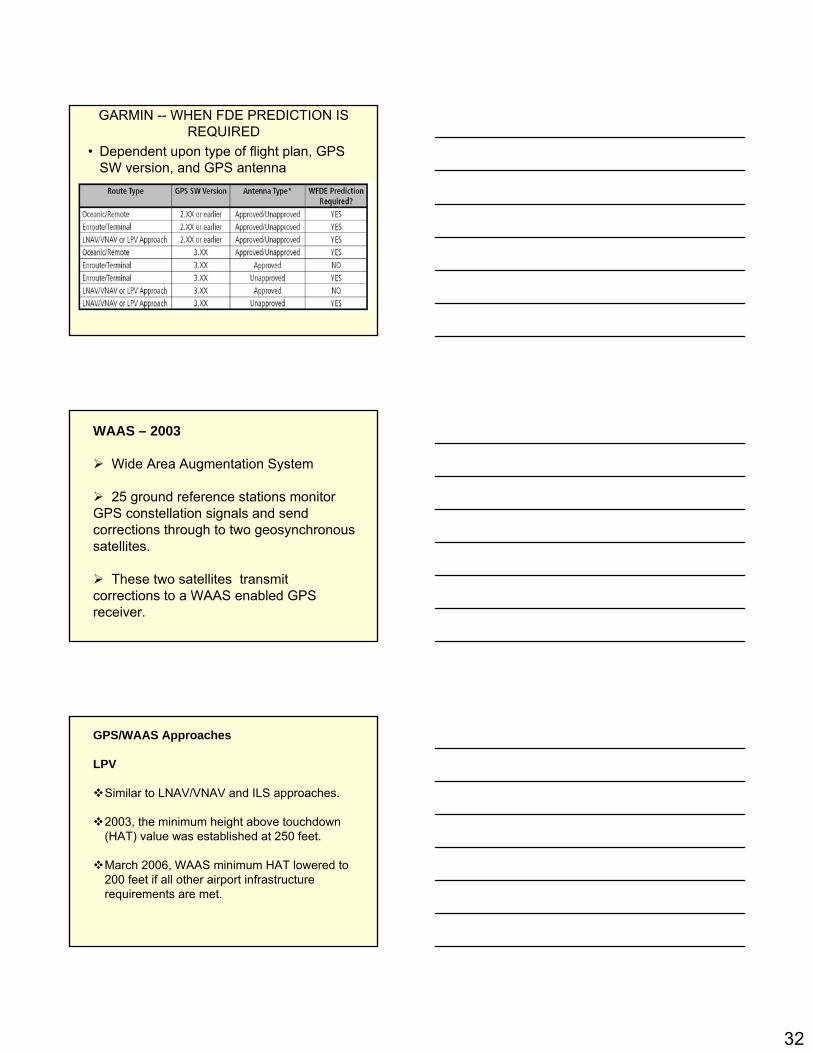
GARMIN -- WHEN FDE PREDICTION IS REQUIRED
• Dependent upon type of flight plan, GPS SW version, and GPS antenna
WAAS – 2003
Wide Area Augmentation System
25 ground reference stations monitor GPS constellation signals and send corrections through to two geosynchronous satellites.
These two satellites transmit corrections to a WAAS enabled GPS receiver.
GPS/WAAS Approaches
LPV
Similar to LNAV/VNAV and ILS approaches.
2003, the minimum height above touchdown (HAT) value was established at 250 feet.
March 2006, WAAS minimum HAT lowered to 200 feet if all other airport infrastructure requirements are met.
33
GPS/WAAS Approaches
LPV
WAAS eliminates the requirements for RAIM predictions, but crews still must check WAAS NOTAMs.
LAAS (Local Area Augmentation System)
LAAS augments GPS to within one meter or less.
Curved approach paths, possible for Category I, II, and III precision approaches.
Similar to WAAS, LAAS monitors GPS signals, but sends corrections directly to the aircraft. Providing greater integrity and quicker alerting.
With a WAAS Receiver you can fly:
LPV
LNAV/VNAV, and LNAV

34
With a WAAS Receiver you can fly:
Why would you fly LNAV/VNAV or LNAV minima if you could fly LPV?
(Some GPS and RNAV(GPS) approaches have LNAV/VNAV, but not LPV minima.)
If WAAS has an outage, you can still fly the LNAV portion.
Think of flying the localizer only approach when the ILS glideslope is INOP.
WAAS / GPS Minima
The altitude calculated by the GPS is geometric height above mean sea level and could vary significantly from altitude displayed by pressure altimeters in aircraft.
It is the pilot’s responsibility for initial missed approach guidance in accordance with published procedure. The unit may not provide correct guidance until established on a defined leg.

35
How WAAS Works
GPS WAAS Coverage

36
With WAAS, I can:
• Skip the RAIM check!• Fly an LNAV/VNAV approach• Fly an LPV approach• Use GPS/WAAS entirely
• …and I can file a GPS alternate
Instrument Approach Update
• NDBs being reduced• No new funding for ILS• Expansion of LPVs
Localizer Performance with Vertical Guidance (LPV)
• Flies like an ILS (but better!)• Minimums down to 200’• Why isn’t it a precision approach?• What about the pilot test standards?

37
Here is a WAAS (RNP)
Approach
Q-Routes
T-Routes
38
Nav Aid Cost
• VOR– Install = $250,000– 20-year life cycle cost = $1,100,000
• ILS– Install = $1,200,000– 20-year life cycle cost = $2,700,000
• Neither figure considers cost of real estate
StreamlinedDepartures
Vector -FreeArrivals
All-WeatherApproaches
StreamlinedDepartures
Efficient, Flexible Routing
Vector -FreeArrivals
All-WeatherApproaches
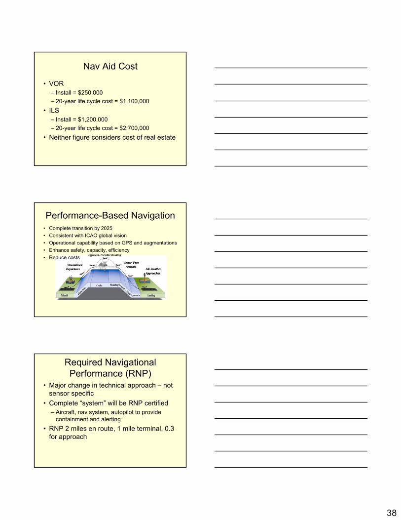
Performance-Based Navigation• Complete transition by 2025• Consistent with ICAO global vision• Operational capability based on GPS and augmentations• Enhance safety, capacity, efficiency• Reduce costs
Required Navigational Performance (RNP)
• Major change in technical approach – not sensor specific
• Complete “system” will be RNP certified– Aircraft, nav system, autopilot to provide
containment and alerting• RNP 2 miles en route, 1 mile terminal, 0.3
for approach

39
(GBAS) Ground Based Augmentation SystemAugments GPS to provide precise navigation service for an airport using a ground based VHF data link.
GBAS supports navigation and precision approach operations within 23 nm from the airport.
The U.S. version of GBAS was initially referred to as the Local Area Augmentation System (LAAS).
RNAV (GPS) Approaches
In 2013, we will celebrate ten years of the Wide Area Augmentation System’s (WAAS) availability to the public.
Pilots are now benefiting from the proliferation of Area Navigation (RNAV) Global Positioning System (GPS) approaches and lower minimums provided by WAAS-enabled systems.
RNAV (GPS) Approaches
As of July 2011, there were twice as many WAAS approaches as Instrument Landing Systems (ILS) approaches.
Currently, (2013) there are over 3000 Localizer Performance without Vertical Guidance (LP) and Localizer Performance with Vertical Guidance (LPV) procedures.
40
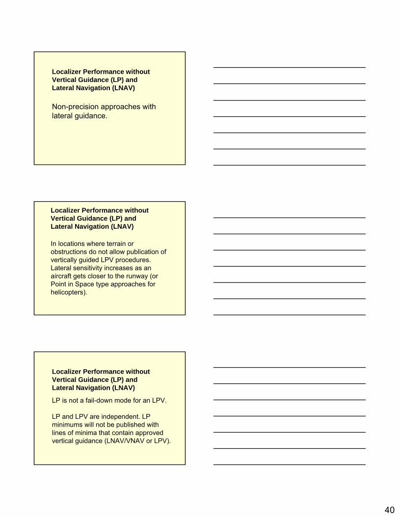
Localizer Performance without Vertical Guidance (LP) and Lateral Navigation (LNAV)
Non-precision approaches with lateral guidance.
Localizer Performance without Vertical Guidance (LP) and Lateral Navigation (LNAV)
In locations where terrain or obstructions do not allow publication of vertically guided LPV procedures. Lateral sensitivity increases as an aircraft gets closer to the runway (or Point in Space type approaches for helicopters).
Localizer Performance without Vertical Guidance (LP) and Lateral Navigation (LNAV)
LP is not a fail-down mode for an LPV.
LP and LPV are independent. LP minimums will not be published with lines of minima that contain approved vertical guidance (LNAV/VNAV or LPV).

41
Localizer Performance without Vertical Guidance (LP) and Lateral Navigation (LNAV)
LP and LPV are independent. LP minimums will not be published with lines of minima that contain approved vertical guidance (LNAV/VNAV or LPV).
Both LP and LNAV lines of minima are Minimum Descent Altitudes (MDAs) rather than DAs.
It is possible to have LP and LNAV published on the same approach chart. An LP is published if it provides lower minima than the LNAV.
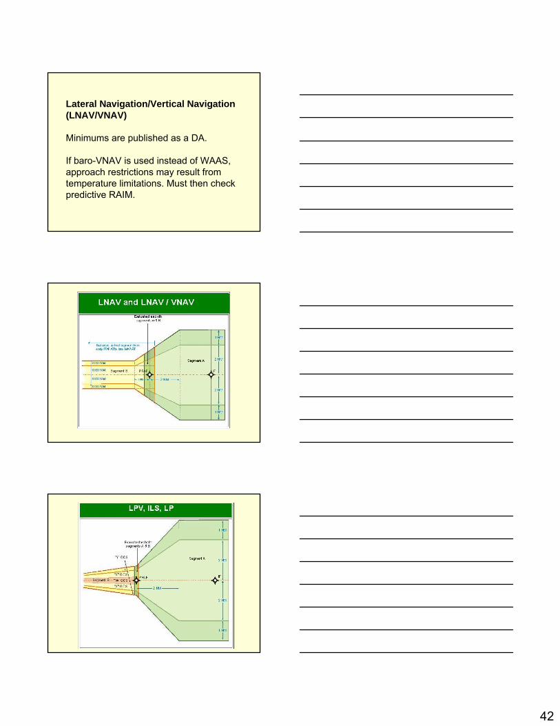
Lateral Navigation/Vertical Navigation (LNAV/VNAV)
LNAV/VNAV approaches provide both horizontal and vertical guidance.
Vertical Navigation (VNAV) utilizes an internally generated glideslope based on WAAS or Baro-VNAV systems.
42
Lateral Navigation/Vertical Navigation (LNAV/VNAV)
Minimums are published as a DA.
If baro-VNAV is used instead of WAAS, approach restrictions may result from temperature limitations. Must then check predictive RAIM.

43
Advisory Vertical Guidance (LNAV+V)
Typically, the manufacturer will use the notation of LNAV+V for an artificially created advisory glide path from the final approach fix to the touchdown point on the runway.
Helps flying constant descent to MDA.
Advisory Vertical Guidance (LNAV+V)
LNAV+V is not the same as LNAV/VNAV or LPV. The barometric altimeter is the primary altitude reference.
Advisory vertical guidance is not required and is an optional capability.
Approved Vertical Guidance
LPV approach can provide WAAS vertical guidance as low as 200 feet AGL.

44
Approved Vertical Guidance
LNAV/VNAV approaches existed before the WAAS system was certified.
At that time, only aircraft with a flight management system (FMS) and certified Baro-VNAV systems could use LNAV/VNAV minimums.
Today, LNAV/VNAV approaches may be flown using approved WAAS equipment.
Localizer Performance with Vertical Guidance (LPV)
LPV takes advantage of refined accuracy of WAAS lateral and vertical guidance to provide an approach similar to Category I ILS.
Like ILS, LPV has vertical guidance and is flown to a Decision Altitude (DA).
Localizer Performance with Vertical Guidance (LPV)
LPV incorporates angular guidance with increasing sensitivity closer to the runway (or point in space for helicopters).
Sensitivities are nearly identical to those of the ILS at similar distances.
This is intentional to aid pilots in transferring ILS flying skills to LPV approaches.

45
Barometric Aiding (Baro-Aiding)
GPS system using the aircraft static system to provide vertical reference and reduces the number of required satellites from five to four.
Current altimeter setting may need to be entered into the receiver.
Barometric Vertical Navigation (Baro-VNAV)
RNAV system which uses barometric altitude information from the altimeter to compute vertical guidance for the pilot.
When using baro-VNAV guidance, pilots should check for any temperature limitations which may result in approach restrictions.
The vertical path is computed between two waypoints or an angle from a single way point.
WAAS LPVs Provide Similar Level of Service to Category I ILS
Vertical guidance
Glidepath more stable than that of ILS
Minimums as low as 200 feet
46
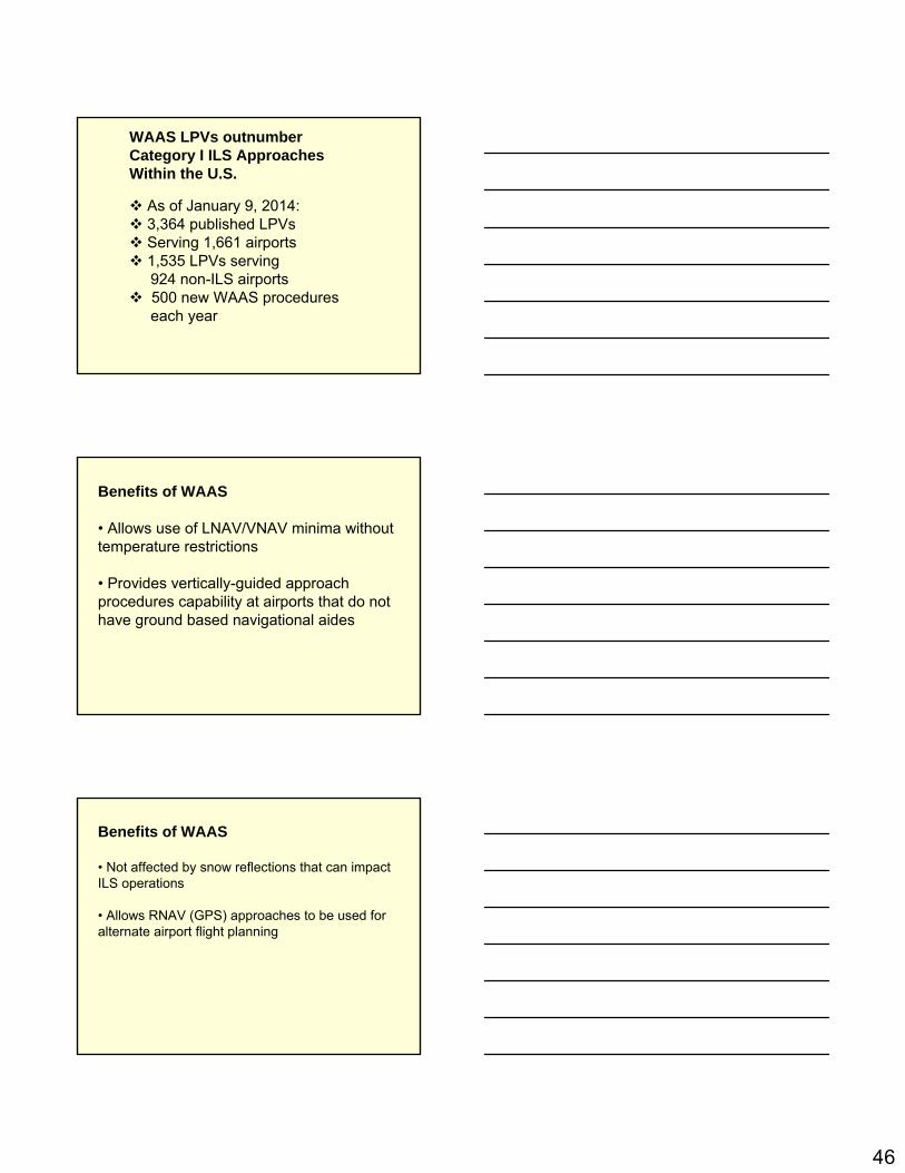
WAAS LPVs outnumber Category I ILS Approaches Within the U.S.
As of January 9, 2014:3,364 published LPVsServing 1,661 airports1,535 LPVs serving 924 non-ILS airports500 new WAAS procedureseach year
Benefits of WAAS
• Allows use of LNAV/VNAV minima without temperature restrictions
• Provides vertically-guided approach procedures capability at airports that do not have ground based navigational aides
Benefits of WAAS
• Not affected by snow reflections that can impact ILS operations
• Allows RNAV (GPS) approaches to be used for alternate airport flight planning

47
Benefits of WAAS
• Increases number of alternate airport optionswhich improves flight planning flexibility
• Satisfies equipment requirements for‘T’ and ‘Q’ routes
Benefits of WAAS
• Eliminates RAIM check requirement
• Enables extension of terminal modeoperations for both departure and arrival tobeyond 30 nautical miles from the airportreference point
GPS/WAAS Technical Standard OrdersTSO-C145c - “Airborne Navigation Sensors Using the GPS Augmented by the Satellite-Based Augmentation System”
TSO-C146c - “Stand-Alone Airborne Navigation Equipment Using the GPS System Augmented by the Satellite-Based Augmentation System”
48
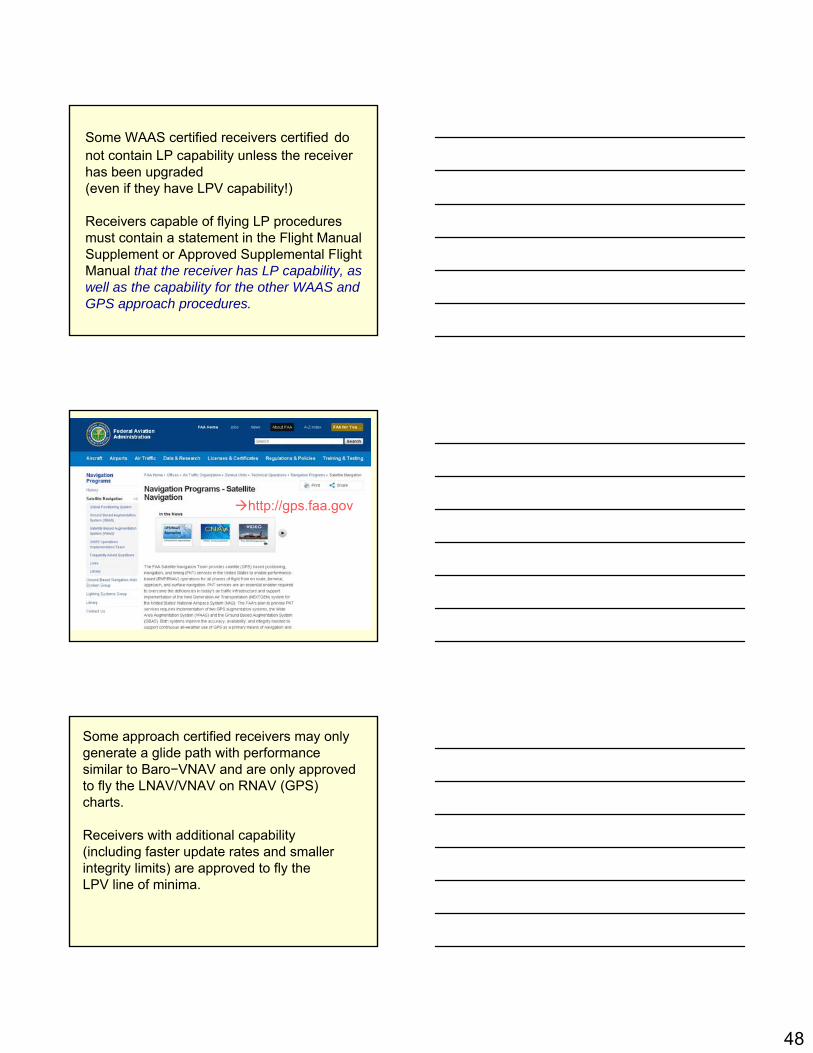
Some WAAS certified receivers certified do not contain LP capability unless the receiver has been upgraded (even if they have LPV capability!)
Receivers capable of flying LP procedures must contain a statement in the Flight Manual Supplement or Approved Supplemental Flight Manual that the receiver has LP capability, as well as the capability for the other WAAS and GPS approach procedures.
http://gps.faa.gov
Some approach certified receivers may only generate a glide path with performance similar to Baro−VNAV and are only approved to fly the LNAV/VNAV on RNAV (GPS) charts.
Receivers with additional capability (including faster update rates and smaller integrity limits) are approved to fly theLPV line of minima.

49
The lateral integrity changes from the 0.3 NM (556 meter) limit for GPS, LNAV and LNAV/VNAV, to 40 meters for LPV.
LPV also provides vertical integrity monitoring, which limits vertical error to 50 meters for LNAV/VNAV and LPVs with minima of 250’ or above, and limits vertical error to 35 meters for LPVs with minima below 250’.
WAAS scaling is also different than C129 units in the initial portion of the missed approach.
C-129 the scaling abruptly changes from the approach scaling to the missed approach scaling, at approximately the departure end of the runway, or when the pilot requests missed approach guidance.
In 145-146 when the first leg of the missed approach is a Track to Fix (TF) leg aligned within 3 degrees of the inbound course, the receiver will change to 0.3 NM linear sensitivity until the turn initiation point for the first waypoint, at which time it will change to terminal (+/−1 NM) sensitivity.
This allows the elimination of close in obstacles in the early part of the missed approach that may cause the DA to be raised.

50
In the future, you will:
• Have to intimately understand the workings of your GPS receiver– Incredibly capable, but it’s a computer
connected to your airplane!
• Spend more time as a “systems operator”
• Love it, or hate it, it’s here to stay!
The NextGen Air Transportation System
Trajectory-Based Operations
Performance-Based Operations and Services
Precision Navigation
Weather Integration
Network-Centric Information Sharing
Surveillance Services
Equivalent Visual Operations
Super Density Operations
Layered, Adaptive Security
Capabilities
There are more of these approaches in the US:
1. WAAS
2. ILS
51
When using WAAS, alternate airports are required to have an approach other than GPS.
1.True
2.False
When using Baro-Aiding a RAIM prediction is required.
1.True
2.False
GPS Instrument TrainingGPS and ADM
March 29, 2014
52
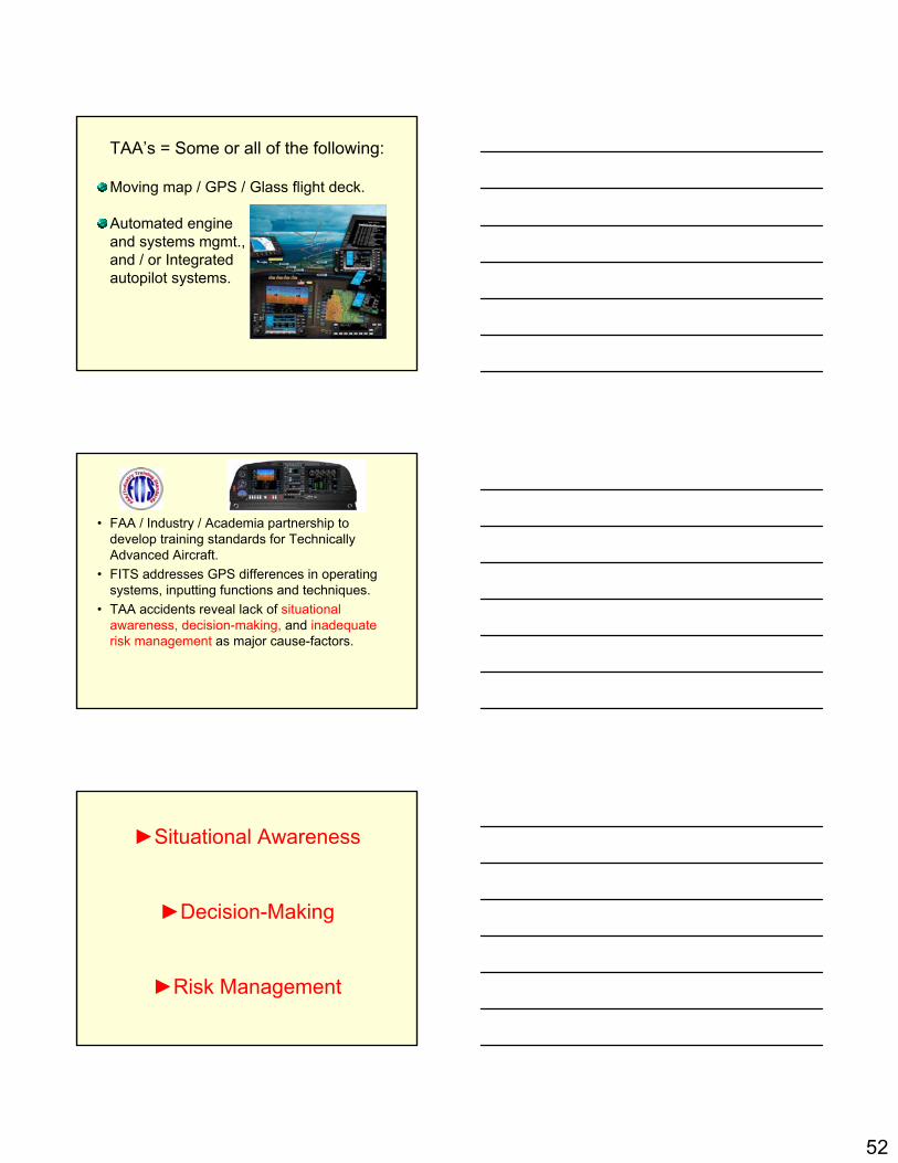
TAA’s = Some or all of the following:
Moving map / GPS / Glass flight deck.
Automated engineand systems mgmt., and / or Integrated autopilot systems.
• FAA / Industry / Academia partnership to develop training standards for Technically Advanced Aircraft.
• FITS addresses GPS differences in operating systems, inputting functions and techniques.
• TAA accidents reveal lack of situational awareness, decision-making, and inadequate risk management as major cause-factors.
►Situational Awareness
►Decision-Making
►Risk Management

53
What is the PIC’sForemost Responsibility?
S A F E T Y !
PIC’s Basic Responsibility
PIC’s Command Authority
PIC’s Command Responsibility
The pilot in command of an aircraft is directly responsible for, and is the final authority as to,
the operation of that aircraft.14CFR 91.3
Each pilot in command of an aircraft is, during flight time, in command of the aircraft and crew and is responsible for the
safety of the passengers, crewmembers, cargo, and airplane.
Basic Responsibility
54
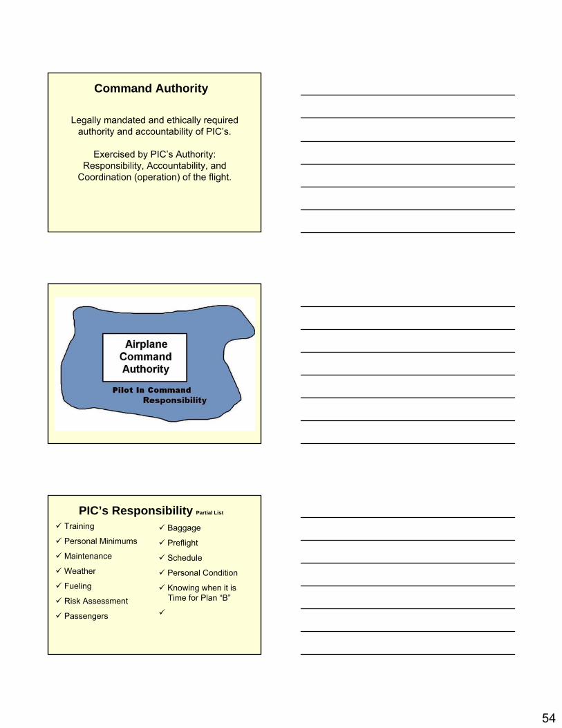
Legally mandated and ethically required authority and accountability of PIC’s.
Exercised by PIC’s Authority:Responsibility, Accountability, and
Coordination (operation) of the flight.
Command Authority
PIC’s Responsibility Partial List
Training
Personal Minimums
Maintenance
Weather
Fueling
Risk Assessment
Passengers
Baggage
Preflight
Schedule
Personal Condition
Knowing when it isTime for Plan “B”
55
Avionics + ADM = SRM
• How should new information provided by technology in flight be usedto improve safety of flight operations?
• How well do you understand the information? Its limitations?
• How do you integrate technology, information and limitations into the ADM process?
PIC’s Basic ResponsibilitySituational Awareness
PIC’s Command AuthorityDecision-Making
PIC’s Command ResponsibilityRisk Management
Accidents revealed a lack of situational awareness, decision-making,and inadequate risk management as major cause-factors.

56
• Automation offers safety and operational advantages
• Increased technical capabilities can tempt pilots to operate outside of their personal (or even legal) limits
• GPS and moving map systems, coupled with traffic and weather information may lead pilots to believe they are protected from the dangers inherent to “scud running,”or otherwise operating in marginal weather conditions.
• While advanced cockpit technologies may mitigate certain risks, they are no substitute for sound ADM
Now Therefore - It Is Resolved
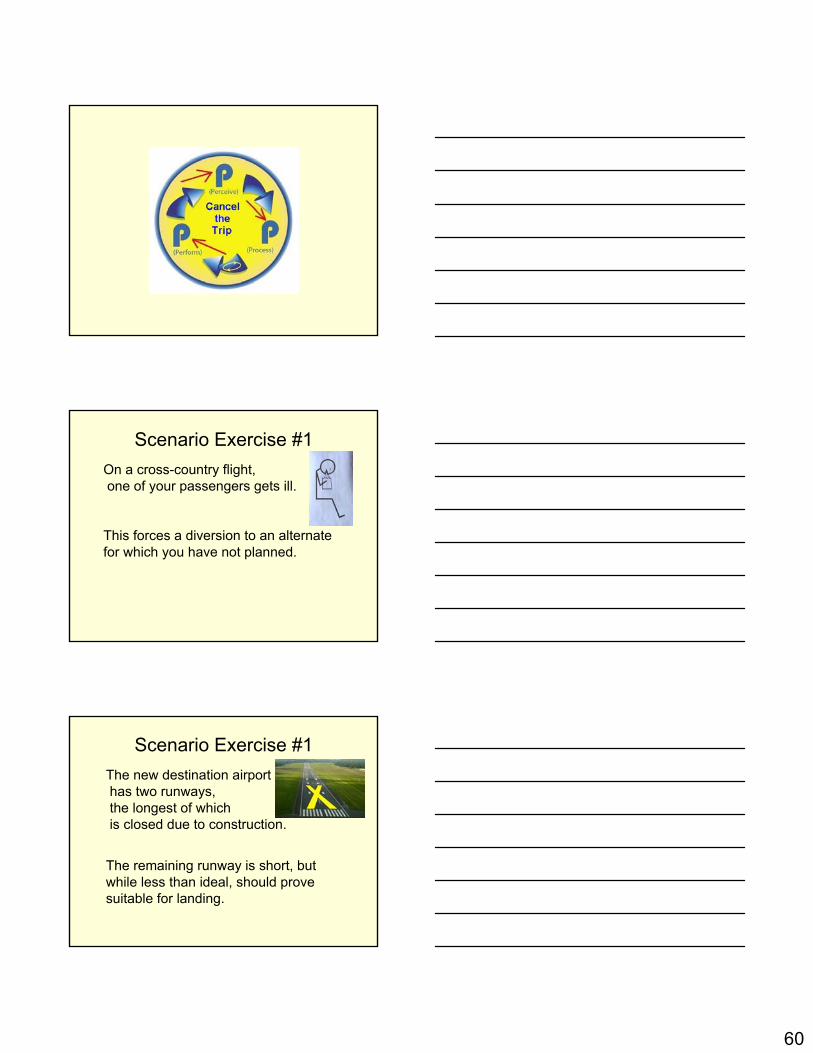
3-P Model• Perceives the given set of circumstances
for a flight.
• Processes by evaluating the impact of those circumstances on flight safety.
• Performs by implementing the best course of action.

57
3-P Model
• A simple, practical, and structured way for pilots to manage risk
• Risk management is a decision-making process designed to:
• Systematically perceive hazards• Assess the degree of risk associated with
a hazard, and • Determine the best course of action.
3-P Model
In the first step, the goal isto develop situational awareness
by perceiving hazards

58
The second step goalis to process this information
to determine whether the identified hazardsconstitute risk
The third step goal is to perform.
Taking action to eliminate hazardsor mitigate risk.
Then continuously evaluate the outcome of this action.

59
60
Scenario Exercise #1On a cross-country flight,one of your passengers gets ill.
This forces a diversion to an alternate for which you have not planned.
Scenario Exercise #1The new destination airporthas two runways,the longest of whichis closed due to construction.
The remaining runway is short, but while less than ideal, should prove suitable for landing.

61
1.Re-divert to your destination.
2.Return to your airport of departure.
3.Attempt the landing.
4.Proceed to a secondary unplanned alternate.
5.Squawk 7700 and announce Mayday over the radio.
What do you do?
Scenario Exercise #2You are PIC on a personal 2-1/2 hour flight.
Your passenger in the frontseat is a licensed pilot,current and qualifiedin the same make and
model aircraft you are flying.
You tell your passenger that he is permitted to operate the radio.
Scenario Exercise #2As you are getting closer to your destination, ATC asks if whether or not you are able to accept a particular STAR?
Your passenger keysthe radio and replies“Affirmative” without first asking you.
What do you do? (Discussion)

62
Scenario Exercise #3You are going to fly to an airport about 30 minutes away to pick up apackage for your businesspartner.
Your partner is away onan important business trip and you need to bring the package back so that the company president can complete negotiations on a new contract for your company.
The airplane you have originally scheduled, and usually fly, is not available and you are going to take another one,which is the same makeand model.
Scenario Exercise #3
While reviewing the maintenance logs, you notice that 2 flights ago, the pilot noted that the primary flight display “flickered a couple of times”.
A mechanic checked the discrepancy and could not duplicate the fault. No other faults have been noted in the past two flights the airplane has flown.
Scenario Exercise #3
63
Scenario Exercise #3
The weather is such that the approaches you will fly might be down to or near minimums at bothyour home airportand your destination.
No SIGMENT or AIRMETS. Winds are forecast to be calm.
What are your actions?
1. Cancel the flight.
2. Take the flight.
3. Ask another pilot to come along.
After the flight departs and gets established in the enroute phase, a failure of the primary flight instruments occurs, requiring flight on the standby instruments.
Scenario Exercise #3

64
ATC issues a hold prior to executing the approach after stating the weather is below minimums but improving.
An EFC time in the holding clearance is 20 minutes. Your fuel is enough for 2 hours of holding.
Scenario Exercise #3
Once in the holding pattern, a loss of communications occurs. You leave holding to begin an approach at the EFC.
During the approach,you re-establish communicationsand learn the weather isright at minimums, settingthe stage for a possiblemissed approach.
Scenario Exercise #3
After executing the approach the required visual references are not visible, and you execute a missed approach, during which time the weather goeswell above minimums,and you are clearedfor another approachto a full stop landing.
Scenario Exercise #3
65
After the landing, maintenance found loose connectors on the radio and PFD and repairs them both.
You have regaining fullpanel and radio operationsfor the flight home. (Discussion)
Scenario Exercise #3
QuestionYour aircraft should be fully configured for landing by the time you reach the Final Approach Fix (FAF) or Final Approach Point (FAP).
1.Agree
2.Disagree