ign.fr ign /dpc/ mission appui cnig inspire natural full scale information a new world of...
TRANSCRIPT
ign.frIGN /DPC/ MISSION APPUI CNIG INSPIRE
Natural full scale Information A new world of Information

ign.fr
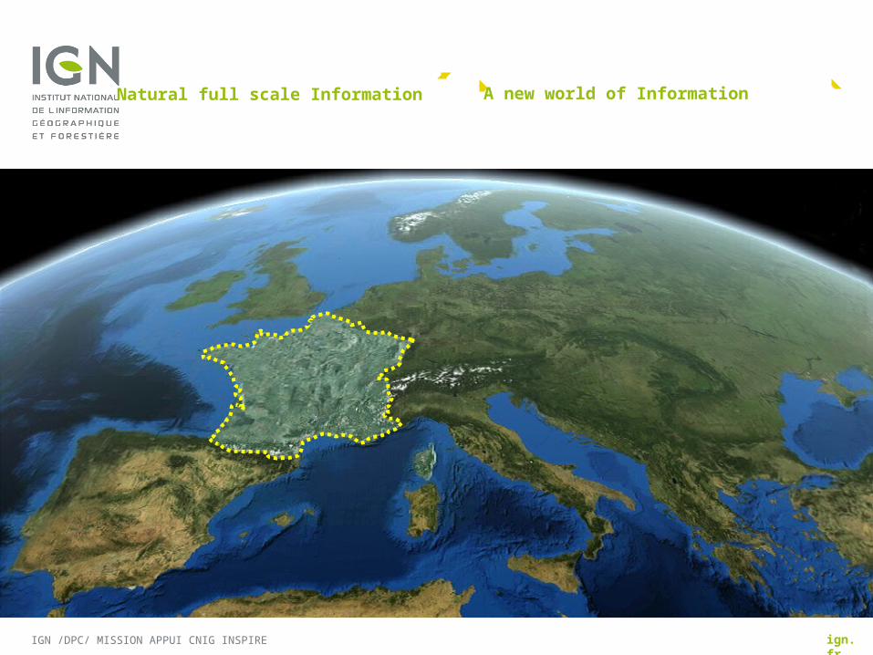
BOUNDARIES OF FRANCE : STATE OF PLAY 2014
Pierre VERGEZhttp://cnig.gouv.fr/
IGN /DPC/ MISSION APPUI CNIG INSPIRE

PLAN
RESPONSABILITIES IN FRANCE
STATE OF PLAY
BOUNDARIES IN IGN DATA BASES
GOALS
IGN /DPC/ MISSION APPUI CNIG INSPIRE 15/10/2013

RESPONSABILITIES IN FRANCE
IGN /DPC/ MISSION APPUI CNIG INSPIRE
Boundaries map
Responsibilities
Three Commissions
INSPIRE Directive 2007, article 10.2

with MonacoLength 4 km
with SpainLength 623 km700 bornes : de 1 à 602 + enclave de LliviaPyrénées (Treaty 1659)delimitation de 1856 à 1868 Last change in 1982 (Arette : 27 ares)
with AndorraLength 57 kmNo Markers. Exchange and 29 new points in 2000. Delimitation Treaty signed in 2012.
with ItaliaLength 515 km800 markers with commune coo. since 2008Utrecht (Treaty 1713,démarcation 1825), Turin (Treaty 1860, démarcation 1861-62),Paris (Treaty 1947, démarcation 1947-1948, 1962-1963, 1975, 1989).Last change in 1967 (Clavières.)Still a diplomatic disagreement (Mont-Blanc)
with LuxembourgLength 73 km400 markers Courtrai (Treaty 1820).Last change : in 2007 : 9 hectares
with GermanyLength 448 km900 markers with R Palatinat, 900 markers with Sarre.Versailles (Treaty 1919),délimitations : 1925 et 1937,Last change in 2000 (Rhin).
with SwitzerlandLength 573 km2900 markers measured by cantonal surveyors, and compilated by SwistopoSeveral treaties(1780, 1816, 1824, 1826, 1891) and territories exchange (1862, 1953, 1959, 1963, 1977, 1984, 1996, 2002).
with BelgiumLength 620 km1000 markersUtrecht (Treaty 1713)Paris (Treaty 1815)Courtrai (Treaty 1820)
with Dutch Antilles (Saint-Martin)Length 13 km
with Surinam( Guyane)Length 520 kmLast change : 1915 agreement on low part of Maroni river. Still a diplomatic disagreement on S-W part
with Brazil (Guyane)Length 730 km1980 : Delimitation agreement signed. 10 points observed in 1937 (1), 1954 (1), 1955 (5) et 1991 (3).10 marks built in 1937 (1), 1961 (3), 1962 (3) et 1991 (3).
2913 km métropolitan boundaries
1263 km overseas territories boundaries
BOUNDARIES MAP

RESPONSABILITIES
Reponsable in coordination and maintenance of the border work, he manages funds
Positions defended by France vis-à-vis neighboring countries
International Treaties and Agreements with France attribute boundary maintenance to heads of district departments and institute bilateral meetings: the commissions..
Cartographic expertise or geodetic
Local expertise
When the best expertise to make is that of the cadastre
Others
Accords and maintenance

3 COMMISSIONS
Internal Affairs Ministery (MI) is in charge of the districts government
responsable for
- bilateral meeting of maintenance of markers (pillars)
Foreign Affairs Minister (MAE) is the French voice in
- bilateral meeting of délimitation
Chaired by diplomats (Foreign affairs).
Since 2013 Frédéric Basaguren, Ambassador in Europe Direction is in charge of boundaries questions
IGN /DPC/ MISSION APPUI CNIG INSPIRE 15/10/2013

INSPIRE DIRECTIVE 2007, ARTICLE 10.2
IGN /DPC/ MISSION APPUI CNIG INSPIRE
” IN ORDER TO ENSURE THAT SPATIAL DATA
RELATING TO A GEOGRAPHICAL FEATURE,
THE LOCATION OF WHICH SPANS THE FRONTIER
BETWEEN TWO OR MORE MEMBER STATES, ARE COHERENT, MEMBER
STATES SHALL, WHERE APPROPRIATE, DECIDE BY MUTUAL CONSENT ON THE DEPICTION AND POSITION
OF SUCH COMMON FEATURES.
situado a ambos lados de la frontera
situato in una località che attraversa la frontiera
un élément géographique qui englobe la frontière

STATE OF PLAY
IGN /DPC/ MISSION APPUI CNIG INSPIRE
Present SBE version?
What remains to be done
Partners on borders
The implementing process of validation
State of play in 2014

IGN /DPC/ MISSION APPUI CNIG INSPIRE 15/10/2013
PRESENT MASTER LEVEL
VERSION
BDUNI administrative line
Source : specific restitution
Markers
CountryL / CountryR :OK
Accuracy : 5 or 30 m
Political status : non agreed
Technical status : national
Last M, moving B : [not filled]
INSPIRID : OK
Attributes :

WHAT REMAINS TO BE DONE
On the northern border, foreign cadaster have worked together and have very few differences (not in the woods)
The south is more mountainous : a large part of the validations is to be studied
IGN /DPC/ MISSION APPUI CNIG INSPIRE
Marks with accurate coordinates
Marks without accurate coordinates
Lines validated
Lines to validate
Diplomatic desagreement

PARTNERSON BORDER
IGN /DPC/ MISSION APPUI CNIG INSPIRE
Andorran administrative Responsable
IGMI
militare
SwissTopo
3 German Landërs
- Sarre
-Rhénanie Palatinat
-Bade Wurtemberg
ACT : cadastre Luxembourgeois
Cadastre Belge
SHOM
Cadastre DGFIP
IGN France
+ Surinam
+ Brésil
- IGNE
- Spanish Army Monaco administrative Responsable
Green colored = no contact yet

THE IMPLEMENTING PROCESS OF VALIDATION
IGN /DPC/ MISSION APPUI CNIG INSPIRE
Office work :Ridgeline stereo restitution
Field works :Measurement
of markers Visits to points of disagreement
Validation of the numerics objects
Expertise :Comparisonof the lines
Proposition
Bilateral Commission
Technical job
2014 : All ridge lines needed are already restituated by IGN.
Italy : on track2005=>2014 : 10% validatedSpain : just started in 2014(first line proposed)
with Italy and Spain

STATE OF PLAY IN 2014
IGN /DPC/ MISSION APPUI CNIG INSPIRE 15/10/2013
Boundaries Markers Line NoteBelgium 3 sectors (15 %) : 55 + 59
(parties W-Fl)3 sectors received from BE/GAPD (déc. 2013) not yet integrated BDUni
No bilateral commission
Luxembourg not yet integrated BDUni No contact yet with cadastreGermany not yet integrated BDUni No contact yet with landers
Swiss Waiting for Swisstopo Waiting for Swisstopo Some improvement to do ? (new restitution in Valais)
Italy 100% (not yet in BDUNI) FR 70 % (and IT 100 %) Still in comparison
Monaco Markers on cadastre only Cadastre adopted
Spain 12% by spanish Restitution doneComparison not started
Andorra No markers yet (2015 ) Restitution to be adopted Treaty 2012 not yet validated
Guyane-Brazil 7 markers known WGS84, 3 markers known coo.astro
Lines on 1:50 000 RGG
Guyane-Surinam No markers Only 1/4 line in official text South disputed (4% surf. Guyane)
Saint-Martin No markers Cadastre to be adopted?

BOUNDARIES IN IGN BASES
IGN /DPC/ MISSION APPUI CNIG INSPIRE
Interoperable authoritative data
Internal organisation
Quality in IGN data base BDUNI
BDUNI Sources
Consistency with Cadastre

IGN /DPC/ MISSION APPUI CNIG INSPIRE
Easy access
Common specifications
Shared format
Edgematchings
Géoportail actualisation from BDUNI : 6 to 9 months for vectors
1970 1980 1990 2000 2010 2020
IGN evolution
PROVIDE INTEROPERABLE AND AUTHORITATIVE DATA
Map 1: 25 000 => Database => Geoportail => INSPIRE services

INTERNAL ORGANISATION
IGN /DPC/ MISSION APPUI CNIG INSPIRE
- restitution (with production)- integration as administrative limit BDTopo- model transformation
- survey and maintenance of markers- fields comparisons
- internal coordination- contracts- external exchanges - expertises new line drafts and comparisons, documented research
IGN department Boundary works
Geodesy and levelling
Civils Programs
Vector Database BDUNI

BORDERS QUALITY IN IGN DATA BASE BDUNI
IGN /DPC/ MISSION APPUI CNIG INSPIRE
General source : text description + topographics details(1: 50 000 =>BdCarto®) => accuracy : 10 to 30 m, without z
except : BdTopo standard improved by cadastre
=> accuracy : 1 => 5 m, without z
except : Upgrading BDUNI, - bilateral validated segments
- new delimitations => accuracy : 1 => 5 m
Not yet written in metadata

BDUNI SOURCES
IGN /DPC/ MISSION APPUI CNIG INSPIRE
Exemple : North-east border
Accuracy is quite good in urban areas BDTopostandard …but can be very bad in forested areas BDTopopays
BDTopo Pays
50 000
BDTopo Standard
Lux.
Sarre.
R.P.
Belgium

CONSISTENCY WITH CADASTRE
IGN /DPC/ MISSION APPUI CNIG INSPIRE
agreements and disagreements
some of cadastral foreign boundaries has been created from historic maps
Mountains : mainly Napoleonian cadastre unchanged since1800 and cadastre of villages are not edge-matched
2008 : Creation of IGN BDParcellaire
2013 : RPCU signed between IGN and DGFIP=> end of disagreements ?
Future : Need to contact cadastre of the Benelux+ landers to check a definitive line.

GOALS
IGN /DPC/ MISSION APPUI CNIG INSPIRE
Changing Context : ELF pour 2016
Changing Context : Contract IGN-MinInt
Changing Context : CNIG
Changing Context between IGN and DGFIP
2015 field actions projects
2018

CHANGING CONTEXT : ELF FOR 2016
IGN /DPC/ MISSION APPUI CNIG INSPIRE
IGN wants to assume the Eurogeographics agreements
IGN is involved in all levels of ELF project
The best boundary lines update will be provided to ELF project before 2016
SBE For treaty level
- with Italy : a systematic process of listing boundary markers is started to integrate them in our database
- with Switzerland : waiting for datas

CHANGING CONTEXT : CONTRACT IGN-MI
IGN /DPC/ MISSION APPUI CNIG INSPIRE
The implications of the INSPIRE Directive and the digital evolution are equivalent to a
Transcription in digital Geographic Information of the border treaties
This effort must be shared by the two ministries (Interior and ecology)
=> Contract project IGN-MI to clarify the responsability
Administrative cost sharing
=> Department and prefects have to organise and pay the markers measures
=> IGN must map the lines
=> Markers and line studies must be worked together to reduce the costs
=> Validation of both markers and lines in bilateral meatings
Signed in 2015?

CHANGING CONTEXT WITH CNIG
IGN /DPC/ MISSION APPUI CNIG INSPIRE
Coordination structure for INSPIRE
With elected policy makers, public and private interest
A specific working group could be created, with cadastre, IGN and responsable from Internal affairs ministry (MI)

CHANGING CONTEXT BETWEEN IGN AND DGFIP
IGN /DPC/ MISSION APPUI CNIG INSPIRE
IGN must supply reference data
National contract 2013-2016 : "specify, collect,
aggregate data and produce an authoritative
reference on geolocation, [...]
and develop services based on IGN aims..
RGE (BDUNI) is a part of the environmental public policy : markers and borderlines are authoritative data (with theirs enhancements, modifications, updates and consistency.)
2013 : after the RPCU (united cadaster) convention
End of IGN-cadastre competition : new agreements with the DGFIP to update our complementary databases with accurate borderlines for 2020.
The Cadastre should become a partner
to define the official numeric France borderline

2015 FIELD ACTIONS PROJECTS
IGN /DPC/ MISSION APPUI CNIG INSPIRE
on Italian border
On 8 sectors, 5 are technically validated, whose first in bilateral commission
on Spanish border
Proposal of 15 days survey marks with spanish team
and study on areas in desagreement
Participation to bilateral meetings : Switzerland, Spain, Andorra, Italy
To organise future data exchanges
Depends on MI ressources

2018 : inspire deadline for annex I
IGN /DPC/ MISSION APPUI CNIG INSPIRE
MarkersDefinitive
BorderLine in 2020 ?Note
Belgium 100% Possible 90% complete Done by BelgiumChecked by FranceDoubts : Ardennes Forest
Luxembourg 100% Possible 100% complete Luxembourg cartography made by IGN => good old links
Germany see Cadastre or LandersExisting Atlas with 100%
see Cadastre or Landers90% complete
Done by cadastreDoubts : Sarre
Swiss 100% 100% Done by Swiss
Italy 100% 95% Mont-Blanc??
Monaco 100% 100% /
Spain 50% metric coordinates50% decametric coord.
98 % if Spain and France can pay
Depends on the French Ministries
Andorra Not yet 100% /

ign.frIGN /DPC/ MISSION APPUI CNIG INSPIRE
QUESTIONS?
Natural full scale Information