igu international geographical union igu/home e … complete brochure can be seen in: . 4) reports...
TRANSCRIPT

IGU International Geographical Union Union Géographique Internationale UGI
IGU/Home E-Newsletter Quarterly
URL: http://www.homeofgeography.org/ e-mail: [email protected]
# 12 April 2008
Editor-in-Chief: Ronald F. Abler — Associate Editor: Markku Löytönen — Editors: Giuliano Bellezza, Woo-ik Yu — Managing Editor: Giuliano Bellezza — Publisher: Home of Geography This Newsletter is circulated to more than 1000 individuals and bodies. Announcements, information, calls for participation in scientific events, programmes and projects are welcome. Please send them to
CONTENTS OF THIS ISSUE 1) Message of Giuliano Bellezza, Director of the Home of Geography 2) Communications from IGU Secretariat General 3) Next IGU Initiatives:
3.1 - International Congress,Tunis, August 2008 3.2 – Regional Conference, Tel Aviv, July 2010
4) Reports from Conferences and Meetings
4.1 - IAG Ethiopia, 26 February – 6 March 2008 4.2 - EURAC, Bolzano (Italy), 13-14 March 2008 4.3 – ESSI Summit in Villa Celimontana, 13-14 March 2008 4.4 – Saudi Geogr. Soc., 14th Assembly, Al Ahsa Province, 10/12-3-1429 (18-20 Apr.08) 4.5 - AAG 104th Annual conference, Boston 15-19 April 2008
5) Forthcoming 2008 Events 5.1 - International Soil Conservation Organization Congress, Budapest, 18-23 May 2008
5.2 - Geographies of Violence, Quebec, 21-24 May 2008 Home of Geography Update
1) MESSAGE OF GIULIANO BELLEZZA, President of the HofG Dear Friends, geographers or not, it is somehow embarrassing for me to write the opening message in this issue, where you will find one more lot of my englalian in the usual Home of Geography Update, with a summary of my Report to the Meeting of the Villa Celimontana EC, held on 22nd April. This same meeting explains somehow why I write the opening lines. In Roma the meeting has been attended by Markku Loytonen, Anne Buttimer and Ron Abler, and after they had just time to come back home, and fly again toward Moscow, to participate in the IGU EC Meeting one week later. Moreover, Markku is engaged as a candidate in the election of the new Rector of the Helsinki University, Ron is candidate as IGU’s next President, Woo-ik Yu, the newly appointed as Chief of Staff of the South Korean Government, is candidate to renew his position as IGU Secretary General, Acting President José Palacio Prieto, new Rector of the Universidad de Mexico had written the Message for the previous issue. But I am no exception, being a candidate for a IGU Vice President, therefore I will be very rapid. I hope you’ll like some reports and contributions (see below point 4) coming from meetings of a kind of non geographers: well, I find it very difficult to define them as such. They all are dealing with matters of high geographical interest, and many of them are already co-operating with geographers. Co-operation with ICSU, ISSC, IYPE, UNESCO and other international entities was one of the main goal of the late Adalberto Vallega and of many components of the IGU EC. I will be delighted in seeing the next IGU EC follow straight on this road. These are fields with practical outcomes, and as such attracting funding: one of the main necessity for our community.
2) COMMUNICATION FROM IGU SECRETARIAT GENERAL Candidates Nominated for IGU President, 2008-2012 1) Slovak Republic. Professor Manfred Fischer, Vienna University of Economics and Business Administration 2) USA, China-Beijing, and South Korea. Professor Emeritus Ronald F. Abler, The Pennsylvania State University Candidate Nominated for IGU Secretary General and Treasurer, 2008-2010 1) South Korea. Professor Woo-ik Yu, Seoul National University Candidates proposed by National Committees for an IGU VP Position 1) Australia. Professor Ruth Fincher, University of Melbourne 2) Belgium. Professor Eric Lambin, Université Catholique de Louvain 3) Canada. Professor Mark Rosenberg, Queens University, Kingston, Canada 4) China-Beijing. Academician Qin Dahe, Academy of Sciences of China 5) China-Taipei. Professor Chang-yi David Chang, National Taiwan University 6) Czech Republic. Professor Ivan Bicik, Charles University of Prague
7) Denmark. Professor Christian Wichmann Matthiessen, University of Copenhagen 8) Egypt. Professor Mahmoud Mohamed Ashour, Ain Shams University 9) France. Professeur Gérard Salem, Université de Paris X 10) Germany. Professor Dietrich Soyez, University of Cologne 11) Israel. Professor Aharon Kellerman, University of Haifa 12) Italy. Professor Giuliano Bellezza, University of Viterbo 13) Japan. Professor Yukio Himiyama, Hokkaido University of Education 14) Mexico. Professor Irasema Alcántara Ayala, National Autonomous University of Mexico 15) Netherlands. Professor Jef Vandenberghe, Free University of Amsterdam 16) Nigeria. Professor Michael O. Filani, University of Ibadan 17) Russia. Professor Vladimir Kolossov, Russian Academy of Sciences 18) Saudi Arabia. Professor Mohammad S. Makki, King Saud University 19) South Africa. Professor Michael Meadows. University of Cape Town 20) Tunisia. Professor Habib Dlala, University of Tunis
3) NEXT IGU INITIATIVES
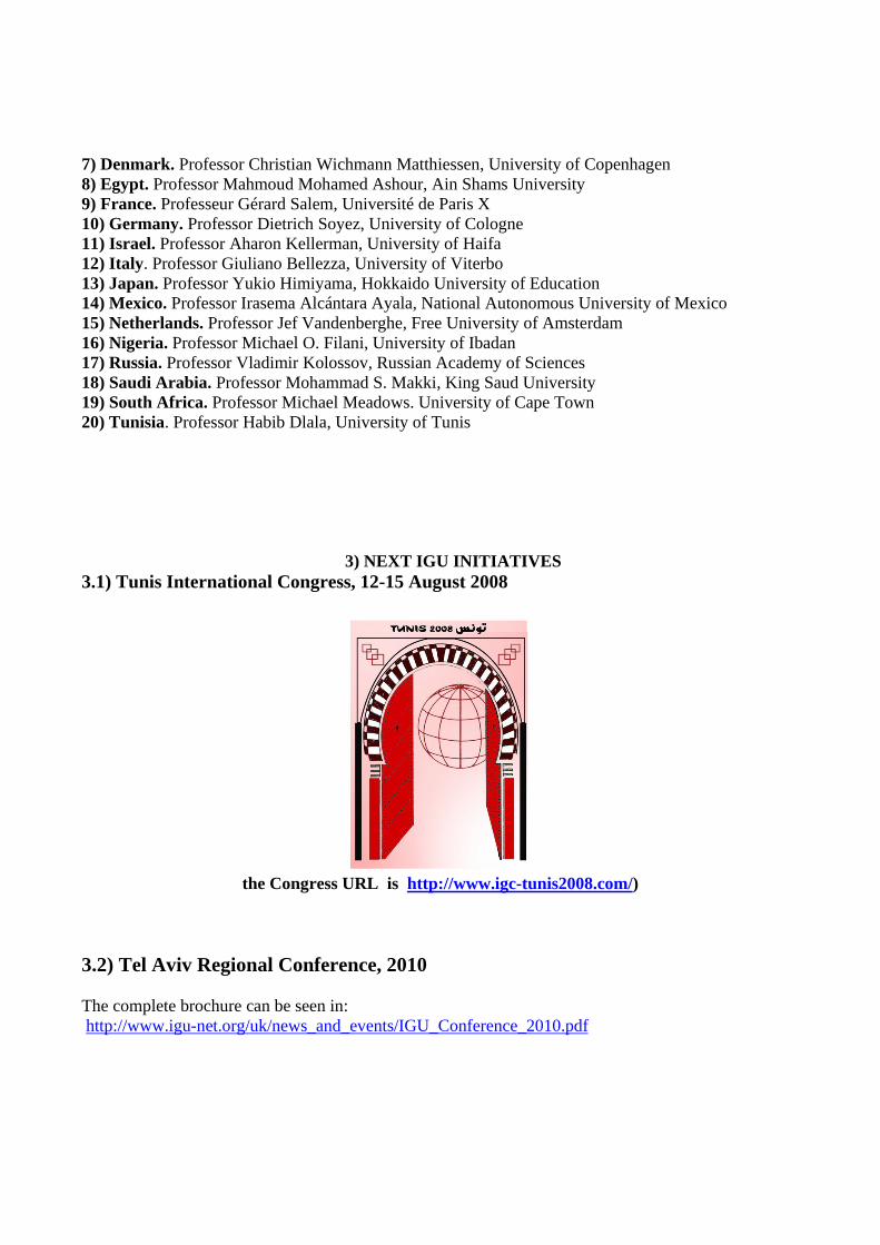
3.1) Tunis International Congress, 12-15 August 2008
the Congress URL is http://www.igc-tunis2008.com/)
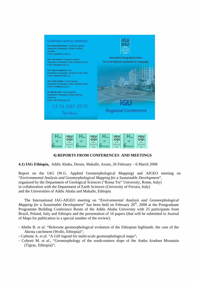
3.2) Tel Aviv Regional Conference, 2010
The complete brochure can be seen in: http://www.igu-net.org/uk/news_and_events/IGU_Conference_2010.pdf
4) REPORTS FROM CONFERENCES AND MEETINGS 4.1) IAG Ethiopia, Addis Ababa, Dessie, Makalle, Axum, 26 February – 6 March 2008 Report on the IAG (W.G. Applied Geomorphological Mapping) and AIGEO meeting on “Environmental Analysis and Geomorphological Mapping for a Sustainable Development”, organized by the Department of Geological Sciences (“Roma Tre” University, Rome, Italy) in collaboration with the Department of Earth Sciences (University of Ferrara, Italy) and the Universities of Addis Ababa and Makalle, Ethiopia
The International IAG-AIGEO meeting on “Environmental Analysis and Geomorphological Mapping for a Sustainable Development” has been held on February 26th, 2008 at the Postgraduate Programme Building Conference Room of the Addis Ababa University with 25 participants from Brazil, Poland, Italy and Ethiopia and the presentation of 10 papers (that will be submitted to Journal of Maps for publication in a special number of the review):
- Abebe B. et al. “Holocene geomorphological evolution of the Ethiopian highlands: the case of the
Akesta catchment (Wollo, Ethiopia)”; - Carbone A. et al. “A GIS legend for multi-scale geomorphological maps”; - Coltorti M. et al., “Geomorphology of the south-eastern slope of the Amba Aradom Mountain
(Tigray, Ethiopia)”;

- Fubelli G. et al., “Geomorphological map and landslides susceptibility maps of Dessie (Wollo, Ethiopia)”;
- Karsprak M. & Migon P. “Mapping fluvial geomorphology as a tool for hazard and risk assessment, West Sudetes, SW Poland”;
- Latocha A. “Geomorphological map as a tool for assessing human impact on landforms”; - Leoni G. et al., “GIS methodology to assess landslide susceptibility: application to a river catchment
of Central Italy”; - Oliveira F.A. & Vieira C.V. “Proposal of semi-detailed geomorphological map of northeastern Santa
Catarina State, Brazil”; - Pucci S. et al., “Earthquake recurrence of the Düzce fault (North Anatolian fault zone): integrating
geomorphological and paleoseismological analyses”; - Zwolinski Z. “Designing a map of the geodiversity of landforms in Poland”.
Participants to the field trip in the northern Ethiopian highlands, from February 27 to 28 - February 27th (on the way to Dessie): coseismic landforms induced by the 1961 May 29 (M=6.6)
earthquake in the Kara Kore-Majete area, located in a marginal graben parallel to the N-S Ethiopian Rift. A major feature among these is a fault scarp in unconsolidated materials opened along the bordering escarpment of the graben. This scarp could be followed over 12–15 km and locally shows a vertical displacement of 2 m.
- February 28th (Dessie area): geomorphology of the urban area of Dessie, located in a tectonic depressions located at ca 2600 m a.s.l. on the western Afar margin; landslides of different types, play an important role in the evolution of slopes (mostly made of ignimbrites, volcanic agglomerates and basalt) inducing heavy risk on the built-up area.
- February 29th (on the way to Makalle, across the Wollo-Tigray border): the Kobo River distributary channels whose beds are dry for most of the time and water flows only when rainfall yields a sufficient volume of runoff.
- March 1st (Makalle area): geomorphological map of Mt. Amba Aradam southern slope made up of the Agula Shales (medium to thick layers of greyish marls and marly clays, interbedded with coquinoid

limestones, quartzitic sandstones and gypsum layers of late Giurassic age) unconformably overlain by the Amba Aradam Formation (a 200 m thick sequence of coarse-grained quartz sandstones and conglomerates with lateritic beds, generically referred to the Early Cretaceous); dolerite sills and dykes of Oligocene age cross the bedrock sedimentary formations. Landslides of different typology and deep-seated gravitational deformation are widespread.
- March 2nd (Makalle area): the Romanat Church native forest (Olea and Podocarpus trees, preserved in the sacred church area) and the Romanat travertine dam.
- March 3rd (Makalle area): the travertine-dammed lacustrine-swampy sequence of the Mai Makden, started before 7310±90 14C yr BP, likely in relation with wetter/milder conditions and developed during the lower-middle Holocene, up to 3450±50 14C yr BP, with alternating incision/aggradation phases.
- March 4th (on the way to Axum): the spectacular landscape of Adua, characterized by a high frequence of conic-shaped volcanic plugs.
- March 5th (Axum): geomorphology and geoarchaeology of the Axum area, one of the major archaeological sites of Ethiopia including the ancient capital, the funerary zone with stelae fields and the monumental cemetery, the ancient Christian church and the Gondarian church of the 17th century, the Guedit stelae field and the so-called “Tomb of Menelik”, the Bieta Giyorgis hill with traces of farming date back to the first millennium BC.
The Romanat travertine Dam 4.2) EURAC, Bolzano (Italy), 13-14 March 2008 2nd Workshop on Applied Remote Sensing in Mountain Regions
How can remote sensing contribute to global change research in mountain regions? Background and objective Mountain areas are amongst the world’s most vulnerable regions to global change (SANDEI). Decreasing snow cover and melting glaciers threaten water availability and winter tourism, the highly diverse mountain flora and fauna is endangered by an upward and northward shift of habitats and

mountain people are at increasing risk to natural hazards such as landslides, rock falls and flash floods (BENISTON). Many of these phenomena have already been studied by means of remote sensing techniques. Yet, the integration of remote sensing approaches within multidisciplinary global change impact studies remains weak. The 2
nd EURAC Workshop on Applied Remote Sensing in Mountain Rettttgion
addressed these shortages (1) by discussing how remote sensing can support global change research in mountain regions and (2) by proposing approaches how to integrate remote sensing in upcoming climate change studies and monitoring activities. The workshop was divided in a conference part with more than 30 scientific presentations and posters and an interactive part with group works on the topics of (a) snow, ice and water, (b) land cover, land use and ecosystem dynamics as well as (c) hazard, risks and vulnerability. A summarising plenary discussion formed the meeting’s conclusion. The event was a follow-up of the first EURAC workshop held in February 2007, which aimed at identifying the status quo and future potential of remote sensing applications in mountain regions in general. The results of this first workshop have been published in: SCHNEIDERBAUER, S, ZEBISCH, M. & STEURER, C. (2007): Applied remote sensing in mountain regions. Mountain Research and Development, 27.
Potential of remote sensing and recent applications The main potential of remote sensing techniques is the provision of area-wide information about any physical objects and phenomena on the earth surface in a repeatable way and across time and space. Remote sensing data dates back until the mid of the 70’s and this allows time series analysis of almost 30 years, long enough to study changes of the earth surface which can be related to climate change (e.g. decrease of arctic ice shield). Studies of recent extreme events (e.g. the heat wave 2003) allow conclusions of the “lessons learnt” type for complex impacts of climate and weather extremes. The variety of presentations and posters (Pressures, Impact, Response) proofed that remote sensing can contribute to global change research in mountain regions at several levels: Supporting the analysis of the pressures on mountain systems, studying the impact of global change and contributing to the necessary response of such potential impacts in form vulnerability assessments (THAPA et al.) or monitoring and early warning systems. As fields of activities the following topics were discussed: Snow and ice. Monitoring snow cover with remote sensing is today not only a research topic but already an

operational service at many scales supporting monitoring and early warning tasks. Time series for snow cover dates back until the 80’s. However, the interpretation of these time series under the aspect of climate change faces challenges with regard to scaling (temporal, spatial) and the harmonisation of data from different sensors (WUNDERLE). Current developments are the data assimilation of optical and radar data (NAGLER et al.) and the link of remote sensing data with hydrological models (MONDINI et al.) which allows improving short term hydrological forecasts as well as long-term studies on the impact of snow-cover on hydrology and water availability. Land-use and land cover change. Even if land cover changes in the mountains are until now mainly driven by changes in socio-economical drivers (CAP, demography) they are regarded as one of most relevant changes in mountain systems. Land-use changes include intensification of use in the valley bottoms as well as extensification of high and remote areas. With remote sensing land-use changes can be traced back until the 50’s (aerial photography). At the conference, examples of land-use change in the Alps (TAPPEINER et al.), in Norwegian mountain ranges (JOHANSEN & KARLSEN) and the Carpathians (KÜMMERLE et al.) demonstrated the relevance of the topic and the capabilities of remote sensing in this field. Furthermore remote sensing can provide specific parameters of land use important for ecological questions in the context of global change research (e.g. upper tree line, fragmentation of forest) (SCHARDT et al.) and provide land cover related parameters for monitoring and early warning systems (e.g. storm damage, forest fires, …). Natural hazards, in particular landslides, floods and storm damage are regarded as one of the most important adverse impacts of climate and weather extremes in mountain regions. Remote sensing can here contribute to early warning systems (SCHEIDGEN et al.), damage assessment and risk mapping (VAN WESTEN, ZISCHG et al.). New radar sensors with high resolution and higher repetition rate will further improve the potential of remote sensing in this field (STROZZI, PARIZZI). Extending information availability in time and space by Spatial up-and downscaling, Increasing the frequency of updating, Transferring point measurements to area wide coverage, providing time series and (retrospective monitoring). Due to these capabilities, remote sensing can help in bridging the gap between in-situ monitoring networks and model studies and can support extending monitoring networks towards early warning systems e.g. for natural hazards. Input parameters for regional climate modelling. For a proper initialisation and validation, regional climate models need a couple of input parameters for the recent climatological period (SEIBERT et al.). Remote sensing can provide, amongst others, information on: Hydrological parameters (snow cover, snow water equivalent, soil moisture) Surface parameters (albedo, thermal properties, ...) Radiation-related parameters (cloud cover, aerosol, ...) Biophysical land-cover parameters (LAI, Roughness, phenology) Future challenges and opportunities The following future challenges and opportunities considering remote sensing particularly with regard to the link to global change research and monitoring were identified: • the need for a better linkage to the ‘modelling community’ and the required input data, * new and upcoming sensors (COSMO SkyMed, TerraSAR-X, ESA Sentinel) will widen the range of topics for that Earth observation is able to provide useful data, in particular radar sensors with higher spatial resolution and extended / new radiometric sensitivity (for example P-SAR). More in general for a number of sensors there will be an increase of the repetition rates (frequency of data provision covering the same area) (BATTAZZA, ARBESSER-RASTBURG). Independently from the link to climate change some key issues for a successful development of services based on remote sensing were underlined: • simple and standardised methods are required considering data integration, assimilation and the development of time series but also considering classification algorithms, • the user / client needs transparency about cost, • the access to Earth observation data needs to be eased (better organisation, ensured access etc.),

• for operational services the continuation of sensors and their data flows need to be guaranteed. As an additional question the ‘real life value’ of the GMES Core services that is supposed to soon achieve operational status, may be debatable. As a consequence it may be asked who will finance through what mechanisms the required efforts in research for the improvement of remote sensing applications and services after the termination of GMES project funding by EC and ESA. As an overall result it can be said that yes, beyond the existing contribution of remote sensing to climate change research there is a great potential for further input particularly by bridging the gap between existing in-situ monitoring networks and model studies. Furthermore, remote sensing can support extending monitoring networks towards early warning systems e.g. for natural hazards. All presentations and the abstracts can be found on http://www.eurac.edu/Org/AlpineEnvironment/RemoteSensing/workshop0208.ht 4.3 – ESSI Summit in Villa Celimontana, 13th-14th March 2008 Abstracts from the Final Report (Preamble, Common contributions, The emerging strategic environment) - (the complete text con be seen in the HofG website, News 2008, April) Preamble The Earth & Space Science Informatics Summit, Rome, March 13th-14th, 2008 was held in response to concerns about the need to establish communication and cooperation among the many geoinformatics and space science informatics entities and initiatives that are growing up rapidly world-wide. Participants at the Summit represented the interests of more than 40 different bodies, agencies, initiatives, and programs (Appendix-C). This was an Electronic Geophysical Year activity organised by IUGG, IUGS (CGI and OneGeology), and the Earth and Space Science Informatics groups in AGU and EGU. The Summit was hosted by the International Geographical Union at the magnificent Villa Celimontana (Home of Geography) in the gardens adjacent to the Colosseum in the heart of Rome. Earth & Space Science informatics (geoinformatics in common parlance) is the fastest growing sector of AGU. There is a revival of schools of informatics; new and innovative funding programs are appearing; people are writing use-cases; standards are advancing and are being adopted; community vocabularies and conventions, and ontologies are spreading; working in informatics is gaining respect and becoming popular; and many agencies are responding. Data-based science requires processing power, storage, network bandwidth, and analysis tools; generally advances in FLOPS and storage have outpaced increases in bandwidth and access to analysis tools. Because the need to share data, information, and services is so ubiquitous in the sciences and elsewhere, we have an obligation to seek unified approaches to common issues in order to reduce replication of effort and a proliferation of different practices and standards.

10
Somobody is asking a question to Peter Fox; in white shirt Charles Barton.
Common contributions Groups represented at the Summit are willing to contribute the following to achieve cooperation. Community
- Get scientists involved at society level in regions - Develop community of practice standards and implement them - Service as section officers, convene sessions, engage peers, submit and review papers to
help establish a peer community - Establish regional ‘nodes’ and advocacy (even programmes, funding) for Europe, Russia,
China, Australia, … - Facilitate connection to the geological, geospatial, and other communities where
collaboration is already established. Communication
- Engage with agencies and funding bodies to convene conference/ workshop sessions around their programs - to encourage PI participation and broad dissemination of project information and results.
Advancing Informatics - Provide links to X-informatics (e.g., Hydroinformatics) an to X-science - Identification of common topics between AGU, EGU, and then use society meeting
structures to hold joint activities. Experience
- Extensive networks in “ground-truth” geology (global geological survey) - Lessons learned from OneGeology (global), European SDI, National Geological Surveys. - Marketing/societal/real-politic viewpoints and advice from various communities of
interest - WDC expertise. Lessons learned through the ICSU review of WDCs. Contact with the
WDC coalition. Sharing resources

11
- Technology and resources - Geological Survey practical know how, OneGeology cookbooks for LEDCs -
The majority of participants on a terrace of Villa Celimontana.
Sitting in front-centre, Bill Robinson and Charles Barton Next Steps and Recommendations Approaches to take
1. Keep it simple, network first, then proceed to more structure if warranted. Discover, Chart, Communicate, Coordinate, Contract, Collaborate, Converge, Consensus.
2. Take a two-prong approach - make contacts with people and work using existing/planned structures
3. Communication and coordinate up and down the hierarchy noted earlier in this report, e.g. society to union. Several gaps are present in this communication flow at the present time. In dealing with gaps, show leadership rather than attempt governance.
Professional structure and coordination 4. Develop a professional structure for the international connectivity (coordination) that is
mentioned by many programs now (e.g. IPY). In the U.S. CODMAC2 would fit well into such a framework as the U.S. voice/inspiration in international deliberations.
5. Explore if an international institute could be established to facilitate meetings, project teams, etc. We noted the International Space Science Institute (ISSI) in Bern as one example. Another is the Institute in Vienna, IIASA, ICTP, and GBIF,
6. Adopt the proposed ICSU/SCCID structure and recommendations. The common needs identified by the Summit align closely with the recommendations of SCID.
7. Establish a coherent lobby for improved data management in the geosciences. There is a clear role here for ICSU Unions, CODATA, FAGS, WDS. Start with the Unions, then spread out.
8. Encourage individual informatics communities to pay attention at the global level across organizations such as ICSU, WDC, and CODATA and find advocates such as: eGY,

12
societies, and academy panels. 9. Bring in others: Unions (e.g. soil science); Cyberinformatics bodies (ACM, IEEE,
Computer Society, GIS), mission agencies and commercial interests. 10. Establish informatics bodies/groups in the individual Unions. Examples are CGI in IUGS,
and the Union Commission for Data & Information proposed within IUGG. 11. Explore the need for a distinct informatics society to facilitate and serve the emerging peer
community – this would be comparable to entities such as ISO, W3, OGC. Such a society should not prevent or discontinue participation in the current science-discipline based forums.
12. Share data policy resources, DFID… Technical and systems
13. Set guidelines for X-data models and X-markup languages; services, protocols, and interfaces; and models and simulations for forecasting. There is a role here for SIF, OGC, ICSU, WGISS, and others. Control to be decided via a Forum of authorities.
14. Encourage the relevant groups to press ahead with WDC certification. Design a scheme that can be expanded to cover any data centre.
15. Establish data citation procedures and conventions. Provide guidance to scientists on how to write a data-based paper, bearing in mind that reproducibility is a cornerstone of science. In data-based research the raw data and a complete history of processing steps is required. Many scientific papers contain an incomplete description of data processing methodology.
16. Make data self-identifying (ownership, lineage). Marketing
17. Continue to reach out into other projects, meetings, fields (unions, societies, mission agencies, commercial),and most of all – publish results, experiences and progress in widely accessible places
18. Identify key (large) projects for marketing. 19. Develop a standard structure for exposing geoprocessing services. 20. Identify the good ideas that are ready to be shared and bring them together (package them
like eGY has done, or as in the INSPIRE synthesis work). Expose these things so they are easier to find.
21. Continue to press for open and timely access to data for scientific research. Status
22. Advance data/information and informatics as the 4th leg of society and science progress 23. Change the reward system for scientists so that fulfilling data responsibilities becomes a
benefit to the scientist (e.g., for career advancement) rather than a hindrance. Change is needed to elevate informatics as a science/service and to motivate scientists to adopt more responsible data management practices.
24. Journal editors to require that data-based publications cite data sources and processing methodologies with detail matching some standard.
25. Increase the relative funding (%) for data and information management. It was noted that it will be hard to make this case since many assume that data management will be done, and that science activities often takes the share at the expense of data and information.
Report editors: P.Fox, C.Barton (the preceding lines are some parts updated to 27 Apr 2008: the complete Report is still being completed or amended in other parts)
13
4.4 – Saudi Geogr. Soc., 14th Assembly, Al Ahsa Province, 10/12-3-1429 (18-20 Apr.08) "Environmental development in the governorate of Al-Ahsa: aspirations and hopes"
10-12/3/1429 (18-20 March 2008)
In the Name of God the Merciful, praise Allah, Lord of the Worlds, prayer and peace be on the messengers and Prophet Muhammad, his family and companions.
Under the auspices of His Highness Prince Badr bin Mohammed bin Galloway, governor of Al-Ahsa province, and the hosting of the Department of Geography, Faculty of Sharia and Islamic Studies, Islamic University of Imam Muhammad bin Saud, branch of Al-Ahsa, Saudi Geographic Society held a scientific symposium: "Environmental development in the governorate of Al-Ahsa: ambitions and hopes". Invitations have been sent by Saudi Geographic Society and the Faculty of Sharia and Islamic studies for Assembly members and those interested to attend the meeting. The participants enjoyed a good meeting with a number of SGS members and the Saudi universities and government institutions and private companies. The meeting was opened by the auspices of His Highness Prince Badr bin Mohammed bin Galloway, governor of Al-Ahsa province. The symposium included two sessions and two workshops and a scientific trip to Al-Ukair coast, Qarah mountain, Joatha mosque, Al- Arbaa' mountain. More than 300 geographers from all over Saudi Arabia attended the assembly. The following recommendations emerged from the meeting: First: The lifting of telegrams of thanks and gratitude: 1 - Participants in the meeting send their sincere thanks and gratitude to His Royal Highness the Prince of the eastern region and so recommend the lifting of a cable of thanks. 2 - Participants in the meeting send their sincere thanks and gratitude to His Highness governor of Al-Ahsa province for sponsoring the scientific meeting and so recommending the lifting of a cable of thanks. 3 - Participants make sincere thanks and appreciation to His Excellency director of the Islamic University of Imam Muhammad bin Saud for agreeing to the participation of the Faculty of Sharia and Islamic Studies in organizing the meeting, and recommends lifting a cable of thanks. 4 – Participants like to thank all companies and institutions that participated in the meeting, they support: Ahsa Intercontintal Hotel, Saudi Aramco, Al-Jabr Trading company, Al-Ahsa company for tourism and recreation, Al-Kifah Holding company, and Bashir Trading and Contracting Company. Second: The symposium concluded with the following recommendations: 1- need to support the tourism industry without damaging the environment (positive trend towards the environment). 2- attract tourism investment on local, national and international levels. 3- take advantage of the characteristics of natural, human and civilizational of the area (mountains, sand dunes, mosques) in the process of tourist attractions. 4 – There is a need to preserve farmland and prevent urban encroachment upon. 5 - maintain springs sites that became dry and develop tourist attraction to their sites. 6 – Pay quick attention to maintenance and protection of archaeological sites as a cultural duty and as factor for tourist attraction. Sites such as Joatha mosque, the ancient port in Ukair need more attention.

14
7 - Development of Academy sections on environment at the Islamic University of Imam Muhammad bin Saud, branch of Al-Ahsa. 8 - recommendation to the Saudi geographical Society and geography departments in Saudi Universities to hold more seminars, discussion groups devoted to complementarities rather than competitions between departments. It can be arranged to focus in each department on a certain direction in geography and non-repetition of the same trends in all or most departments of geography. 9 – The request from all geography departments to intensify the use of modern techniques in the teaching of geographical courses and in research. 10 – Giving more attention to narrow the gap between public education and university education, and urged Saudi Geographic Society to cooperate with the Ministry of Education to participate in geography curriculum development in public education. 11 - The need for openness of higher education in geography department on society in creating a real partnership and operational training and research with the public and private sectors to serve the community, and to urge the depth studies which illustrate the contribution of the public to support education, training and employment. 12 - setting up a central committee along with the local scientific committees to study the content of department's curriculum and the extent of their involvement in preparing students professionally and areas of urgent need of development. 13 – Start periodical review of the university geographical books in terms of quality and the availability and development through the promotion of faculty members for joint authoring, thus helping to increase cooperation and quality of books. 14 – encourage ministries and governmental and non-governmental departments on clearness in providing information and data for researchers on the number of graduates from the departments of geography and the number who have been recruited and who was not able to be absorbed in the labour market, which encourages the work of scientific studies that determine trends, be able to study the potential efficiency in geography departments, and development capacity quality of graduates. 4.5 – AAG 104th Conference, Boston 13th-14th March 2008 An AAG Annual Conference is something unique, difficult to understand in other parts of the world: giving some numbers is necessary, to give but an idea, starting from the participants. A new record is set every year, and in 2008 it reached 7.500. The Congresses of the International Geographical Union remains far below this figure, and are held every four year, while the AAG Conference is a yearly initiative. A titanic organization effort is requested, and the AAG management meets all the requirements: what is more impressive, everything goes on smoothly. Some contributor doesn’t show up, without informing in advance, but the Session’s Chairs are warned to respect the time table. If some person of the public is interested in a paper scheduled in the program at 3.40 p.m., he must be sure that arriving at 3.39 he will listen what he want. So the person speaking at 3.20 was given some extra time, but the next communication was not allowed to start before 3.40. Sounds easy, but now we must inform that 72 meeting rooms were working simultaneously (too many for a single Convention Centre of Marriot Hotel in Copley Square, so 34 of them were booked in the very near Hotels Westlin and Sheraton). This for the space, while relative to time,

15
the Sessions were starting at 7.00 a.m.. and the initiatives were going on for 12 hours, with only a brief lunch break (12-13 p.m.). Of course, after 7.00 there were special events or movies until 11 p.m. We like to remind but 2 of the main initiatives, starting with the plenary opening session, with a lecture given by Jeffrey Sachs, professor on the faculty at the School of International and Public Affairs and Director of the Earth Institute, both at Colombia University, introduced by Thomas Baerwald of the National Science Foundation and Doug Richardson, AAG Executive Director. Doug Richardson introduced also the Conversation with the Noam Chomsky, American linguist, philosopher, political activist, author, and Professor emeritus of linguistics at the Massachusetts Institute of Technology. In both occasions all the seats of the Grand Ballroom of the Marriot were occupied, and so the floor, full of people sitting, so that the doors had to be closed.
After the official end of the Conversation, Noam Chomsky and Doug Richardson had to stay nearly one hour, as dozens of new questions were arising from the attendance.
3) FORTHCOMING 2008 EVENTS There not much activity, but this is only apparent. In fact, <ul><li>the Commissions are preparing their participation in the Tunis Congress, organizing meetings between members more than Conferences, calling for papers Congress of the International Soil Conservation Organization, Budapest, 18-23 May 2008:. URL: http://www.ISCO2008.com.

16
Geographies of Violence, Quebec, 21-24 May 2008. E-mail: [email protected]
HOME OF GEOGRAPHY UPDATE Some days ago, on 22nd April, in Villa Celimontana the 13th Meeting of the Home of Geography EC was held. The best way to inform the readers about the activity of the last period in the Home is to post here the key points of the Report presented by the Director. Meetings On 15th and 16th February 2008 the Home hosted a meeting of the HERODOT Network, lead by Karl Donert, with 12 geography teachers from different European countries. It has been a very fruitful occasion, and I have been invited in the next Herodot Meeting in September in Liverpool to study a common action, in order to apply for funding at European level. On 13th and 14th March 2008 the Home hosted a meeting of the Earth and Space Science Informatics Summit, in the frame of the International Geophysical Year + 50. The meeting had been organised by Peter Fox, Bill Peterson and by Charles Barton, who wanted to enjoy once again the hospitality of Villa Celimontana, having already been here in September 2005, for a Workshop of the several entities organizing the International Geophysical Year +50. Visitors to the HG A delegation of Slovenian Geographers, lead by Anton Gosar and Milan Bufon, visited the Home on 8th February 2008. It has been a short but fruitful workshop, leading to a common initiative (please, see below). Following with CCHD & MRP The Home, following what had been said in the Tokyo Meeting of the IGU EC (April 2007), tried to push forward the activity of the co-ordinators and responsible of the 2 Steering Committee of the last Vallega’s projects. The MRP is producing many results, that will be exposed in Tunis in a dedicated session, as published in our website and newsletter. I want express my appreciation for the help received by Maria Paradiso (not only as organizer, but even proposing research fields) and the Commissions chaired by Aharon Kellerman and Annick Douguedroit. The Co-ordinator Ashour accepted my proposal to include Annick in the Steering Committee, and thanks to the economic help of Società Geografica Italiana, a Meeting will held Villa Celimontana on 13 May, to prepare the presentation of papers in the Tunis Congress. (During the Meeting, Aharon Kellerman will propose to adhere to a new developed project, an online portal dedicated to creating a joint

17
environmental platform for Mediterranean communities, by the Leo Savir Foundation for a Mediterranean Vision 2020 and the Peres Center for Peace). In the CCHD the responsibility of the Project was taken by Benno Werlen, Chair of the Commission on Cultural Approach in Geography. The Home gave him support to update the rationale of the initiative, and stronger help was given by Anne Buttimer, Bruno Messerli and long discussions with many scholars. He found some German funding and, once again thanks to the key contribution of the SGI, a Meeting will be held in Villa Celimontana with Derek Gregory, John Pickles, Karl Donert, Ola Soederstrom, Jacques Lévy, Vladimir Kolossov. Even this initiative will be present with a dedicated session in Tunis. Other Projects of the Home The Home is active in participating in new initiatives. One more promising project is taking shape, based on an initiative of Antoine Bailly, and this also is to be considered the prosecution of a Vallega’s desire: the diffusion of Festivals of Geography, following the example of the FIG in Saint Dié. Bailly, guest in the Festa da Geografia in Mirandela (Portugal), July 2007, proposed to ask for European Intereg funds (minimum 3 countries), for a common initiative to be taken by FIG, Mirandela and Home of Geography. With the help of SGI, I got the co-operation of the Piacenza Municipality, where a Festival had already been organized since two years. Later I proposed to participate to the organizers of the Borders3 Summer School, taking place since some years in borders towns of Italy, Austria and Slovenia, and the project is now starting. After meeting in the Home with the Slovenian partners and a mail exchange with the others, I met with the Italian Director of the Borders3 School, Igor Jelen (University of Trieste), and all of us are invited in the next Festa da Geografia (Mirandela, 21-25 May). The FIG doesn’t appear now as interested, but a Greek representative will also be present, to write the application for the European Intereg Fund. The Piacenza Festival di Geografia will take place in the first days of September, and the “mobile Festival” experiment will be held along the north-eastern Italian border with Austria and Slovenia in the last days of the same month. Financial Situation It has been said in the previous point that the Home is engaged in several projects and, together with different partners, is asking for funds. At the moment the IGU also has financial problems, and our survival is only due now to the help of the Società Geografica Italiana, no longer limited to in kind facilities, as the availability of meeting rooms and of the best geographical library of Europe, surely the most important of Italy. Home of Geography Publications Series: Sale
A 10% discount will be applied when ordering 2 books, and 15% when ordering 3 books or
more.
To obtain copies of the following volumes, please contact Giuliano Bellezza at: [email protected]. Payment can be made by bank transfer or by credit card (Visa or Mastercard). Costs (incl postage and packing) are as follows:

18
Vol I - Human Mobility in a Borderless World? (2002) Ed: A. Montanari (OUT OF PRINT) Vol II – Food and Environment – Geographies of Taste (2002) Ed: A. Montanari (EU: € 13 / non-EU: € 19) Vol III – Rights to the City (2005) Eds: D Wastl-Water, L. Staeheli & L. Dowler (EU: € 18 / non-EU: € 24) Vol IV – The New Geography of Human Mobility – Inequality Trends (2003) Eds: Y. Ishikawa & A. Montanari (EU: € 20 / non-EU: € 26) Vol V – Migrations in Europe – The Four Last Decades (2004) Eds: C. Vandermotten, G. Van Hamme, P. Medina Lockhart & B. Wayens (EU: € 13 / non-EU: € 19) Vol VI – Gendered Cities: Identities, Activities, Networks – A Life-course Approach (2004) G. Cortesi, F. Cristaldi & J. Droogleever Fortuijn (EU: € 20 / non-EU: € 26)
Vol VII – Managing Water Resources in a Changing Physical and Social Environment (2007) Eds: P. J. Robinson, J. A. A. Jones & M-K. Woo (EU: € 18 / non-EU: € 24) Vol VIII – Migration in a new Europe: Peoples, Borders and Trajectories (2007) Eds: T. van Naerssen and M. van der Velde. (EU: € 18 / non-EU: € 24