iii - afcec home
TRANSCRIPT


iii

Table of Contents
Section Page
Introduction .............................................................................................................. 1
The AICUZ Program ............................................................................................... 2
History ....................................................................................................................................... 2
AICUZ Program Objectives ...................................................................................................... 4
AICUZ Study ............................................................................................................ 5
The AICUZ Study Process ........................................................................................................ 5
Noise Analysis and Noise Contours ............................................................................. 6
Accident Potential Zones (APZs) and Flight Safety .................................................... 8
Flight Safety Criteria .................................................................................................... 9
Land Use Compatibility Analysis and Recommendations ......................................... 13
Compatible Land Use ............................................................................................ 14
AICUZ Implementation ........................................................................................ 15
Roles ........................................................................................................................................ 15
The Installation’s Role ............................................................................................... 15
The Community’s Role .............................................................................................. 15
Land Use Tools and Recommendations .................................................................................. 15
Resources ................................................................................................................................ 17
Summary ................................................................................................................. 18

1
Introduction
The purpose of this primer is to provide the public and local governments located
near military airfields (also referred to as air installations) with an increased
understanding of the Air Installations Compatible Use Zones (AICUZ) Program
and how implementation of this program can benefit local communities and the
Air Force. This document provides an overview of the overall AICUZ Program;
AICUZ studies and their development; land use compatibility; and AICUZ
Program implementation and resources.
The information presented herein is based on guidance developed by the U.S.
Department of the Air Force and Department of Defense (DOD): Air Force
Instruction (AFI) 32-7063 (2014) and DOD Instruction (DODI) 4165.57 (2011).

2
The AICUZ Program
Development near military air installations is apparent and the advertisement
slogan, “If you lived here…you’d be home by now!” is appealing for many
homebuyers. People who work on the air installation want to live nearby and
businesses want to provide services for
those employees
As development increases around a
military airfield, more people are
potentially exposed to the noise and
accident potential through incompatible
development, which, over time, could
potentially degrade the installation’s
mission.
In the early 1970s, the DOD initiated the
AICUZ Program to promote compatible
development near military airfields.
The AICUZ program recommends
incorporation of noise contours, accident
potential zones (APZs), and other safety
criteria, into the local land use planning
process and provides recommendations
for development that is compatible with
the air installation’s mission.
History
Historically, military installations were located in rural areas, which provided an
ample buffer between military training areas and urban areas. Following World
War II, rapid development resulted in population growth in many of these
formerly rural areas, which began to affect the missions of military installations.
Military installations became magnets for employment and economic growth
opportunities because of the large number of military and civilian personnel
employed at the installations. In addition, expansion of the interstate highway
system, lack of developable land near urban centers, affordable real estate, and
mortgage programs pushed development outward toward rural areas and
increased development near military installations.
Public and military awareness of aircraft safety and accident potential emerged as
a concern after different types of development occurred around air installations.
In the early 1950s, the federal government initiated studies to better understand
the relationship between aircraft operations and neighboring communities. These
early studies analyzed land uses, aircraft operations, and human sensitivity to
aircraft noise as well as provided recommendations for compatible land uses.
Signs like this are common near military airfields and acknowledge the development near military airfields.

3
“Airfields attract development…” Growth around Nellis AFB, Las Vegas NV: 1950-2005

4
In the 1970s, in response to continuing growth pressure, the DOD established the
AICUZ Program.
Today, the Air Force AICUZ Program, supported by two key instructions, is the
basis for the encroachment management program for Air Force air installations:
DOD Instruction 4165.57: Air Installations Compatible Use Zones
(AICUZ), DOD Instruction (DODI), 2011; and
Air Force Instruction (AFI) 32-1015: Integrated Installation Planning.
Through this guidance, the AICUZ Program has been established for Air Force
air installations throughout the United States. Today, the Program serves as a
crucial tool to promote compatible development; it continues to evolve to address
new development trends, emerging encroachment challenges, and critical needs
of the mission.
AICUZ Program Objectives
The AICUZ Program has four objectives:
To protect the health, safety, and welfare of civilians and military
personnel by encouraging land use that is compatible with aircraft
operations;
To protect military installation investments by safeguarding the
installation’s operational capabilities;
To reduce noise impacts caused by aircraft operations while meeting
operational, training, and flight safety requirements, both on and in the
vicinity of air installations; and
To inform the public about the AICUZ Program and seek cooperative
efforts to minimize noise and aircraft accident potential affects by
promoting compatible development near military air installations.
To satisfy these objectives, the Air Force works with local communities to
discourage incompatible development of lands adjacent to an air installation,
while promoting development compatible with the mission. Cooperation between
5
the air installation and neighboring communities is the key to the AICUZ
Program’s success.
AICUZ Study
The AICUZ Program promotes development compatible with the military flying
mission. The Program encourages local governments to incorporate AICUZ
guidelines into their land use planning and development practices. AICUZ
studies are an integral component of the AICUZ Program and are the tool the Air
Force uses to communicate with local governments and provide compatible land
use recommendations.
AICUZ studies are advisory planning documents – land use control is the
responsibility of local governments. AICUZ studies provide recommendations
that will allow the Air Force and local governments to work together to promote
compatible development.
An AICUZ study is prepared in consideration of past and projected changes in
mission, aircraft, flight paths, and operational levels. The planning year is
installation dependent and determined by foreseeable changes that could occur at
the installation in the future. This approach allows local governments to properly
plan and manage development.
The AICUZ Study Process
AICUZ studies, initiated in coordination with the air installation, major
command, the Air Force Civil Engineer Center (AFCEC), and higher
headquarters, are updated when an air installation has:
A significant change or projected change in aircraft operations (i.e., the
number of takeoffs and landings);
Significant changes or projected changes in flight paths or procedures;
A change or projected change in the type of aircraft stationed and
operating from the installation;
Major changes in land use; or
When other circumstances require such action.
AICUZ studies, developed through a coordinated and strategic team effort,
involve the air installation leadership, installation program manager, planning
staff, pilots and air operations personnel, AFCEC representatives, Air Force
headquarters (HQ) personnel, and a consulting team composed of technical staff
and noise experts.
The three primary components of an AICUZ study presented on the graphic
below and discussed in the following sections are designed to address the AICUZ
Program objectives.
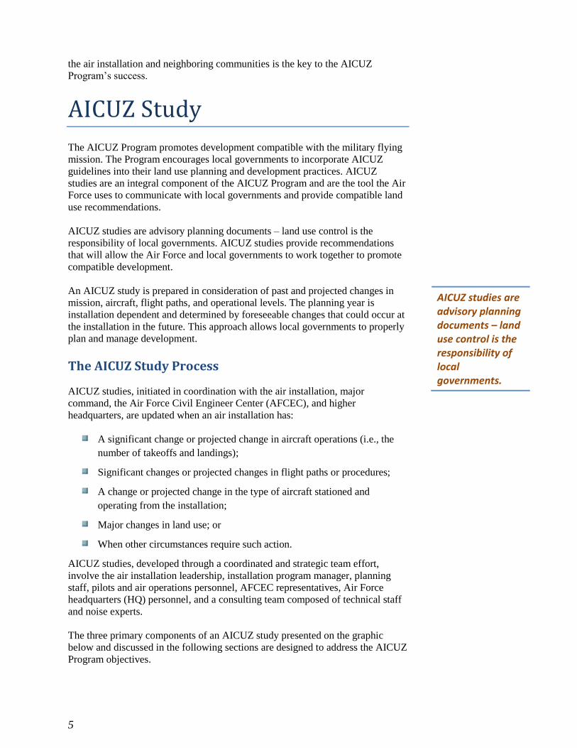
AICUZ studies are advisory planning documents – land use control is the responsibility of local governments.

6
Noise Analysis and Noise Contours
The AICUZ process starts with the collection of aircraft operational data from the
installation, which is used to develop noise exposure contours. The Air Force
identifies noise exposure zones surrounding a military air station as a planning
tool for local planning agencies.
The noise exposure from aircraft is measured using the day-night average sound
level (DNL) metric. The DNL metric, established in 1980, presents a reliable
measure of community sensitivity to
aircraft noise and has become the
standard metric used in the United
States (except California, which uses
a similar metric, Community Noise
Equivalent Level [CNEL]). The
DNL presents the average sound
energy from aircraft operations at a
location over a 24-hour period. The
DNL also adds an additional 10
decibels (dB) to events occurring
between 10:00 p.m. and 7:00 a.m.
This 10-dB “night-time adjustment”
represents the added intrusiveness of
sounds due to the increased
sensitivity to noise when ambient
sound levels are low.
An AICUZ study provides air
installations, local planning
organizations, the public, and other stakeholders, with maps of the modeled
noise-related exposure from aircraft operations. Noise contours, when overlaid
with local land uses, can help identify areas of incompatible land uses and can
assist in planning for future development.
Every AICUZ study contains a map that depicts the noise exposure contours. The
noise exposure contour figure shows the 65, 70, 75, 80 and 85 DNL contours.
Contours outside of 65 DNL are not usually mapped unless local conditions,
Noise contours, developed using DOD-approved computerized simulation models include the following data inputs:
Flight tracks; Type and mix of aircraft; Aircraft speed, altitude,
and power settings; Ground and maintenance
activities; Frequency and times of
operation; and Environmental
considerations.

7
warrant their use. In California, which utilizes CNEL instead of DNL, the Air
Force adds a 60 CNEL contour to align its AICUZ studies with state law.
For land use planning purposes, an area of less than 65 DNL is considered an
area of low impact and does not normally require land use controls. 65 to 75 is
considered an area of moderate noise impact, where some land use controls are
needed The area greater than 75 DNL is the most affected area and requires the
greatest degree of land use controls to achieve land use compatibility.
Representative Noise Contours

8
Accident Potential Zones (APZs) and Flight Safety
The Air Force identifies Accident Potential Zones, or APZs, as areas where an
aircraft accident is most likely to occur – if one occurs – in the vicinity of
airfields; APZs are not a prediction of accidents or accident frequency. APZs
generally follow the extended runway centerline and are based upon analysis of
Air Force historical data.
APZs extend from the end of the runway and apply to the predominant arrival,
departure, and pattern flight tracks. In the case where more than 80% of the
operations follow a particular departure path that varies from straight out, a
curved APZ may also be included.
The APZs are not a prediction of accidents or accident frequency.
In April 2006, a C-5 aircraft
landed short of the runway. No
one on the ground was injured
was due to previous Air Force
efforts to set the land aside as
an AICUZ buffer.

9
The DOD defines three APZs: the Clear Zone, APZ I, and APZ II. If an
accident were to occur, it would most likely occur in the Clear Zone and would
be more likely to occur in APZ I than APZ II. Clear Zones and straight out APZs
are required for all active runways.
Clear Zone: Extends beyond the runway and has the highest potential for
accidents. Clear Zones are the areas with the greatest potential for
occurrence of aircraft accidents and should remain undeveloped.
APZ I: Extends beyond the Clear Zone. Some land uses are compatible
but may recommend density restrictions.
APZ II: Extends beyond APZ I. More land uses are compatible within
APZ II than APZ I but may recommend density restrictions.
Standard Runway, Fixed-Wing APZs
The Air Force provides APZs as a planning tool to assist local governments with
land use planning and future community development. While the possibilities of
an aircraft mishap are remote, the AICUZ Program recommends that land uses
that promote high concentrations of people be avoided in the APZs.
Clear Zones are the areas with the greatest potential for occurrence of aircraft
accidents and should remain undeveloped. APZ I and APZ II have a decreasing
probability of an aircraft accident occurring and have less stringent development
recommendations.
Flight Safety Criteria
Flight safety not only includes measures for pilot safety during aircraft
operations, but also for the safety of those in the community. Height restrictions
can prevent man-made structures from creating an obstruction that could prevent
aircraft from accessing airports or pose an accident hazard. Aircraft approach and
depart from airports on a vertically sloped flight path that gets farther from the
ground as distance from the airport increases. The height obstruction criteria
reflect this principle, and normally permit the placement of taller structures as
distance from the airport increases.

10
Obstructions to air navigation are considered to be:
Natural objects or man-made structures that protrude above the planes or
imaginary surfaces and/or
Man-made objects that extend more than 500 feet above ground level
(AGL) at the site of the structure.
Although the FAA establishes criteria for the height of structures around airports,
the FAA does not have the authority to limit their actual construction. Therefore,
to protect the health, safety, and welfare of populations around airfields, local
communities must enforce the height restriction guidelines established by the
FAA. Local communities are encouraged to restrict development that could
compromise aircraft operations.
Hazards to Aircraft Flight Zone (HAFZ)
Certain land uses and activities pose potential hazards to flight. To ensure land
uses and activities are examined for compatibility; the Air Force has identified a
Hazards to Aircraft Flight Zone (HAFZ). The HAFZ is the area within the
imaginary surfaces that are shown on Figure 5-4. Please note that the area and
shape of the HAFZ may change with the encroachment issue at hand. For
instance, issues related to bird/wildlife aircraft strike hazards may follow natural
boundaries, encompass local bodies of water, and extend along flight paths.
Unlike noise zones and safety zones, the HAFZ does not have recommended land
use compatibility tables. Instead, it is a consultation zone recommending that
project applicants and local planning bodies consult with the Air Force to ensure
the project is compatible with Air Force operations. These land use and activity
compatibility considerations include:
Height: Tall objects can pose significant hazards to flight operations or
interfere with navigational equipment (including radar). City/county
agencies involved with approvals of permits for construction should

11
require developers to submit calculations showing that projects meet the
height restriction criteria of 14 Code of Federal Regulations (CFR) 77.17
for the specific airfield described in the AICUZ Study. City and county
agencies may also consider requiring a “Determination of No Hazard”
issued by the FAA for any tall objects within this zone.
Visual Interference: Industrial or agricultural sources of smoke, dust,
and steam in the airfield vicinity can obstruct a pilot’s vision during
takeoff, landing, or other periods of low-altitude flight. Close
coordination between the installation and landowners can often mitigate
these concerns. For example, irrigating before plowing can greatly
reduce dust concerns.
Light Emissions: Bright lights, either direct or reflected, in the airfield
vicinity can impair a pilot’s vision, especially at night. A sudden flash
from a bright light causes a spot or “halo” to remain at the center of the
visual field for a few seconds or more, rendering a person virtually blind
to all other visual input. This is particularly dangerous for pilots at night
when the flash can diminish the eye’s adaptation to darkness. The eyes
partially recover from this adaptation in a matter of minutes, but full
adaptation typically requires 40 to 45 minutes. Specific examples of light
emissions that can interfere with the safety of nearby aviation operations
include:
o Lasers that emit in the visible spectrum, which can be potentially
harmful to a pilot’s vision during both day and night.
o The increasing use of energy-efficient LED lighting, which poses
potential conflicts in areas where pilots use night vision goggles
(NVGs). NVGs can exaggerate the brightness of these lights,
interfering with pilot vision.
o The use of red LED lights to mark obstructions, which can produce
an unintended safety consequence because red LED lights are not
visible on most NVG models, rendering them invisible to NVG users
in the area.
Bird/Wildlife Aircraft Strike Hazard (BASH): Wildlife represents a
significant hazard to flight operations. Birds, in particular, are drawn to
different habitat types found in the airfield environment, including
hedges, grass, brush, forest, water, and even the warm pavement of the
runways. Due to the speed of the aircraft, collisions with wildlife can
happen with considerable force. Although most bird and animal strikes
do not result in crashes, they cause structural and mechanical damage to
aircraft as well as loss of flight time.
Radio Frequency/Electromagnetic Interference: The American National Standards Institute defines electromagnetic interference (EMI) as any electromagnetic disturbance that interrupts, obstructs, or otherwise degrades or limits the effective performance of electronics/electrical equipment.
EMI can be induced intentionally, as in forms of electronic
warfare, or unintentionally, as a result of spurious emissions and

12
responses, such as high-tension line leakage and industrial
machinery. In addition, EMI may be caused by atmospheric
phenomena, such as lightning or precipitation static.
New generations of military aircraft are highly dependent on
complex electronic systems for navigation and critical flight and
mission-related functions. Consequently, communities should use
care when siting any activities that create EMI. Many of these
sources are low-level emitters of EMI. However, when combined,
they have an additive quality.
EMI also affects consumer devices, such as cell phones, FM
radios, television reception, and garage door openers. In some
cases, the source of interference occurs when consumer electronics
use frequencies set aside for military use.
Drones/Unmanned Aircraft Systems (UAS): The use of drones near military airfields poses a serious flight safety hazard due to the potential for a mid-air collision between military aircraft and small- to medium-sized drones. The FAA maintains specific guidance about where drones (i.e., UAS) can be flown. Currently, non-DoD drone operations are not permitted within certain zones surrounding military bases. Additional restrictions are in place around airports, sports stadiums, and security sensitive areas. For more information on drone use in and around DoD airfields, visit the FAA’s website at: www.faa.gov/uas.

13
Land Use Compatibility Analysis and Recommendations
The AICUZ footprint of an air installation—the combination of noise contours
and APZs—defines the minimum acceptable area in which land use control
measures are recommended to protect the public’s health, safety, and welfare
while sustaining the Air Force’s flying mission. Control over land use and
development in areas neighboring the air installation is ultimately the
responsibility of local governments; however, through the AICUZ Program, local
governments are encouraged to plan for compatible development.
The land use compatibility analysis section of an AICUZ study examines existing
land uses within the AICUZ footprint and determines the level of compatibility
with military air operations. Existing land uses are identified through data
acquired from local or state governments and supplemented with aerial
photography interpretation and ground verification. General and/or
comprehensive plans for the municipalities in the vicinity of the air installation
are reviewed for goals and policies that would influence future land uses within
the AICUZ footprint, allowing for analysis of future land uses. In addition, local
zoning ordinances and zoning maps are reviewed to determine the location of
allowable land uses, building heights and densities, and floor-to-area ratios (for
non-residential development).
The land use compatibility analysis examines whether existing and future land
uses are compatible with current and foreseeable military aircraft operations. The
land use controls recommended in the AICUZ study are dependent on the level
of incompatibility and intensity of land uses in the AICUZ footprint. Figures
depicting compatibility concerns are provided in AICUZ studies and include
recommendations for compatible land use as described in the following section.
The AICUZ footprint consists of the noise contours and APZs.

14
Compatible Land Use
As previously discussed, to protect the health, safety, and welfare of the public,
land uses should be compatible with noise zones, APZs, and flight safety criteria.
Although land use activities outside the installation can affect military
operations, the use and development of the surrounding properties is under the
jurisdiction of the local governments.
The AICUZ Program’s compatibility guidelines encourage noise-sensitive land
uses (e.g., houses and churches) to be placed outside high-noise zones and
discourages people-intensive uses (e.g., apartments and theaters) in APZs. The
table below provides a list of common land use classifications and their
generalized compatibility recommendations within AICUZ noise zones and
APZs. Land use classifications in this table are generalized and do not represent
the local communities’ land use designations.
The land use compatibility analysis provides the basis for land use recommendations.
NOTES: This generalized land use table provides an overview of recommended land use. To determine specific land use compatibility, see AFI 32-7063.
1. Maximum density of 1-2 dwelling units per acre.
2. Land use and related structures generally compatible; however, measure to achieve a Noise level Reduction (NLR) of 25 to 30 dB must be
incorporated in the design and construction of the structures.
3. Maximum floor area ration that limits people density may apply.
4. Facilities must be low intensity.

15
AICUZ Implementation
The AICUZ Program, specifically AICUZ studies, provides guidance on
implementing recommendations.
Roles
Both the Air Force and local government stakeholders share responsibility for the
successful implementation of the AICUZ Program within a community. Al-
though the Air Force is responsible for preparing the AICUZ study, the action to
implement many of the land use recommendations resides with local
governments.
The Installation’s Role
The Air Force actively engages the local community throughout implementation
of an AICUZ study. Base leadership this effort and often delegates the day-to-
day responsibilities of engaging the community to the installation’s AICUZ
program manager. The AICUZ program manager works closely with community
planners, government officials, and installation leadership to develop appropriate
recommendations promoting compatible development within noise zones and
APZs as well as recommendations to minimize noise impacts on existing land
uses. In addition, the Air Force actively encourages local governments to
incorporate AICUZ study maps, land use compatibility tables, and
recommendations into their local zoning ordinance.
The Community’s Role
Within any jurisdiction, only the local government has authority to regulate land
use and, therefore, is responsible for adopting and implementing the appropriate
control measures that pertain to zoning ordinances, general plans, and building
codes. Partnership and coordination with the Air Force ensures that incompatible
land uses are minimized within noise zones and APZs. In addition, local
governments may provide valuable land use and zoning information and data to
support the AICUZ study process.
Land Use Tools and Recommendations
The purpose of an AICUZ study is to identify the AICUZ footprint, determine
land use compatibility with existing and future land uses, and provide
recommendations for minimizing land use conflicts and mitigating noise impacts
on existing land uses. Local circumstances may require unique solutions, which
are often the result of a collaborative effort between the Air Force and local
governments.
The Air Force and local governments share the responsibility of implementing AICUZ study recommendations.

16
The following recommendations are the most common actions taken by the Air
Force to minimize impacts on sensitive land uses in the AICUZ footprint.
Noise Mitigation Measures. Flight crews (pilots and ground
maintenance) are briefed on noise abatement procedures and noise-
sensitive areas detailed in in-flight guides.
Hush Houses and Test Cells. These facilities are located on base.
Aircraft are positioned inside these facilities to reduce the noise
generated during engine maintenance run-ups.
Acquisition of Real Property or Restrictive Easements. While the Air
Force may purchase land or restrictive easements under certain
conditions, funding for this program is scarce and other options often
pursued. If acquisition is required, the Air Force’s first priority is the
Clear Zone and then APZ I and APZ II. The primary focus of these
acquisition efforts is on undeveloped land.
Complaint Response Programs. Air Force installations may set up a
telephone hotline or website to allow the public to submit noise
complaints to the Air Force. The Air Force examines these complaints to
determine if further action is needed to minimize the concern. (Contact
the installation Public Affairs [PA] office for more information.)
Encroachment Partnering. Encroachment partnering is a cooperative,
multi-party, real estate based program authorized by Congress to mitigate
the impacts of potential off-base development that would be
incompatible with military operations or to preserve habitat off-base.
Under this program the Air Force can partner with state, county, and city
governments and private non-governmental organizations to share the
costs of acquiring real estate in the vicinity of an installation to prevent
development. The DoD provides funding through the Readiness and
Environmental Protection Initiative (REPI) and Air Force appropriation
funds.
Monitor and Comment on Proposed Developments. The CO and his
staff, primarily the CPLO, are encouraged to monitor development
activities within and outside of the AICUZ footprint and, if needed,
present their concerns to the appropriate decision-making body (e.g.,
planning commission or city/county council).
The following actions are taken primarily by local governments in coordination
with the Air Force.
Incorporate AICUZ Study Elements into Local Planning. General or
comprehensive plans are long-term planning documents that define the
vision of a community. These planning documents include goals and
policies that guide future development and provide the basis for land use
related decisions. Incorporating AICUZ recommendations into the
general plan emphasizes the importance of ensuring the AICUZ footprint
is free of incompatible land uses and provides the basis for amending
zoning ordinances, building codes, and other city or county codes to
incorporate AICUZ recommendations.

17
Revising Building Codes. Building codes govern the construction and
maintenance of new and existing buildings to ensure buildings are safe
for occupancy. In some instances, building codes should incorporate
additional sound suppression requirements to limit the amount of
military aircraft-related noise that is detectable inside a structure,
especially residences.
Real Estate Disclosure. Real estate disclosures require disclosure to
prospective buyers and lessees that residential properties are located
within noise zones and/or APZs. The Air Force encourages local
jurisdictions to adopt legislation that requires this disclosure.
Resources
In addition to the CO, the base-level staff are important resources serving as
direct representatives with local communities, public elected officials, other
government agencies, and major landowners surrounding installations and within
the region.
Public Affairs (PA) office. The PA manages the day-to-day
responsibilities of responding to community complaints or inquiries and
keeping the public informed of operational changes
Installation AICUZ Program Manager. The AICUZ program manager
manages the day-to-day responsibilities for administering the
installation’s AICUZ program.
Public Outreach Materials. A suite of public outreach materials, such as map
brochures, tri-folds, factsheets, and presentations, is often developed in
coordination with an AICUZ study, which provides excellent tools to
communicate with the local community and should be available from the
installation PA office.

18
Summary
The AICUZ Program, initiated by the DOD to protect and promote the public’s
health, safety, and welfare while concurrently preventing the degradation of the
installation’s mission, is critical to sustaining our military mission. Communities
that surround air stations will continue to grow, and the DOD has the
responsibility to communicate and collaborate with local governments regarding
land use planning, zoning, and mission impacts.
The AICUZ Program, through AICUZ studies, assists governmental entities and
communities in identifying and planning for compatible land use and
development. As a planning document, AICUZ studies project aircraft
operations and recommend that communities incorporate the projections into
their planning documents, encouraging compatible development.
Today, the AICUZ Program is a vital tool used by the military to communicate
with neighboring communities regarding public health and safety, compatible
land use, and development concerns.
For More Information: Contact the PA office at the Air Force air installation nearest you.

19

