image courtesy of ca sec. of state website - colby college sample 2 chris bersbach.… · image...
TRANSCRIPT

World Wildlife Fund Ecoregion NA 1203 – California montane chaparral and woodlands
By Chris Bersbach Brandeis University
April 30, 2003
Image courtesy of CA Sec. of State website

Executive Summary
The California montane chaparral and woodland ecoregion is both delicate and
diverse, both of which make its preservation extremely important. Spanning the Santa
Lucia Mountains of the central California coast and the Transverse Range further to the
south, the region covers altitudes from sea level to as high as 11,500 feet and covers
almost 8,000 square miles. The climate is characterized by a short rainy season in the
winter and warm, dry summers that contribute to the regular occurrence of wildfire.
There exist very few regions similar to the coastal mountains of California anywhere else
in the world, but the wide variety of oaks and evergreens found here are well adapted to
the climate, and some of them actually depend on the naturally occurring fires for
survival (WWF website).
Despite these treasures, only 30 percent of the montane chaparral and woodlands
remains intact. The region is threatened by sprawl from nearby developed areas such as
Los Angeles and is already severely fragmented by roads. Rare species, such as the
California condor, are at risk of extinction because of poisoning from lead bullets in the
carrion that they feed upon. Damage to rivers and streams from mining threatens a
number of less well known – but no less at risk – amphibians, such as the California red-
legged frog. Additional threats include air pollution, which has recently been shown to
harm some of the region’s rare, endemic pines, tree-killing pathogens about which little is
known so far, and suppression of the wildfire on which many species in the area depend.
Despite the extent of damage already done to California’s montane chaparral and
woodlands, the diversity of the region is not lost. Current destructive practices can be
slowed and future protection ensured by expanding and properly managing the national

Bersbach 1
forests, wilderness areas, and state parks throughout the region, funding essential research
on the effects of air pollution and deadly plant diseases such as sudden oak death and
pine pitch canker, avoiding the suppression of fire wherever possible and conducting
proscribed burns where fire must be suppressed.
While the fact that only one third of the montane chaparral and woodlands in
California remains is disheartening, the diversity that can be found here still surpasses
expectation. We must not let the damage already done to the region discourage our
conservation efforts, but rather we must be called to action by the possibility that the
region can still be saved from further damage.

Bersbach 1 The western side of Southern California is draped in low, mostly evergreen shrubs
and trees that are well adapted to the warm, dry weather and sparse yearly rainfall.
Chaparral, as this environment is called, is found in only a few places around the world
other than Southern California – the southwestern coast of South America, the southern
edge of Australia, and the coastal Mediterranean (Wilson and Perlman, 2000).
Collectively, these ecosystems make up the Mediterranean forests, woodlands, and scrub
biome.
The World Wildlife Fund divides the chaparral of Southern California into three
ecoregions: California coastal sage and chaparral (NA1201), California interior chaparral
and woodlands (NA1202), and California montane chaparral and woodlands (NA1203)
(WWF website). The biodiversity in the latter of these three will be the focus of this
paper.
Where Are We?
The montane chaparral of Southern California is split into two sections by lower
elevation areas that are characterized by different flora, fauna, and ecosystems (Figure 1).
The northern of these two parts is a roughly 50 kilometer wide stretch which starts at
Point Piños and runs south along the coast to just above San Louis Obispo. This section
includes the Ventana wilderness, part of the Santa Lucia mountain range, and a large
portion of Los Padres National Forest. The southern section begins at the southern coast
of Santa Barbara county, running about 70 kilometers inland, and stretches east through
Ventura and into Los Angeles county, where is splits. From there, one branch of the
ecoregion runs inland (northeast) about 180 kilometers and the other stretches southeast

Bersbach 2
through Los Angeles, San
Bernardino, and Riverside counties,
finally ending 100 kilometers
northeast of San Diego. This section
includes most of the Transverse
mountain range and parts of San
Bernardino and Angeles National
Forests (UT website).
The total area of the
combined segments of the ecoregion
is 20,400 square kilometers. While
the region does border the coast in two places, it is mostly mountainous (montane), with
peaks in the Transverse range as high as 3,500 meters (WWF website).
Causes of Regional Biodiversity and its Significance
This Place Rocks – History & Geology
The infamous San Andreas fault runs southeast down the California coast, and as
such, through both the northern and southern section of the montane chaparral. There are
several other faults running through the area as well, but the San Andreas is the largest.
These faults are more than just background features, they are the very reason that the
mountains exist. For the last six million years the tectonic plates on either side of each of
these faults have been sliding along each other, creating a pressure that forces rock
Figure 0 - NA1203 - California montane chaparral and woodlands, outlined in red (CA Sec. of State website)

Bersbach 3 upwards, creating mountains and exposing rock that has been buried or undersea for
millions of years (Los Padres NF website).
The rock that is exposed by the process that created these mountains is composed
of crustal basement rocks and layered
sedimentary. The crustal basement rocks
make up what was the deeper of the two
layers, consisting of hard, dense rocks that
formed at high temperatures and pressures
deep under the surface of the earth. These
rocks, exemplified by quartzite and marble,
can range in age from 130 to 1,300 million years. The layer of sedimentary rock (Figure
2) formed on top of the crustal basement layer at the bottom of the Pacific Ocean.
Erosion of crustal basement rocks in the older Sierra mountain range and the decomposed
remains of sea life created a horizontally layered rock as thick as 6 kilometers on the
ocean floor from about 120 million to 24 million years ago (Los Padres NF website).
Trial by Fire – Climate and Fire Ecology
The rise of the Sierra Nevada mountain range about six million years ago, by
processes similar to those that created the Transverse range, altered the climate of
California greatly. Before this event, California as a whole was becoming more arid, but
the Sierras created a barrier isolating the western side of the state from this arid
environment and creating a more Mediterranean climate (Status and Trends, p. 596).
The current climate of most of southwestern California is characterized by long,
dry summers and cool winters. Summer is often a time of drought. Later in summer the
Figure 0 - Layers of sedimentary rock (Los Padres NF Geology website)

Bersbach 4 Santa Ana Winds blow from west to east across the mountains and through valleys
(National Weather Service website). Precipitation occurs mostly during winter and
spring and is usually in the form of rain, except at the highest altitudes. Most often,
precipitation is light, but it can be above 2,000 milliliters per year further north and at
middle and higher elevations (Status and Trends, p. 594-5).
These dry, windy summers in combination with relatively low, dense plant cover
create the perfect environment for fire (Hanes, 1971). These fires usually burn all of the
biological matter that is not underground. Plant material that is not consumed aids the
process of regeneration. Seeds, some of which only germinate in the presence of heat or
charred powdered wood (charate), sprout and underground roots regrow (Keeley, 1987).
Furthermore, fire releases some of the minerals and nutrients trapped in plant matter
(Debano and Conrad, 1987).
Natural fires (usually set by lightning) tend to burn an area every ten to forty
years. The indigenous Chumash and Costanoan Indians used fire as a tool to shape
landscape from as early as 10,000 years ago to as recently as the early 19th century
(California’s Natural Resources website, Presidio of San Francisco: Native History
website). They found that fire allowed them to create grazing areas for animals and to
select for desirable vegetation. All of these fires, naturally occurring and deliberately set,
have the additional effect of clearing the thick chaparral growth. If the undergrowth is
allowed to build up too much, fire becomes more devastating than helpful to the
ecosystem (Status and Trends, p. 607-8).

Bersbach 5 Lions and Tigers and Trees, Oh My! – Flora and Fauna
Despite the incredible diversity found in most chaparral, many of the plants
adapted to the warm, dry climate and shallow soil display strikingly similar
characteristics. Most chaparral plants are woody and evergreen with broad, waxy,
sclerophyllous (literally “thick leaves”) leaves. These leaves are more rigid than most
broad leaves because they are made up of cells with especially hard walls that are perfect
for conserving moisture through drought (Hanes, 1971).
Montane chaparral is differentiated from the other two chaparral ecoregions by
the differences caused by altitude and geology. The geological history of the mountains
explains many of the differences in environment and vegetation that we can see between
the montane chaparral and the coastal and interior chaparral. Because of their rocky
makeup and shallow soil, the mountains of the montane chaparral are less fertile than
areas with thick topsoil or large amounts of deteriorated plant matter. This means that
much the vegetation of this region must be adapted to less fertile soil, or even to
specialized soil types (such as serpentine soil, discussed briefly later in this section) that
may only appear in small patches (WWF website, Hanes, 1971).
Despite this, the dry climate and regular fire season promotes the plant diversity
that is characteristic of Mediterranean ecosystems. As noted, many chaparral plant
species are fire dependent in some way, such as only germinating with heat or in the
presence of charate. These include eastwood manzanitas (Arctostaphylos glandulosa),
silktassel (Garrya flavascens), matilija poppies (Romneya trichocalyx), and all species of
ceanothus (Ceanothus spp.). Other species, however, are not so directly fire dependent,
and have managed to find their niche in this community by other means. For California
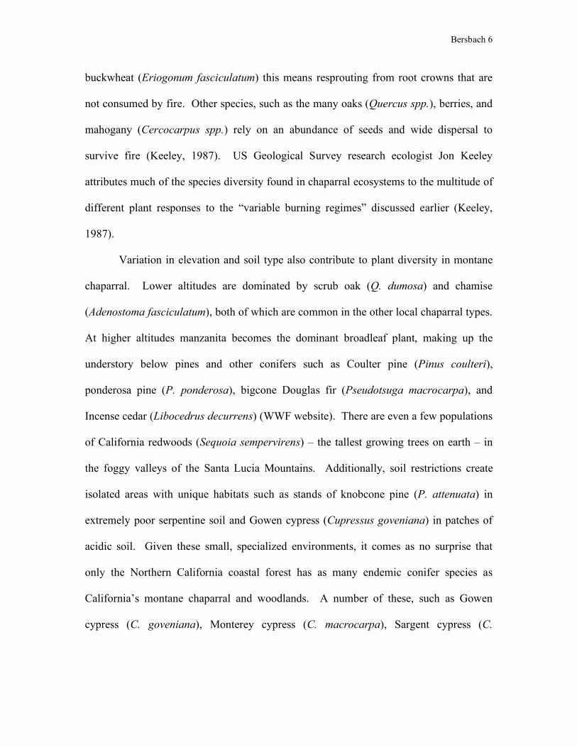
Bersbach 6 buckwheat (Eriogonum fasciculatum) this means resprouting from root crowns that are
not consumed by fire. Other species, such as the many oaks (Quercus spp.), berries, and
mahogany (Cercocarpus spp.) rely on an abundance of seeds and wide dispersal to
survive fire (Keeley, 1987). US Geological Survey research ecologist Jon Keeley
attributes much of the species diversity found in chaparral ecosystems to the multitude of
different plant responses to the “variable burning regimes” discussed earlier (Keeley,
1987).
Variation in elevation and soil type also contribute to plant diversity in montane
chaparral. Lower altitudes are dominated by scrub oak (Q. dumosa) and chamise
(Adenostoma fasciculatum), both of which are common in the other local chaparral types.
At higher altitudes manzanita becomes the dominant broadleaf plant, making up the
understory below pines and other conifers such as Coulter pine (Pinus coulteri),
ponderosa pine (P. ponderosa), bigcone Douglas fir (Pseudotsuga macrocarpa), and
Incense cedar (Libocedrus decurrens) (WWF website). There are even a few populations
of California redwoods (Sequoia sempervirens) – the tallest growing trees on earth – in
the foggy valleys of the Santa Lucia Mountains. Additionally, soil restrictions create
isolated areas with unique habitats such as stands of knobcone pine (P. attenuata) in
extremely poor serpentine soil and Gowen cypress (Cupressus goveniana) in patches of
acidic soil. Given these small, specialized environments, it comes as no surprise that
only the Northern California coastal forest has as many endemic conifer species as
California’s montane chaparral and woodlands. A number of these, such as Gowen
cypress (C. goveniana), Monterey cypress (C. macrocarpa), Sargent cypress (C.

Bersbach 7 sargentii), and Monterey pine (P. radiata), are restricted to as few as two or three stands
(WWF website).
Animal species vary in size from mice and kangaroo rats to small predators, such
as bobcats (Lynx rufus), coyotes (Canis latrans), and pumas (Bassariscus astutus). Some
of the smaller creatures, however, are the most
famous. While few people may have heard of
the California red-legged frog (Ranatra aurora
draytonii) (Figure 3) by either its common or
scientific name, many have read Mark Twain’s
famous short story about it, “The Celebrated
Jumping Frog of Calaveras County” (Faucett,
2002). It is estimated that these frogs were
abundant in California once, but they have been reduced to one quarter of their historical
range (Our Living Resources, p. 132). In June of 2002 over 100 red-legged frogs – the
largest native frogs in California – were discovered living in the Angeles National Forest,
where only a few were thought to still reside (Faucett, 2002). The California red-legged
frog is only one of more than 14 species of amphibians living in the montane chaparral,
five of which are endemic (Status and Trends, p. 622, WWF website).
Perhaps the most famous of all endangered species in the ecoregion, if not in all
of California, is the California condor (Gymnogyps californianus) (Figure 4). The condor
has historically existed in small numbers (possibly fewer than 100 birds). The
Pleistocene extinction of large mammals in California 10,000 years ago left condors with
fewer carcasses off of which to scavenge, reducing their numbers from perhaps
Figure 0 - California red-legged frog (Ranatra aurora draytonii) (Status and Trends, 1998)

Bersbach 8
thousands. Attempts to slow the
decline of condor populations go back
as far as 1937 with the establishment of
the first condor sanctuary in Los Padres
National Forest. Captive breeding has
proven successful to a degree, but birds
released back into the wild have proven
susceptible to electrocution by power lines and lead poisoning from eating the carcasses
of animals killed by hunters using lead bullets (Our Living Resources, p. 80-1).
Threats to Regional Biodiversity
In the previous section I introduced the elements of geological, ecological, and
taxonomic diversity in California’s montane chaparral and woodlands. In this section I
will move on to discuss factors threatening the biodiversity in the area.
David J. Rapport, Professor of Rural Planning and Development at the University
of Guelph in Ontario, organizes external sources of environmental stress into five
categories: The extraction of renewable resources, changes in the way land is used,
human generated pollution, exotic species, and extreme natural events (Rapport, 1985).
Since many environmental stressors constitute threats to biodiversity, this is also an
excellent framework for considering factors that threaten the biodiversity of California’s
montane chaparral and woodlands.
Figure 0 - California condor (Gymnogyps californianus) (Ventana WS website)

Bersbach 9 The Demand Curve – Resource Extraction
Generally, one would expect wood to be the most valuable forest resource in an
area. Fortunately, the montane woodlands of Southern California have just enough pine
and fir to be called woodlands, but not enough to make them an economically viable
source of lumber. In a general technical report published by the Forest Service, John
Stephenson and Gena Calcarone point out that even the relatively small amount of
logging that does take place in San Bernardino and Los Padres National Forests has fallen
off since the 1960’s and 70’s. Between 1980 and 1990, fewer than 5 million board feet
of wood per year were extracted from Los Angeles and San Bernardino counties
combined (Stephenson and Calcarone, 1999, p. 99).
Mining and oil drilling constitute a more serious risk to the area, although these
are still some of the smaller threats to the biodiversity of the montane chaparral and
woodlands. Most of the mining operations
are small enough so as not to cause any
large scale harm, except in cases where
they disturb sensitive habitats. Two
situations in which this is a very real
problem are when mining is on mineral-
rich limestone deposits where rare,
endemic plants grow, and when the mining
being done requires suction dredging (Figure 5). This involves sucking water and
sediment up from stream beds, filtering out the desirable minerals, and discharging the
filtered water and rock back into the stream. The disturbance that this causes can
Figure 0 - A dredge mine filters heavy metals, such as gold, from sediment (Bureau of Land Management in CA website)

Bersbach 10 severely damage aquatic and riparian habitats (Stephenson and Calcarone, 1999, p. 104-
5).
Recently, there has been a strong push to open Los Padres National Forest to oil
and gas drilling. An environmental impact statement has yet to be published on the likely
effects of doing so. The yield of such an operation, as predicted by geologists would be
under one percent of the total oil reserves in the United States. Other environmental
impacts aside, this would probably involve opening up more roadless areas in the
ecoregion. Efforts to extract resources from an area invariably require accessing the area.
The requisite roads contribute to habitat fragmentation, an issue that we will deal with
more heavily in the following section (WWF website; Stephenson and Calcarone, 1999,
p. 36-38).
You Can’t Always Get What You Want – Land Use Change
About 30 percent of the montane chaparral and woodland remains intact. The rest
has been urbanized, intentionally altered for human purposes, or otherwise disturbed (in
which case what grows back is not always what was there in the first place – see section
IV on exotic species for more information). Because most of the ecoregion is
mountainous, it is not as threatened by urbanization as other nearby regions, such as the
flatter coastal sage and interior chaparral. So far higher altitudes remain less developed,
while lower areas, such as valleys between ranges, are becoming significantly urbanized.
This selective development contributes to habitat fragmentation by creating isolated areas
of intact habitat at higher altitudes (WWF website).
Urbanization inevitably leads to higher recreational use of nearby non-urbanized
lands. While recreation does not have to cause ecological damage, it often does,

Bersbach 11 especially when associated with the large human populations supported by areas within
and near the ecoregion (Stephenson and Calcarone, 1999, p. 92-95). One of the most
tangible dangers of recreation in California is the toll that hunting can take on the
endangered California condor. The condor is not hunted, but as a scavenging bird, it is at
risk from consuming lead from bullets in the bodies of deer or coyotes. In high enough
doses, the lead exposure from consuming hunters’ bullets can kill a condor (Knight
Ridder Newspapers, 2002).
Urbanization and
recreation require a network of
roads throughout and between
cities and recreational areas.
On their own, roads contribute
to fragmentation in the area at
least as much as urbanization
(Figure 6). Not only does a
large system of roads isolate
undisturbed areas from one
another, but it also increases
access to once undisturbed areas. This leads to a greater likelihood of disturbance by
humans and increased susceptibility to exotic species that can take advantage of the
habitats on the edges of fragments (WWF website; Wilson and Perlman, 2000).
Certain habitats are at risk of disturbance even without roads. Aquatic and
riparian habitats can be damaged or destroyed for miles in either direction by dams.
Figure 0 - Areas on 1,000 acres or more that are without roads are shaded gray (Stephenson and Calcarone, 1999)

Bersbach 12 Dams, which are usually built to regulate the supply of water for human populations and
to generate power, flood habitats upstream and alter the water flow to habitats
downstream. Often this change means long periods of very low flow followed by
intermittent releases of large quantities of water. This change can make it difficult for
native organisms to live and reproduce in the streams (Stephenson and Calcarone, 1999,
p. 14-16).
Don’t Trust Air You Can’t See – Pollution
Of all the various types of pollution created by humans, none are as destructive to
the montane woodlands as air pollution. Not only is oxidant air pollution worse in the
Southern California mountains than almost anywhere else in North America, but two
species of conifers in these mountains, ponderosa pine (Pinus ponderosa) and Jeffrey
pine (P. jeffreyi), are especially susceptible to damage from the ozone gas that it contains.
These can include injury to the pine’s foliage ranging from relatively minor harm to
abscission (when a plant initiates removal of a particular structure because of disease or
extreme damage), crown thinning, and stunted growth (Planning for Biodiversity:
Abstracts website).
These ozone vulnerable species are eventually replaced by more resistant species,
such as white fir (Abies concolor), incense cedar (Libocedrus decurrens), sugar pine (P.
lambertiana), and California black oak (Fagus kelloggii). This change in forest
composition puts much more of the forest at risk, as these ozone tolerant species
generally have lower branches and thinner bark making them much more vulnerable to
fire damage (Miller, 1996).

Bersbach 13 Foreign Exchange – Exotic Species
Exotic species of plants, animals, and pathogens in Southern California number in
the thousands, but thankfully those that are harmful are far less numerous. Non-native
plant species are the most abundant of the three types of exotics in the montane chaparral
and woodlands, and most of the most invasive of these are grasses. Many of them do not
compete with local species in native habitats, but instead tend to overtake disturbed sites.
A few species, however, compete directly with native species. Those specifically
invading the montane regions include French broom (Genista monspessulana), which is
toxic to humans and livestock, spotted knapweed (Centaurea maculosa), a strong
competitor for already scarce moisture and minerals, three species of oats, and cheatgrass
(Bromus tectorium), which increases fire frequencies (Stephenson and Calcarone, 1999,
p. 78-82).
Many non-native animals in the region stream or shore dwelling, and thrive in
already modified aquatic and riparian habitats. In many cases, this makes it difficult to
discern whether the threat to native organisms is the habitat modification or the
introduced species. Evidence of some native species thriving in altered habitats suggests
that the exotic organisms are an independent threat. Of these, the most salient threat is
probably the bullfrog (Rana catesbeiana). Brought west by humans because of its large
size – which means larger frog legs on the dinner table – the bullfrog preys on smaller
reptiles and amphibians such as the endangered California red-legged frog to satisfy its
proportionately larger hunger (Science Now bullfrog website, Stephenson and Calcarone,
1999, p. 82-88).

Bersbach 14
Figure 1 - Resin seems from a pine infected with pine pitch canker (UC Center for Forestry Pitch Canker website)
In terms of sheer killing power, the greatest threat probably comes from exotic
pathogens. Two recently discovered diseases endanger the lives of several native tree
species. The lesser threat comes from pine pitch canker fungus (Fusarium circinatum),
which is spread by native bark and twig beetles. Infected trees lose branches to the
disease, and eventually develop a large canker from which resin flows (Figure 7). The
fungus may kill up to a fourth of Monterey pines (P. radiata) in infested stands, and
could affect populations of Bishop pine (P. muricata), Coulter pine (P. couteri),
knobcone pine, ponderosa pine (P. ponderosa), gray pine (P. sabiniana), Torrey pine (P.
torreyana), and even Douglas fir (Pseudotsuga menziesii) (California Forest Health
website, UC Center for Forestry website; Stephenson and Calcarone, 1999, p. 78).
The greater threat is from another more recently
discovered sudden oak death fungus (Phytophthora
ramorum) (Figure 8). The name turns out to be a
misnomer both because the fungus has been associated so
far with 26 different plant species in 15 different families
(and only five of which are in the oak family) and
because it takes up to ten years to kill a tree. The name
developed from the fact that most of the species for
which the fungus is fatal are oaks. Unfortunately, many
of the associated species for which the disease is not fatal
help to spread the fungus. California bay laurel (Umbellularia californica) and members
of the Rhododendron family (Rhododendron spp.) act as a reservoir for the disease,
developing infections on their leaves that spread spores in the rain (California Oak

Bersbach 15 Mortality Task Force website). The fungus was only discovered in the 1990’s, making it
difficult to gather precise information as to how many trees have fallen to the disease so
far, but the numbers are thought to be in the thousands, with many more trees infected
(Bernman, 2002; Fields, 2002).
The Eternal Flame – Extreme Natural Events
Regular fires have been one of the most powerful forces shaping the ecosystems
of the montane chaparral in Southern California. Fires are also a danger to human
settlements though, and this has
contributed to the popular view that fire
has only the power to destroy. For about a
century this view was the driving force in
a remarkably successful campaign to
suppress fires. In recent decades fire
suppression efforts have been less
effective, and individual fires have
become more and more ravenous as
measured by the acreage that they
consume (Status and Trends, p. 45). Additionally, we have relented somewhat in our
effort to suppress all fires. Humans are beginning to learn that fire is not just a destroyer,
but a regenerator. Fire turns overabundant biomass into new soil nutrients. In the end,
fires actually increase ecosystem fertility and biodiversity (Our Living Resources, p. 222-
3). When fire is suppressed, the small plants and undergrowth that it usually clears out
continue to build up, severely increasing the risk of major wildfires – fires that burn
Figure 1 - A young oak killed by the Sudden Oak Death fungus (Nature Conservancy Wildland Invasive Species Team website)

Bersbach 16 larger and hotter than the standard fire regimen, consuming even very large trees and
actually damaging soil fertility. During the long time that plants require to regrow in this
damaged soil, the land easily erodes, damaging lower elevation riparian habitats (Los
Padres NF Fire Management website). As mentioned earlier, air pollution can further
increase the risk of high fire damage, and the pines that are more ozone tolerant tend to
have thin bark and low branches that make them ideal fuel for wildfires.
While we have an understanding of the negative effects of many of the threats
discussed so far, the consequences of the last threat that we will discuss, global climate
change (often referred to as global warming) are mostly guesswork thus far. Some of the
evidence that is used to make projections for the future is historical – throughout the
West, including California, average temperature has risen between 2 and 5˚F, and rainfall
has increased up to 50% through the 20th century. The two major projections for climate
change in the next century, the Hadley and Canadian models, are based on computer
representations of ecological, hydrological, and socioeconomic systems. Both of the two
major predictive models for climate change project a further increase in temperature
during the 21st century, from 10˚F as to as high as 15˚F. The two models also predict an
additional 50-100% increase in rainfall in the montane chaparral and woodlands of
California (Figure 9) (Climate Change Impacts website).
We can hardly say for certain what the actual effects of these changes will be, but
the Hadley and Canadian models project that the chaparral and woodland that now make
up most of the ecoregion could begin to convert to coniferous forest and thicker
woodland (Climate Change Impacts website). What this will mean for the biodiversity of
the area is hardly within our capacity to tell, but some inferences can be made. The

Bersbach 17 diversity of the region, in combination with fragmentation, could hamper species’
attempts to migrate in order to adapt to climate change. Invasive species that exploit
disturbed ecosystems might find that climate change enables them to more easily
outcompete native species. Finally, it is possible that even if climate change does alter
the amount of total rainfall, it may not affect yearly precipitation patters (wet winters
followed by dry summers). If this occurs, hotter temperatures could increase natural fire
frequency especially if total yearly precipitation increases. Such an increase would likely
spur growth of understory plants that serve as fuel for fires in the dry summers (Climate
Change Impacts website).
Figure 1 - Two major models for Global Climate Change, the Canadian and the Hadley, offer projections for temperature and rainfall in the western United States during the 20th and 21st centuries (Climate Change Impacts website)

Bersbach 18
What is Being Done to Protect Regional Biodiversity?
So far I have discussed the geological, ecological, and taxonomic diversity in
California’s montane chaparral and woodlands and current threats to this diversity. In the
following section I will consider current efforts to protect the area, and in addition I will
propose further measures that may help safeguard the future of the ecoregion.
This Land is My Land; This Land is Your Land - Managed Areas
The managed areas in the montane chaparral and woodlands discussed herein will
be some of the largest in the ecoregion. This approach is not to be considered a judgment
against the value of smaller managed areas and reserves, but rather is being used because
larger areas give us a better idea of what large-scale efforts are being made to protect
biodiversity throughout the ecoregion.
The managed areas covering the largest expanse of the ecoregion are national
forests (Figure 10).
There are three national
forests that include land
in the montane
chaparral: Los Padres
(708,225 hectares),
Angeles (over 260,000
hectares), and San
Bernardino (over
280,000 hectares) (US
Forest Service website). Figure 1 – National parks in California montane chaparral and woodlands. The ecoregion is outlined in red (TNC Internet Map Server and US Forest Service website)

Bersbach 19 Since national forests, unlike national parks, are open to limited resource extraction, this
does not necessarily mean that any organisms and ecosystems in the forest are protected.
Logging, mining, damming, road construction, and other resource extraction operation
and land use changes are regulated by the National Forest Service, which is run by the
Department of Agriculture. Ongoing debate exists between the Forest Service and
ecologists (as well as within the Forest Service itself) as to exactly what level of
development is acceptable in national forests. While logging and mining both occur in
these national forests, neither constitutes a current major threat to biodiversity in the
region (Stephenson and Calcarone, 1999, p. 99, 104-105). Recently, the larger debate has
been over whether or not oil drilling in the national forests is acceptable. The proposal is
still pending further study by the forest service, but is being fiercely debated at both the
political and local levels (Gable, 2003). Thus the situation with California’s National
Forests seems to be that their biodiversity is relatively safe at present, but its future safety
is not necessarily guaranteed.
In addition to national forests, there are several areas in the ecoregion that are
denoted as wilderness areas under the control of the United States Forest Service (Figure
11). The largest of these are Ventana (96,840 hectares), Sespe (88,913 hectares), San
Rafael (79,880 hectares), and Dick Smith (27,115 hectares) (National Wilderness
Preservation System website). The Forest Service policy on wilderness areas states that
the land is not to be developed or otherwise allowed to be disturbed by human influence.
Wilderness land is used only for “primitive recreation” (operationalized as recreation that
does not have an adverse impact on the wilderness area) and scientific study (US Forest
Service Wilderness Policy website).

Bersbach 20 Other managed
areas in the ecoregion
are relatively small in
comparison to the
National Forests and
wilderness areas. These
smaller areas include
military reservations,
Indian reservations and
state parks (Nature
Conservancy Internet
Map Server website).
The only of these that claims a dedication to preserving native biodiversity is the
California state park system. The mission of the California Department of Parks and
Recreation, which manages the state parks, is to protect biodiversity and cultural and
natural resources for the benefit of the people of California. This means protecting the
ecological health of intact parks, and restoring areas of parks that were already in poor
ecological health when they were designated (California State Parks website)
Thank You Sir, May I Have Another? - What Else Is Being Done?
There are certain potential threats that are most easily regulated on managed land,
such as resource extraction and land use change. While these can certainly be threats on
land that is not managed, they are become far easier to control on a piece of land that is
being managed with a particular ecological goal in mind. Often the purpose of denoting a
Figure 1 - Wilderness areas in California montane chaparral and woodlands. The ecoregion is outlined in red (TNC Internet Map Server and US Forest Service website)

Bersbach 21 managed area is to limit the amount of resource extraction, or to prevent that parcel of
land from being developed or otherwise altered. Other issues, however, have to be dealt
with wherever they occur, regardless of whether this is in a state park, undeveloped
private land, or a suburban yard. These include pollution damage, fire, and to a lesser
extent, the spread of exotic species, especially pathogens. We are now going to consider
some of these issues, while still basing most of our information on how they are being
dealt with in managed areas in the ecoregion (this method is utilized primarily because of
the difficulty in obtaining data on the private sector).
The fire regime of Southern California was disrupted because we thought that fire
could only be destructive – a force that was harmful not only to people and their homes,
but to the natural environment as well. As we have discussed in the previous papers,
recurring small fires are actually an essential part of the chaparral ecosystem. The fire
prevention campaign of the last century or so has led to the buildup of small understory
plants which increase the risk of very large and destructive fires (Status and Trends, p.
47). Recently, this new knowledge has changed the way that we think about managing
fires. Often this still means rushing to put out fires set by humans, and even those caused
by ‘natural’ sources, such as lightning. The major change has been in the development of
what are called “fuel management programs” usually involving a combination of
proscribed burns and construction of fuel breaks, or areas across which fire will not burn
because of a lack of fuel (Los Padres NF Fire website). These methods are necessary in
much of the ecoregion because of the proximity of human development to areas prone to
fire.

Bersbach 22 In terms of pollution caused by humans, the most hazardous type by far in the
montane chaparral and woodlands is air pollution. It is clear that the ozone present in
oxidant air pollution seriously damages ponderosa and Jeffrey pine (Pinus ponderosa and
P. jeffreyi respectively) (Planning for Biodiversity: Abstracts website). The extent of
damage is still being assessed, and further data are needed by environmental protection
agencies in order to make any changes in current ambient air quality standards (Miller,
1996).
Exotic invasive species vary both in the danger that they present to native
biodiversity and in the way that they are viewed by different types of landowners or
stewards. A government agency that is managing an area might see a particular invasive
as very dangerous, but a private landowner may not even be aware that the species is
non-native, let alone that it might outcompete native species. Many of the invasive plants
in the montane chaparral are grasses that can quickly dominate a large area. The thick
growth of these grasses uses up resources that could otherwise be used by native species
and provides a plentiful and
fast-growing fuel for fires
(Stephenson and Calcarone,
1999, p. 78-82). Research is
progressing on plants that
might be able to compete with
these invasives, but in many
cases, these too are non-native
species. Introduction of other Figure 1 - Bullfrogs are a threat near the central California coast, as they predate on smaller, native amphibians (Northern Prairie Wildlife Research Center website)

Bersbach 23 non-natives will, at best, merely increase exotic biodiversity, leaving native species no
better off (TNC Wildland Invasive Species Team website – Spotted Knapweed).
In terms of invasive animal species, the threat is even less likely to be seen by
landowners who don’t have a vested interest in the protection of biodiversity. The most
threatening invasive animal in the area is the Bullfrog (Rana catesbeiana) (Figure 12),
which is only a threat to the native (and often very rare) frog species. Control has been
attempted by introducing fish that might prey on the bullfrog, but with little success.
Again, there is no guarantee that the species being introduced to control the Bullfrog will
themselves native to the area.
The most serious threat from any invasive species in the ecoregion is from exotic
pathogens. As mentioned
previously, pine pitch
canker (Fusarium
circinatum) (Figure 13)
and sudden oak death
(Phytophthora ramorum)
are fungi that each have
the potential to kill
members of several
different tree species.
Because both of these
pathogens were discovered relatively recently, most of the work being done right now is
research to determine how they can best be dealt with. Short of this, land managers are
Figure 1 - Distribution of Pine Pitch Canker in and around California montane chaparral and woodlands (Pitch Canker Task Force website)

Bersbach 24 able to remove diseased trees, but this may not always be early enough to halt the spread
of the pathogens (Pitch Canker Task Force website). In the case of sudden oak death, the
threat is considered so great that a ruling was made restricting movement of hosts and
possible carriers of P. ramorum (California Oak Mortality Task Force website). No such
legislation has been passed regarding pine pitch canker.
What More Can Be Done?
Keep off the Grass! – Change in Managed Areas
As discussed earlier, most of the managed land in the ecoregion is under the
control of the US Forest Service. While some of this land is designated wilderness, much
of it is national forest, which is open to limited logging, mining, and possibly oil drilling
in the near future. Because of the relatively low resource availability in the area, I
recommend re-designation of sections of the current national forest as wilderness (not
necessarily increasing the total managed area, simply changing what practices are
acceptable on already managed land). This would further limit the threats presented by
mining operations – especially dredge mining – to local endemic species and riparian
ecosystems. Should this occur, the loss of the land for economic use will not be
excessive, given the limited nature of the resource extraction that currently occurs in the
area. On the other hand, significant portions of the national forest must remain open to
resource extraction to avoid the backlash of private industry and local loggers, miners,
and other individuals who make their living off of resource extraction.
In addition to the current managed areas, some new wilderness and national and
state parks might be designated. The advantage of increasing wilderness would be that

Bersbach 25 new areas could be connected to established areas, effectively creating corridors that
would allow for unhindered movement of animals across areas of differing altitudes,
climates, and ecosystems. Such corridors, if they are oriented to allow north-south
migration, could prove essential for the survival of some species should the climate of the
area drastically change over time. While a state or national park could accomplish the
same goals, they may not prove as easily managed in combination with wilderness land,
since each type of managed area is under the control of a different state or federal
government agency. On the other hand, having areas managed by a variety of
government agencies could prove an advantage since agencies often have different ideas
of how the land ought to be managed. While the Forest Service manages land for current
and future resource use, the goal of the National Park Service, under the Dept. of the
Interior, is simply to preserve “unimpaired” wilderness for “the enjoyment of future
generations” (National Park Service Mission website). To this end national parks are
open to the public, but not for the purpose of resource extraction.
Denoting additional managed areas of any type would have the added benefit of
increasing the area in which the presence of invasive plants and animals can be most
easily monitored and managed. Additionally, depending on shape and size of the new
areas, it could make human access more difficult (by virtue of distance from access
points) and thus less prone to disturbance. Any disturbance, such as fragmentation by
hiking trails, can create niches that are easily invaded by exotic species (Stephenson and
Calcarone, 1999, p. 78-82, 82-88). Optimally, the new land chosen for parks and
wilderness areas would be large areas that are not already extensively fragmented from
previous resource extraction or recreation. Not only will this make human access more

Bersbach 26 difficult, but it will allow humans to let fires to burn naturally without endangering
human habitations, popular recreation areas, or other assets in or near national forests and
wilderness areas.
Put Another Shrimp on the Barbie – Fire Policy
The rhetoric used during the last century to justify fire suppression still affects
popular views on how fire should be managed. The Los Padres National Forest website
still maintains that their values with respect to fire management are “fire prevention,
suppression and a program of fuels management” (Los Padres NF Fire website). The
difficulty in allowing fire to burn is risk to human interests. At the same time, in order to
protect developed areas, humans have a vested interest in keeping fuel buildup low to
prevent the very large wildfires that are more difficult to control.
Wide expanses of undeveloped area will aid efforts to return as much land as
possible to a natural fire regime. Fire that is not close to any developed areas can be
managed as needed (but not necessarily suppressed). Proscribed burning can be utilized
closer to human interests where the danger of significant economic damage because of
fire is great. In order to ensure public support for such a plan, park goers and local
residents must be educated as to the necessity of fire for the functioning of local
ecosystems so that they understand that fire is a force to be respected, not feared.
It’s Getting Hot in Here – Response to Global Climate Change
In addition to creating and maintaining north-south migration corridors to help
species survive in the event of continued global climate change, we need to make sure
that we protect against the added risk of invasive species and increased frequency of
wildfire that climate change could cause. As discussed, anything that disturbs the normal

Bersbach 27 functioning of an ecosystem increases the risk of the invasion of that ecosystem by exotic
species. Climate change could disturb the ecology of the entire region (obviously global
climate change will very likely disturb the greater part of the worlds ecosystems, but the
scope of this paper remains limited to the ecoregion). The only options for lowering this
risk seem to be increased efforts to remove current invasives and control the influx of
additional exotic species (especially those that thrive in warmer, wetter environments),
and further controls on CO2 emissions and other factors that exacerbate climate change.
Such controls might appear in the form of tradable pollution permits for CO2 emissions.
The rise in average temperature that is predicted to result from global climate
change may increase the natural fire frequency in the area. For almost two hundred years
humans have attempted to suppress all fire in the area, leaving us with little historical
knowledge of what natural fire patterns looks like, and a change to that pattern caused by
climate change will make it even more difficult for us to determine the natural frequency
of fire. Our imperfect knowledge obviously limits us, but we still must make every
attempt, following the plan laid out in the previous subsection, to ensure that
undeveloped areas of the ecoregion are burned regularly, both to prevent excessive
buildup of undergrowth and to preserve the species that rely on fire for their very
survival. With respect to the former concern, regular proscribed burning on all land close
to human developments is essential.
Pulling an All-Nighter – Further Research
Other dangers to biodiversity in the area, such as oxidant air pollution and the
Pine Pitch Canker and Sudden Oak Death pathogens, are so new that it is difficult to
propose an obvious management scheme. Government funds need to be made available

Bersbach 28 to finance further research into the dangers air pollution poses to ponderosa and Jeffrey
pine. It has been noted that damage to them may lead to the succession of species that
pose a high fire risk (Miller, 1996). If this is the case, the economic damage done by
increasing pollution restrictions may turn out to be far less than the fire danger created
indirectly by the air pollution coming from nearby Los Angeles and other cities.
Research is also necessary to determine how we can deal with the relatively new
invasive pathogens pine pitch canker and sudden oak death. For now, the best we can do
is to restrict the spread of these diseases. The most obvious ways to accomplish this are
the removing infected plants and restricting the transport of possible carrier species. A
more long-term solution is to plant and cultivate the seeds individuals among the
vulnerable species that exhibit any resistance to either of these pathogens (Pitch Canker
Task Force website).
The Final Exam – Looking Toward the Future
While the damage already done to the montane chaparral and woodlands may
seem irreparable, and the additional threats to the future discouraging, we must remember
that the ecoregion is still home to greater biodiversity than can be found even in many
more intact areas. Highways slice across the land, but roadless holdouts still remain.
Fires are often prevented form taking part in the ecology of the area, but it will still burn
if we let it. Condors number only in the hundreds, but they still soar over the Santa Lucia
Mountains. That so much of California’s diversity still remains should fill us with hope,
and that it is still under serious threat must be our call to arms.

References
Animal Diversity Web - Bullfrog. http://animaldiversity.ummz.umich.edu/accounts/rana/r._catesbeiana. Accessed April 2, 2003 Bernman, D. 2002, September 12. Sudden Oak Death Found in Calif. Redwoods, Douglas Firs. Land Letter, Forests. Bureau of Land Management in California website. http://www.ca.blm.gov/news/reports_docs/annualreport_2000/minerals.html. Accessed March 13, 2003. California Forest Health in 1994 and 1995. http://www.r5.fs.fed.us/fpm/fh_94-95/. Accessed March 13, 2003. California’s Natural Resources: California’s Native People website. http://ceres.ca.gov/ceres/calweb/native.html. Accessed April 23, 2003. California Oak Mortality Task Force. http://www.suddenoakdeath.org/. Accessed March 12, 2003. California Secretary of State Kevin Shelly. http://www.ss.ca.gov/museum/landscape.htm. Accessed February 11, 2003. California State Parks website. http://cal-parks.ca.gov/. Accessed April 24, 2003. Climate Change Impacts on the United States – Overview: West. http://usgcrp.gov/usgcrp/Library/nationalassessment/overviewwest.htm. Accessed March 13, 2003. Debano, L. F., and C. E. Conrad. 1987. The Effect of Fire on Nutrients in a Chaparral System. Ecology, 59, 489-497. Faucett, R. 2002, August 27. Los Angeles Creek is Hopping with Frogs. Los Angeles Times, California Metro. Fields, H. 2002, October 21. Sudden Oak Death a Silent Killer Amongst the Trees in Monterey County, Calif. Monterey County Herald. Gable, E. 2003, January 9. Fight Over Oil Drilling in Los Padres Heats Up. Land Letter, National Forests. Hanes, T. L. 1971. Succession of Fire in the Chaparral of Southern California. Ecological Monographs, 41, 27-52.

Keeley, J. E. 1987. Role of Fire in Seed Germination of Woody Taxa in California Chaparral. Ecology, 68, 434-443. Knight Ridder Newspapers. November 15, 2002. Lead Takes Deadly Toll on Struggling Species. The Seattle Times. LaRoe, E. T., G. S. Farris, C. D. Puckett, P. D. Doran, and M. J. Mac. 1995. Our Living Resources: A report to the nation on the distribution, abundance, and health of U.S. plants, animals, and ecosystems. U.S. Dept. of the Interior, National Biological Service, Washington D.C. Los Padres National Forest Fire & Aviation website. http://www.fs.fed.us/r5/lospadres/fire/index.html. Accessed April 1, 2003. Los Padres National Forest Fire Management website. http://www.r5.fs.fed.us/lospadres/firesite/ecology.html. Accessed March 14, 2003. Los Padres National Forest Geology. http://www.r5.fs.fed.us/lospadres/ecosystem/geology/index.html Image: http://www.r5.fs.fed.us/lospadres/about_us/photo_gallery/forest_wide/ geology/rock_outcrop.html. Accessed February 11, 2003. Mac, M.J., P. A. Opler, C. E. Puckett Haecker, and P. D. Doran. 1998. Status and Trends of the Nation’s Biological Resources. 2 vols. U.S. Dept. of the Interior, U.S. Geological Survey, Reston, VA. Miller, P. R. 1996. Evaluating Ozone Air Pollution Effects on Pines in the Western United States. General Technical Report. Pacific Southwest Research Station, USDA Forest Service, Albany, CA. http://www.psw.fs.fed.us/Tech_Pub/Documents/gtr-155/index.html. Accessed April 2, 2003. National Park Service Mission website. http://www.nps.gov/legacy/mission.html. Accessed April 26, 2003. National Weather Service, San Diego. http://nimbo.wrh.noaa.gov/Sandiego/snawind.html. Accessed February 11, 2003. National Wilderness Preservation System website. http://www.wilderness.net/nwps/maps/ca_map.cfm. Accessed April 1, 2003. Nature Conservancy Internet Map Server. http://tncgis.env.duke.edu/data/IMS/TNChtml/. Accessed April 1, 2003. Nature Conservancy Wildland Invasive Species Team website. http://tncweeds.ucdavis.edu/photosmore.html. Accessed March 13, 2003.

Nature Conservancy Wildland Invasive Species Team website – Spotted Knapweed. http://tncweeds.ucdavis.edu/esadocs/centmacu.html. Accessed April 2, 2003 Northern Prarie Wildlife Research Center website – Bullfrog. http://www.npwrc.usgs.gov/narcam/idguide/bullfrog.htm. Accessed April 2, 2003. Pitch Canker Task Force Prevention & Management website. http://frap.cdf.ca.gov/pitch_canker/prevention_management/treenotes.html. Accessed April 2, 2003 Planning for Biodiversity: Bringing research and management together – Abstracts. http://www.werc.usgs.gov/socal/abstra.html. Accessed March 13, 2003. Presidio of San Francisco: Native History website. http://www.nps.gov/prsf/history/ohlone.htm. Accessed April 23, 2003. Rapport, D. J., H. A. Regier, and T. C. Hutchinson. 1985. Ecosystem Behavior Under Stress. The American Naturalist, 125, 617-640. Science Now: The Bully Frog website. http://www.calacademy.org/science_now/archive/wild_lives/bullfrog_tadpole.html. Accessed April 20, 2003. Stephenson, J. R., G. M. Calcarone. 1999. Southern California Mountains and Foothills Assessment: Habitat and species conservation issues. Pacific Southwest Research Station, USDA Forest Service, Albany, CA. http://www.psw.fs.fed.us/Tech_Pub/Documents/gtr-172/gtr-172-index.html. Accessed March 13, 2003 United States Forest Service website. http://www.fs.fed.us/. Accessed April 1, 2003. United States Forest Service Wilderness Policy website. http://www.wilderness.net/nwps/policy/fs_manual_policy.cfm University of California Center for Forestry: FAQ about pitch canker website. http://www.cnr.berkeley.edu/forestry/curr_proj/pitch/faqpitch.html. Accessed March 13, 2003. University of Texas. http://www.lib.utexas.edu/maps/. Accessed February 10, 2003. Ventana Wilderness Society. http://www.ventanaws.org/condors.htm. Accessed February 11, 2003 Wilson, E. O. and D. L. Perlman. 2000. Conserving Earth’s Biodiversity. Island Press, Washington D.C.

World Wildlife Fund website. http://www.worldwildlife.org/wildworld/profiles/terrestrial_na.html#mediter. Accessed February 10, 2003.