images module - bricsys
TRANSCRIPT

www.aplitop.com
TcpMDT Images V8 © Aplitop 1
TcpMDT
Digital Terrain Model – V8
Images
Images Module
This module is designed for needs of projects involving Topography, Civil Engineering, Architecture, Archaeology etc. in which it is frequent to work with different types of images in combination with vector drawings. MDT incorporates the majority of the TcpImage functions.
Orthophotos
MDT Images automatically inserts in their real position on the drawing a series of orthophotos in the most usual formats (see requirements).
Aerial Photos and Scanned Maps
There are several options for georeferencing images, assigning them real terrain coordinates.
The simplest is to draw reference lines connecting known points on the image to points on the drawing. For more complex cases marks can be inserted with a name and subsequently link them to topographic points.
TcpMDT Images V8 © Aplitop 2
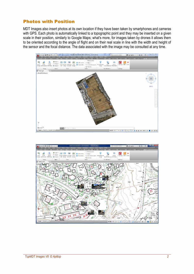
Photos with Position
MDT Images also insert photos at its own location if they have been taken by smartphones and cameras with GPS. Each photo is automatically linked to a topographic point and they may be inserted on a given scale in their position, similarly to Google Maps; what's more, for images taken by drones it allows them to be oriented according to the angle of flight and on their real scale in line with the width and height of the sensor and the focal distance. The data associated with the image may be consulted at any time.

TcpMDT Images V8 © Aplitop 3
Web Map Services
It is possible to capture and insert in their real position on the drawing the compatible WMS (Web Map Services) and WMTS (Web Map Tile Services) provided by any supplier (i.e. regional mapping institutes, cadaster and other public and private entities).
Operations with Images
Without leaving CAD it is possible to carry out on the images inserted in the drawing all kinds of basic transformations such as rotating, flipping, adjusting brightness, contrast, intensity, saturation, color balancing etc. The resolution, size and depth in color may also be changed. Other useful tools are: delimiting image as from a polyline, dividing an image into several images based on a sheet diagram and pasting images.

TcpMDT Images V8 © Aplitop 4
Images Deformation
By means of the use of reference lines or marks an image may be deformed by two methods: projective transformation or Rubber-Sheeting. The projective transformation will adjust four points at the most irrespective of the number of points used for calculation. The Rubber-Sheeting technique consists of a bilinear transformation of each of the cells of the grid generated from the pairs of points and whereby an adjustment will be obtained to all the points involved in the calculation.
The diagram shows an example of transformation which an image would suffer according to the Rubber-Sheeting technique:
The images obtained will be created, applying the nearest neighbor method, bilinear or bicubic interpolation or the Lagrange method. The calculation shows the mean squared error data, residues etc.
TcpMDT Images V8 © Aplitop 5
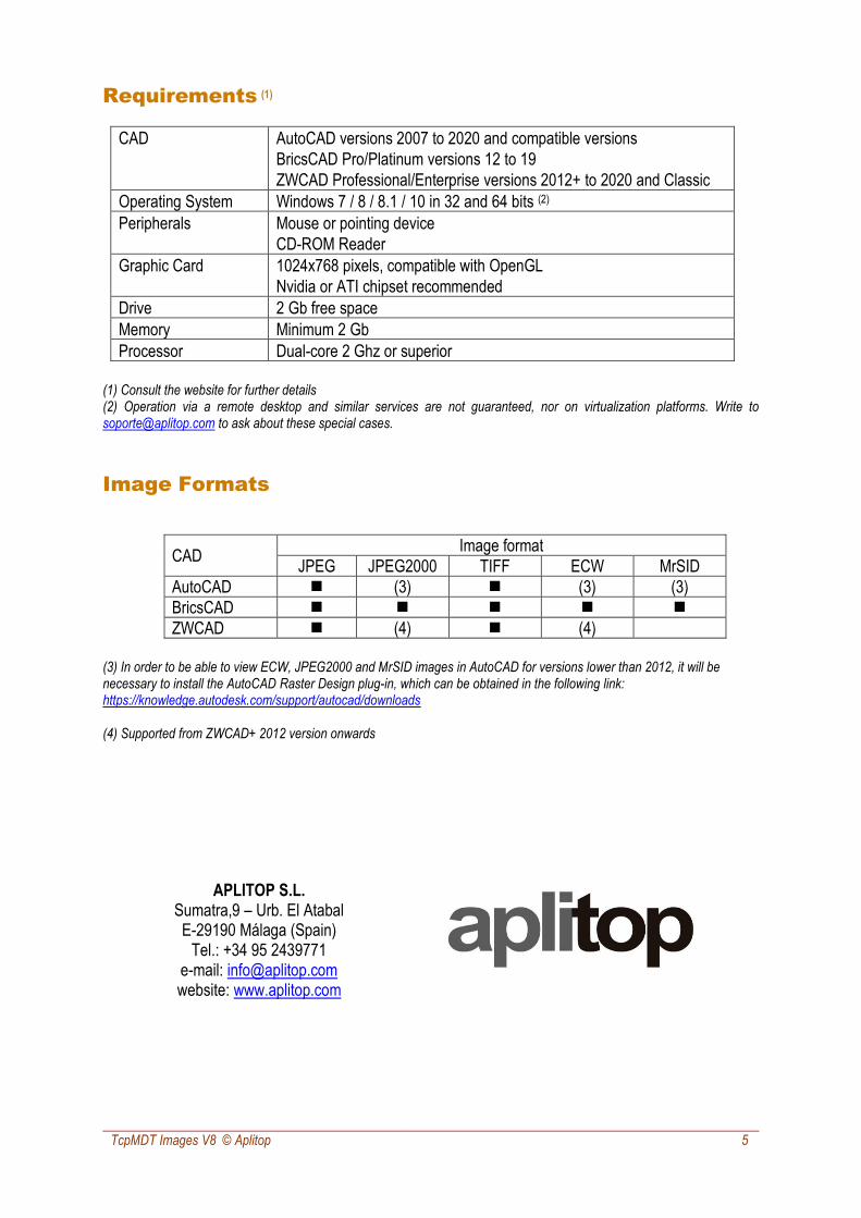
Requirements (1)
CAD AutoCAD versions 2007 to 2020 and compatible versions
BricsCAD Pro/Platinum versions 12 to 19
ZWCAD Professional/Enterprise versions 2012+ to 2020 and Classic
Operating System Windows 7 / 8 / 8.1 / 10 in 32 and 64 bits (2)
Peripherals Mouse or pointing device
CD-ROM Reader
Graphic Card 1024x768 pixels, compatible with OpenGL
Nvidia or ATI chipset recommended
Drive 2 Gb free space
Memory Minimum 2 Gb
Processor Dual-core 2 Ghz or superior
(1) Consult the website for further details (2) Operation via a remote desktop and similar services are not guaranteed, nor on virtualization platforms. Write to [email protected] to ask about these special cases.
Image Formats
CAD Image format
JPEG JPEG2000 TIFF ECW MrSID
AutoCAD ◼ (3) ◼ (3) (3)
BricsCAD ◼ ◼ ◼ ◼ ◼
ZWCAD ◼ (4) ◼ (4)
(3) In order to be able to view ECW, JPEG2000 and MrSID images in AutoCAD for versions lower than 2012, it will be necessary to install the AutoCAD Raster Design plug-in, which can be obtained in the following link: https://knowledge.autodesk.com/support/autocad/downloads (4) Supported from ZWCAD+ 2012 version onwards
APLITOP S.L.
Sumatra,9 – Urb. El Atabal E-29190 Málaga (Spain)
Tel.: +34 95 2439771 e-mail: [email protected] website: www.aplitop.com