imagine louisville · imagine being able to take your child to school, travel to and from work, and...
TRANSCRIPT
IMAGINE LOUISVILLE“BEYOND TRAFFIC: THE SMART CITY CHALLENGE”
Application for Participation in

TABLE OF CONTENTS
Section 1: Imagine Louisville -- The Louisville Smart City Vision
Section 2: Population Characteristics of our City
Section 3: Other Characteristics of Our City
Section 4: Map
Section 5: Vision Elements
Section 6: Risk Mitigation
Section 7: Partnerships
Section 8: Infrastructure and System Features
Section 9: Data Currently Collected
Section 10: Standards and Architecture
Section 11: Goals, Objectives, and Performance Measures
Section 12: Our Commitment and Previous Experience
Section 13: Leveraging Federal Funding
Imagine Louisville Application for Participation in “Beyond Traffic: The Smart City Challenge”
01
06
07
09
10
16
19
22
24
27
28
29
30
Imagine being able to take your child to school, travel to and from work, and do
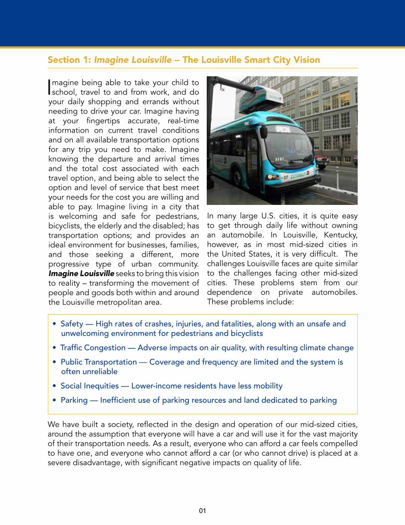
your daily shopping and errands without needing to drive your car. Imagine having at your fingertips accurate, real-time information on current travel conditions and on all available transportation options for any trip you need to make. Imagine knowing the departure and arrival times and the total cost associated with each travel option, and being able to select the option and level of service that best meet your needs for the cost you are willing and able to pay. Imagine living in a city that is welcoming and safe for pedestrians, bicyclists, the elderly and the disabled; has transportation options; and provides an ideal environment for businesses, families, and those seeking a different, more progressive type of urban community. Imagine Louisville seeks to bring this vision to reality – transforming the movement of people and goods both within and around the Louisville metropolitan area.
In many large U.S. cities, it is quite easy to get through daily life without owning an automobile. In Louisville, Kentucky, however, as in most mid-sized cities in the United States, it is very difficult. The challenges Louisville faces are quite similar to the challenges facing other mid-sized cities. These problems stem from our dependence on private automobiles. These problems include:
01
Section 1: Imagine Louisville -- The Louisville Smart City Vision
Section 1: Imagine Louisville -- The Louisville Smart City Vision
• Safety — High rates of crashes, injuries, and fatalities, along with an unsafe and unwelcoming environment for pedestrians and bicyclists • Traffic Congestion — Adverse impacts on air quality, with resulting climate change• Public Transportation — Coverage and frequency are limited and the system is often unreliable• Social Inequities — Lower-income residents have less mobility • Parking — Inefficient use of parking resources and land dedicated to parking
We have built a society, reflected in the design and operation of our mid-sized cities, around the assumption that everyone will have a car and will use it for the vast majority of their transportation needs. As a result, everyone who can afford a car feels compelled to have one, and everyone who cannot afford a car (or who cannot drive) is placed at a severe disadvantage, with significant negative impacts on quality of life.

02
The Imagine Louisville initiative will transform the Louisville metropolitan area’s transportation system and improve the quality of life for all residents. The projects envisioned as part of Imagine Louisville will expand the availability of safe, dependable, efficient, and affordable transportation options. In doing so, residents will enjoy greater mobility while the overall number of vehicle miles traveled (VMT) in and around the city will fall.
In 2013, Louisville received a federal grant to develop a strategic multimodal transportation plan, which became known as Move Louisville. The plan will be finished in early 2016. One of the primary goals of Move Louisville is to reduce VMT. There are multiple benefits associated with achieving this goal, including improved safety, enhanced mobility options, reduced environmental impact, enhanced social/economic equity, and improved community livability. In the short-term, cars will remain the dominant mode of transport, but there are opportunities now to be more efficient with our car travel and to accelerate the transition to alternative modes. This shift in how we move about our city can have broad impacts on our health, air quality, built environment, and connectivity. Imagine Louisville seeks to provide our residents and visitors with mobility choices which are currently lacking, not only in Louisville, but in most mid-sized American cities.
Why Louisville: The challenges facing Louisville are not unique. In fact, they are quite common to mid-sized cities across our nation. We have aging transportation infrastructure that we struggle to maintain. Each year, traffic congestion worsens. Although expanding roadway capacity is an option, this is an unsustainable, fiscally irresponsible solution. Many residents have expressed a desire for additional
modal options that respond to the needs of motorists, bicyclists, and pedestrians. Louisville’s mobility challenges will not be eliminated with a single solution, so Imagine Louisville will implement a range of new infrastructure and planning projects to improve transportation accessibility. Imagine Louisville is not just a short-term initiative; it is a commitment to move our city into the 21st century by creating an enduring and resilient transportation network.
Pursuing the Vision: Components of Imagine Louisville Over the past three years, the Louisville Metro Government (LMG) has asked citizens for input on improving the city’s built environment through Vision Louisville and Move Louisville, two of the city’s major planning initiatives. These initiatives embrace the ideas of connecting people to work and the revitalization of neighborhoods promoted in the U.S. DOT’s Ladders of Opportunity. Citizens have repeatedly called for improving mobility options — specifically, mass transit. However, there are several obstacles Louisville must navigate to achieve this, including low population density and an expansive metropolitan area. The region’s transit provider, the Transit Authority of River City (TARC), has limited resources available to meet these challenges. Move Louisville provides a framework to improve the city’s transportation system and a starting point to guide the investments in transit that are needed to foster better mobility.
Imagine Louisville works with the goals and priority projects identified by Move Louisville, along with ongoing capital investments, to improve the transportation network. The project seeks to leverage existing infrastructure and recent investments to create a 21st Century
Imagine Louisville Application for Participation in “Beyond Traffic: The Smart City Challenge”
02

03
transportation system. Three primary initiatives are proposed to transform surface transportation within and around the Louisville metropolitan area. They are:(1) Smart Lane Pilot Project, (2) Information Leveraging, &(3) Urban Automation. Two enabling activities support the initiatives: Infrastructure Enhancement and Innovation Facilitation. These primary initiatives and enabling activities are described separately below, but they are not independent efforts. Using public engagement to refine the scope, these initiatives will be developed and deployed in a fully integrated manner in order to maximize the collection, availability, and use of data and improve the efficiency and effectiveness of all modes and methods of transport.
Initiative #1: Smart Lane Pilot Project
This initiative will leverage the TIGER Grant recently awarded to LMG, TARC, and the Kentucky Transportation Cabinet (KYTC) for the Transforming Dixie Highway (TDH) Project. This initiative will expand upon the Bus Rapid Transit (BRT) components of the TDH project and grow the system through the use of smart and virtual lanes. The TDH project has three major components: Complete Streets, Intelligent Transportation Systems (ITS), and Louisville’s first BRT line.
The Dixie Highway Smart Lane will be the first in a series of smart lane investments. Creating a virtual lane or using a two-way left turn lane as a dedicated BRT/smart lane will streamline transit mobility. Connected vehicles will be able to use the smart lane as an express lane. These vehicles will be connected to the governing system for the BRT coaches. Enhanced BRT Stations/Stops will be integrated into the smart lane to establish safe crossing points for
pedestrians. Monitors displaying real-time transit information will be installed at stops along the route to provide greater access to the information and data already being collected by TARC. If segments of the corridor are found to not be conducive to the dedicated lane down the middle of the roadway, a virtual smart lane will be created, with the connected vehicles interacting with an adaptive signal system. The connectivity between the vehicles and the adaptive signal system will allow the signal system to grant preference to the connected vehicles, based on established priorities.
After successful implementation of the Dixie Highway Smart Lane, the smart lane concept will be expanded onto Broadway and eventually Bardstown Road, creating a modern and connected BRT line that networks a significant portion of Louisville’s population and job centers.
Initiative #2: Information Leveraging
Data outputs from the Imagine Louisville effort will be critical for creating an environment supportive of public and private innovations. Louisville will develop programs to encourage citizens to participate in crowdsourcing data initiatives focused on infrastructure, traffic, and multimodal transportation. Crowdsourced data will be processed almost instantaneously by KYTC’s cloud computing platform, which can process over 1 million records per second and can monitor up to 2 million sensors in real-time. The city will use crowdsourced data to validate internal governmental data and transition from a reactive model to a preemptive model of traffic management. Louisville will analyze its data in conjunction with data from partners like Waze to identify correlations between multiple datasets,

04
allowing for new mobility innovations. All data will be made publicly available, as allowed by law, in a machine-readable format, creating a test-bed for urban automation. LMG will implement this effort through several sub-initiatives, such as:
• Collaborate with private partners on External Crowdsourcing/Gamification• Leverage existing technologies (e.g., AVL) to use public assets to monitor traffic• Make more data public through Louisville Metro’s new Open Data Portal• Establish an open data standard for traffic information • Deploy smart sensors to collect environmental data such as temperature, air quality, and noise pollution• Modernize the traffic operations center
One of the most unique crowdsourcing opportunities is through AIR Louisville, a program that supplies asthma sufferers with inhalers that record and transmit use data when activated. This crowdsourced data can be used to track the health of individuals and air quality information across Louisville. With 1,000 sensors already established, no other community can compete with this person-based network of health/air quality data. Integrating this data with the Air Pollution Control District’s sensors will significantly improve efforts to monitor community well-being and help build a healthier Louisville.
Beyond AIR Louisville, the city will work with local and regional partners to install travel sensors in vehicle fleets and personal automobiles. When these vehicles move through the city, they will collect valuable data that will increase public knowledge about traffic behavior. This information will not only be of value to the typical driver, but also to the transit and logistics communities. Potential partners are UPS, Ford, Papa Johns, Yum! (Yum! includes KFC, Taco Bell, and Pizza Hut), and Humana, because of their large footprints in the city. Louisville will collaborate with any partner, however, irrespective of their company’s size.
Initiative #3: Urban Automation This initiative will transform Louisville into a national leader in urban automation by developing infrastructure to support automated and intelligent transportation. Automation will reduce vehicle crashes, promote a safer environment, lessen the public’s reliance on private automobiles, maximize transit and non-motorized options, and make comprehensive, real-time data available to travelers. This project will seize upon revolutionary developments in transportation technology and will give industry experts the opportunity to test — in Louisville — new innovations that integrate intelligent and automated transportation systems.
The installation of Mobileye’s Shield +TM technology on TARC’s bus fleet will improve
Imagine Louisville Application for Participation in “Beyond Traffic: The Smart City Challenge”

05
safety through driver assist technology, coupled with our capacity to collect, analyze, and share data, will provide a wonderful opportunity to test a connected transit system in a city that is prepared to leverage the technology and related data.
Technological advancements and widespread data availability will drive this initiative. Travelers should have access to real-time, accurate information on all available transportation options at their fingertips. This information will let them evaluate their options (including the associated travel times and costs) and choose the one that works best for them. When this system is in place, mobility options for Louisville’s residents will be enhanced, and citizens will be less dependent on private automobiles. Automation has many benefits — it reduces VMT, improves mobility, increases safety, reduces carbon emissions, and enhances quality of life.
The Urban Automation initiative increases mobility through the introduction of automated and connected shuttle service. Louisville envisions this service as augmenting currently available transportation modes (such as conventional transit, paratransit, and private-sector-provided taxi/shuttle services). It will be integrated with those services, so that information on all transportation options will be available to area residents from a single application. LMG will identify areas of the city where automation can yield the most transformation benefits. It will also create a plan to enhance infrastructure, modify regulations to accommodate new technologies, and nurture a culture that encourages private innovation. By taking these steps, Louisville is confident it will transition to the infrastructure necessary
to support automated and connected vehicles.
Planning and infrastructure development must be accomplished now to prepare the city for urban automation, including the integration of all travel modes, ridesharing options, and the provision of a smartphone application. As automated vehicles become available, they can be seamlessly integrated into the Louisville Metro transportation system.
Enabling ActivitiesIn addition to the key initiatives described above, underlying/enabling activities will be essential to the success of all initiatives. For this discussion, these activities have been classified into two groups — Infrastructure Enhancement and Innovation Facilitation.
Infrastructure Enhancement activities create the framework for Louisville’s infrastructure to accommodate the evolution to smart and connected transportation. These activities include providing: (1) Smart Lanes that set the framework for a city-wide BRT; (2) Mobility Centers that create connections between travel modes, facilitate the first and last mile of trips, and serve as nodes of activity where people can take care of their daily errands and other activities; and (3) Smart Parking, which will more efficiently use Louisville’s land resources by using technologies to monitor parking facilities and share information with users.
Innovation Facilitation activities will leverage LMG’s ability to encourage and coordinate private venture investments to fill mobility gaps in the city’s transportation network. These activities will motivate economic development, while giving the private sector the support it needs to solve the problems that LMG

06 07
is unable to fix. Waze and CycleHop (the city’s bike sharing network) are examples of public-private partnerships that fill a mobility gap.
Project Management LMG’s Office of Performance Improvement and Innovation is a leader in open data, performance management, innovation, and cross-functional teamwork, and will be the lead entity for Imagine Louisville. A project team with representatives from multiple public and private partners will provide direction and assistance for this project. This cross-functional team will include representatives from LMG, TARC, KYTC, Traffic Response and Incident Management Assisting the River City (TRIMARC), Louisville Gas and Electric, and the University of Louisville’s Logistics and Distribution Institute.
Project Evaluation The Kentucky Transportation Center (KTC), located at the University of Kentucky, will serve as an outside advisor and evaluator of the project. KTC will provide regular reports documenting Imagine Louisville’s performance and impacts. Independent evaluation and reporting will be critical for transferring knowledge to other mid-sized cities wanting to implement projects for which Louisville will serve as a testing ground.
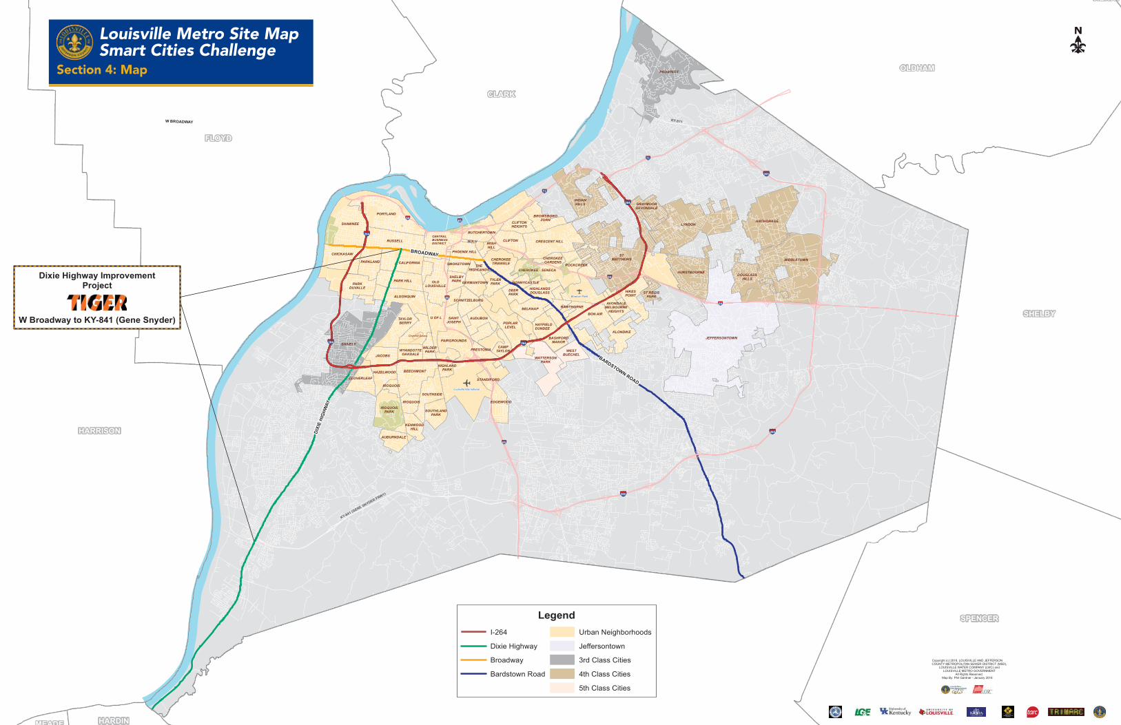
Section 2: Louisville’s Population Characteristics
Louisville’s population characteristics make it an ideal setting in which to showcase
the potential of smart city technologies. The Louisville metropolitan area blends a dense, urban core with suburbs that radiate throughout Jefferson County. The 2010 U.S. Census lists Louisville’s population
at 741,096. This includes all of Jefferson County, which encompasses approximately 380 square miles. Thirty-two percent of the population (≈ 240,000 residents) live within the area bounded by Interstate 264 (the Watterson Expressway) and the Ohio River. Historically, a large proportion of the city’s population and job centers have been located in this area (see map).
Like other cities, many areas of downtown Louisville and its edge neighborhoods have been revitalized over the past 20 years. However, significant portions of the area — especially west of downtown — have suffered from ongoing disinvestment. Many of the workers that live in these areas also experience long and grueling commutes to work. For example, between 2002 and 2013, the number of workers in the depressed Shawnee and Portland neighborhoods travelling 10 miles or less to their jobs dipped by 10%. At the same time, there was a 6% increase in the number of workers commuting more than 25 miles to their places of employment. Improving the mobility of these individuals is critical for the region’s continued economic success, as jobs continue to decentralize.
With regard to the Smart City Challenge, a key strength of Louisville is its normalcy: the city is typical of many mid-sized U.S.
Imagine Louisville Application for Participation in “Beyond Traffic: The Smart City Challenge”
07
cities. Louisville’s Smart City Vision can be readily transferred to other cities because of its diverse neighborhood profile. Transportation Secretary Foxx has observed that a densely populated urban center encounters different challenges than a city defined by sprawl. Because Louisville has both urban and sprawl components, it is the perfect location to demonstrate strategies that can be applied across multiple contexts.
Section 3: Other Characteristics Of Our City
Louisville’s exceptional leadership positions it well to execute the
Imagine Louisville initiatives described here. Before the Smart City Challenge was announced, under the innovative guidance of Mayor Greg Fischer, Louisville had already introduced new projects to transform itself into a smart city. Vision Louisville offers a blueprint to make the city a more “Connected, Creative, Competitive, and Compassionate” place. The mayor’s leadership and forward-thinking goals have established a culture of ingenuity and excellence. For example, Mayor Fischer established the Office of Performance Improvement and Innovation (OPI2) to translate the City’s multi-year vision and goals into a comprehensive, implementable strategic plan. OPI2 brought LouieStat online, which has put Louisville in the national spotlight for data tracking and performance. Louisville ranks 13th out of 104 ranked cities according to the 2015 U.S. Cities Open Data Census. Louisville maintains an Open Data Portal through which citizens have access to 177 different data sets. As a smart city, Louisville expects to build on the foundations laid
by Vision Louisville and Move Louisville to improve safety, enhance mobility, and address climate change through a culture of synergistic innovation.
Another example of Louisville’s innovative culture can be found in the creation of the city’s first-ever Office of Sustainability, which has been tasked with remaking Louisville into one of the country’s greenest cities. In 2015, Louisville was rated as a 4-STAR Community for its sustainability achievements, the 13th community in the nation to be recognized as such. Another key initiative is AIR Louisville, described previously in this application. The data generated by AIR Louisville gives local public health officials and transportation planners vital information on air quality. AIR Louisville provides evidence of the city being committed to giving the public access to machine-readable data. The mayor is intent on creating future initiatives to produce open access data, which can be used by the public to fuel entrepreneurship and innovation.
In the previously described Move Louisville, Metro Government is coordinating with TARC to rework transit by making it more reliable and convenient, while also

08
increasing ridership to reduce VMT. This will remake Louisville into a more thoroughly multimodal and livable city. TARC is the public transportation provider for the Louisville (and southern Indiana) area, whose mission is to explore and implement transportation opportunities that enhance the social, economic, and environmental well-being of the Greater Louisville community. Founded in 1974, TARC provides approximately 15 million passenger-trips each year. These trips are spread across 41 bus routes, which collectively average 47,000 boardings per day. TARC owns and operates 225 buses and 92 paratransit vehicles. It also provides a door-to-door paratransit service called TARC3 for people with disabilities so they may access jobs, medical services, and all that life has to offer.
Many Louisville residents — especially low-income ones — depend on TARC. Although commute times are generally low for Louisville workers (67% of workers have a commute of 25 minutes or less), more than half of all workers who rely on transit have a commute time over 45 minutes; 36% have commutes over one hour. The prospect of long transit commutes dissuades many potential riders from riding the bus. Indeed, approximately 82% of commuters drive to work alone, while just 3% of commuters opt for transit. About 70% of TARC trips carry riders to work or school, underscoring the importance of TARC for the region’s economy.
In 2015, TARC introduced electric buses on two downtown circulator routes. The service is called ZeroBus, in reference to the fare-free rides and zero emissions. The all-electric system — 10 buses and two charging stations — represents an $11 million investment, with the bulk of this coming from federal and state grants. Louisville now has one of the
largest electric bus fleets of this kind in the country (with five more buses on the way).
To bolster its multimodal efforts and reduce VMT, Louisville supports other efforts, particularly through the sharing economy. The city launched a car-sharing program in late 2014, which is housed in facilities owned by Louisville Metro’s Parking Authority (PARC). Louisville Metro also won a grant to establish a bike-share program. The planned 300-bike system is set to launch in 2016 or 2017. Beyond LMG’s direct investments, the community has welcomed popular ride-sharing services like Lyft and Uber. Louisville is also home to a rideshare program that operates over 77 vanpools regionally. This partnership between PARC and the Kentuckiana Regional Planning and Development Agency (KIPDA) has a fleet of over 100 vehicles.
The transportation landscape is undergoing rapid change, with vehicle automation and other technologies set to revolutionize the automotive industry and how people move. Responding to this trend, in 2016 Mayor Fischer’s Commission on Public Art (COPA) is spearheading a new project called Upward Mobility. This public art initiative will bring together artists, coders, and neighborhoods to explore the implications of Big Data and to initiate a public dialogue with citizens about the future of smart mobility in Louisville. Upward Mobility is about finding new ways to contextualize and visualize data in a manner that erases the boundary between art and information. Upward Mobility’s aim is to use digital public art as a tool to facilitate inclusive conversations about transportation, health, and equitable city planning. Upward Mobility demonstrates Louisville’s willingness to adopt imaginative tools and strategies to engage the public on transportation-related subjects.
09
Imagine Louisville Application for Participation in “Beyond Traffic: The Smart City Challenge”
o
p
§̈¦71
§̈¦264
§̈¦264
§̈¦65
§̈¦65
§̈¦64
§̈¦64
§̈¦64
§̈¦265
KY-841 (GENE SNYDER FRWY)
§̈¦71
§̈¦265
§̈¦65
§̈¦264
§̈¦265
§̈¦264
Churchill Downs
Bowman Field
Louisville International
FLOYD
BULLITT
HARRISON
OLDHAM
SHELBY
SPENCER
CLARK
HARDINMEADE
HENRY
Louisville Metro Site MapSmart Cities Challenge
LegendI-264
Dixie Highway
Broadway
Bardstown Road
Urban Neighborhoods
Jeffersontown
3rd Class Cities
4th Class Cities
5th Class Cities
PORTLAND
SHAWNEE
RUSSELLCENTRALBUSINESSDISTRICT
CHICKASAW
PARKLAND CALIFORNIA
BUTCHERTOWN
PARKDUVALLE
PARK HILL
ALGONQUIN
OLDLOUISVILLE
PHOENIX HILL
CRESCENT HILL
CHEROKEETRIANGLE
TAYLOR BERRY
U OF L
SCHNITZELBURG
GERMANTOWNTYLERPARK
DEERPARK
CLIFTONIRISHHILL
CLIFTONHEIGHTS
BROWSBOROZORN
SMOKETOWN
SHELBYPARK
THEHIGHLANDS
POPLARLEVEL
AUDUBON
CHEROKEE - SENECA
CHEROKEEGARDENS
HIGHLANDSDOUGLASS
BONNYCASTLE
NULU
HIKESPOINT
BON AIR
BASHFORDMANOR
HAYFIELDDUNDEE
BELKNAP
FAIRGROUNDS
SAINTJOSEPH
HIGHLANDPARK
JACOBS
CLOVERLEAF
HAZELWOOD
WYANDOTTEOAKDALE
WILDERPARK
BEECHMONT
SOUTHSIDE
SOUTHLANDPARK
IROQUOISPARK
IROQUOIS
AUBURNDALE
KENWOODHILL
IROQUOIS
CAMPTAYLOR
KLONDIKE
HAWTHORNE
EDGEWOOD
STANDIFORD
PRESTONIA
BROADWAY
DIXI
EHI
GHW
AY
BARDSTOWN ROAD
INDIANHILLS
PROSPECT
GRAYMOORDEVONDALE
LYNDONANCHORAGE
HURSTBOURNE
STMATTHEWS
ST REGISPARK
WATTERSONPARK
WESTBUECHEL
JEFFERSONTOWN
DOUGLASSHILLS
MIDDLETOWNROCKCREEK
AVONDALEMELBOURNE
HEIGHTS
SHIVELY
KY-871
Copyright (c) 2016, LOUISVILLE AND JEFFERSON COUNTY METROPOLITAN SEWER DISTRICT (MSD),
LOUISVILLE WATER COMPANY (LWC) and LOUISVILLE METRO GOVERNMENT
All Rights Reserved.Map By: Phil Gardner - January 2016
W BROADWAY
Dixie Highway ImprovementProject
W Broadway to KY-841 (Gene Snyder)
Section 4: Map
Louisville Metro Site MapSmart Cities Challenge

10 11
The proliferation of connected and autonomous vehicle technologies, combined with advances in collecting, processing, and distributing data, will drive urban automation. Imagine Louisville’s Urban Automation initiative will enable and support the use of connected and automated vehicles (including self-driving shuttles) to expand travel options and create a seamless and fully integrated urban transportation system. The Smart Lane Pilot Project will incorporate connected coaches on its bus rapid transit (BRT) line, and Louisville will encourage private sector partners to find uses for the dedicated express lane (such as fully automated trucks) to enhance urban logistics. Data gathered from vehicle-based and infrastructure-based sensors will be managed through the Information Leveraging initiative, which will also make data available to the public through Louisville’s Open Data Portal.
Imagine Louisville Application for Participation in “Beyond Traffic: The Smart City Challenge”
Vision Element Smart Lane Pilot
Information Leveraging
Urban Automation
1: Urban Automation X X X
2: Connected Vehicles X X
3: Intelligent, Sensor-Based Infrastructure X X X
4: User-Focused Mobility Services and Choices X X X
5: Urban Analytics X X
6: Urban Delivery and Logistics X X
7: Strategic Business Models and Partnering Opportunities
X X X
8: Smart Grid, Roadway Electrification, and Electric Vehicles
X X
9: Connected, Involved Citizens X X X
10: Architecture and Standards X X X
11: Low-Cost, Efficient, Secure, Resilient ICT X X
12: Smart Land Use X
Vision Element #8Smart Grid, RoadwayElectrification, & EVs
Section 5: Vision Elements
This section describes the activities the city will pursue as part of Imagine Louisville. It discusses how the city’s strategic vision aligns with the 12 U.S. DOT vision elements
contained in the Smart City Notice of Funding Opportunity. The table below summarizes how the three primary initiatives of Imagine Louisville relate to each of the DOT’s vision elements.

A longstanding barrier to improving traffic flow and roadway design has been the lack of quality data about vehicle movements. Adopting intelligent, sensor-based infrastructure will remove this barrier. Louisville’s smart city initiatives will build a more data-rich environment, one in which it will be possible to collect and share new kinds of data. LMG and its partners will outfit their connected vehicles with sensors to collect real-time data on vehicle traffic, bicycling, pedestrians, environmental conditions, on-street parking, crashes, and other information. Along with these mobile sensors, the city will strategically install a fixed network of ITS infrastructure throughout Louisville. Initial work will focus on downtown and the Dixie Highway Smart Lane. Data collection vehicles, along with the city’s ITS infrastructure network, will provide real-time traffic updates to users of smart transportation, take safety measurements to prevent crashes, be interfaced with existing operations (TRIMARC, TARC, PARC, and emergency vehicles), and forge links to Louisville’s network of 500+ air quality sensors.
11
Vision Element #8Smart Grid, RoadwayElectrification, & EVs
Vision Element #8Smart Grid, RoadwayElectrification, & EVs
Connected vehicles are an essential component of Imagine Louisville’s Urban Automation initiative. As described above, Louisville plans to invest heavily in developing, testing, and deploying connected and autonomous vehicle technology. In doing so, these vehicles will become an integral component of personal transportation within the metro area. Through V2V and V2I communications, connected vehicles will play a key role in optimizing urban transportation networks. Connected buses will also be a cornerstone of the Smart Lane Pilot Project. Once they are operational, new connected vehicles will be introduced to the corridor. Another V2I application that will improve drivers’ experience with transportation infrastructure is the implementation of Smart Parking.

12 13
Imagine Louisville Application for Participation in “Beyond Traffic: The Smart City Challenge”
Consistent with the U.S. DOT’s goals for the Smart City Challenge, Imagine Louisville will empower users in multiple ways. By reducing dependency on private automobile ownership, optimizing modal choices available to travelers, and letting travelers acquire real-time data, people will be able to choose the trip option that best meets their needs. These initiatives will benefit all of Louisville’s residents, but the benefits will be particularly significant for the city’s elderly and disabled population. The Urban Automation initiative will give travelers unprecedented ability to customize their travel routes while reducing their expenses. The BRT line will be an attractive option for commuters wanting more efficient transit along the Dixie Highway corridor. The Information Leveraging initiative will facilitate private sector development of innovative services and options, such as an electronic trip request, scheduling, and payment engine that will let travelers track their transportation history, view and print receipts, see trip times, and locate the best nearby transportation options in a single integrated application that can be accessed using a kiosk, computer, tablet, or smartphone.
Vision Element #8Smart Grid, RoadwayElectrification, & EVs
Vision Element #8Smart Grid, RoadwayElectrification, & EVs
Imagine Louisville’s ambitious initiatives will give LMG officials, entrepreneurs, manufacturers, researchers, and members of the general public access to groundbreaking real-time data and sophisticated analytical tools. There will be a repository of data derived from origin-to-destination (or trip) reports, crash reports, observations of bikes and pedestrians, and traffic flow and congestion patterns. The Smart Lane Pilot Project will provide real-time updates on the status of connected buses and additional traffic information along the Dixie Highway corridor. The Information Leveraging initiative will collect, format, and distribute these data to public and private users who can then analyze them. The KYTC advanced supercomputer will have access to these data streams. From them, it will derive advanced predictive analytics that will be fine-tuned to identify new crash prevention strategies and reduce congestion in downtown Louisville and on the Dixie Highway corridor. Smart parking sensors will generate data on the use of parking infrastructure and how its level of use has been impacted by the new downtown mobility options. Enriched traffic incident data will be used by TRIMARC and first responders to improve response and clearance times. Emissions data will be used to assess the air quality impacts of declining personal vehicle travel, greener TARC fleets, and the availability of new modal options.

13
Louisville has identified an exciting array of partners to collaborate with during the planning and implementation of its smart city projects. These include public agencies, non-profits, foundations, academic institutions, and a University Transportation Center (UTC). Public agencies participating in Imagine Louisville include several departments within LMG (Public Works, Develop Louisville, OPI2, and Information Technology), TARC, PARC, and TRIMARC, as well as fire, police, and EMS services. Key state agency partners include KYTC, the Kentucky Cabinet for Economic Development, the Department for Aging and Independent Living, and the Division for Air Quality. Non-profits, such as KIPDA, AIR Louisville (a partnership between Propeller Health and the Robert Wood Johnson Foundation), and the Kentucky-Indiana Joint Board (which controls the Ohio River Bridges Project), will be instrumental for providing regional planning assistance, air quality monitoring, and technology integration. Academic partners will include the Kentucky Transportation Center (KTC), a UTC located at the University of Kentucky, and the University of Louisville’s Logistics and Distribution Institute (LoDI). Potential private sector partners include: UPS, Ford, Siemens, Humana, Waze, and communications companies such as AT&T, Verizon, and Google, which is considering Louisville as a potential Google fiber city.
Vision Element #8Smart Grid, RoadwayElectrification, & EVs
Vision Element #8Smart Grid, RoadwayElectrification, & EVs
Although moving people in an efficient and equitable manner is critical for any smart city, quickly transporting goods throughout the transportation network merits attention as well. The city will explore partnerships with freight and logistics companies, such as UPS, which has its main hub at Louisville International Airport. As part of Imagine Louisville’s Urban Automation initiative, the city will collaborate with private logistics companies to evaluate the use of autonomous delivery vehicles. The city envisions logistics firms using the Smart Lane for express delivery. Logistics companies and service providers will be able to leverage the Open Data Portal to optimize trips and routing options.

14 15
Imagine Louisville Application for Participation in “Beyond Traffic: The Smart City Challenge”
Vision Element #8Smart Grid, RoadwayElectrification, & EVs
Vision Element #8Smart Grid, RoadwayElectrification, & EVs
Vision Element #8Smart Grid, RoadwayElectrification, & EVs
Louisville is on the cutting edge of exploring applications of electric vehicle technologies and identifying strategies to install vehicle charging stations around the city. Currently, there are two locations in downtown Louisville where vehicle operators have access to electric vehicle charging stations. PARC has plans to install additional Level II charging stations at city-owned garages throughout the area. Successfully executing the Urban Automation and Smart Lane initiatives will entail significantly expanding the smart grid infrastructure, and the city is currently in the early planning stages of this expansion. Charging stations and electric vehicle technologies will also play a key role in the Urban Automation initiative.
The Information Leveraging initiative will emphasize the collection of crowdsourced traffic data. For this initiative to succeed, citizens must be engaged. Louisville will develop and coordinate campaigns to promote citizen involvement. Robust citizen participation will ensure the availability of sufficient data to support the city’s projects. Louisville has a strong history of working with citizens on important planning and decision-making processes. As with Vision Louisville and Move Louisville, the public will fully participate in the planning for Imagine Louisville. These efforts will place information at the fingertips of Louisville residents to enhance options and enable informed decision-making.
Louisville is committed to using technologies and delivering services in a manner other mid-sized cities across the U.S can replicate as part of their own smart city programs, including a stance of product/vendor neutrality and supporting full interoperability.

15
Vision Element #8Smart Grid, RoadwayElectrification, & EVs
Vision Element #8Smart Grid, RoadwayElectrification, & EVs
All technologies, systems, and services must be designed, implemented, and documented in full compliance with existing standards and architectures, including the National ITS Architecture and the Connected Vehicle Reference Implementation Architecture (CVRIA). The partnership includes individuals who participate in various standards committees that contribute to a common protocol for Connected Vehicles and other ITS technologies.
ITS infrastructure and vehicle-based communications established as part of Imagine Louisville will introduce new methods to solve the lingering challenges hampering the city’s transportation system. Increasing and diversifying sources of transportation data is a critical element of this. The city envisions drivers, bicyclists, pedestrians, Uber/Lyft users, vehicle-mounted cameras/sensors, smart parking sensors, and many other sources contributing to data collection. The mayor’s office will establish a panel tasked with issuing recommendations for safeguarding personally identifiable information (PII), a plan for interfacing with the U.S. DOT’s prototype security credential management system (SCMS), and a blueprint to address any unmet ITS standards referenced in Vision Element #10. The privacy and security plan will ensure that ITS components protect the identity of individuals and provide secure DSRC communications among connected vehicles, drivers, and infrastructure while interfacing with new smart city tools developed as part of Imagine Louisville.
Imagine Louisville rests on a vision of reducing citizens’ dependency on private vehicles to meet their transportation needs. Transportation and land use are closely linked, and the type and nature of urban and suburban development greatly influences the effectiveness of the transportation system. Innovatively engineered streets and a sprawling transit system are nearly worthless if users cannot complete the trip by walking safely and comfortably to their destination. Imagine Louisville would leverage Mobility Centers to encourage transit-oriented development and promote compact growth patterns. Enhancements to these Centers will let users take advantage of the various smart city technologies to offer faster, seamless and data-driven transportation choices. Parking demands will be lessened by the initiatives that provide alternatives to private automobile usage. By lowering the demand for downtown parking, Louisville can repurpose downtown lots, garages, or on-street parking for parks, art exhibits, green space, or other positive uses.

16 17
Imagine Louisville Application for Participation in “Beyond Traffic: The Smart City Challenge”
Section 6: Risk Mitigation
To provide good stewardship of U.S. DOT funds and to ensure that Imagine
Louisville is bold yet achievable, it is essential to identify and mitigate potential risks. To reduce risks, the project team will set up a steering committee consisting of LMG officials and other stakeholders. This team will facilitate communications and bring together all of the required expertise to handle the logistics of planning and implementing demonstrations. In addition to project management and monitoring, this group will develop and execute a risk mitigation plan. According to a National Academy of Sciences (NAS) study, risk mitigation plans should be incorporated into any project execution plan. Louisville’s risk mitigation plan will address institutional, technical, and policy issues by adopting the procedures outlined in the NAS study, which include:1
• Identify, describe and quantify risk factors• Evaluate what various risk factors could potentially interact with one another, and identify common causes• Identify risk mitigation alternatives in the project execution plan, and develop strategies, methods, and tools to address each major risk factor
• Assess the benefits of various mitigation alternatives and prioritize strategies accordingly• Ensure partners can commit the resources required to implement risk mitigation strategies
Institutional FactorsAchieving the goals envisioned by Imagine Louisville will require sustained commitment from all partners. Incentivizing these commitments will entail the creation of institutional arrangements that clearly delineate what each partner is responsible for. The institutional charter will address financial responsibility for project deliverables and work toward sustaining the functionality of ITS and associated technologies — planning for the use and sharing of connected vehicle networks downtown, careful planning for usage and sharing of dedicated-use lanes on the Dixie Highway corridor, establishing a clear leadership hierarchy, and creating incentives for partners to remain engaged in the initiative. The risk mitigation plan should consider the following issues and strategies for risk mitigation:
1 Committee for the Oversight and Assessment of the U.S. Department of Energy Project Management. 2005. The Owner’s Role in Project Risk Management. The National Academies Press: Washington, D.C. Accessed 23 January 2016 at: http://www.nap.edu/download.php?record_id=11183#
1) Organizations face different levels of risk, and some will have little incentive to remain engaged and prioritize the Vision. Therefore, regular meetings of the steering committee will be held to keep partners engaged. The city government will also formulate incentives during initiative planning to elicit the continuous participation of stakeholders.
2) Louisville will reach out to the city’s residents and present them with an alternative vision for transportation, one that moves away from private automobile transportation. LMG and the project team will develop a citizen engagement plan that lays out marketing strategies, ridership incentives, crowdsourcing incentives, and mechanisms to evaluate rider feedback and improve customer service. Citizen representatives for public/shared transportation users will be appointed to the steering committee.
3) Cost overruns often occur because of inadequate project management. KYTC recently partnered with KTC on its Project Management Boot Camp training program for the state’s highway engineers. Project managers in LMG will benefit from a modified version of the Boot Camp to prevent cost overruns and delays.
4) The city will exercise care in contracting practices and setting vendor requirements to guarantee that any technology, goods, or services function as advertised. Members of the committee will be asked to discuss and evaluate requests for proposals (RFPs) before publicizing them. To ensure optimal performance, all ITS technology will be subject to robust beta testing and detailed third-party evaluations. Steering committee members will discuss, set parameters, and vet vendor maintenance contracts before signing. Partners will compare procurement procedures, F&A rates, and departmental overhead to determine which agency is best suited to procure various equipment, goods, or services.
5) LMG will provide bold leadership and hold partners accountable for their commitments. Mayor Greg Fischer, who was re-elected in 2014, will remain in office until January 2019. If re-elected, he will serve a third four-year term that will run through January 2023. Mayor Fischer’s commitment to Imagine Louisville, along with the fact that he will be in office for the entire duration of the project, means that Louisville can provide a high level of continuity in project management, as compared to a city holding a mayoral election in 2016 or 2017.
17

18 19
Policy Factors Related to the institutional factors are the statutory, regulatory, and operating policies of the various jurisdictions and organizations with authority over Louisville’s transportation network. LMG and its partners will move immediately to address any laws, regulations, pending court decisions, or policy practices that could hinder implementation of Imagine Louisville. This includes policies which affect private sector partners. The most challenging policy factors will be those decided at the federal, state, or regional level. However, it may be necessary to work with the city council to pass new laws in support of Imagine Louisville.
At the earliest possible opportunity, the steering committee will assemble a team to look at potential legal obstacles. Potential statutory and regulatory issues include:
• State and local laws/regulations pertaining to use of connected or automated vehicles
• State and local laws/regulations pertaining to use of ridesharing services
• State and local laws/regulations pertaining to the installation or inclusion of additional ITS hardware and infrastructure on public roadways and ITS architecture standards
• Pending state/federal court cases between a ride-sharing service agency and a public agency or private business
• Local traffic ordinances
• State/local restrictions on the utilization of federal grants or private foundation grants
Additional reliable funding sources will be required in order to implement a BRT line. TARC will provide the personnel and establish policies to govern its operation. Other agencies will need to adapt accordingly. Organizations that are involved in the proposal will assist with planning and implementation to avoid potential snags in deployment triggered by insufficient funding, personnel, or resources. From a technology policy standpoint, LMG will introduce new policies necessary to make the initiative operational. Broadly speaking, the agency will create internal policies to ensure conformity with the National ITS Architecture, CVRIA, KIPDA, KYTC, and local ITS standards.
Technical FactorsTechnical issues can arise during complex deployment projects, particularly when implementing nascent technology. An implementation subcommittee will be formed to handle day-to-day technical issues as they emerge. The subcommittee will hold routine calls and will maintain a list of actionable items to distribute to the steering committee. The project team has identified some technical issues that may arise during implementation:
Imagine Louisville Application for Participation in “Beyond Traffic: The Smart City Challenge”
Section 7: Partnerships
Imagine Louisville will strategically combine public and private innovation
efforts. Partnerships will be integral for its success. Louisville is a uniquely positioned city, nestled between the Eastern Seaboard and the Midwest. The Ohio River, three major Interstates (I-64, I-65, and I-71), a strong rail network, and an international airport have made the region a hub of national intermodal distribution. Toyota, General Motors, and Ford have major assembly facilities in the region and generate significant traffic via road, rail, and barge. UPS’s worldwide air hub (Worldport) at Louisville International Airport
has enticed many corporations, such as Amazon, Ann Taylor, and Genentech, to locate distribution centers in the area. Louisville can use this corporate presence to accelerate its smart city initiatives.
The Imagine Louisville team consists of organizations and professionals with many years of practical experience in fields directly related to the Smart City Challenge. Team members have participated in complex, federally funded projects, exhibiting and strengthening the following skills through their work:
19
1) The Smart City Vision hinges on the widespread adoption of automated vehicles. It is unlikely that fully automated vehicles will achieve market saturation in the next few years. Because they are an integral component of Imagine Louisville, the steering committee will work toward getting the infrastructure and business plan in place to take advantage of this coming technology.
2) LMG will sign up partners to distribute information and develop the software applications, integrate databases and systems, and create the user interfaces necessary to make the system functional. Incentivizing citizen participation has a technical dimension as well — during the planning stages, LMG will select the best approach to incentivize crowdsourced data collection, identify methods to track the participation of citizens, and decide how to reward citizens for their efforts.
3) New regulations will need to govern lane leasing and specify what vehicles are permitted to use the Smart Lane. Inclusion of a user agreement/lease agreement will be critical. The control and coordination of lane use will require data collection and ongoing analysis.
4) A failure common to many ITS implementation projects is poor coordination between road maintenance crews, construction contractors, and state agencies responsible for maintaining ITS equipment. An ITS infrastructure deployment and maintenance subcommittee will be formed to address these issues

20
• Ability to successfully lead and collaborate with stakeholders on complicated projects
• Demonstrated leadership in innovating and implementing new technologies
• Envisioning and carrying out research projects, new procedures, and policies
Imagine Louisville will showcase partnerships among the following stakeholders:
Public Agencies
• LMG: Public Works, Develop Louisville, OPI2, and Information Technology, and the Parking Authority of the River City (PARC)
• Traffic Response and Incident Management Assisting the River City (TRIMARC)
• Transit Authority of River City (TARC)
• Kentucky Transportation Cabinet (KYTC)
• University of Louisville — Logistics and Distribution Institute
• University of Kentucky — Kentucky Transportation Center
• Louisville Gas and Electric Company (LG&E) • Kentuckiana Planning and Development Agency (KIPDA)
Private and Business Partnerships Waze, Ford, Siemens, UPS, Humana, and Communications Companies (AT&T, Verizon, etc.)
City of Louisville – LMGUnder Mayor Fischer’s leadership, LMG has laid the groundwork for Louisville to become a leading 21st-century city. The Metro Government prides itself on a commitment to open and transparent governance. All agencies publish data on
the city’s Open Data Portal.
The Transit Authority of River City (TARC)TARC is the public transportation provider for the Louisville region. Louisville residents take approximately 15 million passenger trips a year on TARC’s 41 bus routes. It operates 225 buses and 92 paratransit vehicles. About 70% of TARC trips shuttle riders to work or school. In 2015 TARC introduced an all-electric fleet on two downtown circulator routes. This required an $11 million investment to purchase 10 buses and two charging stations. Louisville is now home to one of the largest electric bus fleets of this kind in the country, with five more buses on the way.
TARC uses Automatic Vehicle Location systems (AVL) on its bus fleet, allowing for the collection of real-time bus data, which is used by TARC’s Trip Planner, Google Maps, and private smartphone applications, e.g., The Next Bus, Moovit, and Transitapp.
Imagine Louisville Application for Participation in “Beyond Traffic: The Smart City Challenge”

Traffic Response and Incident Management Assisting the River City (TRIMARC)TRIMARC was established in 1998 as part of a national initiative to utilize ITS technologies to improve transportation in large metropolitan areas across the United States. The system includes sensors, cameras, dynamic messaging signs, and computers that monitor over 100 miles of interstate traffic in the Louisville metro area. TRIMARC is designed to improve system efficiency, traffic flow, and the dissemination of information to the public.
Kentucky Transportation Cabinet (KYTC)KYTC is responsible for planning, constructing, and maintaining the commonwealth’s multimodal transportation system. KYTC manages more than 27,000 miles of highways and provides direction for 230 licensed airports. KYTC and Louisville have a strong record of collaboration, most recently demonstrated in their work on the Louisville-Southern Indiana Ohio River Bridges Project.
University of Kentucky (UK) — Kentucky Transportation Center (KTC)KTC serves as the focal point in Kentucky for interdisciplinary research on all facets and all modes of transportation. With a 35-year history at UK, KTC is a charter member of the Council of University Transportation Centers (CUTC), is currently a member of two federally-funded UTC consortia, and is designated by the Kentucky Revised Statutes as the research arm of KYTC. The Center’s Technology Transfer (T2) Program, designated by FHWA as Kentucky’s Local Technical Assistance Program (LTAP), offers training and technical assistance to governmental agencies and private sector firms across the Commonwealth.
University of Louisville (UofL) - Logistics and Distribution Institute (LoDI)The Logistics and Distribution Institute (LoDI) works to develop new models, technologies, and decision support systems that will help the private and public sectors cope with the dramatic changes taking place in the logistics and distribution industry. LoDI analysts create advanced models to design, operate, and manage logistical and distribution systems efficiently in a rapidly changing technological landscape.
Louisville Gas and Electric Company (LG&E)LG&E is part of the PPL Corporation and serves over 1.2 million customers.
Waze Waze, the world’s largest community-based traffic and navigation app, is a GPS-based
21
Having over 4,500 lane miles of pavement, sidewalks, curbs, bridges, and bicycle facilities, Louisville’s transportation network is one of the city’s greatest physical assets,
with an estimated replacement value of $4.8 billion. The following table summarizes ownership and maintenance responsibilities for Louisville’s roadways:
22 23
system that provides directions, travel times, and route details to users. In return, Waze relies on users to provide data and is connecting drivers through open data sources. Both KYTC and LMG have existing partnerships with Waze.FordWith both the Louisville Assembly Plant and Truck Plant, Ford has served as a powerful engine of community development and innovation. Ford is committed to research and new technologies; the company is eager to support Louisville’s smart city initiatives. This partnership will connect not just with Urban Automation, but also with the Information Leveraging initiative. SiemensSiemens is a global powerhouse in electronics and electrical engineering. It delivers engineering solutions for various industries as well as the energy, healthcare, and infrastructure sectors. Siemens employs over 630 people at eight locations in Kentucky. The Siemens Rail Automation facility, which is located in Louisville, houses the global headquarters of the Siemens Freight and Products business unit. Siemens provides ITS throughout the U.S. to manage infrastructure in cities, regions, and states. It is also a leader in developing hardware and software for connected vehicles in the U.S. and in Europe.UPSUPS’s Worldport is a worldwide air hub at the Louisville International Airport that employs over 20,000 people and handles an enormous volume of express and international packages. UPS is a major supporter of research focused on the success of businesses and the community as a whole. Humana Humana is a major health insurance company headquartered in Louisville, with over 13 million customers in the U.S. (as of 2014). Its innovative approach to the health insurance business makes it a strong partner for Imagine Louisville.
Section 8: Infrastructure and System Features
Functional Certification Owner Total Mileage
METRO KYTC
Major Arterial 8.81 197.41 206.22
Minor Arterial 121.19 131.03 252.22
Primary Collector 216.14 66.87 283.01
Secondary Collector 140.87 1.52 142.39
Local 1695.3 16.13 1711.43
2595.27
Imagine Louisville Application for Participation in “Beyond Traffic: The Smart City Challenge”

23
KYTC owns and operates the interstate highway system in Kentucky. Within the Louisville metropolitan area, there are 196.36 centerline miles of interstate and 108.61 centerline miles of interstate ramps. Since 2010, Louisville’s system of bike lanes and shared-lane markings has grown tremendously. The city is rapidly moving toward a bike network that spans the entire metro area, having installed 92 of 550 miles of planned bicycle facilities. An additional 50 miles of a 100-mile bike and pedestrian trail loop will be opened in early 2016.
Public Transit ServicesTARC’s bus routes cover 1036.79 centerline miles of roadway. With the addition of ZeroBus (described previously), Louisville has shown itself as a progressive leader in alternative transportation. Vehicle SharingZipcar is one of the world’s leading car rental networks. On December 8, 2014, Mayor Greg Fischer announced Zipcar’s introduction to Louisville. Zipcar members in the Louisville area are able to reserve vehicles in the city from two spots leased by PARC at the Brown Hotel (South 4th St. and West Broadway).
Enterprise Car ShareEnterprise Car Share opened its University of Louisville program to the community in 2014. Members of the program have access to three vehicles, all located near the University campus, for an annual $35 membership fee and $8 per hour.
Uber and Lyft are the leading peer-to-peer shared-use mobility companies in the world. Both have contracts to operate in Louisville. Uber’s and Lyft’s mobile applications facilitate 24/7 peer-to-peer ridesharing by connecting passengers who need a ride with drivers who have a car.
Ticket to Ride is a transportation program offered through KIPDA. Services include ridesharing for carpools, vanpools, and schoolpools. Rideshare services are available to commuters who work or live in the KIPDA region, which includes Jefferson, Bullitt, Oldham, Spencer, Shelby, Trimble, and Henry Counties in Kentucky and Clark and Floyd Counties in Indiana.
B-cycle is a bike-sharing program available to Humana associates in Louisville. Bikes are checked out using a membership card. B-cycle relies on the integration of hardware and software to keep track of members and bikes and all the interactions between users and bikes. Proprietary GPS and RFID technologies simplify bike sharing. LMG has its own Bike-Share business plan in place and is expected to begin this program in 2016 or 2017.
Information & Communication Technology (ICT), Transportation Management Centers, and Intelligent Transportation Management Centers The Louisville Metro Traffic Control Center (TCC) facility resides in City Hall and houses the Centracs Advanced Traffic Management System (ATMS) traffic signal control system. All communications for approximately 650 traffic signals move through this facility via once-per-second polling, establishing the basis for real-time monitoring and commanding capabilities. Dynamic Message Sign (DMS) Management lets LMG directly and instantaneously update and display valuable traveler information messages. The KYTC Traffic Operations Center (STOC) is located at the Transportation Cabinet building in Frankfort, KY. This is the statewide operations center that continuously monitors transportation conditions throughout Kentucky. STOC

24
LouisvilleKy.gov
25
hosts the TransPHAT servers for all state traffic signal control. TRIMARC is an integrated system of sensors, cameras, dynamic message signs, highway advisory radio and computers monitoring over 100 centerline miles of interstate traffic in the greater Louisville area. Operational hours are 24/7 x 365, using over 120 cameras. TRIMARC assists with traffic flow management and reduces congestion while improving mobility, safety, air quality, and productivity.
MetroSafe dispatches the service calls for Police, Fire and Emergency Management Service (EMS) throughout the Louisville metropolitan area. MetroSafe also obtains, documents, disseminates, and tracks activities and information of members of the Metro Police Department, Louisville Fire and Rescue, Louisville Metro EMS, Local Government Radio, and SuburbanFire Districts. Its capabilities include linking
radio communications with public safety agencies outside of Metro’s jurisdiction.
Section 9: Data Currently Collected
LMG collects wide-ranging data on its operations, the community, and
governmental performance. Since Mayor Fischer took office in 2011, LMG has focused on increasing data collection, dissemination, and analytical capabilities. To galvanize this process, Mayor Fischer created OPI2 to engrain a culture of data-driven decision-making throughout the government. OPI2 established an internationally recognized Performance Stat system, LouieStat (http://louiestat.louisvilleky.gov/), which monitors Key Performance Indicators (KPI) across LMG.
Mayor Fischer also issued a nationally recognized executive order making the city’s data open and accessible to the
Imagine Louisville Application for Participation in “Beyond Traffic: The Smart City Challenge”

25
public. LMG has an Open Data Portal (http://portal.louisvilleky.gov/service/data) that contains 177 data sets focused on a cross-section of government activities and city attributes. Included in the data is information on infrastructure, land use and building use, public transit, and community services. Additionally, the mayor’s strategic plan envisions uploading more datasets to Louisville’s Open Data Portal. This initiative supports his commitment to transparency and fulfills one of his key pledges — establishing a citizen bill of rights.
Because of the Open Data Portal’s success, Louisville was ranked 13th in the country by the U.S. Open Data Census. Additional improvements will be forthcoming, following a recent engagement with Johns Hopkins’ Center for Government Excellence and the Bloomberg initiative: “What Works Cities.” Louisville has also joined the White House Police Data Initiative, which commits the city to releasing significant amounts of
law enforcement data.
LMG, along with TRIMARC and KYTC, provide well-planned, safe, and secure transportation services, and these activities produce an ever-growing collection of data. These agencies capture information on the movement of people and goods via surface transportation modes, the construction and maintenance of transportation infrastructure, and the economic vitality of transportation services. These transportation agencies produce large quantities of data, including research studies, engineering diagrams, environmental reports, asset inventory databases, traffic data, and geographic information systems (GIS) layers. Through its partnership with KYTC, LMG has the ability to process 1 million independent records per second and monitor up to 2 million sensors in real-time using a Hadoop

26 27
• Current traffic conditions (e.g., travel time, speed, level of congestion), traffic incidents, work zones, and/or lane closures
• Time and location of traffic control actions (e.g., traffic signal control, lane control signals, message board content)
• Incident and emergency management data, including the location, cause, extent, and time history of roadway incidents
• Roadway characteristics, intersection data, and traffic control data
• Vehicle probe data, including recent real-time speed and travel time, historical speed and travel time, and data quality measures, including completeness, accuracy, latency, and validation
• State/local-generated detector data, such as information on real-time traffic volume, occupancy, speed, travel times, and vehicle type, in addition to historical volume, occupancy, speed, and travel times
• Comprehensive weather information and its impacts on roadways, type of event, and the event’s intensity and duration
• General Transit Feed Specification (GTFS) real-time data, which lets public transportation agencies transmit real-time updates about their fleets to Google Maps and application developers. Ridership data by time and location, as well as passenger origins and destinations, are available for a limited number of randomly selected trips
• Network typology, such as link capacity, free-flow speed, and number of lanes
• Traffic volume, speed, vehicle classification, weight, turning movements, and position trajectories
Imagine Louisville Application for Participation in “Beyond Traffic: The Smart City Challenge”
Building on the advances that have been made with the city’s traffic and governmental data, Louisville is pushing ahead with new data initiatives. The city has identified over 40 additional transportation and infrastructure datasets to make available through the Open Data Portal. These datasets will be created as Application-Programming Interfaces (APIs)
and visualized in a citizen-friendly format. One such dataset will give citizens the opportunity to view road conditions during snow removal as well as access a regularly updated index on pavement conditions.
To capitalize on data-related initiatives, Imagine Louisville plans to use the
server with a Spark stack. This processing power allows Louisville to overlay complex traffic, infrastructure, environmental, and geospatial data for analysis and dissemination in near real-time.
Real-time data currently available through LMG and regional and state partners include:

27
city’s Open Data Portal as the primary dissemination point, integrating traffic-data feeds into the proprietary systems across Metro that departments use to manage their operations. Currently, the city uses APIs to push scheduled road closures and other information to various departments and partners, including TARC. Using APIs and national metadata standards will let the city quickly integrate traffic data among internal departments as well as making it available to the public and to partners at higher levels of government. There may not be Open Data standards for all of the data the city will collect, but Louisville plans to create national standards for all traffic and infrastructure datasets collected by city departments to facilitate local, regional, and national benchmarking and data sharing.
Louisville has made great strides in public data dissemination, while extending its data collection efforts to bolster data-sharing partnerships. Two notable public-private partnerships are with Waze and AIR Louisville. City officials believe these two partnerships are just the start. LMG continues its outreach to potential local, regional, and national partners to improve its data collection, usage, and dissemination. Long-term, the city hopes that these partnerships will improve the government’s efficiency and ability to serve all citizens.
For all Imagine Louisville partnerships focused on data acquisition and transfer, the city will establish data-sharing agreements that will protect all parties. Louisville has established many such agreements that include provisions to secure any sensitive or proprietary data which cannot, for legal or contractual reasons, be shared with the public.
Section 10: Standards and Architecture
LMG and KYTC have recognized the importance of implementing updated
advanced traffic control systems throughout the region. Through partnerships, regional transportation agencies are addressing the needs of the traveling public with ITS and ATMS techniques and methodologies. Multiple CMAQ-funded projects over the past 20 years have expanded the traffic signal system and incident management systems by installing flexible equipment and robust central control capabilities on a countywide and regional level. These projects comply with existing standards, architectures, and certification processes for ITS technologies and equipment.
Product and process technologies are rapidly evolving. Competition is becoming more and more global. Various agencies and stakeholders emphasize improved quality and reliability, but shrinking
28 29
budgetary resources demand scrutiny of costs and affordability. This dynamic requires the use of integrated product development (IPD) concepts to reduce development cycle time and improve product quality and value. Louisville Metro proposes an IPD approach based on integrating the design and manufacturing of products with support processes. It is not just a matter of assessing the producibility, testability, supportability and quality of the products after they have been designed. All of the competitive factors must be considered from the very start of product development and designed into these products. The design of products and processes must be integrated to optimize the manufacture and support of the products and systems.
Section 11: Goals, Objectives, and Performance Measures
To measure the progress of Imagine Louisville, a number of objectives
have been established. The goals further the U.S. DOT’s Ladders of Opportunity as well as align with Vision Louisville and Move Louisville.
Goal #1: Improve Safety of Pedestrians, Bicyclists, and All Vehicle Occupants — By collecting more data and making it available to the citizens of Louisville, as well as by leveraging and implementing connected-vehicle technology, safety will be improved, reducing the number of crashes, injuries, and fatalities.
Objective 1.1: Reduce overall crash, injury, and fatality rates Objective 1.2: Reduce injury and fatality rates involving pedestrians Objective 1.3: Reduce injury and fatality rates involving bicyclists Objective 1.4: Reduce number of secondary crashes
Objective 1.5: Increase public availability of safety-related data
Goal #2: Improve Efficiency and Enhance Mobility — Increasing the number of affordable and efficient transportation options in Louisville will improve the efficiency of the city’s transportation system and the mobility of all citizens. Data availability and transparency will inform the public about the initiative’s progress.
Objective 2.1: Reduce travel times Objective 2.2: Increase frequency on TARC routes that connect high job/ population centers Objective 2.3: Increase TARC ridership Objective 2.4: Increase number/mileage of bike lanes Objective 2.5: Increase use of non-personal-automobile modes of transportation Objective 2.6: Increase the public’s “level of satisfaction” for transportation system Objective 2.7: Increase public availability of transportation-related data
Goal #3: Improved Air Quality — Reducing VMT and increasing alternative travel options will lead to noticeable improvements in air quality.
Objective 3.1: Reduce Vehicle-Miles Traveled Objective 3.2: Reduce transportation- related emissions Objective 3.3: Increase number of hybrid and electric vehicles registered in Louisville Objective 3.4: Increase number of charging stations for electric vehicles
Imagine Louisville Application for Participation in “Beyond Traffic: The Smart City Challenge”

29
KTC will lead the evaluation of Imagine Louisville. KTC will work with the project partners and other key stakeholders to develop a detailed evaluation plan and, once the plan is approved, to carry out the evaluation in accordance with that plan. Initial steps in developing the evaluation plan will include defining performance metrics and establishing baselines for those metrics. A preliminary list of possible performance measures is presented here:
o Average daily traffic in traditional US31W (Dixie Highway) lanes o Ridership on BRT o Ridership/utilization of Smart Lane o Number of crashes (property damage only, injury, and fatal) o Interest in lane leasing and related economic development o Number of public crowdsourced records o Number of private crowdsourced records o Percent change in traffic-related injuries (walk, bike, car) o Percent change in TARC ridership o Percent change in air quality in Louisville o Ridership for automated shuttles o Reduction in VMT by personal automobiles o Public survey on transportation-related satisfaction
Section 12: Our Commitment and Previous Experience
LMG and its partners have successfully completed many large-scale
transportation projects. Significant projects that have been built and/or implemented in recent years include the bi-state construction of two Ohio River Bridges and reconstruction of the Kennedy interchange — where three interstate highways converge in downtown Louisville. This multi-billion-dollar project is currently within budget and ahead of schedule. While the city is justifiably proud of this project, there are other examples of LMG’s rich project experience. Other notable projects include TARC’s Zero Emissions Bus program, the Jeffersontown Streetscape project, and the Southwest Levee Trail project. A project completed in 2014 that still garners recognition is the Big Four Pedestrian Bridge, which recently won the 2015 Indiana MPO Council award for Outstanding Transportation Project for Special Design/Construction.
LMG has the in-house staff expertise needed to manage a project like Imagine Louisville and has the skills and knowledge required to effectively collaborate with professional and engineering services to acquire additional resources. To focus management staff on performance management, the city government conducts in-house training on project management, Lean Six Sigma, and others. LMG’s staff is currently managing 60 local public agency (LPA) transportation projects, which includes both federal- and state-funded projects. Some of LMG’s other notable projects and achievements over the past five years are listed below.

30
• Added more than 78 additional miles of bike lanes in the past 5 years.
• Awarded a $300,000 National Highway Traffic Safety Administration grant aimed at improving safety for pedestrians through education and enforcement activity.
• Completed a $180 million expansion of the downtown convention center, increasing the contiguous trade show space to 230,000 square feet, from 146,000 square feet.
• Created the $30 million West Louisville Food Hub to aggregate and process food from local farmers to increase demand for local food.
• Awarded a $2.9 million federal grant for Code Louisville, which provides free training to prepare people for software coding jobs. This effort is part of the city’s broader workforce development strategy to respond directly to the skill sets that employers need.
• Designated a $14 million Southwest Regional Library on Dixie Highway as a destination for learning, discovery, and community engagement.
Imagine Louisville Application for Participation in “Beyond Traffic: The Smart City Challenge”
Imagine Louisville will build upon two projects already funded by the federal
government. In 2013, Louisville received a $650,000 grant to develop a strategic multimodal transportation plan (Move Louisville). By developing this plan, Louisville has identified the core goals of preserving its existing transportation system and reducing VMT. This plan will guide transportation system investments and provide a newly formed set of goals and policies to inform Imagine Louisville. The city also won funding for its Transforming Dixie Highway project, a TIGER Grant project that included $16.9 million in TIGER funds, $12 million in state funds, and $500,000 in local funds. This
project will transform Dixie Highway by implementing complete streets, ITS, and BRT. The Smart Lane Initiative would build on this TIGER project.
Louisville’s relationship with KYTC will be critical for helping Imagine Louisville succeed. KYTC will use its unrivaled resources to assist with the data processing and analysis needed for this project. LMG is working closely with several partners that have won federal and state funding. Groups such as KTC and TRIMARC are key members of the Imagine Louisville team and will leverage government funding as partners in the initiative.
Section 13: Leveraging Federal Funding


Private & Business Partnership