in this issue: may 26, 2000 throckmorton, tx · pdf filein this issue: may 26, 2000...
TRANSCRIPT

November-December 2000 Volume 24, No. 1
TIM MARSHALL, EDITOR RICH HERZOG, ASST. EDITOR email: [email protected]
TIM VASQUEZ, ON-LINE EDITOR http://www.stormtrack.org
In this issue: MAY 26, 2000 THROCKMORTON, TX TORNADO and the APRIL 8, 1998 BIRMINGHAM, AL TORNADO
Cover: House wrenched off block foundation from tornado near Birmingham, AL thatoccurred on April 8, 1998.

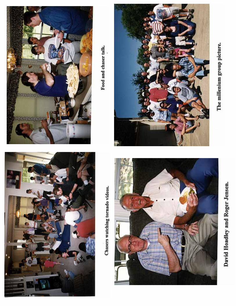
acquisition and advancement of knowledge concerning severe storms. It is published bi-monthly by Master Graphics inLewisville, Texas. David Hoadley founded the publication in 1977 and STORMTRACK has continued to grow and im-prove ever since. David Hoadley still contributes drawings and sketches. Darlene Egli designed the current cover. Rightnow, we have about 600 subscribers!
Anyone can submit an article or letter to STORMTRACK. Articles should be single-spaced and contain proper English.Right justified margins are preferred or the editor can retype the text. High contrast photographs reproduce best. Diagramsshould be clear and legible, subject to photo-reduction. All articles will be edited.
Subscription rates are: U.S. First Class mail $18/year. For Canadians, it’s also $18/year in U.S. Currency. Overseas is $22/year in U.S. Currency. The hard copy publication will end with the November-December 2001 issue. STORMTRACK isavailable on-line free of charge at http://www.stormtrack.org. Individual regular back issues are available for $3 each,expanded issues $5 each, and double expanded issues $10 each. Hard copy back issues are available for $18 per year from1996 through 1999 and the complete 20 year set (1978-1997) can be purchased on CD-ROM for $65. To subscribe or renew,send a check or money order PAYABLE ONLY to Tim Marshall, 4041 Bordeaux Circle, Flower Mound, Texas 75022-7050.
STORM TRACK CLASSIFIEDS
Sell or swap your wares. Only 30c per word with a 20 word minimum = $6. Quarter page ads are $70, half page ads are$130, and whole page ads are $250. Send your request for the next issue by January 31, 2001._______________________________________________________________________________________________ HARD COPY STORMTRACK TO END WITH NOVEMBER 2001 (25th ANNIVERSARY) ISSUE
It is time for everyone to renew. The amount owed is noted on the front cover of this issue adjacent to your name. Thereare six issues left after this issue. Credit is made for those of you who are renewing in the year 2001. For those of you withyour last issue now, please remit $18.00, January 2001 $15.00, March 2001 $12.00, May 2001 $9.00, July 2001 $6.00 andSeptember 2001 $3.00. No NEW yearly subscribers will be accepted after the January-February 2001 issue (mailedMarch 15, 2001) and submitted checks will be returned.. No expiration notices will be issued after the next issue. Ad feeswill still be accepted anytime to the end of the publication. The last issue will be November-December 2001 and will bean expanded issue. Thanks.. Tim M.._____________________________________________________________________________________________
A FISTFUL OF TWISTERS—Chase highlights of 1999-2000, including the tornadic supercell near Waterloo,Iowa, the Brady, Nebraska tornado, and a beautiful tornadic supercell in Corson County, SD, on June 8, 1999.Send check for $20.00 to William Reid, 607 Via Colinas, Westlake Village, CA,91362. (3/01)
TEMPEST TOURS STORM EXPEDITIONS is accepting reservations for Spring 2001. Ride along with our team ofveteran storm chasers as they traverse Tornado Alley in search of nature’s most spectacular weather. Space islimited. Complete details are available on-line at www.TempestTours.com (1/01)
JUST ANOTHER CHASE DAY - Features the highlights captured during my year 2000 chase trips to the plainsstates including the LP Bell at Wheeler, TX on May 24th, the funnel cloud near Loving, TX on May 26th, a fantasticmulti-tiered storm base over the Nebraska sand hills on May 29th, and a bow echo tornado being wrapped in rainnear Glasgow, MT on July 2nd. Other great shelf cloud structure and lightning from MT and ND are also featured.This 85 minute VHS video was captured and produced using digital equipment to assure suburb quality. Will swapyour highlights tape or ship post paid in the U.S. for $15. Brian Morganti, 932 Christmas Village Road, Bernville, PA19506 - [email protected] (11/00)
i

STORMTRACK http://www.stormtrack.org
email: [email protected] $18/year
I. COMMENTARY THE WARNING TRIAD
It has been my experience that most people rely upon the television media for their weather warning information. But whathappens if the electric power goes out or your not home watching television? What other sources are there to receivewarning information? I have found that few radio stations carry live, up-to-the-minute weather broadcasts. I also havefound that few people have a NOAA weather radio or actually use them. Few cities have sirens or have adequate coverage.Surprisingly, more and more people are receiving their warnings from pagers and cellular telephones. After the May 3, 1999tornadoes in Oklahoma City, I found that a number of people received warnings from relatives on their pagers or cell phones.I also have found there are some private companies out there trying to use this market too. I am all for multiple warningsystems. After all, the U.S. military depends on multiple warning and deterrence systems (the “triad”) in case of a nuclearattack. A similar program should be in place for hazardous weather. However, I would like to see more LINKAGE of theweather warning systems. For example, why can’t we make NOAA weather radio standard in automobiles? How about anNWS warning that automatically trips an alarm on your cell phone, car radio, or television?
II. CHASER NEWS
FEBRUARY 24th: The Dallas area SKYWARN class will be held on Saturday, February 24th at the Garland PerformingArts Center beginning at 9am. This is one of the largest spotter training classes in the country and people from manysurrounding states also attend. The training session lasts until 1 or 2pm.
MARCH 29th: The National Weather Associations 2001 SEVERE STORM AND DOPPLER RADAR CONFERENCEwill begin on Thursday, March 29th at 5pm and adjourn Saturday at 10pm. The conference will be held at the UniversityPark Holiday Inn in West Des Moines (same as last year). Check out their web site at http://www.iowa-nwa.com The editorwill be there provided another city is not struck by a tornado.
FUNNEL FUNNY
1
MAY 3, 2000 METROPLEX SUPERCELL by Ted Best KD5JEO
May 3, 1999 is a date that lives in chaser infamy when a series of tornadoes struck central Oklahoma. One year later, asupercell tracked across the Dallas-Fort Worth (DFW) area producing my most exciting chase of the spring. The synopticsituation was not the typical trough/dryline but an upper closed low spinning over Oklahoma moving very slowly eastward.The circulation above 850mb combined with backed surface winds provided adequate low-level shear. The 12Z, 300mbanalysis showed two speed maximums circling the low, one at Monet, MO and the other at Amarillo, TX. Numerous surfaceboundaries were likely intact from previous convective activity. Meanwhile, 70 plus dewpoints were heading northwardinto the DFW metroplex to provide instability and another round of afternoon storms.
I left work in Garland just after 5pm, when the NOAA weather radio alarm caught my attention. Tarrant County Skywarnwas tracking a rotating hailstorm in northeast Tarrant County moving southeast. The persistence of this storm was apparentas I monitored Tarrant County Skywarn while getting ready to chase. I could see the anvil edge toward the southwest withthe remainder of the sky being clear. After conducting an inventory of my chase gear, I headed out to intercept the storm.
It should have been an easy chase, but it was not. I was without my chase partner, and I did not have a detailed map tonavigate off the highways. I envisioned heading south then west into the dry slot. As I rounded the southeast side of Dallason I-635, I could see the anvil spreading to the southeast. By 6:30pm, Dallas Skywarn spotters were tracking the storm as itmoved southeastward into Ellis County with a forward speed of about 25 mph. National Weather Service (NWS) Dopplerradar showed persistent rotation as the storm intensity cycled up and down. I exited southbound on I-45 in light rain. At onepoint, the NWS indicated that the storm was slightly outflow-dominant and was choking off its inflow. While driving southon I-45, I became anxious to move west toward the core before the storm lost its organized structure. My decision to exit andmove west near the small town of Ferris, TX was premature, though, as I found myself trapped on the back side of theforward flank downdraft (FFD) and precipitation core without a good route to move south. When I tried to head southweston highway 342, I began encountering small hail and I immediately retreated. By this time, around 7:10pm, Ellis CountySkywarn was tracking the storm and reported three inch diameter hail. I decided to stay on the north side of the storm andsettle for some spectacular shots of the storm towers backlit by the setting sun.
I stopped in the town of Red Oak, TX near highway 342 and I-35 and watched the storm rumble into Navarro County. Atfirst, rain and sunlight on the north side of the FFD produced a dazzling display of rainbows. Then, subsidence behind thestorm produced clearing skies and near perfect viewing conditions of the storm towers with the “rings-of-Saturn” formation.After Ellis County Skywarn shut down their RACES net, I spoke briefly with their net control station, Danny, KA5YDB.Their fine storm spotting certainly kept me out of trouble!
I returned home to watch the weather report, complete with video of the storm’s bell-shaped wall cloud and beaver tail fromthe Channel 8 Doppler Radar site at Corsicana. I was able to see the storm from both sides after all, though not as I hadintended. Although the storm contained a rotating mesocyclone through most of its long life, it never produced a tornado oreven a funnel, to my knowledge. The longevity of the storm was indicative of a favorable environment with good moistinflow and no competing storms. Weak low and mid-level winds and variable inflow/outflow balance appear to be factorswhich prevented the storm from producing tornadoes.
2000 TORNADO CHASES - Highlights from this years chase season include: 1) the incredible Fort Worth, Txtornado on March 28th and damage survey, 2) tornadoes in Louisiana on April 23rd, 3) Olney, Tx tornado on April30th, a beautiful LP “spaceship” supercell near Pampa, Tx on May 24th, 5) Throckmorton, Tx tornado on May 26th,and funnel cloud at Jacksboro, Tx on May 27th. 87minutes, VHS, $25 U.S., $30 Canada, $45 overseas (U.S. Currencyplease). Send check or money order to Tim Marshall, 4041 Bordeaux Circle, Flower Mound, Texas 75022-7050.
3

MAY 26, 2000 WEATHER SITUATION by Tim Marshall
An upper low was progged to move from western Kansas into northern Missouri today bringing nice southwesterly flowacross the region. At the surface, an outflow boundary extended across north Texas from Shamrock to Paducah to Dallas.This boundary was left in the wake of last nights convection and can be seen as a line of cumulus on satellite with a clearregion to the north of this line. Surface winds in west Texas were from the southwest whereas winds were southeast north ofthe boundary. The air south of the boundary was very unstable. I expected storms to fire along the outflow boundary; withthe best storm to fire where the southwesterlies intersected the boundary at Paducah. I picked Vernon, TX as the place tobase myself as I wanted to be prepared if the boundary moved north into southern Oklahoma. SPC had issued a MODER-ATE RISK for north Texas and western Oklahoma west of I-35. They also saw the outflow boundary as the region mostlikely for severe storm initiation.
Carson was unable to chase today, so my wife and I left Flower Mound around noon and headed up the infamous Rt. 287 andhad lunch in Wichita Falls. We reached Vernon at 2:55pm and noticed a line of towers extending east-west south of town.A few towers actually became Cb’s but quickly orphaned. Other towers were sheared off as they moved over the boundary.At 4pm, a Tornado Watch was issued extending from 90 miles either side of a line from Abilene to Altus. That put us rightin the middle of the box. Finally, around 5pm, two Cb’s stayed put. One storm was near Paducah and the other was nearShamrock. I decided the southern Cb would be closer to the undisturbed air and we headed southwest on Rt. 70 and droppedsouth on FM 267 and Rt. 222. At 6pm, we broke out of the rain core and saw a large flat rain free base with sharp anvil edgecutting across the southern sky. Just then, Carson Eads and Sam Barricklow called and told me a tornado warning had beenissued for this storm. I started looking for a good photo spot and finally found one about 7 miles north of Highway 380. Thestorm was moving slowly eastward. I was not happy about the weak southeast inflow into this storm but soon inflow bandsformed overhead and a wall cloud developed to my west with weak rotation. The rear flank downdraft started taking overand a “hole” formed in the middle of the updraft. The wall cloud fizzled and it looked like the storm was becoming outflowdominant. I decided to stick with it since it was the only storm around. We headed east on Rt. 380 to Throckmortonencountering a bunch of chasers including the DOW team, and filled up the gas tank. Around 7:15pm, we headed north onRt. 283 out of town and saw a large area of scud to the west. We turned northeast on Rt. 79 and stopped at FM 2356. At7:30pm, a funnel cloud formed ahead of the scud area and a dust whirl developed just southwest of us off Rt. 79 lasting lessthan one minute. Outflow undercut the storm producing an extensive shelf cloud. The Shamrock storm died. Two largertornadoes were reported in central Oklahoma.


4MAY 26, 2000 - THROCKMORTON, TX STORM by William Hark
I started out in Dodge City, KS after chasing a severe thunderstorm the previous day near Amarillo, TX (and missing theHereford tornado). I had planned to position myself for a chase in Nebraska or Kansas. Unfortunately things had changedby the morning of May 26th and I’d probably have to go south. I traveled to Kinsley, KS and was able to check data at thelibrary. It looked like I’d either have to go to eastern Kansas or travel south. I decided the target was Childress, TX andblasted south. In Pratt, KS I checked a fax from Tim Vasquez’ Chase Hotline and it agreed with my target area, though alittle northeast at Altus, OK. The Pratt Library did NOT have internet access. I continued south and again checked data ata library in Seiling, OK. The Oklahoma mesonet showed southwest winds throughout the state except extreme southwestpart. Cumulus already was developing in my target area so I had to hurry.
By the time I reached Clinton, OK there was cumulus overhead and to the southeast, obviously the edge of last nightsoutflow boundary. To the west, the sky was clear. I reached Altus, OK at 4:20pm and some cumulus to my east was showingvertical development. Now where to go? I wanted to check a satellite image at the community college but its library wasclosed. I called the Chase Hotline for a satellite report. There was some convergence of cumulus near Haskell, TX and someto my east. An anvil sighted to my west had “orphaned”. I decided that there was better moisture to the south and headed toHaskell.
I went south and by 5:20pm. I could see a storm to the southwest. It was in southwest Haskell County moving northeast at10 mph. Soon, the cumulus around me were vanishing except for the quickly growing storm. At 5:50pm, near Seymour, Icould see two smaller storms left splitting from the main storm. I took Highway 277 southeast, then FM 266 south out ofGoree, TX. At 6:28pm, I observed some marble-sized hail while on FM 222, at the edge of the storm. I wanted to get southand avoid core punching. At 7:00pm, I stopped in Throckmorton and ran into Charles Edwards of Cloud 9 Tours, JimLeonard and R.J. Evans. I had a quick dinner of an Allsups beef and bean burrito while waiting for R.J. to download a radarimage. (Thanks R.J.!) The storm contained several mesocyclones as it was approaching the town.
I went north of the town on and watched. It was awesome with swirling clouds and striations. I chatted with some localswhile filming. Suddenly, the cows in a nearby field started running away. The last time I saw that happen was before atornado. Soon, the storm became more organized and a ragged rotating lowering developed around 7:20pm. A tornadowarning came over the radio. When it was too close, I headed south and then east on Highway 380 following the storm.There was a large chaser convergence with groups of chasers lining the road along with the Doppler on Wheels. As thestorm moved east, everyone would move down the road and park again. Most chasers were well behaved. At 7:35pm, therewas a nice short fat funnel cloud in the center of a rotating wall cloud. I drove a little farther and again stopped by a Cloud9 tour van. At 7:38pm, a spin-up occurred to my east after it crossed the road and picked up some dirt and debris. Thetornado lasted less than one minute. At no time was there a condensation funnel extending to the ground. Then the stormlost its organization but was still beautiful. I continued to watch the storm, then went to Mineral Wells, TX to spend thenight. A very long but satisfying chase. Moral of the story: I found that getting data on the road can be very difficult withouta laptop. Email: [email protected]
MAY 26, 2000: CENTRAL OKLAHOMA TORNADOES by Rob Satkus
Things really looked good for today. There were numerous subtle boundaries around mostly due to overnight convection.The most unstable areas were over northwestern OK, where winds veered, so we discounted that area. Thus, the area wetargeted was southwestern and southern OK. For the first time this year, it really looked unstable outside, with lots of thick,building cumulus and some small towers. Val Castor and his wife, Amy, met me in Norman and we went to Chickasha, thenwest from there to near Carnegie. There was a windshift line just west of us, with winds veered slightly behind it. We set upa few miles south of town, with a great view to the west. There were several areas we were watching. To our southwest, atower tried to go up, but was getting sheared over. To our west, there was a small cluster of towers that would go up anddown repeatedly. And to our north, another cluster of small towers. It was really hot and humid with good south-southeastwinds at our location. While we waited, we noticed a
6

funnel coming from a cumulus cloud nearly overhead. It lasted 3 or 4 minutes and was rather photogenic. The towers to thesouthwest slowly got better, but looked somewhat multi-cellular. The towers to our west were looking the best of all, butwere slow to build. The northern towers looked less impressive with time. After about an hour of watching and waiting, atower just to our west began to anvil out. The towers to our southwest were increasing rapidly as well, but there was nosingle updraft, unlike the one to our west.
We headed north to Highway 152, then west to near Corn, OK as a core developed to our west-northwest. The storm wasinitially somewhat high based, but was increasing rapidly. Another storm was developing under the anvil of our storm, andhad a lower base. I was concerned about that one as I have heard some storms that fire in that area can be quite interestingand potentially tornadic. In addition, the towers to our south had evolved into a storm, but from where we were we could seeit was also a little high based. Inflow at our position was near zero, but the core to our northwest was increasing rapidly. Wedrifted back east to near Colony then north on a county road. Mark Hill, who was west of us, called and said our storm wasabsolutely explosive in nature. We stopped south of Colony, under the base, only to be greeted with outflow. We weremomentarily disheartened, but if the updraft was explosive as Mark said, we felt that outflow would nor become dominant.Indeed, the gust front never pushed to far out from the storm. Inflow bands were developing to the southeast of the storm andthere was extremely chaotic motion overhead. We noted that precipitation was surging south to our west, giving the appear-ance of a developing hook echo. We also noticed an apparent microburst to our northwest.
We started to head into Colony, but decided to drop back south towards Highway 152 to avoid the core, which had baseball-size hail. This was a good decision in more ways than one. We drifted south a bit and stopped. I noted disorganized rotationnearly overhead with a ragged wall cloud. There was a nice cinnamon swirl overhead, but of more importance was a newwall cloud that formed very rapidly just northeast of the wall cloud over us. Rotation was organized, but slow. There wasmuch better rising motion with it, but a funnel formed none-the-less. As it drifted slowly east, we found a road that took usto a high point before it ended, still south of Colony. The rotation remained fairly weak, and it soon appeared the wall cloudwas becoming occluded. We could, in fact, see another wall cloud further northeast. We were just about ready to head eastto the new wall cloud, when rotation increased with the old wall cloud. A small funnel formed and remained well aloft. Thestorm was moving very slowly east, so we held our position. The funnel lowered only slightly, maybe about 1/4 of the waydown. Suddenly, I saw a dust whirl on the ground to our east, a little south of the funnel. TORNADO! It moved slowlysouth-southeast, pushed along by outflow. The funnel itself remained nearly stationary. The tornado moved through opencountry, occasionally throwing up tree limbs. It was on the ground for 5-7 minutes, with the funnel remaining aloft the entiretime.
While this was going on, the new wall cloud also produced a funnel, but as far as I know it did not touch down. After thetornado finally ended, we went east again on Highway 152. The storm seemed to be trying to become more HP in nature.South of Eakly, we saw a new wall cloud. We continued east, hoping to put ourselves in a good photographic positionshould something else form. While this was happening, I noticed rapidly rotating rain curtains to the west near Eakly. Inaddition, another wall cloud further northeast was looking more and more ominous. However, we focused on the rotatingrain curtains. I was amazed at how rapidly they were rotating, and was amazed that there wasn’t a large condensation funnelin there. I believe this was a tornadic circulation, likely producing damage. We went further east as this area approached us,stopping again to see unbelievably rotating rain curtains continuing. We could now see dust being raised and were positivethis was a tornado. There was a lot more rain rotating around now and during the entire process, we noticed a lot of descend-ing motion within this circulation. This may have contributed to the lack of any funnel. At any rate, the overall circulationwas large.
We head to keep moving east to stay out of this tornado. At one point Amy said:, “What is that back there?” We stopped andcould see a funnel shaped object to our west through the trees. I thought it was scud from the advancing gust front, but it mayhave actually been another tornado or the ending of the larger tornado we had seen. I could see a new wall cloud north of usand saw a power flash underneath it. We continued on towards Binger as this wall cloud occluded without producing atornado. By now, darkness was setting in and visibility wasn’t good. We went into Binger and could see what appeared tobe a shelf cloud to our north. We soon began to get northeasterly outflow winds. The storm rapidly became outflowdominant at this point and weakened substantially. We followed it east for a little longer, but soon gave up and linked upwith a live truck to send back video to the station. Finally, a good day! To the best of my knowledge, these were the onlytornadoes in Oklahoma today. The Colony tornado will probably go down as an F0. The Eakly tornado is hard to say. I don’tthink it did much damage, but the circulation was very strong.
7

MAY 26, 2000 - ELLSWORTH, KS HAILSTORM by Ted Best
My family and I departed Dallas, TX for Great Bend, KS the day before for a fun, old fashioned Memorial Day weekend. Ofcourse, we made a detour through the SPC/NSSL in Norman. It looked like May 26th was going to be an active day overnorthern Kansas and southern Nebraska. A surface low was progged to move east out of Colorado. A warm front wasprogged to be along I-70 and serve as a focus for convection. Backed surface winds north of the front would provideincreased low-level shear. I anticipated an interesting day and this was to be my first warm front chase.
On the morning of May 26th, the SPC Day 1 Convective Outlook called for “widespread thunderstorm development after18z as large scale ascent associated with the left front quadrant of the mid/upper level jet coincides with instability along andsouth of the surface warm front.” A kidney-shaped MODERATE RISK area had been drawn with its two foci over northwestTexas and southeastern Kansas. The 300 and 500mb 12z winds at Midland and Amarillo showed a 55-65 knot speedmaximum heading for southern and southeast Kansas. Surface dewpoints in central Kansas were in the mid-60’s. However,the moisture at the surface was shallow as indicated by the 10 degree 850mb dewpoint spread on the 12z Dodge City, KSsounding. That sounding also showed a morning temperature inversion at around 850mb.
By 17z, widespread cumulus had formed in Great Bend, KS. Many of the cloud elements were already building and it wasapparent that the capping inversion would quickly break. The widespread nature of the convection made it difficult for meto know where to chase. I finally decided the best storms would likely form to my northeast along the warm front wherethere was greater low-level shear and upper dynamics. I departed Great Bend eastbound on Highway 56 at 1:20pm (1820Z).Just minutes outside of town, I could see cumulus congestus to my north. Widespread thunderstorm development wasindeed occurring as progged by SPC. One tower in particular was firm to my northeast, so I proceeded east to Lyons thenheaded north on Rt. 14. As I turned to the north around 2pm (19z), the NWS in Wichita issued a severe thunderstormwarning for Ellsworth County. The storm I was watching was located 28 miles east of Russell moving northeast at 25 mph.Meanwhile, another tower had formed to my south and I was on the northern edge of the precipitation core.
I pulled off the highway on a small gravel farm road about 2:15pm about six miles north of Lyons and took some photo-graphs and video. The storm had a small flanking line on its southwest corner, but its anvil quickly became fuzzy with noovershooting top. Its visible characteristics looked more like a multi-cell than a supercell. As I prepared to move in closer,a farm worker pulled up in his truck and told me there was golfball-size hail in the storm (which NOAA later verified). Thisencounter reminded me of Tim Marshall’s and Carson Eads “Reality Check in the Information Age” funnel funny whichappeared in the May-June 2000 issue of STORMTRACK. I moved in to shoot some close up photos of outflow features andpicturesque skyscapes of the deep blue thunderstorm base over the vast expanse of Kansas farmland. By 2:30pm, the coreof the storm was seven miles northeast of Konopolis and was weakening. I watched the whole complex move off to the easttoward Salina and then headed back to Great Bend.
8
THE SECOND SEASON - IN BIG SKY COUNTRY by Brian Morganti
On July 2, 2000, I had two choices: head towards home and maybe catch up with some severe storms in northernIowa late in the day or head in the opposite direction for more isolated severe storms that should initiate in north-east Montana. Of course, I headed to Montana. I liked the area between Williston, ND and Glasgow, MT. Therewas good moisture pooling at the surface, strong insolation would aid in steep lapse rates, and helicity valuesindicated supercells were likely. Upper winds were strong out of the southwest, while surface winds remainedstrong all day screaming in from the east.
Overcast conditions finally yielded to sunny skies just as I crossed the Montana border. Just west of Bainvilleseveral promising towers started to go up to my southwest. I filmed these and one quickly orphan anviled -then theprocess started over again. It was still early and LCL’s (lifting condensation levels) were just too high as everyupdraft was doomed to evaporate. I thought if I got to a higher viewpoint, I could see better in all directions. Idrove past the town of Brockton on Rt. 2 and took a short drive north on Rt. 251 to a high point on the FortPeckland Indian Reservation. I hooked up my satellite dish and watched the tornado warned storms in Iowa fortwo hours, since there was nothing to watch in the skies over Montana! I fretted for two hours but decided to standmy ground. This was my last chase day and it really should just be a matter of time. At 4:32 p.m. CDT a severethunderstorm watch box was issued for several counties just to my west. Well all right then, this is more like it!I could see some weak radar returns just west of Fort Peck Dam. Time to get moving and head west. At 5:30 p.m.CDT all the counties in northeast Montana were included in the severe thunderstorm watch box. Great!
Just west of Wolf Point, I could see some fibrous anvils off to my west and a severe warning was issued for twocells in Petroleum County. These were moving northeast. I began plotting an intercept course. By the time I got toGlasgow, one severe cell was just to my northeast over open country. I pursued this one only long enough to geta couple of quick photos since I wanted to get in position for the developing severe storm to my southwest. Roadoptions? Well, there are no options in Montana. Route 2 jogs hard northwest just west of Glasgow, so I wouldhave to connect with this storm a few miles west of town. I set up my cameras to capture some lightning just as apronounced shelf cloud was taking shape. Soon this shelf cloud took on an awesome multi-tiered laminar look andhad several small needle shape funnels rotating around in its turbulent base. I had to blast back east quickly andsoon had an even better view of this incredible shelf cloud. There was a large vaulted updraft base that raced aheadof the main shelf cloud to my southeast. This thing was HUGE and had a white/green swirled effect where thevault entered the mid level anvil area. While I was filming this feature, the National Weather Service issued atornado warning for this storm! I had to head east again and began to get rocked by 70 mph outflow winds and rainfrom the south. Dust plumes were racing across the eastern horizon while I was being attacked by tumbleweedsfrom the south.
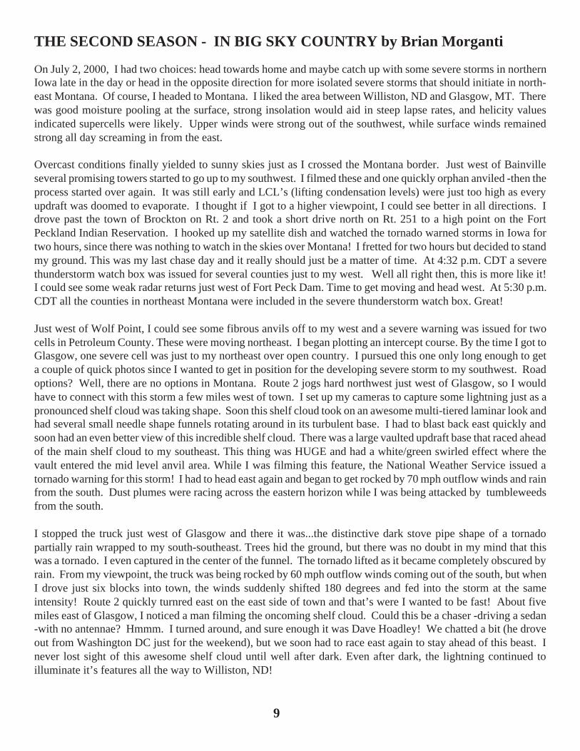
I stopped the truck just west of Glasgow and there it was...the distinctive dark stove pipe shape of a tornadopartially rain wrapped to my south-southeast. Trees hid the ground, but there was no doubt in my mind that thiswas a tornado. I even captured in the center of the funnel. The tornado lifted as it became completely obscured byrain. From my viewpoint, the truck was being rocked by 60 mph outflow winds coming out of the south, but whenI drove just six blocks into town, the winds suddenly shifted 180 degrees and fed into the storm at the sameintensity! Route 2 quickly turnred east on the east side of town and that’s were I wanted to be fast! About fivemiles east of Glasgow, I noticed a man filming the oncoming shelf cloud. Could this be a chaser -driving a sedan-with no antennae? Hmmm. I turned around, and sure enough it was Dave Hoadley! We chatted a bit (he droveout from Washington DC just for the weekend), but we soon had to race east again to stay ahead of this beast. Inever lost sight of this awesome shelf cloud until well after dark. Even after dark, the lightning continued toilluminate it’s features all the way to Williston, ND!
9

TORNADO DEATHS BY CENSUS REGION, 1680-1999 by Tim Kenny
It has long been considered fact by many, including the author of this article, that the Great Lake states, northern GreatPlains, and central Great Plains collectively constitute the center of both tornadic activity and tornado deaths in the UnitedStates. As a sociologist dealing with detailed population statistics, I have been fascinated by the immense amount of data inthe successive editions of SIGNIFICANT TORNADOES, a work by Tom Grazulis. During the past several years, I havebeen tabulating statistics from this book on tornado deaths and the available reports after 1995 by census region. Theexamination of these data have revealed that, in fact, a clear majority of fatalities have occurred in the South, with even ahigher percentage of persons killed in the South in the most recent decade.
The Census Bureau has divided the U.S. into four regions. There are nine states in the Northeast Region, 12 states in theNorth Central Region, 13 in the West Region, and 16 states including the District of Columbia in the South Region. It shouldbe admitted that some states might qualify to be put in regions other than those chosen by the Census Bureau. The tornadodata base for this article was compiled from SIGNIFICANT TORNADOES and its 1992-1995 update plus post-1995 yeartotals derived from WEATHERWISE MAGAZINE, news accounts, and other sources. The latter references should beviewed with some caution until further verified.
The total number of tornado related fatalities in the U.S. was 19,821 from 1680 to the end of 1999. There is probably asignificant component of uncounted deaths prior to the 1950’s, with the number increasing the farther back one goes inhistory. Of the deaths that have been recorded, 12,202 (61.6%) were in the South Region, 7,117 (35.9%) were in the NorthRegion, 437 (2.2%) were in the Northeast Region, and 65 (.3%) were in the West Region. Interesting patterns were found inthese data when looking at 100-year intervals. Between 1700-1799, there were only 13 recorded deaths in the South andNortheast Regions as most of the U.S. population was still east of the Appalachain Mountains. Between 1800 and 1899,there were 4,657 recorded deaths in the U.S. reflecting the both the rapid growth of U.S. population as well as the westwardmovement of people into tornado-prone areas. Most of the tornado deaths (53%) occurred in the North Central Region withmost of the remaining deaths (43.8%) occurring in the South Region. Between 1900 and 1999, there were 15,150 reportedtornado deaths in the U.S. Besides the tripling of reported deaths over the previous century, there was a pronounced regionalshift with most deaths (67%) occurring in the South Region with about one-third (30.7%) of the reported deaths occurring inthe North Central Region.
The reasons for the immense southern death toll are many and varied. Vegetation cover and visibility are two related factors.Many Nebraskans and Kansans can look out across miles of flat, treeless land and spot approaching storms at a considerabledistance. In contrast, people living in the wooded hills of Arkansas and northern Alabama have no such advantage. Varia-tions in construction practices are another factor. Many people in the central Plains and Midwest have basements whereasmost people in the south do not. Also, more people live in manufactured homes in rural areas. Thus, many southernhomeowners lack the important protection of being able to go below ground level in times of violent weather. The benignsouthern climate is another factor with mild winters allowing less robust dwellings to be built than farther north. Further-more, the south usually has a longer tornado season that is not as sharply peaked allowing for further complacency. Thenthere is the possibility of a night time tornado outbreak which is more likely to occur in the south providing increased risk toa mostly sleeping populace. My analysis of both tornado and census data has led me to conclude that deadly tornadooutbreaks are going to continue with people in the South at greatest risk. Obviously more needs to be done in terms ofeducating the public on this tornado threat.
Reported U.S. Tornado Deaths by State “The Deadly Dozen” 1680 - 1999
1. Mississippi 2059 7. Missouri 12212. Texas 1732 8. Georgia 11323. Illinois 1628 9. Kansas 7094. Arkansas 1472 10. Iowa 7005. Alabama 1418 11. Tennessee 6816. Oklahoma 1290 12. Louisiana 673 U.S. Census Regions
10

APRIL 8, 1998 BIRMINGHAM, AL TORNADO by Tim Marshall
On the evening of April 8, 1998, a squall line developed in Mississippi and moved rapidly northeastward through northernAlabama and northern Georgia. A supercell developed within a broken line segment and produced three tornadoes innorthern Ala. The tornadic storm developed and propagated along a pre-existing boundary. See Pence and Peters (2000) fora meteorology discussion of this event. The second tornado traveled 31 miles over the rolling, forested terrain, lifting just asit reached the northwest suburbs of Birmingham. The tornado killed 32 people and produced F-5 damage in several areasalong its path. I flew to Birmingham to conduct a damage survey and met with Mr. Brian Peters, the meteorologist in chargeof the Birmingham National Weather Service, Matt Biddle an OU student, and Jeff Wright, a long-term ST subscriber fromPinson, Alabama. We spent two days surveying the damage from this tornado.
The F5 tornado began just south of the remote community of Scrap about 7:53pm CDT and traveled northeast throughremote areas. The first major damage occurred on the northwest side of Oak Grove where the High School suffered majordamage. The main school building was a one- and two-story steel-framed structure enclosed by concrete masonry. Openweb steel joists and steel decking supported the roof. Classrooms were arranged along the sides of the building with a centerhallway. This was a typical school building with many windows in the classrooms. The tornado center line passed just northof the school placing it on the right side of the tornado track. Thus, the school experienced the strongest winds (rotation plustranslation) which struck from south through west. Windows blew in along the south and west sides of the building and mostof the second story roof deck blew away leaving the welded steel roof joists in place. Shards of glass and other debris werefound in the north and east walls inside the classrooms. Most hallways provided adequate shelter from the tornado, how-ever, a few interior walls did topple into the southern portion of the building filling the hallways with concrete masonryblock. It was a good thing, school was not in session when the tornado struck.
South of the High School building was a large auditorium. The building was constructed with concrete and brick masonrywalls that extended about 30 feet above the ground. The roof was supported by large steel trusses which spanned the entirestructure. Eleven cheerleaders were practicing their dance routines inside the auditorium when the tornado struck. Theyreportedly cowered against the wooden (stackable) bleachers on the northeast wall. The auditorium collapsed like a houseof cards with the entire structure toppling to the northeast. The heavy steel trusses fell striking the tops of the bleachers andprotected the cheerleaders from being crushed. Interestingly, there was a one-story foyer on the southeast side of theauditorium which survived unscathed. The roof had heavy, double-tee, concrete roof planks which stayed intact. Even theglass lined trophy cases inside the building remained undamaged and none of the trophies were moved.
The tornado continued through a heavily forested area. Thousands of trees were literally mowed down along a half milewide path amounting to about 4,000 acres of flattened woodlands. Many hills and valleys stood in the path of the tornado,but it did not matter. Several people we spoke with told us of how they could see neighbors they never had seen before.Many rural residents lived in unanchored wooden-framed houses supported on block or brick piers. Such buildings were nomatch for the intense tornado and these homes were swept clean from their foundations. Brick piers were simply placed onthe ground to level and support the wooden floor beams. Thus, these homes were displaced from their foundations anddisintegrated in relatively low wind speeds. Windward walls acted like a sail to catch the wind and the houses would bepushed downwind. In some instances, homes were totally destroyed whereas surrounding trees sustained little damage.Although the damage in this tornado was consistent with an F-5 rating, I could find no evidence of F-5 wind speeds. Peoplewho sought shelter inside such buildings had little chance of surviving without being seriously injured. Legates and Biddle(1998) indicated that 89% of the tornado victims died of Blunt Force Trauma (BFT) from being impacted by debris and/orthe ground. They also indicated that their was conclusive evidence in 71% of the cases that the victims became airborne.Few mobile homes were struck, thus, most of the injuries and fatalities occurred in regular homes. We heard that emergencyresponse was impaired by the numerous downed trees and power lines.
As the tornado approached the outskirts of Birmingham, it went through several communities including Pleasant Grove,Edgewater, and McDonald’s Chapel. The tornado destroyed (F2 or greater) 1,100 homes, 15 churches, 13 commercialbuildings and 20 apartment units. Had the tornado stayed on the ground another two miles, downtown
11

Birmingham would have been hit. Most of the residential construction was poor including newly constructed homes. Manysuburban homes consisted of wooden-framing built on top of hollow block masonry walls. The bottom plates on the woodenframe were attached to the top course of masonry using one-foot long “J-type” bolts that were inserted into the cells in themasonry and grouted. Many homes failed at this connection. Typically, the bolts broke out of the concrete masonry or thetop blocks were transported downwind along with the house. We also saw many instances where the bolts did not have nutsor washers. Legates and Biddle (1998) indicated that only 19% of the homes in their survey had any type of foundationanchoring.
One man told me that he had arrived at home just before the tornado struck. The local weatherman on television warned ofa tornado approaching from the southwest. The man stood out on the front porch watching the sky to the southwest. It waspitch black and he really couldn’t see anything. Then, he started to hear a roaring sound. It was getting louder and louder.He said puddles of standing water began to vibrate as the ground shook like an earthquake. He ran back into the house andgathered the family in the bathroom and huddled down next to the bathtub. The tornado hit quickly taking the roof and walls.The west wall of the bathroom fell outward and the east wall fell eastward leaving the family unscathed huddled on thewooden floor. They were the tallest thing left. Had the tornado moved slower, like in Jarrell, Tx in 1997, they wouldn’thave survived. The Birmingham tornado traveled 32 miles in 36 minutes, or an average speed of 54 mph. The tornado liftedjust west of the city of Birmingham around 8:28pm CDT.
The fast moving storm caught some people off guard, especially if they weren’t paying attention to the weather. Mostpeople we spoke with received warning about the tornado from the local television news media who had continuous cover-age showing real time Doppler images of where the storm was and where it was headed. A tornado warning was issued forJefferson County at 7:45pm, eight minutes from the reported first touch down and about thirty minutes before striking themore densely populated suburbs.
Legates, David R., and Matt Biddle, 1998: Warning Response and Risk Behavior in the Oak Grove-Birmingham, AL Tor-nado of 08 April, 1998., Quick Response Report #116, Natural Hazards Center, Univ. of Colorado, Boulder. Also availableat: http://www.colorado.edu/hazards/qr/qr116/qr116.html
Pence, Kevin J. and Brian E. Peters, 2000: The Tornadic Supercell of 8 April 1998 across Alabama and Georgia, 20thConf. on Severe Local Storms, Orlando, FL, p. 206-209. Also see: http://www.srh.noaa.gov/bmx/april_08_1998/april_08_1998.html
Map showing tracks of tornadoes on April 8, 1998 along with most intensetornado striking near Birmingham, Alabama (courtesy of BHM NWS).

