inagua archaeology - florida museum
TRANSCRIPT

Inagua Archaeologyby William F. Keegan
Miscellaneous Project Report Number 51 Department of Anthropology
Florida Museum of Natural History May 1993
Introduction
Great Inagua Island occupies a strategic position in the northernWest Indies. Straddling the passage between Cuba andHispaniola, Great Inagua is the apex in an equilateral triangle thatdefines the Windward Passage. Inagua's location is important intwo regards. First, if one branch of the Ceramic Age colonization ofthe northern West Indies proceeded along the north coast ofHispaniola to Cuba, then Great Inagua is the likely first landfall inthe Bahama archipelago. Second, Irving Rouse (1992) hasconclusively demonstrated that cultural developments in the WestIndies are focused on interisland passages. It is therefore likelythat the first Inaguans participated in the interchange betweenwestern Hispaniola and eastern Cuba across the WindwardPassage.
With those themes in mind, Dr. Steven Mitchell and I conducted anarchaeological and geological survey of Great Inagua in 1984. TheInagua investigation was one of several comprehensive surveyswe conducted in the south and central Bahama Islands between1982 and 1987 (Keegan 1983a, 1983b, 1988; Keegan and Mitchell1983, 1984a, 1984b; Keegan, Williams, and Seim 1990; Mitchelland Keegan 1987). The results of the Inagua survey weresummarized in my dissertation (Keegan 1985), but the details werenever fully published. There was no compelling reason toelaborate on that summary until I reinvestigated archaeologicalsites on Great Inagua in 1992 and 1993. The 19921993investigations developed out of a contract with U.S. Customs. U.S.Customs was preparing to build an Aerostat base on Great Inagua.Because Inagua is ecologically and archaeologically sensitive, theBahamas National Trust asked Customs for an external review ofthe archaeological impacts of the Aerostat project. This evaluationwas conducted in September 1992 (Keegan 1993), and again inMarch 1993.
The present report has three objectives. First, the probableimportance of Great Inagua in West Indian prehistory is discussed.

Second, the investigations conducted in 1984, 1992, and 1993 arereported in detail. Third, complete reports for the 13 archaeologicalsites on the island are appended. It is clear in this report that muchadditional work needs to be done. Great Inagua has not beencompletely surveyed and Little Inagua has not been investigated atall. Moreover, the 19921993 investigations showed that eventhose areas that were surveyed previously merit additionalattention. Lastly, many of the sites are difficult to assess given thelimited amount of material comprising their surface scatters. Testexcavations at all of these sites are needed. Great Inagua is ahuge island; it will consume enormous energies before itsprehistory is fully revealed.
Environmental Background
Great Inagua is located between 20.9° to 21.4° North latitude and73° to 73.9° West longitude in the Commonwealth of the Bahamas.With an area of 1544 square kilometers it is the third largest islandin the archipelago. However, Lake Windsor comprises almost onequarter of the interior, and most of remaining area is dominated bylow, swampy terrain. The highest elevation is 33 meters. Despiteits large size, there is only one settlement, Matthew Town, locatedin the southwest corner of the island. The population todaynumbers less than 1500. The major industry on the island isMorton Salt, which operates a huge solar distillation facility justnorth of town. That industry was modernized by the Erickson familyin the 1930s (Erickson 1987). Much of the rest of the island is aNational Park managed by the Bahamas National Trust for theprotection of a large flamingo colony. In addition, the island was,quite accidently, the site of the first natural history studyundertaken in the Bahamas (Klingel 1940).
During our 1984 survey we discovered that the more thingschange, the more they stay the same. Less than half of the island'scoast is accessible by road. In the west the road ends at theBahama National Trust camp at Union Creek, an hour drive fromMatthew Town; to the east, 4wheel drive vehicles have recentlyextended the road past South East Point. The island remains ahaven for local hog and pigeon hunters and fishermen. Our 1984survey took us to end of the road in both directions (approximately130 km or 80 miles).
For the purposes of investigating the prehistory of the Bahamas,investigators have found it useful to identify three biomes (Searsand Sullivan 1978; Keegan 1992). The boundaries between thesebiomes conform to the 800, 1200, and 1500 mm rainfall isohyets,and also reflect minor differences in seasonal temperaturefluctuations. The combination of rainfall and temperature havecontributed to modern differences in vegetation. In the northernsubarea the vegetation is characterized as subtropical moist forestwith yellow pine (Pinus caribaea v. bahamensis). The centralsubarea is tropical moist forest dominated by mahogany(Swietenia) woodland. The southern subarea, which includesGreat and Little Inagua, the Turks and Caicos Islands (except

North Caicos), Ragged Island, and the southern tip of AcklinsIsland is characterized by tropical very dry forest. In contrast to thenorthern islands, with their distinct wet (May/June to October) anddry seasons, there is a pronounced drier break (July to August) inthe April/May to October/November rainy season (Little et al.1977:9). October is the wettest month.
In the southern islands the constant trade winds exert a pervasiveinfluence on life zones (see Klingel 1961). While longterm recordsare not available, the average wind speed in the southern islandsis somewhat higher than the average for the northern islands (cf.Halkitis et al. 1980). Doran (1955) reports that tropical stormsoccur at an average of about one every four years. Only threehurricanes were recorded between 1871 and 1963.
The wind affects the environment by increasing evaporation andtranspiration. The early settlers of this subarea found that theremoval of trees increased the evaporation rate, which in turnincreased the yields from solar distillation of salt. Land clearancecontributed to the rapid dessication of the landscape, and its affecton soil fertility has prevented natural reforestation. When theislands were forested, the forest cover limited nutrient leaching,diffused rain drops, maintained cooler soil temperatures, providedlitter at a faster rate than decay, and acted to neutralize thealkaline carbonate matrix (Webster and Wilson 1966).Deforestation reversed those processes and exposed the soil todirect insolation and rainfall, which further reduced the amountsand availability of plant nutrients (Roosevelt 1980).
On Great Inagua, potential evapotranspiration is 2.5 times higherthan average rainfall (Little et al. 1977). For plants, especiallythose with stomata adapted to xeric conditions, that difference issignificant only when an alternative source of water is not available(e.g., groundwater). All of the southern islands presently lack welldeveloped groundwater resources, although localized freshwaterlenses do occur. Groundwater levels were probably significantlyhigher prior to human colonization. The best evidence for highergroundwater tables comes from Pine Cay, Caicos Islands, whichhas the only standing freshwater ponds in this subarea. There arepresently seven ponds on the cay, but an eighteenth centuryFrench navigation manual reported the presence of a large"lagoon" with enough freshwater for 50 ships crews (Bellin 1768).The dissection of this lagoon reflects modern construction activitiesand increased aridity from land clearance.
Previous attempts to correlate prehistoric occupations withenvironmental variables have given primary attention to the aridcharacter of the modern environment. Sears and Sullivan (1978),for example, cite the occurrence of ponds that produce saltthrough solar distillation. However, it should be noted that solar saltproduction was not limited to the southern subarea. Commercialsalt production was conducted on Long Island, Rum Cay, LittleExuma, Eleuthera, Cat Island, and San Salvador in the centralsubarea; and on New Providence, the Berry Islands, and several

small cays in the northern subarea (Bahamas Department ofArchives, 1980).
Agricultural land in the southern islands is limited to the westernshores, and the modern settlements on Great Inagua, Mayaguana,and the Turks and Caicos Islands are largely restricted to thewestern sides of these islands. Vegetation along the easternwindward shores tends to be stunted, xerophytic, and salt tolerant.Higher average wind speeds have contributed to the developmentof a low (c. 1 m) vegetation that is visibly bent by the wind. AsGilbert Klingel (1961:178) expressed it: "Life flowed all in onedirection." With the Atlantic Ocean as a potential fetch, oceanswells break on the near shore reefs in a cascade of spray. Thissalt spray is carried on the tradewinds, and at times produces theeffect of rainfall on shore. Because rainfall is, for the most part,limited to summer convective showers, the windward east coastsreceive less rainfall. Convection cells are generated over sunheated landmasses and shallow banks. When the heated airpenetrates cooler levels of the atmosphere, cumulus clouds areformed. Rainfall would be evenly distributed if these clouds werestationary, but the tradewinds, which are at their strongest in thesummer, form the clouds into a narrow band which is directed tothe westnorthwest (Little et al. 1977; Sullivan 1981).
Paleoecological and geological evidence point to higher levels ofrainfall and deeper soils in the past (see Carbone 1980). The bestexample is found in Conch Bar Cave on Middle Caicos wheresolution features in the cave were produced when acidic waterdissolved the limestone walls of this enormous cavern. A higherlevel of rainfall would have been required to produce the observedeffect, and a deeper soil layer was necessary to neutralize thecarbonate matrix and to acidify the water that passed through thesoil. Even though higher rainfall levels and soil fertility probablymaintained a more verdant vegetation, a clinal variation from eastto west would, even then, have characterized the environment.The windward shore would have supported low, stunted tropicalwoodland and thornbrush with cacti and other succulents. Movingto the west, canopy height would have increased with woodlandvegetation dominating thornbrush.
Great Inagua has many qualities that would have promotedaboriginal settlement. Despite modern conditions, the island wouldhave supported a more verdant vegetation, especially along thewest coast. Abundant marine resources are found along the coast,and especially in the large protected tidal creeks. Lake Windsormay have supported marine fish and mollusks prior to thedevelopment of salt works. [The original salt works on the islandwere located near South West Point and on Red Salt Pond nearUnion Creek.] Rainfall was probably somewhat higher, soil fertilitybetter, and the island is outside the main track of tropical stormsand hurricanes.
Today, the vegetation can be divided into three basic categories orformation types. The sandy soils along the coast support a

"whitelands" vegetation which is dominated by pioneer speciessuch as sea grapes, grasses, purslane, and Palmetto palms. Sincetheir introduction during historic times, the Australian Pine(Casuarina litorea) and coconut palm (Cocos nucifera) haveproved to be successful colonists of this zone. "Coppice"vegetation, comprised of tropical hardwoods and shrubs,dominates the interior and more developed soils. Along themargins of ponds and estuaries mangroves, buttonwoods, andsimilar species comprise a "pondtype" vegetation. Differences invegetation have proved important in identifying archaeologicalsites (Sullivan 1981), the majority of which occur in areas ofcoppice vegetation.
Four coastline types are important for the archaeology of GreatInagua (see Keegan 1991b): sand beaches, eolianite, beach rock,and tidal creeks. Sand beaches are composed of unconsolidatedaccumulations of marine sediments. Beaches are importantbecause they provided unimpeded canoe landings for theAmerindian inhabitants of the islands. Most archaeological sites inthe archipelago are located on or adjacent to sand beaches.Eolianite is composed of cemented sediments that have erodedinto sharp dissected surfaces punctuated by sharp pinnacles (e.g."dogtooth" limestone). Only minor changes have occurred ineolianites during the past 500 years.
Beach rock is composed of poorly cemented marine sediments. Itis formed beneath sand dunes through the cementation of sand,crushed shell, precipitates, and other beach materials. Its age canbe estimated from color, texture, and degree of cementation. Fossilbeach rock terraces attest to higher eustatic sea levels (prior to35,000 years ago), and extensions of beach rock into the seaattest to periods of lower relative sea level. There is no evidence oftectonic uplift. Recent beachrock formations have incorporatedmodern artifacts such as nails and bottle caps. Archaeologicalsites are common above recent beach rock formations, but areusually absent from the vicinity of older formations.
Tidal creeks are the Bahamian equivalent of estuaries coastallakes with an outlet to the sea. They are not, however, trueestuaries because they lack a freshwater influx (Sealey 1985).Mitchell's (1986a, 1986b) studies of the evolution of coasts frombays to tidal creeks to lakes have demonstrated that many coastallakes were actually tidal creeks during the period of prehistoricsettlement. In 60 cases, Mitchell found that modern lakes that weretidal creeks 500 to 1000 years ago have evidence for Lucayansettlement, while lakes that were lakes during that period do not(Mitchell and Keegan 1987; Keegan 1991b).
Initial Colonization of the Bahamas
The Bahama archipelago was first settled during the Ostionoidexpansion that began from western Puerto Rico about A.D. 600and concluded in Cuba and Jamaica about A.D. 1200 (Keegan1992; Rouse 1992). Some date the colonization of the Bahamas toaround A.D. 800, coincident with the development of Meillacan

Ostionoid pottery on the north coast of Hispaniola (Sears andSullivan 1978; Sullivan 1981). Meillacan pottery is common inBahamian sites, while its predecessor Ostionan Ostionoid potteryis virtually absent (cf. Hoffman 1967; Sullivan 1981; Berman andGnivicki 1991). Others date the timing of initial colonization to atleast a century earlier; the opinion favored by myself on the basisof demographic indicators (Keegan 1985, 1992). This difference ofopinion may soon be resolved. Excavations directed by Mary JaneBerman and Perry Gnivecki at the Three Dog site, San Salvador,have yielded two of the earliest radiocarbon dates yet obtained fora Bahamian site. An earlier date obtained by Richard Rose fromthe Pigeon Creek site from turtle bone may be affected by themarine reservoir effect and isotopic discrimination (see section onradiocarbon dates, below).With calibrated ages in the mideighth toninth centuries A.D. they offer some support to the preMeillacansettelement thesis. In addition, Berman has identified some of thepotsherds in the lowest levels of the site as being OstionanOstionoid. A full evaluation of these materials must await thepublication of their analyses (Berman and Gnivecki 1991).However, it should be noted that Rouse (1992) gave his support totheir findings in his recent book.
When considering the timing and location of initial colonization it isworth considering possible motives. At first glance, the small sizeand arid conditions of the southern Bahamas would seem to offerfew enticements to people living on the much larger and wetterislands of the Great Antilles. For that reason, convential wisdomhas held that the Bahamas were settled out of necessity: Either theislands of the Greater Antilles had filled to capacity and colonistswere literally pushed into the Bahamas (Sears and Sullivan 1978),or Island Carib raids on the Greater Antilles caused people to fleeto the Bahamas to escape the onslaught (Craton and Saunders1992), or the presence of a crucial dietary mineral, salt, attractedcolonists who sought to control its trade (Sullivan 1981). None ofthese explanations is satisfactory.
In the first place, the population in the Greater Antilles at the timethe Bahamas were colonized would have been relatively small.The fact that the population seems to have grown rapidly untilSpanish contact contradicts the filledtocapacity explanation (cf.Cook and Borah 1971; Henige 1978). Second, the Island Caribnever expanded beyond the Windward Islands of the LesserAntilles, and their development occurred many centuries after theBahamas was colonized (Rouse 1992). Furthermore, as theSpanish learned, the Tainos were quite capable of defendingthemselves against foreign intrusions. Finally, although salt mayhave been a major trade good during late Classic Taino times, itsimportance and stimulating influence would not have been felt untilseveral centuries after the Bahamas were colonized.
Despite their smaller size and drier climate, the southern Bahamaswould have been very attractive to root crop horticulturalists. Asdiscussed above, the prehistoric vegetation would have beencharacterized by tropical woodlands or tropical forest, and even if

rainfall was not appreciably greater, the taller tropical vegetationwould have acted to retain water and make the islands significantlyless dry. The soil would have been richer, given almost two millionyears of undisturbed development, and the sandy soils would havebeen wellsuited for the type of rootcrop cultivation that waspracticed by Ostionoid peoples. Moreover, manioc, their stablecultigen, produces more starch when the rainy season is follwedby a pronounced dry season (Roosevelt 1980).
With regard to the first arrivals, the easily hunted land animalswould have occurred in high density due to the absence ofpredators and competitors. Seasonal aggregations of monk sealsand green turtles would have provided an abundant food sourcethat was easily harvested. The smaller sizes of the Bahamaislands were actually an advantage for people who relied on thesea for a substantial portion (perhaps 50%) of their food (Keeganand DeNiro 1988). Marine animals of all types would have beenmore abundant and more readily accessible than they were onnorthcoast locations in the Greater Antilles. In sum, theabundance of marine and terrestrial resources in the Bahamascombined with the more favorable climate and vegetation providestrong support for the conclusion that these islands would havebeen attractive to Ostionoid colonists.
Another aspect that remains to be shown is the source area for theinitial colonists. I have emphasized a single source of colonistsbecause the prehistoric Bahamas seem to have a single Potteryware (Mann 1986). I cannot accept that multiple migrations fromseparate sources would not have produced multiple wares, evengiven the apparent technological constraints. It is possible thatmultiple wares will be identified, we presently have only arudimentary knowledge of Palmetto ware and its constituents. Untilmultiple origins are demonstrated, I will concentrate on identifyinga single source.
With regard to pottery, the similarities between pottery in thenorthern Lesser Antilles and Palmetto ware in the Bahamas, firstmentioned by Hoffman (1967:125) should be reexamined. With thedate for Saladoid colonization of the West Indies being pushedback into the last half of the first millennium B.C., the long pausebetween their arrival in Puerto Rico and their expansion intoHispaniola grows longer. If the frontier in eastern Hispaniola was afunction of a hostile indigenous population, it is possible that thelargest islands of the Greater Antilles were bypassed and theBahamas were settled directly from the Virgin Passage (easternPuerto Rico/Virgin Islands area). Although the distance issubstantial (about 400 miles), it is not impossible, especially if thefinal step in the jump was first attempted eastern Hispaniola.Furthermore, in addition to similarities in pottery manufacture(shelltempered wares) and decoration, the islands are of similarsize and have similar marine and terrestrial resources.
In my book (Keegan 1992), I described three other possibilities,Cuba to Long Island, Hispaniola to the Caicos, and Hispaniola to

Great Inagua. These will be reviewed briefly to incorporatecomments that my discussion elicited. When I began conductingresearch in the Bahamas, one of the first theories I heard was thatthe initial colonists came from Cuba. Trying to pin this theory on aparticular investigator proved daunting. In 1978, Sears andSullivan (1978:22) noted that "The Bahamas were first settled inZone III between 800 and 1000 A.D. by Arawaks who madeMeillacoid pottery from either Hispaniola, Cuba, or both." Yet, bothSears and Sullivan had discarded the Cuba connection by 1981(Sullivan 1981).
In writing about this theory (Keegan 1988, 1992), I turned to apaper by Winter, Granberry and Liebold (1985) because theydiscussed Cuba as a possible source of colonists and becauseWinter had presented a paper in 1982 in which he seemed to favora Cuban source area (recently published as Winter and Gilstrap1991). The context in which I cited their work offended both Winterand Granberry, although I meant no offense. Winter (1989)responded in a Letter to the Editor of the Journal of the BahamasHistorical Society. Granberry (1993) responded in a review of mybook, in which he stated, "I know of no professional Lucayanistwho subscribes, would subscribe, or has ever subscribed to such aCubaLong Island initial "Taino" settlement hypothesis" (Granberry1993:59; emphasis in original). It is with pleasure that I put thisphantom theory to rest, with apologies to those I offended.
Whether Cuba or Hispaniola (or the Virgin Passage area) was thesource of colonists remains an open question. Several possibilitiesneed to be explored. First, because Rouse (1992) has shown thatcultural developments were centered on interisland passages itmight be more accurate to view colonists as originating in theWindward Passage rather than on Hispaniola or Cuba. In otherwords, their homeland was not defined by insular boundaries.
Second, Granberry has shown that the Lucayan name for GreatInagua (Inawa) glosses as "Small Eastern Land," and the Lucayanname for Grand Turk (Abawana) glosses as "First Small Country"(Granberry 1991:10). He then uses other surviving names to tracetwo migration routes into the Bahamas. One is from Hispaniolathrough Grand Turk, the other is from Cuba to Great Inagua andfrom there to Ragged Island into the central Bahamas (LongIsland). These routes are discussed in turn.
The earliest scientific archaeology in the southern Bahamas wasconducted by Shaun Sullivan in the mid 1970s (1976, 1980, 1981).Sullivan's discoveries on Middle Caicos led him to suggest that theCaicos Islands were the first to be settled. He also concluded thatthe eastern Caicos (East Caicos, South Caicos) and the Turksgroup were never inhabited because their climate was too dry.Recent investigations have shown that the eastern Caicos andTurks group were inhabited (Keegan et al. 1990; Keegan 1991a).Ongoing investigations in the Turks and Caicos are providing thedata needed to evaluate both Sullivan's and Granberry'ssuggestions regarding the colonization of the Bahamas. Although

additional details must await the completion of the NationalGeographic Society sponsored project "Precolumbian CulturalInteractions in the northern West Indies," it has already beenreported that a Taino outpost dating to the early 13th century A.D.was established on Grand Turk (Keegan 1992b).
With regard to the central Caicos as the site of initial colonization,Sullivan used three data sets to support this hypothesis: settlementpatterns, pottery analysis, and ecological factors (Sullivan 1981).Elsewhere I have argued that the data do not support an earlyintrusion into the Caicos, but rather reflect a late period expansionof Antillean Taino hegemony into the periphery (Keegan 1991b,1992a). I will not recount that argument here. At present, there isnot sufficient evidence to support the Turks or Caicos Islands asthe location of the initial Taino colony in the Bahama archipelago.
According to Rouse (1986, 1992), the Ostionoid expansion acrossnorthern Hispaniola to Cuba stalled on the Cuban frontier. Oneresult was a growing population in stuck western Hispaniola thatwas ready to avail itself of the Bahamian outlet only 90 kilometers(54 miles) to the north. Moreover, given his reclassification ofpottery styles, the frontier that Rouse identified in this area mightbe better reclassified as a passage area. In other words, ifPalmetto ware developed directly out of an Ostionan Ostionoidtradition, then its origins may be traced to the Windward Passage,and the colonization of the Bahamas could date to before thedevelopment of Meillacan Ostionoid pottery around A.D. 800 (seeBerman and Gnivecki 1991; Rouse 1992).
Taino expansion along the north coast of Hispaniola and ontoCuba may be the key to the colonization of the Bahamas. Theproblem remains finding archaeological evidence that matches thatexpected of the first colony. The 1984 archaeological survey GreatInagua provided a partial breakthrough. Great Inagua had beenignored previously because the architects of an earlier colonizationmodel did not have time to survey the island. In their summary ofBahamas prehistory, William Sears and Shaun Sullivan (1978)simply concluded that Great Inagua must have been too dry tohave ever supported permanent settlement. Our survey uncoveredevidence for permanent habitation sites.
Great Inagua is a better candidate for the first colony than is theCaicos for several reasons. Inagua is larger and is closer to bothHispaniola and Cuba. Moreover, if salt were the motive behindcolonizing these islands (Sullivan 1981), Great Inagua is at leastequally likely because it has more substantial saltproducing pondsthan does the Caicos. Great Inagua also has a higher likelihood ofbeing contacted from Hispaniola.
Two factors are of immediate importance (Keegan and Diamond1987; Held 1993). The first is distance; the second is maritimeconditions that influence travel (e.g., wind, waves, and currents).With regard to distance, none of the southern Bahamas are visiblefrom Hispaniola. However, signs of these islands in the form ofweather patterns and bird migrations (especially flamingoes) would

indicate the presence of islands to those who knew how tointerpret the signs. In terms of measured distance, Great Inagua isthe closest Bahama Island to the Greater Antilles being only aboutten kilometers (six miles) farther from Hispaniola than is Cuba.
Maritime conditions can be divided into the categories of winddirection, wind intensity, and ocean currents. The net effect ofthese three factors is to favor voyaging from east to west. Theprimary factor is the easterly trade winds which are dominant abouttwothirds of the year. These winds are complemented by thenorthwesterly trending Antilles Current which flows through theislands at between 0.5 to 0.9 knots. These winds and currentstoday move a variety of floating objects onto beaches in thesouthern Bahamas. On the windward beaches of Great Inaguaand Mayaguana, the author has observed wooden statues andspoons, dugout canoes, and a canoe paddle of apparent Haitianorigin. A Haitian source has been proved in one case: rockstrapped in the root system of a palm tree that washed ashore onGreat Inagua have been shown to match the unique geologicassemblage in the vicinity of Cap Haitien (Keegan and Mitchell1986). If the Tainos on Hispaniola simply let the winds and currentstake them where they would, they would have drifted to GreatInagua.
Wind, waves, and ocean currents interact to either favor passagebetween islands, by pushing the craft along its intended course, orthey may impede travel by blowing from some angle to thedirection of travel thereby deflecting the canoe from its intendedcourse. If voyages from Hispaniola to the southern Bahamas weretimed to coincide with favorable marine conditions, travel to GreatInagua would have been favored about 281 days per year, whiletravel to the Caicos Islands would have been favored on about 91days per year. Great Inagua was an easier target than the CaicosIslands because it is both closer and more accessible. GreatInagua is the logical first colony, but logic is not by itself sufficientproof. Before addressing the question of whether Great Inaguawas the first island colonized, the results of archaeological surveysand excavations on the island will be reviewed.
Archaeological Survey of 1984
From June 23 to July 5, 1984, Dr. Steven Mitchell and I conductedan archaeological and geological survey of Great Inagua. Becausethe island had not been extensively surveyed, our objective was tocover as much of the island as possible. In sum, we coveredalmost 130 km (80 miles) of the coast. The speed of the surveyprevented us from covering all of the areas as thoroughly as wewould have liked, but it proved sufficient in providing an overviewof much of the island. Moreover, as previous and subsequentsurveys have shown, we were likely to have encountered at leastthe largest sites in the areas we examined. To provide as completean account of the survey as possible my field notes from thesurvey are presented below.

Bahamas National Trust turtle camp at Union Creek.
23 June. We arrived on Great Inagua and arranged housing. Itwas afternoon by the time we set out. We surveyed from MatthewTown to South West Point and up to the public warehouse. Fromthere we hiked the road back to Matthew Town. From town thebeach is eolianite rock to just beyond the lighthouse where it turnsto sand. The soil is extremely sandy, but looked tan near thechannel excavations. Shells occur along the beach. Threepunched conch shells were found in different locations, but nomidden or pottery was observed. The beach around the cornerfrom South West Point has been building steadily. Today there arebetween 4 and 6 fossil dunes preserved. Viewed from the air theshore has a corrugated appearance. The vegetation is whitelandsand all of the fossil dunes were each examined in several places.No sites were found. The beach here is littered with all sorts offlotsam, including dense mats of seaweed.
24 June.Jimmy Nixondrove us tothe BahamasNationalTrust (BNT)Field Stationat UnionCreek. Stevewent toexamine thetidal creekwhile Iwalked alongthe road toSmith SloopPoint. The
beach to Black Wood Point is sand, but very narrow with the tidalcreek behind. There are lots of shells along the beach and theroad, but most show evidence of having washed up. The soil isvery sandy. Beyond Black Wood Point the shore turns to very thickbeach rock about twometers wide in massive blocks. Areas alongthe beach look suited for settlement, except for the beach rock andnarrow width of the beach. No evidence of sites was found.
25 June. Steve and I hiked north across the causeway onto alarge cay. Most of the coast is sand beach, but beach rock occursbetween the ruins and the next point. We examined areas all alongthe beach and found one site (GI1) at the northern of two areas ofcasual cultivation. The site begins about 7 meters behind a sandbeach which fronts on a shallow marine flat with dense beds ofThalassia turtle grass. The site is near the mouth of a formeropening into Union Creek. A dense scatter of shell covers the site,including Strombus, Codakia, Cittarium, Chiton, Fasciolaria,Tellina, Nerita, and coral. Pottery is widely scattered and small insize. The 22 sherds we observed were collected; including 13imports and 9 Palmetto ware. In general the imports are larger, twosherds were decorated rims. Small limestone (firecracked) rocks
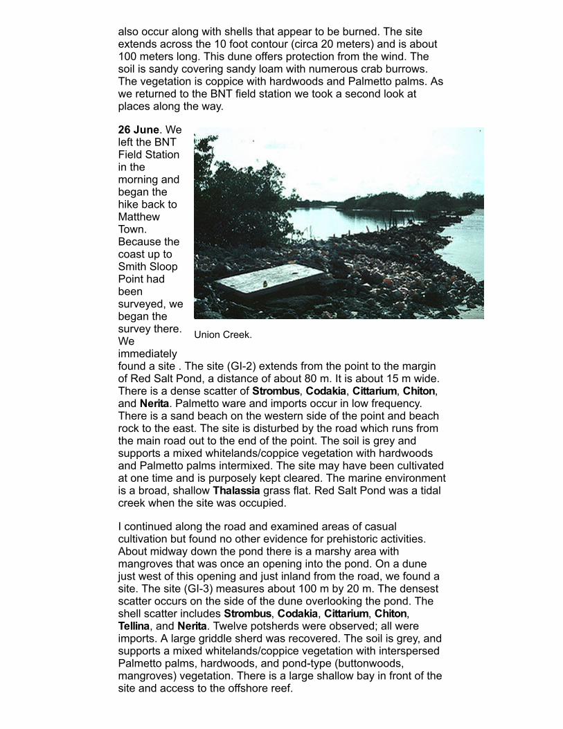
Union Creek.
also occur along with shells that appear to be burned. The siteextends across the 10 foot contour (circa 20 meters) and is about100 meters long. This dune offers protection from the wind. Thesoil is sandy covering sandy loam with numerous crab burrows.The vegetation is coppice with hardwoods and Palmetto palms. Aswe returned to the BNT field station we took a second look atplaces along the way.
26 June. Weleft the BNTField Stationin themorning andbegan thehike back toMatthewTown.Because thecoast up toSmith SloopPoint hadbeensurveyed, webegan thesurvey there.Weimmediatelyfound a site . The site (GI2) extends from the point to the marginof Red Salt Pond, a distance of about 80 m. It is about 15 m wide.There is a dense scatter of Strombus, Codakia, Cittarium, Chiton,and Nerita. Palmetto ware and imports occur in low frequency.There is a sand beach on the western side of the point and beachrock to the east. The site is disturbed by the road which runs fromthe main road out to the end of the point. The soil is grey andsupports a mixed whitelands/coppice vegetation with hardwoodsand Palmetto palms intermixed. The site may have been cultivatedat one time and is purposely kept cleared. The marine environmentis a broad, shallow Thalassia grass flat. Red Salt Pond was a tidalcreek when the site was occupied.
I continued along the road and examined areas of casualcultivation but found no other evidence for prehistoric activities.About midway down the pond there is a marshy area withmangroves that was once an opening into the pond. On a dunejust west of this opening and just inland from the road, we found asite. The site (GI3) measures about 100 m by 20 m. The densestscatter occurs on the side of the dune overlooking the pond. Theshell scatter includes Strombus, Codakia, Cittarium, Chiton,Tellina, and Nerita. Twelve potsherds were observed; all wereimports. A large griddle sherd was recovered. The soil is grey, andsupports a mixed whitelands/coppice vegetation with interspersedPalmetto palms, hardwoods, and pondtype (buttonwoods,mangroves) vegetation. There is a large shallow bay in front of thesite and access to the offshore reef.

We continued along the road. When we reached the North WestPoint peninsula Steve walked to the point along the beach while Itook the road to the south, which cuts directly across to theopposite shore. No sites were found by Steve on his trek to thenorth. After crossing the peninsula I walked up and met Steve atNorth West Point and we examined areas along that shoretogether. The bay here is a high energy with beach rock, rubble,and large boulders along the shore and tossed up onto the dune.There are groves of coconut palms all along the shore. Returningto the junction in the road, I first walked through a coconut grovealong the back side of the pond. The land is low and probablyfloods periodically. No evidence of sites was found. At the roadjunction just west of Red Salt Pond I found a single Palmetto waresherd in a coconut grove (GI4). The area is highly disturbed byroads, sand intrusion from the beach, and coconut plantings.Surface visibility is poor due to palm fronds, coconuts, and densevegetation. The shell scatter includes includes Strombus, Codakia,Cittarium, Chiton, Tellina, Fasciolaria, and Nerita, and corals alongwith beach wash. The scatter is quite large and extends from thenorthsouth road to the pond. The size of the site cannot bedetermined because the area has been used for many years (apipe stem was found along the road). The hardwoods are verylarge in this area, and the soil is sand covering tan sandy loam.The sea in front of the site gets deep quickly with the reef locatedjust offshore. The shore changes from sand beach to beach rockjust beyond the site. We hiked about a mile closer to town and setup camp for the night. The mosquitoes have been horrible.
27 June. About a mile north of the Morton Salt Works at the onlybreak in the ancient beach rock there is a short stretch of sandwith a field and three disused houses behind the road. The fieldhas been cultivated in the past and presently is covered by densefallow vegetation. Four import sherds (one is either a griddle orhistoric), separated by a total of 60 m, were found (GI5). includesStrombus, Codakia, Chiton, and Tellina were observed on thesurface along with beach wash and numerous small limestonerocks. The site's size cannot be determined from this survey.Surface visibility is poor, the mosquitoes intolerable, and there arefew crab burrows to bring material up from beneath the surface.The sea is very deep in front of the site and there is access to anearshore reef.
The area of the salt works was highly modified during saltpanconstruction. The beach is beach rock until it changes into fossilreef toward the point. We followed the road to the southwestcutting off the point. The area where the road forks near the beachwas carefully examined, but the land is very low and apparentlyfloods periodically. The bay is high energy with stormtossed rockalong the intertidal zone. Just behind the coastal dune is apermanent swash which continues up to the airport. Just north ofthe road to the airport a single Palmetto ware sherd (GI6) wasfound in a field that has been cultivated in the past. The field iscovered by sixfoot tall fallow vegetation. The soil is sandycovering tan sandy loam. The density of plant growth and leaf litter

Steve Mitchell hiking between salt piles at the Morton Saltfacility.
obscurethesurface.Thereare lotsof rocksin thefield andtheyappearto bealigned.A littleshelloccurson thesurface
(Strombus, Codakia, and beach wash), but it does not appear tobe from a midden. Crab activity in the area is limited. The site isacross the road from a sand beach. The water rapidly gains depthfrom shore. We returned to town by following the rock coast.
2830 June. We remained in Matthew Town for three days waitingto arrange transportation to South East Point. During this time Iwent out by the airport to reexamine GI6. No additional materialwas found in the 15 minutes I had to look. After 15 minutes oflooking I was approached by a police officer who felt compelled toexamine my permit in detail. I was compelled to return to town andto wait several hours while they attempted to call Nassau. Untilrecently Great Inagua has been a busy transshipment point fordrugs being smuggled from South America to the U.S. TheBahamas police force had recently cleaned up Great Inagua, butthey were still sensitive about activities in the vicinity of the airport.We were asked not to return to the vicinity of the airport until wewere ready to leave the island. We also examined the cemeteryand the sand beaches among the rock shore in Matthew Town.Nothing was found. These sand beaches appear to be the productof historic construction.
1 July. At 1:00 am we climbed aboard Essoud Cartwright's fourwheel drive truck for the trip to South East Point. We stopped tostash food and water along the way and reached our destination at3:30 am. In the morning we walked west to a small point whichoffers some protection to a small shallow bay. There is a narrowdune between the beach and seasonally flooded swash. There aredense concentrations of mollusc shells on the dune, especiallyincludes Strombus, (many of which are punched) Codakia,Cittarium, Chiton, and Chama also occur. There are numeroussmall limestone rocks, and many of the rocks and shells appearburnt. No pottery was found despite a very careful examination ofthe dune along its entire length. This may be a resourceprocurement area. Discouragements to permanent settlement arethe rough water in the bay, exposure to strong easterly trade
Great Inagua's manual lighthouse.
winds, low rainfall levels, salt spray, sandy soil, and stuntedhitelands and coppice vegetation. Perhaps the strongest factor isthe lack of a protected beach landing. Wave refraction around thesmall point would make conditions in the bay rough on most days.There were whitecaps in the bay on this day.
In the afternoon we walked north to the southern end of the pond.Today the pond has been filled with airborne sediments. Theeastern shore is extremely windy. The vegetation is low andstunted and grows on very sandy soil. Nothing was found, whichdid not surprise us. The intertidal mollusc populations in this areaappear to be undisturbed by human predation. Therefore, theymay reflect resource availability at the time the Bahamas were firstcolonized by the Tainos (see intertidal mollusc counts, below).
After returning to camp we discovered the remains of a palm nearthe crest of the beach. Within its roots was soil and rocks, androcks were also scattered in a 50 cm diameter area around theroot. The rocks are all from outside of the Bahamas (see Keeganand Mitchell in 1986). A rock measuring 10 cm by 5 cm by 2.5 cmthick was found in a cavity near the base of a large hardwood treewhich had washed ashore nearby.
2 July. We hiked from South East Point to a point about one mileeast of the start of Lantern Head peninsula. Up to this point thecoast is buffeted by the easterly tradewinds and is washed bystrong surf. The reef comes close to shore. From our camp wehiked to Gun Point. Here there is a small bay that gets someprotection from the point. Even with this protection the bay hadsmall whitecapped waves on the ebbing tide. The area did,however, appear suited for settlement. The soil is very sandy andthe vegetation is mixed whitelands/Palmetto woodland. Thecoastal dune has been covered by beach wash. Near the base ofthe point we found punched conch on a former beach which is 5meters behind the present beach. The dune is backed by a pondthat has filled with windborne sediments. No evidence of a midden
or pottery was found. Almost all of the dune from Gun Point to thehigh dunes at its western end was surveyed.
Returning to camp I then surveyed southwest to the beginning ofLantern Head peninsula. The reef departs from the shore just westof Gun Point and a broad shallows occurs in the bay. Much of thisis exposed mud flats at low tide. The shells of economicallysignificant mollusks are found washed up on the beach. The soilon the dune is very sandy and supports whitelands vegetation withPalmetto palms. Sand is continuously blown onto the dune whileits face is being eroded by the sea at high tide. No evidence ofmidden accumulation or pottery was found along this stretch. Thedune is quite narrow and is backed by the former pond so it wouldafford little area for cultivation. Just west of our camp mangrovesand pondtype vegetation attest to the former connection of thepond to the sea. In several locations the beach is littered withpunched conch.
3 July. We hiked the road to the other side of Lantern HeadHarbour. We did not survey Lantern Head peninsula. Steveexamined the tidal creek and found it to be devoid of mollusks,both recent and fossil. I examined the shore and areas behind theponds nearby. The back sides of these ponds have rock shoresand low coppice vegetation. The shore is eolianite backed by a lowdune that would be awash in high water. At such times the pondsbehind the dune, which today are dry, would flood.
We continued along the road and made camp at Sandy Point. Theentire area does not appear suited for settlement. A high ridgeoccurs along most of the coast and is covered by coppice andstunted coppice vegetation, depending on wind velocity in thearea. Behind the dune is a low area of xerophytic, salttolerantvegetation in an area that floods periodically. In front of the ridgesare ponds, lakes, tidal creeks, or low areas that have eitherstanding water or flood periodically. Most of the ponds weobserved are dry with a thin crust of salt. Continuing to the shoreone encounters a narrow dune ridge along the beach. This dunesupports whitelands vegetation. Sand is being blown and washedonto the dune. Permanent settlements are unlikely because of thelack of suitable agricultural land. However, the areas surveyedsupport good fishing and shellfishing grounds so temporaryprocurement camps may have been established in the area. Wedid not find any evidence for such camps.
4 July. We hiked along the road to a point west of Conch ShellPoint. Here we established camp in the picnic ground built byEssoud Cartwright . We examined the shore near Conch ShellPoint but found no evidence of a site. The dune is quite high alongmuch of the shore and the reef is close to shore making the seaquite rough. Up to Conch Shell Point the coastal zone is asdescribed yesterday.
Just to the southeast of Cartwright's camp we found a site (GI7).The soil is sandy and has been dug up by donkeys and crabs, butthese depressions and holes are quickly covered. Although the

area is fairly open, little occurs on the surface. Two import sherdswere found, and a wide area is covered by a light scatter of shells:Strombus, Codakia, Cittarium, Chiton, Tellina, and limpets. Thesite could be large, up to 100 m by 15 m, as shell covers at leastthis size area. However, the paucity of potsherds makes the sizeimpossible to determine without test excavations. The shell scattercovers the entire dune width. The soil is sandy, but supports agood growth of coppice vegetation that continues into the interior.The beach is sand with beach rock in the intertidal zone. Beachrock is today forming in this area. Southeast of this point the reefcontinues to the west while the shore trends to the north, forming alarge shallow area with Thalassia seagrass beds. We examinedthe area to the north for a short distance. Shell was clearly visible,but no pottery was found. Punched conch occur in both areas andin the beach rubble southward on the coast.
5 July. We left camp and hiked along the road which cuts the backside of the coastal dune. Shell continues in this area, but nopottery was found. The road traverses Salt Pond, which today ismostly dry, although it is wet just below the surface. At Salt PondHill we visited the cave site (GI8) reported by Krieger. The cave isin the smaller hill (20 foot contour) to the west of the 101.8 footelevation hill. The cave opens to the east, but the opening is filledwith small limestone rock rubble. The 10m long tunnel ends in alarge chamber about four meters in diameter. There are fouropenings to the surface above the tunnel and a large openingabove the chamber. There is about five centimeters of watercovering the bottom of the chamber. Cave earth has been dugfrom the cave. We found six import sherds on the surface abovethe cavern near the main skylight. All appear to be from the samevessel. Krieger (1937:98) reported, "Handmolded figure headswhich occur as handles joined to the earthenware bowls of theisland Arawak were not seen there [on Long Island] but were notedon the thinwalled red ware pottery recovered from the Salt PondHill cave, Inagua." We continued along the road which follows onthe inside of the dune above the pond. The road cuts into thedune. Along the road we found Palmetto ware and importsscattered for 500 meters along the road. Strombus, Codakia,Tellina, Fasciolaria, Nerita, and corals occur along the cut face; asdo small limestone (firecracked) rocks. White sandy soil covers tansandy loam. The vegetation is whitelands with low coppice. Thesite is focused on the pond, which may have been a tidal creek1000 years ago, but is likely to have been closed for at least 500years. The beach in front of the site is sand, and the reef is a gooddistance offshore. Near the western end of Salt Pond we found fivePalmetto ware sherds (two fit together) in a small cluster. Theymay all be from one vessel. The only shell in the area wasStrombus. The site is in the same setting as GI9. We returned toMatthew Town where our survey ended.
Aerostat Archaeology
As part of their drug interdiction program, U. S. Customs selecteda location at North West Point on Great Inagua to build an Aerostat
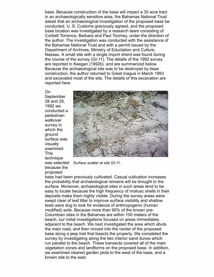
Surface scatter at site GI11.
base. Because construction of the base will impact a 30 acre tractin an archaeologically sensitive area, the Bahamas National Trustasked that an archaeological investigation of the proposed base beconducted. U. S. Customs graciously agreed, and the proposedbase location was investigated by a research team consisting ofCorbett Torrence, Barbara and Paul Toomey, under the direction ofthe author. The investigation was conducted with the assistance ofthe Bahamas National Trust and with a permit issued by theDepartment of Archives, Ministry of Eductation and Culture,Nassau. A small site with a single import sherd was found duringthe course of the survey (GI11). The details of the 1992 surveyare reported in Keegan (1992b), and are summarized below.Because the archaeological site was to be destroyed by baseconstruction, the author returned to Great Inagua in March 1993and excavated most of the site. The details of this excavation arereported here.
OnSeptember28 and 29,1992 weconducted apedestrianwalkoversurvey inwhich thegroundsurface wasvisuallyexamined.Thistechniquewas selectedbecause theproposedbase had been previously cultivated. Casual cultivation increasesthe probability that archaeological remains will be brought to thesurface. Moreover, archaeological sites in such areas tend to beeasy to locate because the high frequency of mollusc shells in theirdeposits make them highly visible. During the survey areas wereswept clear of leaf litter to improve surface visibility and shallowtests were dug to look for evidence of anthropogenic (humanmodified) soils. Because more than 90% of the known preColumbian sites in the Bahamas are within 100 meters of thebeach, our initial investigations focused on areas immediatelyadjacent to the beach. We next investigated the area which abutsthe main road, and then moved into the center of the proposedbase along a jeep trail that bisects the property. We completed thesurvey by investigating along the two interior sand dunes whichrun parallel to the beach. These transects covered all of the mainvegetation zones and landforms on the proposed base. In addition,we examined cleared garden plots to the west of the base, and aknown site to the east.

The investigation resulted in the discovery of one smallarchaeological site in the center of the proposed base. The site,designated GI11, is on the jeep trail which bisects the property.GI11 is along an old dune line approximately 300 meters from thebeach. It is roughly circular surface scatter about five meters indiameter. The surface scatter was composed of conch shell(Strombus gigas), West Indian top shell (Cittarium pica), nerites(Nerita sp.), chiton plates (Chiton sp.), and valves of tiger lucineclams (Codakia orbicularis). These shells comprise the typicalsuite of shells in precolumbian Bahamian sites. The only definiteartifact of human origin was a single piece of pottery. The potterywas heavily encrusted with calcium carbonate (caliche), whichsuggests that it may be quite old. The examination of a fresh breakshowed small white pieces of temper, which suggested that thiswas a sherd of Palmetto ware.
Test excavations (30 cm square) were dug on four sides of the sitejust beyond the surface scatter. Soil from the tests was sievedthrough 1/4 inch mesh screen. No artifacts were found below thesurface. A trowel test made in the middle of the deposit also failedto reveal subsurface deposits. A representative collection ofmaterials was made, and it was determined that no additionalexcavations would be necessary. The following materials werecollected: 1 potsherd, 2 firecracked limestone rocks, 2 pieces ofCittarium pica, 6 chiton plates, 8 fragments of Strombus gigas, 1Cerion shell fragment, 3 Codakia valves, 1 Tellina radiata valve, 2small bivalves, 1 fragment of Nerita, 2 pieces of coral, and onehalfof a fish otolith. These items have been deposited in theDepartment of Archives, Nassau.
Based on the single "Palmetto ware" potsherd, the suite of molluscshells, the size of the scatter, the absence of subsurface deposits,and a location at least 300 meters from the beach, GI11 wasdiagnosed as a farmstead. Farmsteads are sites at which smallshelters were maintained in agricultural fields (Keegan 1992).Because farmsteads are usually located within 3 kilometers oflarger sites (i.e., they are satellites of more permanent villages), weinvestigated the coastline near the proposed Aerostat base.Surveys conducted elsewhere in the Bahamas have revealed thatlarger sites (villages and hamlets) occur in pairs at regular intervalsalong the coast (Keegan 1992). Once a pair of villages or hamletswas established, no other sites would occur for a substantialdistance. Thus, if such larger sites occur in the area, then it is lesslikely that any ever existed on the Aerostat property. Our survey ofthe adjacent coastline revealed a large site, which was identifiedas part of GI3 (Keegan 1985), with a surface scatter extendingalong the road for more than 500 meters. The site is about 3 kmfrom the Aerostat site. Eighteen small import sherds were collectedfrom the surface of GI3. These sherds have been deposited in theDepartment of Archives, Nassau, following petrographic analysis atthe Florida Museum of Natural History.
The artifacts that were collected from the surface of the Aerostatsite were analyzed at the Florida Museum of Natural History. The

Setting and excavation units at GI11.
pottery was examined by Ann Cordell, Director of the CeramicTechnology Laboratory at the Florida Museum of Natural History.She examined the sherd at 70X magnification with a binocularmicroscope and fiberoptic light source. The microscopic analysisof the sherd from the Aerostat site (GI11), revealed the presenceof very small clear quartz inclusions. In addition, the white flecks,which to the naked eye appeared to be shell, are actually opaquewhite quartz. Other noncarbonate minerals were also observed(e.g., feldspar). A piece of the sherd was then immersed inhydrochloric acid; no reaction was observed. When subjected tosimilar acid immersion, a Palmetto ware sherd from the collectionsproduced a violent bubbling and released a white gas. Thisanalysis demonstrated that the Aerostat sherd has a noncarbonatetemper and matrix and must therefore have been brought to theBahamas from elsewhere. In addition, the sherd had similaringredients to a group of sherds from GI3.
Because laboratory analyses revealed that the sherd was notPalmetto ware, the significance of the site increased substantially.Funding to return to the site was requested, and approved. Thegoal was to determine the possible function of the site. Forinstance, the presence of satellite settlements in a sedentaryagrarian economy, like that of the Lucayans, was expected so thediscovery of a small scatter of shell with a single 'Palmetto ware"sherd was not unusual. Similar sites with only one or a few importsherds are unusual (see Sullivan 1981). They might reflectseasonal visits from the Greater Antilles, the first settlementsestablished during the initial colonization of the island and/orarchipelago, or the might be satellites of larger Antillean Tainosettlements established during the expansion of the Tainochiefdoms after A.D. 1100. A second look at the site was evenmore critical because the site was slated for development.

Excavations at GI11.
I returned to Great Inagua by myself on March 13, 1993. The mainpurpose of this trip was to excavate site GI11. In addition, sectionsof the Aerostat base had been cleared since our survey inSeptember so I used this opportunity to look for sites along thesenew cut lines. Lastly, because I had use of a vehicle and wasstaying at the Bahamas National Trust camp at Union Creek, Imade brief visits to the other known sites in the area (GI2, GI3,GI4). While driving between Union Creek and Matthew Town Inoticed a shell scatter along the road between Black Wood Pointand Smith Sloop Point. This location was given the number GI13because a single import sherd was observed (described below).
At GI11, a grid was established with the main northsouth axis(grid north) along the jeep trail. The surface scatter is concentratedin a 3 m (northsouth) by 6 m (eastwest) area. Onemeter squareswere marked out over this concentration. These squares wereexcavated by trowel as a single level to a depth of 15 cm. The soilis light brown in color, with occasional spots of grey in which shellis decomposing, to a depth of 8 cm. Below 8 cm the soil changesto pink sand. All of the artifacts (i.e., shells) are within 9 cm of thesurface. Because the soil was very sandy it was impossible to missthe shall artifacts. For that reason the soil was not screened. Everyscrap os shell from the excavation units was collected. Only onepossible feature was noted, a roughly circular, small, dark stainwith little depth in N7E1. It may simply be the remnants of aburned stump. Casual cultivation has been practiced in this areaup until recently. I completed units N6W1, N6E0, N6E1, N7E1,N7W1, and N8W2, the morning of March 14th. The followingmorning I dug units N6E2 and N9W2, which are on either side ofthe jeep trail. N6E2 slopes up to 9 cm above the surface of theroad, and the southwest corner of N9W2 is 6 cm higher than theroad surface.
Several 30cm squaretest pitswere alsodug. A testpit at N0E0had pinksand soilfrom thesurface to60 cmbelowsurface(bs). Theonly objectin the unitwas asmallStrombus gigas spire apex (top of a queen conch shell). Becausesite GI12 (described below), located about 70 m to the west, isactually 20 meters north of the dune on which GI11 is situated, I

tested the area north of GI11 at 10, 15, and 20 meter intervals. Inthe units 15 and 20 meters north, the soil is light color and sandy.At 10 m north there was 10 cm of light sand covering brown sandyloam which changed to pink sand at 30 cm bs. All of the test unitswere dug to 70 cm bs.
In sum, the site is composed almost entirely of burned shell whosesmall size is best described as pulverized. Tests excavationsindicate that the site is limited to a surface scatter that covers an18 square meter area along the jeep trail which bisects theAerostat base. One imported potsherd is the only artifact of definitehuman manufacture on the site. Comparison of this sherd withimports from other sites in the area suggest that it is Taino. Myconclusion is that the site is a satellite of a larger site in the vicinity(perhaps GI3), which was probably used as a farmshelter. Theburned shell is the remains of meals prepared in the field.
On the afternoon of March 14th I walked the cut lines that weremade after we gave the U.S. Customs Service a conditionalconstruction clearance. The cut lines are about 5 meters wide, andextend around the perimeter of the property with several additionalcuts extending inward toward the center of the property. Trees anda thin layer of topsoil were pushed to the side of the cuts atintervals. About 70 meters to the west of the jeep trail on which GI11 is situated there is a cut which begins on the beach side of theproperty (north) and forms a large cross, , ending in the vicinity ofthe center of the property. In the top of this cross (south) I found adense scatter of burned shell, including Strombus gigas, Cittariumpica, and chiton plates along with firecracked limestone rocks. Nopottery or other artifacts were found. Even in the absence ofdiagnostic artifacts this shell scatter was clearly a site (GI12). Thesite is about 250 meters from the sand beach. No other evidencefor aboriginal activities was found elsewhere on the cut lines, noteven in places where the cuts cross the dune with which GI11 andGI12 are associated.
I returned to GI12 the following morning (March 15th) andtroweled a onemeter square in the center of the mostconcentrated deposit in the hopes of finding some diagnosticartifact. This concentrated deposit occupies a 9 meter square areaon the western side of the top of the cross. The soil is very black incontrast to the surrounding light tan sand and brown sandy loam.The very black soil goes from the surface to 10 cm bs; it containsmost of the burned shell, and one fish bone was also observed.From 10 to 20 cm bs there is a transition zone of dark gray soil,below which the soil is light color (yellow) sand. The unit was dugto 60 cm bs. Other shells and coral are scattered around the area.I dug one 30 cm square test pit on the eastern side of the top ofthe cross near a scatter of coral. The soil here is brown sandyloam; no artifacts or shell were encountered. A test pit in the bushjust west of the cut line and four in the cardinal directions around,but off, the black deposit, had neither shell nor other artifacts belowthe surface. The soil was predominantly brown sandy loam to adepth of 20 cm with light sand below to a depth of 60 cm.

The only materials collected from GI12 were three large fragmentsof burned queen conch shell (2 lips and 1 columella). These wereradiocarbon dated (see radiocarbon dating section, below), andgave a corrected and calibrated age range [minimum (calibratedage) maximum] of: A.D. 1040 (1174) 1270. Like its neighbor, GI11,it is likely that GI12 was a satellite of a larger site and that itsdeposit reflects farming activities in the area. Both sites are toorecent to reflect mollusc collecting sites which would, moreappropriately, be located closer to the coast.
After finishing at GI11 and GI12, I made a brief stop at GI3 tocollect samples for pottery analysis and radiocarbon dating. Alongmost of the coast the road runs right along the beach until itreaches a spot where the beach and pond almost meet. The pondobviously had an opening in this location in fairly recent past. Fromthis juncture the scatter of shell and pottery along the road extends425 meters to the southwest. I collected one import sherd (10.6 gin weight) from this area. I dug four 30 cm square tests in search ofshells for radiocarbon dating. One test unit and two additionalscrapings were made along the road. These revealed a veryshallow soil deposit covering beach rock. Three test units in thepreviously cultivated fields behind the road revealed deep (c. 40cm) sandybrown loam. No artifacts were found in any of the testpits, which suggests that the deposit along the road is either ascatter created during the construction of the road, or that the sitewas completely destroyed by the road. At present, the formerseems more likely. Two queen conch shells were collected fromthe surface. Both shells were punched and both came from thefallow fields between the road and the pond. One of these shellshad a Triton's trumpet spire wedged into its aperture. For thatreason it was selected for dating. The corrected and calibrateddate from this shell is A.D. 1320 (1433) 1510 [minimum (calibratedage) maximum, at two standard deviations]. Which means there isa 95% statistical probability that the sample dates to between 1320and 1510.
The site also continues to the north beyond this pond/sea juncture,although the road here runs behind a coastal dune and along themargin of the pond. I collected five import sherds, including onesharply inturned rim (almost 90°), and one very small Palmettoware sherd. The import sherds have a total weight of 38.8 grams;the Palmetto sherd weighs 6.9 grams (Table 2). Two Codakiaorbicularis valves found near each other, and believed to be fromthe same animal, were also collected for possible C14 dating.They are 3 cm in diameter and weigh 100.5 grams. The dunebetween the beach and the road is quite wide here so the sitecould be quite large. However, the high density of sites along thiscoast makes it difficult to distinguish where each starts and stops.For instance, the single Palmetto ware sherd from this area mayindicate that Palmetto is present, albeit unobserved, to thesouthwest, or the Palmetto ware may come from the Smith SloopPoint site (GI2), which is no more than 300 meters to the north.

I made a brief stop at Smith Sloop Point to reacquaint myself withthe site. It appears that part of the point was bulldozed recentlyand washing out of a cut I found a very large fragment of aPalmetto ware bowl. This bowl, if circular, had at least a 42 cmdiameter and was about 20 cm deep (Table 2). A second largePalmetto ware bowl fragment has nearly straight sides, with atleast a 15mmthick base. If this base was flat, then not all largethickflat Palmetto ware sherds come from griddles. Four importsherds were collected, one of which has fineline obliquealternating incision along the rim above the shoulder (Meillacanstyle). The pottery is described further in Table 2. Most of thepottery that was observed was not collected. The potsherds on thissite are much larger than those observed on most other Lucayansites. In addition, mollusc shells and fish bones were observed onthe surface.
In the late afternoon I made a brief stop in the vicinity of site GI4,but was unable to relocate the site. I then stopped along the coastnear Smith Sloop Point and collected nerites and chiton forallometric and nutritional analyses (see intertidal mollusc counts,below). In the vicinity of Union Creek, I collected 17 Codakiaorbicularis for similar analyses.
Driving from the BNT Union Creek Camp to the Traveler's Rest fordinner, I noticed a shell scatter in the road between Black WoodPoint and Smith Sloop Point. A brief investigation of the arearevealed a single import sherd on the side of the road. The scatteroccupies a relatively small area, and I was able to examine theentire extent of the shell scatter in a short period of time. The dunebetween the road and the coast is fairly wide here, and becausethe road cuts the back side of the dune, the site could be quitelarge. I was not prepared to investigated the site further, andbecause the sun was setting so I marked the location, assigned asite number, GI13, and quit for the day. The next morning Ideparted from Inagua.
Table 2. Characteristics of pottery collected from Great Inagua.
No. Color/Source Thick (mm) Weight (gm)Comments
GI2 surface collection, 1993, 23 sherds.
1 brown import 4.7 24.0 fineline, alternating oblique incisedbetween shoulder and rim
1 brown import 6.0 32.3
1 redbrown import 3.5 2.4 triangular, pointed rim
1 orange import 6.2 41.7
1 Palmetto ware 710.3* 307.6 22 x 10 cm sherd from largecasuela with triangular pointed rim

1 Palmetto ware 1118.3* 235.0 10 x 10 cm sherd from largestraightside, openmounth, flatbottom bowl
17 Palmetto ware 812.5* 87.0 small sherds, some may be fromcasuela
GI3 surface collection, 1992, 8 sherds.
1 brown import 5.3 9.6
1 brown import 6.8 5.7
1 gray import 4.5 22.2 small flaredlip bowl
1 gray import 5.2 8.1
1 orange import 7.1 4.9
1 orange import 6.4 3.4
1 orange import 6.1 1.2
1 orange import 7.9 1.8
GI3 surface collection, 1993, 7 sherds.
1 Palmetto ware 13.9 6.9 small, thick sherd
1 orange import 8.0 10.6
1 orange import 7.9 12.6
1 brown import 6.2 7.3
1 brown import 5.3 5.3
1 brown import 6.9 9.0 sharply inturned flat rim
1 brown import 5.1 4.2
GI11 surface collection, 1992, 1 sherd.
1 orange import 5.5 4.1 caliche encrusted
*Note: minimummaximum thicknesses are given for Palmettoware sherds because they exhibit substantial variation.
Radiocarbon Dates
Two radiocarbon dates were obtained during the course of theAerostat Project. The dates, from sites GI3 and GI12, were ofStrombus gigas shells. The analysis was done by Beta Analytic,Inc., Miami, FL, between March 22 and April 21, 1993. Beforereporting these dates, a word on radiocarbon dating and thecalibration of radiocarbon dates is warranted.
All living tissues contain carbon; it is the major building block of life.Carbon enters the food web through plants which convert thecarbon in the atmosphere into energy and tissues in a processcalled photosynthesis. Three different forms of carbon occur in theatmosphere, and all three are incorporated into living tissues.These different forms, called isotopes, differ according to theiratomic weight, a value that is determined by the number ofneutrons in the atom. Two of the carbon isotopes C12 and C13(with 12 and 13 neutrons respectively) are stable, they do notbreak down. The third is a radioactive form of carbon, C14, whichdoes break down. Carbon14 breaks down with a halflife of 5568years. As long as the tissue is living, the total amount of C14remains constant because its loss is balanced by the uptake ofnew C14. But when the organism dies, its C14 clock begins to tick.No new C14 is added and the C14 in the tissues begins to declineat the above mentioned halflife. This means that after 5568 yearshalf of the C14 in a sample is gone; half of what remained is goneafter an additional 5568 years; half of that after another 5568years; and so on. By measuring the amount of C14 remaining in asample it is possible to determine its age.
Radiocarbon dates are reported as a mean date and a standarddeviation. As the Beta Analytic report states:
These dates are reported as RCYBP (radiocarbon years before1950 A.D.). By international convention, the halflife of radiocarbonis taken as 5568 years and 95% of the activity of the NationalBureau of Standards Oxalic Acid (original batch) used as themodern standard. The quoted errors are from counting of themodern standard, background, and sample being analyzed. Theyrepresent one standard deviation statistics (68% probability),based on the random nature of the radioactive disintegrationprocess. Also by international convention, no corrections aremade for DeVries effect, reservoir effect, or isotopic fractionation innature, unless specifically noted above.
It has long been recognized that C14 does not have a homogeneous distribution in either time or space. The activity of theradioactive isotope of carbon in atmospheric carbon dioxide hasvaried over time. Moreover, because carbon is stored in a varietyof reservoirs (e.g., atmosphere, sea water, ponds, etc.) theconcentration of C14 available to its plant consumers can varysubstantially. In addition, the plants themselves can vary in theiruse of carbon isotopes. Efforts to take this variability into accountwhen interpreting radiocarbon dates have taken two forms. One isa C13/C12 correction; the other is calibration curves which takeinto account temporal variation in C14 concentrations.
The C13/C12 correction is an extremely accurate measurement ofthe ratio between heavier (C13) and lighter (C12) carbon isotopescompared to a standard and reported in parts per thousand (permil). This ratio is important because the relative proportion ofheavy and light isotopes in the sample can vary substantially. Forexample, plants which use the Calvin photosynthetic pathway (C

3) have been shown to discriminate against the heavier isotopes ofcarbon (C13 and C14), while tropical grasses (e.g., maize, sugarcane) which use the HatchSlack photosynthetic pathway (C4),show no such discrimination. As a result, C4 plants are enrichedin C14 relative to C3 plants and will give radiocarbon dates thatare as much as 400 years too young (Creel and Long 1986). Asimilar situation occurs in Thalassia seagrass meadows which areenriched in the heavier carbon isotopes. This enrichment is passedalong to the animals which live in this environment (e.g., Strombusgigas, Codakia orbicularis). By measuring the isotopic ratio of asample, the original concentration of radioactive carbon can becalculated and the sample age corrected accordingly. In thesamples from Great Inagua, these corrections amounted to 450years for GI3 and 460 years for GI12. These corrections meanthat the sample ages were actually 450 and 460 years older thandirect measurement of the shells would suggest. Although not asdramatic as seagrass mollusks and C4 grasses, all samples mayhave isotopic corrections (e.g., charcoal samples from Grand Turkhad corrections which added 10 years to the sample age).
The isotopic correction by itself is not enough. The date must alsobe calibrated. [It should be noted that dates must be correctedbefore they can be calibrated.] As Stuiver, Pearson, and Braziunas(1986) point out:
The calculation of the age of the sample assumes that the specificactivity of 14C in atmospheric CO2 has been constant. However,this is not true. The 14C activity in the atmosphere and otherreservoirs, and thus the initial activity of the samples dated, hasvaried over time. A calibration curve is necessary to convertradiocarbon ages into calibrated calendar years (cal years). Bymeasuring the radiocarbon age of tree rings of known age it ispossible to construct calibration curves for the last 9,200 years forsamples in equilibrium with atmospheric CO2. Computer modelinghas provided a similar calibration curve for marine samples.
In sum, samples must be calibrated to obtain an accurate date(Pearson 1987; Davis 1988). Fortunately, this task has beensimplified by the "Calib & Display" computer program whichproduces instantaneous calibrations (Stuiver and Reimer 1986).The calibrated dates presented below were calculated using thisprogram.
The Strombus gigas shells submitted for dating were treated in thefollowing way (letter from Dr. Jerry Stipp, Beta Analytic, Inc., April21, 1993):
A portion of each sample was selected and then washed,scrubbed and abraded to remove any soil matrix or looseweathered carbonate material. This was followed by repeatedapplications of acid solutions to dissolve away all outer layers.Sample GI15 [renumbered GI12] appeared to be recrystallizedthroughout and we discussed this condition with you; the decisionwas to proceed as the recrystallization was probably the result of

heat. With the exception of that anomaly, all other analytical stepsincluding syntheses and countings proceeded normally.
The results are:
Site:GI3
Material dated: Strombus gigas
Lab number: Beta61909
Radiocarbon age 480 ± 60 b.p.
C13/C12 ratio +2.0 per mil
C13 adjusted C14 age 930 ± 60 b.p.
Calibrated C14 age, 2 sd minimum (calibrated age) maximum:
A.D. 1320 (1433) 1510
Site: GI12
Material dated: Strombus gigas
Lab number: Beta61910
Radiocarbon age 800 ± 50 b.p.
C13/C12 ratio +2.6 per mil
C13 adjusted C14 age 1,260 ± 50 b.p.
Calibrated C14 age, 2 sd minimum (calibrated age) maximum:
1040 (1174) 1270
These dates indicate that: 1. The Strombus gigas shell collectedfrom the surface of GI3, chosen because it was punched and hada Triton's trumpet spire wedged in its aperture, has a 95%statistical probability of dating between A.D. 1040 and 1270, with acalibrated age of 1174; 2. The burned Strombus gigas shells (2 lipsand one columella) collected from just beneath the surface in theblack midden earth of GI12 has a 95% statistical probability ofdating between A.D 1320 and 1510, with a calibrated age of 1433.
Intertidal Mollusc Counts
Intertidal mollusc populations were counted on two separateoccasions. The first was in July 1984, the second in March 1993.On July 1st, 1984, while surveying the beach near South WestPoint, we realized that the intertidal mollusc populations wereprobably as pristine as we would find anywhere in the West Indiestoday. South West Point is extremely remote, and is today visitedonly by the few hunters with 4wheel drive vehicles who come tohunt pigeons and hogs. The beach in this area is a twometerwide

slab of beach rock. Counts were made of three intertidal molluskson an ebbing tide.
1. Nerita spp. Only the largest nerites were collected. Hundreds ofreticulate nerites were passed over. The collection was made on atwometer wide beachrock shore that was washed by surf. A 15by 10 by 10 cm container was filled in five minutes with a total of175 snails.
2. Chiton spp. In two counting episodes I observed about 100chitons in a 10 square meter area. In one 38 cm diameter basin Icounted 48 snails. Additional counts were made on other parts ofthe beach with the lowest estimate being 50 snails per 10 squaremeters.
3. Cittarium pica. A timed counting was undertaken on the beachnorth of South East Point. The snails were not collected, butcollection would involve simply picking the animal off the rock. Tosimulate collecting a snail was counted when it was within reach.Over a 40 meter stretch of 2m wide beach rock I counted 189snails in 3 minutes 15 seconds. All of the snails counted were ofgood size. Less systematic counts further down the beach gavesimilar results.
On March 13, 1993, 302 nerites were collected in ten minutes fromthe beach rock shore near Smith Sloop Point. As with previouscollections, the largest snails were collected first. The collectionhad no observable impact on the nerite population. In addition, sixchitons were also collected. It was my intention to collect 100chitons, but very few were observed. These collections were madeto obtain samples for a more accurate allometric equation relatingshell size and weight to meat weight, and to obtain flesh forproximate nutritional assays. Proximate analysis measuresCalorie, protein, fat, and moisture content. These measurementsare important for estimating economic returns from prehistoricmollusc collecting.
Conclusions
In their 1978 overview of Bahamas prehistory, William Sears andShaun Sullivan concluded, "The Inaguas, Grand Turk andassociated cays, and East and South Caicos do not appear tohave been settled because they are too dry to support anagricultural population" (Sears and Sullivan 1978:21).Archaeological surveys conducted in 1984, 1992, and 1993 by theauthor and his assistants have demonstrated that that conclusionis wrong (Keegan 1991a, 1992a). Thirteen prehistoric sites havebeen located along the almost 130 kilometers (80 miles) ofInagua's coastline that was surveyed. At least five of these sitesreflect settled occupations (GI1, GI2, GI3, GI7, and GI9).Moreover, two others (GI11, GI12) appear to be farmsteads,which reflect satellite activities associated with a longterm,permanent habitation.
Although a substantial section of the island's coast has beenexamined, there is a great deal left to do. In addition to the lack ofsurveys along the northern shorelines, the sites that are alreadyknown require additional study. All of the sites have a highfrequency of imported pottery. The sites should, therefore, informus with regard to cultural interactions between the Bahamas andGreater Antilles, especially as this island helps to define theWindward Passage. The two radiocarbon dates suggest that therewas a Antillean Taino presence on the island as early as the 12thcentury A.D. Moreover, this Taino presence may have beenindependent of the Lucayan occupation of the island. Futureresearch will focus on collecting the data needed to address issueson colonization, settlement, and interisland exchange.
Acknowledgements
Almost nine years have passed since my first trip to Great Inagua.That original survey would not have been possible without SteveMitchell. Morever, our collaborations throughout the Bahamasestablished the base on which my more recent work has beenbuilt. It has also been my good fortune to conduct myinvestigations under the auspices of the Department of Archives inNassau, and with the gracious help of Dr. Gail Saunders and herstaff. During all three trips the cooperation of the BahamasNational Trust has proved essential. Mrs. Lynn Gape, in Nassau,was an enormous help in making logistical arrangements onInagau. Jimmy and Henry Nixon provided important servicesduring all three visits, not the least of which was the use of theBNT facilities at Union Creek. In 1984, Essoud Cartwright providedtransportation to the otherwise inaccessible South East Point. In1992, transportation was provided by Glanville Cartwright. Theassistance of the Inagua Police Department on two occasions isgreatly appreciated.
During the Aerostat project I was assisted by Corbett Torrence, MAcandidate at the University of Florida, and by volunteers Reed andBarbara Toomey. Their assistance made the rapid completion ofthe Aerostat survey possible. Pericles Mailis, President of theBahamas National Trust, and Bill Holcomb, with U.S. CustomsService, made the project possible. Their contributions aregratefully acknowledged. The assistance of the Narcotics AffairsSection of the American Embassy in Nassau with groundtransportation on Inagua in 1993 is also appreciated, as is theaccess to facilities provided by the U.S. Coast Guard on Inagua.Ann Cordell, Director of the Ceramic Technology Laboratory,Florida Museum of Natural History, analyzed the pottery fromInagua.
Bibliography
Bahamas Department of Archives 1980 The Salt Industry of the Bahamas. Nassau: Ministry of
Education and Culture.
Bellin, N.

1768 Description Geographique des Debouquemens qui sont auNord de l'Isle de Saint Dominigue. Paris.
Berman, Mary Jane and Perry Gnivecki
1991 The Colonization of the Bahamas Archipelago: a View Fromthe Three Dog Site, San Salvador Island. Paper presented at the15th International Congress for Caribbean Archaeology, Barbados.
Carbone
1980 The paleoecology of the Caribbean area. The FloridaAnthropologist33(3):99119.
Cook, S. F. and W. Borah
1971 The Aboriginal Population of Hispaniola. In Essays inPopulation History. Vol. 1: Mexico and the Caribbean, edited by S.F. Cook and W. Borah, pp. 376410. University of California Press,Berkeley.
Craton, Michael and Gail Saunders
1992 Islanders in the Stream. Volume One: From Aboriginal Timesto the End of Slavery. Athens: University of Georgia Press.
Creel, Darrell and Austin Long
1986 Radiocarbon Dating of Corn. American Antiquity 51:826837.
Davis, Dave D.
1988 Calibration of the Ceramic Period Chronology for Antigua,West Indies. Southeastern Archaeology 7:5260.
Doran, Edwin, Jr.
1955 Landforms of the Southern Bahamas. Austin: University ofTexas Press.
Granberry, Julian
1991 Lucayan Toponyms. Journal of the Bahamas HistoricalSociety 13:312.
1993 The People Who Discovered Columbus: The Prehistory ofthe Bahamas, A Review and Commentary. The FloridaAnthropologist 46:5660.
Halkitis, M., S. Smith, and K. Rigg
1980 The Climate of the Bahamas. The Bahamas GeographicalAssociation, Nassau.
Held, Steve O.
1993 Islands in Space: Quantification and Simulation inTheoretical Island Archaeology. In Prehistoric Island Communities:Studies in Island Sociogeography, edited by K. Brown and MarkPatton. Oxford: Archaeological Reports/Tempus Reparatum.
Henige, David
1978 On the Contact Population of Hispaniola: History as HigherMathematics. Hispanic American Historical Review 58:217237.

Hoffman, Charles A., Jr.
1967 Bahama Prehistory:Cultural Adaptation to an IslandEnvironment. Ph.D. dissertation, University of Arizona. UniversityMicrofilms, Ann Arbor.
Keegan, William F.
1983a An Archaeological Reconnaissance of Crooked Island andAcklins Island, Bahamas. Report submitted to the Department ofArchives, Nassau, Bahamas.
1983b Archaeological Investigations on Mayaguana, Bahamas: APreliminary Report. Report submitted to the Department ofArchives, Nassau, Bahamas.
1985 Dynamic Horticulturalists: Population Expansion in thePrehistoric Bahamas. Ph.D. dissertation, UCLA. Ann Arbor:University Microfilms.
1988a Archaeological Investigations on Crooked and AcklinsIslands, Bahamas: A Preliminary Report of the 1987 Field Season.Miscellaneous Project Reports Number 36, Florida Museum ofNatural History, Department of Anthropology, Gainesville.
1988b New Directions in Bahamas Prehistory. Journal of theBahamas Historical Society
1991a The Governor's Beach Site, Grand Turk: First ProgressReport. Miscellaneous Project Report Number 48, Florida Museumof Natural History, Gainesville.
1991b Lucayan Settlement Patterns and Coastal Changes in theBahamas. In Paleoshorelines and Prehistoric Settlement, edited byLucy Lewis Johnson. CRC Press, Boca Raton.
1992a Preliminary Report on the Archaeological Investigation ofthe Proposed Aerostat Base, Great Inagua, Bahamas.Miscellaneous Project Report Number 50, Florida Museum ofNatural History, Gainesville.
1992b The People Who Discovered Columbus: The Prehistory ofthe Bahamas. University Press of Florida, Gainesville.
Keegan, William F. and Michael J. DeNiro
1988 Stable Carbon and NitrogenIsotope Ratios of BoneCollagen Used to Study CoralReef and Terrestrial Components ofPrehistoric Bahamian Diet. American Antiquity 53:320336.
Keegan, William F. and Jared M. Diamond
1987 Colonization of Islands by Humans: A BiogeographicalPerspective. In Advances in Archaeological Method and Theory,Vol. 10, edited by M.B. Schiffer. Academic Press, New York. Pp 4992.
Keegan, William F. and Steven W. Mitchell
1983 An Archaeological Reconnaissance of Long Island,Bahamas. Report to the Department of Archives, Nassau,Bahamas.
1984a The Archaeological Survey of Long Island, Bahamas: FinalReport. PRIDE Foundation Publications in Caribbean Science, No.1. 1984b Archaeological Investigations on Great and Little Exuma,

Bahamas. PRIDE Foundation Publications in Caribbean Science,No. 2.
1986 Possible Allochthonous Lucayan Arawak ArtifactDistributions, Bahama Islands. Journal of Field Archaeology13:255258.
Keegan, William, Maurice Williams, and Grethe Seim
1990 Archaeological Survey of Grand Turk, B.W.I., MiscellaneousProject Report Number 43, Florida Museum of Natural History,Department of Anthropology, Gainesville.
Klingel, Gilbert
1961 The Ocean Island (Inagua). New York: Natural History Press.
Krieger, Herbert W. 1937 The Bahama Islands and their Prehistoric Population.
Smithsonian Institution Explorations and Field Work, 1936: 93 98,Washington, D.C.
Little, B.G., D.K. Buckley, R. Cant, P.W.T. Henry, A. Jefferiss, J.D.Mather, J. Stark, and R.N. Young, editors
1977 Land Resources of the Bahamas: A Summary. Ministry ofOverseas Development, Land Resource Study No. 27, Surrey,England.
Mann, C. J.
1986 Composition and Origin of Material in PreColumbian Pottery,San Salvador, Bahamas. Geoarchaeology 1:183194.
Mitchell, Steven
1986a Surficial Geology of Rum Cay, Bahamas Islands. InProceedings of the Third Symposium on the Geology of theBahamas, pp. 231241. H. A. Curran, ed. CCFL Bahamian FieldStation, Fort Lauderdale.
1986b Sedimentology of Pigeon Creek, San Salvador Island,Bahamas. In Proceedings of the Third Symposium on the Geologyof the Bahamas, pp. 215230. H. A. Curran, ed. CCFL BahamianField Station, Fort Lauderdale.
Mitchell, Steven W. and William F. Keegan
1987 Reconstruction of the Coastlines of the Bahama Islands in1492. American Archaeology 6:8996.
Pearson, Gordon W.
1987 How to Cope With Calibration. Antiquity 61:98103.
Roosevelt, Anna C. 1980 Parmana. New York: Academic Press.
Rouse, Irving
1986 Migrations in Prehistory. New Haven: Yale University Press. 1992 The Tainos. New Haven: Yale University Press.
Sealey, Neil

1985 Bahamian Landscapes: An Introduction to the Geography ofthe Bahamas. London: Collins Caribbean.
Sears, W. H. and S. D. Sullivan
1978 Bahamas Prehistory. American Antiquity 43(1):325.
Stuiver, M., G. W. Pearson, and T. Braziunas 1986 Radiocarbon Age Calibration of Marine Samples Back to
9000 Cal Yr BP. Radiocarbon
Stuiver, M. and P. J. Reimer 1986 A computer program for radiocarbon age calibration,
Radiocarbon 28:10221030.
Sullivan, S. D. 1976 Archaeological Reconnaissance of the Turks and Caicos
Islands, British West Indies. Report submitted to the Governmentof the Turks and Caicos.
1980 An overview of the 1976 to 1978 archaeologicalinvestigations in the Caicos Islands. The Florida Anthropologist33(3):9498.
1981 Prehistoric Patterns of Exploitation and Colonization in theTurks and Caicos Islands. Ph.D. dissertation, Department ofAnthropology, University of Illinois, Ann Arbor: UniversityMicrofilms.
Webster, C. C. and P. N. Wilson
1966 Agricultue in the Tropics. London: Longman Group Ltd.
Wilson, C. L., W. E. Loomis, and T. A. Steeves 1971 Botany (5th ed.). New York: Holt, Rinehart and Winston.
Winter, John
1989 Letter to the Editor. Journal of the Bahamas HistoricalSociety11:28.
Winter, John and Mark Gilstrap
1991 Preliminary Results of Ceramic Analysis and the Movementsof Populations into the Bahamas. In Proceedings of the TwelfthInternational Congress of Caribbean Archaeologists, pp. 371386.FortdeFrance, Martinique.
Winter, John, Julian Granberry, and Arthur Leibold
1985 Archaeological Investigations within the Bahamas. InProceedings of the Tenth International Congress for the Study ofthe PreColumbian Cultures of the Lesser Antilles, pp. 8392.Centre de Recherches Caraibes, Montreal.