ing. ammar h. kamel application of a hydrodynamic mike … · 1 a. h. kamel application of a...
TRANSCRIPT
1
A. H. KAMEL
APPLICATION OF A HYDRODYNAMIC MIKE 11 MODEL FOR THE EUPHRATES RIVER IN IRAQ
Ing. Ammar H. Kamel
Slovak University of TechnologyFaculty of Civil EngineeringDepartment of Hydraulic Engineering Radlinskeho 11,813 68 Bratislava
Research field: Hydraulic modelling
1. INTRODUCTION
The Iraqi water resources have suffered from severe pollution and an unreasonable management policy during the last 10 years. The Euphrates River has been subjected to the continual disposal of industrial and irrigational wastes directly to the river without any type of monitoring. The lack of a reasonable policy of water resources management in the lakes and rivers caused severe environmental obstacles in recent years. The operational policy of Al-qadissiya Dam on the Euphrates River near the city of Al-hadithah depended on the requirements of electrical generation in the electrical generation system of the dam so the discharge of the river fluctuated from time to time upon the demand for electricity in the region. Because the available data (hydraulic and hydrologic) for the Euphrates River in Iraq is poor, the river suffers from problems with the design and operation of hydraulic structures on the river (Water Resources Report, 2004).
The river had no chance for maintenance or any type of management so deposits settled in the river bed and many side effects were noticed in the microbiological system. Also, in some years, the heavy rainfall causes the water level to raise leading to some damage in the flood plain area.The planning and management of water resources requires good long-term hydrological and hydraulical investigation, which are too limited in these regions. Therefore; a technical approach in this study may be necessary to quantify it (Kamel, 1997).River modelling assists decision makers in the prevention and prediction of flood events (flood analysis), and the design and operation of hydraulic structures along rivers. Computer modelling techniques assist engineers by determining data about the hydrologic and hydraulic behaviour of the rivers more accurately. Computer models for river simulations require: 1) a hydrologic model which develops rainfall-runoff from a design storm or historic storm event, and 2) a hydraulic model which routes the runoff through stream
2008 SLOVAK UNIVERSITY OF TECHNOLOGY
ABSTRACT KEY WORDS
• Unsteady flow, • 1-dimensional flow, • Rivers modelling, • MIKE 11 HD
This paper presents a 1-dimensional unsteady flow hydraulic model used for the simulation of flow in rivers: the MIKE 11 model from the Danish Hydraulic Institute (DHI). In this study, the hydraulic model use flow and stage hydrographs in a time series format from field measurements. The approach for this model leads to unsteady flow simulations along stream channel reach. The study case applied to the model is the Euphrates River in Iraq; the stream length used for this model is 1.6 km. The study’s focus was the development of a MIKE 11 model based on surveyed, stream cross-section data. The results of this study explain that the model gives a good simulation of the flow according to a comparison between the estimated and observed stage hydrograph; also, the comparison between this model and the Uday model that was used for the same river explains that the MIKE 11 model give better simulation.
2008/2 PAGES 1 – 7 RECEIVED 13.1.2008 ACCEPTED 26.4.2008
Kamel.indd 1 17. 6. 2008 6:02:45
2
channels to determine the water surface profiles at specific locations along stream network (Harding (2001)). Most of the previous hydraulic modelling techniques use one-dimensional (1-D) steady state flows measured at a specified point in time (Ahmad, et al., 1999). Since flows in streambeds are naturally random and unsteady, steady-state methods do not always accurately depict water surface profiles. The steady-state modelling technique is also limited by how the modeller spatially synchronizes the rainfall-runoff routing for multiple drainage basins at a specified point in time. Such methods are subject to human error and can be very time consuming (Snead , 2000). Developments in fully dynamic, unsteady models have provided engineers with highly accurate hydraulic modelling methods. The Danish Hydraulic Institute (DHI) is one of the world’s leading software developers for incorporating water resources related time-
series data into modelling. DHI’s MIKE 11 hydrodynamic model uses 1-D implicit, dynamic wave routing based on the St.Venant equations for unsteady flow.
2. CASE STUDY
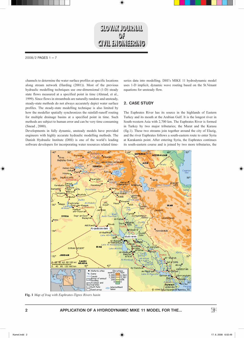
The Euphrates River has its source in the highlands of Eastern Turkey and its mouth at the Arabian Gulf. It is the longest river in South-western Asia with 2,700 km. The Euphrates River is formed in Turkey by two major tributaries; the Murat and the Karasu (fig.1). These two streams join together around the city of Elazig, and the river Euphrates follows a south-eastern route to enter Syria at Karakamis point. After entering Syria, the Euphrates continues its south-eastern course and is joined by two more tributaries, the
2008/2 PAGES 1 — 7
APPLICATION OF A HYDRODYNAMIC MIKE 11 MODEL FOR THE...
Fig. 1 Map of Iraq with Euphrates-Tigres Rivers basin
Kamel.indd 2 17. 6. 2008 6:02:49
3
Khabur and the Balikh. Both of these tributaries have their sources in Turkey, and they are the last bodies of water that contribute to the river. After entering Iraq, the river reaches the city of Hit, where it is only 53 m above sea level. From Hit to the delta in the Arabian Gulf, for 735 km, the river loses a major portion of its waters to irrigation canals and to Lake Hammar. The remainder joins the Tigris River near the city of Qurna, and the combined rivers are called the Shatt al-Arab. The Karun River from Iran joins the Shatt at Basra, and they empty into the Arabian Gulf altogether (Dogan, 2004). The basin is largely fed from the snow precipitation over the uplands of eastern Turkey, where the annual total often surpasses 1000 mm. The precipitation is commonly around 300 mm in Iraq and Syria. The annual flow of the Euphrates changes between 28.5 and 30.5 BCM. The contribution of Turkey to the Euphrates remains around 90%; the remaining 10 % comes from Syria. Evaporation in the basin remains around 6% in the upper parts of the basin, whereas it becomes 14% in the lower parts (Dogan, 2004).Agriculture is the main economic activity in the basins, since Syria and Iraq have been trying to become independent countries in terms of food, most of the water from the rivers is used for irrigation. The second most important economic activity is energy production due to development potential of the countries, followed by industrial and domestic usage.
3. AVAILABLE DATA FOR CASE STUDY
The data were collected from the Ministry of Water Resources in Iraq. It includes 14 cross sections for the Euphrates River near the city of Al-Fallujah, the length of the reach river 1.6 km, field measurements for the time series discharge at upstream reach, field measurements for time series water level at the downstream reach (boundary conditions) and a stage hydrograph at the cross section between the upstream and downstream for simulation purpose. There is a stage hydrograph at the same cross section between upstream and downstream evaluated by Uday, who used a two dimensional depth-averaged hydrodynamic model. It was developed and applied for the same reach. The model that is used by Uday is based on the conservation of mass and momentum equations to estimate the discharge and water level. This model is applied in the Euphrates River simulation for different purposes in Iraq (Uday, 1998).
4. MIKE 11
The MIKE 11 is an implicit finite difference model for one dimensional unsteady flow computation and can be applied to looped networks and quasi-two dimensional flow simulation on
floodplains. The model has been designed to perform detailed modelling of rivers, including special treatment of floodplains, road overtopping, culverts, gate openings and weirs. MIKE 11 is capable of using kinematic, diffusive or fully dynamic, vertically integrated mass and momentum equations (the “Saint Venant” equations). The solution of the continuity and momentum equations is based on an implicit finite difference scheme. This scheme is structured so as to be independent of the wave description specified (i.e. Kinematic, Diffusive or dynamic). Boundary types include water level (h), Discharge (Q), Q/h relation, wind field, dambreak, and resistance factor. The water level boundary must be applied to either the upstream or downstream boundary condition in the model. The discharge boundary can be applied to either the upstream or downstream boundary condition, and can also be applied to the side tributary flow (lateral inflow). The lateral inflow is used to depict runoff. The Q/h relation boundary can only be applied to the downstream boundary. MIKE 11 is a modelling package for the simulation of surface runoff, flow, sediment transport, and water quality in rivers, channels, estuaries, and floodplains. The most commonly applied hydrodynamic (HD) model is a flood management tool simulating the unsteady flows in branched and looped river networks and quasi two-dimensional flows in floodplains. When using a fully dynamic wave description, MIKE 11 HD solves the equations of conservation of continuity and momentum (the ‘Saint Venant’ equations). The solutions to the equations are based on the following assumptions (MIKE 11, 2005). • The water is incompressible and homogeneous (i.e. negligible
variation in density) • The bottom slope is small, thus the cosine of the angle it makes
with the horizontal may be taken as 1 • The wave lengths are large compared to the water depth,
assuming that the flow everywhere can be assumed to flow parallel to the bottom (i.e. vertical accelerations can be ignored, and a hydrostatic pressure variation in the vertical direction can be assumed)
• The flow is sub-critical (a super-critical flow is modelled in MIKE 11; however, more restrictive conditions are applied)
The equations used are: Continuity:
Momentum:
2008/2 PAGES 1 — 7
APPLICATION OF A HYDRODYNAMIC MIKE 11 MODEL FOR THE...
Kamel.indd 3 17. 6. 2008 6:02:51
4
Where Q – discharge, (m3/s)A – flow area, (m2) q – lateral inflow, (m2/s)h – stage above datum, (m) C – Chezy resistance coefficient, (m1/2/s) R – hydraulic or resistance radius, (m)α – momentum distribution coefficient
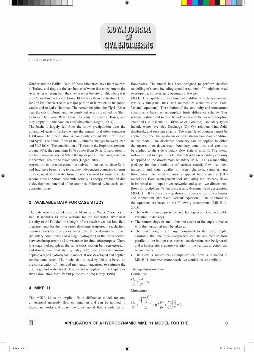
The four terms in the momentum equation are local acceleration, convective acceleration, pressure, and friction (Source: www.dhigroup.com).In MIKE 11, a network configuration depicts the rivers and floodplains as a system of interconnected branches. Water levels and discharges (h and Q) are calculated at alternating points along the river branches as a function of time. It operates on basic information from the river and floodplain topography to include man-made features and boundary conditions.
5. DEVELOPMENT OF MODEL
The processing of the data for simulation in the MIKE 11 hydrodynamic module involves; preparation of the network (can assume a straight stream channel), Cross section, and hydrodynamic and, boundary parameters. The hourly data rainfall, water level and flow are created in compatible MIKE 11 time series in a separate file as the input for the parameter editors.
5.1 The River Network file
The River Network file allows the modeller to 1) define the river network and reference cross-sections and control structures to the network; and 2) graphically obtain an overview of the model information in the current simulation.
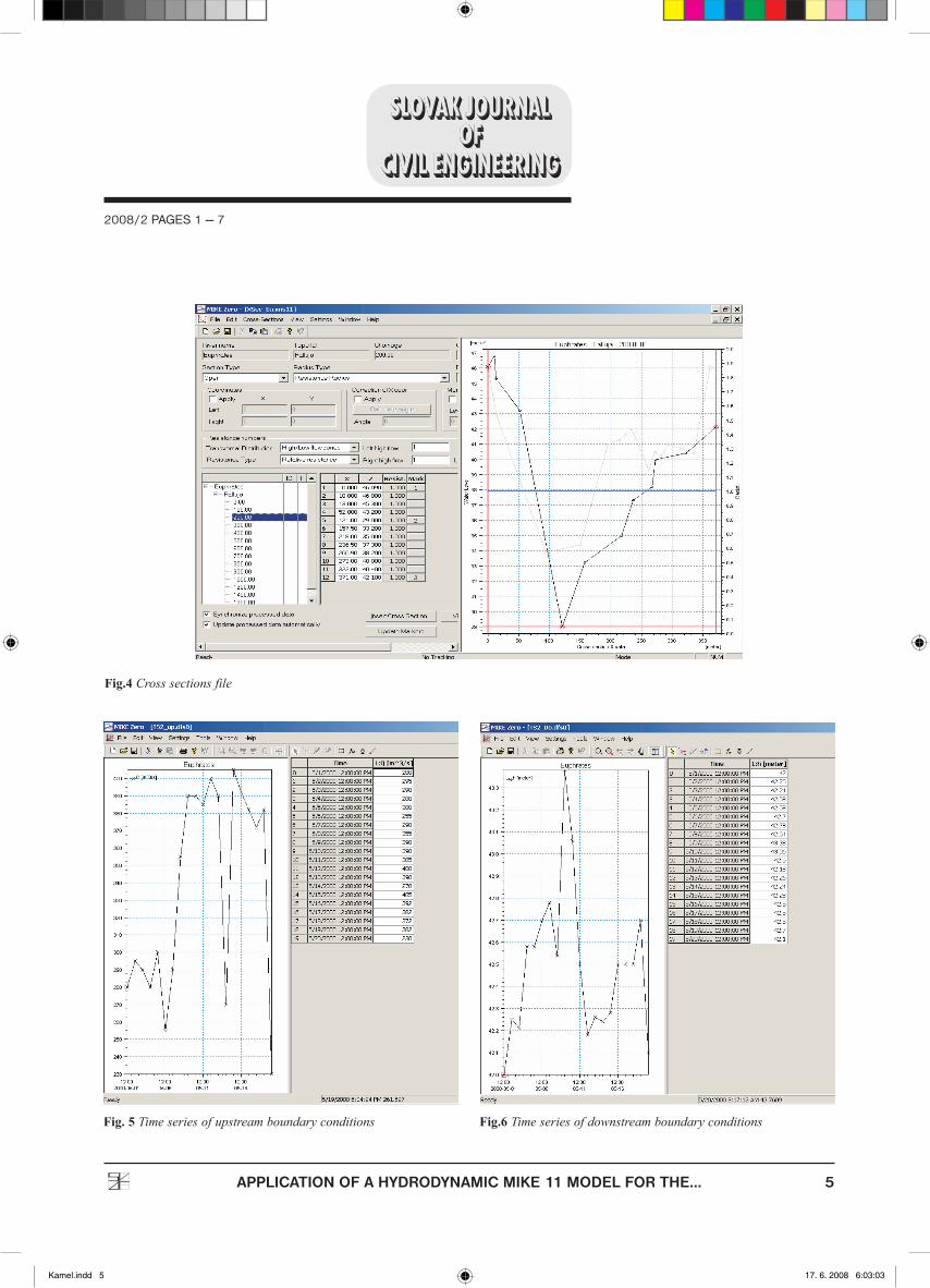
5.2 The Cross-Section File
The Cross-Section file contains streambed cross-sections as specified locations along a river network. The geometry of cross-sections is usually obtained from field-surveyed data.
5.3 The Boundary File
The Boundary file consists of boundary conditions in a time-series format for the river network’s boundaries. The water level boundary must be applied to either the upstream or downstream boundary condition in the model. The discharge boundary can be applied to either the upstream or downstream boundary condition and can also be applied to a side tributary flow (lateral inflow). The lateral inflow is used to depict the runoff for this study. The Q/h Relation boundary can only be applied to the downstream boundary.
5.4 The Hydrodynamic Parameter File
The Hydrodynamic Parameter file requires bed and floodplain resistance data for the river network. The differentiation between the streambed and flood plain along the river network is accomplished at each cross-section in the Cross-section file.
2008/2 PAGES 1 — 7
APPLICATION OF A HYDRODYNAMIC MIKE 11 MODEL FOR THE...
Fig. 2 channel section with computational grid
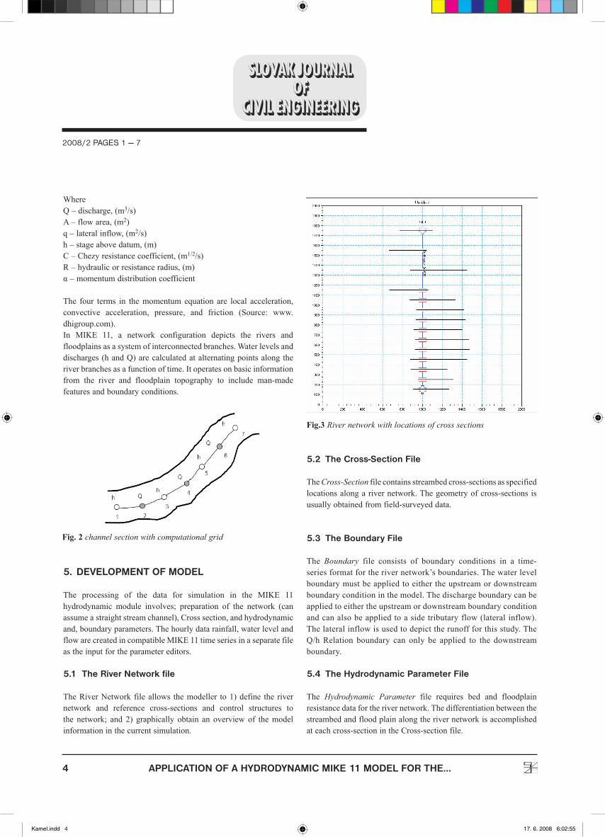
Fig.3 River network with locations of cross sections
Kamel.indd 4 17. 6. 2008 6:02:55
5
2008/2 PAGES 1 — 7
APPLICATION OF A HYDRODYNAMIC MIKE 11 MODEL FOR THE...
Fig. 5 Time series of upstream boundary conditions Fig.6 Time series of downstream boundary conditions
Fig.4 Cross sections file
Kamel.indd 5 17. 6. 2008 6:03:03

6
6. MODEL TESTING AND EVALUATION
There is no generally admissible criterion by which a model can be considered plausible. This consideration closely depends on the model’s application. Therefore, the hysteresis argument of model evaluation is comparatively general.After developing MIKE 11 for the Euphrates River, the issues needed to be evaluated so as to affirm the model’s validity. The virtual test of a model is its capability to predict a system response (the stage hydrograph at Cross section No.3 about 200m from downstream boundary). This test was made by comparison the stage hydrograph at Cross section No.3, which was evaluated from MIKE 11 with an observed stage hydrograph at the same cross section, fig. (7)
6.1 Model Comparison
Presently, additional substantial criteria in the development of hydraulic modelling will be compared with the performance worth of the different models. Until now, two indicators have rendered comparisons somewhat difficult. The first one is that several modellers have displayed their results in various fashions, because they have differing ideas of the performance of their objectives and criteria. However, at least one direct comparison should be possibly obtained from the emanations of the various models.The second indicator of the simulation process is seldom applied on the same river by different modellers. In order to satisfy any faithfully pointed comparisons, models should be confronted with coincident data, which represents the feasible extent of the hydraulic investigations. There is no generally admissible criterion by which a model can be considered plausible. This consideration closely depends on the models application. Therefore, the hysteresis argument of model evaluation is comparatively general. The MIKE 11 model was compared with the Uday model, i.e. who’s studied the same reach of the Euphrates River with the same cross sections and same storm event. The comparison is illustrated in fig. (7). This figure illustrates that the MIKE 11 model provide a good simulation (the shape of the hydrograph, peak flow) better than the Uday model, while the Uday model better in time to peak, may be this because the assumptions with MIKE 11 model are assume the length of flow too large comparison with depth (1-D) flow while Uday model is (2-D) model, we need more measurements and tests to confirm these results.
7. SUMMARY AND CONCLUSION
This study presents the application of a 1-dimensional unsteady flow hydraulic model used for the simulation of flow in rivers: the MIKE 11 model from the Danish Hydraulic Institute (DHI). In this study, the hydraulic model uses a flow and stage hydrograph in a time series format from field measurements. The approach for this model leads to unsteady flow simulations along a stream channel reach. The study area applied to the model is the Euphrates River in Iraq; the stream length used for this model is 1.6 km. Using unsteady flow models to develop a river simulation model is complicated and lengthy, depending on the size of the study area. Many factors can affect the results, especially if the data sources are inaccurate or incomplete. The amount of stream geometry data can become very substantial as the size of the stream network increases. It is best to choose a modelling method that best accommodates the processing of the geometric data. Because the available data for case study is so limited, the estimated stage hydrograph for cross section
2008/2 PAGES 1 — 7
APPLICATION OF A HYDRODYNAMIC MIKE 11 MODEL FOR THE...
Fig.7 Model comparison
Kamel.indd 6 17. 6. 2008 6:03:06
7
No.3 was compared to observed hydrograph to test the model’s validity. Then the evaluated stage hydrograph was compared with another model (the Uday model) which was used for the same reach to check the accuracy of the model compared to the model that was used for the same river. Fig. (7) Show the MIKE 11 model gives the best results.
8. FUTURE WORK
Since the extent of the surveyed cross-sections was limited, the MIKE 11 model’s flow characteristics did not account for the entire floodplain resistance that actually occurs. In order to improve the MIKE 11 model, the stream geometry data could be extracted from the terrain model by integrating the MIKE 11 model with the
geographic information system (GIS) by MIKE 11 GIS. When using the MIKE 11 GIS extension for Arcview GIS, the time-series results from a MIKE 11 simulation can be imported into a GIS-based digital terrain model. An add-on geographic information system (GIS) module provides an interface for display of river modelling results for water resources and floodplain management.The limited number of gauge stations in the Euphrates watershed led to the use of only one storm event, while the model’s validity and calibration required good long-term hydrological and hydraulically investigations; therefore, it is very important to set more gauge stations along the river for stage and flow measurements as well as gauge stations in and around the catchment basin area of the river. We also, need to test the model’s validity for a reach with a length more than 1.6 km.
• Kamel, A., H. (1997): Evaluation of runoff volume in Iraqi western desert.
• Harding, B. S. (2001): An Unsteady Hydraulic Surface Water Model of the Lower Cosumnes River, California, for the Investigation of Floodplain Dynamics. University of California.
• Chow, V., T., Maidment, D., Mays, L., W. (1998): Applied Hydrology. Mc Graw-Hill Book Company, USA. .
• Snead, D. (2000): Development and Application of Unsteady Flood Models using GIS, University of Texas at Austin.
• Snead, D. (2000): Flood Analysis using MIKE 11 Software of Mill Creek. Cincinnati, Ohio.
• MIKE 11 (2005): Users Manual. Danish Hydraulic Institute. • Dogan, A. (2004): Development and Management of the
Euphrates–Tigris Basin, International Hydropower Association and Department of Civil Engineering, Middle East, Technical University, Ankara, Turkey, Water Resources Development, Vol. 20, No. 1, 15–33.
• Ahmad, S., Simonovic, S., P. (1999): Comparison of One-Dimensional and Two Dimensional Hydrodynamic Modelling Approaches for Red River Basin. Natural Resources Institute, Facility for Intelligent Decision Support, University of Manitoba, Winnipeg, Manitoba, Canada.
• Water Resources Report (2004): Ministry of Water Resources of Iraq.
• Uday (1998): 2-D model for the flow of Euphrates River at Fallujah regulator, Al-Anbar University-Iraq.
REFERENCES
APPLICATION OF A HYDRODYNAMIC MIKE 11 MODEL FOR THE...
2008/2 PAGES 1 — 7
Kamel.indd 7 17. 6. 2008 6:03:08